| Report Type | Full |
| Peak(s) |
Grizzly Peak - 13,435 feet "Cupid" - 13,126 feet |
| Date Posted | 05/30/2010 |
| Date Climbed | 05/29/2010 |
| Author | Jelgan |
| Cupid and Grizzly - Loveland Pass |
|---|
|
After a couple weeks of badgering I finally convinced my friend Allen to come along on a hike with some actual altitude to start getting ready for the summer climbing season. At his insistence I had to look for a route that was relatively free of snow, and following peter303's advice decided to go for Grizzly and Cupid in the Front Range. Weather forcast looked good, with only a slight chance of thunderstorms after 2pm, and sustained winds up to 15mph, with gusts up to 30mph. We arrived at Loveland Pass around 7:45 and set out on the trail. While not that early, the lot was only about 1/3 full when we arrived whereas when we left later that day it was completely full with a couple cars idling waiting for spots to open. The puddles of water at the side of the road had a layer of ice, but it was fairly thin and I broke through when testing my weight on them and they were completely melted when we got back. 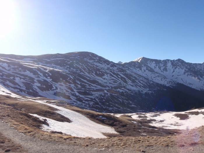 Following Bill's route description (and the very obvious trail) we started up towards Point 12,915. There were 2-3 short snow patches along the way up, but they were only a few feet across on the trail and easily avoidable if you didn't want to walk through them. 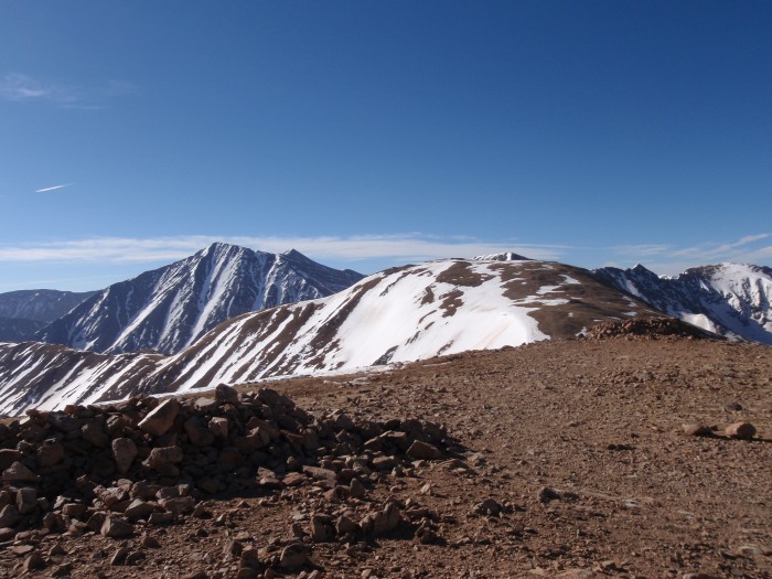 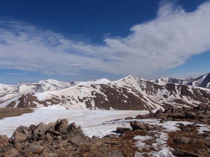 From there it was over to Cupid, this part of the trail did have more significant snow cover on it, but was still avoidable by walking around/at the edge of it without adding that much more distance. Cupid's actual summit is slightly out of the way of the direct path to Grizzly, so we snagged the peak along the way there but circled around it on the way back. 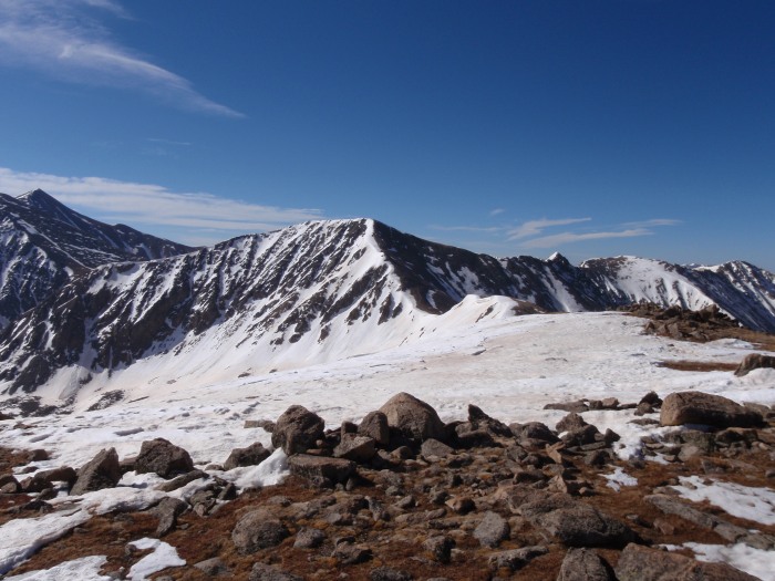  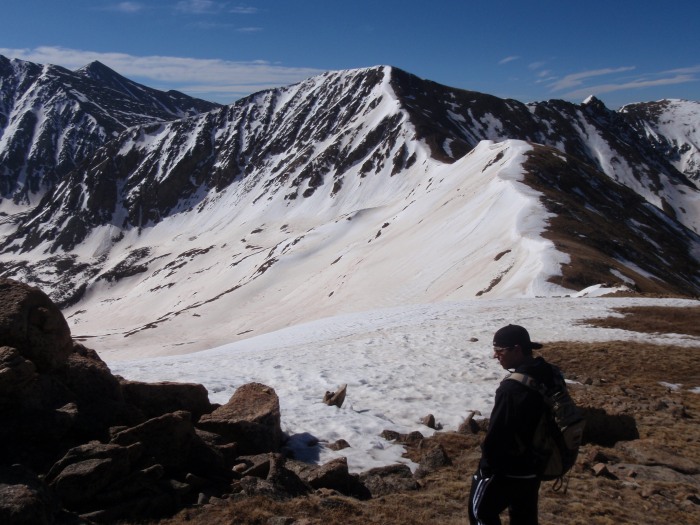 After a couple minute break at Cupid we moved along the ridge to Grizzly and the sub-peaks in the way. The trail started having snow on it a bit more consistently, but it was still avoidable by walking a bit further west. I elected to put on my microspikes and gaiters to test of firm and deep the snow was. I was post-holing every 4-5 steps, typically 6-18 inches down (I was probably about 215 pounds with my pack on). Allen chose to just walk around all the snow, and we made roughly equal time. On one of the two bumps coming down from cupid there's a set of moderately difficult class 2 rock on the west side and was still covered in snow on the east side. Given how much I was already post holing and not knowing how deep the snow went, I chose to follow Allen on the rock at that point. As we continued on we saw a group behind us chose to take the snow route, and it seemed to go fine for them. 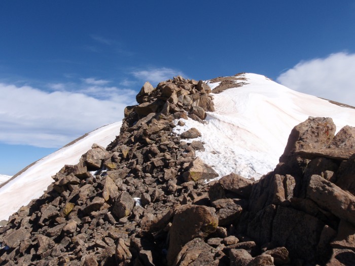 The wind had been blowing all morning, but as we left Cupid and started up Grizzly it got worse and worse. While the winds probably didn't gust more than 30-35 mph as the weather predicition had stated, it was gusting more often than not for a good while. Allen had been fighting to keep his hat on for a while, and finally lost the battle as it was blown right off his head and into the valley below. My sunglasses also got blown off once, but I was able to snag them before they got far. The climb up Grizzly is definitely harder and steeper terrain than most the rest of this trip, but still wasn't horrible. We were able to walk up bare rock the whole way up, but were often only a few feet from where the snow started up again. Right as we hit the summit the wind calmed a bit, and we took the opportunity for a snack. After the wind started picking up again we decided it was time to head back. We passed a couple groups heading up on the way back, including one guy who was planning on heading on to Torreys afterwards, props to him. I had taken my microspikes off to climb the rock sections, and figured postholing would be worse with the snow having warmed up a bit more and so I just stuck with Allen on the bare ground for the trip back. 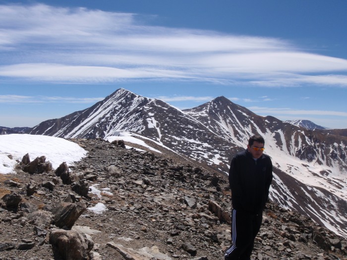 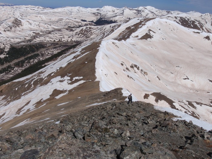 We were both starting to feel pretty tired at this point, me not having been at this elevation since last September and him not since July. We looked for way of walking around some of the peaks to minimize the elevation gain on the way back, but nothing significant was apparent and we only shaved 20-30 feet off most of the peaks on the way back. The wind started to die down some after Cupid, but didn't really become calm until we were almost to the parking lot. Still a successful trip overall, my first two 13er's checked off, and that much more ready for the longer and higher stuff this summer! 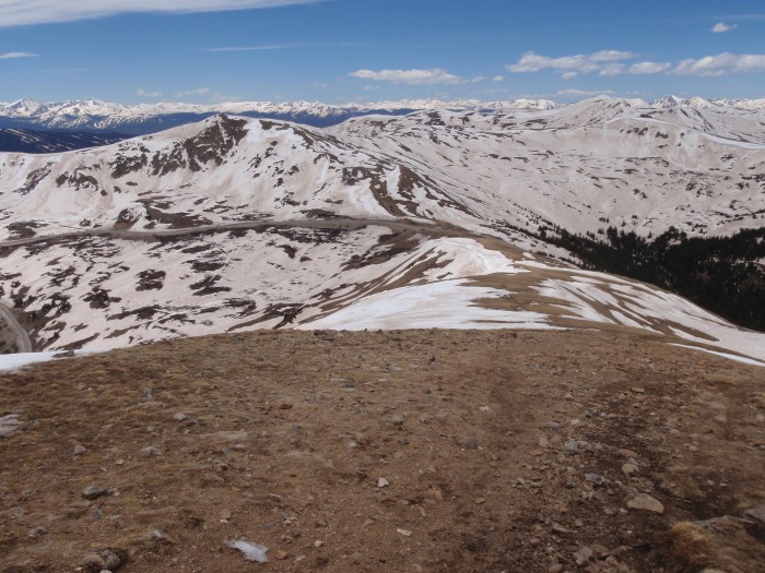 Thumbnails for uploaded photos (click to open slideshow):  Cupid just left of center, Grizzly about halfway between Cupid and right edge.")
 Looking at Cupid from Point 12,915.")
 Looking at Mt. Sniktau, the other direction from Point 12,915.")
 From Cupid, looking at the ridge to Grizzly.")
 Closeup of the ridge.")
 Another look at the ridge a little ways off Cupid's summit. Notice Allen's hat.")
 We elected to scramble down the rocks at this point. A group behind us took the snow immediately right of the rocks.")
 Looking at Greys (right) and Torreys (left) from Grizzly. Allen after his hat has been blown off by the wind.")
 Heading back down Grizzly. We walked just to the left of the snow pretty much the whole way back.")
 Looking down to the parking lot from Point 12,915.")
|
| Comments or Questions |
|---|
|
|
Caution: The information contained in this report may not be accurate and should not be the only resource used in preparation for your climb. Failure to have the necessary experience, physical conditioning, supplies or equipment can result in injury or death. 14ers.com and the author(s) of this report provide no warranties, either express or implied, that the information provided is accurate or reliable. By using the information provided, you agree to indemnify and hold harmless 14ers.com and the report author(s) with respect to any claims and demands against them, including any attorney fees and expenses. Please read the 14ers.com Safety and Disclaimer pages for more information.
Please respect private property: 14ers.com supports the rights of private landowners to determine how and by whom their land will be used. In Colorado, it is your responsibility to determine if land is private and to obtain the appropriate permission before entering the property.

