Download Agreement, Release, and Acknowledgement of Risk:
You (the person requesting this file download) fully understand mountain climbing ("Activity") involves risks and dangers of serious bodily injury, including permanent disability, paralysis, and death ("Risks") and you fully accept and assume all such risks and all responsibility for losses, costs, and damages you incur as a result of your participation in this Activity.
You acknowledge that information in the file you have chosen to download may not be accurate and may contain errors. You agree to assume all risks when using this information and agree to release and discharge 14ers.com, 14ers Inc. and the author(s) of such information (collectively, the "Released Parties").
You hereby discharge the Released Parties from all damages, actions, claims and liabilities of any nature, specifically including, but not limited to, damages, actions, claims and liabilities arising from or related to the negligence of the Released Parties. You further agree to indemnify, hold harmless and defend 14ers.com, 14ers Inc. and each of the other Released Parties from and against any loss, damage, liability and expense, including costs and attorney fees, incurred by 14ers.com, 14ers Inc. or any of the other Released Parties as a result of you using information provided on the 14ers.com or 14ers Inc. websites.
You have read this agreement, fully understand its terms and intend it to be a complete and unconditional release of all liability to the greatest extent allowed by law and agree that if any portion of this agreement is held to be invalid the balance, notwithstanding, shall continue in full force and effect.
By clicking "OK" you agree to these terms. If you DO NOT agree, click "Cancel"...
First off, we did not summit today. If your looking on a report for the last bit of this trek, this isn't the thread for you. However, your success will likely come from our failure today! Read on and you will quickly understand why! FOR A QUICK SUMMARY OF THINGS TO BRING THIS TIME OF YEAR, SKIP DOWN TO THE VERY BOTTOM. (The "Spoiler" Section)
You will learn that we were significantly off the trail, we eventually did get to the right spot. We just unknowingly took a much harder route getting there. If your going up, you can make the correct route, and possibly blaze a new trail by doing so, or follow our tracks, which are dug out nicely, just possibly taking a little detour. It's up to you.
Mt Yale - 2/12/10
Introduction
We camped and used the TH - Avalanche Gulch.
Photo cred goes to the 14ers quick peak photos.
Again, thanks Kevin, this was a productive trip on many levels. This trip consisted of myself, and Kevin (Kevin8020). We made the decision to camp overnight near the TH in his Jeep Patriot the night before. We had ample supplies, time, snowshoes and crampons at the ready. We thought we were prepared for whatever this mountain had to throw at us.
Photo cred goes to the 14ers quick peak photos.
Our original plan was to arrive at the TH at around 10. After some "interesting" REI complications with boots/crampons, and a unwise choice to sit down (and have mexican food!), we didn't arrive at the TH until around 11:30. We then basically took everything out of the car, and put back in all that was necessary, laying down sleeping pads and bags. Everything considered, we didn't settle down until short after midnight.
The plan was to hit the TH at 5, because we thought no one had been up recently. However, before settling into bed, we checked the beginning of the trail, to happily discover what we later discovered to be four day old tracks. After seeing this, we chose to take a 6:15 TH start.
The Hike - Ascent
(Right now i'd like to apologize for lack of pictures. Sorry! With the difficulty of the terrain and later circumstances made pictures somewhat uneasy.)
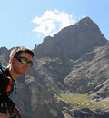
A windy Mascot left and Yale just peaks out from behind. (Pic by Kevin8020)
We hit the trail at approximately 6:15. Note: When we hit the TH i had a half a Clif Bar(basic granola bar) in me, and Kevin had a Shot Rock (ball of energy, basically). This was not a great start to the day. We hit the switchbacks at the beginning of the Mt. Yale trail soon, and I was having a unusually hard time breathing. I soon blamed it on my Balaclava (facemask), possibly to help me mentally. This helped. We trekked on at a relatively brisk pace until we reached the first challenging part of this hike.
The easy part of the "challenging" section. (Photo by Kevin8020)
This "challenging" portion was a sharply angled area with little exposure, other than jagged logs a good fifteen feet below us. No problem considering the snowshoes, or so we thought. We soon learned, after having a gear rescuing problem, that these slopes were "ready to go". Also, it was here were a gust of wind actually forced us to brace ourselves in as snow blew violently in our faces. Meaning we quickly decided it was a bad idea to be on them, considering we prefer not to seek out avalanches.
After getting off this slope which we thought was really hard, we began to face steep slopes, however, there were still tracks we could use instead of breaking our own trail. For now. After these somewhat physically demanding sections, we realized it was PAST TIME for breakfast. We took a reasonably long break to load up on some helpful goo, bars, and wonderful, wonderful water. At this point, it is highly recomended to have snowshoes. However, after this point of the hike, they are ABSOLUTELY required. Keep reading.
Reason being for snowshoes required, after a short stretch from "breakfast spot" we saw the trails from four days ago turned around. We however, had no intentions of turning around this early on this good looking day. At least not yet, while it WAS still a good day.
A cool picture from near the "breakfast" spot. (Photo by Kevin8020)
After this section, we needed to break in our own trail. This meant post holing, for miles, and miles. The trail just kept going today, and everytime we thought we were getting close, we would see that we were not, which was very, very demoralizing. This term was used often today. Kevin and I took turns breaking trail for about 3 miles, switching and zig zagging up this powdery, unbroken trail. Demoralizing.
Pre-post holing, just another angled slope of the day which provides some eye candy. (Photo by Kevin8020)
We got up to a point were we could see the rest of our trek up Yale. After some calculations, we estimated a summit of 3:00 at the VERY latest. We made some calls home and let the families know what the deal was. After, we broke trail literally about 40 feet, only to see that to get to the point where we would start the real accent of Yale, we would have to go DOWN a very intimidating stretch. At this point, we could see the storm that would later pose a threat coming in.
We reevaluated our decision to try to summit, assuming the sunset is about 5:43. This gave us two and three quarter hours of daylight after summit, if we make our estimated time, which was risky. This means probably an hour and a half of hiking in the dark, with only a helmet light for safety. I had never not made a summit, nor been challenged like this. I had no intention of turning around, but think it would take stupidity not to make the decision we eventually agreed on.
The Hike - Descent
After this decision crushed me initially. The farther we got down the mountain, the more I knew we had made the right decision. Wind blown snow lowered visibility drastically (seems to be a trend to winter climbing ). Also, snow was falling at an alarming rate, however wind was the primary concern. We made great time on the descent. IF YOUR PLANNING ON DOING YALE SOON, DO NOT FOLLOW OUR TRACKS!!! THEY WERE SIGNIFICANTLY OFF THE ROUTE, KNOW THE ROUTE, THIS ALSO MEANS YOU MAY HAVE TO DO SOME OF THE CRAP WE DID AT AN ALARMINGLY SLOW RATE TO COMPLETE THE CORRECT ROUTE.
Like I said, since we were doing fine on strength, which WAS somewhat surprising considering what we really had done. We broke the trail down nicely, especially higher up the ridge. We finished the descent in 4 hours. Which included us taking breaks to enjoy scenery, and wonder where we got the strength to do all that we had.
After Hike
We had a little more time than usual for out after hike, but also uncharacteristically for this season didn't have to experience any dig outs! After packing everything and organizing from the morning, we left. However, before we left, we saw either a Red Honda Passport or a Jimmy speed of when we got into sight. After thinking how odd it was, we saw some big game animal hide on the side of the road that WAS NOT there that morning.
Once we got to BV (Buena Vista), we settled down and grabbed some grub at Eddyline, it was great. However, looking back at the mountain, this being at about 2:30 /3:00 the mountain was engulfed in the storm that had chased us off. I was now almost 100% confident we made the right choice.
The last part of the 100% confident came when driving by South Park, when that storm quickly made ice on the road and briefly threatened driving conditions. Yes, Mt. Yale. I will be back.
Summary
Total Distance (Round Trip): 6.18 miles
Total Elevation Gain: 2,765ft
Start Time (9,375ft): 6:05am
Begin Postholing (10,888ft): 9:13am
Top of Ridge (12,145ft): 12:03pm
End Time: 2:34pm
I want to share a few things before wrapping up.
1) The night before our hike when we had everything ready, we turned off all lights and listened and looked towards the sky. I have never been so amazed to see such bright and defined stars and such quite mountain sounds, like the brisk stream not far from the TH. Crazy. Little things like this made this hike worth it.
2) I have heard of another Avalanche death today. It took place somewhere in the San Juans. Please keep his friends/family in your thoughts and prayers.
Spoilers!
1) Get a very early start. This wouldn't have made much of a difference for us, but in the future it's not a bad idea to get going early.
2) MUST have snowshoes. Crampons reccomended for higher parts closer to summit.
3) Get a good breakfast in your stomach before starting. From what I know, Sawatch mtns generally start steep.
4) Know your route, to be completely honest. We may have gotten off route, consequently adding time and mileage. Edit: Just found out we were SIGNIFICANTLY off route.. Instead of following the ridgeline the whole time, which may seem like the right route. Take the valley to the ridge of Mt. Yale which is visible. Do NOT try to stay on highest altitude when you drop to the valley.
5) Know when to turn it around. Thankfully (surprisingly), I did have what it took to agree to call it. Severe danger may have occured if we had not done so.
All taken from Kevin 8020's post.
1) There's a slope (west facing) around 10,500ft (not too far from the car), where you hike along the east-edge of a gully and then cross it. The slope has very loose snow and is steep enough to be prone to sloughing avalanches. We lost a hat into the gully, and in my descent to reach it, I basically just rode the snow down. The gully isn't deep at all, so I wasn't worried, however, an ice axe is very beneficial to crossing this section.
2) Snowshoes are a must.
3) This hike is as long as the trip reports state. If you have the option for a treeline camp, I'd take it - especially if trail isn't broken.
4) We've got a trough down for you up to the ridge where we stopped, and it's a trough that will work, HOWEVER, it's not the correct trail. The correct trail is not broken at all, and can be hard to find if you aren't looking for it. Here's a map with the correct and incorrect routes:
Constructive criticism always appreciated. Thanks for your time let me know if there are any questions!
Thumbnails for uploaded photos (click to open slideshow):
Kevin, you and Travis had the good sense to know it wasn't going well, and made a disappointing but very wise decision to turn back. We've all had to do that, and it is very difficult for us as climbers because we're driven. If we weren't driven, we wouldn't succeed as climbers.
Having the wisdom to temper that strong drive is a mature and admirable quality. Kudos, gentlemen!
I've always liked seeing TR's on this site that showcase good judgment and decision making. You guys learned a whole lot more on this trip than if you had charged to the summit in a storm in the dark and gotten a lucky summit. Hopefully when you guys return things will click better, thanks for the TR.
Thank you, Kevin & Travis for the beta. Our bid for Monday is still on. We probably (hopefully) will benefit from your experience. Hope to return the favor sometime!
Caution: The information contained in this report may not be accurate and should not be the only resource used in preparation for your climb. Failure to have the necessary experience, physical conditioning, supplies or equipment can result in injury or death. 14ers.com and the author(s) of this report provide no warranties, either express or implied, that the information provided is accurate or reliable. By using the information provided, you agree to indemnify and hold harmless 14ers.com and the report author(s) with respect to any claims and demands against them, including any attorney fees and expenses. Please read the 14ers.com Safety and Disclaimer pages for more information.
Please respect private property: 14ers.com supports the rights of private landowners to determine how and by whom their land will be used. In Colorado, it is your responsibility to determine if land is private and to obtain the appropriate permission before entering the property.


")
")
")
")
")
")
")