Download Agreement, Release, and Acknowledgement of Risk:
You (the person requesting this file download) fully understand mountain climbing ("Activity") involves risks and dangers of serious bodily injury, including permanent disability, paralysis, and death ("Risks") and you fully accept and assume all such risks and all responsibility for losses, costs, and damages you incur as a result of your participation in this Activity.
You acknowledge that information in the file you have chosen to download may not be accurate and may contain errors. You agree to assume all risks when using this information and agree to release and discharge 14ers.com, 14ers Inc. and the author(s) of such information (collectively, the "Released Parties").
You hereby discharge the Released Parties from all damages, actions, claims and liabilities of any nature, specifically including, but not limited to, damages, actions, claims and liabilities arising from or related to the negligence of the Released Parties. You further agree to indemnify, hold harmless and defend 14ers.com, 14ers Inc. and each of the other Released Parties from and against any loss, damage, liability and expense, including costs and attorney fees, incurred by 14ers.com, 14ers Inc. or any of the other Released Parties as a result of you using information provided on the 14ers.com or 14ers Inc. websites.
You have read this agreement, fully understand its terms and intend it to be a complete and unconditional release of all liability to the greatest extent allowed by law and agree that if any portion of this agreement is held to be invalid the balance, notwithstanding, shall continue in full force and effect.
By clicking "OK" you agree to these terms. If you DO NOT agree, click "Cancel"...
In an effort to somehow prove my continued relevance in the face of turning 30, I decided to attempt Mt. Elbert in winter. I had gone up the East Ridge last winter but was turned back by poor visibility, weather and route finding, so I had a strong reason to go back. Besides, standing on the highest peak in the snow-covered Rockies is incredibly compelling.
My good friend Scott, with whom I've had some great mountain adventures, was game for the climb. We stayed at a friend's house in Leadville on Friday night to avoid a super early start from Boulder. We hoped to hike the Northeast Ridge the next day, but were concerned that Halfmoon Creek Road wasn't plowed high enough to make it reasonable. We arrived in town relatively early that evening, and a friend was cool enough to take us to reconnoiter. By our estimates the road closure would have added about 6-7 miles to Northeast Ridge route, so the East Ridge it was.
We left the lower trailhead at the Mt. Elbert Trail trailhead by Twin Lakes at 6:40. It was somewhere around -5 F and dawn was providing just enough light to see without headlamps.
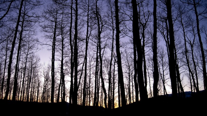
We could tell the overcast sky that had been forecast wasn't going to materialize. The two miles up the jeep road were a good warm-up, especially given how cold it was. The snowshoe track was well worn, and we reached the upper trailhead in 50 minutes.
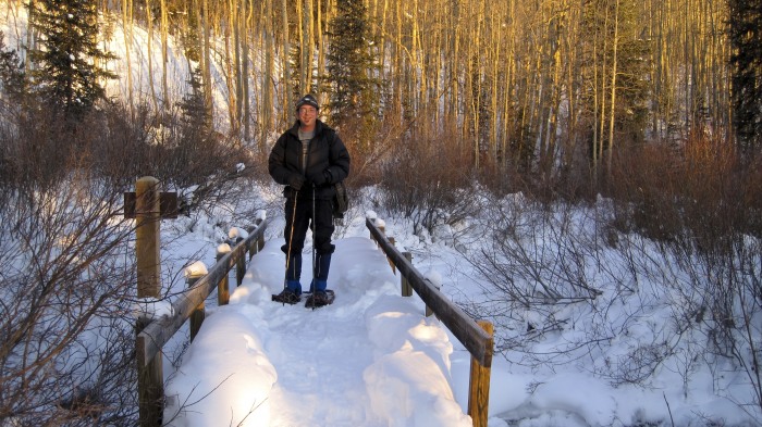
Crossing the bridge, we hiked the 1/8 mile to the sign for the trail junction mentioned in the route description and headed uphill.
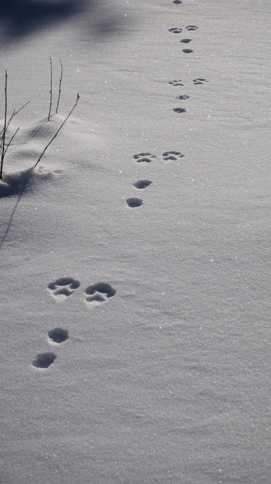
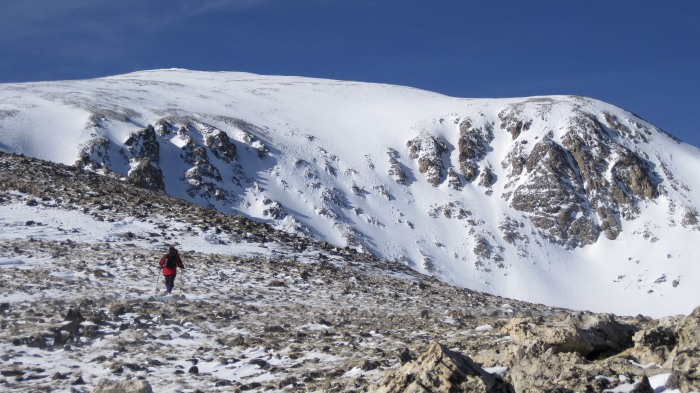
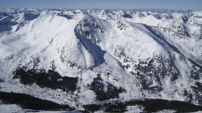
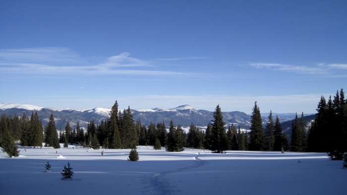
The trail up the face was good, and we made decent time. We got to a ridge overlooking the large meadow that lies at the base of the cirque. This is where I had made a wrong call last time and descended into that meadow since I couldn't see any peaks. I didn't want to do that again. The trail ascending the ridge was cool as it wound through trees. It was a beautiful winter morning and had warmed into the 20s; we were making good time. We came into some meadows and could clearly see the east ridge of Elbert"and lynx or bobcat tracks (how cool!). If you know which animal left these tracks, please let me know.
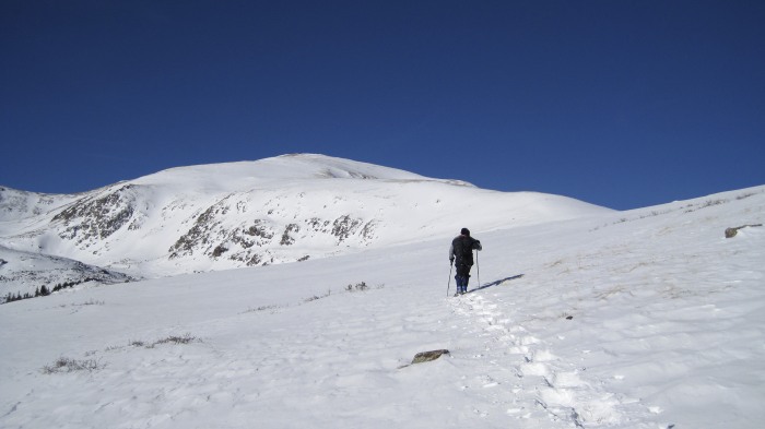
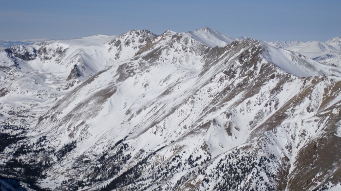
We aimed for the low saddle just below the treetops on the right in the last photo (Scott in the meadow) and in this next photo, on the right after we had cleared timberline.
As we neared the saddle, the wind began to hit, and it was in full effect once we were on top. We were still in our snowshoes as we climbed to the saddle and above, but put them on our packs while attempting to clear the first hump in the ridge on the right.
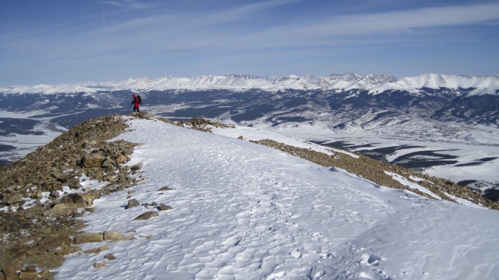
We made it to this point around 11:30. The remaining mile or so of the ridge above was a combination of large scree and windblown snow, so we were fine in boots.
The wind was sustained 30-35 mph, and it was cold. Luckily the day before I had found my old Masque, which I hadn't worn for 15 years, and with that combined with my goggles and hood, I was good to go. Which was huge, because the wind was relentless, as demonstrated by the cool sastrugi (ski pole baskets?).
This next shot looks down on the route.
The way the mountain rolls caused a few false summits"it was tough going, and I delicately expressed my frustration at them to the mountain winds.
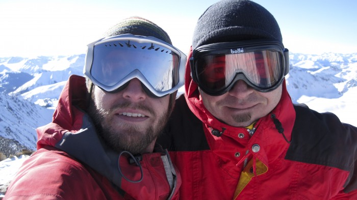
After six hours of hiking we reached the summit.
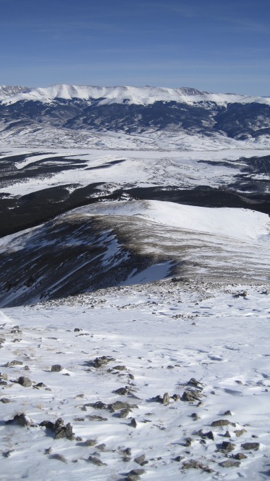
The view from the top was epic.
Mt. Massive is aptly named.
It was cold and a little windy, but nice enough for us to eat some much needed lunch, rest and enjoy the view for about 45 minutes. We were up higher than anybody else in the entire Rocky Mountains! Very cool.
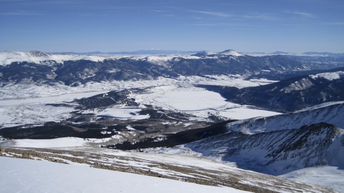
The six-mile descent to the truck (between the Twin Lakes in the photo, just where the trees start) was much more enjoyable than the ascent.
The wind wasn't too bad, and the sun was just about to dip behind the peaks when we reached the upper meadows.
The sun went down but we had good light for the remainder of the hike. The last two miles of jeep road were very unnecessary, but at least we got to see the classic work of a beaver.
The descent took three hours. We arrived back at the truck at 4:24. We had hiked 12 miles and 4,900 vertical feet in just under 10 hours (including 45 minutes chilling on the summit). We couldn't have asked for better weather (well, no wind, but who are we kidding?) or conditions. We had our beacons, but they weren't needed.
It had been a long and incredibly taxing day, but an excellent day. This was my first successful summit of a Fourteener in the winter, and I can't wait to do another one. All things considered, I think I lived up to the claim made by my t-shirt!
I hope you enjoyed the trip report!
-Kevin
Thumbnails for uploaded photos (click to open slideshow):
Good call on the snowshoe hare tracks. I looked them up, and they definitely match the track. But they‘re more paw-like and not as long as the photos that come up. Maybe it‘s because the snow was hard?
Box Creek looked like it had plenty of snow in the chutes. You can see that a bit in the eighth photo above. My only concern would be with the wind loading that‘s occurring up there. I didn‘t get on a similar aspect slope to gauge avy conditions, but I wouldn‘t be surprised if there was a significant wind slab in those chutes.
I hope it‘s safe and that you have a successful ski this weekend. They look like a ton of fun.
What a great shot of the Bells and Snowmass and Capitol! And, that ”beaver-chewed-tree” looks like an accident waiting to happen. :wink: Nice report ... thanks for posting. Happy trails! :D
Age is just a number - coming from someone who's 29 with a few anniversaries :roll: :lol: ...Every year gets better!
Hope to see more TR's from you this winter.
This is a well done write up and your pics are great!
Happy climbing!
Great report and pics. Winter summits are awesome. I love the solitude, the blanket of white on the surrounding peaks and the extra effort to reach the summit. I agree with sunny1, just keep up the frisky attitude, your age doesn‘t matter. Keep dreaming and doing...
Caution: The information contained in this report may not be accurate and should not be the only resource used in preparation for your climb. Failure to have the necessary experience, physical conditioning, supplies or equipment can result in injury or death. 14ers.com and the author(s) of this report provide no warranties, either express or implied, that the information provided is accurate or reliable. By using the information provided, you agree to indemnify and hold harmless 14ers.com and the report author(s) with respect to any claims and demands against them, including any attorney fees and expenses. Please read the 14ers.com Safety and Disclaimer pages for more information.
Please respect private property: 14ers.com supports the rights of private landowners to determine how and by whom their land will be used. In Colorado, it is your responsibility to determine if land is private and to obtain the appropriate permission before entering the property.


")
")
")
")
")
")
")
")
")
")
")
")
")
")
")
")
")
")
")
")
")


