Crestone Peak (14,294')
August 30, 2009
South Face / Red Gully
Round Trip: 8 miles
Elevation Gain: 4,600'
Damage, Inc.: Scott, Nate, Brian, Keith
"Mmm, that sounds good. I'll have that." - Lloyd Christmas
I knew it was a gamble to spend thirteen and a half hours on the trail on Saturday, with the main event for the weekend planned for Sunday, but I did it anyway. After all, Kit Carson and Challenger have eluded me for three years, and it was a great feeling to finally see them for myself. Safely back to camp, the attention turned to the star attraction of the Crestone Group, the Crestones themselves, specifically the traverse, and our goal for the day.
"4 a.m.? What? You want to start when? " I was incredulous, or maybe terrified, as Scott and I hashed out our plan for the following day over 2-way radio. 4 a.m. for Scott and Nate means 3 a.m. for Brian and I, which actually means 2 a.m. to wake up and get ready. Ugh, this was going to be a grinder. First things first, as we loitered in the four wheel drive lot, talking to Kristin and Anne, who also intended to climb the Peak first thing in the morning. Shortly before the sun's final efforts failed the day, Derek and Zack pulled in as well, their sights set on the Needle for Sunday. It was a busy weekend at South Colony.
My obnoxious Blackberry interrupted my slumber. I'm still trying to figure out if I was awake and thinking I was sleeping, or sleeping and dreaming that I was awake; either way, it was a restless night, and I had no reason not to stir myself into a dressed state and get moving. Brian was surprisingly moving as well, and we somehow managed the process of breakfast and gear preparation, and were hiking at 3 a.m. sharp. Stumbling up the access road in the dark, it was impossible to see anything beyond the halo of the headlamp, and our plodding disturbed the peace of the night time wilderness. I was moving, but definitely feeling like I had expended some effort the day before, and focused more on pacing myself than worrying about where I was, what time it was, or any other factor that I could not easily control. We reached Scott and Nate's trailside camp site right at 4 a.m., and did not loiter long before trudging up the Broken Hand trail. I think the introduction was over early on this one, as I was sweating profusely long before we reached the steep, loose and generally unpleasant gully that leads to Broken Hand Pass. The short class three crux snuck up on us in the dark, and it seemed like we made reasonable time to the pass. The disheartening drop down to Cottonwood Lake was steeper than I expected, especially in the dark, but we soon found ourselves passing by the lake, dropping even more precious feet until Scott and Nate took shelter on the side of a large outcrop, looking directly up at Crestone Peak, and the convoluted south face that contains the famous traverse route to the Needle. Daylight was beginning its transition from the night, and we ate, drank, and changed gear, stowing headlamps and donning helmets. The fun was going to begin soon!
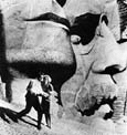
Crestone Peak is somewhere up there...

The trail turns to the right and heads directly for the prominent red gully that splits the south face of Crestone Peak. I was surprised at how good it is, with rock steps all the way up to the bench that leads to the gully itself. The trail crosses under a waterfall to the west side of the gully, but we scrambled straight up to the right and then worked onto the red rock, avoiding the water running down the center. Looking ahead, there was no discernible destination, other than the next slab or cliff, and there is no end to the gully in sight. Although interesting, it is one of the more simple routes on any Fourteener that I've climbed. Just go forward, weaving from left to right as needed. I felt that the hardest sections were during this first couple of hundred yards.
The entrance area to the red gully...

The lower third of the gully is smooth and slabby in places...

I fell behind the others immediately, with Scott and Nate leading the way, and Brian falling in a few minutes behind them. As straight forward as the climbing seemed, it was also tiring, and we all stopped to catch our breath, almost in sequence, a line of climbers inch-worming up the red rock. I could tell that I was going to work really hard for this one, and thoughts of completing one of the four great Fourteener traverses on this day were becoming less than optimistic. I knew I would make the summit of Crestone Peak, though, and that sort of confident thinking kept me focused enough to keep moving slowly upwards. The gully would soon choke down to only a few feet across, and the crux of the entire route presented itself, a steep area with only one obvious passage on the left side of the gully. A crack runs along the wall, providing a staircase of sorts, emerging into an even steeper pitch of true class three rock. The rock is smooth but not loose, with obvious, plentiful holds, and we all scurried beyond it with only physical exertion as payment.
Brian observes Scott and Nate attacking the crux...

Taking a look at our progress; sure seems like we've come a long way...

The journey across Mars continues...

Brian remarked at how the landscape seemed alien, from another world, and it's hard to not agree. The countless ribs, spires and towers all blend together, forming what appear to be sheer walls above and to the sides, and it was fascinating to experience the transformation of the scene ahead with each step. Nearing the center stretch of the gully, it widens and becomes loose and filled with rubble. I would guess that this was the snow field only a few weeks ago; snow would make it more enjoyable. A trail winds through the looseness, from cairn to cairn, and the best climbing is along the center of the gully on a solid rib. When that option seems less exciting, weaving to either side is in order, just picking the best line. Other climbers caught and passed me, as I continued to slow down ever so slightly. My energy was definitely waning, and it was before 8 a.m.
Does this thing ever end?

The gully widens, and something resembling a peak emerges, covered in sunlight...

If you turn around, you might see some stuff...

What seemed to be the top of the couloir finally came into view, albeit a long way off in the distance, providing at least some semblance of purpose after nearly two hours of plodding along in this continuously changing but unending place. The sun began to illuminate the upper reaches of the gully, and the dramatic scenery to the left obscured any hint of the actual summit, instead threatening with impassable and impossible cliffs. I knew that it wouldn't be that difficult up ahead, but could not help but be intimidated by the sight. The Crestones are consuming, powerful and magnificent, and climbing here removes you from anything having to do with the civilized world. It is altogether mesmerizing and magical to be captured in the moment on these peaks.
Getting closer?

Looking for the summit is useless here...

Approaching the final stretch...

I watched ahead as Scott, Nate and other climbers began to work their way up the more solid rock above the rubble field. I was actually relieved to see more climbing, as the loose rock in this part of the gully was more tiresome and annoying than enjoyable. I guess I'm getting pretty comfortable on class three terrain, and I certainly can't pretend that I don't enjoy solid climbing. I'm still afraid of falling, though!  Even though it looked solid, there was still an element of potential danger, as one climber dislodged a trio of rocks that fell directly for Brian. Fortunately, they all missed the mark, but it was a reminder to be careful. By now my energy was nearly spent, and my only focus was to step, breathe, step and breathe. A couple of climbers made their way down from above, and offered some valuable advice. Shortly before the very top of the couloir, on the left, look for darker colored rock. There is a fairly obvious ledge that will lead to the summit pitch, and provides a short cut to avoid the direct ascent of the ridge from the notch. I had watched Brian disappear up that line, so I had an idea, and their confirmation was very welcome. I guess I would have to get there, first. Even though it looked solid, there was still an element of potential danger, as one climber dislodged a trio of rocks that fell directly for Brian. Fortunately, they all missed the mark, but it was a reminder to be careful. By now my energy was nearly spent, and my only focus was to step, breathe, step and breathe. A couple of climbers made their way down from above, and offered some valuable advice. Shortly before the very top of the couloir, on the left, look for darker colored rock. There is a fairly obvious ledge that will lead to the summit pitch, and provides a short cut to avoid the direct ascent of the ridge from the notch. I had watched Brian disappear up that line, so I had an idea, and their confirmation was very welcome. I guess I would have to get there, first.
Leaving the rubble field behind...

Better climbing in the upper gully, but still riddled with loose rock...

As I began to work my way to the left, I could see the darker rock that I was looking for, and began to scan for an exit. A trail of sorts led up to a notch, but I didn't feel that it was what I was looking for, and kept moving along the edge on the pronounced scree trail. A few feet more and I had my exit, and the growing expectation of the impending summit! This was more fun, and I found a cairn to guide me onto the route, criss-crossing up the ledges towards the sky, with that familiar feeling that comes along with topping out on a mountain. Only this one still had a surprise or two. As I crested the ridge, I looked straight down into the abyss of the north face, a vertical drop at least a thousand feet to anything resembling a landing. I let out a "Yeeee" type of sound, and looked up to see Scott, Nate and Brian chuckling at me on the summit, about 30 feet away. Apparently they had all enjoyed this same exact sensation. Gerry Roach refers to it as "spontaneous yodels". Dropping off of the ridge proper for just a few feet, I scampered over to the summit, except it wasn't the summit. A short down climb leads into a gash betwixt this side and that, a saddle that escapes steeply to either side. Another quick look into the abyss below and I finished the climb, scaling the four or five feet up to the airy summit, with a minute to spare before 9 a.m.
Looking towards the dark rock of the shortcut exit...

Looking back at the exit from the couloir...

Two climbers give away the route up the summit block...

Brian's arrival at the edge of oblivion... (image by Scott)

Yodel! (image by Scott)

It was an absolutely beautiful day for late August, a little cool and breezy, but hardly cold or unpleasant. We relaxed, snacked and admired the unbelievable scenery in every direction. With the San Luis Valley to the west, and the Wet Mountain Valley to the north east, the prominence of the Sangres could be felt with every turn of the head. The summits of these mountains make you feel like you're standing in the sky. Surveying the route I had taken yesterday from the Bear's Playground to the summit of Challenger Point, I couldn't help but marvel at what a day it had been. Would today be as equally epic? The answer came shortly as we all agreed that the effort of climbing this Peak was enough to discourage a traverse across complicated terrain culminating in a one hundred foot scramble up near vertical fourth class rock. I knew I would be a liability on such an endeavor, and felt relieved that my partners had already made up their minds as well. It will be there another day. I signed the summit register and noted a familiar name on the line above mine, CODave, with the comment "For TalusMonkey". Thank you Dave for always remembering your dear friend, and reminding all of us of the lessons that he's taught our community, both before and after his accident. I was looking for you guys up there, and still don't know how I missed you.
The Kit Carson Massif and northern Sangre de Cristo Mountains...

The Great Sand Dunes sprawling before the Blanca Group, the prominence is awe-inspiring...

Crestone Needle guards Humboldt Peak...

Looking north east over the clouds in the Wet Mountain Valley...

Mom and dad's Christmas present this year...

I thought I heard snoring...

All good things come to an end, and our stay on this magnificent peak could not be an exception. We scrambled back over the gash and up onto the ridge, and made our way down the ledges from cairn to cairn. Exiting back into the gully, we encountered a couple on their way up, followed shortly by Kristin and Anne, whom I'd been looking for all morning. We pointed them to the shortcut and continued our descent, keeping our eyes peeled for the exit to the traverse, which none of us were able to spot on the climb up. With climbers below, we fanned out and chose lines that would not produce rock fall directly above anyone. As we descended the red rock and neared the field of rubble, we managed to work our way out of the gully and begin looking for cairns, finally finding what we were looking for, directly across from a pronounced and obvious gap on the west side of the couloir. Once we found a first cairn, I could easily spot another, and another, shooting along an obvious ledge away from a rubble strewn side gully. Scott and Nate decided to scout it out, while Brian and I scrambled along, not in any hurry to drop back into the main gully. It was nice to just have time to play.
Descending the red couloir; Kristin and Anne on their way up...

Looking west from the traverse route, this is what you should see... (image by Scott)

The beginning of the traverse; small cairns can be seen lower left of center...

Brian, Scott and Nate on the traverse route...

Brian trying to stay above the loose stuff...

One last look at the smooth slabs of the lower gully...

The descent was slow and painstaking, as we took care to avoid dislodging loose rock, and weaved back and forth looking for the best line. I always feel that down climbing, even just hiking down the steep trails, is harder than the climb up, and this was no exception. My feet were growing increasingly angry with me, and all I could think of was water, cold water, perhaps in a lake far below. Mercifully, we reached the exit to the east, and the good trail that leads back to Cottonwood Lake. I was ready for a break. Brian and I threw our feet in the water of the lake, each with our own rock oasis in the middle of the shallow water. This is what a post-hike should feel like, except it wasn't post hike. We still had to re-climb Broken Hand Pass! Whose idea was that? The cold water felt great regardless, and renewed my energy just enough to painfully pull my boots back on for the home stretch. Scott and Nate had caught up to us after their scouting adventure, and we began the plod along the lake, slowly heading uphill. It was time to just grunt it out.
Nate leads the way past the bizarre, alien like flora...

Halfway to the top...

Crestone Needle from Broken Hand Pass... I'll be back.

I felt like it took forever to climb to the pass, and just as long to drop down the east side, negotiating the steep, slick and less than pleasant dirt and scree. My knees joined with my feet in protest, and it became a test of stamina and constitution, will power being my only weapon to make the discomfort go away. It was one foot in front of the other, the all too familiar feeling that accompanies me on each long hike, that sense of being physically drained, and even more pronounced given my weekend as a whole. Over 18 miles and 9,000' of elevation in two days will take something out of a person. My throat was dry from dehydration, my skin burnt from stubbornly choosing not to apply sunscreen, and my back aching in chorus with my sore lower extremities. I was still having fun, though, and enjoying the freedom to think and consider while hiking along this by now familiar trail. There are few things I'd rather be doing on a Sunday afternoon.
Even in ugliness there is beauty... (image by Scott)

|