Download Agreement, Release, and Acknowledgement of Risk:
You (the person requesting this file download) fully understand mountain climbing ("Activity") involves risks and dangers of serious bodily injury, including permanent disability, paralysis, and death ("Risks") and you fully accept and assume all such risks and all responsibility for losses, costs, and damages you incur as a result of your participation in this Activity.
You acknowledge that information in the file you have chosen to download may not be accurate and may contain errors. You agree to assume all risks when using this information and agree to release and discharge 14ers.com, 14ers Inc. and the author(s) of such information (collectively, the "Released Parties").
You hereby discharge the Released Parties from all damages, actions, claims and liabilities of any nature, specifically including, but not limited to, damages, actions, claims and liabilities arising from or related to the negligence of the Released Parties. You further agree to indemnify, hold harmless and defend 14ers.com, 14ers Inc. and each of the other Released Parties from and against any loss, damage, liability and expense, including costs and attorney fees, incurred by 14ers.com, 14ers Inc. or any of the other Released Parties as a result of you using information provided on the 14ers.com or 14ers Inc. websites.
You have read this agreement, fully understand its terms and intend it to be a complete and unconditional release of all liability to the greatest extent allowed by law and agree that if any portion of this agreement is held to be invalid the balance, notwithstanding, shall continue in full force and effect.
By clicking "OK" you agree to these terms. If you DO NOT agree, click "Cancel"...
The stats ... Total elevation gain (including some up and down on the trails): at least 5,000 feet
Total distance: about 17 miles (it's 18 miles if you take the Ouzel Falls trail and go up and back via Lion Lakes, but if you take the campground trail instead of the Ouzel Falls trail, it's about 16 miles; if you do the loop and take Boulder-Grand Pass / Thunder Lake, it adds a bit of mileage and you'll undoubtedly do some zig-zagging along the Divide, which, based on my rough estimate, brings the total to about 17 miles)
Trailhead: Wild Basin, Rocky Mountain National Park
Route up: Lion Lakes to Mt. Alice's north slopes / Hourglass Ridge
Route down: Boulder-Grand Pass / Thunder Lake
Start: 5 a.m.
Summit: 9:30 - 10 a.m.
Finish: 1:30 p.m.
*Click on images to see larger versions (some panoramas are much larger than they appear).
Let me start by saying this was one of the most scenic loop hikes I've ever done. The diversity of scenery was amazing. Everything from dense forests to broad, windswept ridges; cascades and waterfalls to alpine lakes; 50-ton granite boulders along the trail to boilerplate slaps and sheer cliffs; craggy peaks to rippling creeks. Unfortunately, this sweet loop requires a long approach.
While driving to the trailhead, sometime before 4 a.m., we talked about how most people on the road during those hours seem to be cops and drunks. And wouldn't you know it, we crest a hill on Hwy 66 and come across a riot of lights from cop cars and fire trucks. Jen got excited because she thought it was a checkpoint. I worried that those few beers I had the night before would still be in my system. But it ended up being a crash. A one-car crash, as it appeared. And it looked as if it had rolled many times. Not sure how that happened in a 45-mph work zone.
Our hiking journey began at 5 a.m. when we entered the pitch-black forest. Jen must've been having a good day because I had to put the pedal to the metal just to keep up with her.
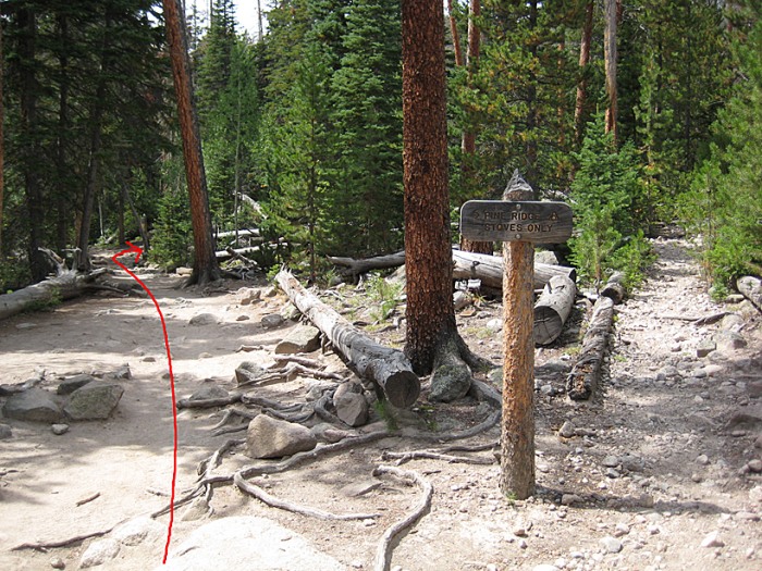
Within a half hour we saw the right-hand turn to take the campground trail (the Ouzel Falls trail adds unnecessary mileage out and back). Within maybe 50 yards or so the trail fizzled out. We both scouted around in the dark, darting our headlamps here and there. Nothing. So back down the trail we went ... and we found the correct turn-off a very short distance up the trail.
The following photo was taken on the way down, with the red arrow marking the correct turn-off (wrong turn-off in the foreground):
Once we were on the correct trail, Jen started bolting up the trail. Somehow I managed to keep up.
At about 6:10 a.m. I was finally able to see without the headlamp. It's getting later and later ...
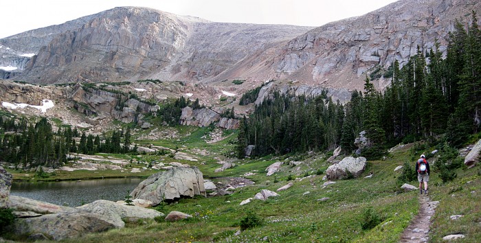
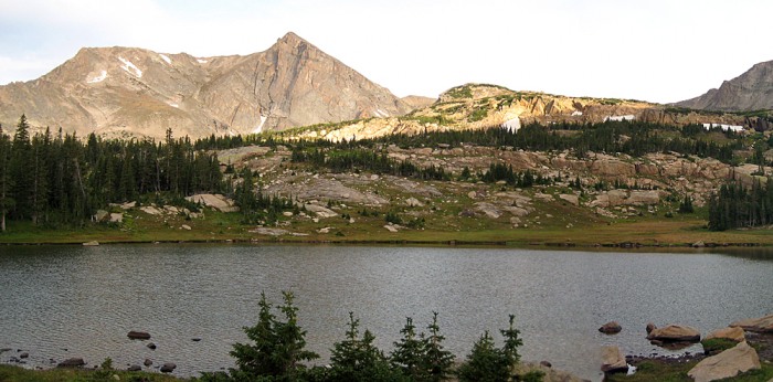
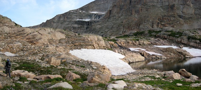
We hiked for a long time, and then Lion Lake No. 1 came quick.
That's about the time we were afforded our first good views of Mt. Alice.
We cruised around the lake with no problem and found some easy-to-follow cairns up some slabs of rock.
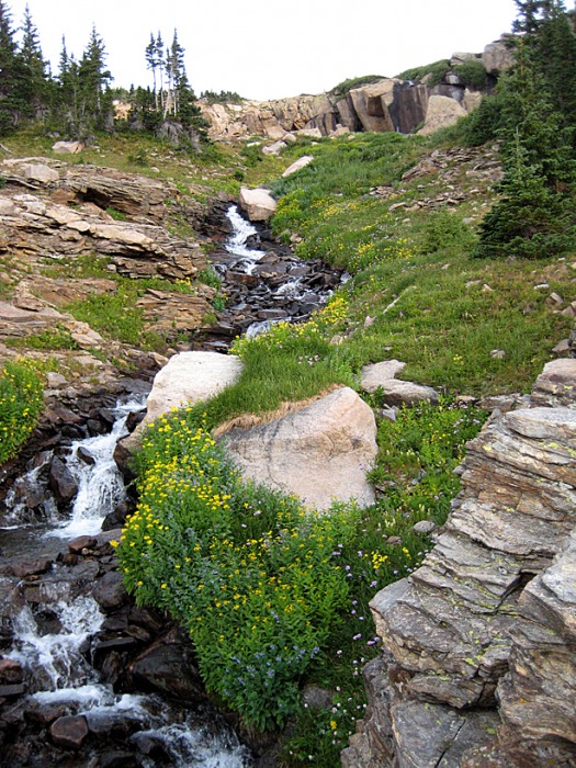
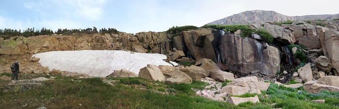
We crossed one little stream, and then we followed a faint trail along a stream that flowed from the Trio Falls. At first, we followed it on the right side, then we went up the left.
Near the falls, we easily skirted up the left side of the snow.
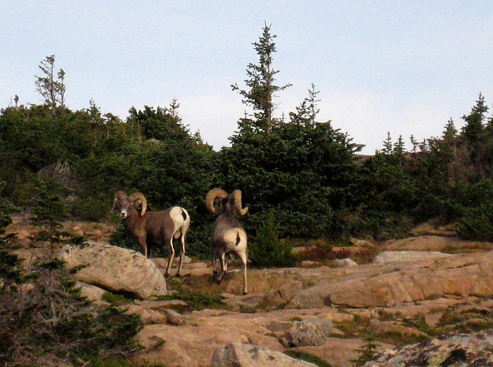
Right after I took the following photo, Jen blurted out a strange string of four-letter words.
As I learned, a bighorn sheep was standing right above her, and it startled her. After I finally got her to complete a sentence, I quickly scrambled up in the hopes of shooting one of those rams (with a camera). Unfortunately they covered some ground pretty quickly, so this is all I got (check out the horns!):
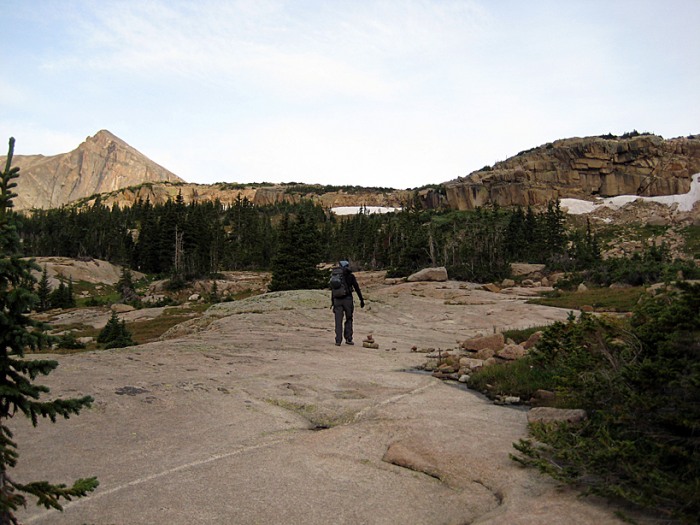
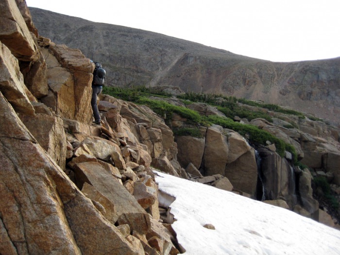
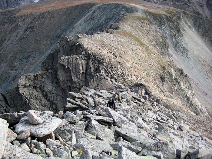
This was about when the trail faded and the cairns disappeared. But it wasn't a problem. We just continued to scamper up the slabby slope, past Lion Lake No. 2, I believe it was.
It was really awesome to see bighorn sheep in the wild. I usually just see them licking salt on the shoulder of I-70.
We were also treated to some other curious creatures - a couple high-altitude trail runners, just ahead of us.
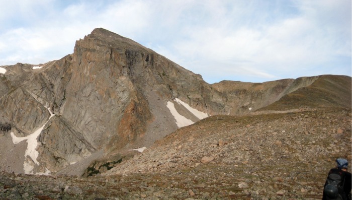
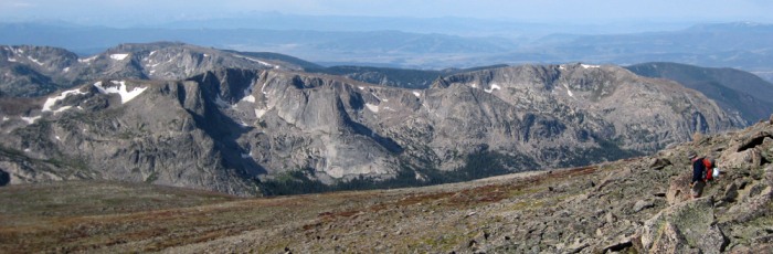
Above the shrubbery, our objective was obvious: follow the gentle ridge to the Continental Divide, then head south via the Hourglass Ridge to Mt. Alice's summit.
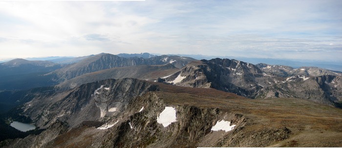
Gaining the Continental Divide was quite the slog. But the incredible views of McHenrys, Longs and Chiefs Head made it all worth it.
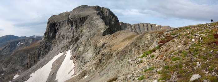
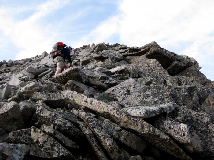
And then the scrambling fun began.
I should say, this route is rated Class 3, but Jen and I questioned that designation. While you could find yourself on 3, it wouldn't be too difficult to keep it at Class 2+ or super-easy 3, at the most. And by staying to the left of the ridge's crest (which ended in a steep cliff on the right), exposure wasn't so bad.
For the most part, we stayed close to the ridge crest and the climbing was easy yet enjoyable. Also, most boulders were locked in and grippy (very little loose rock to contend with).
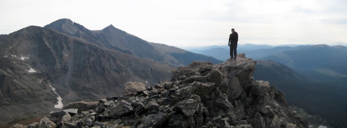
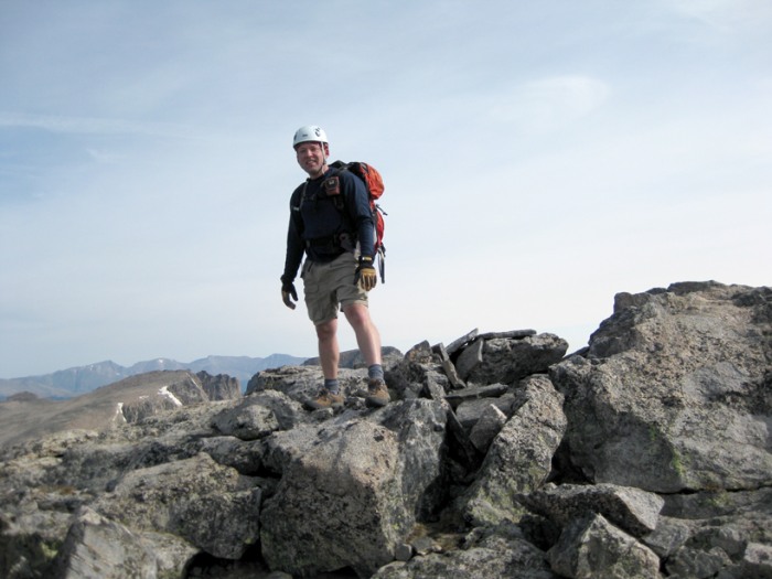
At 9:30 a.m., with a chilly wind blowing from the west, we gained Mt. Alice's east summit.
And then we went over to the west (true) summit. (Register tube was cracked and empty.)
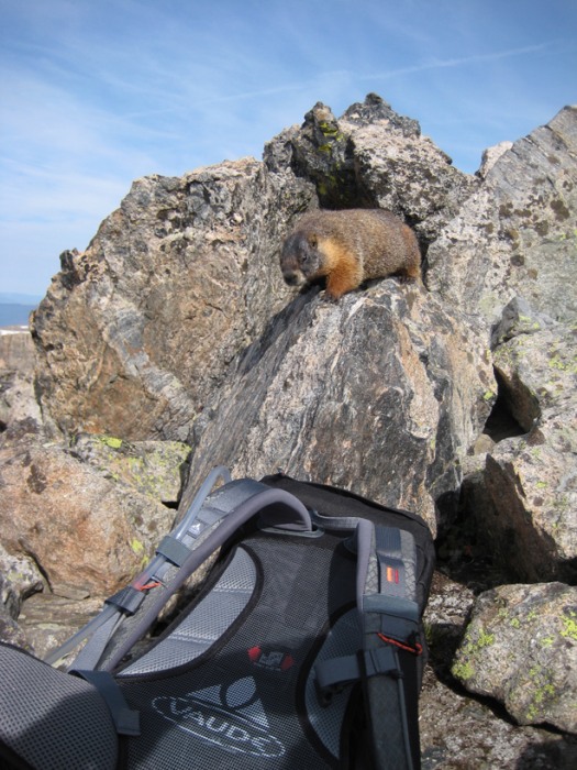
Behind a wind block, we took a half-hour break ... and got harassed by this little brave bastard:
Instead of going back the way we came, we decided to try the loop. From our vantage point, we couldn't tell exactly where the Boulder-Grand Pass was, but we figured we'd find it on our way down.
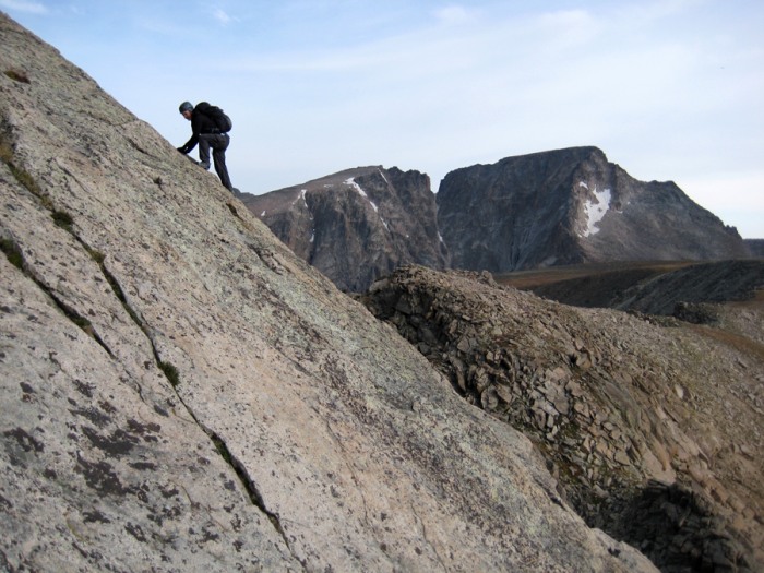
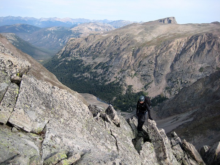
Me descending Mt. Alice, with Grand County in the background:
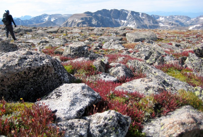
I didn't see any wildflowers on the broad, windswept Continental Divide ridge, but that didn't mean it was devoid of color:
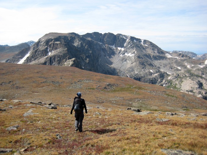
Jen, sauntering along the Continental Divide, with Isolation Peak ahead:
After taking a pee on the Divide, being careful to send a little to the Pacific and a little to the Gulf of Mexico, we started heading down the gully to the Lake of Many Winds.
It was steep, loose and crappy, and it sucked, but at least it was short.
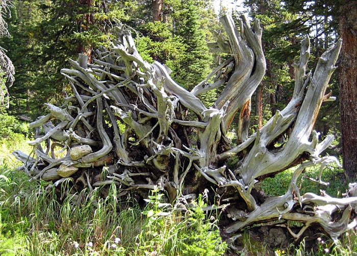
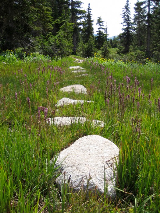
As we descended, the beautiful scenery continued to surprise. We descended bench after bench of incredibly scenic terrain, and my few pics don't even come close to doing it justice. This area is amazing.
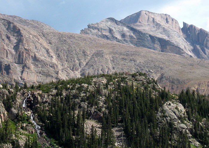
The views of Longs, from its uncommon backside, were also stunning. You could clearly see the Narrows, the Homestretch, Keplingers Couloir, the Loft, etc.
And then there were other, smaller sights that were candy to the eyes.
Sure, the hike out was brutal and painfully long. (We cruised and made it back at 1:30, and I have a nasty blister to show for it.) But if you haven't made it to this area of the Park, I highly recommend it. It takes some effort, but it's worth it.
And it truly is a wonderland.
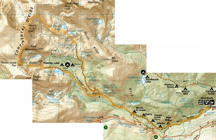
Here's a highlighted map of our route for reference:
Thumbnails for uploaded photos (click to open slideshow):
We did that loop many years ago ... it‘s still just as beautiful. And, yes, we do need to get back up to RMNP ... we‘ve got some long distance 13ers to knock off. Thanks for posting. Happy trails! :D
lordhelmet, the Thunder Lake side was just as beautiful; it was just different. It had some really cool benches/steps. I thought it was amazing going up the Lion Lakes side, but I was really surprised by how different and amazing the descent was from Boulder-Grand Pass.
Presto, that area of the Park is awesome. I just wish the approaches weren‘t so long (and relatively unexciting). But I guess that‘s what makes those areas so special ... and uncrowded.
Thanks for the trip report , I‘ll be needing 1/19/2010 11:13pm
I am planning on doing this same trip later on this summer. I‘ve been studing all the reports on Mt. Alice I can find. It‘s a big park, so I don‘t want to get lost. Not that I would care, but my wife might if I did‘nt show up for work the following monday. I am also planning on camping the night before in one of the sites there. If not, it‘s going to be a long walk for me to. And I always enjoy the picture.
You're a few steps ahead of me! I had planned a trip of Mt. Alice earlier this summer. I studied all the route info (I had planned to do the exact loop you did) and identified the backcountry campsites that would serve me best. When I called the RMNP BC office, the campsites were reserved for the weekends I wanted so I climbed in Indian Peaks instead. I just can‘t fathom hiking Mt. Alice as a day trip.
So Mt. Alice is still on my list of places to experience and your excellent trip report makes me want to visit even more. Thanks for the report.
Aubrey, I was there saturday, basically doing the exact same thing, sans the descent from Boulder-Grand Pass due to some delirious route finding issues and some fast incoming clouds. I looked at my camera, think I took around 150 shots of that hike, half of which were taken around Lion Lake (I took a dip in the upper lake, no2). and I too saw those Bighorns, except I surprised them coming over a ridge along the ramp to the Chiefs Head/Alice saddle.
I agree with you saying this is one of the most scenic loops around, its got its fair share of diversity, but if I had never read your report, I would‘ve thought no one had been back there in years. I was bummed to see the register cracked and I was having trouble figuring which summit was actually higher?? (so I tagged both). That view looking south towards Isolation, Copeland and the IPW really makes you feel back in there. Thanks for the report, now I don‘t have to do one, have a good one.
Caution: The information contained in this report may not be accurate and should not be the only resource used in preparation for your climb. Failure to have the necessary experience, physical conditioning, supplies or equipment can result in injury or death. 14ers.com and the author(s) of this report provide no warranties, either express or implied, that the information provided is accurate or reliable. By using the information provided, you agree to indemnify and hold harmless 14ers.com and the report author(s) with respect to any claims and demands against them, including any attorney fees and expenses. Please read the 14ers.com Safety and Disclaimer pages for more information.
Please respect private property: 14ers.com supports the rights of private landowners to determine how and by whom their land will be used. In Colorado, it is your responsibility to determine if land is private and to obtain the appropriate permission before entering the property.


")
")
")
")
")
")
")
")
")
")
")
")
")
")
")
")
")
")
")
")
")
")
")
")
")
")
")
")
")
")


