Download Agreement, Release, and Acknowledgement of Risk:
You (the person requesting this file download) fully understand mountain climbing ("Activity") involves risks and dangers of serious bodily injury, including permanent disability, paralysis, and death ("Risks") and you fully accept and assume all such risks and all responsibility for losses, costs, and damages you incur as a result of your participation in this Activity.
You acknowledge that information in the file you have chosen to download may not be accurate and may contain errors. You agree to assume all risks when using this information and agree to release and discharge 14ers.com, 14ers Inc. and the author(s) of such information (collectively, the "Released Parties").
You hereby discharge the Released Parties from all damages, actions, claims and liabilities of any nature, specifically including, but not limited to, damages, actions, claims and liabilities arising from or related to the negligence of the Released Parties. You further agree to indemnify, hold harmless and defend 14ers.com, 14ers Inc. and each of the other Released Parties from and against any loss, damage, liability and expense, including costs and attorney fees, incurred by 14ers.com, 14ers Inc. or any of the other Released Parties as a result of you using information provided on the 14ers.com or 14ers Inc. websites.
You have read this agreement, fully understand its terms and intend it to be a complete and unconditional release of all liability to the greatest extent allowed by law and agree that if any portion of this agreement is held to be invalid the balance, notwithstanding, shall continue in full force and effect.
By clicking "OK" you agree to these terms. If you DO NOT agree, click "Cancel"...
My name is Ben Pettus, and in August of 1975 John Cox and I climbed Longs Peak, via the Dovetail. Our pictures were taken on 110 slides and I just recently had them converted to digital. In addition, I just returned to Longs Peak (Aug 2009) and climbed the Loft Route with my son and cousin. I am posting a trip report on that climb, so I decided to post one on the 1975 climb also.
John and I both grew up in Flat River MO, south of St. Louis, and did a lot of rock climbing there so we decided to try out the real thing one summer during college. We took 3 weeks in Aug 1975 and climbed Longs Peak, then went up to the Tetons and climbed Grand Teton, Mt. Owen, Mt. Teewinot and Baxter's Pinnacle. All technical climbs.
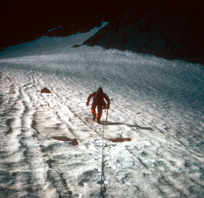
For Longs Peak, we hiked up to the Boulder Field and camped one night, climbed the next day, stayed again that night on the Boulder Field and then hiked back down the next day.
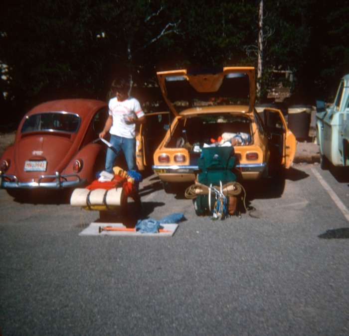
This is John getting gear ready in the parking lot at the trailhead, note John's 1973 Chevy Vega - the perfect car for our trip!
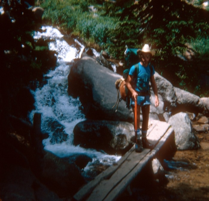
This is me crossing a bridge on the trail up - which is still there today, but now they have added a handrail and another section, behind where I am standing.
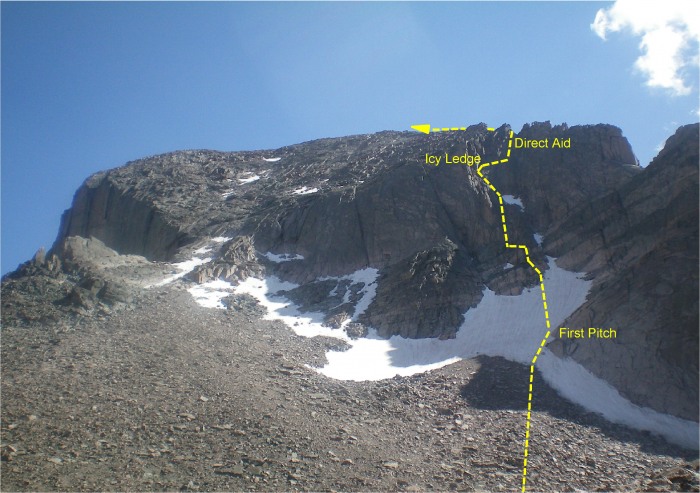
This is a picture I just took in Aug 2009 with our 1975 route indicated by the yellow line. There are actually 2 Dovetail Routes - Left Dovetail and Right Dovetail. I think we were on Left Dovetail, however, it was very difficult to determine where the route actually was when we were on the mountain. At one point we got into an area that required Direct Aid and according to our route directions that shouldn't have happened, so we were obviously off the route in that spot. It‘s amazing that 34 years later, the Dove snowfiled looks the same today as it did back then.
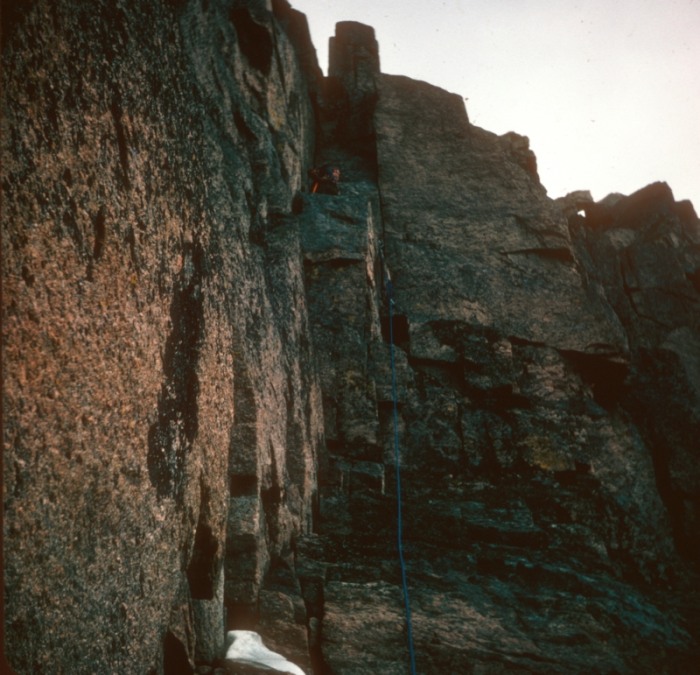
This is our first pitch, coming up to the Dovetail. John was belaying me from the rock outcrop that you can see in the route photo.
This shot is taken looking up at John during the same pitch as the previous photo.
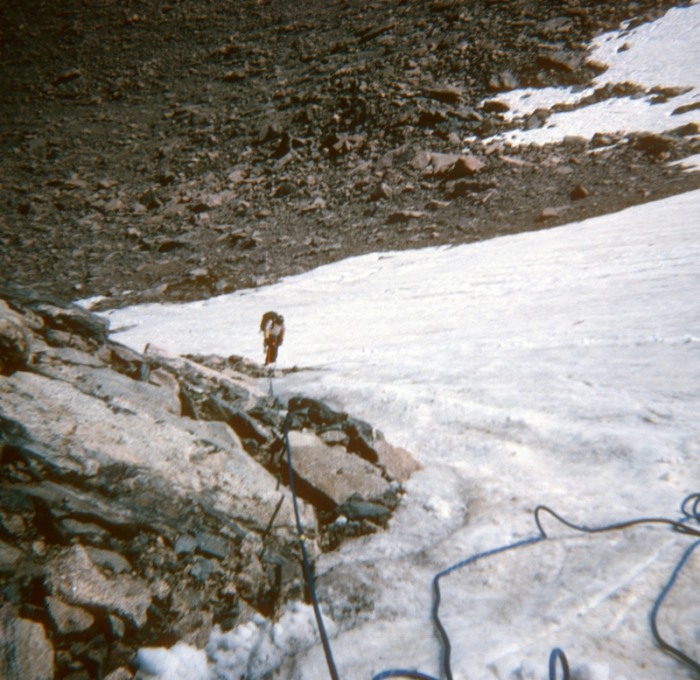
This is John crossing over the Dove snowfield toward the spot we got on the rock to go up.
John is on a ledge where we took a little break and had a snack.
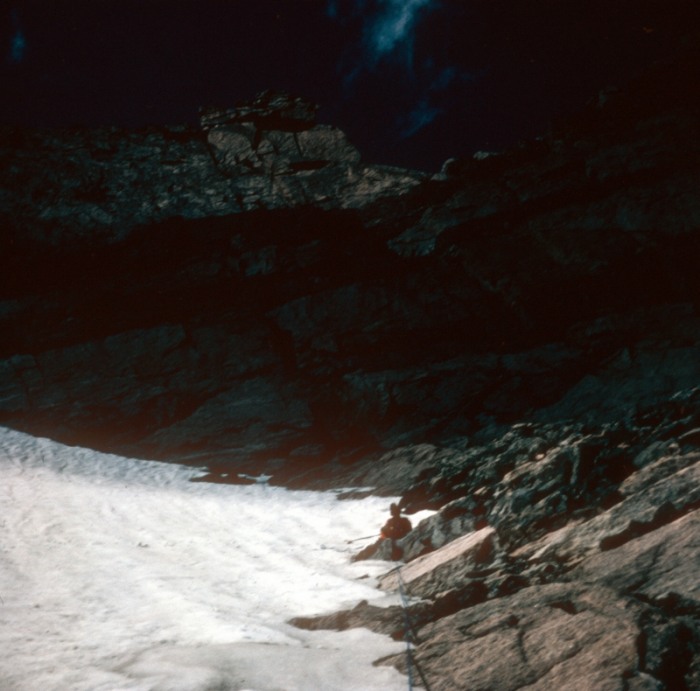
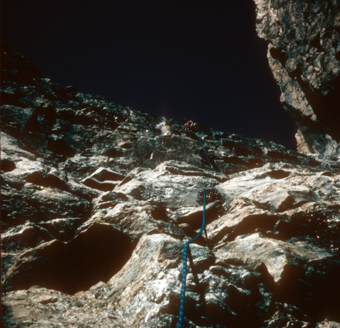
Here I'm sitting on a ledge belaying John, who is directly above me. You can just make out my arms in my orange sweater. You can also very clearly see the Dove snowfield directly beneath us.
This picture was taken by me from about the same place as the previous photo looking up at John, who is standing directly above me, about 25' up.
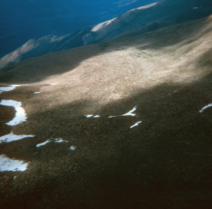
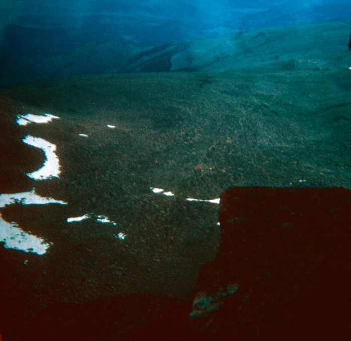
This shot is looking out at the Boulder Field. We were starting to get pretty high up at this point.
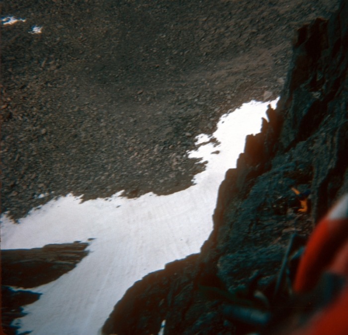
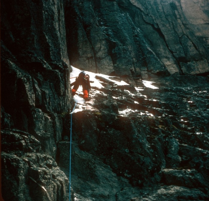
This picture is taken from that same level as the previous shot and was a particularly hard area to advance. We were here for quite a while because there was a sheer wall on the left and the ledge to the right was completely covered with ice and a lot steeper than it looks in this picture. John climbed up the snow along the wall all the way to the corner and then traversed to the right along the wall above him in this picture. This was a pretty dangerous spot, as John wasn't able to place much protection. I was belaying him from the spot that the picture was taken.
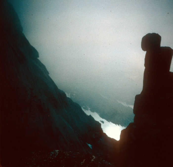
This section is where we had to use Direct Aid because there were no holds. This area was just above and to the right of the icy ledge in the previous picture. A storm began to blow in during this portion of the climb and The next 2 pictures show the clouds coming in. It rained, hailed and snowed. We were in an area that was well protected and we waited it out, which fortunately wasn't that long.
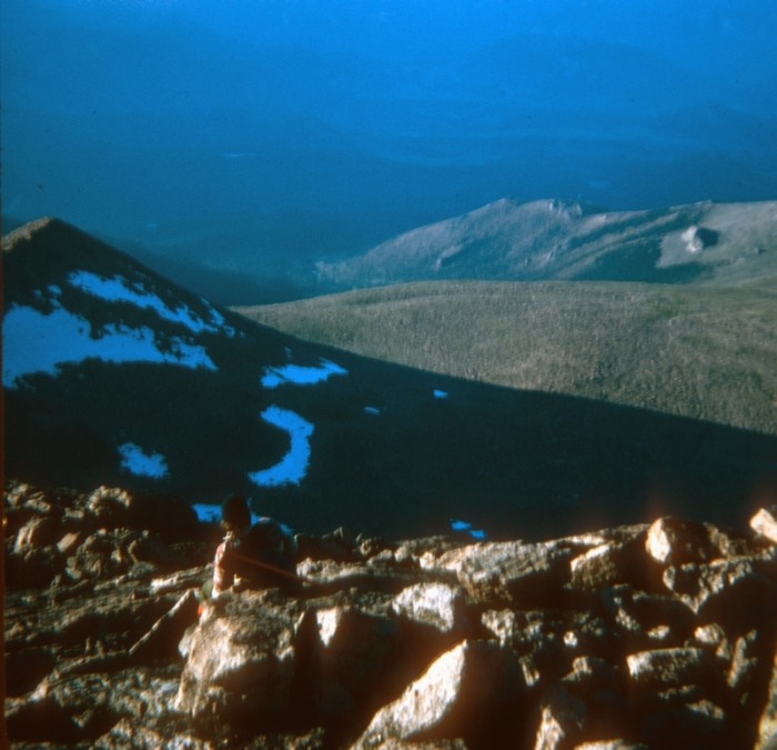
Here is John taking a break on the ridge, almost to the summit and the clouds had lifted by then and it didn't rain anymore.
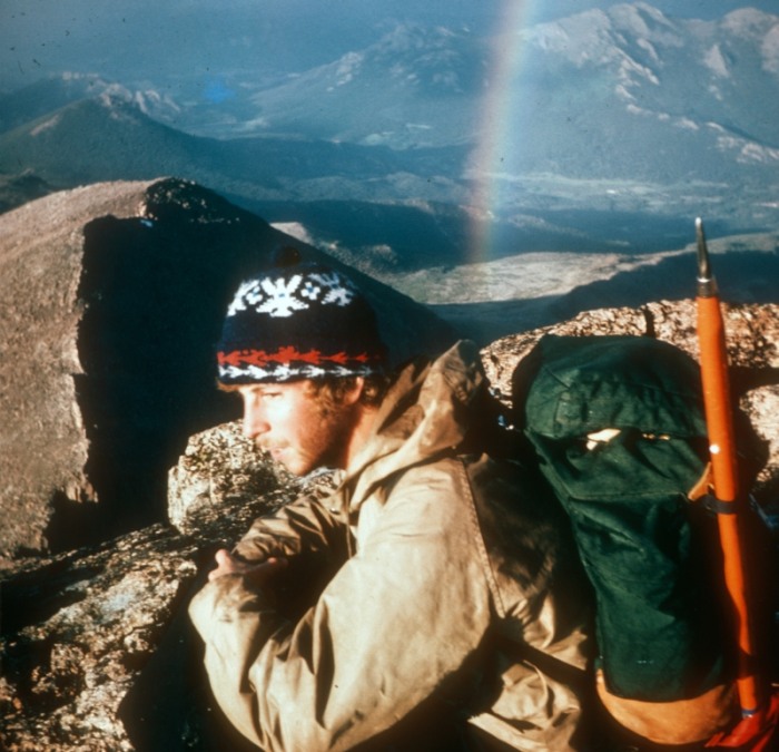
This is me taking a break before going to the summit, with a cool rainbow in the background.
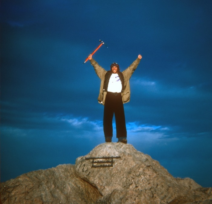
Here is me on the summit; and John on the summit.
Unfortunately, it took us a lot longer than expected to get to the summit and we stayed up there too long also. We underestimated how long it would take to get back to our base camp at the Boulder Field, via the Keyhole Route, and how difficult it would be. We wound up descending most of the Keyhole Route in the dark, with only a pin light for finding the bulls eyes painted on the rocks. We finally got back to our tent at about 2:00 AM. Not smart - but we didn't panic, we cautiously plodded along and made it back without incident.
Thumbnails for uploaded photos (click to open slideshow):
Got any more recently digitized ol‘ timey trip reports to share? It‘s good to be reminded that we‘re all (literally) following in the footsteps of the true trailblazers. :D
Great report Ben, I love reading this stuff, photo 11 is the stuff dreams are made of. You should submit some of this stuff to Alpinist, whether or not they print it, I‘m sure they would love seeing it. If you have more please post it, I don‘t think I‘m the only one that wants to see more of it. Cheers.
Ben, I hope you‘ve had #16 on the wall for many years. Whenever I get a little discouraged, I think about guys like you, getting it done in flannel, while I‘m ”suffering” with the latest gear. I hope my kid looks back on my photos with the same perspective when her rocket boots are acting up.
Thanks for the TR, and if you have any more from the rest of your trip, please post them.
What a great TR - I love seeing different routes up Long's, such a great mountain. Excellent vintage photos! (applause!!)
Thanks for posting this. I give you a standing ovation! :D
Caution: The information contained in this report may not be accurate and should not be the only resource used in preparation for your climb. Failure to have the necessary experience, physical conditioning, supplies or equipment can result in injury or death. 14ers.com and the author(s) of this report provide no warranties, either express or implied, that the information provided is accurate or reliable. By using the information provided, you agree to indemnify and hold harmless 14ers.com and the report author(s) with respect to any claims and demands against them, including any attorney fees and expenses. Please read the 14ers.com Safety and Disclaimer pages for more information.
Please respect private property: 14ers.com supports the rights of private landowners to determine how and by whom their land will be used. In Colorado, it is your responsibility to determine if land is private and to obtain the appropriate permission before entering the property.


")
")
")
")
")
")
")
")
")
")
")
")
")
")
")
")
")
")