Download Agreement, Release, and Acknowledgement of Risk:
You (the person requesting this file download) fully understand mountain climbing ("Activity") involves risks and dangers of serious bodily injury, including permanent disability, paralysis, and death ("Risks") and you fully accept and assume all such risks and all responsibility for losses, costs, and damages you incur as a result of your participation in this Activity.
You acknowledge that information in the file you have chosen to download may not be accurate and may contain errors. You agree to assume all risks when using this information and agree to release and discharge 14ers.com, 14ers Inc. and the author(s) of such information (collectively, the "Released Parties").
You hereby discharge the Released Parties from all damages, actions, claims and liabilities of any nature, specifically including, but not limited to, damages, actions, claims and liabilities arising from or related to the negligence of the Released Parties. You further agree to indemnify, hold harmless and defend 14ers.com, 14ers Inc. and each of the other Released Parties from and against any loss, damage, liability and expense, including costs and attorney fees, incurred by 14ers.com, 14ers Inc. or any of the other Released Parties as a result of you using information provided on the 14ers.com or 14ers Inc. websites.
You have read this agreement, fully understand its terms and intend it to be a complete and unconditional release of all liability to the greatest extent allowed by law and agree that if any portion of this agreement is held to be invalid the balance, notwithstanding, shall continue in full force and effect.
By clicking "OK" you agree to these terms. If you DO NOT agree, click "Cancel"...
The Plan:
Do a thru hike from Wetterhorn, to Matterhorn, and over to Uncompaghre. Have a vehicle parked at each 4WD TH. ~14-15 miles, with ~7,000' vertical. Starting early, it's totally do-able.
The Reality...
Delays in the morning and pre-noon storms foiled my ever so slightly ambitious plans
Prelude:
Driving 5.5 hours solo to the San Juans gives one a lot of time to think about random things. It may just be the recent Transformers movies, but I got to thinking how awesome it would be to have a transformer vehicle. For the highways, an Aston Martin and then upon reaching the 4WD roads, it transforms back into my truck. Or maybe it just that my truck, while awesome, doesn't like steep hills. So when I get into the left lane to pass up hill, and someone cuts me off at the last second, making me lose precious momentum, I get peaved!
After what seemed like a really long time, I reached Lake City just after sunset. I was meeting my friends somewhere up the Nellie Creek road. I made my way up, easily in the dark. Nothing too bad with the road, just some rollercoaster bumps here and there. Of course during one of these, I had to be drinking some juice, which splashed all over me. Up to that point I had thought the road was so easy, I could do both at the same time. At the 2nd stream crossing I was really wishing I had some off-road lights on my truck. The hard right turn up a steep slope with big rocks almost caught me off guard. As I was approaching the TH, I started wondering how I was going to find my friends in the dark. They were wondering where I was (~10pm), so they were out on the road with headlamps, so it all worked out. We camped in our respective vehicles for the night, and tried to sleep.
The climb, Day 1:
We woke up at 3am, none of us had slept well at all. My breakfast was a drinkable yogurt smoothy. Simple & quick, except for the fact that during my first sip it tasted a bit too fizzy and tart. Yak, it had turned. Hmmm, not a good start to the morning.
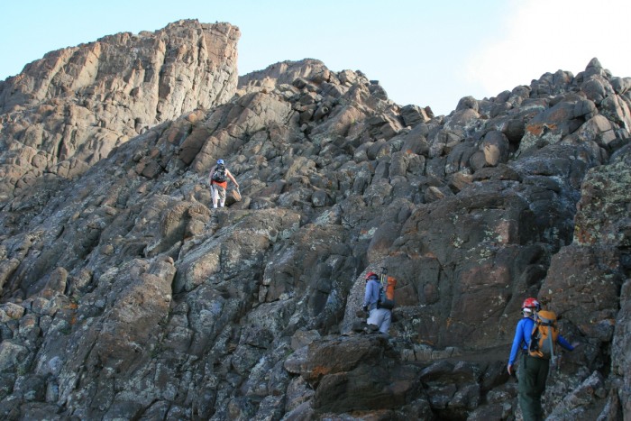
At ~4:15am, we took my truck over to the Matterhorn 4WD TH as fast as I could drive the rough roads in the dark, again wishing for off-road lights. We hit the trail at 5am, at least an hour off where we should be. We scooted up the trail as fast as we could go, watching the sunrise on the ridges around us.
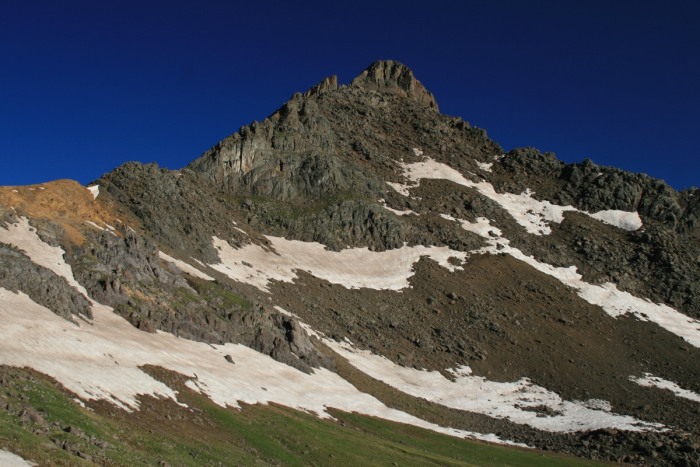
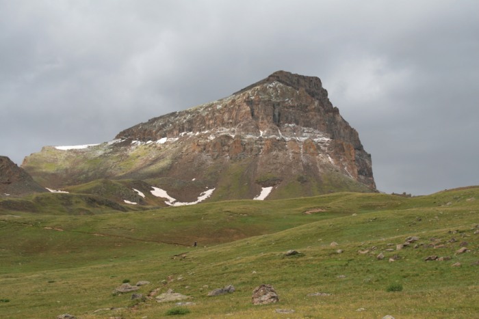
First view of Matterhorn:
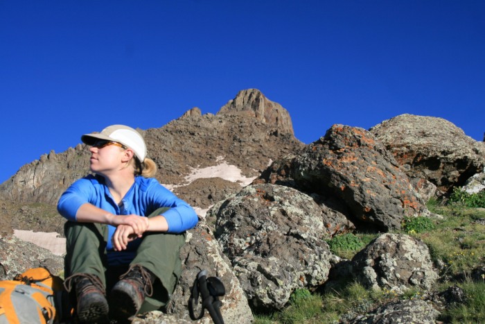
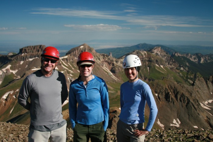
Karen, with what will be her first 14er behind:
Josh enjoying dragging everything out of his pack :
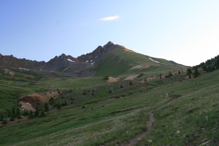
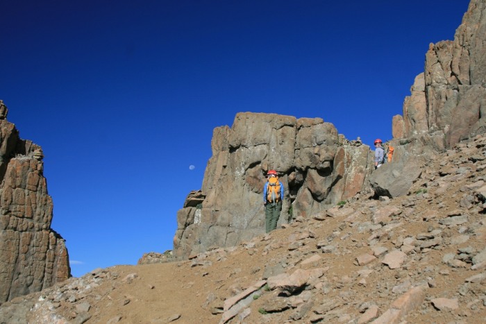
Wetterhorn in the morn:
Close up of the SE face:
There's only 2 small snowfields to cross on the way up to the ridge. Nothing to worry about, but trekking poles are useful.
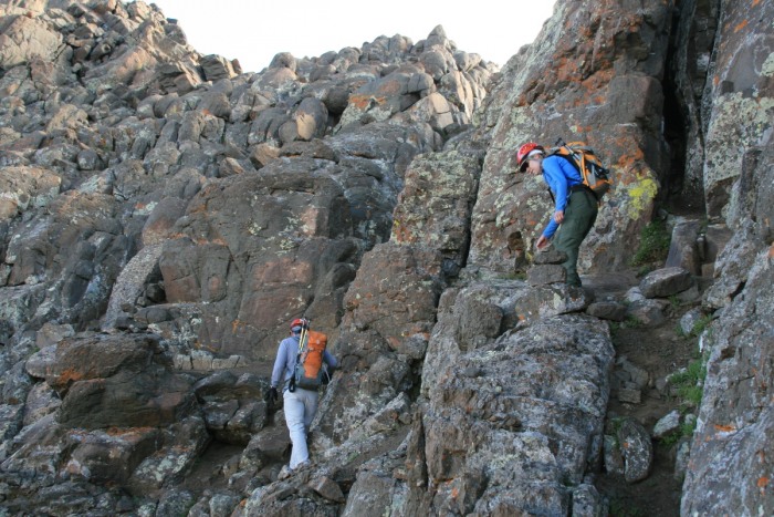
We made really fast time up the upper route. Too fast in fact. I barely managed to get my camera out twice before we were on the summit. I was enjoying it so much, but it went by way too quickly! I wanted the class 3 section to be much longer. I guess there are other peaks I get to look forward to then.
Here's what I managed to capture of the upper route (snow and ice free):
Congrats to Karen on her first 14er!
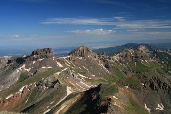
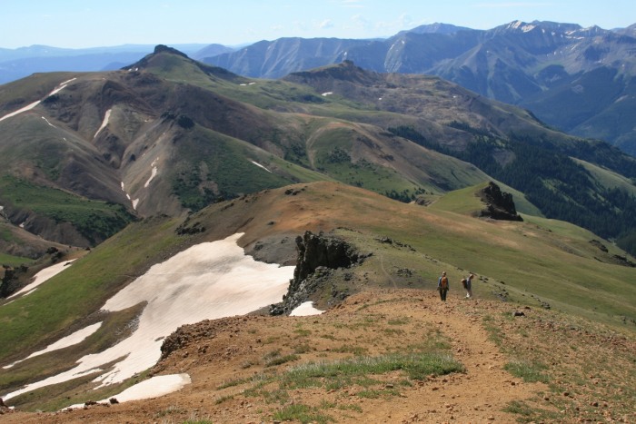
Some interesting looking 13ers. Will need to look into these!
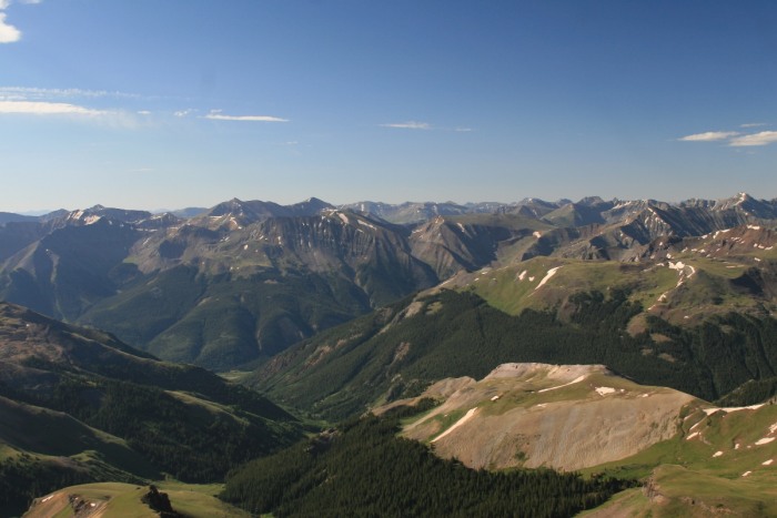
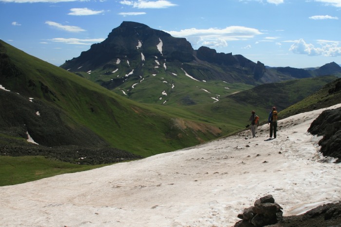
Our goals for tomorrow, somewhere in there...
The remainder of the route I had planned... looking inviting! The trail over to Uncompaghre winds around in the valley.
Down further on the ridge:
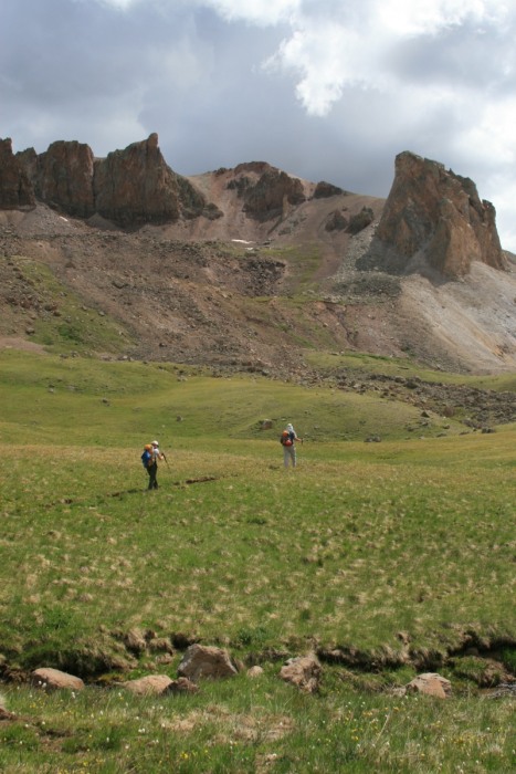
My friends, down hiking faster than I can draw my camera:
The only remaining snowfield on a slope. No prob in the warming sun:
We made good time over to Matterhorn, but the sky was starting to look not so nice. Since this was the "Extra Credit" on the trip, we decided to skip it, and go for the big one.
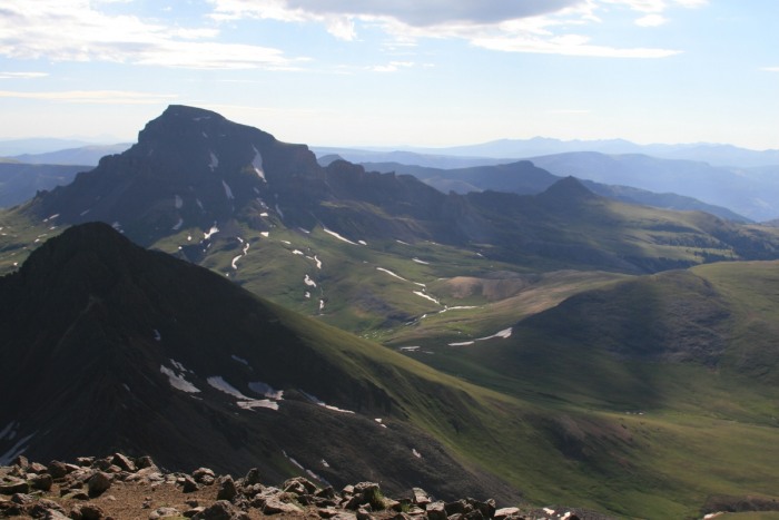
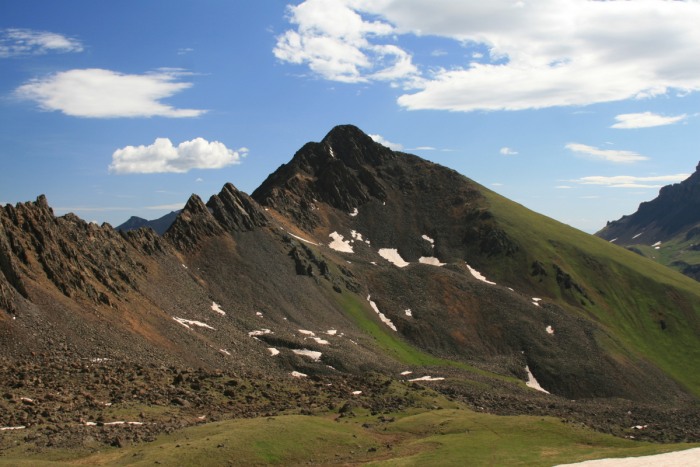
Matterhorn and connecting ridge:
On the rather long trek from the Horns over to Uncompaghre, Josh serenaded us ladies with some pretty, ahhhh... ummm, non repeatable/mentionable songs & lyrics. We did get into a rousing rendition of "You've Lost That Lovin' Feelin' ", somewhere in the golf course part of the connecting trail.
Travellin' fast, too fast for me to draw my camera... gotta practice that quick draw action!
Uncompahgre, so close, yet so far:
Are we there yet?
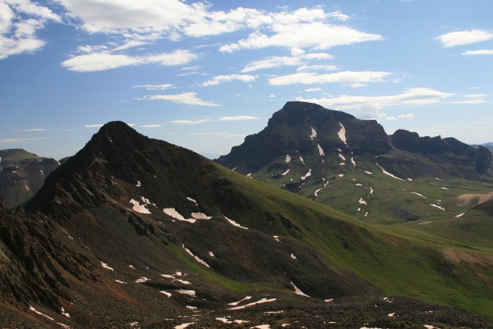
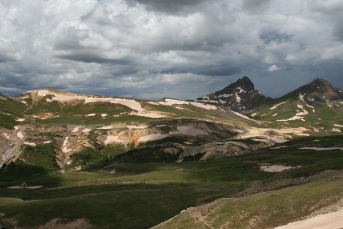
Wetterhorn and Matterhorn looking stormy. Doesn't it look like a crazy golf course?
We get up to the JCN of the Uncompahgre trail with rumblings surrounding us. It looks so close, only 1 more hour! That's all we needed... We sit and take a rest and wish the weather would improve. The storms are not moving, they're building. Josh suggests a secret vote. We all close our eyes, and whoever wants to call it and go down, raise their hand. Yeah, about that.....
So do I feel lucky? No
Shortly after starting our retreat down to the Nellie Creek TH, the storm exploded over our heads. Confirmation of a good decision! Hail pounded us and made for some pretty shots of the peak, once the sun peaked out briefly.
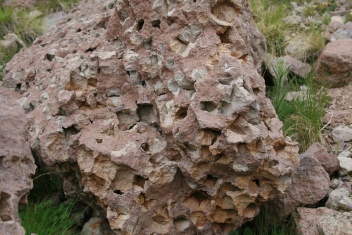
Further down the trail we stop to admire the volcanic rock surrounding us.
Back at our next camp, digging into my pack I find rocks (I'm a geoscientist) from a previous excursion. Gah, so I packed at least a pound of rocks up and down and around....
Lessons learned:
1. Get up much earlier than you think will be necessary. Plan for that super early storm.
2. Camp at the starting TH. No matter how fast you can drive these roads, it eats precious time!
3. The distance between these peaks only feels small when you are close to them...
Loved the TR and the beautiful pics! I found myself chuckling reading about your ”transforming” truck...last time I went down to Lake City in my jeep, I thought the exact same thing while getting passed by everyone on Monarch Pass. :lol: :wink:
...are pretty difficult on the highway & hills, nothing like driving in 3rd gear just to keep up. :lol:
On the way home I got to thinking if it would be possible to ”lift” an Aston Martin, and have hydraulics to drop it for highways... That‘s a long drive :roll:
Caution: The information contained in this report may not be accurate and should not be the only resource used in preparation for your climb. Failure to have the necessary experience, physical conditioning, supplies or equipment can result in injury or death. 14ers.com and the author(s) of this report provide no warranties, either express or implied, that the information provided is accurate or reliable. By using the information provided, you agree to indemnify and hold harmless 14ers.com and the report author(s) with respect to any claims and demands against them, including any attorney fees and expenses. Please read the 14ers.com Safety and Disclaimer pages for more information.
Please respect private property: 14ers.com supports the rights of private landowners to determine how and by whom their land will be used. In Colorado, it is your responsibility to determine if land is private and to obtain the appropriate permission before entering the property.


")
")
")
")
")
")
")
")
")
")
")
")
")
")
")
")
")
")
")
")
")
")
")


