| Report Type | Full |
| Peak(s) |
Mt. Democrat - 14,154 feet |
| Date Posted | 07/12/2009 |
| Date Climbed | 07/12/2009 |
| Author | Brad |
| Mt. Democrat via Kite Lake |
|---|
|
Route: East Ridge from Kite Lake Partner: Amber RT mileage/elevation: 4.25 miles and +2150' Amber and I attempted Mt. Democrat on May 23, 2009 but quickly found the snow conditions to be far worse than we expected, and thus turned around after a brief series of post holes. The first picture is from May 23 and the second is from July 12. 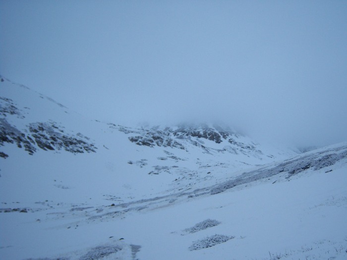  To say the area looked different is an extreme understatement. Then, we needed snowshoes and warm jackets. Today, we were in shorts and t-shirts within 20 minutes of leaving the trail head. Our morning started abruptly at 3:45 AM thanks to an alarm clock nearby our bed. We had prepared our packs the night before and so were out the door in an hour (yes, we hit snooze once...or twice) and drove to Carl's Jr. for a carb-loaded, grease infested breakfast. We were greeted at the drive-through speaker by a woman with a very perky, friendly, soothing voice (odd at 4:50 AM). We approached the window and found that our lady was in fact a man. Oh well, he still was perky and wished us a "fabulous" day. We parked nearby and ate like two people who had not seen food in days. As we made our way into the early morning, we noticed clouds here and there, and then rain in Woodland Park. We drove on, hoping for better weather. We arrived at the trail head around 7:10 AM, and were greeted with this: 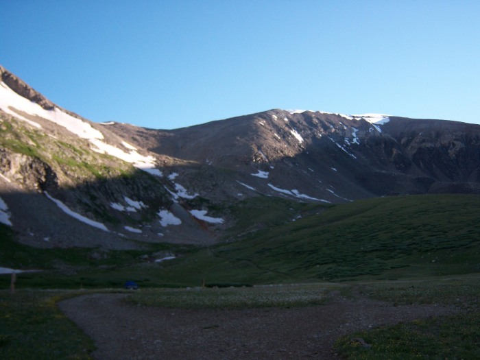 After paying our parking fee, we were on our way at 7:20 AM. The trail is very easy to follow, and has maybe three stream crossings, all with plenty of rocks for easier crossing. We were soon out of the shadows and hiking in full sun, greeted with a picture of Mt. Democrat: 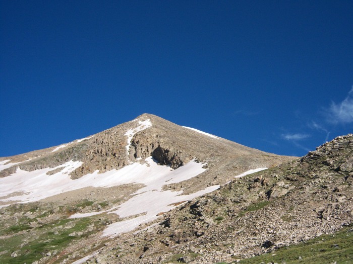 As we neared the Mt. Democrat/Mt. Cameron saddle, we looked back and took in the view of Kite Lake and its valley: 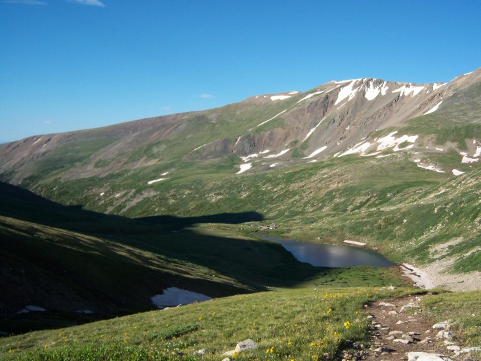 We continued our way up the well-worn path, reaching the summit at 9:22 AM. The summit is small and was very crowded, so our stay was brief. It was also a bit windy and chilly, so I donned my wind stopper again. Here is my summit shot: 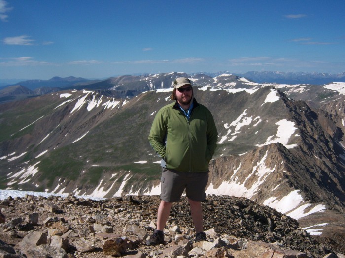 After about 10 minutes we were on our way again, navigating the crowds and loose rock. My opinion is that this rock is similar to Quandary Peak. And, I would divide the trail into thirds: 1 - packed dirt and grass; 2 - rock steps; 3 - loose rock, varying in size from golf ball to truck tire. On the way down we quickly left the crowds - many were heading over Mt. Cameron to complete the Decalibron, but we were happy with our lone summit. I stopped for a moment on the way down and spotted a spider hanging out on a flower: 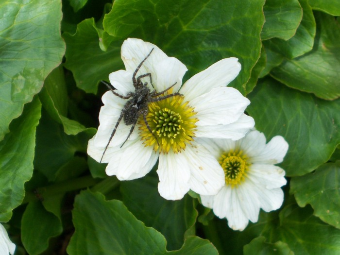 I also turned around in time to see the clouds rolling in over Mt. Cameron: 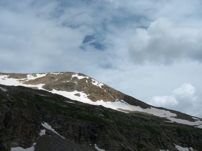 Now, we were really happy about our decision to take one summit and head home. We were back at our car at 11:20 AM, capping a four-hour hike. I did notice a black Toyota 4Runner next to my car with a 14ers.com sticker. Thumbnails for uploaded photos (click to open slideshow): ")
")
")
")
")
")
")
")
|
| Comments or Questions |
|---|
|
|
Caution: The information contained in this report may not be accurate and should not be the only resource used in preparation for your climb. Failure to have the necessary experience, physical conditioning, supplies or equipment can result in injury or death. 14ers.com and the author(s) of this report provide no warranties, either express or implied, that the information provided is accurate or reliable. By using the information provided, you agree to indemnify and hold harmless 14ers.com and the report author(s) with respect to any claims and demands against them, including any attorney fees and expenses. Please read the 14ers.com Safety and Disclaimer pages for more information.
Please respect private property: 14ers.com supports the rights of private landowners to determine how and by whom their land will be used. In Colorado, it is your responsibility to determine if land is private and to obtain the appropriate permission before entering the property.

