| Report Type | Full |
| Peak(s) |
Pawnee Peak - 12943 |
| Date Posted | 07/12/2009 |
| Date Climbed | 07/11/2009 |
| Author | krz2fer |
| Pawnee Peak - East Ridge |
|---|
|
Peak: Pawnee Peak (12,943') Date: Saturday, July 11, 2009 Team: krz2fer (Chris), ajkagy (Adam) Route: Long Lake Trailhead, East Ridge Roundtrip: ~8 miles This Saturday, ajkagy and myself decided to check out Pawnee Peak's East Ridge route in the IPW. Without a lot of beta in photo format online, we knew it'd be interesting. We were also curious about the Class 4 section and how it stacked up against previous scrambles. Hopefully this post will help out those down the line who want more in-depth info. We left the Long Lake trailhead a little after 5am and made quick work of the lake trail and finally cut north into the forest just beyond the lake. Mosquitoes were surprisingly vicious, but I'm betting it was due to the higher levels of snow recently melting off, creating the damp forest floor. 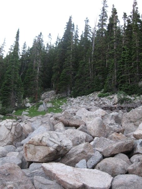 A stiff ~1000' gain up to the east ridge. 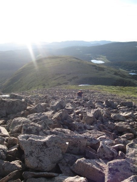  Views once above treeline were terrific. 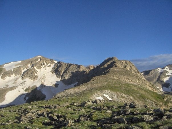 The journey during the first part of the ridge was self-explanatory and wasn't more than Class 2.  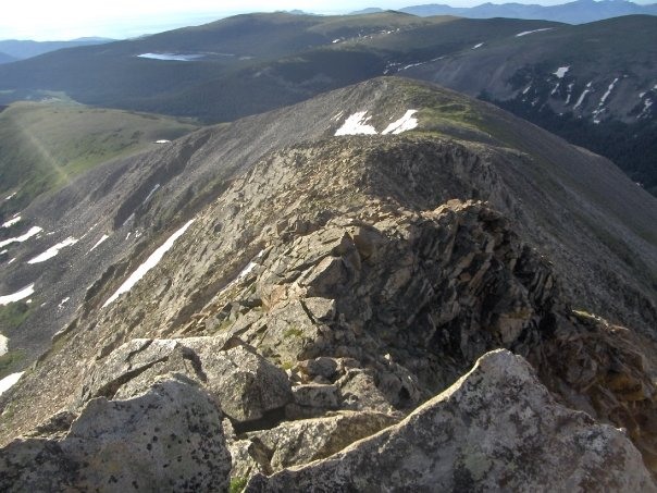 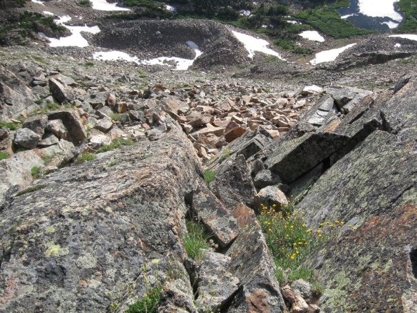 Things quickly turn to Class 3 scrambling, however, and stay consistent the rest of the ridge. 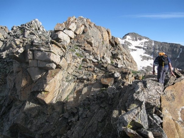 I think it's important to hammer home the fact that exposure on this route is very real, but it felt understated in a lot of the beta I read about. 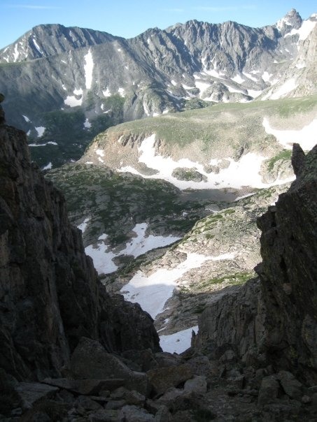 Scrambles down and up through notches provided great views into both the Blue Lake and Isabelle Lake drainages. Pretty cool to see so many ridge lines and peaks in close proximity! The meat of the ridge is continuous Class 3 scrambling with sections of Class 4 downclimbing depending on how you choose to tackle it. The main crux has been noted as the wall downclimb off Little Pawnee, and it did not disappoint. I would say this is about as much maneuvering with exposure as I would want to do without a rope. 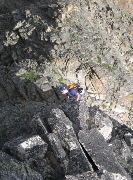 Beginning the crux.   A look back at the crux wall. Beyond this section, you still must battle with constant route finding (we stayed to the north) so as to not become cliffed out with nowhere to go. We ran into a few small Class 4 sections beyond this point, and always were kept on our toes with the rock and grass ramps that line the ridge walls.  Me, taking a peek at the best way down. 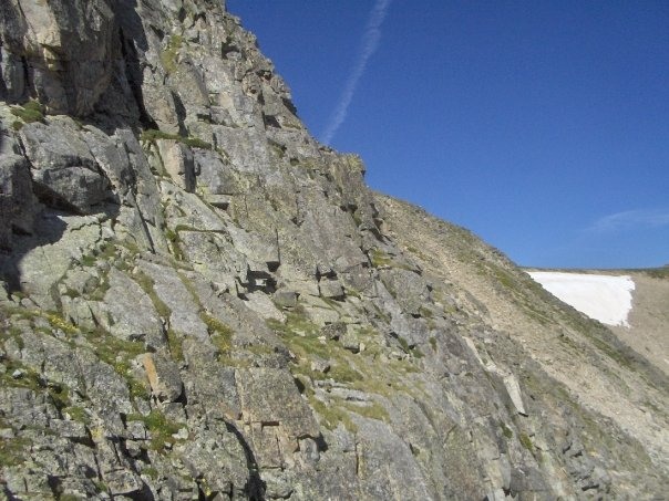 Not to be forgotten is the smaller knife edge that is easily walked over if you have a steady foot. I saw it more as fun than terrifying, but I'm also comfortable with the verticality of what's on either side of me. If you're a little less confident, a more scoot-like approach would be fine as well.  Knife edge views. The final portion of the journey requires more route finding and an eventual ascent of a Class 2 slope to the summit. The rewards are excellent with views of Apache, Navajo, Toll, Paiute, Audobon, and many more. We took the standard trail down over Pawnee Pass (windy!) and kept an eye on the ridge as we descended. Overall, this was a stiff hike with a lot of route finding required. It's not for the faint of heart, and certainly not for those intimidated by Class 4 moves. It's a step up from your Kelso Ridge hikes but not quite on order with a rope-requirement.  Approaching the summit. 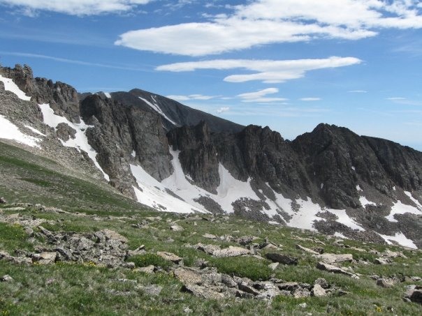 Western part of the ridge. 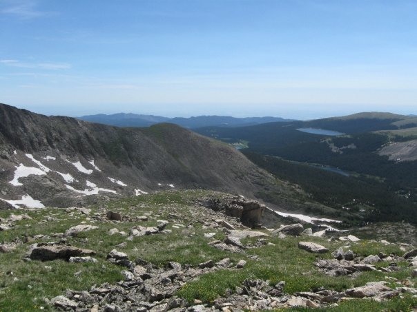 Eastern part of the ridge.  A postcard finish! The vibe of the hike seemed stop and go; perhaps because we were taking our time, but also because there's not really an obvious way to go for quite a ways. It was a terrific hike in the end, but do be aware that it's not simple, nor quick. My parting words: come prepared, come in shape, and be safe! Have fun out there. Thumbnails for uploaded photos (click to open slideshow): ")
")
")
")
")
")
")
")
")
")
")
")
")
")
")
")
")
")
")
|
| Comments or Questions |
|---|
|
|
Caution: The information contained in this report may not be accurate and should not be the only resource used in preparation for your climb. Failure to have the necessary experience, physical conditioning, supplies or equipment can result in injury or death. 14ers.com and the author(s) of this report provide no warranties, either express or implied, that the information provided is accurate or reliable. By using the information provided, you agree to indemnify and hold harmless 14ers.com and the report author(s) with respect to any claims and demands against them, including any attorney fees and expenses. Please read the 14ers.com Safety and Disclaimer pages for more information.
Please respect private property: 14ers.com supports the rights of private landowners to determine how and by whom their land will be used. In Colorado, it is your responsibility to determine if land is private and to obtain the appropriate permission before entering the property.

