Download Agreement, Release, and Acknowledgement of Risk:
You (the person requesting this file download) fully understand mountain climbing ("Activity") involves risks and dangers of serious bodily injury, including permanent disability, paralysis, and death ("Risks") and you fully accept and assume all such risks and all responsibility for losses, costs, and damages you incur as a result of your participation in this Activity.
You acknowledge that information in the file you have chosen to download may not be accurate and may contain errors. You agree to assume all risks when using this information and agree to release and discharge 14ers.com, 14ers Inc. and the author(s) of such information (collectively, the "Released Parties").
You hereby discharge the Released Parties from all damages, actions, claims and liabilities of any nature, specifically including, but not limited to, damages, actions, claims and liabilities arising from or related to the negligence of the Released Parties. You further agree to indemnify, hold harmless and defend 14ers.com, 14ers Inc. and each of the other Released Parties from and against any loss, damage, liability and expense, including costs and attorney fees, incurred by 14ers.com, 14ers Inc. or any of the other Released Parties as a result of you using information provided on the 14ers.com or 14ers Inc. websites.
You have read this agreement, fully understand its terms and intend it to be a complete and unconditional release of all liability to the greatest extent allowed by law and agree that if any portion of this agreement is held to be invalid the balance, notwithstanding, shall continue in full force and effect.
By clicking "OK" you agree to these terms. If you DO NOT agree, click "Cancel"...
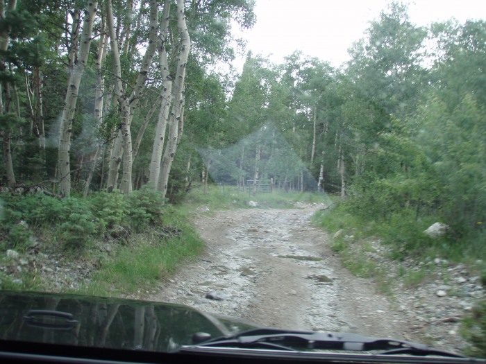
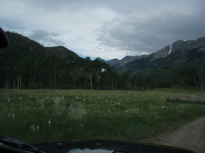
Here we are leaving Lake Como Road to get to the Lilly Lake TH and get some much needed R&R.
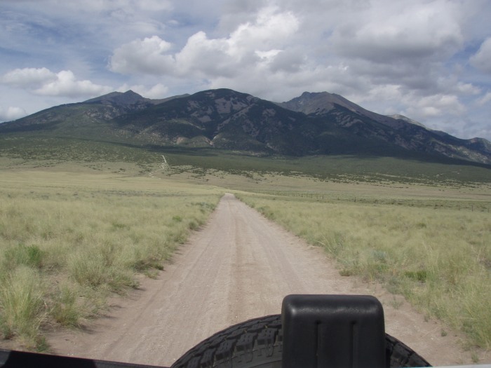
The drive is about an hour and a half from Lake Como Rd turnoff to the TH. Once you are off of 69 and onto the forest roads, it gets a little bumpy, but after tackling Lake Como Rd, it felt like a newly paved highway.
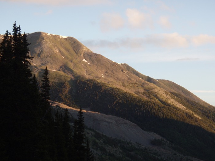
The views on the drive in were amazing
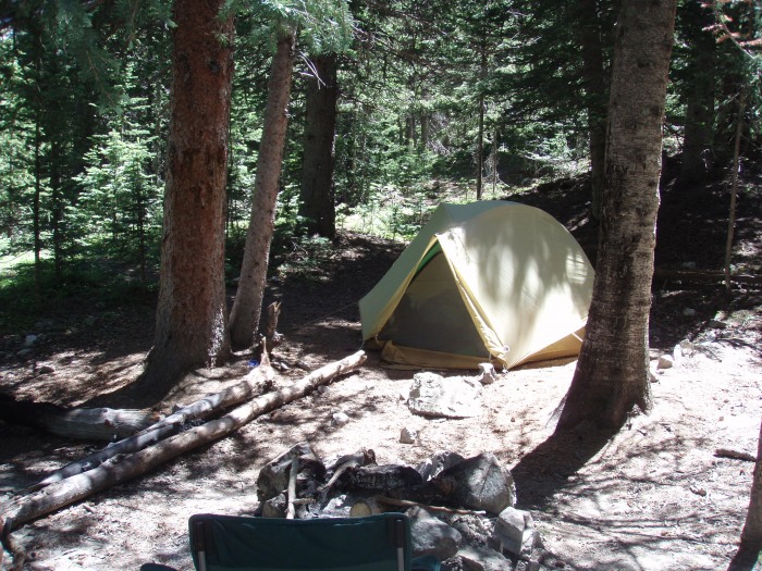
There are a ton of campsites on the road to the TH and we were lucky enough to get a great one.
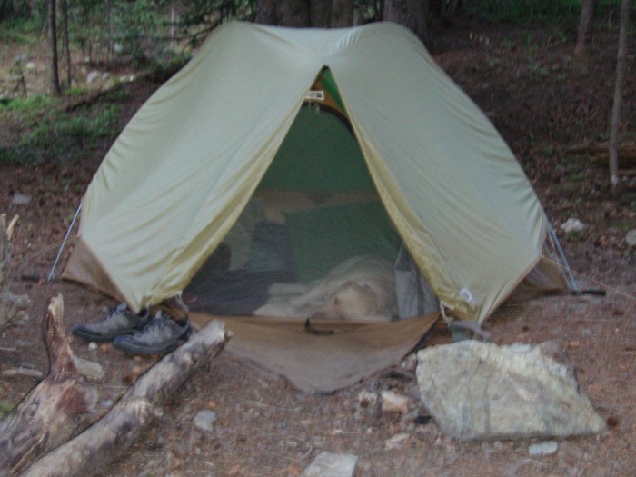
After a day of about 11 miles of hiking/climbing we were all tired and hungry. We set up camp and then fed Aspen who immediately indicated to us that she wanted to go into her den, er, our tent to go to sleep.
Now that we were all set up and our dog taken care of, it was time for us to eat. We borrowed my father-in-law's camping stove for the trip, which I think was last used in 1991 and soon found out there was a reason it has not been used since 1991... it doesn't work. Note to self: check all gear that you rely on before going on a trip. It was now about 9:30pm and we wanted to save our other food for tomorrow after the hike. We ate some fruit and protein bars and passed out.
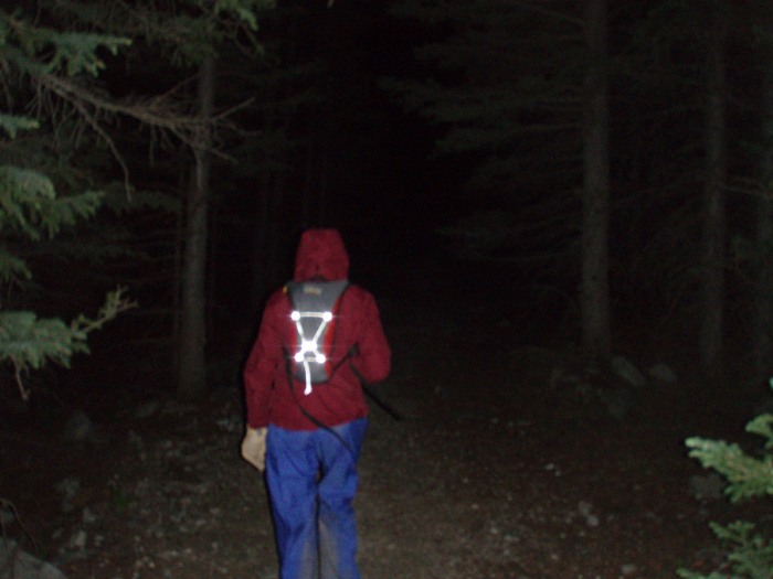
Woke up at 4am and got our packs together and set off. We decided to let Aspen sit this hike out as she was in visible pain from the prior two days and didn't seem to want to go anywhere. We set up a nice comfortable bed for her in the back of the Jeep and we were off.
Hit the trail at 4:30ish under clear and starry skies. A nice contrast to the day before. However, the darkness made trail finding very difficult at first. As soon as you pass through the meadow and enter the trees we came across several crossing trails with what we finally determined the main trail being washed out by run-off... it made it very difficult at night to realize that was the proper trail. After I was able to convince Brooke that it was the right way, we continued on to the river crossing and then started to ascend the ridiculously steep uphill through the trees and past the boulder field on hiker's left.
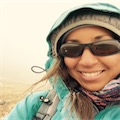
Here is Brooke climbing with determination... blurry pic because she's moving so fast!
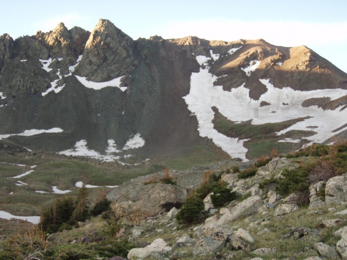
By the time we got out of the trees the sun was rising and we were able to take in the true beauty of this hike.
As we keep pushing on through the basin, Lindsey appears.
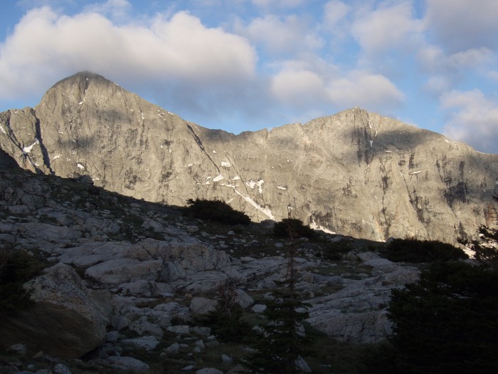
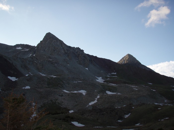
Approaching the ridge
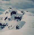
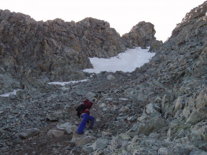
We make it up to the ridge and can see the gully that we are about to climb. Its the one with the snow in it.
We stay right along the rocks and and although difficult with some serious class 3 climbing, we are able to get up fairly easily. And then we hit the ice/snow.
Here is Brooke on the lower portion.
Brooke reaches the ice/snow first and yells down that it is all ice. Given that it was still early, it was still very frozen. Unfortunately there is no other route but to hug the rock and try and use the iced over tracks. The first move she makes she slips on the ice and goes flat on her stomach... my heart drops as there would be nothing I can do to stop a serious fall down the ice and into rocks. She manages to catch herself by her fingertips on the edge of the ice between the rock and stop the fall. Close one.
She keeps going and I then maneuver around and we continue up the ridge to the well deserved summit.
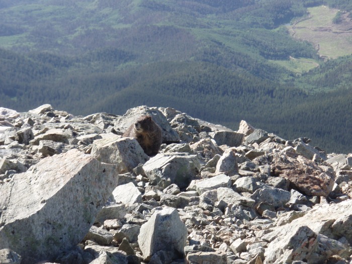
Shared the awesome views with a very friendly visitor.
Headed back down the gully with another climber behind us who has posted his own trip report on this day as well. It was nice to have someone else there in addition to Brooke and I, and I think he felt the same. With the ice that was still there in the morning, it personally was the most exposure that I have encountered in my limited experience. As we were down, there was a group of 4 others about to go up who seemed much better equipted... If I had to do it again, would definitely have a helmet and an ice axe. Met another couple on the way down- hopefully for them the snow softened up by then and they had an easier time of it.
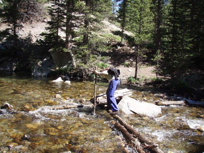
Brooke crossing the river on the way back.
All in all it was a great day with amazing views, and the difficulty of the top half of the gully has definitely added a few notches to my climbing bed post.
Best. Fire. Ever.
Hope this report helps out someone.
Thumbnails for uploaded photos (click to open slideshow):
I was certainly glad to have company going down the top of the gulley, thanks again. Best of luck on the future climbs, maybe we‘ll cross paths again. It was a great day to be out early, I was wondering how you managed the forest in the dark. I lost trail in good light several times, both down and up.
You two did the same thing we did. We climbed Lindsey on July 5th to make up for our failure on Little Bear. I‘m glad you guys got a summit too!
Caution: The information contained in this report may not be accurate and should not be the only resource used in preparation for your climb. Failure to have the necessary experience, physical conditioning, supplies or equipment can result in injury or death. 14ers.com and the author(s) of this report provide no warranties, either express or implied, that the information provided is accurate or reliable. By using the information provided, you agree to indemnify and hold harmless 14ers.com and the report author(s) with respect to any claims and demands against them, including any attorney fees and expenses. Please read the 14ers.com Safety and Disclaimer pages for more information.
Please respect private property: 14ers.com supports the rights of private landowners to determine how and by whom their land will be used. In Colorado, it is your responsibility to determine if land is private and to obtain the appropriate permission before entering the property.


")
")
")
")
")
")
")
")
")
")
")
")
")
")
")
")
")
")
")
")
")
")