| Report Type | Full |
| Peak(s) |
Castle Peak - 14,274 feet Conundrum Peak - 14,037 feet |
| Date Posted | 07/06/2009 |
| Date Climbed | 07/04/2009 |
| Author | Bobo |
| North Face Couloir of Castle, plus Conundrum |
|---|
|
Route: North Face Couloir Climbing Crew: Solo (but met a couple of other 14er.com members for the descent. Thanks CUaaron25 and KiethK. Nice to meet you guys.) I was playing this one by ear...we had been having a family reunion at Snowmass Village in celebration of my parents 50th wedding anniversary, and had climbed La Plata on June 29th. I had hoped to bag another 14er while in the area, but things were conspiring against me. Mostly just scheduling around other things that the family group had planned. Finally, when it looked like I was going to be solo, and the forecast made a long day trip to Snowmass or Capitol look unlikely to succeed, I decided on Castle and Conundrum (probably best for my first Elk Range 14er). Knowing that there was large snowfields to climb through, and keeping the possibility of a north face couloir climb in mind, I packed both my stiff boots, and my 'new' crampons. I left the Condo in Snowmass Village at ~4:30, and parked near the cabin along the Montezuma road near 10,900 feet. After much self debate, I put on the stiff boots, and packed the crampons, hoping for solid snow and a mostly snow climb. I was hiking just after 6:00 am. Early sun illuminates the view south towards Pearl Pass just after crossing Castle Creek near 11,000 feet. (the bridge is out but easily crossed on foot, but probably impossible for all but the most serious of 4-wheelers. 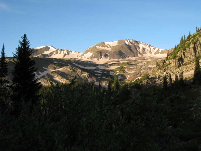 Near 11,600 feet, looking up towards the Montezuma Basin, still lots of road walking ahead. 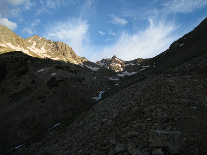 Looking back on the route so far, to the southeast from the next set of switchbacks between 12,100 and 12,200 feet. 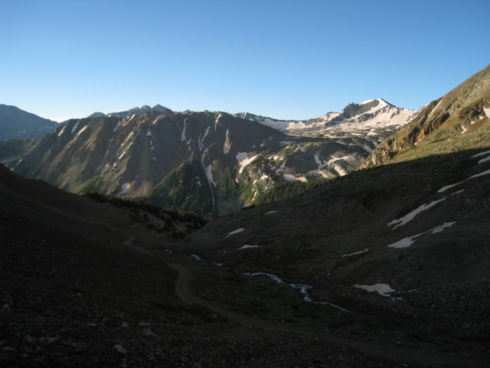 The road continues up into the basin now mostly clogged with snow. Looking west from the final set of switchbacks near 12,600 feet.  First good view of the snow covered lower headwall from about 12,700 feet. By this time, I had been checking the snow along the road, and was pleased to see that it was very firm. I started to think that the North Face Couloir would be "in".  I had passed two hikers along the road, and as I donned my crampons at the end of the road, I could see one solo climber ahead of me near the top of the headwall. I followed what appeared to be the only fresh tracks of the day up the left side of the headwall on still firm snow (now I was getting really pumped about the N. Face Couloir!) From 12,800 feet looking up the headwall. 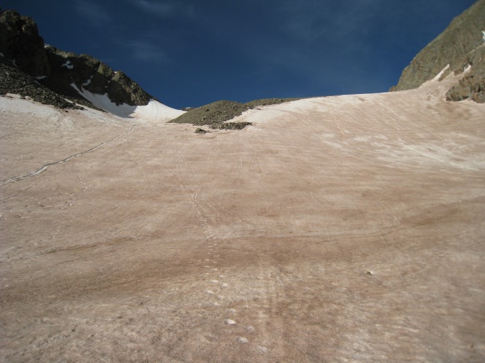 Not quite at the top of the headwall (near 13,400 feet), looking back down on the end of the road, I could see that the solo climber ahead of me had started up the Northeast Ridge route, and another climber was approaching the end of the road. At this point, I was sure I was going to give the N. Face a go. 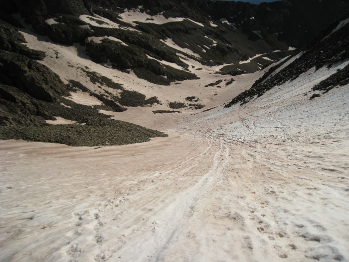 I made an ascending traverse from the top of the headwall towards the lowest set of rocks to the climbers left of the couloir entrance, and started up. The climbing in the lower couloir was great on firm snow. Somewhere near 13,800 and 13,900 feet or so, as the snowfield narrowed, the aspect must have changed slightly, and the snow softened up considerably, I found the best climbing on the left side in the transition zone between rock and snow. It appeared to have slid sometime in the past, and the rock/snow mix was fairly solidified. The top-out on the snow covered ridge was dramatic with great views to the south. The rest of the elk range comes into dramatic view through the low point in the northwest ridge from approximately 13,800 feet (guessing) in the N. Face Couloir. 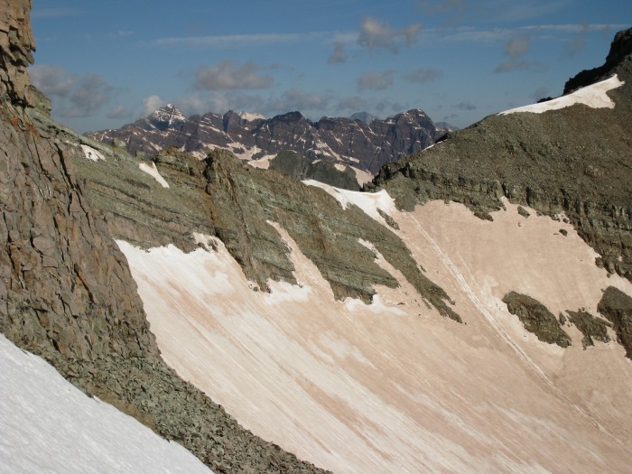 Looking back down on the route and the upper Montezuma Basin and the melt-water lake from the top of the couloir near 14,100 feet. Too bad the snow is so brown this year. I think it's altered the color of the lake. 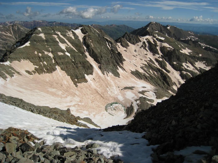 The view south from the top of the couloir...spectacular! 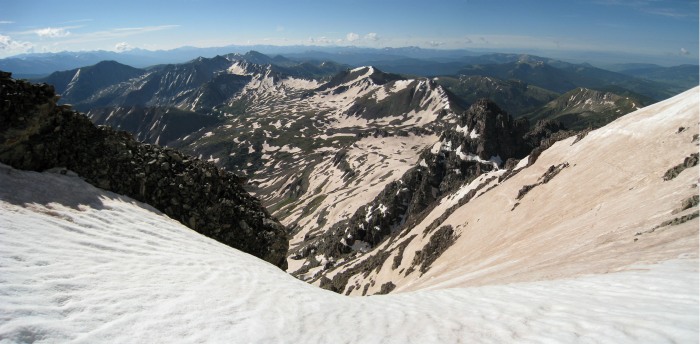 The final summit ridge (phew). I left my crampons on hoping to stay on snow, in hindsight, I probably should have taken them off. Oh well, I needed some practice in 'dry tooling' the crampons.  I reached the summit around 9:15 (a little over 3 hours). I was surprised to be alone on the summit. I felt very slow in the upper couloir, and thought that the solo climber ahead of me would get there before me, and the one coming up behind (also on the northeast ridge route) was making good time last I saw him. A few minutes after I arrived Aaron (CUaaron25) arrived. Obligatory and gratuitous summit shot. 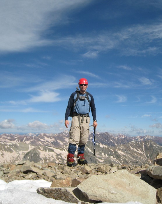 View of the rest of the Elks from the summit 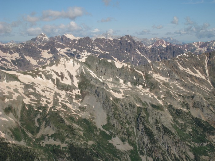 Aaron and I left the summit of Castle together heading for Conundrum. Aaron was moving faster than me, and I got this shot of him on top of Conundrum from South Conundrum. 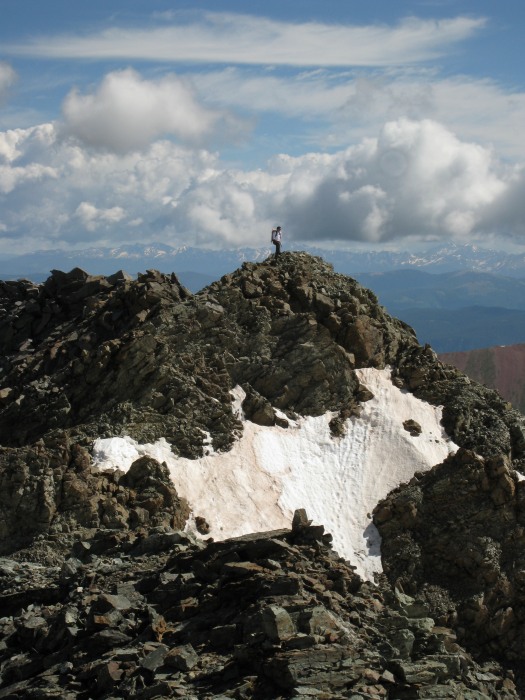 Another view of the elk range (this time from the summit of Conundrum) 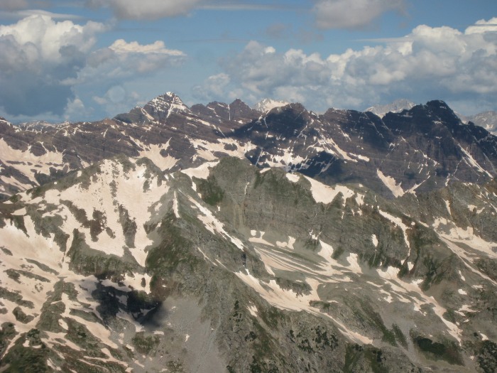 View of the upper portion of my route from the summit of Conundrum. (note: if you zoom in real close to the upper ridge portion, you can see that either a. I flew up the final portion of ridge, or b. my photoshop skills need some work) 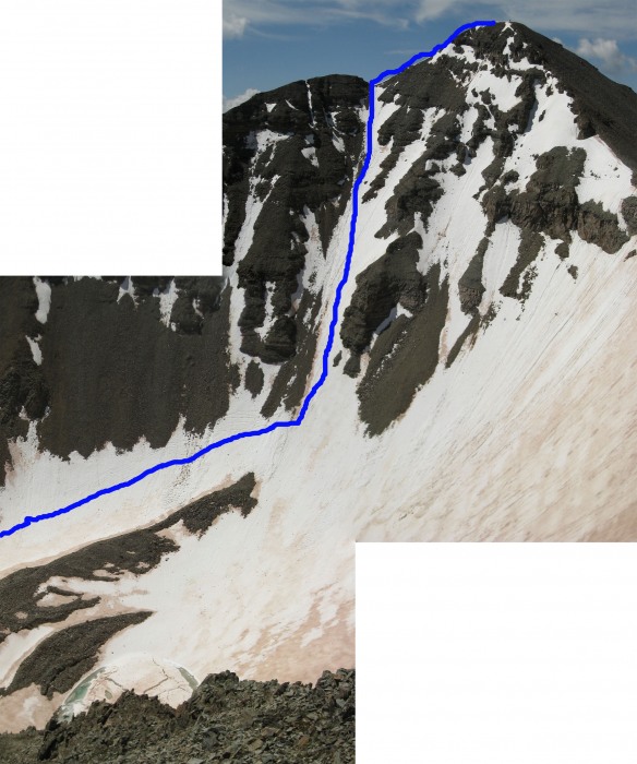 Same shot as above (basically) without the blue line. 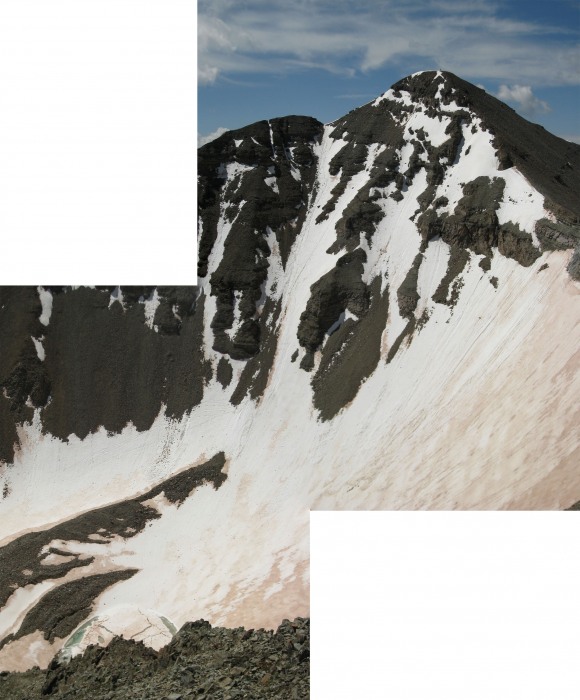 Here's a shot looking down on the Montezuma Basin Road.  On my descent off of Conundrum towards the Conundrum-Castle Saddle, I met fellow 14ers.com member Keith K. Keith joined Aaron and I on the walk out after summiting Conundrum himself. We all glissaded as much as possible from the saddle, and if the side hilling above the melt-water lake were any steeper, I would have put my crampons back on. Aaron put his rain pants on for the glissade (I accused him of trying for Mach 2 versus the standard Mach 1). Other than the occasional rock in the path, this is a relatively safe glissade, as the runout is gentle and long (just stay out of the lake, and above the now hidden rock crevase). Here's a shot of Aaron glissading the upper headwall. 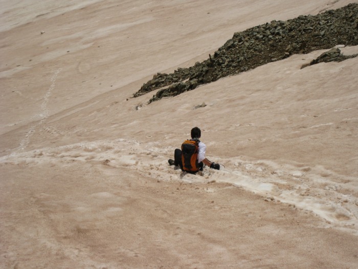 And, Keith K. 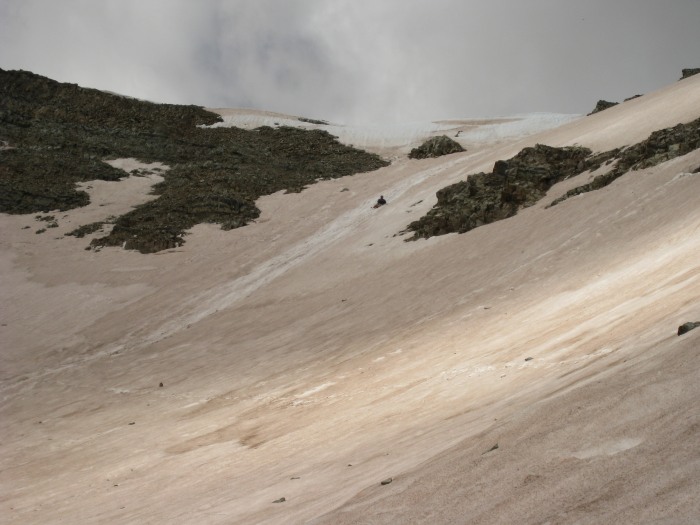 A closer view of the melt-water lake. 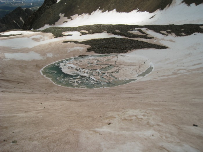 Unknown hikers enjoying the side-hilling (they turned around here).  One last shot of Aaron glissading (wonder why he's smiling so big...maybe he just saved himself about 500 vertical feet of walking?) 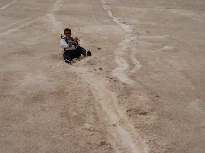 The cascade of Castle Creek above the upper creek crossing  The bridge at the upper creek crossing is out...but a jeep headed up just as I was hiking down, and I didn't see it again, so I assume it made it across. Walking across to the up-hill side was pretty straightforward. 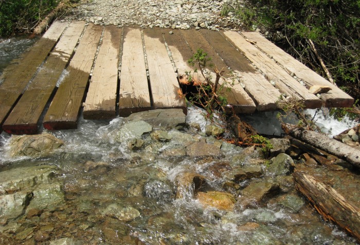 It was a great day out, I loved the ascent of the N. Face Couloir. Once again, it was great meeting you Aaron and Keith, good luck on the rest of your 14er hikes this summer, I'll be roasting in Southern New Mexico until September. Thumbnails for uploaded photos (click to open slideshow):
|
| Comments or Questions | |||
|---|---|---|---|
|
Caution: The information contained in this report may not be accurate and should not be the only resource used in preparation for your climb. Failure to have the necessary experience, physical conditioning, supplies or equipment can result in injury or death. 14ers.com and the author(s) of this report provide no warranties, either express or implied, that the information provided is accurate or reliable. By using the information provided, you agree to indemnify and hold harmless 14ers.com and the report author(s) with respect to any claims and demands against them, including any attorney fees and expenses. Please read the 14ers.com Safety and Disclaimer pages for more information.
Please respect private property: 14ers.com supports the rights of private landowners to determine how and by whom their land will be used. In Colorado, it is your responsibility to determine if land is private and to obtain the appropriate permission before entering the property.


