| Report Type | Full |
| Peak(s) |
La Plata Peak - 14,344 feet |
| Date Posted | 07/05/2009 |
| Date Climbed | 06/29/2009 |
| Author | Bobo |
| La Plata (still some glissading to be had) |
|---|
|
Route: Standard (NW ridge) Climbing Crew: Bob (14ers Bobo), Pam (my better half), Bill (my brother), John (my cousin-first 14er), and Dave (my uncle...more on him below). We were having a family reunion at Snowmass Village in celebration of my parents 50th wedding anniversary (my first 14er was with my dad). I planned a family 14er hike, and chose La Plata because it's class II, and the trail head is relatively close to Snowmass. There were 47 people at the reunion, and it sounded at one time like we would have 4 kids and 9 adults...but by the time that we settled on a 5:00 am departure time for an all day hike, and cousins wanting to play with cousins etc...etc... the 'expedition' had dwindled to 5. Among our group though was my uncle, a 62 year old brit who in 1972, as a member of the British Antarctic Survey, made the first ascent of the north ridge of Mount Andrew Jackson, the highest point on the Antarctic Peninsula. It was the second ascent, and it has only been climbed one more time since. Despite his climbing experience, this would be his first 14er at age 62, he hardly ever rested on the ascent, just kept plugging away, and summited in about 4 hours. 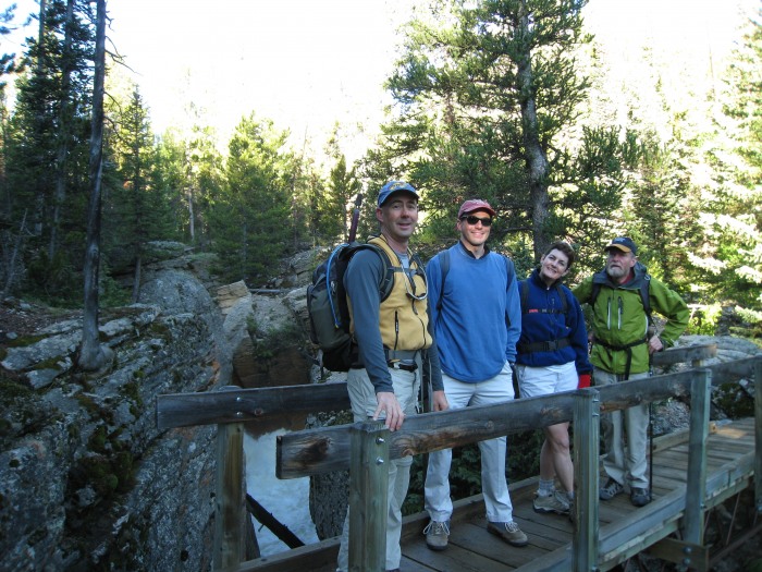 L to R, Bill (brother), John (cousin), Pam (my better half), and Dave (uncle) on the bridge across the spectacular cascade of South Fork Lake Creek. (10,100 feet)  The cascade from the bridge. 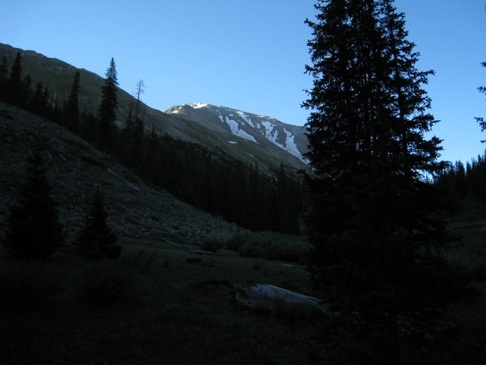 First view of the upper reaches of La Plata, from the relatively gentle upper La Plata Gulch near 11,000 feet. This area is a nice respite after a climb through the forest along the steep cascade of La Plata Gulch creek. The respite is short lived as the trail begins climbing sharply towards the ridge to the left shortly. 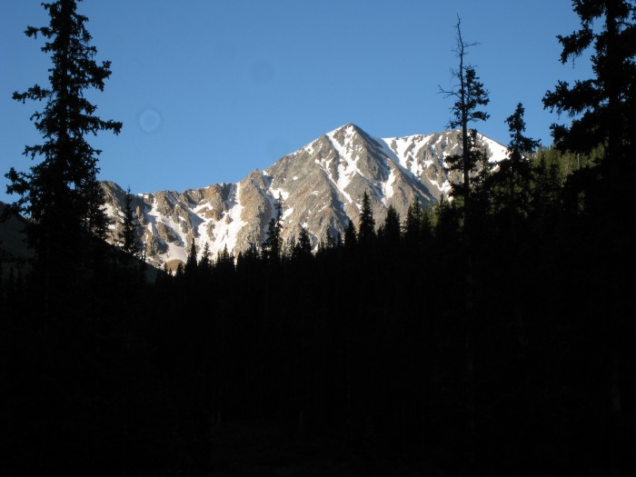 Nice view towards Sayres Peak (13,738 feet) at the head of La Plata Gulch from the vicinity of the previous photo. 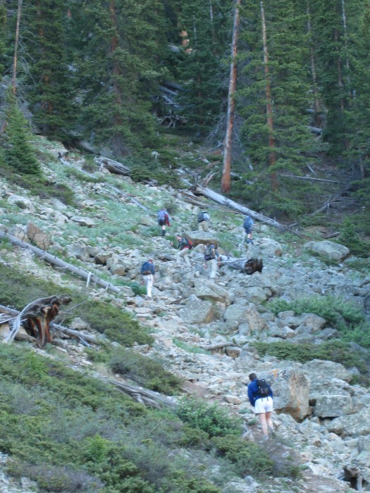 Some rocky areas of trail are crossed as the trail begins it's initial ascent up the ridge. Our group, plus another group mixed during the ridge ascent. Near 11,200 feet.  Working hard to gain the ridge (and the sunshine), Dave continues the upward slog near 12,200 feet. Still more switchbacks and 500 feet of climbing to gain the ridge. 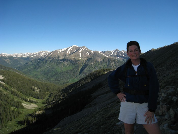 Pam still smiling (but not for much longer) at the same point (12,200') 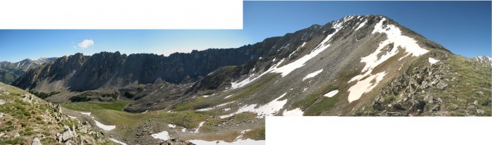 Ellingwood Ridge and summit in panorama from the ridge crest near 12,700 feet. 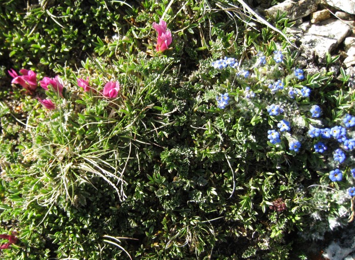 Tufted Milkvetch (astragalus spatulatus) and Alpine Forget-Me-Nots (Myosotis alpestris) in full bloom on the ridge. 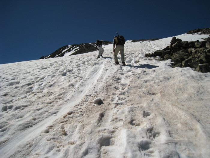 Bill and John beginning the climb through the snowfield on the upper ridge. The snow was firm, and postholing only evident near the edges (easily avoided). Near 13,500 feet. We guess we ascended almost 800 vertical feet on snow. 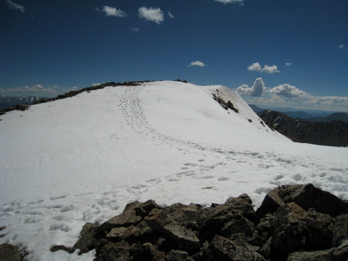 The summit viewed from a minor false summit. 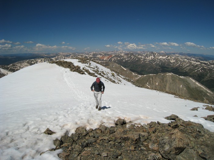 John shows his stuff, and sprints to the summit. 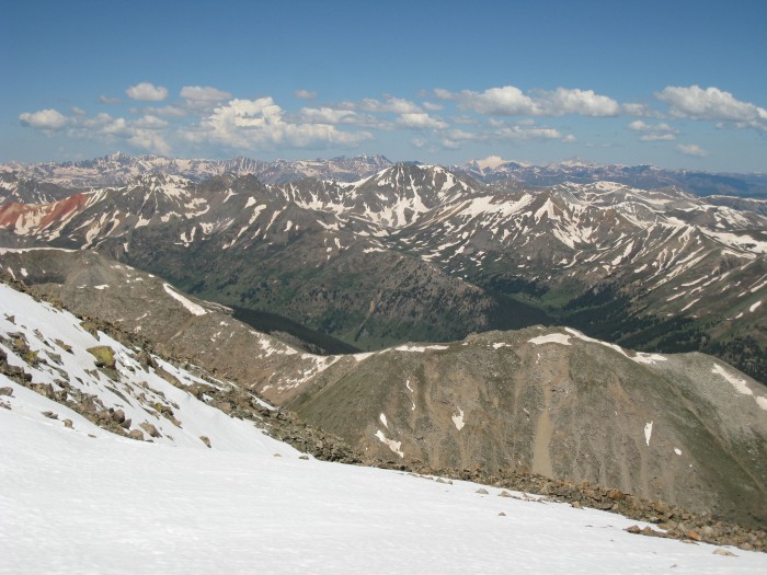 Looking WNW from the summit. Along with the Bells, and Capitol, Snowmass Peak is easily recognizable.  The little snow summit to the SE from the actual summit appeared higher than the actual summit...Pam and I are all smiles here. 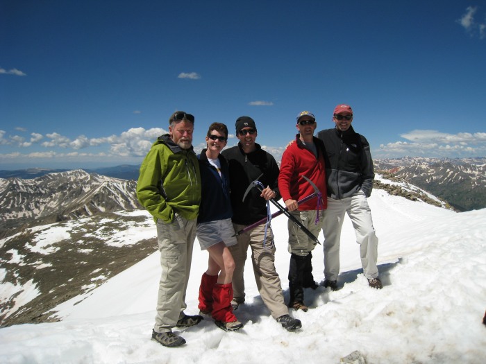 The whole gang on the summit. 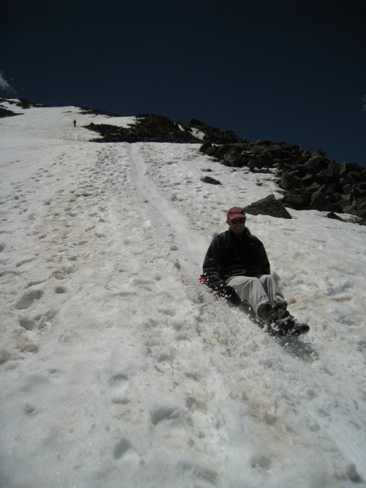 John on Glissade 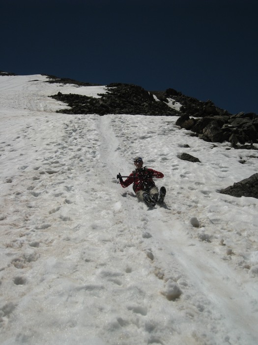 Bill on Glissade 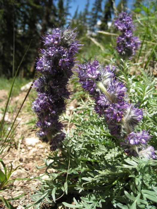 Penstemons (?) along the trail. 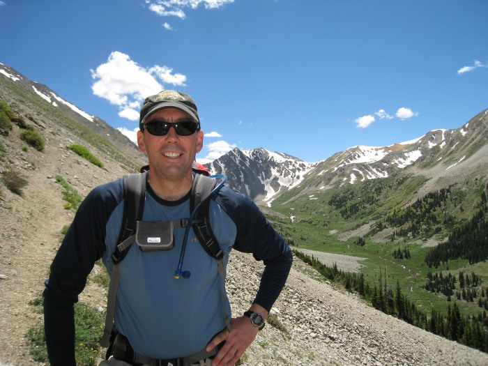 On the hike out, one last view up towards Sayres peak. No afternoon thunderstorms here, what a spectacular day. Hmm, might have to get a new pack, this one covers up my 14ers.com logo Thumbnails for uploaded photos (click to open slideshow): ")
")
")
")
")
")
")
")
")
")
")
")
")
")
")
")
")
")
")
|
| Comments or Questions |
|---|
|
|
Caution: The information contained in this report may not be accurate and should not be the only resource used in preparation for your climb. Failure to have the necessary experience, physical conditioning, supplies or equipment can result in injury or death. 14ers.com and the author(s) of this report provide no warranties, either express or implied, that the information provided is accurate or reliable. By using the information provided, you agree to indemnify and hold harmless 14ers.com and the report author(s) with respect to any claims and demands against them, including any attorney fees and expenses. Please read the 14ers.com Safety and Disclaimer pages for more information.
Please respect private property: 14ers.com supports the rights of private landowners to determine how and by whom their land will be used. In Colorado, it is your responsibility to determine if land is private and to obtain the appropriate permission before entering the property.

