Download Agreement, Release, and Acknowledgement of Risk:
You (the person requesting this file download) fully understand mountain climbing ("Activity") involves risks and dangers of serious bodily injury, including permanent disability, paralysis, and death ("Risks") and you fully accept and assume all such risks and all responsibility for losses, costs, and damages you incur as a result of your participation in this Activity.
You acknowledge that information in the file you have chosen to download may not be accurate and may contain errors. You agree to assume all risks when using this information and agree to release and discharge 14ers.com, 14ers Inc. and the author(s) of such information (collectively, the "Released Parties").
You hereby discharge the Released Parties from all damages, actions, claims and liabilities of any nature, specifically including, but not limited to, damages, actions, claims and liabilities arising from or related to the negligence of the Released Parties. You further agree to indemnify, hold harmless and defend 14ers.com, 14ers Inc. and each of the other Released Parties from and against any loss, damage, liability and expense, including costs and attorney fees, incurred by 14ers.com, 14ers Inc. or any of the other Released Parties as a result of you using information provided on the 14ers.com or 14ers Inc. websites.
You have read this agreement, fully understand its terms and intend it to be a complete and unconditional release of all liability to the greatest extent allowed by law and agree that if any portion of this agreement is held to be invalid the balance, notwithstanding, shall continue in full force and effect.
By clicking "OK" you agree to these terms. If you DO NOT agree, click "Cancel"...
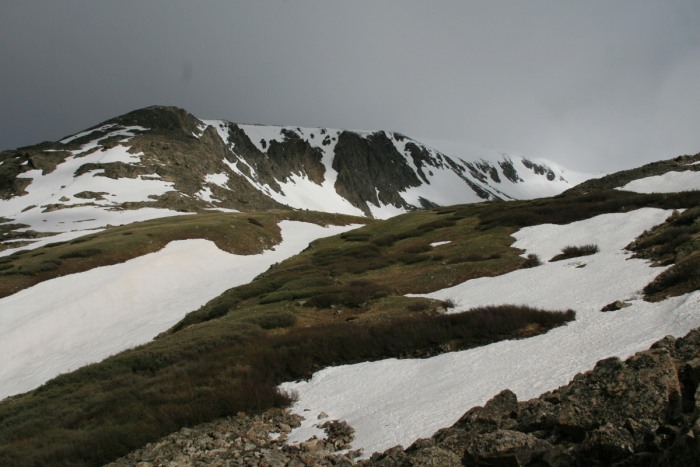
Low clouds and wind greeted me at the trailhead. I decided to leave the snowshoes in the truck, as there didn't seem to be a lot of snow to make the extra weight worth it. From the previous trip reports, I did pack my crampons.
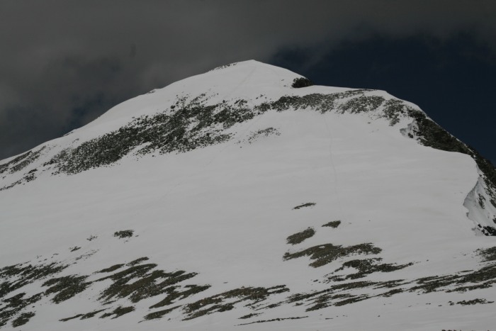
Low clouds, starting on the trail:
The first part of the trail involves being whipped in the face by bushes. Not so pleasant, but once past that section, the trail isn't too bad. A little past the mining ruins, the snow starts in larger patches. One couple turned around from post-holing too much and too deep. I decided against going up the ridge, as the wind sounded pretty fierce. I also like to ascend what I will want to glissade on the way down.
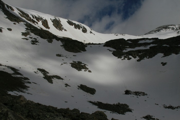
There is still plenty of snow left in the upper basin. At least a foot of new snow fell on the upper areas, probably in Saturdays rain we saw on the plains. 8) In a few flat areas snow shoes would have been useful. But the slope is steep enough, I found kicking steps to be easier, if tiring.
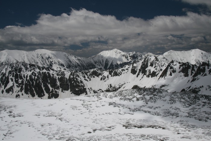
Upper basin area:
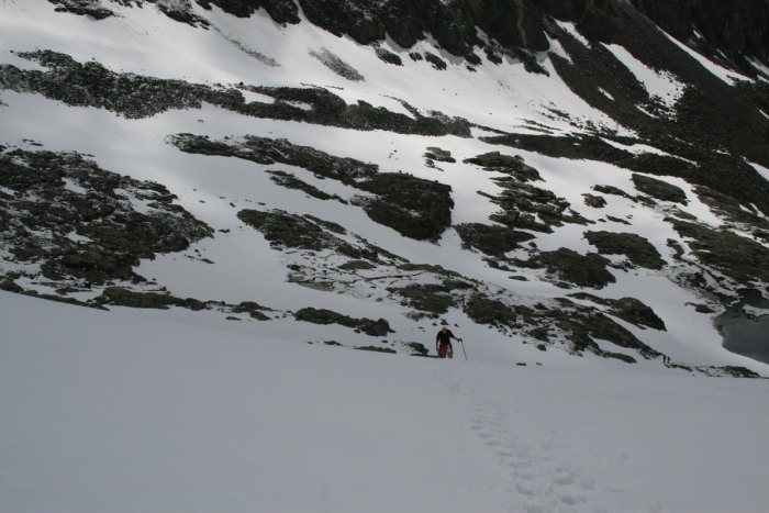
A grateful guy following my boot steps up to the Quandary-Fletcher connecting ridge. I wish he did have beers to give me for my efforts!:
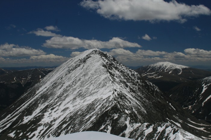
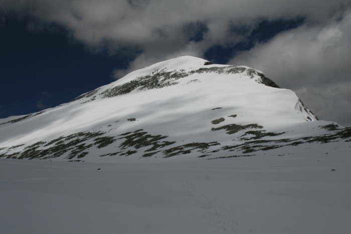
View of the way ahead:
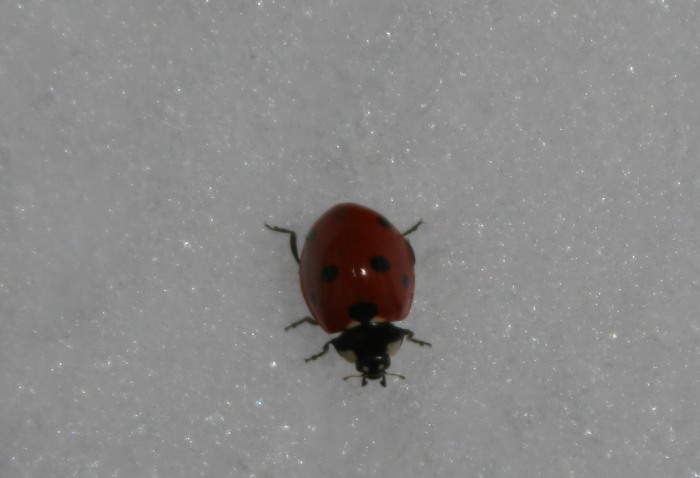
Saw a few lady bugs on the snow. What are these guys doing?
From a previous trip report, Dave Cooper's Colorado Snow Climbs book, and from my trip up Atlantic, I knew that there were cornices along the ridge. So I stayed away, and chose to climb well onto the SE face of Fletcher. The last section was pretty steep, so I stayed at least 5' away from the edge.
A photo from later in the day, showing my ascending and descending routes:
For the upper section I donned my crampons, and practiced my slow mountaineering rest step, to make sure I had stable footing.
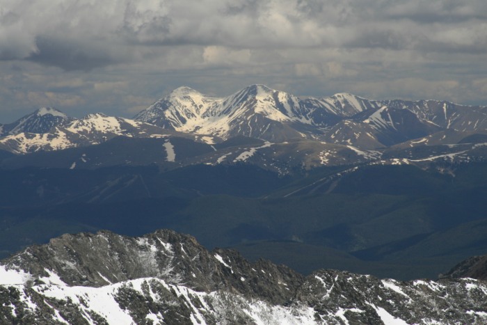
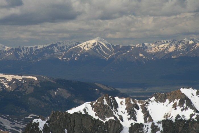
A view of Decalibron from the ridge:
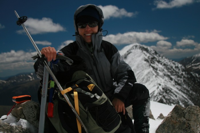
A happy face, glad to have safely avoided the cornices:
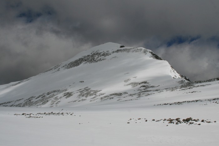
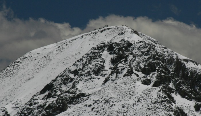
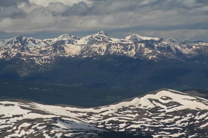
Quandary:
Here's a zoom in, showing at least 20+ people on the summit of Quandary:
Drift Peak:
Grays and Torreys:
Mt of the Holy Cross:
Mt Massive:
Mt Elbert:
I glissaded down the SE face, off the summit very slowly. Not only to be safe, but because the fresh snow had started melting in the bright sun. In fact it was very difficult to glissade at all!
Back down in the high valley, the impressive ridge off of Drift Peak:
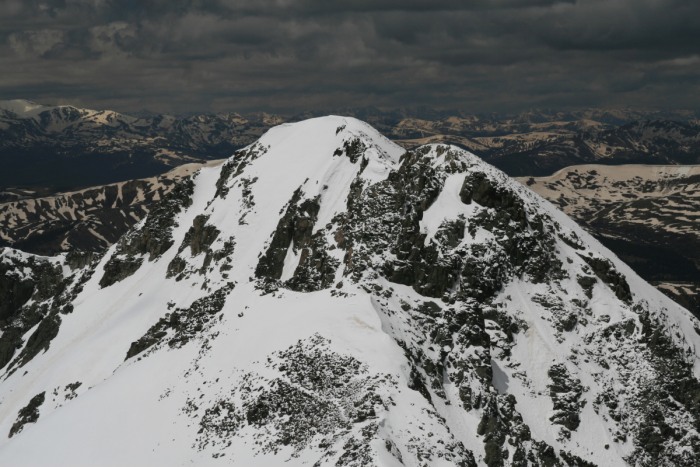
Looking back at Fletcher, before I go down into the lower valley:
I had hoped that lower down, the glissading would get better, but the slush didn't want to let me pass by easily. I had to get a mini sled of snow underneath me to slide, as my boots kept stopping me.
One of my slushy paths:
The last glissade worked much better, as I think it was the steepest and wettest one.
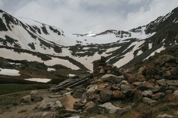
Mining ruins, with Fletcher Mtn in background:
Talked with a few people on the way down, who had attempted the west ridge of Quandary and turned back, and one who had wanted to attempt Fletcher but got on the wrong path a few times. One took my photo, so that this report wouldn't be all scenery
Zooming in on the summit, one last time. Had the mountain all to my self, amazing!
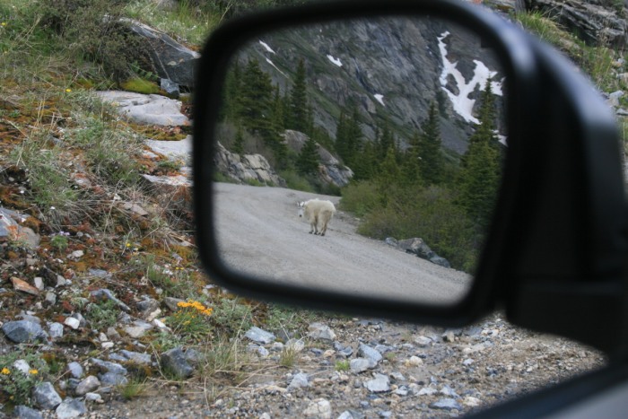
And what would a trip to this area be without goats?
Thumbnails for uploaded photos (click to open slideshow):
Isn‘t the solitude wonderful on these high 13ers ?? The past couple of weekends, I‘ve hiked up Ouray, Horseshoe, and Sheridan - and never ran into one other person. Like your picture of Quandary with 20 people on the summit, I took one of Sherman with a load of people on it from Sheridan‘s quiet summit. Last summer I hiked up Northstar, enjoying the solitude, and shook my head at the conga line of people hiking up Quandary. To each their own, I guess. :D Thanks for posting this trip report - I am looking forward to doing Fletcher in the near future.
I agree with mtgirl that the high 13ers are awesome. I was on Atlantic Peak Friday, no one around except my partner and I. Drove past the Quandary TH afterwards and there must have been 20+ cars at the TH. The Northface of Fletcher looked very inviting as a nice snow climb, after a few cornice slough off. Nice report and pics.
Glad to finally meet a 14er poster on the trail and that my photo of you came out good. Great pics of the top of the climb. 13 sounds easier than 14, but this was not an easy climb with the mushy snow and cornices. Happy to have kept your gear from being bread crumbs on the way down :)
Wow, it could have a disaster if I started loosing stuff out of my pack... :oops: those bushes were brutal!
Caution: The information contained in this report may not be accurate and should not be the only resource used in preparation for your climb. Failure to have the necessary experience, physical conditioning, supplies or equipment can result in injury or death. 14ers.com and the author(s) of this report provide no warranties, either express or implied, that the information provided is accurate or reliable. By using the information provided, you agree to indemnify and hold harmless 14ers.com and the report author(s) with respect to any claims and demands against them, including any attorney fees and expenses. Please read the 14ers.com Safety and Disclaimer pages for more information.
Please respect private property: 14ers.com supports the rights of private landowners to determine how and by whom their land will be used. In Colorado, it is your responsibility to determine if land is private and to obtain the appropriate permission before entering the property.