Download Agreement, Release, and Acknowledgement of Risk:
You (the person requesting this file download) fully understand mountain climbing ("Activity") involves risks and dangers of serious bodily injury, including permanent disability, paralysis, and death ("Risks") and you fully accept and assume all such risks and all responsibility for losses, costs, and damages you incur as a result of your participation in this Activity.
You acknowledge that information in the file you have chosen to download may not be accurate and may contain errors. You agree to assume all risks when using this information and agree to release and discharge 14ers.com, 14ers Inc. and the author(s) of such information (collectively, the "Released Parties").
You hereby discharge the Released Parties from all damages, actions, claims and liabilities of any nature, specifically including, but not limited to, damages, actions, claims and liabilities arising from or related to the negligence of the Released Parties. You further agree to indemnify, hold harmless and defend 14ers.com, 14ers Inc. and each of the other Released Parties from and against any loss, damage, liability and expense, including costs and attorney fees, incurred by 14ers.com, 14ers Inc. or any of the other Released Parties as a result of you using information provided on the 14ers.com or 14ers Inc. websites.
You have read this agreement, fully understand its terms and intend it to be a complete and unconditional release of all liability to the greatest extent allowed by law and agree that if any portion of this agreement is held to be invalid the balance, notwithstanding, shall continue in full force and effect.
By clicking "OK" you agree to these terms. If you DO NOT agree, click "Cancel"...
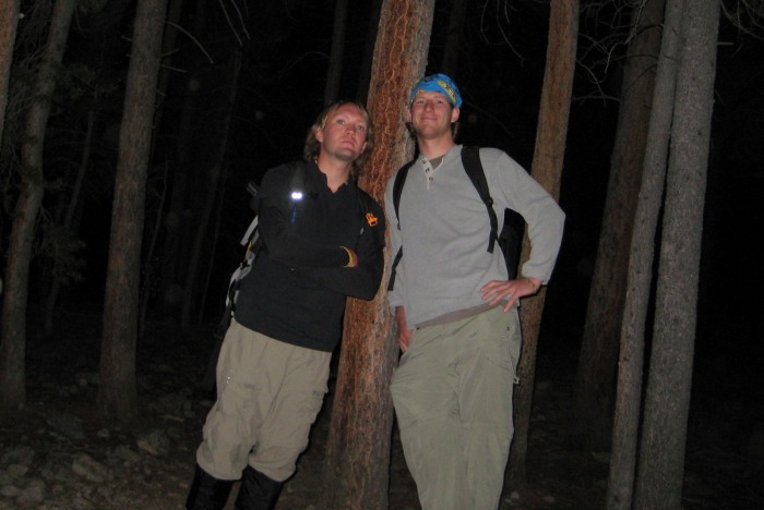
My friend Dan and I woke up early and drove down to the trailhead on Saturday morning. The dirt road is in pretty good shape... I have a 4WD vehicle, but that probably isn't even necessary to reach the TH. We hit the trail at 4:30am, a little later start than planned, so we missed the 14ers group that was planning to start at 4am or before.
Dan and I at the trailhead
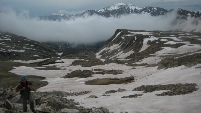
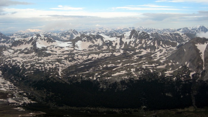
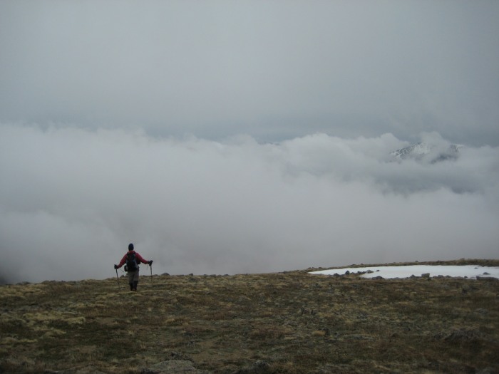
The walk through the woods was gradual, but long (the length of that section hit home on the way out). Eventually we got above treeline and saw Columbia and Harvard for the first time. We also realized that the weather probably wasn't going to clear up.
First view of Harvard
Looking back at Yale, which briefly appeared through the clouds
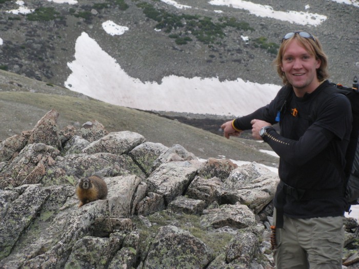
Marmot and Me
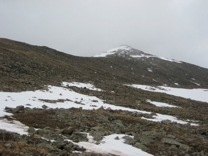
The trail up to Harvard is really easy to follow, and never really gets too steep. A couple patches of snow near the top, and we were at the summit.
Micah and Jean on the summit
The weather cleared for a few seconds, and I was able to snap this picture from the summit
Dan reaches the top
I discussed the Columbia traverse with Micah, Jean, Matt, and Dan while on the summit. We decided that while it was cloudy, it didn't look too threatening, and we would give it a shot. Dan had developed some bad blisters on his feet, so he decided to call it a day on Harvard and head back to the trailhead.
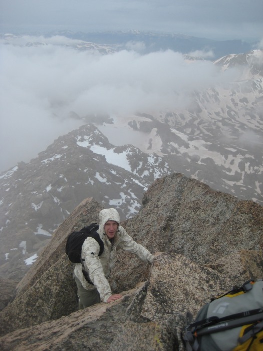
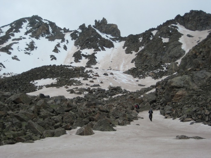
Micah did a nice job explaining the specifics of the traverse to Columbia in his trip report, so I won't rehash any of that information. While it wasn't a long traverse in terms of mileage, there was a lot of scrambling, crossing snow fields, loss of elevation, etc. It took a while, to say the least!
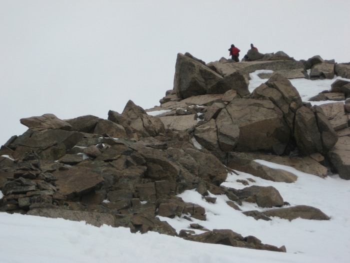
Micah descending the ridge
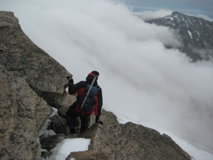
Matt hanging out above the clouds
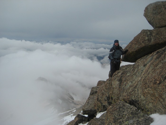
Jean leading the way
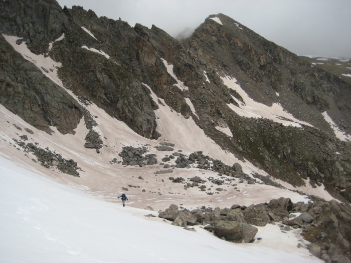
This was from about 12,400, when we started heading back UP to Columbia
The snow was just firm enough to make the route we chose possible. My legs were feeling great, so I set the bootpack up the snowfields.
Jean following behind me
Finally, the ridge to Columbia!
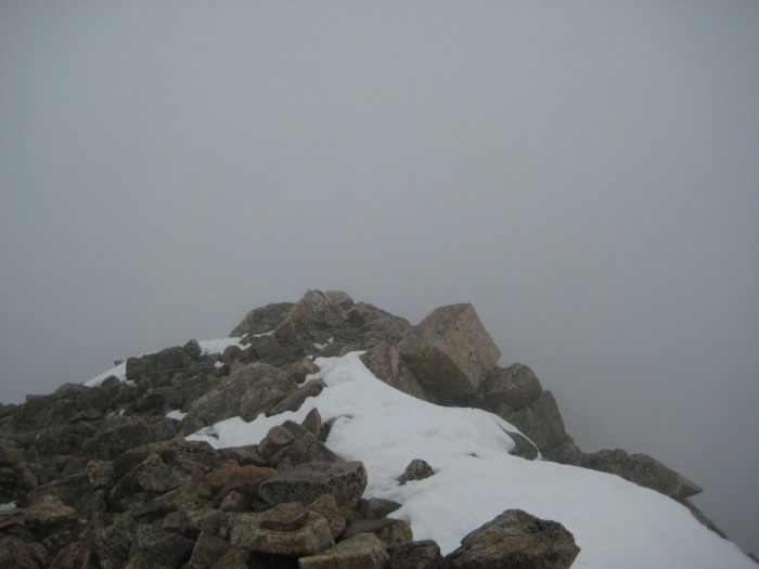
And the stunning view from the summit!!
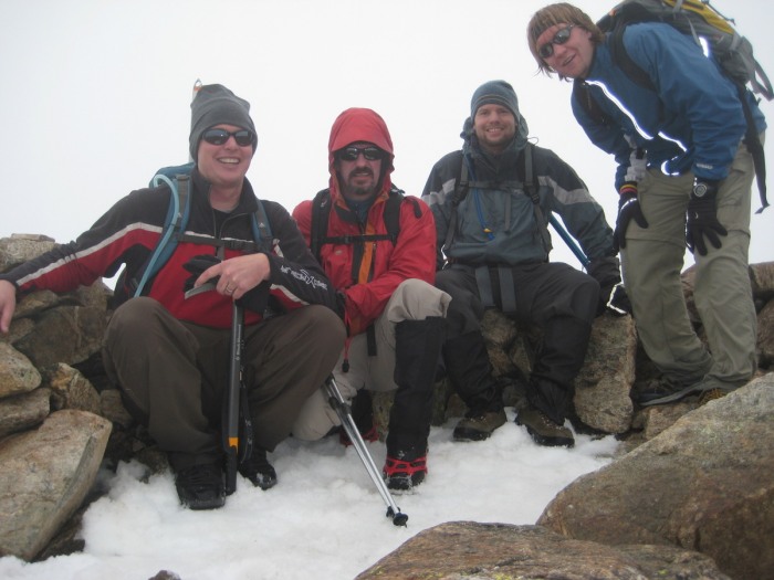
Group shot on the summit of Columbia
The scramble up to the top of Columbia took some effort and careful foot placement, because it was snowing/raining. About 150-200 ft from the top, we heard a couple rumbles of thunder. That got everyone's heart beating a little faster, and we really hauled it to the top... spent about a minute snapping some pictures, and then immediately began our descent. The trail down Columbia's west slopes is essentially just a loose rock field, and when its wet, it can be treacherous! We were all soaked by the time we hit treeline, and needless to say, it felt good to get in the car and turn the heat on! It took me a couple hours to warm back up.
Thanks to Dan, Micah, Matt, and Jean for a great hike. It was a good day in the mountains, despite less than ideal conditions. The advantage of all the precipitation? The next day there was fresh snow on Missouri Mountain, which made for some great turns on my ski descent! I'll get that trip report posted shortly.
Thumbnails for uploaded photos (click to open slideshow):
Jake,
Nice suppliment to the TR. It is nice to see others pics cause you don‘t get many of yourself. It was great hiking with you guys. Maybe we can grab some more peaks together in the near future.
It was a pleasure hiking with you - your legs were kickin butt! I‘m gonna steal some of these photos if you don‘t mind :-) that one of me on top of Harvard is saaweeeeet!
Caution: The information contained in this report may not be accurate and should not be the only resource used in preparation for your climb. Failure to have the necessary experience, physical conditioning, supplies or equipment can result in injury or death. 14ers.com and the author(s) of this report provide no warranties, either express or implied, that the information provided is accurate or reliable. By using the information provided, you agree to indemnify and hold harmless 14ers.com and the report author(s) with respect to any claims and demands against them, including any attorney fees and expenses. Please read the 14ers.com Safety and Disclaimer pages for more information.
Please respect private property: 14ers.com supports the rights of private landowners to determine how and by whom their land will be used. In Colorado, it is your responsibility to determine if land is private and to obtain the appropriate permission before entering the property.