| Report Type | Full |
| Peak(s) |
Mt Baker - 10778 |
| Date Posted | 05/30/2009 |
| Modified | 10/04/2010 |
| Date Climbed | 05/27/2009 |
| Author | bergsteigen |
| 8,000‘ of Mt Baker via Boulder Glacier/Cleaver |
|---|
|
Mt Baker May 25-28, 2009 Rope Team: Josh, me, Rob, Mike Details: Ascent: Boulder Glacier Descent: Boulder Cleaver/Ridge Total Elevation Gain: 8,500' Total Mileage: 16mi Total Hours: 30 Prelude: On this trip we had 2 highly experienced mountaineers, me (medium skills - well, I started the trip at medium, and learned a lot!) and one 100% novice. Rob has never snow camped, been on a rope team, wore crampons, or used an ice axe. Add in the added altitude from sea level, and it was a very tough mountain to start on, and he learned a lot and did an amazing job considering where he started. This peak, and especially this route is NOT a beginner mountain by any stretch. We only made it through patience, perseverance and sheer force of will. A lot more time was added to the trip to instruct and coach. Day 1 Mileage: 5 Elevation gain: 2,643' Access to the trailhead was hampered by some snow on the last switchback. We almost had to rent a chainsaw to clear a downed tree that blocked the road at the last junction, but thankfully someone had done it before we got there. There is a good trail for about 2.1 miles on and around Boulder Ridge that was fairly easy to follow. There are stretches of snow and mud throughout. From day 1 to day 4 when we packed out, a lot of snow had melted due to the warm temperatures (and rain). A few downed trees exist that had to be circumvented, crawled under and over.  Leaving the trail to gain the ridge, there is a lot of snow piled up still. Lots of kicking steps. Up on the ridge proper, we come across a meadow with our first good views of Baker 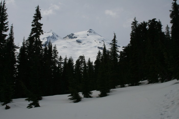 Here's a close up of the upper crevasse field  The ridge was narrow and heavily snow covered. It made for some incredible views. 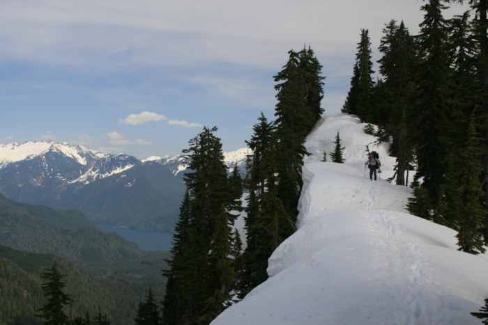 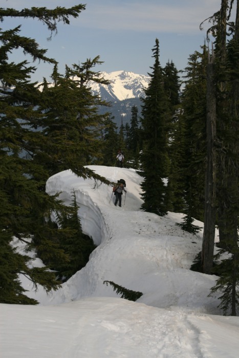 There was some exposed ridge hiking and tree climbing, before the ridge open up to show the way clearly. 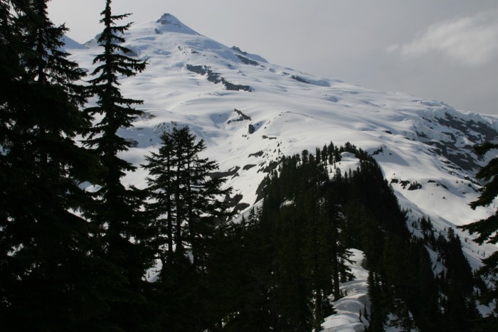 Making our way up to where the glacier starts 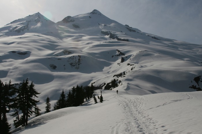 Setting up our high camp at 5,000'  A beautiful sunset on neighboring Mt Shuksan 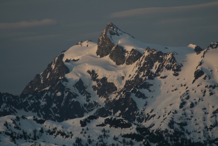 Map of the approach on day one (as well as the descent - in purple) 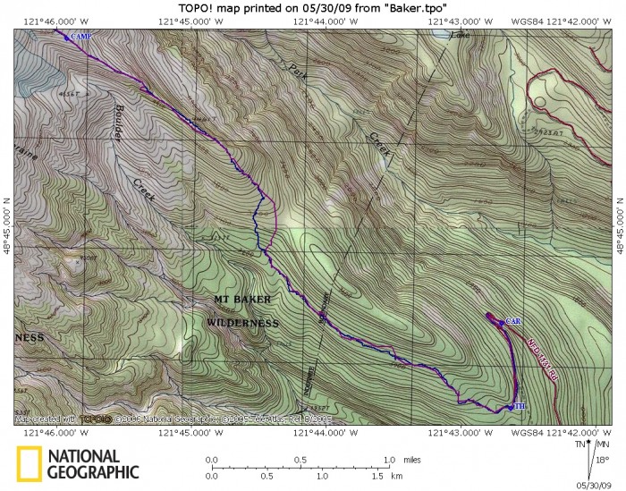 Day 2 Mileage: 0 Elevation gain: 0' RAIN!!!!! We were either in the clouds, or being rained on all day long. We got one very brief sunny couple minutes, before being socked in again. Everything was wet and soaked through. We had puddles (well, more like a pool) in our tent. In order to funnel the water out, we had to "mold the snow" into ditches under the tent. Walking around camp was a slushy nasty affair. At least we got to catch up on our sleep and rest. The Clobiosh card tournament was deadlocked at 1-1, though I did get creamed at the iPhone hockey...  Day 3 - Summit Day Mileage: 6 mi Elevation gain: 5,791' Hours: 17 We wake to no rain (Woohoo!) but some clouds... that thicken around us. We are pumped up for a good summit day!   We rope up and start up the ridge, and into the clouds...  We ended up veering onto the Boulder Glacier (not our intended route), and had ice falls and crevasses to navigate in the clouds via our GPS units, maps and compasses.   Soon enough, we climb above the clouds and get some amazing views of peaks sneaking out of the clouds with us 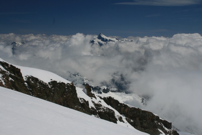 It sure made navigating around the upper, larger, longer crevasses much easier!   Heading up glacier and having some fun while doing it!:  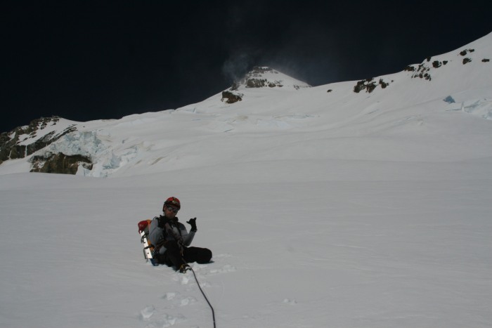 Glad we were not near these! 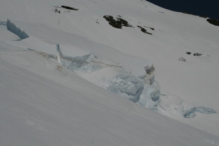 We decided to climb up onto the ridge, and onto some rocks, as the crevasses get bigger and more extensive. Then comes the STEEP, icy and windy summit cone pitch.  Taking a break along the way, to enjoy the views   Here's the last nasty pitch... (and summit) I had to break out my obnoxious NYker attitude   Here we are approaching the last few feet.... the wind is NASTY!   Our happy smiling faces on the summit!!! 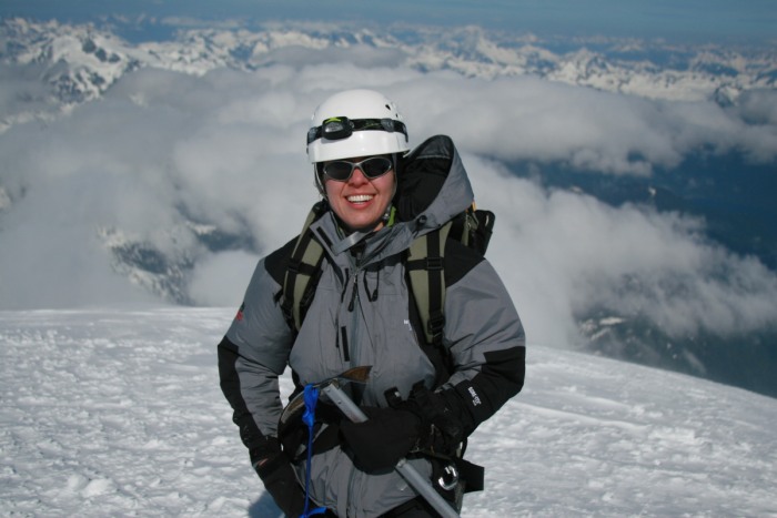 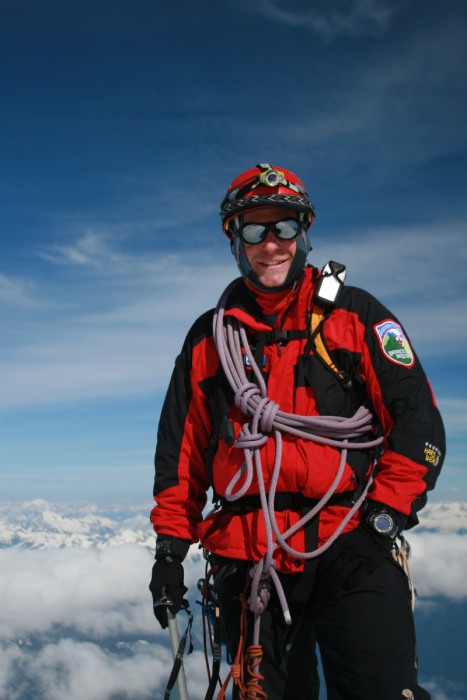   Now for our very long descent, can't quite see our tents...  We decide on a different, and easier way down. Navigating crevasses in the dark was not desired. We go to the saddle between Sherman Peak and go down the upper part of the glacier, before meeting up with our earlier trail on the ridge. We then follow the ridge all the way down to our tents. The active part of the volcano... we could see some active fumaroles and we smelled sulfur most of the day 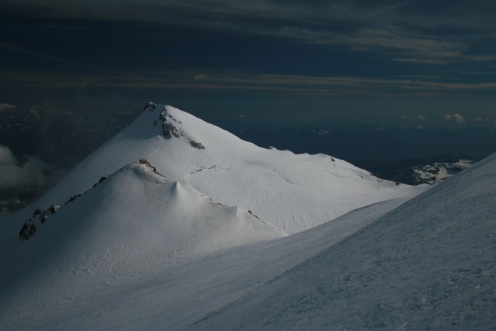 The way down was a lot of work, Rob thought it might be harder than the way up! He had to learn some tricky and non-intuitive crampon work to get down the icy sections. That and I had to show him the proper ice axe arrest form, since he kept falling. 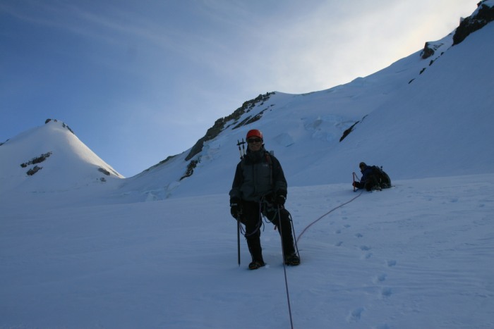 We got some great views into British Columbia and those gorgeous peaks 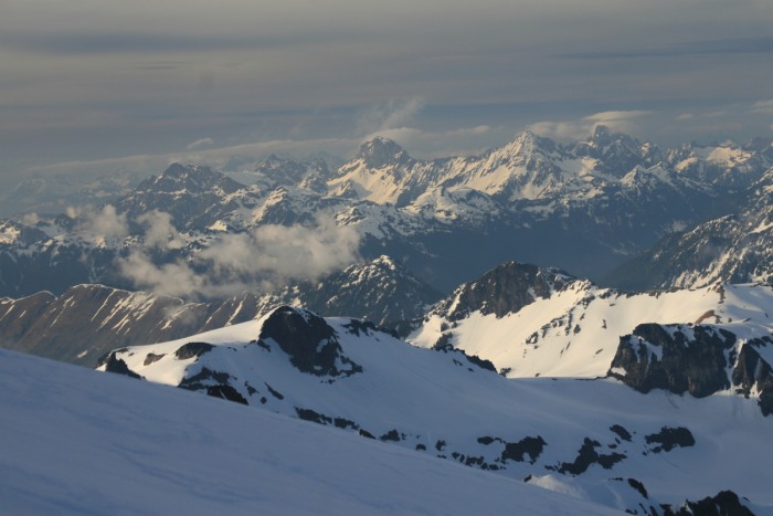 The upper section of the ridge was ice crusted with a gooey center... so we post-holed for quite some time, until we taught Rob how to glissade in a safe area (still roped up). Then we sought out every slope to slide down. Not all worked for everyone. Post-holin' is hard work! Poor Josh 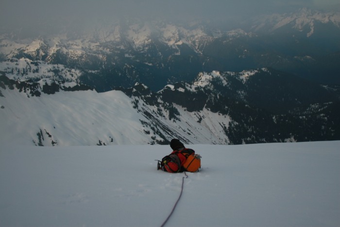 It was rather dark when we got close to our tents, and I caught the moon setting behind Mt Baker 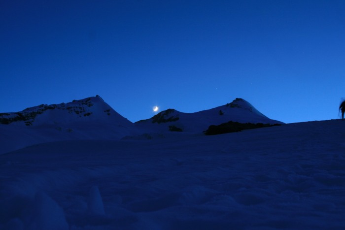 After a long day we take off our boots and eat a bit before crawling into our tents for a very short sleep. Map of the summit trek. Blue: up Purple: down 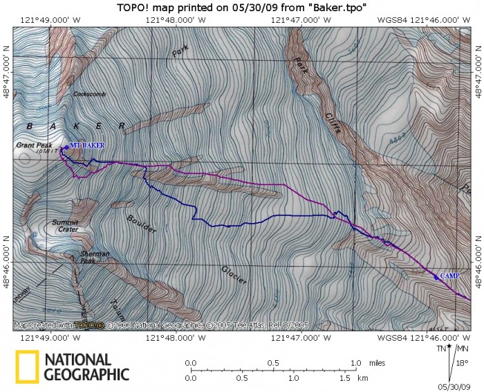 Day 4 Mileage: 5 mi Elevation gain: 60' Up as early as we can stand it, as only 2 of us have ANY hope of making our flights out of Seattle. A beautiful sunrise awaited us, to cheer us on our way. 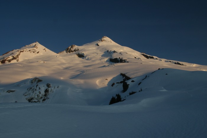 So we pack up and take our parting shots at the mountain, some more humorous than others 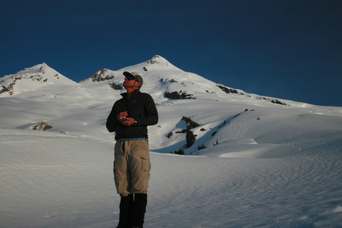 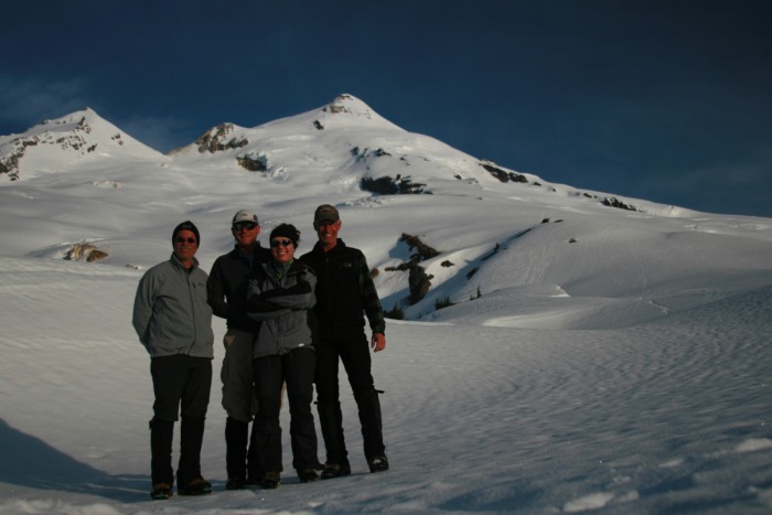 We rappelled down a slope on the ridge to avoid the nasty tree-huggin down climb from day 1. Here Josh is taking Rob's pack down 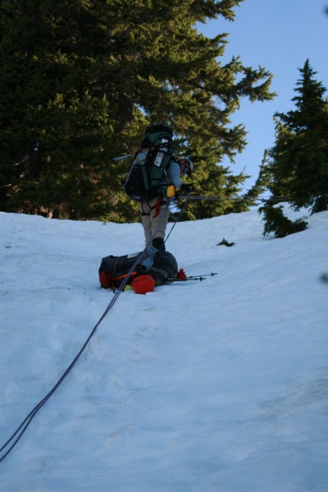 Josh pointing the way to the lower ridge trail that we tried for awhile, until returning to the ridge trail. 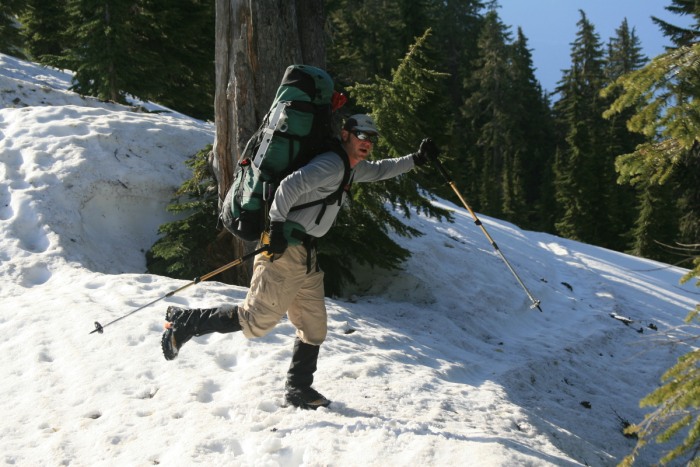 Bye Bye Mt Baker, you were awesome!!! 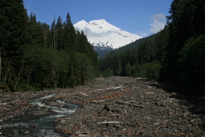 Overview map of the entire trip: Blue: up Purple: down 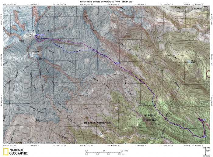 Conclusions: 1. The Boulder Glacier direct route was amazing and loved by all. While the ridge route is the easier of the two. 2. While you can camp higher than we did, our campsite was naturally protected from the wind. Only needed to build a couple snow walls for cooking. 3. Snowshoes may have come in handy, and prevented a lot of post-holin'. But they are added weight. 4. The summit day can be a lot shorter than 17hrs depending on the strength/endurance of the group. Thumbnails for uploaded photos (click to open slideshow):
|
| Comments or Questions | ||||||
|---|---|---|---|---|---|---|
|
Caution: The information contained in this report may not be accurate and should not be the only resource used in preparation for your climb. Failure to have the necessary experience, physical conditioning, supplies or equipment can result in injury or death. 14ers.com and the author(s) of this report provide no warranties, either express or implied, that the information provided is accurate or reliable. By using the information provided, you agree to indemnify and hold harmless 14ers.com and the report author(s) with respect to any claims and demands against them, including any attorney fees and expenses. Please read the 14ers.com Safety and Disclaimer pages for more information.
Please respect private property: 14ers.com supports the rights of private landowners to determine how and by whom their land will be used. In Colorado, it is your responsibility to determine if land is private and to obtain the appropriate permission before entering the property.


