| Report Type | Full |
| Peak(s) |
Huron Peak - 14,006 feet |
| Date Posted | 05/20/2009 |
| Date Climbed | 05/26/2001 |
| Author | Easy Rider |
| East Face ‘01 |
|---|
|
5/26/2001 It was memorial weekend, and a few other folks were camping at the Rockdale TH. Clear Creek was raging in the afternoon. I made camp up on the hill while the beer cooled in the creek. I joined my neighbors, WP Lee, Chris & the cook. A half dozen others showed later, but I made myself go to bed early. I crossed the icy creek with my board and bike about 2 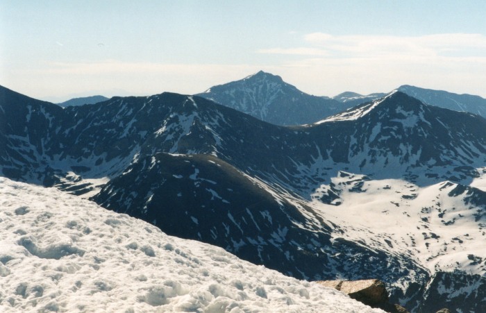   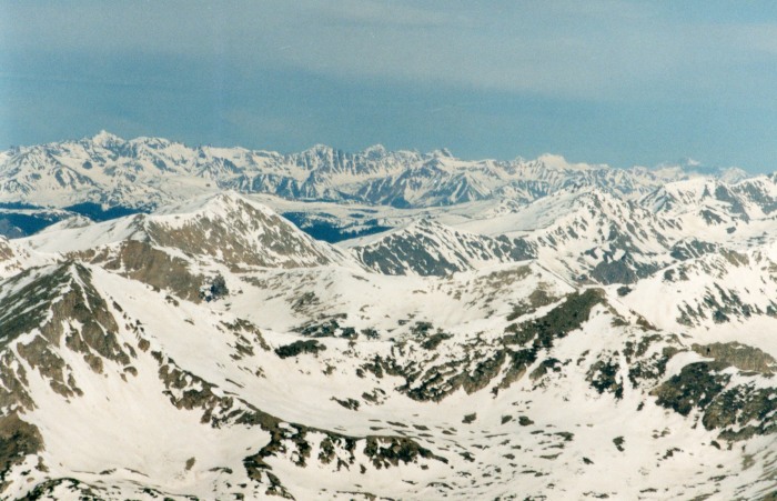   I did not waste much time at the summit. Incredible view of Ice Mountain and the north side of the peaks around Taylor Park. I still couldn't see the condition of the choke in the central couloir, so opted for a variation back to the main couloir. I rode off the summit to the hanging flatiron between the routes, working right. This part was a little exposed, but really fun. A steep, rotten gully let me re enter the upper couloirs. I held my toeside to favor the last shaded areas. I augered into some sauce once, and snagged some rocks. It was time to get the hell out of there. The snow improved again as I descended into the basin. I carried speed out across the runout to a nice lunch rock.  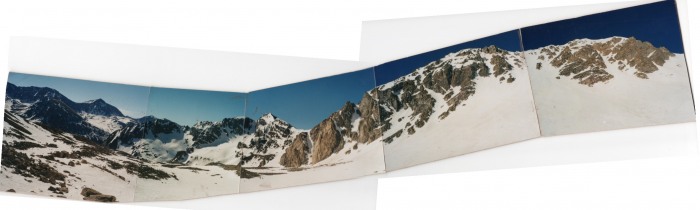 Lee skinned into the upper basin, and a few members of the crew. I warned them that it was getting dangerous on the face. They radioed down to the others, who decided to bail. A couple of them continued on to the pass. I wished them well, and rode out of the upper cirque to the rolling maze on the basin floor. I lost my momentum at Lois Lake, and had to split to move through the mush. I spotted Chris on the other side rummaging through a pack. "That's some bushwhack, huh?" "Oh, man!", he was headed right back into it again too, poor guy. I assembled the board again to ride a couple more pitches on the right over the boulder fields on rotten wet snow. A half hour later I was back to the lake purifying water. 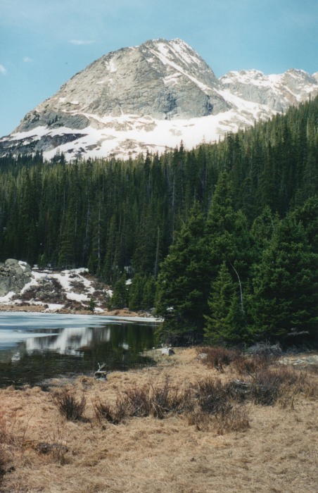 I crossed the outlet, catching a glimpse of Chris for a moment, realizing the trail must circle the private land there. I caught up to him back at the 4X4 TH. Then retrieved my bike, finding a nasty rip in the sidewall of my front tire, and the tube bulging out! I had my tire kit, so improvised a tire boot with duct tape, and pumped it up again. The pump would not give me more than about 30 psi for some reason, so I had to try to be gentle on the way down: not easy with a pack full of soaking wet gear. I walked the scree field to avoid damage to the bike and myself. Otherwise, it was nice to have at that point. The tire held. I collected my shoes and shorts, and rolled back down to the creek crossings. Thumbnails for uploaded photos (click to open slideshow):
|
| Comments or Questions |
|---|
|
|
Caution: The information contained in this report may not be accurate and should not be the only resource used in preparation for your climb. Failure to have the necessary experience, physical conditioning, supplies or equipment can result in injury or death. 14ers.com and the author(s) of this report provide no warranties, either express or implied, that the information provided is accurate or reliable. By using the information provided, you agree to indemnify and hold harmless 14ers.com and the report author(s) with respect to any claims and demands against them, including any attorney fees and expenses. Please read the 14ers.com Safety and Disclaimer pages for more information.
Please respect private property: 14ers.com supports the rights of private landowners to determine how and by whom their land will be used. In Colorado, it is your responsibility to determine if land is private and to obtain the appropriate permission before entering the property.

