Download Agreement, Release, and Acknowledgement of Risk:
You (the person requesting this file download) fully understand mountain climbing ("Activity") involves risks and dangers of serious bodily injury, including permanent disability, paralysis, and death ("Risks") and you fully accept and assume all such risks and all responsibility for losses, costs, and damages you incur as a result of your participation in this Activity.
You acknowledge that information in the file you have chosen to download may not be accurate and may contain errors. You agree to assume all risks when using this information and agree to release and discharge 14ers.com, 14ers Inc. and the author(s) of such information (collectively, the "Released Parties").
You hereby discharge the Released Parties from all damages, actions, claims and liabilities of any nature, specifically including, but not limited to, damages, actions, claims and liabilities arising from or related to the negligence of the Released Parties. You further agree to indemnify, hold harmless and defend 14ers.com, 14ers Inc. and each of the other Released Parties from and against any loss, damage, liability and expense, including costs and attorney fees, incurred by 14ers.com, 14ers Inc. or any of the other Released Parties as a result of you using information provided on the 14ers.com or 14ers Inc. websites.
You have read this agreement, fully understand its terms and intend it to be a complete and unconditional release of all liability to the greatest extent allowed by law and agree that if any portion of this agreement is held to be invalid the balance, notwithstanding, shall continue in full force and effect.
By clicking "OK" you agree to these terms. If you DO NOT agree, click "Cancel"...
Date Climbed: 8/31/2008
Group: My brother Bill and I
Elevation Gain: 4,140ft (including re-ascent of Broken Hand Pass on return to camp)
R/T Distance: ~6miles (estimate)
Time: 3:50 ascent, ~20mins on summit, ~ 3:00 descent (w/ lunch)
Route: Red Gully via Broken Hand Pass from near S. Colony Lake
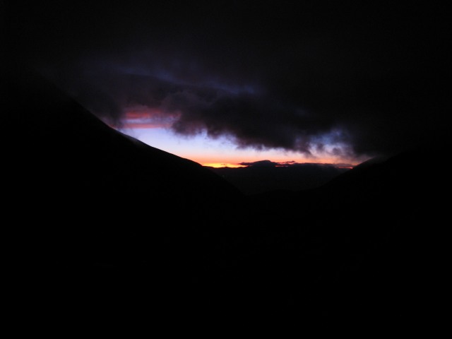
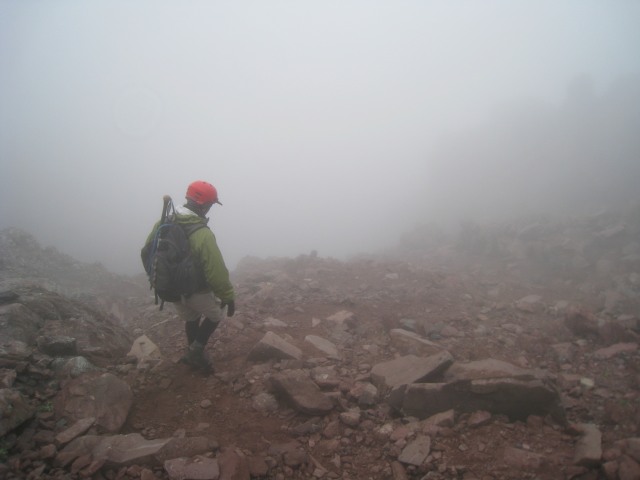
We were camped approximately 1/3 mile below S. Colony Lake at the first available campsite as you hike from the upper trailhead (see Humboldt trip report). Bill said set the alarm for 5:00 am, but I set it for 4:30 (I like my coffee). He was out of the tent first, and reported "no stars visible". He didn't need to report on the wind, we could hear it (although it wasn't too bad in camp). After oatmeal and coffee, we were on the trail around 5:15 am (no watch, cell phone stashed in pack). Our goal was to have enough daylight to climb the upper reaches of Broken Hand pass without headlamps. As the first light of dawn started to light the eastern sky, it became pretty obvious that we were hiking under low cloud cover.
First light to the east during ascent of Broken Hand Pass
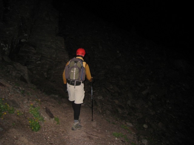
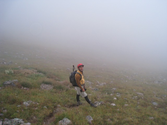
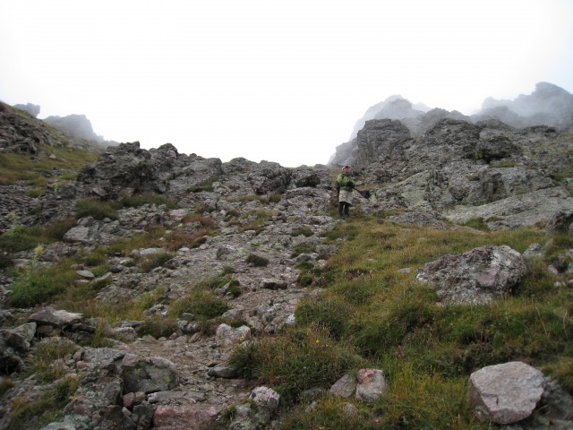
We pretty much timed our goal perfectly, about the time it was light enough to see, it was also time to don helmets for the upper reaches of Broken Hand pass. While we were stopped, a baseball sized rock came bounding down from above, splitting nicely between me and Bill (whizzing by is too strong, you get the picture). At that point, there is no trail above, so it must have been kicked loose by wildlife or released naturally. I was thinking "helmet? Check!", but surprisingly it was the semi-serious last rock fall event we saw for the day.
Continuing the ascent of Broken Hand Pass after donning helmets
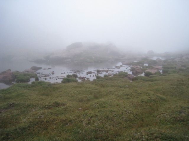
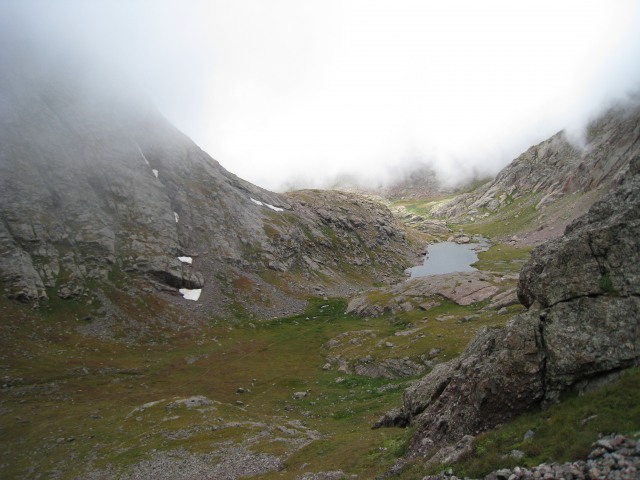
We could see the lake below as we continued up towards the cloud base.
First light on S. Colony Lake
Further up the pass, we could see another set of headlamps working their way up. Coincidentally, we also saw lights on Humboldt and someone apparently Bivy'd on or near a ledge below Ellingwood Arête (hard to tell exactly where they were between the dark and the fog/cloud).
Looking up the pass, two headlamps (one red, one white) visible
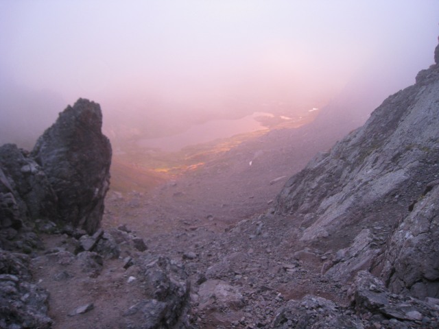
From near the top of the pass, we saw first (and maybe last for the day?) sunhit on S. Colony Lake.
Sunhit on S. Colony Lake from near the top of Broken Hand Pass
It was miserable at the top of the pass. Strong winds, and fog caused condensation on everything. Suddenly we were pretty wet. The two climbers ahead of were hunkered down in a slot between rock ribs on the east side of the pass, deciding to continue or not (they were planning the Needle). We didn't chat long because we wanted to get off the top of the pass, I think the total conversation was something like: them: "are you climbing the needle in this weather?" Bill: "we're climbing the peak first". Them: "oh". Me: "good luck". And we were off. The wind eased quickly below the west side of the pass, but if anything, the fog thickened.
Bill descending the west side of the pass
We really didn't see much of Cottonwood lake until we were right there. I thought maybe we were somehow transported to Ireland, but Bill pointed out that we were in a "Lord of the Rings Movie". "Yeah, watch out fo5 the Nazgul on their winged horses" I said.
Cottonwood Lake in a scene from "The Lord of the Rings"?
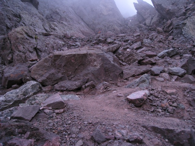
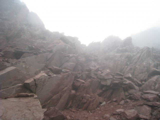
Route finding and trail conditions to this point and up to the entrance to Red Gully were nothing short of a breeze. The CFI has done an outstanding job of building trail (with the exception of the upper reaches of broken hand pass). On the one hand, the adventure of finding your own way (see San Luis TR) is lost, but the fragile ecosystem is protected from too much human trampling. Bottom line is even in the bad weather, route finding isn't an issue. Near the west end of the lake, we spoke briefly to a gentleman camped nearby who told us that a party of 7 were ahead of us climbing the peak. They had camped on the Cottonwood lake side of the pass. We followed the good trail to the entrance of the gully and started climbing. I stuck almost exclusively to the climber's left side of the gully. Bill picked and chose his way up (sometimes picking the tougher route as pictured below).
Bill finding some sporting climbing in the lower reaches of the gully (near 13,300')
While we were wet from condensation and the wet rock, the wind continued to blow, but only my hands started to get cold. The gloves I had were less than effective (except at absorbing moisture). Eventually, they got really cold, and started to get that brick-like feeling. Near 13,900, I told Bill I had to stop and warm my hands. I started to warm them, while Bill rummaged through his pack to see if he had an extra pair. Success, he had an extra pair...with hands warm, we continued and quickly gained the top of the gully where a climber from the earlier party was waiting. We chatted briefly, then continued climbers left towards the summit. We encountered the rest of the other party descending, they reported similar conditions on the summit. From the top of the gully, to the summit, the scrambling is solid, and the route not difficult to find. The fog may have hidden the exposure (which is okay by me).
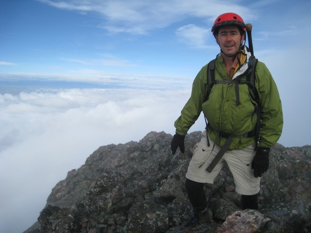
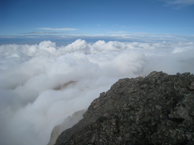
Just as we reached the summit, we broke out of the clouds momentarily. I don't know exactly what was said, but I'm sure Bill and I both exclaimed something profound...like "Wow!!" It was pretty spectacular (and lucky) to break into the sun even though fleeting. Even with the sun, the wind continued, and neither of us felt very comfortable standing upright on the summit. We took some photos, and hunkered down in a west facing hollow for a snack.
Summit photos:
Bill on the Summit of Crestone Peak
Bob on the Summit of Crestone Peak
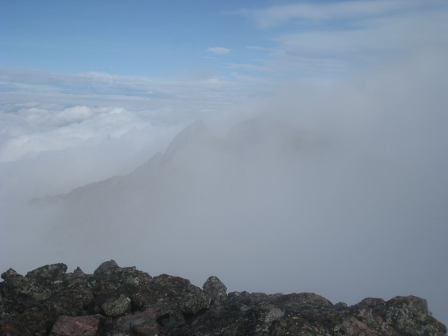
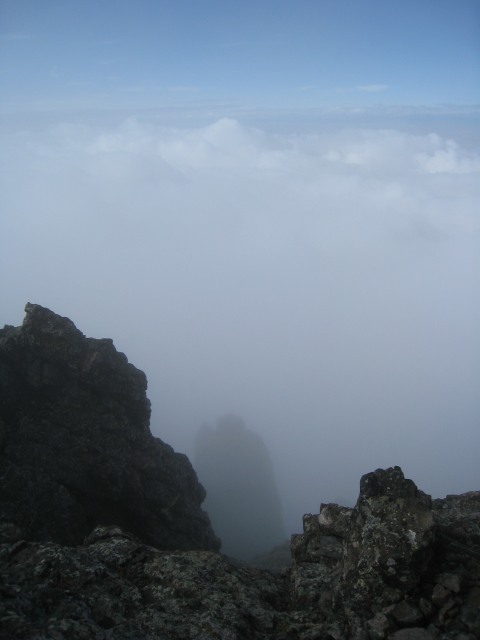
View towards KC and Challenger (peaking from the clouds)
View Looking East?
The clearest view we had (Northwest?)
I'm not sure where I went wrong, but I somehow started the wrong direction off the summit (along a ridge more south than east?) Fortunately, there is good scrambling up there, and I was able to traverse some ledges below the ridge crest back over to the route (where Bill was on the correct route). We quickly re-entered the fog and started the descent of the gully.
Bill descending in the gully
Looking back at the upper reaches of the gully
A few sprinkles of rain between the bottom of the gully and the lake where we encountered a solo climber with his dog (later at camp he came by and reported a successful climb in worse conditions than ours). Nearer the lake, we encountered another two climbers (Brits?) and chatted with them for a while with regards to distance and time to get to the summit. I had to admit I didn't think they would summit (given conditions, and the time), but later they also came by camp reporting success. Bill chatted with another group lunching near the lake, but I didn't get the gist of the conversation, whether they were continuing or abandoning, or what. Congrats to the other summit'ers of the day.
We lunched sheltered from the wind in some rocks just beyond the east end of Cottonwood lake. The fog lifted a little, and we had some nice views of the lake, and looking up towards the needle and broken hand pass. At this point, we were still considering the attempt on the needle, even though the discussion was "lets see how we feel, and how the weather is on the top of Broken Hand pass is then decide", I was already leaning heavily towards no, and I suspect Bill was too. I would have to have felt a real spring in my step climbing back up to the pass to say yes.
Cottonwood lake emerges from the fog
Looking up at wispy clouds on the pass/needle
Climbing the pass, my decision on whether to attempt the Needle or not was easy...my legs were fatigued, the wind continued unabated, and there were some slight sprinkles, even though the clouds lifted a little. No Needle for me today. We were afforded a view of momentary sunshine on the lake as we got nearer to the top of the pass.
Sunlight on Cottonwood lake
Bill waiting for me ascending the west side of Broken Hand Pass
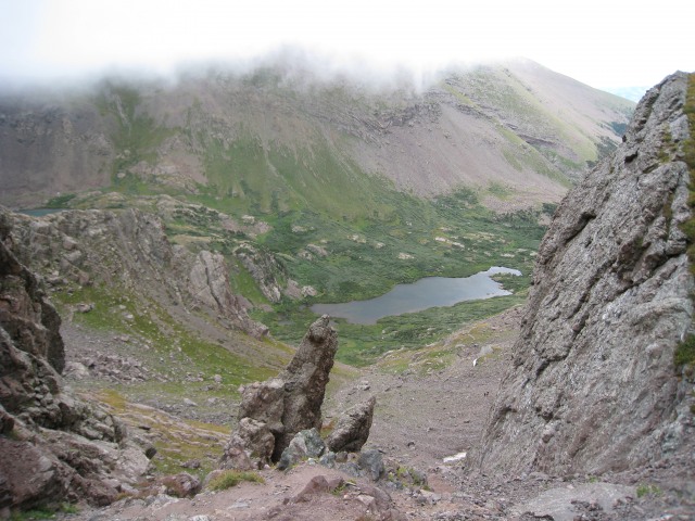
Looking over the top of the pass, S. Colony lakes was also in the clear.
Looking down on S. Colony from the top of Broken Hand Pass
We descended the pass, past the lake (light drizzle) and were back in camp somewhere between 1 and 2 (no watch). Despite some slight drizzle at camp, the weather must have deteriorated at the lake. A steady stream of day hikers and fisherman trooped by camp, occasionally stopping to chat, and all reporting wind and rain at the lake despite us being only about a third of a mile away. Our dry conditions didn't last long, we prepared and ate dinner in the rain under a poncho strung up like a rain fly. As the evening progressed, and the rain continued to increase, the steady exodus of day-trippers turned into an exodus of backpackers. I managed to light and keep a small fire going through the evening, but it was small comfort given the rain. We went to bed early, and heard the HARD rain until I don't know when. In the morning it was dry but still windy, and cloudy above. With all of our gear wet, we decide pretty quickly not to try the Needle. The steady stream of campers leaving the lake area continued in the morning (some looking like drowned rats and miserable, others like us had a relatively comfortable night, but not much fun). I offered dry gloves for sale (even though I didn't have any).
We packed up, and hiked out. Some nice wildflowers on the hike out. And found the upper parking lot (not so) surprisingly empty (compare to Humboldt TR photo).
On the drive out, the Chevy Cavalier which we had seen way...way...way too far up the road for a vehicle of that caliber was gone (no photo), and a chevy van with very low running boards was being extricated by a party of six or so. We also saw two of several grouse crossing the road.
At my truck we enjoyed a "Left Hand Ale", then agreed to meet in Salida for some lunch. Bill had to work on Tuesday, but I'm off all week, so we discussed my options. Since he has more 14'ers under his belt than me, I'm trying to climb ones he's already done when solo. I decided on San Luis (see separate TR).
Thumbnails for uploaded photos (click to open slideshow):
I guess you were among the few who summitted either the Peak or the Needle that day.
Lostsheep5 and I were the two you came across hunkered down at the pass. I remember you being the first two that we saw coming up the pass after us. We didn‘t get the Needle that day, as I was afraid of the wet rock being too slippery - especially for the return. We did Humboldt instead - in VERY strong winds.
We had previously met the two who were trying the Arete, and saw their headlamps on our way up to the pass. Didn‘t see them afterwards, but it seems unlikely to me that they would have continued in that weather.
for the great comments folks. It was a fun day with the weather making it a little more interesting.
Carpe: I think we talked to you and Lostsheep at our camp too, nice meeting you. You guys were wise to make a safe decision (we also decided against the needle that day). I hope I didn‘t misrepresent our conversation on the pass ;-)
Caution: The information contained in this report may not be accurate and should not be the only resource used in preparation for your climb. Failure to have the necessary experience, physical conditioning, supplies or equipment can result in injury or death. 14ers.com and the author(s) of this report provide no warranties, either express or implied, that the information provided is accurate or reliable. By using the information provided, you agree to indemnify and hold harmless 14ers.com and the report author(s) with respect to any claims and demands against them, including any attorney fees and expenses. Please read the 14ers.com Safety and Disclaimer pages for more information.
Please respect private property: 14ers.com supports the rights of private landowners to determine how and by whom their land will be used. In Colorado, it is your responsibility to determine if land is private and to obtain the appropriate permission before entering the property.


")
")
")
")
")
")
")
")
")
")
")
")
")
")
")
")
")
")
")
")


