Download Agreement, Release, and Acknowledgement of Risk:
You (the person requesting this file download) fully understand mountain climbing ("Activity") involves risks and dangers of serious bodily injury, including permanent disability, paralysis, and death ("Risks") and you fully accept and assume all such risks and all responsibility for losses, costs, and damages you incur as a result of your participation in this Activity.
You acknowledge that information in the file you have chosen to download may not be accurate and may contain errors. You agree to assume all risks when using this information and agree to release and discharge 14ers.com, 14ers Inc. and the author(s) of such information (collectively, the "Released Parties").
You hereby discharge the Released Parties from all damages, actions, claims and liabilities of any nature, specifically including, but not limited to, damages, actions, claims and liabilities arising from or related to the negligence of the Released Parties. You further agree to indemnify, hold harmless and defend 14ers.com, 14ers Inc. and each of the other Released Parties from and against any loss, damage, liability and expense, including costs and attorney fees, incurred by 14ers.com, 14ers Inc. or any of the other Released Parties as a result of you using information provided on the 14ers.com or 14ers Inc. websites.
You have read this agreement, fully understand its terms and intend it to be a complete and unconditional release of all liability to the greatest extent allowed by law and agree that if any portion of this agreement is held to be invalid the balance, notwithstanding, shall continue in full force and effect.
By clicking "OK" you agree to these terms. If you DO NOT agree, click "Cancel"...
West Elk Peak (13035') Attempt via Storm Pass
July 5, 2008
Mill-Castle Trail
Round Trip: ~16 miles RT to Storm Pass (18.5 miles to summit)
Elevation Gain: 3500 ft. to Storm Pass (~500ft more to summit)
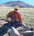
Hikers: Jon, Patrick, Tiffany
My friends and I wanted to do something out of the norm for the 4th and the idea of hiking out by Crested Butte came up. I suggested the Mill Creek (actually Mill-Castle) trail because I'd seen some pictures of the Castles formation before and heard the trail was amazing. A side bonus would be that we could attempt West Elk Peak while there. Information on this trail that we could find was limited. The best information we could find came via Summitpost and even that wasn't very helpful. Vague reports of campsites about 6.5 miles along the trail led us to believe we could find somewhere good to spend 2 nights.
We left Denver at 7am on Friday and got to the trailhead about 11:30am. The trailhead directions here on Summitpost are correct:
The last half mile to the TH is a bit rough but careful driving would get a 2wd car there or you could park a bit farther down. In our case an Outback did just fine.
Maps show the trail on the north side of the creek for the first 1.5 miles. Whether this trail has been rerouted or the info is incorrect I'm not sure but the first part of the trail is actually on the south side following an old road. There are also a horde of agressive mosquitos so bring bug spray! At roughly 1.5 miles you have to do a creek crossing to reach the wilderness boundry. The crossing wasn't too bad but was knee high both times and caution was necessary not to fall in and get wet.
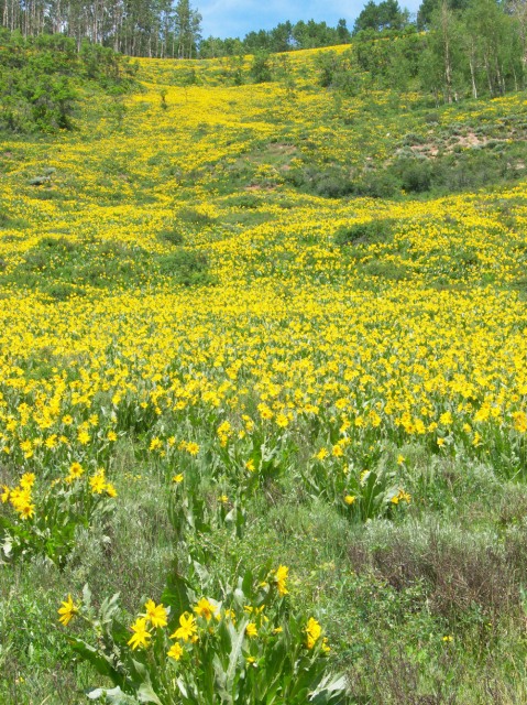
We also saw a ton of cows along this stretch so watch your footing and make sure you don't startle a cow. After the crossing the trail winds through a beautiful aspen forest. I'm sure in fall this area is incredible.
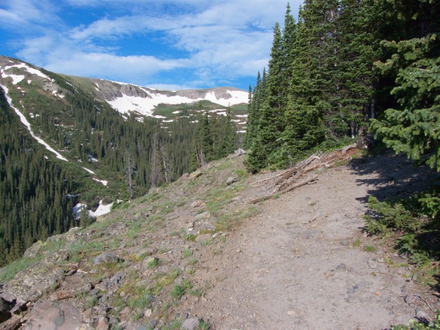
About 4 miles in another steep section is reached and the trail goes through some willows. This section is not terribly hard to follow but the bushwhack is annoying and the switchbacks are steep with a pack. Summitpost mentions some campsites about a mile or two past the wilderness sign but we saw very little along this stretch that looked good except for one site with a fire ring.
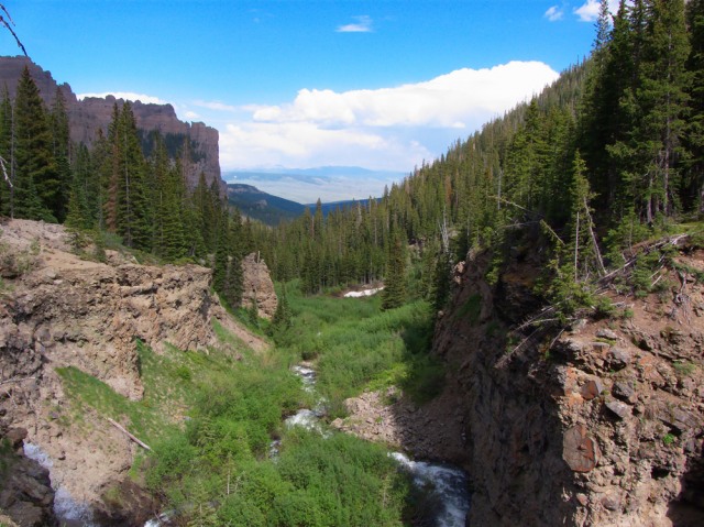
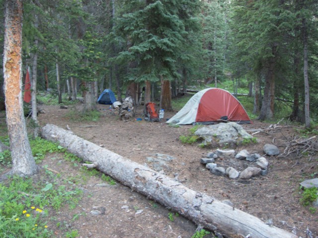
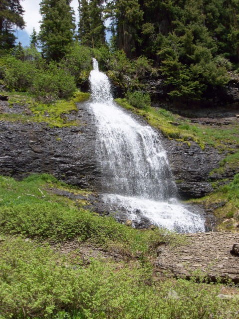
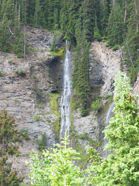
After 5 miles and immediately after a creek crossing we found a large campsite just off the trail. Since we were tired and figured we had gone far enough for the day we decided to camp here. This turned out to be a great site with close access to water and a very nice view of the cliffs and some waterfalls.
The next morning we got up around 6am and planned to head up to Storm Pass and from there to West Elk Peak. We knew there was some snow in the upper basin that we had seen on the drive in but we figured it might be more dry up there than it looked. The trail from our campsite went steeply uphill for a while and then stayed high on the north side of the valley. We passed a beautiful waterfall and some places that could be used as campsites but decided from what we saw that we had made the right choice to camp where we did.
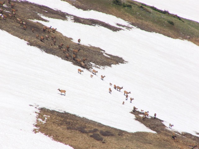
We found the turnoff to Storm Pass marked with two cairns and headed up higher into the basin. We saw two large groups of elk across the basin. This was more elk in one place than any place I had seen outside of RMNP. I think we saw at least 30 in total. The trail up to Storm Pass was relatively dry except for some very short snow patches. As we reached the top of the pass I decided to climb directly up about 15 feet of snow for fun while my two friends bypassed the snow on dry ground higher up.
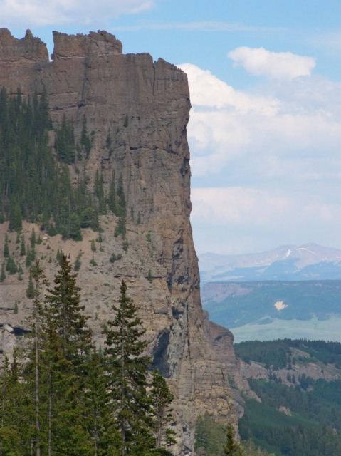
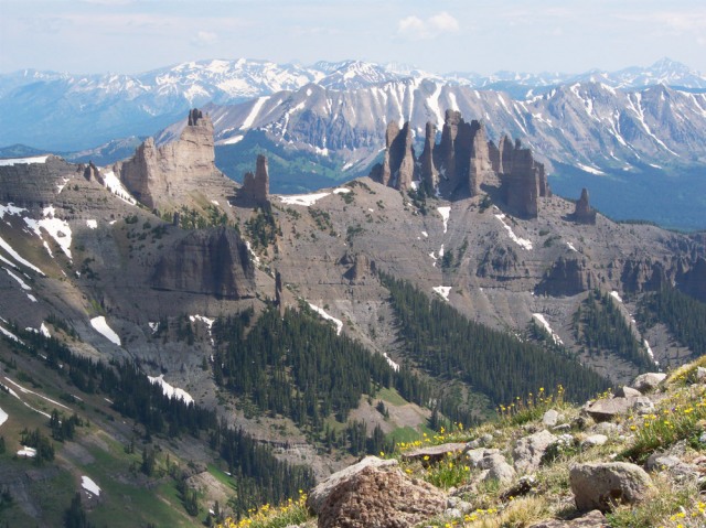
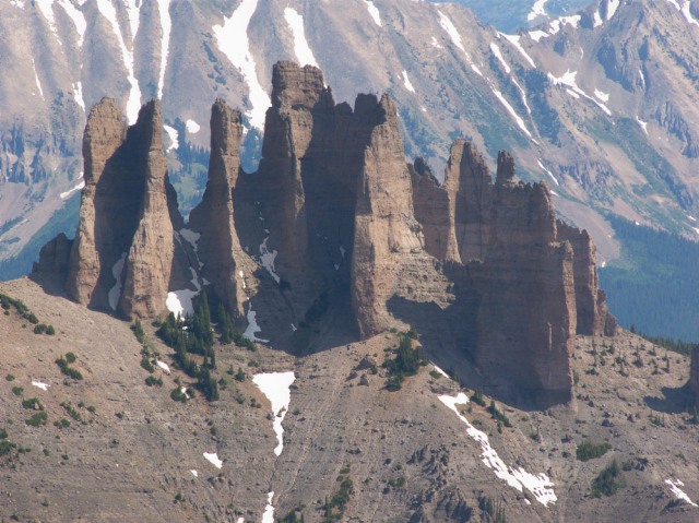
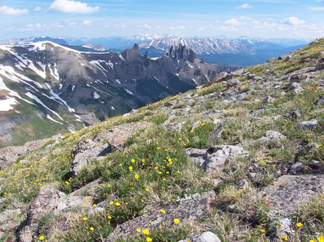
As I got to the pass I got an amazing view of the Castles in the next valley over and we stopped to take pictures. We had started from camp at 7:30 and reached the pass at 11. I also saw two people over on West Elk Peak. It looked a long way off and we were starting to see clouds build. We took a break and kept our eyes on the clouds. I knew via the GPS that it was 500 feet and over a mile to the peak so I made the decision that there wasn't enough time to get there and back before the weather hit. I would have a long way to go above treeline before being able to get back to safety. The goal for the trip had been the pass and since the peak was only a bonus I wasn't too upset to not get over there. This would be a great place to revisit in any case.
West Elk Peak from Storm Pass:
We headed back down to have lunch near the waterfall we saw earlier and then back to camp.
As we got near camp it started to rain hard and then the lightning began. It rained hard for the next few hours and it validated our decision not to go over to the summit. During this storm it aslo became quickly apparent that the waterproofing on the bottom of my tent has ceased to exist. I quickly wound up with water leaking through on one side and had to move gear to one side to avoid the growing lake. My thermarest got soaked and my sleeping bag started to absorb water. After the storm ended I had to use my space blanket as a barrier between the wet thermarest and the sleeping bag in order to keep it from getting worse. Down doesn't insulate when wet so I didn't want to spend a freezing night because of a damp sleeping bag.
We spent another night in camp and in the morning tried to dry out gear as best we could. The hike back down went quickly and we reached the car in about 2.5 hours. I hadn't put on bug spray for the hike out and got eaten alive the last mile.
We headed out north on Ohio Pass for some pictures and then into Crested Butte for lunch at a pizza place. We had some great pizza and beer and then headed back to Denver after a great weekend.
Thumbnails for uploaded photos (click to open slideshow):
I did a 3 day backpack/loop here last summer and loved it.
Very imkpressive rock formations up there in a beautiful setting. And we saw only one other person...a hunter out on a scouting trip.
what happens when you find something other than a 14er? You get solitude, interesting rock formations, both which make for phenomenal pictures, and a damn fine trip report.
Storm Pass is our secret, one of my favorite local hikes. It can actually get quite crowded (errr... well, that's relative... crowded for Gunni... you might see a few folks) on the trail to the view of the castles, but I've never run into a single soul on the other side of the creek.
Do you recall suitable camping sites higher in the basin before you headed up Storm Pass? Looks like you had a good site down in the darker timber and would like to camp a little higher.
Thanks
Caution: The information contained in this report may not be accurate and should not be the only resource used in preparation for your climb. Failure to have the necessary experience, physical conditioning, supplies or equipment can result in injury or death. 14ers.com and the author(s) of this report provide no warranties, either express or implied, that the information provided is accurate or reliable. By using the information provided, you agree to indemnify and hold harmless 14ers.com and the report author(s) with respect to any claims and demands against them, including any attorney fees and expenses. Please read the 14ers.com Safety and Disclaimer pages for more information.
Please respect private property: 14ers.com supports the rights of private landowners to determine how and by whom their land will be used. In Colorado, it is your responsibility to determine if land is private and to obtain the appropriate permission before entering the property.


")
")
")
")
")
")
")
")
")
")
")
")
")
")
")
")
")
")
")
")