Download Agreement, Release, and Acknowledgement of Risk:
You (the person requesting this file download) fully understand mountain climbing ("Activity") involves risks and dangers of serious bodily injury, including permanent disability, paralysis, and death ("Risks") and you fully accept and assume all such risks and all responsibility for losses, costs, and damages you incur as a result of your participation in this Activity.
You acknowledge that information in the file you have chosen to download may not be accurate and may contain errors. You agree to assume all risks when using this information and agree to release and discharge 14ers.com, 14ers Inc. and the author(s) of such information (collectively, the "Released Parties").
You hereby discharge the Released Parties from all damages, actions, claims and liabilities of any nature, specifically including, but not limited to, damages, actions, claims and liabilities arising from or related to the negligence of the Released Parties. You further agree to indemnify, hold harmless and defend 14ers.com, 14ers Inc. and each of the other Released Parties from and against any loss, damage, liability and expense, including costs and attorney fees, incurred by 14ers.com, 14ers Inc. or any of the other Released Parties as a result of you using information provided on the 14ers.com or 14ers Inc. websites.
You have read this agreement, fully understand its terms and intend it to be a complete and unconditional release of all liability to the greatest extent allowed by law and agree that if any portion of this agreement is held to be invalid the balance, notwithstanding, shall continue in full force and effect.
By clicking "OK" you agree to these terms. If you DO NOT agree, click "Cancel"...
Uncompahgre / Wetterhorn from the North - East and Middle Cimarron
Climbing Uncompahgre and Wetterhorn from the North
East and Middle Cimarron trails
June 29 - July 4
Nathan Hoobler
Bryson Hoobler
Sarah Hoobler
My brother Bryson told me about an interesting way to climb Uncompahgre and Wetterhorn -- from the north. This could be accomplished by a moderate backpacking loop up the Middle and East Fork drainages of the Cimarron River. I'd never been to this beautiful area of the state and, after having camped and climbed there, I hope to go back someday.
Here's our approximate route, starting south of Silver Jack Reservoir:
We had planned on starting in the Middle Fork, going over Middle Fork Pass, camping in the East Fork and climbing the mountains from there. However, since we weren't sure about snow conditions getting over the pass, we decided to start in East Fork instead.
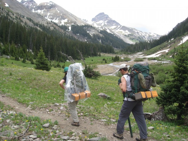
Over the course of Saturday and Sunday, we packed in the nine miles to a camp high in the East Fork Valley. This is an amazing valley with a lot of terrific scenery and solitude. We didn't see a single person on our hike through this valley until we were hiking near the 14ers.
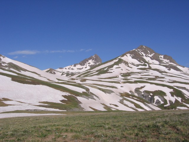
Hiking in East Cimarron, around Silver Jack Mine. Uncompahgre is in the distance.
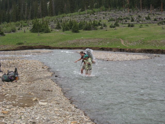
There was a LOT of melting snow on the trip. Bryson and I had studied the USGS Real-time Streamflow Conditions (http://waterdata.usgs.gov/nwis/rt) and found the Cimarron had record flows a few weeks earlier. Streams were passable when we arrived, but some were still quite high, especially in the afternoon.
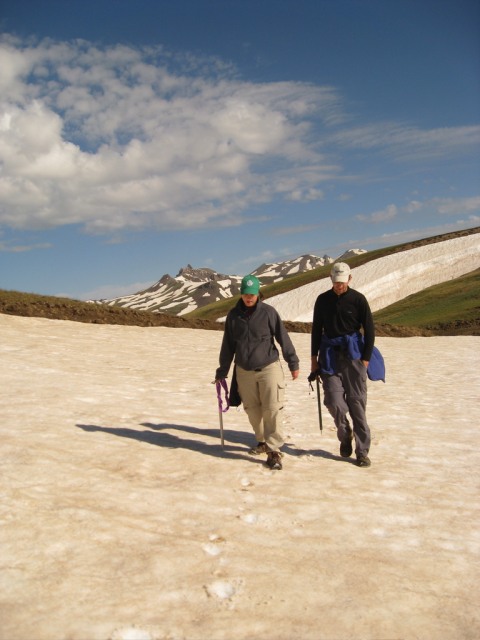
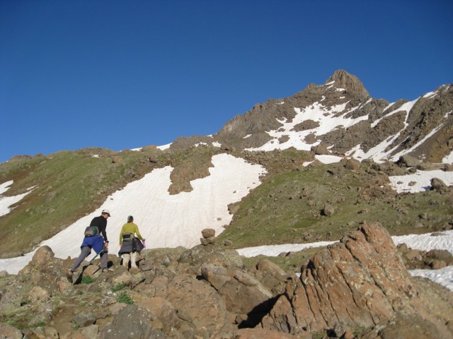
On Tuesday, we headed out of camp early to climb over many snowfields (and some grassy meadows) to reach Matterhorn Pass.
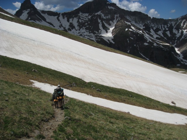
Crossing a snowfield on the way to Uncompahgre. El Punto is far in the distance.
Once at Mattherhorn Pass, we climbed the standard, gentle, and fairly long trail up and around the south side of Uncompahgre. Near the top, we chatted with some gentlemen who were doing some work to preserve the Uncompahgre Peak Butterfly, which apparently only lives in this area of the state and only above 13,000 feet. We saw several. Here's a photo from another website:
We also saw 50 or 60 cow elk with calves in a valley to the south.
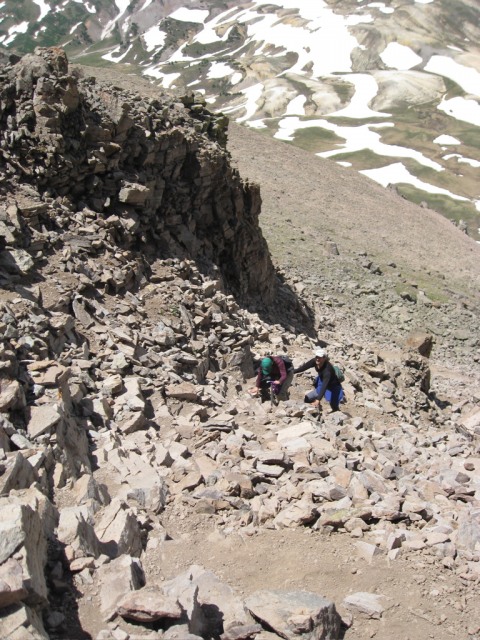
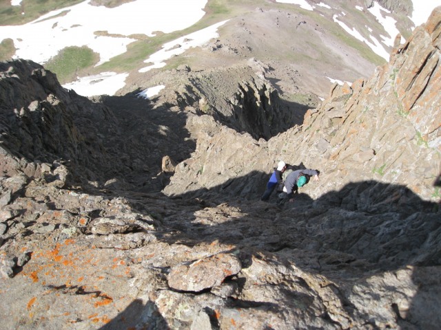
Bryson and Sarah come up the brief (and only) scrambling section the Uncompahgre standard route.
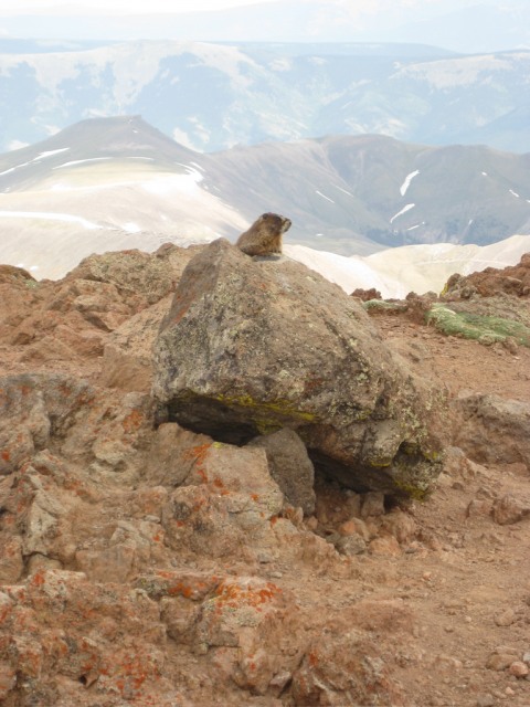
A marmot guards the USGS marker on Uncompahgre:
The group enjoys the summit of Uncompahgre. It's a LONG way down to the North!
The view of Wetterhorn from the summit of Uncompahgre. Looks like some weather is rolling in...
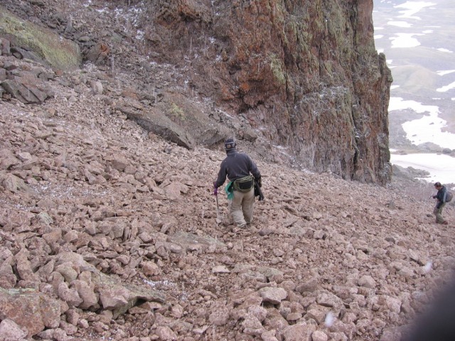
Wouldn't you know it? A hailstorm kicked in as we descended Uncompahgre:
On Wednesday, we headed toward Wetterhorn. This was a little bit shorter hike, but involved a lot more scrambling, so we started even earlier (around 4 am).
The route to Wetterhorn from the area around Matterhorn Pass:
Around 12,500 feet (I think) on Wetterhorn.
Um...off-route.
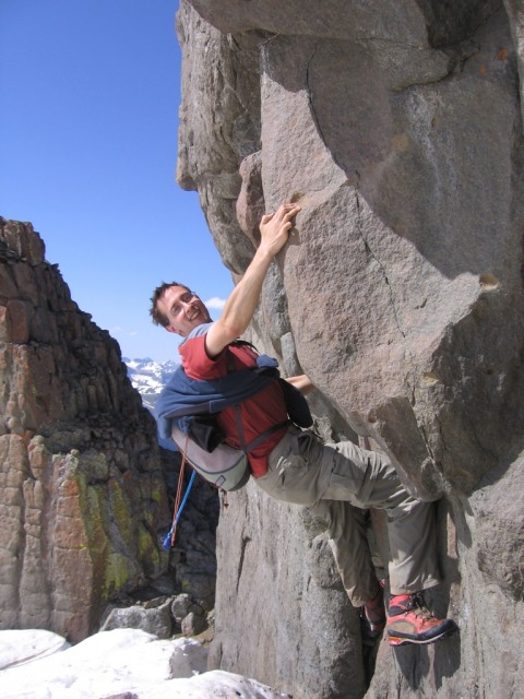
We met fellow 14ers.com members CFTBQ and trishapajean on the final pitches of Wetterhorn and chatted with them occasionally as we ascended. Here is CFTBQ climbing the final pitch.
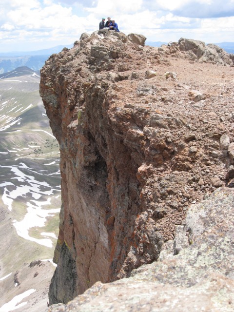
Bryson and Sarah climb the summit pitch. I think it's fair to say that, yes, it IS as steep as it looks in this picture!
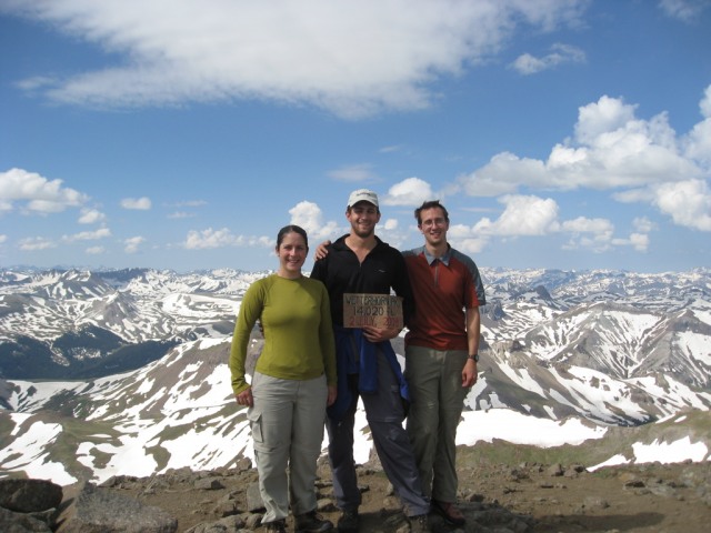
The group on the summit of Wetterhorn. CFTBQ was gracious enough to let us use his summit sign.
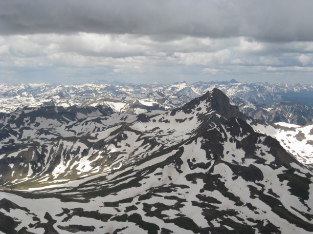
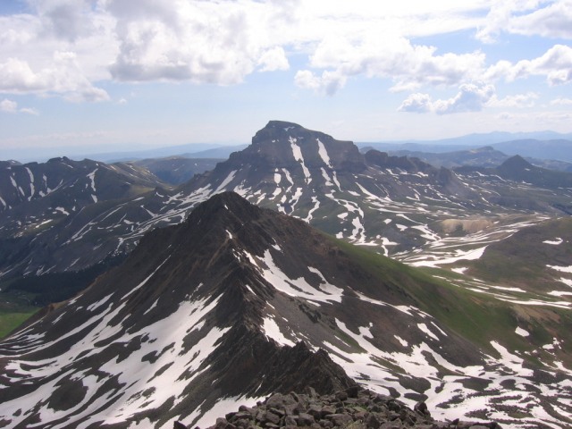
The view of Uncompahgre and Matterhorn from Wetterhorn.
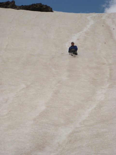
Glissading down Wetterhorn was definitely the best way down! Gotta use those axes somehow!
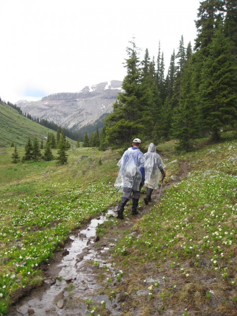
We ran into a pretty major thunder and lightning storm this day and (after hiding in the trees for awhile as the worst of the storm passed) walked back on trails that were even wetter than the rest of the week.
On Thursday, we headed over Middle Fork Pass into the even more spectacular Middle Fork drainage. Lined with amazing and craggy peaks, this has got to be one of the prettiest valleys I've visited in Colorado.
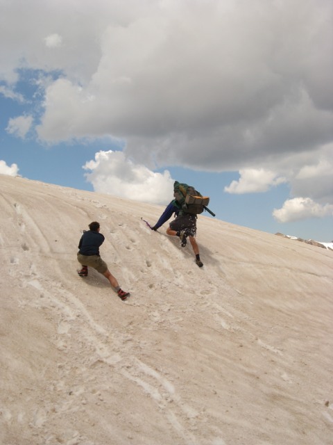
Hey, that's no supposed to be there! On the way down from Middle Fork Pass, we encountered an enormous snow bank covering the trail.
So, the only way around it is some easy (and fun!) snow climbing.
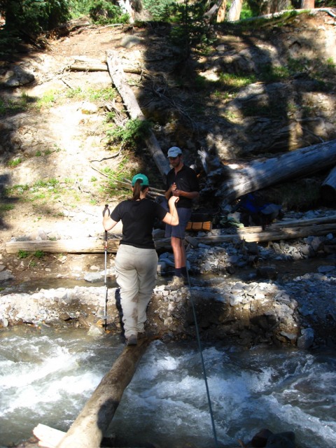
Crossing a stream on the way out. The map shows a footbridge across this tributary of the Middle Fork, but a fellow hiker told us that it had been gone for over a decade:
We had planned on camping somewhere in the Middle Fork drainage on Thursday, but our energy surprised us, so we headed back to the trailhead. There, a very generous man named Michael gave me a ride back to my car. I returned to pick up Bryson and Sarah and we headed back to civilization.
What a great way to spend 4th of July. Thanks, Bryson and Sarah!
Thumbnails for uploaded photos (click to open slideshow):
The Cimarrons are fantastic! I‘ve climbed a lot of those ”craggy” peaks in the area, and have always thought it would be fun to reclimb Wetterhorn & Uncompahgre using that approach.
Thanks for the great rundown of your extended route--impressive! Thanks for the mention, too. Sorry you guys got caught in that spate of rain; we managed to get the heck out of Dodge (i.e., back to the TH) just in the nick of time.
Caution: The information contained in this report may not be accurate and should not be the only resource used in preparation for your climb. Failure to have the necessary experience, physical conditioning, supplies or equipment can result in injury or death. 14ers.com and the author(s) of this report provide no warranties, either express or implied, that the information provided is accurate or reliable. By using the information provided, you agree to indemnify and hold harmless 14ers.com and the report author(s) with respect to any claims and demands against them, including any attorney fees and expenses. Please read the 14ers.com Safety and Disclaimer pages for more information.
Please respect private property: 14ers.com supports the rights of private landowners to determine how and by whom their land will be used. In Colorado, it is your responsibility to determine if land is private and to obtain the appropriate permission before entering the property.


")
")
")
")
")
")
")
")
")
")
")
")
")
")
")
")
")
")
")
")


