Download Agreement, Release, and Acknowledgement of Risk:
You (the person requesting this file download) fully understand mountain climbing ("Activity") involves risks and dangers of serious bodily injury, including permanent disability, paralysis, and death ("Risks") and you fully accept and assume all such risks and all responsibility for losses, costs, and damages you incur as a result of your participation in this Activity.
You acknowledge that information in the file you have chosen to download may not be accurate and may contain errors. You agree to assume all risks when using this information and agree to release and discharge 14ers.com, 14ers Inc. and the author(s) of such information (collectively, the "Released Parties").
You hereby discharge the Released Parties from all damages, actions, claims and liabilities of any nature, specifically including, but not limited to, damages, actions, claims and liabilities arising from or related to the negligence of the Released Parties. You further agree to indemnify, hold harmless and defend 14ers.com, 14ers Inc. and each of the other Released Parties from and against any loss, damage, liability and expense, including costs and attorney fees, incurred by 14ers.com, 14ers Inc. or any of the other Released Parties as a result of you using information provided on the 14ers.com or 14ers Inc. websites.
You have read this agreement, fully understand its terms and intend it to be a complete and unconditional release of all liability to the greatest extent allowed by law and agree that if any portion of this agreement is held to be invalid the balance, notwithstanding, shall continue in full force and effect.
By clicking "OK" you agree to these terms. If you DO NOT agree, click "Cancel"...
Start of climb: 4:15am
Summitted Isolation Peak: 9:30am
Time on Isolation summit: 30 minutes
Summitted Mahana Peak: 11am
Returned to trailhead: 3:45pm
Distance: ~17 miles round trip, about 5000 ft elevation change
Gear: standard essentials, wore some light low-top hiking shoes,
ice ax.
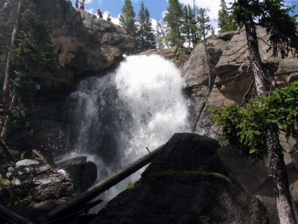
Started from the Wild Basin trailhead in RMNP in the dark. Needed a headlamp for the first 45 minutes. Hiked right next to a creek that was absolutely raging. Passed Copeland Falls, Calypso Cascades in the dark. The sun was coming out just as I passed Ouzel Falls. Made a mental note to definitely stop there on the way back as it sounded awesome. Took my first break just after the turnoff to Ouzel Lake at 6am, about 4.4 miles from the trailhead. The trail was completely clear of snow except for one 5 foot patch.
The next 2 miles up to Bluebird lake were much slower going due to a lot of snow in the last mile up to Bluebird Lake. The snow was easy enough to walk on top of. There were a couple of steep snowfields to ascend that were avoidable only by doing some rock scrambling.
Once I got to Bluebird Lake (elevation 10,900 feet), the snow was more easily avoided.
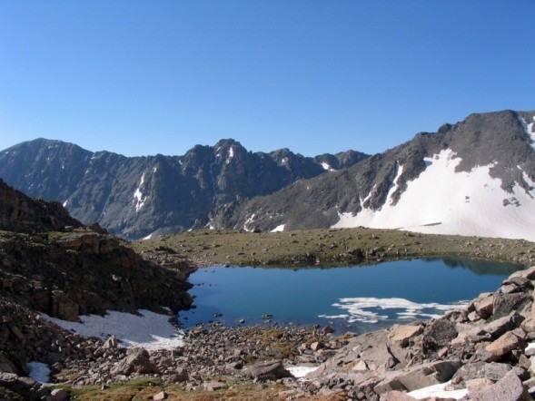
Crossed a small stream and headed to the north side of the Bluebird Lake. Headed northwest up some steep talus slopes and doing some occasional scrambling up some big boulders. I pretty much tried to head as far north as I could until I was under the cliffs of Mahana Peak. Once under those, I headed west about 300 feet above Bluebird Lake. After about a mile of traveling west over fairly easy terrain, I headed north again towards Isolation Lake at elevation 12,000+ feet.
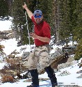
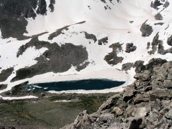
It was 8:30 when I arrived at Isolation Lake. Took a nice long break here. Here are some pics:
Ouzel Peak in the background:
From Isolation Lake to the Peak was pretty easy, it was mostly following a gully heading east up to the peak. It was mostly stable talus with some occasional/optional scrambling. It took about 45 minutes to ascend the last 1000 feet from Isolation Lake to the peak.
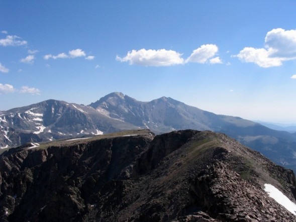
The summit was surprisingly small, there were only a few rocks to sit on at the time. Spectacular views all around. Here are a few shots from the summit:
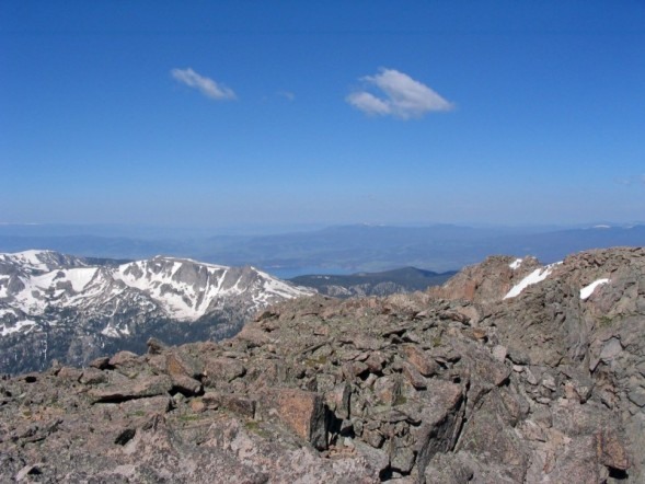
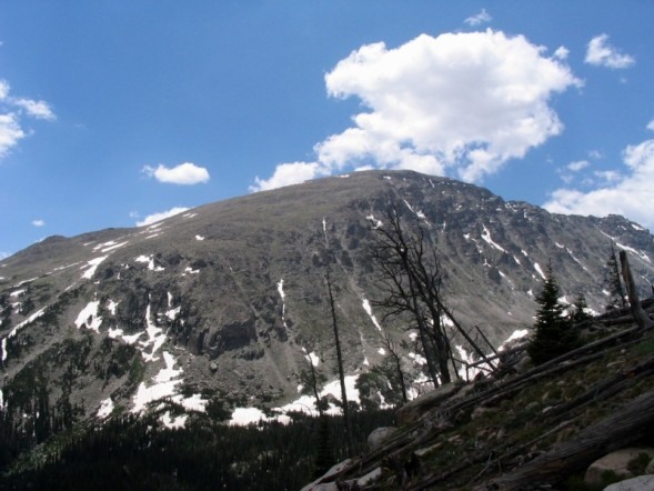
Mt Alice, Longs Peak, Mt Meeker from Isolation Peak:
From the summit of Isolation looking west:
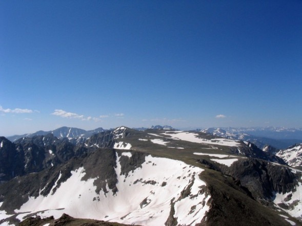
Looking south:
Spent about 30 minutes on the airy summit. Didn‘t want to leave, since the temps were perfect and there was no wind!
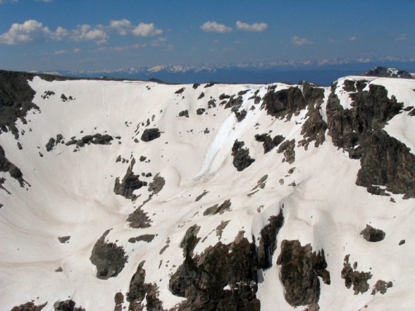
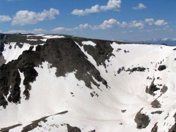
I had intended to visit the summits between Ouzel Peak and Ogalalla Peaks to the south of Isolation, but scraped that plan due to the fact that the route between Ouzel and Isolation Peaks was totally covered in snow, and other than an ice ax, I had no gear. Here‘s some pics of that terrain:
Instead, I headed directly to the saddle between Mahana and Isolation Peaks. It was mostly on talus. A couple big boulders were a little tippy. I preferred the ascent route up the gully b/w Isolation Lake and the Peak much more! At the saddle of Isolation Peak and Mahana Peak, I met 2 ladies who had ascended the east ridge of Mahana and were headed to Isolation Peak. We exchanged info on our respective routes and I decided to summit Mahana Peak and descend the east ridge of Mahana.
From the saddle, the climbing was nice and short to the top of Mahana. Was only about 300 of easy class 2 climbing. Here are some pics from the top of Mahana:
Alice, Longs, Meeker from Mahana:
Some lake west of Bluebird Lake:
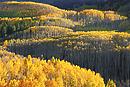
After hanging out on the summit of Mahana, I descended down the gentle grassy east slope of Mahana. To the south, it cliffed out in several places so I headed east on the ridge for a long time, probably for at least a mile and a half. Finally, when I could see Ouzel Lake almost due south, I bushwhacked through a bunch of dead/half-burnt trees (from a fire in Wild Basin several years ago). The bushwhacking wasn‘t too bad at all. There isn‘t too much underbrush to fight. Scary to think of what would happen if another fire occurred there though, since there are so many dry dead logs still lying around. Here are some pics of that area:
Copeland Mt:
Ouzel Lake:
Stopped at Ouzel Falls on the way back. The falls are spectacular right now and should be for a while.
I would definitely recommend this hike if you enjoy long hikes on fairly gentle terrain and you don‘t mind a little off-trail route-finding and bushwhacking.
>
Thumbnails for uploaded photos (click to open slideshow):
Hi, was thinking of doing Ouzel soon. You wouldn‘t happen to have a good photo of the east ridge from either at Bluebird Lake or from just above Bluebird Lake?
Hi,
I was thinking about doing Isolation from the West side (starting the trip from Grand Lake East Inlet Trail). I was thinking that past Fifth lake I would follow the stream to the source, then climb the summit to Isolation and then down the other side toward Bluebird. I will use your TR info for my trip down, it is very helpful!. Do you have any info on the ascent to Isolation from the West side? Thanks
Thanks for the compliment. I don‘t have too much beta on the west side of the park. This book by Lisa Foster,
http://www.amazon.com/Rocky-Mountain-National-Park-Complete/dp/1565795504, is amazing. It pretty much covers every non-technical hike in the whole park. Page 205-206 has the information you‘re looking for on Isolation Peak. Have fun!
Caution: The information contained in this report may not be accurate and should not be the only resource used in preparation for your climb. Failure to have the necessary experience, physical conditioning, supplies or equipment can result in injury or death. 14ers.com and the author(s) of this report provide no warranties, either express or implied, that the information provided is accurate or reliable. By using the information provided, you agree to indemnify and hold harmless 14ers.com and the report author(s) with respect to any claims and demands against them, including any attorney fees and expenses. Please read the 14ers.com Safety and Disclaimer pages for more information.
Please respect private property: 14ers.com supports the rights of private landowners to determine how and by whom their land will be used. In Colorado, it is your responsibility to determine if land is private and to obtain the appropriate permission before entering the property.


")
")
")
")
")
")
")
")
")
")
")
")