Download Agreement, Release, and Acknowledgement of Risk:
You (the person requesting this file download) fully understand mountain climbing ("Activity") involves risks and dangers of serious bodily injury, including permanent disability, paralysis, and death ("Risks") and you fully accept and assume all such risks and all responsibility for losses, costs, and damages you incur as a result of your participation in this Activity.
You acknowledge that information in the file you have chosen to download may not be accurate and may contain errors. You agree to assume all risks when using this information and agree to release and discharge 14ers.com, 14ers Inc. and the author(s) of such information (collectively, the "Released Parties").
You hereby discharge the Released Parties from all damages, actions, claims and liabilities of any nature, specifically including, but not limited to, damages, actions, claims and liabilities arising from or related to the negligence of the Released Parties. You further agree to indemnify, hold harmless and defend 14ers.com, 14ers Inc. and each of the other Released Parties from and against any loss, damage, liability and expense, including costs and attorney fees, incurred by 14ers.com, 14ers Inc. or any of the other Released Parties as a result of you using information provided on the 14ers.com or 14ers Inc. websites.
You have read this agreement, fully understand its terms and intend it to be a complete and unconditional release of all liability to the greatest extent allowed by law and agree that if any portion of this agreement is held to be invalid the balance, notwithstanding, shall continue in full force and effect.
By clicking "OK" you agree to these terms. If you DO NOT agree, click "Cancel"...
Summits: Mt. Belford (14,197') and Mt. Oxford (14,153') Elevation gain: 5900' RT distance: 11.5 miles Route: Missouri Gulch Trailhead to Mt. Belford, Belford-Oxford saddle to Mt. Oxford, back over the saddle and down via Elkhead Pass. Partner: Amber (wife)
Our trip began Friday, July 4th as we left our house in Colorado Springs and headed west to Buena Vista with the goal of hiking to Ptarmigan Lake mid-morning as a chance to breathe some 12,000' air. Apparently we were not the only ones with this plan, as the parking lot was overfull, so we settled on driving to Cottonwood Pass and walking around a bit there.
Cottonwood Pass marker:
View from Cottonwood Pass looking west:
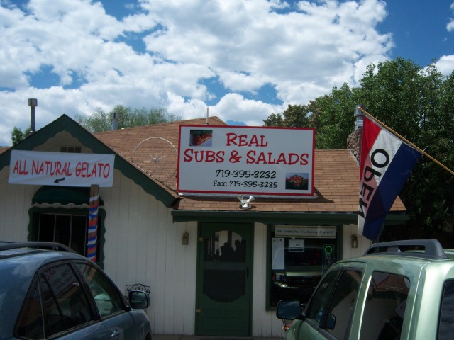
After an hour or so here, we headed into Buena Vista for some lunch at Real Subs & Salads. The food is quick and the menu is comprised of cold and hot subs and sandwiches, along with a few salads. This place is definitely worth the stop.
Here they are:
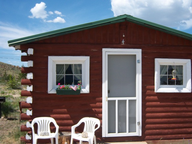
We then made our way to our cabin in Balltown, at the intersection of US 24 and CO 82. We have passed Win-Mar Cabins several times while traveling through the area and so decided to give them a try. They offer one and two-room cabins with kitchenettes, a shower, and full bed.
A look at our cabin:
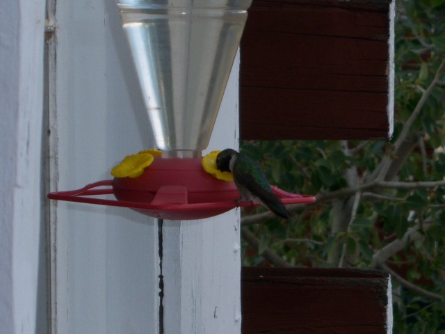
A hummingbird visiting the feeder:
With the alarm set for 4:00 AM we headed to bed for some shut eye. We awoke promptly at 4:00 AM after a fairly restless night of sleep and made our way to the trailhead after a breakfast of cold fried chicken tenders and potato salad. By the time we began hiking at 5:30 AM, the sun was up enough to light our path.
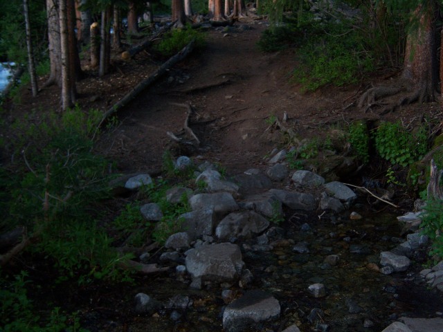
Here is a look at the forested trail at the beginning of the switchbacks:
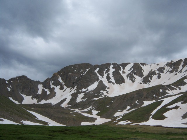
After maneuvering the switchbacks and a couple of stream crossings, we came to the willows and were greeted with our first view of Mt. Belford.
Mt. Belford:
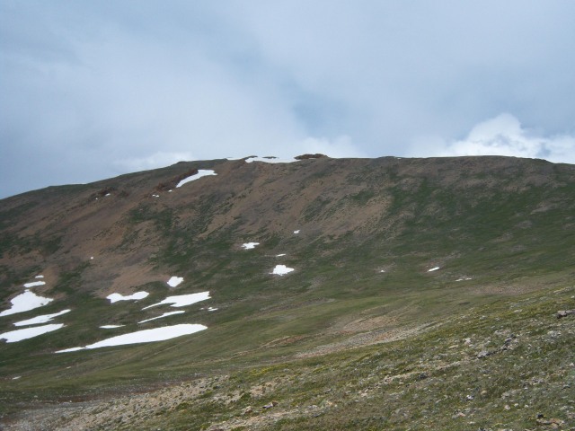
As we made our way further into the gulch, the remaining route showed itself on Mt. Belford's north ridge:
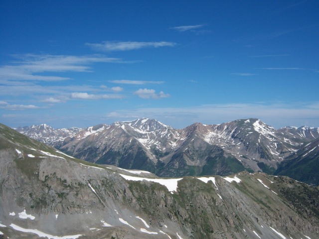
As we toiled up the ridge we were treated with views to the west of the snowy peaks beyond:
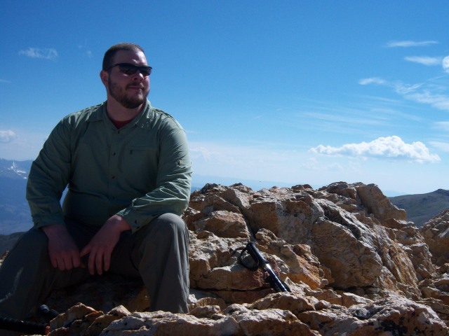
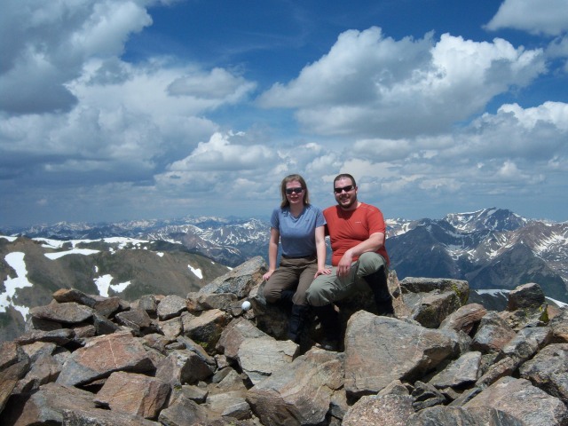
Finally, at 10:00 AM we reached the summit and had it to ourselves for the ten minutes we spent there.
Summit photo:
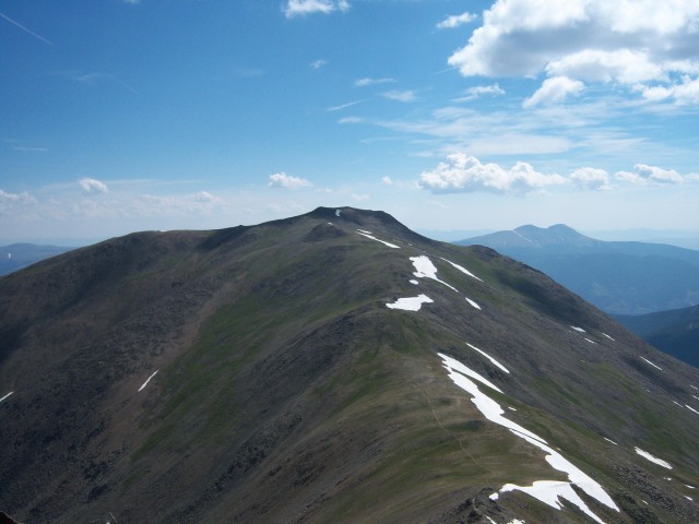
After a quick couple of shots we began to make our way to Mt. Oxford via the saddle connecting the two peaks.
The saddle:
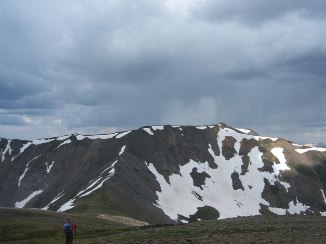
As we traverse the saddle we begin to notice the clouds growing but not becoming threatening. We make our way to Mt. Oxford's summit at 11:30 AM. We stopped here for some snacks and pictures.
Summit photo:
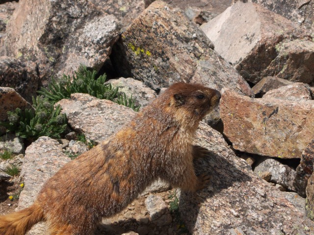
We were greeted by a rather aggressive marmot who seemed rather used to being very close to people.
Here it is approaching:
And again he poses for us:
The clouds growing over Mt. Belford:
After 30 minutes on the summit, we begin our descent at 12:00 PM, perhaps about 30 minutes too late to avoid the fast-moving storm. About a third of the way across the saddle we begin to feel the cold sting of grapple snow hitting us sideways. At this point there is no thunder or lightening but this is not making the return trip to Mt. Belford any easier as the rocks are getting slippery. Once on Mt. Belford's southern ridge we drop down for a descent over Elkhead Pass. Here, the snow had stopped and the first of the weather was past us. More was coming though.
A view of Mt. Belford from 13,220' Elkhead Pass:
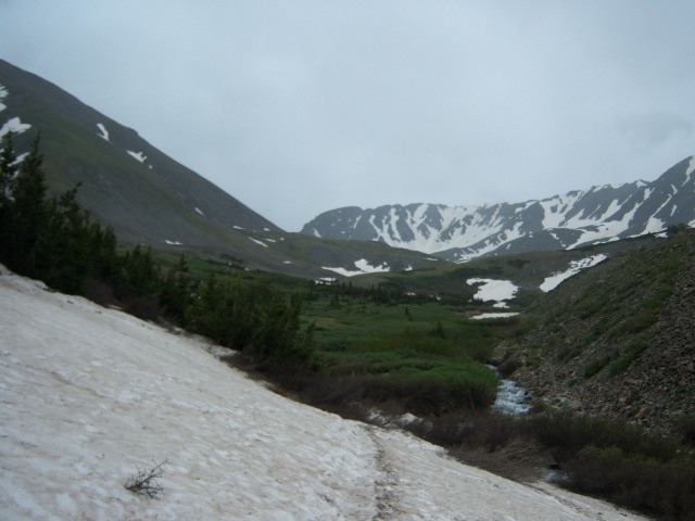
On our ascent there were only two very short snowfields to cross. The upper portion of Missouri Gulch had several more. There was minimal post holing and the snow was less than a foot deep in its deepest.
A shot of some fairly deep snow that has been caving into the creek:
A look up at Missouri Mountain:
A cloudy Missouri Mountain:
The trail was fairly easy to see as it went into and out of snowfields but there came a point where crossing the creek was not our first choice. So, we decided to navigate the willows; and the rain showed up with thunder and distant lightening. At our best count the lightening was 8 - 11 miles away but our pace became quicker. In hindsight, crossing the creek would have been easier than navigating the willows, as the bottom of my legs will attest. We followed the creek the best we could and finally found our chance to cross, and then quickly regained the trail. The rain became harder but our rain gear was doing its job. Upon reaching the trees, the rain settles down and virtually stops so we stop for fresh, dry socks. The trip down the switchbacks was quick and the forest had that fresh rain smell and look to it.
A look at the moist trail:
We arrived back to the car at 5:00 PM after a long 11.5 hour day, two fourteener summits, threatening weather, sore legs, and a desire to get back out in the near future. Back at the cabin we enjoyed a pot luck style dinner with the various leftovers loitering in our fridge and settled in for a much better night's sleep. Our stay in the Sawatch area ended with breakfast at Bongo Billy's, a coffee shop on the southern end of Buena Vista.
Thumbnails for uploaded photos (click to open slideshow):
Real Subs = order the half; I could not imagine eating a whole one.
Yeah, it was tough day and we took a lot away from this trip. BV is definitely becoming one of our favorite spots in the state; there is no shortage of things to do there.
Caution: The information contained in this report may not be accurate and should not be the only resource used in preparation for your climb. Failure to have the necessary experience, physical conditioning, supplies or equipment can result in injury or death. 14ers.com and the author(s) of this report provide no warranties, either express or implied, that the information provided is accurate or reliable. By using the information provided, you agree to indemnify and hold harmless 14ers.com and the report author(s) with respect to any claims and demands against them, including any attorney fees and expenses. Please read the 14ers.com Safety and Disclaimer pages for more information.
Please respect private property: 14ers.com supports the rights of private landowners to determine how and by whom their land will be used. In Colorado, it is your responsibility to determine if land is private and to obtain the appropriate permission before entering the property.


")
")
")
")
")
")
")
")
")
")
")
")
")
")
")
")
")
")
")
")