Download Agreement, Release, and Acknowledgement of Risk:
You (the person requesting this file download) fully understand mountain climbing ("Activity") involves risks and dangers of serious bodily injury, including permanent disability, paralysis, and death ("Risks") and you fully accept and assume all such risks and all responsibility for losses, costs, and damages you incur as a result of your participation in this Activity.
You acknowledge that information in the file you have chosen to download may not be accurate and may contain errors. You agree to assume all risks when using this information and agree to release and discharge 14ers.com, 14ers Inc. and the author(s) of such information (collectively, the "Released Parties").
You hereby discharge the Released Parties from all damages, actions, claims and liabilities of any nature, specifically including, but not limited to, damages, actions, claims and liabilities arising from or related to the negligence of the Released Parties. You further agree to indemnify, hold harmless and defend 14ers.com, 14ers Inc. and each of the other Released Parties from and against any loss, damage, liability and expense, including costs and attorney fees, incurred by 14ers.com, 14ers Inc. or any of the other Released Parties as a result of you using information provided on the 14ers.com or 14ers Inc. websites.
You have read this agreement, fully understand its terms and intend it to be a complete and unconditional release of all liability to the greatest extent allowed by law and agree that if any portion of this agreement is held to be invalid the balance, notwithstanding, shall continue in full force and effect.
By clicking "OK" you agree to these terms. If you DO NOT agree, click "Cancel"...
Peak: Wheeler Peak, NM (NM Highpoint)
Elevation: 13,161 ft.
Route: Ascent via Bull of the Woods trail, Descent via Williams Lake
Round Trip Distance: ~13mi (not including a few backtracks to search for a dog bootie)
Elevation Gain: ~4,100 ft (includes drop into La Cal basin and elevation regained)
Party: Solo
This is arguably the closest thing NM has to a 14er (the other argument is that Culebra is the closest thing NM has to a 14'er as it's only about 13 miles north of the NM state line). I was inspired in part by Aubry's trip report the other day, so thanks Aubry and Jen.
I wasn't sure how this would play out...I had the option of leaving Thursday night, and sleeping when I got tired, leaving Friday morning and camping in the La Cal basin, or any other option in between. I ended up leaving Las Cruces after work on Thursday (after packing etc. I didn't get away until close to 7:00 pm). I arrived at the Taos Ski Valley parking lot at around 1:30 am, rolled out a tarp, pad, and sleeping bag and enjoyed a nice night under the stars (living like a hobo isn't so bad). My internal clock woke me up at ~5:15, and after making some oatmeal and coffee, I was hiking at 10 after 6.
I was a little surprised at how steeply the trail climbed right out of the parking lot...but hey, with ~4,000 feet to climb, it's gotta go up right?
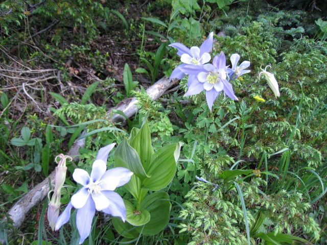
Early morning New Mexico Columbines
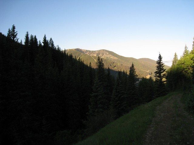
First sunlight on the peaks across the valley
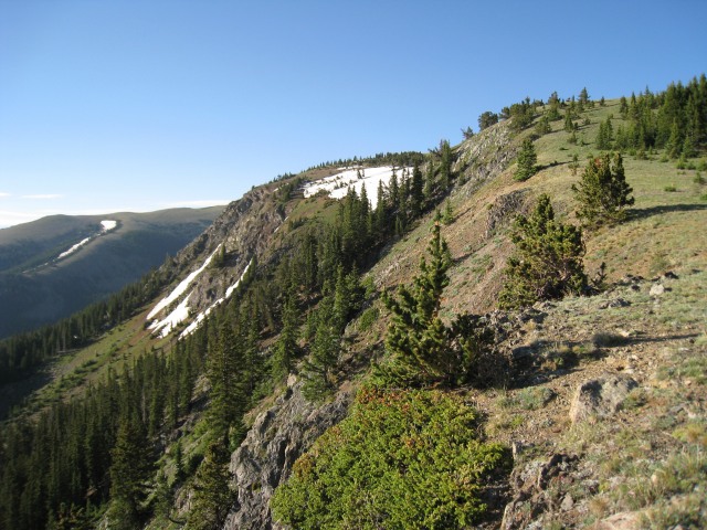
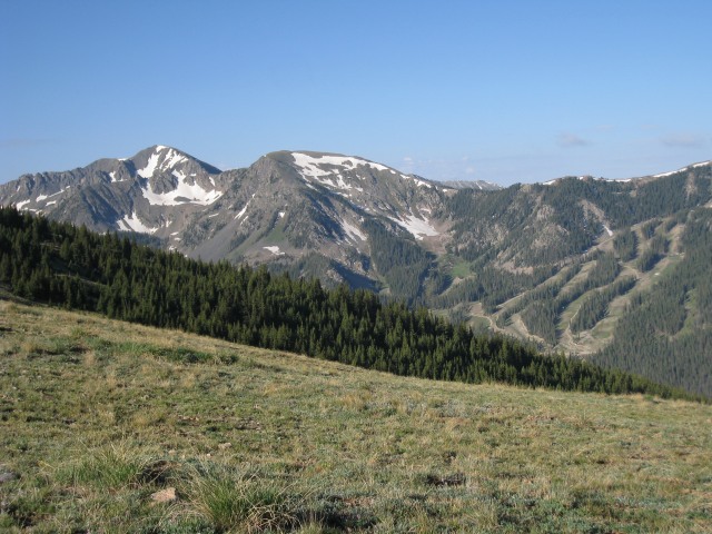
I started to encounter some snow in the trees above 11,000 feet, but what little I walked across was plenty firm. Treated to the first real vista's around 11,500.
Looking off the to the SW over the western edge of the ridge
Low clouds forming before 8:00 (portent of thunder or easily burned off by the sun?)
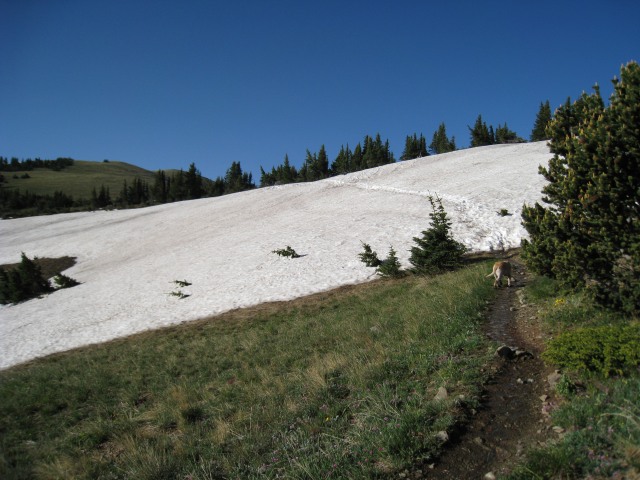
First major snowfield to cross near 11,700 feet.
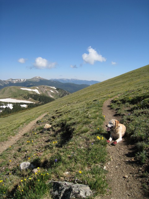
No worries crossing this snowfield, but the dog wasn't getting the traction he needed with his booties on, and at one point started to slide down the snow enough to have me worried. He self arrested with his belly and tail, and seemed to get the hang of his booties from then on. About half mile later, I noticed he only had 3 booties on, and had to backtrack to find the other one. He goes out and fetches the paper every morning...but when I asked him to go fetch his bootie, he looked at me and said "riiight, after these dang things almost made me slide down into some trees, you think I'm going after them?".
From above the snowfield, looking SW at Kachina Peak (right) and Lake Fork Peak (left)
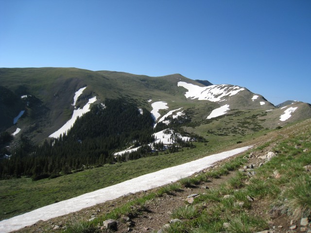
I took my first break just as the trail starts down into the La Cal basin (this is where I had planned to camp if I couldn't have started early today).
The La Cal basin
View to the North from above the La Cal Basin
The trail switch backs down into the basin, and eventually through the trees before switching back up to the ridge near the center of the photo. I debated an ascending right traverse through the basin to avoid the obvious snow in the trees, but since I love snow, I followed the trail. As expected from Aubry's report I encountered deep snow, but firm, once down in the trees. I traversed fairly level through the trees, most likely staying above the trail, then crossed two streams before ascending a snowfield in the second streambed. Once above the trees again, I easily found the trail and as the hash house harriers would say: "on...on...on". At the first switchback there is a faint use trail that appears to do what I considered...traverse through the basin above the snowfields (there may be some difficulty crossing one of the stream beds...but I dunno).
Came across these fellas on the switchbacks coming out of the basin
There were two large Ram's crossing the snowfield to the west, but they were too far away for a decent image.
"You take pictures of the sheep, I need a rest..."
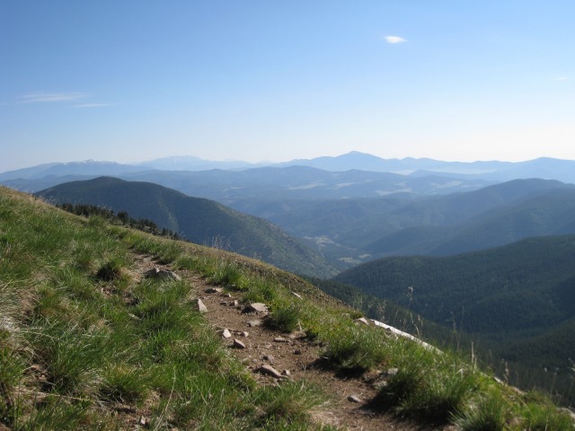
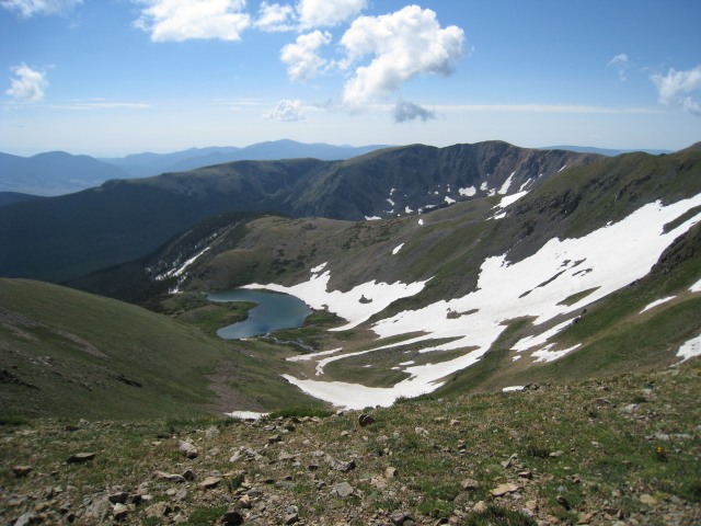
Once back on the ridge there's a nice view down into Horseshoe Lake
Somehow, I entered the coordinates for the summit into my GPS incorrectly (GPS was set on decimal degrees, and I got dd.hh.mm.mm off of Google Earth or something). Anyway, when I came across this trail junction, I saw a trail on the far ridge in the distance, and my GPS still said something like 0.7 miles to go...I thought:
This is going to be a long ridge hike
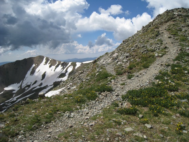
Nonetheless, I took the right fork (might as well capture the sub-peaks I thought)...and lo and behold, this was the summit. Nice!
Looking over into Williams Lake
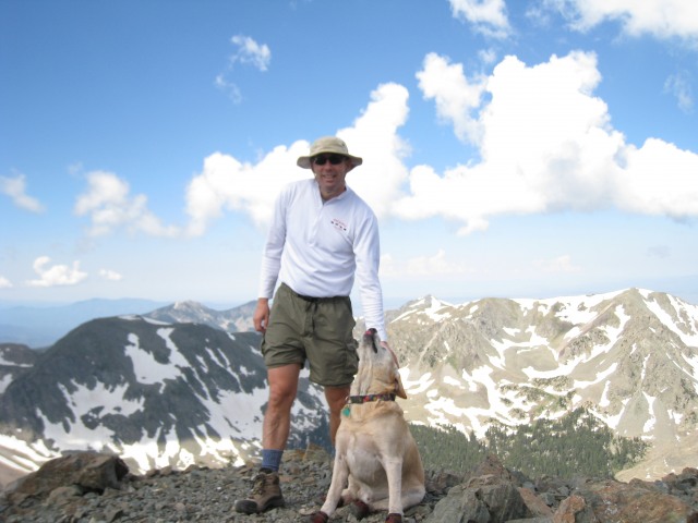
Summit shot
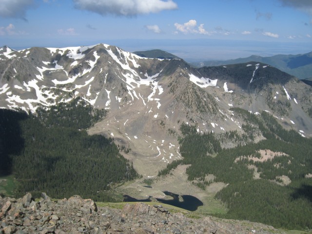
I decided to complete the tour de Wheeler, and descend via the Williams Lake route. The first 500 or so vertical feet of the descent is a steep scree fest (scree skiing made the descent fast, but coming up that way would be rough). Below that, it was steep, but not too loose almost all the way to the lake (slight reprieve once you get to the trees).
I had a few opportunities to glissade...but glissading is for people that don't ski. Skiers (when the don't have skis) boot ski. Kids, don't try this at home, be warned that any boot skiing can turn into an un-intended and un-controlled glissade, know your run-out before you start, and if you aren't willing to slide uncontrolled into the run-out, don't do it.
Boot Skiing = fun fast descent
Williams Lake
From Williams Lake it's an easy hike back to the base of the Kachina Peak Chair at Taos Ski Valley. This part of the trail is very crowded compared to the rest of the hike. The dog got lots of attention with his cute booties and all. I on the other hand must have looked like I slept in a parking lot last night (oh yeah...I did). Doing this as a loop, I also had to hike back to the base area. From the Kachina chair, I highly recommend taking the ski trail, and avoiding the dusty road. Go left through a gate above the base of the lift, or once past the parking area, at the first bend in the road, drop down to the stream on a trail, and cross at a log bridge.
The ski trail parallels this beautiful stream.
And you arrive at the base of the famous Al's Run
Back at "camp" two tired dogs (one of them with a Sierra Nevada IPA)
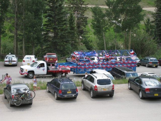
I arrived just in time for the Taos Ski Valley 4th of July Parade and had a perfect view
After relaxing, a bit, I hopped in the car and drove back to Las Cruces. Total trip time ~28 hours...(w/ about 3:45 of sleep).
Thumbnails for uploaded photos (click to open slideshow):
Skiers (when the don't have skis) boot ski 8/25/2008 8:41pm
right on! Great TR from one of my favorite (backcountry ski) areas and impressive movie of a very stable boot ski.
Videos of my boot skiing are guaranteed to made you sick! Were you in a tele stance by chance :wink:
Caution: The information contained in this report may not be accurate and should not be the only resource used in preparation for your climb. Failure to have the necessary experience, physical conditioning, supplies or equipment can result in injury or death. 14ers.com and the author(s) of this report provide no warranties, either express or implied, that the information provided is accurate or reliable. By using the information provided, you agree to indemnify and hold harmless 14ers.com and the report author(s) with respect to any claims and demands against them, including any attorney fees and expenses. Please read the 14ers.com Safety and Disclaimer pages for more information.
Please respect private property: 14ers.com supports the rights of private landowners to determine how and by whom their land will be used. In Colorado, it is your responsibility to determine if land is private and to obtain the appropriate permission before entering the property.


")
")
")
")
")
")
")
")
")
")
")
")
")
")
")
")
")
")
")


