Download Agreement, Release, and Acknowledgement of Risk:
You (the person requesting this file download) fully understand mountain climbing ("Activity") involves risks and dangers of serious bodily injury, including permanent disability, paralysis, and death ("Risks") and you fully accept and assume all such risks and all responsibility for losses, costs, and damages you incur as a result of your participation in this Activity.
You acknowledge that information in the file you have chosen to download may not be accurate and may contain errors. You agree to assume all risks when using this information and agree to release and discharge 14ers.com, 14ers Inc. and the author(s) of such information (collectively, the "Released Parties").
You hereby discharge the Released Parties from all damages, actions, claims and liabilities of any nature, specifically including, but not limited to, damages, actions, claims and liabilities arising from or related to the negligence of the Released Parties. You further agree to indemnify, hold harmless and defend 14ers.com, 14ers Inc. and each of the other Released Parties from and against any loss, damage, liability and expense, including costs and attorney fees, incurred by 14ers.com, 14ers Inc. or any of the other Released Parties as a result of you using information provided on the 14ers.com or 14ers Inc. websites.
You have read this agreement, fully understand its terms and intend it to be a complete and unconditional release of all liability to the greatest extent allowed by law and agree that if any portion of this agreement is held to be invalid the balance, notwithstanding, shall continue in full force and effect.
By clicking "OK" you agree to these terms. If you DO NOT agree, click "Cancel"...
6/14/08
Northeast Ridge ascent; East Ridge descent; Colorado Trail traverse
North Elbert Trailhead: 7:00am
Summit: 10:00 - 10:30 am
4WD Parking South Elbert Trailhead: 12:30 pm
North Elbert Trailhead: 2:00 pm
Round trip distance: 11.5 - 12 miles
Background: I drove to Leadville on Friday night. Primarily, I wanted to avoid getting up at 4am for the drive. I don't know whether it was sleeping at a higher elevation, or sleeping for an extra hour, but it seemed that I had more energy for this hike.
I stayed at the Days Inn, which was nice, but the free continental breakfast didn't open until 6:30am. I purchased a few donuts at Safeway the night before for a quick breakfast. The hotel is on the SW side of Leadville, making for a quick drive to the trailhead.
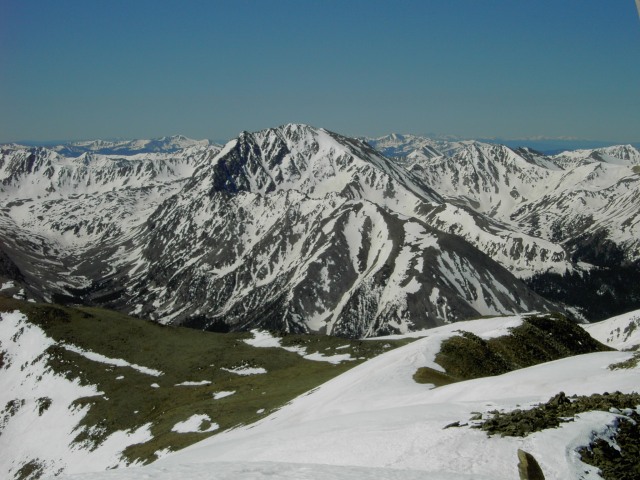
Shot from the road, showing Elbert and the Northeast Ridge, mostly clear of snow.
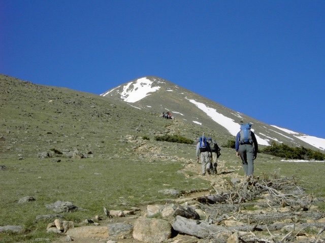
I reached the large trailhead parking area at about 6:45 am. Geared up and left about 7:00am. I thought that the hike up through tree line was fairly exhausting. I tend to start out a hike slow and out of breath, thus the turnoff for Mt. Elbert seemed farther than the 1 mile listed in the guide. The hike up to the clearing before tree line was uneventful, but between the clearing and true tree line was quite a bit of snow. No snowshoes needed, but the trail was hard to find. I followed a path alternating between dirt and snow, and ended up about 100 yards north of the trail at true tree line.
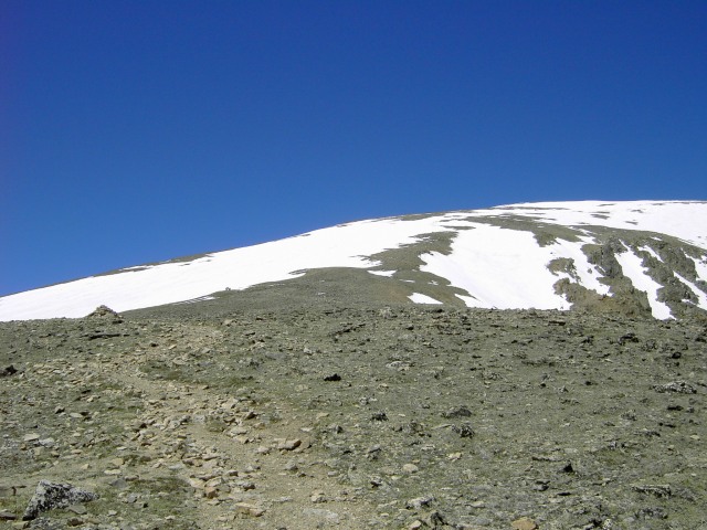
View from tree line of the first part of the path up to the Ridge
The hike up the switchbacks to the ridge was pretty easy, but there was quite a bit of wind coming from the NW. It made heading toward Elbert more difficult than the switchbacks that generally headed SE.
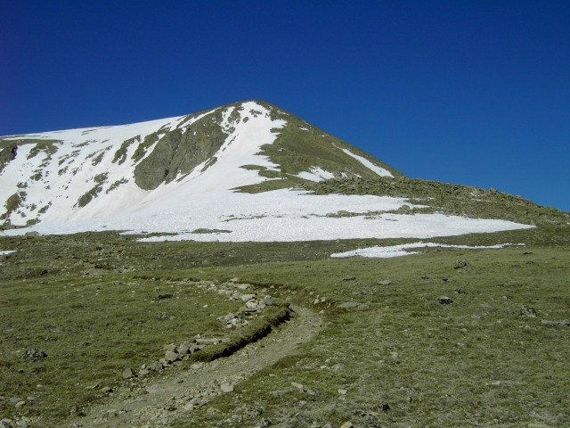
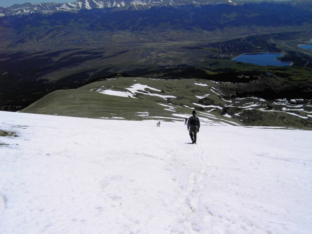
View from the ridge of the bulk of the remaining trail, generally just to the right (north) of the snow
The ridge was easy for a while, a few very small snowfields to cross; the majority of them could be bypassed. Very near the start of the steep section is a very nice wind shelter, just to the south of the trail. As the wind was blowing, it was a nice place to take a break.
The route up the steep section had quite a few switchbacks, thus making the hike pretty easy. Rounding the steep section to the north was windy, but not difficult.
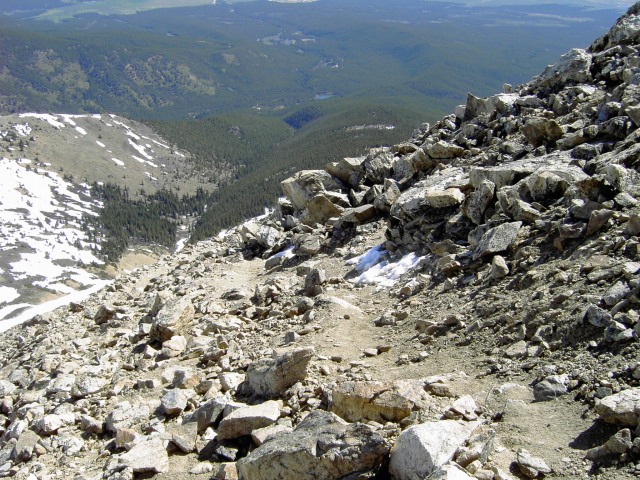
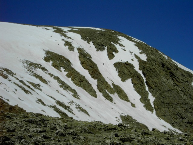
Looking back on the trail around the steep section
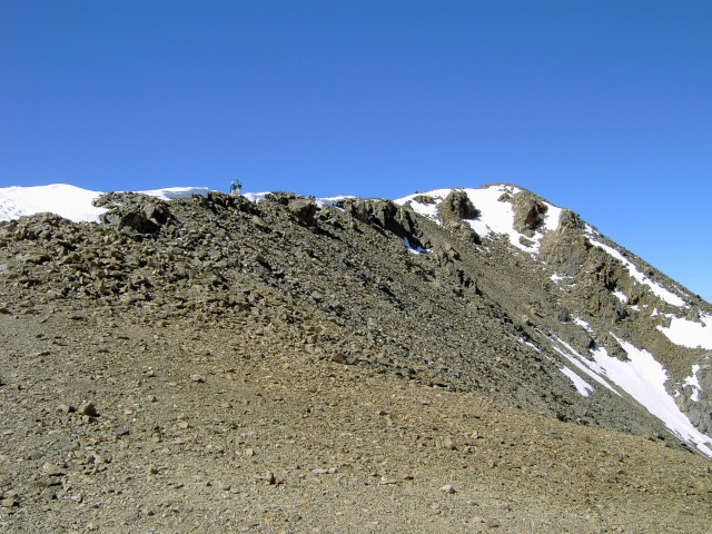
After regaining the ridge, at approximately 14,000' there is a bit more hiking to do before finally reaching the last true ridge to the summit. The last bit was narrower, and had snow on it, which was worn very smooth and somewhat slick.
The summit ridge
Summit shot, Massive in the background
View of La Plata to the Southwest
I reached the summit at about 10am. I ran into Walt, a guy who I went through the Sawtooth with last year. He mentioned that he had come up the East Ridge and offered me a ride back to the trailhead if I wanted to try a different route down. After about 30 minutes, we left down the East Ridge route.
There were several small snowfields and one large snowfield between about 13,000' and 12,400'. This was a nice glissade spot. There were several groups at the bottom that appeared indecisive about going up, but the snow was solid as of about 11:00 - 11:30am.
Coming down the large snowfield
Shot from below the large snowfield, trail crossed up and to the left. Recommendation was to stay to the right straight up the ridge, and missing most of the snow
Shot looking over to the NE Ridge route, with several people hiking up
Bonus shot of three people doing a snow climb, tough to tell what is a rock and what is a person (lower right, center, and left center (bottom of the three dots)
From there to tree line were several more snowfields, with increasingly more post holing. Back in tree line, there were several spots of snow, but not nearly as many as on the NE ridge route below tree line.
At about 12:30, we made it to the junction of the East Ridge route and the Colorado Trail. I felt that I had enough energy, so I parted ways with Walt and headed north.
Photo of the Colorado Trail between trailheads
The walk back to the North Elbert trailhead was longer than I expected, as I was more tired than I thought. There are several uphill slopes that were moderate, but started to wear on me more and more. After crossing Mill Creek, the trail climbs back to the junction from the north side. Between the junctions, the trail was very easy, much easier than the downhill walk from the junction to the car.
I reached the car at about 2pm. My GPS didn't work this time, but from the books, I estimate that the round trip was 11.5 - 12 miles. I don't know how much additional elevation I gained on the Colorado Trail; my guess is about 500'.
I wasn't disappointed in my route selection, but I looking back, I don't think that I would have done this loop, there is a reason that Roach doesn't call this "a good tour de Elbert". It might be interesting to leave the East Ridge trail at about 12,400' and traverse north to rejoin the Northeast Ridge, but I didn't walk over to survey the potential route.
Bonus shot of Massive from the road
Thumbnails for uploaded photos (click to open slideshow):
Nice report and great job getting to the top and back quickly. I was the 2nd snow climber and it was a bit slushy by 10am. If you wouldn‘t mind, could you please send the full resolution pictures of us on the couloir to jay.johnson (at) gatech (dot) edu.
I‘d love to have the photos.
Cheers.
Caution: The information contained in this report may not be accurate and should not be the only resource used in preparation for your climb. Failure to have the necessary experience, physical conditioning, supplies or equipment can result in injury or death. 14ers.com and the author(s) of this report provide no warranties, either express or implied, that the information provided is accurate or reliable. By using the information provided, you agree to indemnify and hold harmless 14ers.com and the report author(s) with respect to any claims and demands against them, including any attorney fees and expenses. Please read the 14ers.com Safety and Disclaimer pages for more information.
Please respect private property: 14ers.com supports the rights of private landowners to determine how and by whom their land will be used. In Colorado, it is your responsibility to determine if land is private and to obtain the appropriate permission before entering the property.


")
")
")
")
")
")
")
")
")
")
")
")
")

