Download Agreement, Release, and Acknowledgement of Risk:
You (the person requesting this file download) fully understand mountain climbing ("Activity") involves risks and dangers of serious bodily injury, including permanent disability, paralysis, and death ("Risks") and you fully accept and assume all such risks and all responsibility for losses, costs, and damages you incur as a result of your participation in this Activity.
You acknowledge that information in the file you have chosen to download may not be accurate and may contain errors. You agree to assume all risks when using this information and agree to release and discharge 14ers.com, 14ers Inc. and the author(s) of such information (collectively, the "Released Parties").
You hereby discharge the Released Parties from all damages, actions, claims and liabilities of any nature, specifically including, but not limited to, damages, actions, claims and liabilities arising from or related to the negligence of the Released Parties. You further agree to indemnify, hold harmless and defend 14ers.com, 14ers Inc. and each of the other Released Parties from and against any loss, damage, liability and expense, including costs and attorney fees, incurred by 14ers.com, 14ers Inc. or any of the other Released Parties as a result of you using information provided on the 14ers.com or 14ers Inc. websites.
You have read this agreement, fully understand its terms and intend it to be a complete and unconditional release of all liability to the greatest extent allowed by law and agree that if any portion of this agreement is held to be invalid the balance, notwithstanding, shall continue in full force and effect.
By clicking "OK" you agree to these terms. If you DO NOT agree, click "Cancel"...
| Report Type |
Full |
| Peak(s) |
Commando Run - 11710
|
| Date Posted |
04/06/2008 |
| Modified |
05/27/2015 |
| Date Climbed |
04/05/2008 |
| Author |
MountainHiker |
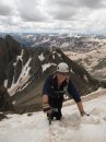
| Commando Run |
My friend John had been lobbying us to do Commando Run for the past few years.
It finally came together.
I had done Commando Run previously with John back on 4-2-95.
Vail wasn't as big then, so our route was necessarily longer.
Commando Run is named for the 10th Mountain Division ski troops who used to train along this route.
The basic route starts at Vail Pass, heads up Shrine Pass road,
turns onto Lime Creek road, then heads over some mountains to Vail Ski area.
You then ski down Vail.
Strong map and route finding skills are required for this route.
You can't depend on there being an obvious track to follow,
especially with the wind we have had this winter.
Also we encountered some tracks that had other apparent destinations.
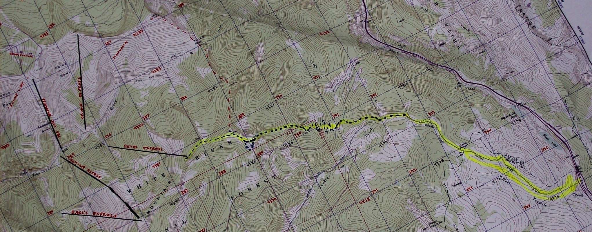
This is the map I used - scroll to see it all UTM grid on NAD27
Disclaimer - I plotted the lift locations by eye from a different & smaller scale map.
Expect up to 100m shift on hand drawn lift locations.
Route line is estimate - not GPS track.
For this trip it was MountainHikerette, John & myself.
John's wife Karen, their daughter and a friend did the first part of the route with us.
We parted company at Shrine Pass where they did a shorter ski to a hut and returned to Vail Pass.
They were able to provide the vehicle shuttle.
There was another party on the route that day.
Our two groups were mixed together until some of them turned back. The faster two in their group then pulled ahead of us.
It was then just the three of us for the rest of the journey.
At the Vail Pass exit there is a pay parking lot to the right where you enter the rest area.
The fee is $6.00. There were no pay envelopes!
Shrine Pass road starts right at this parking lot.
Instead of following Shrine Pass road to the summit of Shrine Pass,
there is a marked trail that parallels the road on the left hand side.
This trail meets up with the road near the summit where there is an outhouse.
http://www.topozone.com/map.asp?lat=39.53399&lon=-106.22953&size=l&u=4&datum=nad83&layer=DRG

You might want to take your skins off for the next downhill stretch.
Watch for another road that turns to the right after about 1.5 miles.
There is a sign that says Lime Creek.
This is where you will have to put your skins back on.
http://www.topozone.com/map.asp?lat=39.56042&lon=-106.25856&size=l&u=4&datum=nad83&layer=DRG

About a ¼ mile up this road you will pass another road that turns off to the right.
That road was marked with a couple "no snowmobile" signs.
http://www.topozone.com/map.asp?lat=39.56334&lon=-106.26695&size=l&u=4&datum=nad83&layer=DRG

About 500' after passing this side road we found a track that headed W/NW up the mountainside.
http://www.topozone.com/map.asp?lat=39.56216&lon=-106.2706&size=l&u=4&datum=nad83&layer=DRG
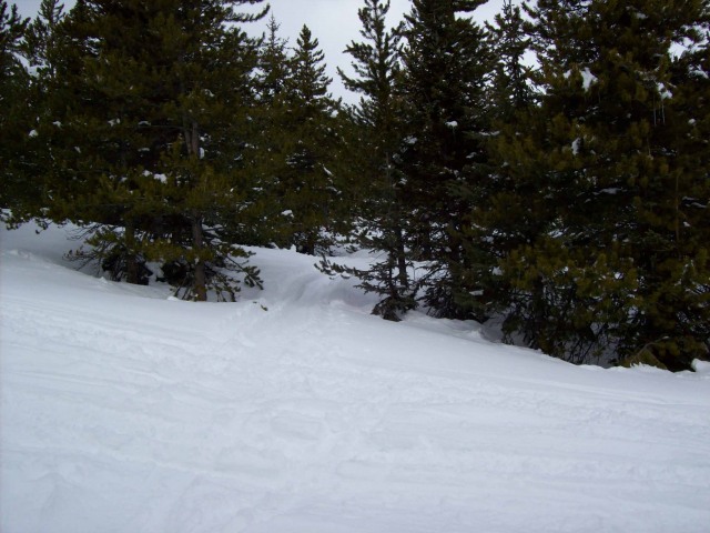
I suspect this was one of a few tracks heading up the mountain.
Whoever made it headed more directly uphill than we were able to get traction.
We did a lot of switch backing while climbing point 11611.
We skirted point 11611 on the left.
http://www.topozone.com/map.asp?lat=39.56593&lon=-106.27782&size=l&u=4&datum=nad83&layer=DRG

We met up with more of a track as we headed along the broad topped ridge in the trees to point 11710.
We were a little to the left of the high point as we passed 11710.
http://www.topozone.com/map.asp?lat=39.56838&lon=-106.29231&size=l&u=4&datum=nad83&layer=DRG
We broke into an open area as we crossed to point 11696.
http://www.topozone.com/map.asp?lat=39.5713&lon=-106.2968&size=l&u=4&datum=nad83&layer=DRG

When I did Commando Run before, this was where we headed north to Two Elk Pass.
http://www.topozone.com/map.asp?lat=39.59157&lon=-106.29398&size=l&u=4&datum=nad83&layer=DRG
That time we skirted high points on the left as we followed the most efficient line around to Vail Ski Area.
We passed the top of Orient Express
http://www.topozone.com/map.asp?lat=39.60527&lon=-106.32194&size=l&u=4&datum=nad83&layer=DRG
and continued on until we got where we could ski down the front side.
This time however, we skirted point 11696 on the left.
We switch backed through the trees down to the saddle between 11696 & 11608.
http://www.topozone.com/map.asp?lat=39.5727&lon=-106.30368&size=l&u=4&datum=nad83&layer=DRG

There is a clearing at this saddle.
A road goes from this saddle to the west past the south side of point 11608.
This road is not shown on the topo.

We followed this road to where we entered Vail Ski Area at UTM 387678 4380911 NAD27.
http://www.topozone.com/map.asp?lat=39.57247&lon=-106.3077&size=l&u=0&datum=nad27&layer=DRG
As we passed into Vail the top of Pete's Express was just to our right.

The following sign was posted at this point.

We skied blue runs down Blue Sky Basin until we got to the Orient Express Lift.

There was no lift line and more empty chairs than full.
The lift operator didn't seem to be watching for commandos as we boarded.
An express lift ride later we were at the top of Vail.
From the top of Orient Express we headed west until we could ski down the front side.

We started from Vail Pass at around 7:30. We got to Vail at around 1:00.
We got to the base of Vail at around 3:00.
Important Note: I don't know if Vail has an official policy,
or if the staff has a prevalent attitude about people who enter the ski area after doing Commando Run.
If you choose to do this route you assume that risk for yourself.
|
Caution: The information contained in this report may not be accurate and should not be the only resource used in preparation for your climb. Failure to have the necessary experience, physical conditioning, supplies or equipment can result in injury or death. 14ers.com and the author(s) of this report provide no warranties, either express or implied, that the information provided is accurate or reliable. By using the information provided, you agree to indemnify and hold harmless 14ers.com and the report author(s) with respect to any claims and demands against them, including any attorney fees and expenses. Please read the 14ers.com Safety and Disclaimer pages for more information.
Please respect private property: 14ers.com supports the rights of private landowners to determine how and by whom their land will be used. In Colorado, it is your responsibility to determine if land is private and to obtain the appropriate permission before entering the property.