Download Agreement, Release, and Acknowledgement of Risk:
You (the person requesting this file download) fully understand mountain climbing ("Activity") involves risks and dangers of serious bodily injury, including permanent disability, paralysis, and death ("Risks") and you fully accept and assume all such risks and all responsibility for losses, costs, and damages you incur as a result of your participation in this Activity.
You acknowledge that information in the file you have chosen to download may not be accurate and may contain errors. You agree to assume all risks when using this information and agree to release and discharge 14ers.com, 14ers Inc. and the author(s) of such information (collectively, the "Released Parties").
You hereby discharge the Released Parties from all damages, actions, claims and liabilities of any nature, specifically including, but not limited to, damages, actions, claims and liabilities arising from or related to the negligence of the Released Parties. You further agree to indemnify, hold harmless and defend 14ers.com, 14ers Inc. and each of the other Released Parties from and against any loss, damage, liability and expense, including costs and attorney fees, incurred by 14ers.com, 14ers Inc. or any of the other Released Parties as a result of you using information provided on the 14ers.com or 14ers Inc. websites.
You have read this agreement, fully understand its terms and intend it to be a complete and unconditional release of all liability to the greatest extent allowed by law and agree that if any portion of this agreement is held to be invalid the balance, notwithstanding, shall continue in full force and effect.
By clicking "OK" you agree to these terms. If you DO NOT agree, click "Cancel"...
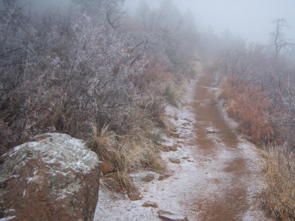
So I set out late from the TH under foggy conditions at 8:20 AM. This picture is early on the trail:
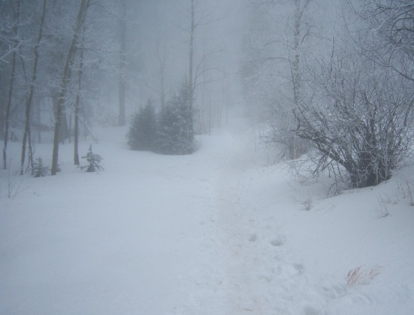
The hike up the W‘s was relatively nominal with little to no snow or ice, just what had fallen the night before. Shortly after No Name Creek the fog got real thick with it actually becoming ice fog and precipitating:
Fortunately that did not last long but the snow was beginning to thicken on the trail. Several icy spots exist by know. At 9800‘ I was treated to my first sun of the day, along with a view of Pikes Peak:
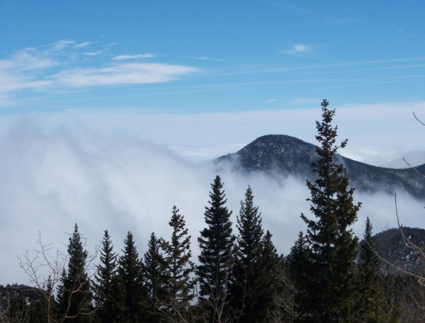
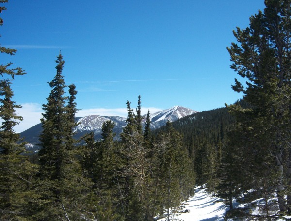
I continued on to Barr Camp, stopping for a snack and a chat with Neil. He indicated that he had been up to the top two days prior and another hiker had been up one day prior. Other than that the trail above camp was little traveled. After leaving camp I was treated to some nice views above the clouds:
and
The trail above camp had some tracks on it but was unused for the most part. As long as I kept to shadowy spots I stayed on top of the snow but the sunny spots let me fall right through, several times to my waist. A look at the trail above Barr Camp:
and
So, no summit but I made it 8.25 miles up the trail with 4690‘ gained but it was getting late (1:45 PM) so I headed home. I do plan on going back on the 11th of April for another round on the trail.
Thumbnails for uploaded photos (click to open slideshow):
Yeah, I feel good about the hike. It was a long day and I definitely got a workout. My wife actually convinced me to get up Saturday morning at 4:00 AM and do Pikes from the Crags but my boots were still soaked through so we ditched that plan, but we did get up at 4 AM, at least for half an hour. After I got above the clouds I could not stop looking down over them. It really gave me a sense of solitude on a traditionally busy trail near a large city.
I love your third picture of Pike‘s and trees. Must have been pretty cool to see that in person! Nice job on the 16 miles. Barr Trail is always a beautiful hike (at least for me) even if you don‘t make the summit.
The first two pictures with the fog remind me of hikes in the Smokies. I really like your third picture with the rime on the trees though... I wish I could see more of that on my hikes. Even though you didn‘t reach the summit, over 16 miles roundtrip and 4690‘ of elevation gain is quite laudable.
Caution: The information contained in this report may not be accurate and should not be the only resource used in preparation for your climb. Failure to have the necessary experience, physical conditioning, supplies or equipment can result in injury or death. 14ers.com and the author(s) of this report provide no warranties, either express or implied, that the information provided is accurate or reliable. By using the information provided, you agree to indemnify and hold harmless 14ers.com and the report author(s) with respect to any claims and demands against them, including any attorney fees and expenses. Please read the 14ers.com Safety and Disclaimer pages for more information.
Please respect private property: 14ers.com supports the rights of private landowners to determine how and by whom their land will be used. In Colorado, it is your responsibility to determine if land is private and to obtain the appropriate permission before entering the property.


")
")
")
")
")
")
")