Download Agreement, Release, and Acknowledgement of Risk:
You (the person requesting this file download) fully understand mountain climbing ("Activity") involves risks and dangers of serious bodily injury, including permanent disability, paralysis, and death ("Risks") and you fully accept and assume all such risks and all responsibility for losses, costs, and damages you incur as a result of your participation in this Activity.
You acknowledge that information in the file you have chosen to download may not be accurate and may contain errors. You agree to assume all risks when using this information and agree to release and discharge 14ers.com, 14ers Inc. and the author(s) of such information (collectively, the "Released Parties").
You hereby discharge the Released Parties from all damages, actions, claims and liabilities of any nature, specifically including, but not limited to, damages, actions, claims and liabilities arising from or related to the negligence of the Released Parties. You further agree to indemnify, hold harmless and defend 14ers.com, 14ers Inc. and each of the other Released Parties from and against any loss, damage, liability and expense, including costs and attorney fees, incurred by 14ers.com, 14ers Inc. or any of the other Released Parties as a result of you using information provided on the 14ers.com or 14ers Inc. websites.
You have read this agreement, fully understand its terms and intend it to be a complete and unconditional release of all liability to the greatest extent allowed by law and agree that if any portion of this agreement is held to be invalid the balance, notwithstanding, shall continue in full force and effect.
By clicking "OK" you agree to these terms. If you DO NOT agree, click "Cancel"...
With College Starting I decided to take a two day trip and climb two last peaks before the end of the summer; La Plata Peak and Mt. Sherman (Trip report to come). I left Colorado Springs at 4:00 a.m. having no idea of the adventure to come.
From Buena Vista head north to the dirt road county 290 and take a left, follow 290 all the way to the town of Winfield. Hang a right at the center of the old mining town and follow to just beyond the cemetery. Most cars can make it to this point, for high clearance vehicles you can continue all the way to the trail head at 10,900 feet.
I began my climb at about 6:30 a.m. and was very discouraged by the weather. I decided to begin climbing and if the weather got worse I would turn back. After cutting through the forest for a short distance I arrived to an open valley.
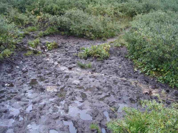
What looked like an easy hike became slow going as I had to navigate many thick mud puddles that covered the trail. Any way of avoiding these was blocked by the thick willows.
As I made my way through the valley the weather started to look less and less promising so I decided to hang around for a while and see what it was going to do. Large dark clouds would form and then burn off over and over again. I finally decided to turn around, go back and live to do it another day. Just as I reached tree line the cloud cover burned off and the sun beamed down very convincingly so I decided to turn around yet again and go for it. This turned out to cause problems later on for me. At the end of the valley the trail began to climb steeply up the ridge.
At the top of the ridge things flatten out for a while. The views back to the valley were amazing but the summit and most of the remaining rout was hidden behind the cloud cover. I could see one other climber way behind me and other then that the trail was mine.
From here on out the mountain showed no remorse and climbed up a large false summit. I thought for sure this was the true summit and on a clear day the real one could probably be seen but the thick clouds made it hard to see more 100 feet ahead of me.
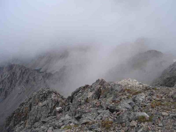
My picture taking from here to the top was very limited as the visibility was horrible. Every now and then the clouds would open up and do something cool.
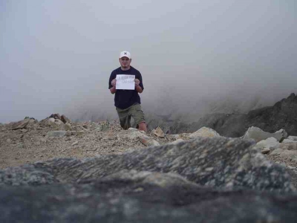
I climbed about two false summit before getting to the top at 10:30, much later then I had hoped for but the going back and forth took a lot of extra time. I was the only person on the summit that I know of. There may have been 50 people up there hiding in the fog for all I knew. I spent about 10 minutes taking pictures and looking for the guest book that I never found and then decided to head down. Little did I know the going down would be the hard part on this mountain and the worse was yet to come.
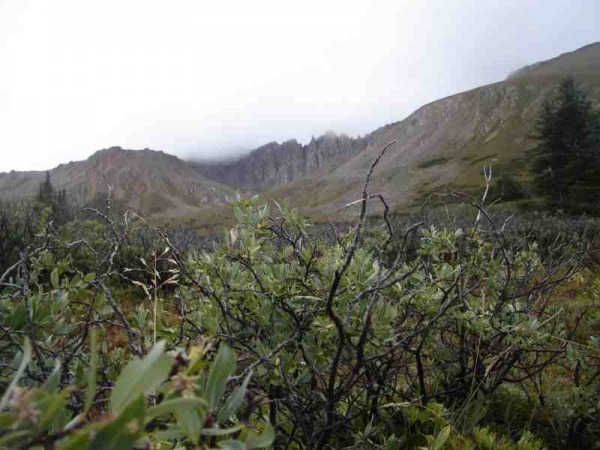
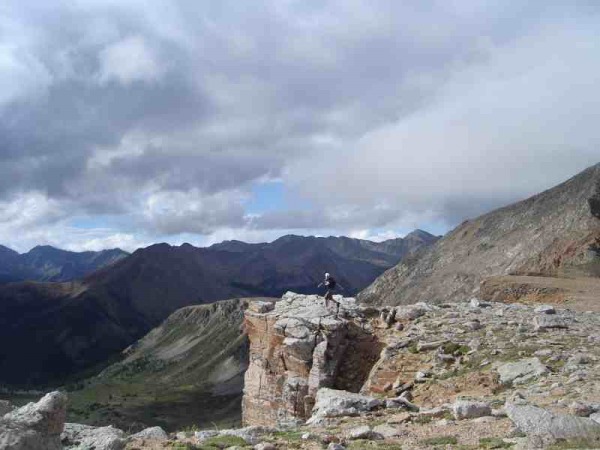
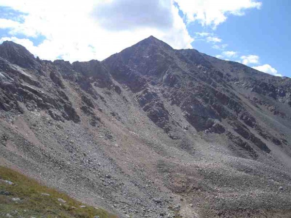
As I started heading down I ran into what I thought was the hiker I saw behind me earlier, we exchange brief words and continued on our way. Assuming this was the hiker I saw earlier I assumed that I was on the correct rout down. After about 30 minutes of hiking I realized that I in fact was not on the correct as nothing around me looked familiar. I saw a large patch of snow that I didn't remember seeing on the way up. I figured I was descending the northwest ridge and left the trail to try and find the southwest slope I had climbed up. Unable to see in the thick fog I found myself just plain LOST As the clouds let up for a minute I could see what looked like the valley I crossed way below me. The problem was getting there. I had to descend what seemed to be a 90 to 100% grade. I lost my footing countless times and had to just slide at times. I found an old rust ice axe and one cramp on the someone must of lost on a bad fall. The image below is my rout down.
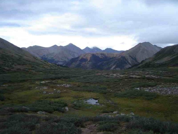
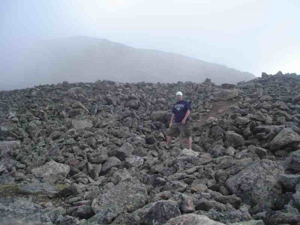
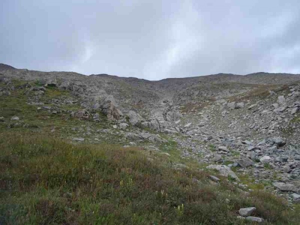
I finally reached the valley and found myself more LOST. This was not the valley I had ascended from and nothing around me looked like anything I had seen. The good news was that the sky had cleared. I pulled out my compos and found that I was far west of where I needed to be. Walking through the valley was impossible as the willow trees were as thick as I had ever seen them. My only option was to climb back up to about 11,000 ft. and cut back to the south. Below is a look at where I was stuck.
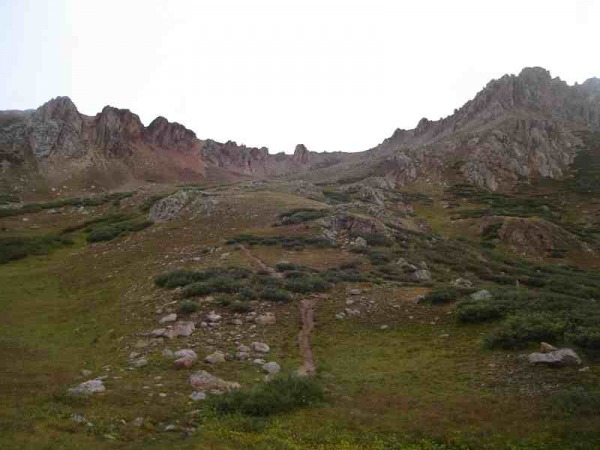
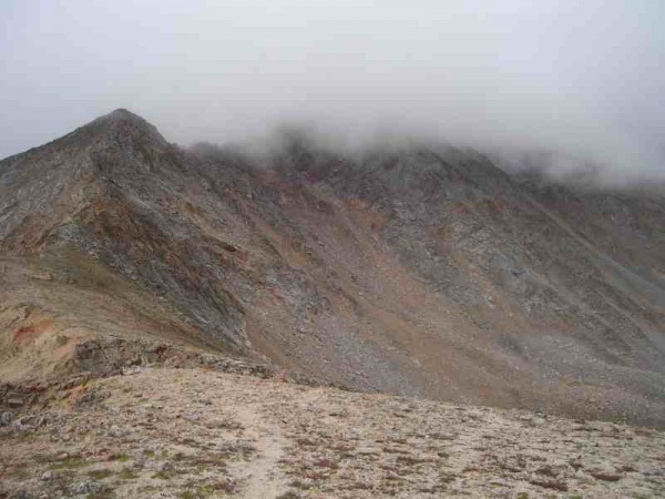
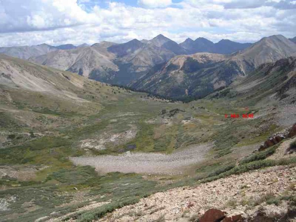
I had to ascend another large ridge, hoping that it would show me something that I recognized on the other side. Out of water and at 3:30 I finally saw the valley that I had originally crossed. I was so happy at this time all I could do was jump around and do my inzone dance. I actually met up with the trail that I had come up. Below is the ridge I climbed.
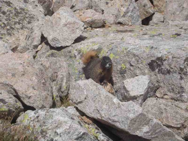
I took my time getting back to the car as my legs were about to give out. I was more then ready to stomp right through those mud puddles on the way back and I did just that. I arrived back to my car at 4:30 later then I ever imagined. Even the damn marmots were looking at me like I was crazy.
I learned a few very important things on this mountain:
1) Don't question the weather
2) Question the rout
3) I am not as good of a mountaineer as I thought
4) BUY A GPS
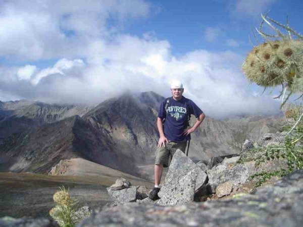
Thumbnails for uploaded photos (click to open slideshow):
...for persevering.
You should probably have just continued on instead of turning around the first time. But you made it; that's the most important thing.
We did this route with very little difficulty in June of '06. The soft snow on the way down was much easier to deal with than mud. Without the mud, it's a very nice route.
You must have dropped off the north side of the ridge on the way down. Clouds would make it hard to keep Sayres Benchmark (to the west)in view, which would eliminate this possibility.
Anyway, congrats on a successful climb of one of Colorado's highest, and (IMHO) nicest peaks.
Caution: The information contained in this report may not be accurate and should not be the only resource used in preparation for your climb. Failure to have the necessary experience, physical conditioning, supplies or equipment can result in injury or death. 14ers.com and the author(s) of this report provide no warranties, either express or implied, that the information provided is accurate or reliable. By using the information provided, you agree to indemnify and hold harmless 14ers.com and the report author(s) with respect to any claims and demands against them, including any attorney fees and expenses. Please read the 14ers.com Safety and Disclaimer pages for more information.
Please respect private property: 14ers.com supports the rights of private landowners to determine how and by whom their land will be used. In Colorado, it is your responsibility to determine if land is private and to obtain the appropriate permission before entering the property.
")
")
")
")
")
")
")
")
")
")
")
")
")
")


