Download Agreement, Release, and Acknowledgement of Risk:
You (the person requesting this file download) fully understand mountain climbing ("Activity") involves risks and dangers of serious bodily injury, including permanent disability, paralysis, and death ("Risks") and you fully accept and assume all such risks and all responsibility for losses, costs, and damages you incur as a result of your participation in this Activity.
You acknowledge that information in the file you have chosen to download may not be accurate and may contain errors. You agree to assume all risks when using this information and agree to release and discharge 14ers.com, 14ers Inc. and the author(s) of such information (collectively, the "Released Parties").
You hereby discharge the Released Parties from all damages, actions, claims and liabilities of any nature, specifically including, but not limited to, damages, actions, claims and liabilities arising from or related to the negligence of the Released Parties. You further agree to indemnify, hold harmless and defend 14ers.com, 14ers Inc. and each of the other Released Parties from and against any loss, damage, liability and expense, including costs and attorney fees, incurred by 14ers.com, 14ers Inc. or any of the other Released Parties as a result of you using information provided on the 14ers.com or 14ers Inc. websites.
You have read this agreement, fully understand its terms and intend it to be a complete and unconditional release of all liability to the greatest extent allowed by law and agree that if any portion of this agreement is held to be invalid the balance, notwithstanding, shall continue in full force and effect.
By clicking "OK" you agree to these terms. If you DO NOT agree, click "Cancel"...
Overview: camped near Clear Creek, hiked Huron Peak the next day (Monday). One of the easier 14ers to hike, with a nice forest section early on. No drama, saw four other groups on the trail, and we beat the weather.
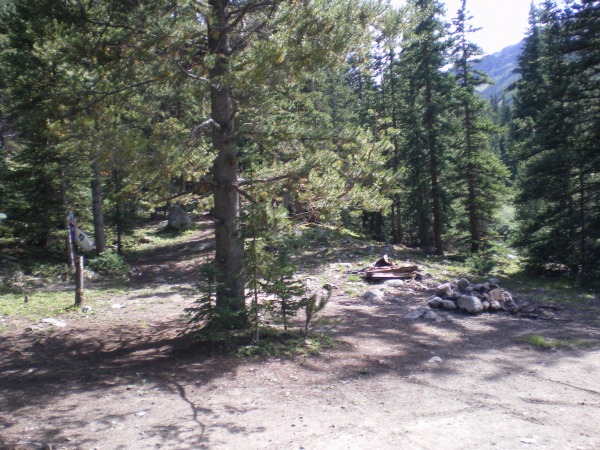
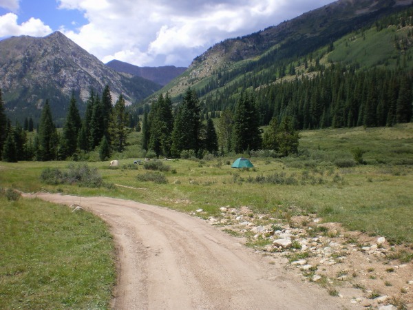
Two buddies and I drove in on Sunday afternoon on County Road 390. After Winfield, the road is not bad, not even 4WD, at the BEGINNING and the END near the trailhead, but the MIDDLE third part was a little rough. We were in a Ford Escape, were cautious, and had no real problem. An Xterra or a Jeep would hardly have noticed. Anyhoo, there are a couple of decent spots to camp even along the rough stretch, and we took one of those for Sunday night.
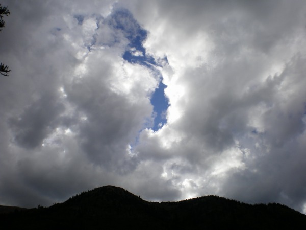
This is what "40% chance of thunderstorms" looks like late in the afternoon.
The next morning, we hiked the remainder of the road...
...and found there were even more, better campsites close to the trailhead.
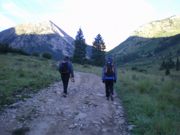
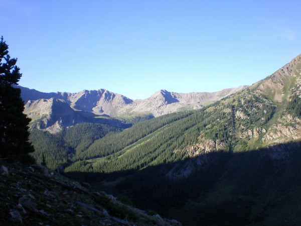
This trail has a good long stretch in the trees right after the trailhead, and the forest was cool and damp. We started about 7 am, and the trail is west of the mountain, so we hiked in shadow for a good while but got scenes like this.
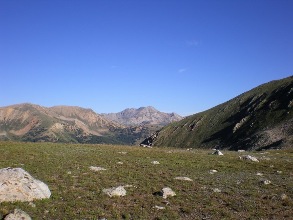
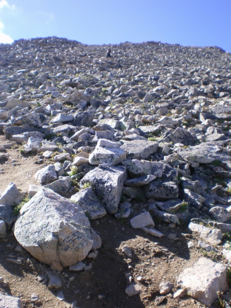
Pretty soon we hiked out into the sunlight, and got into the basin. The basin is dotted with these white boulders.
Because the ground of the basin is pretty flat, we ended up hiking back into the shadow of Huron, then hiking up out of the shadow into a second sunrise.
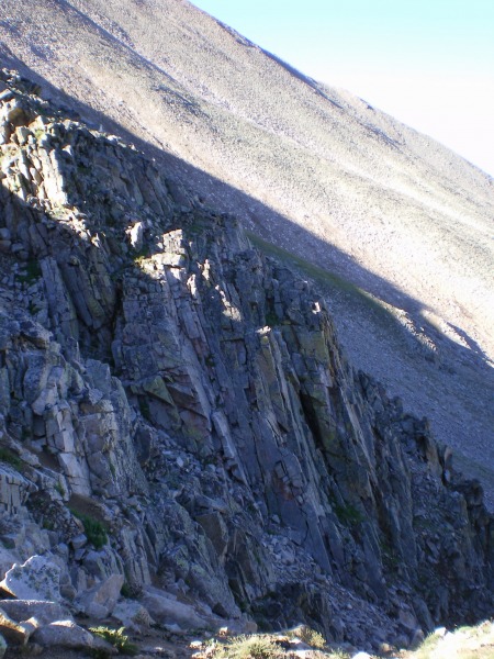
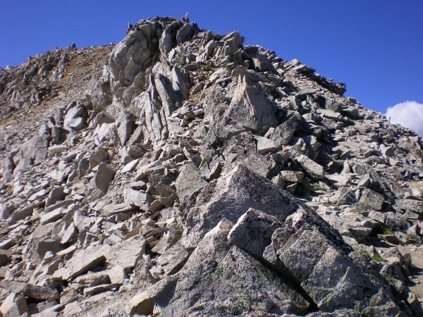
Huron Peak doesn't have much in the way of dramatic ground; these cliffs were the most interesting relief we saw on the mountain.
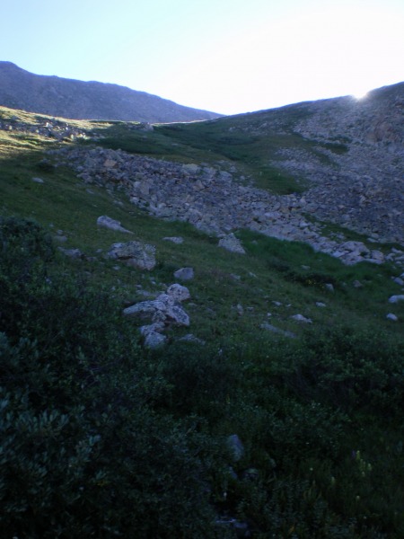
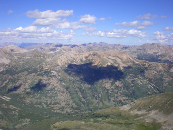
Here's a shot of the basin seen from above, looking back down the trail.
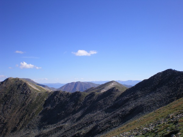
Brown Mountain, to the north of Huron Peak.
The trail got steeper.
9:30 am and already the cumulus were getting big enough to cast shadows like this one...we knew that a 40% chance of thunderstorms might mean they would start earlier than usual.
Just below the summit, the trail is certainly Class 2, and the rock is a little loose in a few spots, but this stretch is short.
Made the summit at 10 or so. The summit itself is unremarkable, average-sized, rock dirt with a few boulders sticking out. However, we did see some goats in the distance.
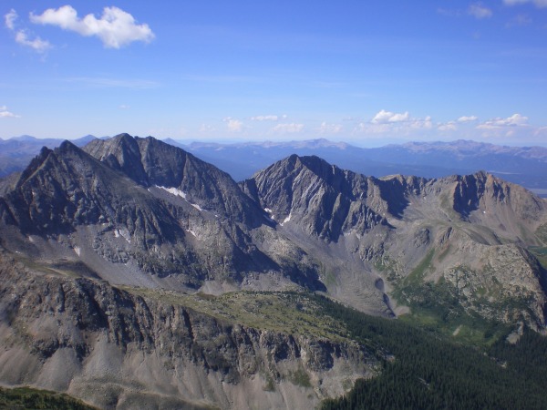
Plus, we had a good view of the Three Apostles.
Thumbnails for uploaded photos (click to open slideshow):
Comments or Questions
Caution: The information contained in this report may not be accurate and should not be the only resource used in preparation for your climb. Failure to have the necessary experience, physical conditioning, supplies or equipment can result in injury or death. 14ers.com and the author(s) of this report provide no warranties, either express or implied, that the information provided is accurate or reliable. By using the information provided, you agree to indemnify and hold harmless 14ers.com and the report author(s) with respect to any claims and demands against them, including any attorney fees and expenses. Please read the 14ers.com Safety and Disclaimer pages for more information.
Please respect private property: 14ers.com supports the rights of private landowners to determine how and by whom their land will be used. In Colorado, it is your responsibility to determine if land is private and to obtain the appropriate permission before entering the property.


")
")
")
")
")
")
")
")
")
")
")
")
")
")
")

