Download Agreement, Release, and Acknowledgement of Risk:
You (the person requesting this file download) fully understand mountain climbing ("Activity") involves risks and dangers of serious bodily injury, including permanent disability, paralysis, and death ("Risks") and you fully accept and assume all such risks and all responsibility for losses, costs, and damages you incur as a result of your participation in this Activity.
You acknowledge that information in the file you have chosen to download may not be accurate and may contain errors. You agree to assume all risks when using this information and agree to release and discharge 14ers.com, 14ers Inc. and the author(s) of such information (collectively, the "Released Parties").
You hereby discharge the Released Parties from all damages, actions, claims and liabilities of any nature, specifically including, but not limited to, damages, actions, claims and liabilities arising from or related to the negligence of the Released Parties. You further agree to indemnify, hold harmless and defend 14ers.com, 14ers Inc. and each of the other Released Parties from and against any loss, damage, liability and expense, including costs and attorney fees, incurred by 14ers.com, 14ers Inc. or any of the other Released Parties as a result of you using information provided on the 14ers.com or 14ers Inc. websites.
You have read this agreement, fully understand its terms and intend it to be a complete and unconditional release of all liability to the greatest extent allowed by law and agree that if any portion of this agreement is held to be invalid the balance, notwithstanding, shall continue in full force and effect.
By clicking "OK" you agree to these terms. If you DO NOT agree, click "Cancel"...
Peaks: Kit Carson, Columbia Point, Sangre de Cristo Range Date Climbed: August 7, 2007 Group: Stu (marmotman) and Ben (benners) Route: East Ridge from South Colony Lakes TH
My Dad, his girlfriend Janet, Stu and I headed to Westcliffe the night of August 6 and stayed at the Mountain View Inn, our "basecamp" for climbing the Crestones, Kit Carson, and Humboldt (my final four fourteeners) on the 7th and the 8th. I would highly recommend this place, it was extremely well kept and relatively cheap. Stu and I woke up at 2:30am and piled our gear into our rental Jeep which we picked up in Salida the night before (I would also highly recommend a rental for the South Colony Lakes road if you have the money). We headed for the South Colony Lakes Jeep trail with the intention of getting as high as we could in the rental vehicle. We ended up being able to reach the upper TH and we were on the trail by 4:30am.
We had two climbing days avaliable to us to summit the four peaks. The initial plan was for T.j. and Janet to hike Humboldt (my finisher) with Stu and I on the second day so we could all celebrate together on the summit. This meant Stu and I were going to attempt to get the hard part out of the way first and summit Kit Carson and the Crestones the first day, making for an easy finisher day entailing a walk up Humboldt. As we would soon discover, the weather had a different plan for us. We hiked under the stars for about an hour and a half and reached the Humboldt/Crestone Peak saddle at sunrise.
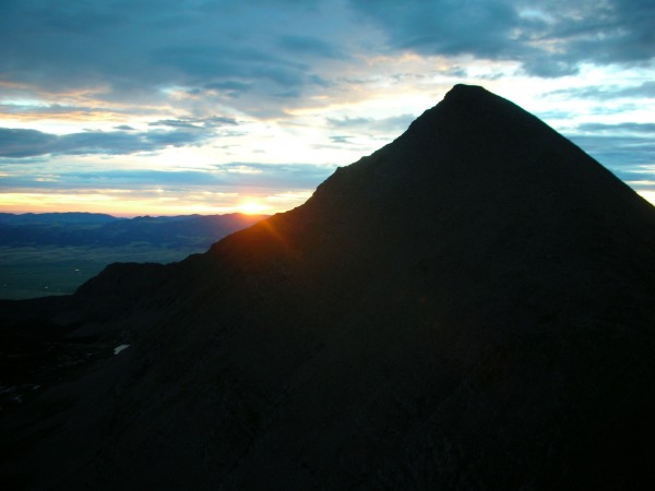
Sunrise over Humboldt from the Humboldt/Crestone Peak Saddle:
We intentionally passed over the easy ascent of Humboldt as we wanted to wait for T.j. and Janet to join us the following day. The scramble over to Bear's Playground entailed suprisingly difficult routefinding. Generally we stayed high on the ridge, occasionally dropping below on either side. We strolled onto the playground at 6:40am and considered our options.
Bear's Playground at 6:40am, August 7th:
You know what these are:
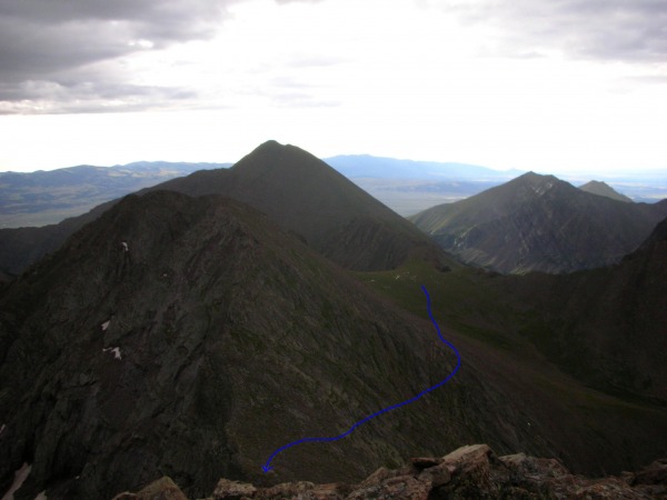
The logistics of getting all four peaks in the correct order (landing T.j. and Janet on the top of Humboldt at the same time as Stu and I) were suprisingly difficult to agree upon. Do we get the Crestones today and then go for Kit Carson tomorrow (while T.j. and Janet head up Humboldt) and hopefully hike fast enough to backtrack and meet them on the summit? Do we hit Kit Carson and the Crestones today and hike with them the whole way tomorrow? For whatever reason we decided to try for Kit Carson and the Crestones in one day which seemed possible at the rate we were moving, given that the weather held. We began contouring underneath Point 13,799 (aka "Obstruction Peak") towards Columbia Point and gained the saddle between the two peaks in thirty minutes. From the saddle we summited Columbia Point (aka "Kat Carson") after "Kitty Kat Carson" (I absolutely hate that name) in order to gain access to Kit Carson from the east. The trail leading up to Columbia Point is Class 2+.
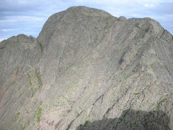
"Kitty Kat Carson"/Columbia Point from below Point 13,799:
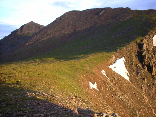
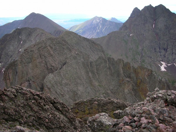
The route from Bear's Playground, Point 13,799 and Humboldt in the background:
We summited Columbia Point at 7:35am and contemplated the next section. Basically the route drops a few hundred feet in elevation down a Class 3 face to the saddle connecting Columbia and Kit and then climbs Kit's East Face. The route is well marked and fairly obvious.
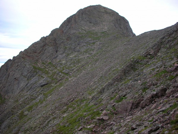
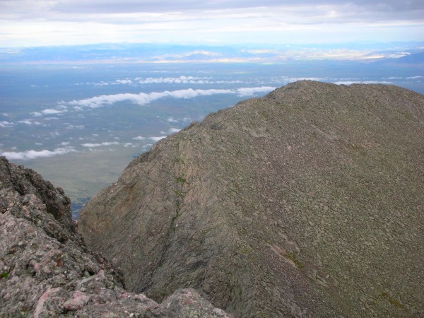
Kit Carson from Columbia's summit:
We tediously wound our way through the rock formations and topped out on Kit Carson at 8:10am.
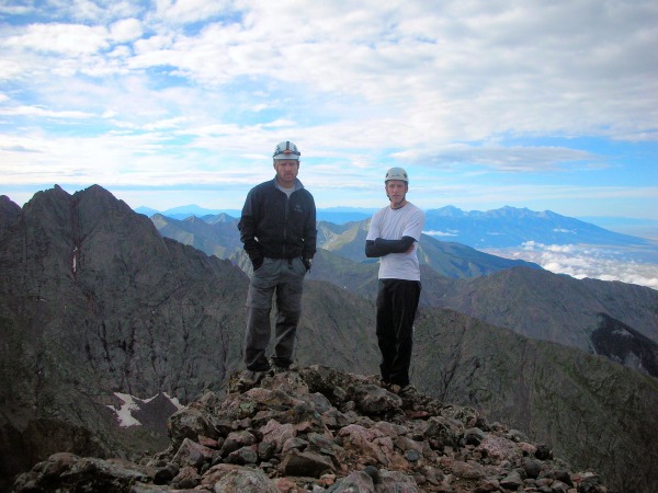
Kit Carson summit, "The Peak" in the background:
Challenger Point (which Stu and I summited last September):
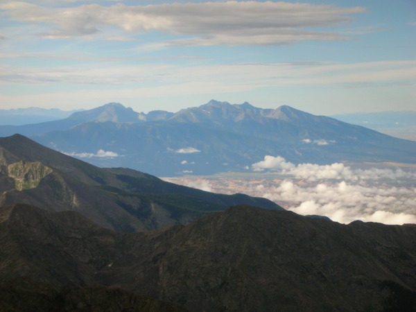
The Great Sand Dunes, Little Bear, Blanca, Ellingwood, and Lindsey:
Some ominous, moisture-laden clouds began forming in the area, and the high peaks were starting to get obscured in the clouds. The idea of getting back to Bear's Playground and then going for the Crestones seemed like wishful thinking at this point, we were still going to at least give it a try though. We completed our habitual summit checklist and began the long trek back to the playground.
The terrain between us and Bear's Playground; a bit demoralizing:
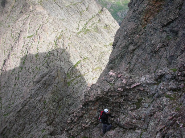
Scrambling up the west side of Columbia:
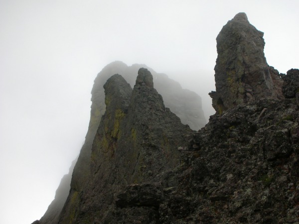
We descended, ascended, and descended again, reaching the playground at 9:45am. Unfortunately Kit Carson took much more time than we anticipated, we found ourselves with one of the most difficult climbs of our lives ahead of us and it was 10:00am. On top of that the clouds were gaining moisture, turning increasingly dark, and moving in our direction. At this point I felt uneasy about the whole thing and thought that pushing it was going to be a bad idea. Stu (like many of us would) was not keen on the idea of having to hike all the way out and then return to Bear's Playground the following day and he convinced me to give the Crestones a shot. We wanted to go for the North Buttress route to add a little spice to the climb, we found that we were also under-aquainted with the route. We ended up traversing a fourth of a mile too far underneath the North Buttress route turnoff and wasted an hour in the process. The entire thing became even tougher as the clouds rolled in and covered the entire upper half of the mountain, restricting our view of the route we wanted to be on.
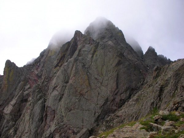
Crestone Peak in the clouds:
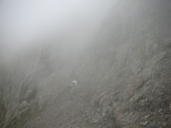
The clouds continued to thicken and the visability decreased to a couple hundred feet. We were still off route at this point trying to backtrack and figure out what we did wrong.
Somewhere under Crestone Peak:
Looking up in the general direction of the Peak:
At 10:45am we called it off. It just wasn't worth the risk, we realized we were letting the pressures of the surrounding situation control our judgment rather than considering what was important. This was the first failed attempt for Stu and I in twenty six summits (for we have been very fortunate with the weather this summer). The Crestones had defeated us! (temporarily of course) We headed back to Bear's Playground, traversed back across the ridge to the base of Humboldt, and descended to the lakes.
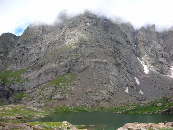
Crestone Needle from lower South Colony Lake:
We reached the Jeep at 1:15pm and headed back to Westcliffe, planning to return the following morning and get both Crestones and Humboldt. Overall we learned a good lesson about turning back and what should and shouldn't be considered when making a decision on these mountains.
I'm not sure why, we're definately not mad though, in fact most of the time when we climb we are just down right slap happy. Marmotman may be mad in some of these photos because he has yet to become one with the marmots, they keep shunning him from their community and he perceives it as a slap in the face. Unlike him, I have no good reason to be mad, maybe I'm hungry in these photos.
Thinking of doing Kit Carson/Challenger from Colony Lakes this weekend but can't find a good description of the route. Is the route marked at all? Do you start by climbing the trail to Humboldt and depart at the ridge or use Roach's approach by climbing the scree gulley? Is the route from Kat Carson to Kit Carson easy to follow?
Excellent stuff, Benners. The Crestones from Bear's Playground and the clouds over the Sand Dunes...whew. Great pics.
How come you two look mad in all your summit shots?
Caution: The information contained in this report may not be accurate and should not be the only resource used in preparation for your climb. Failure to have the necessary experience, physical conditioning, supplies or equipment can result in injury or death. 14ers.com and the author(s) of this report provide no warranties, either express or implied, that the information provided is accurate or reliable. By using the information provided, you agree to indemnify and hold harmless 14ers.com and the report author(s) with respect to any claims and demands against them, including any attorney fees and expenses. Please read the 14ers.com Safety and Disclaimer pages for more information.
Please respect private property: 14ers.com supports the rights of private landowners to determine how and by whom their land will be used. In Colorado, it is your responsibility to determine if land is private and to obtain the appropriate permission before entering the property.