| Report Type | Full |
| Peak(s) |
Capitol Peak - 14,138 feet |
| Date Posted | 08/02/2007 |
| Date Climbed | 08/01/2007 |
| Author | phantastikdan |
| Found some rocks on Capitol (NE) |
|---|
We started the trail at about 11 after picking up some snickers from the Conoco gas station at the start of Snowmass Creek road. mmm snickers. The road is decent, should be no problem with any 4wd. take the ditch trail at the back end of the parking lot, when the road basically dead-ends. Enjoy the 6 1/2 miles of solid ground. Look for the well-marked right turn a few miles in. There are rocks or good logs for every stream crossing, but you may have to stary a few feet from the trail to find them. We were delayed en route while trying to recapture my doggy, who was alternating barking at cows and running from them. 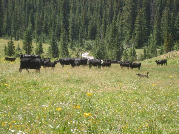 We made it to the lake after about 3 1/2 hours and set up camp. The lake is beautiful, and you should see the trail going up to the left, just before the lake. We spent some hours here, cooking pasta and killing mosquitos. It's more fun if you make a game of it. And use a belt. They seemed impervious to my bug repellant.  Started at 8:30 the next morning, and made the ridge fast despite some dizziness. Mt. Daly is on your left, which is the most fun-looking mountain you'll see if you ever drive brush creek road into snowmass village. Go up the ridge, then descend about half way to the valley. Stay right and reasonably high, and look for cairns. You'll quickly find a difficult section, which means you're too high. At least it did for us. Stay about half way up for a while, until you come across some snow-fields near the end of the valley. Go up and right, not straight, to the right of a little hump that is K2. It won't look like much from the bottom.   Once on K2, you'll know what you're in for. Ponder your future, as the Roach book advises. You've got 2-4 hours until you're back on solid ground. Stay as close to the ridge as possible, at least until you're within a few hundred feet of the summit. Stay smart, rest when tired, and always find strong hand-holds. The knife will greet you soon. By now you should be prepared for it. Straddling it works, but holding the top and walking along below it feels better and easier, though perhaps slightly more dangerous. 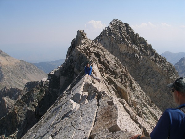 The knife may be the most intimidating part of this journey, but it's certainly not the end of the challenges. You'll be able to walk for a little bit after it, then you'll encounter a smaller knife ridge. After this, head up on the ridge. The ridge is the best way to go for a while. You'll have a lot of moderately difficult moves from here to the top no matter where you go. 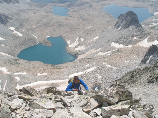 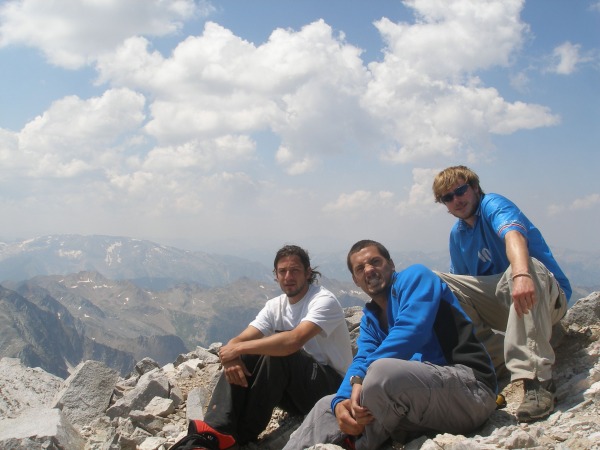 Enjoy the view from the summit. I thought all the razor thin connected ridges made it look like a great Mario-kart level. 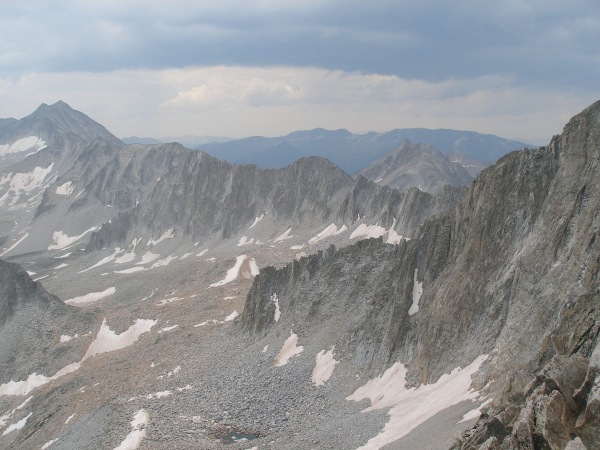 Be careful down-climbing. 80% of climbing deaths happen on the way back down. 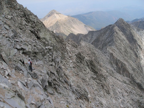 Rain will make it much more difficult. Choose your route carefully, enjoy solid ground back on the saddle, smell the flowers on the way back down. 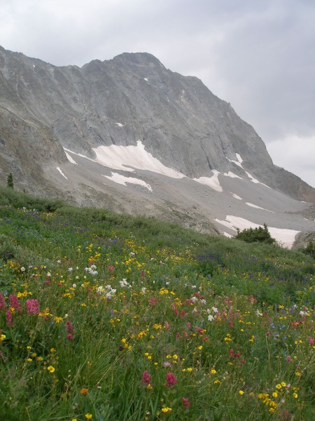 This mountain is a battle. It is physically and mentally demanding. But if you always find strong holds, are in moderate shape, and start early enough, you shouldn't have a problem. It's worth it. We saw a 60 year old woman up there. So quit reading trip reports and get at it. other notes -the old route is still closed. The ditch trail is located in the same parking lot. This is different than the ditch trail that is located near snowmass village and krablooniks restaurant. -We met a guy who found a camera on K2. He said he'd leave a note at the trailhead. -this is my first trip report, hope you enjoyed it. Thumbnails for uploaded photos (click to open slideshow): ")
")
")
")
")
")
")
")
")
")
|
| Comments or Questions |
|---|
|
|
Caution: The information contained in this report may not be accurate and should not be the only resource used in preparation for your climb. Failure to have the necessary experience, physical conditioning, supplies or equipment can result in injury or death. 14ers.com and the author(s) of this report provide no warranties, either express or implied, that the information provided is accurate or reliable. By using the information provided, you agree to indemnify and hold harmless 14ers.com and the report author(s) with respect to any claims and demands against them, including any attorney fees and expenses. Please read the 14ers.com Safety and Disclaimer pages for more information.
Please respect private property: 14ers.com supports the rights of private landowners to determine how and by whom their land will be used. In Colorado, it is your responsibility to determine if land is private and to obtain the appropriate permission before entering the property.


