Download Agreement, Release, and Acknowledgement of Risk:
You (the person requesting this file download) fully understand mountain climbing ("Activity") involves risks and dangers of serious bodily injury, including permanent disability, paralysis, and death ("Risks") and you fully accept and assume all such risks and all responsibility for losses, costs, and damages you incur as a result of your participation in this Activity.
You acknowledge that information in the file you have chosen to download may not be accurate and may contain errors. You agree to assume all risks when using this information and agree to release and discharge 14ers.com, 14ers Inc. and the author(s) of such information (collectively, the "Released Parties").
You hereby discharge the Released Parties from all damages, actions, claims and liabilities of any nature, specifically including, but not limited to, damages, actions, claims and liabilities arising from or related to the negligence of the Released Parties. You further agree to indemnify, hold harmless and defend 14ers.com, 14ers Inc. and each of the other Released Parties from and against any loss, damage, liability and expense, including costs and attorney fees, incurred by 14ers.com, 14ers Inc. or any of the other Released Parties as a result of you using information provided on the 14ers.com or 14ers Inc. websites.
You have read this agreement, fully understand its terms and intend it to be a complete and unconditional release of all liability to the greatest extent allowed by law and agree that if any portion of this agreement is held to be invalid the balance, notwithstanding, shall continue in full force and effect.
By clicking "OK" you agree to these terms. If you DO NOT agree, click "Cancel"...
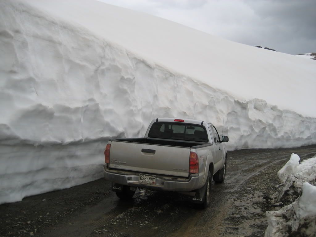
After Sunshine and Redcloud, we drove up Cinnamon Pass to its summit to check out the views and get in some fun four-wheeling. The signs at the bottom of the pass say its still closed, but it was plowed clear to the top and as far as we could see down the Ouray side. The terrain in this area is amazing, I wish it was closer to home I would be lapping this stuff every day possible.
Near the summit of the freshly plowed Cinnamon Pass
We got a great view of Handies all along the pass.
Handies west face from Cinnamon Pass
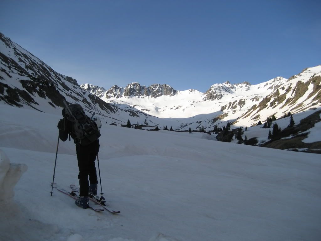
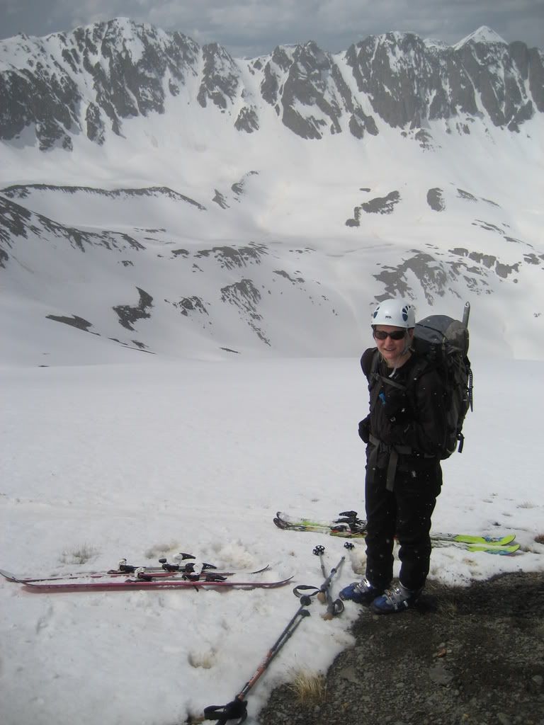
We slept back down at the Silver Creek Trailhead at our established camp. A much later start was afforded by our route which receives late sun hit. The trailhead to American basin is clear, although it's a stretch to call it a 2WD road. A high clearance vehicle might be required. You can reach 4WD parking just pass the stream crossing at 11,200' which is were we started our day at 7:45 am. Two other skiers began the route just before us. This was a special day for me and even more so for Debbie. She has skied less than a dozen times but this route provided the perfect intro to backcountry touring for her. She is making good use of her AT setup before most people start skiing blue runs at the resort.
Note: if you head into the backcountry with this much experience without a guide you're asking for trouble. I was on the fence on whether or not this was a good idea. If at any time I felt she couldn't handle the terrain ahead, we were going to drop the skis and switch her to snowshoes.
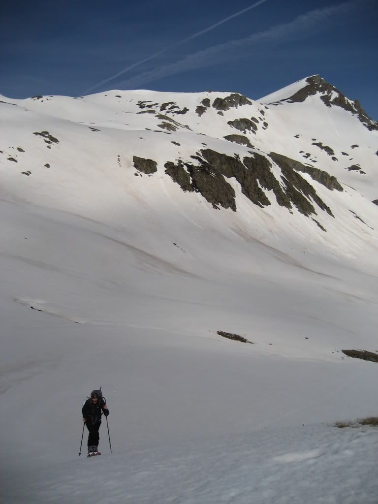
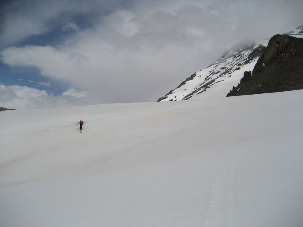
Debbie clicks in to start her first BC tour
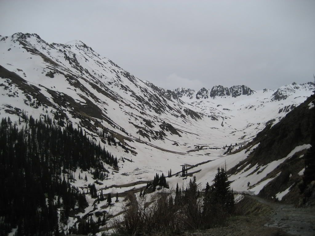
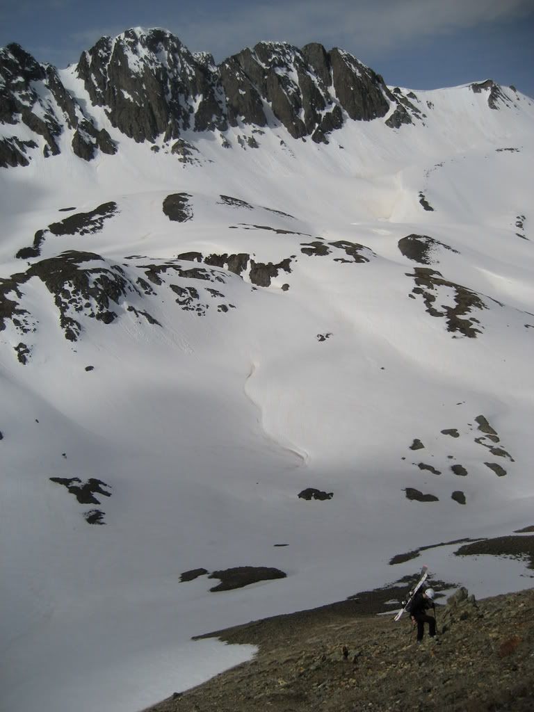
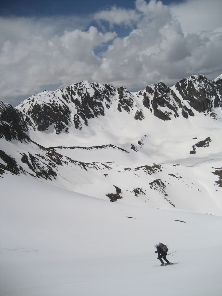
Looking ahead toward American Basin, two skinners just entering the sun
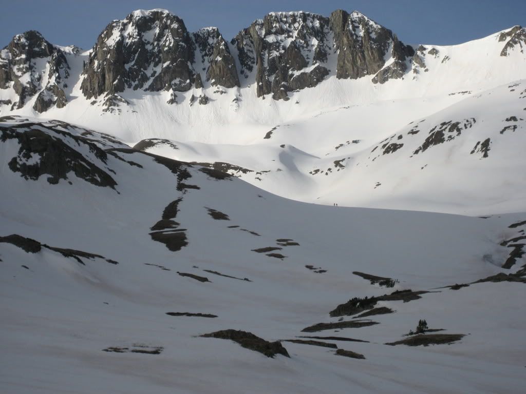
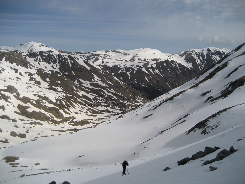
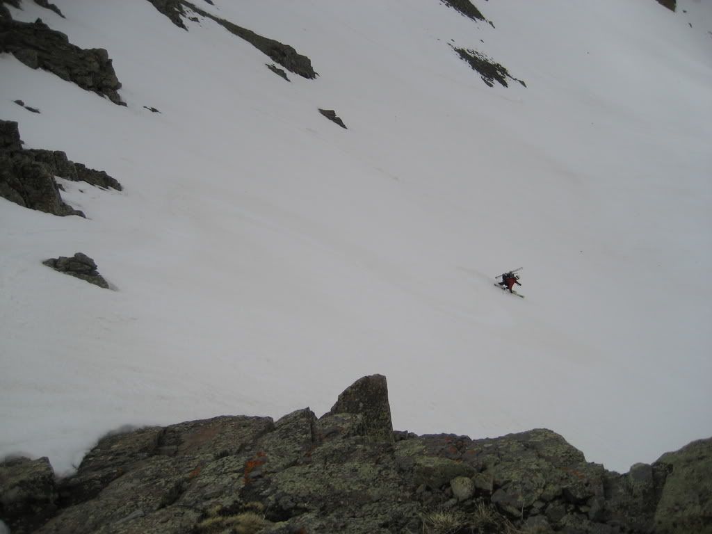
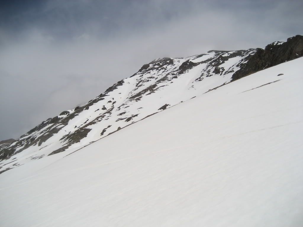
We remained in the shadows until reaching the middle of American Basin, which is a spectacular alpine setting. Ski routes down the west face towered above us. Looking for a line with western exposure? This comes directly off the northern false summit of Handies.
Western facing ski route off the false summit of Handies
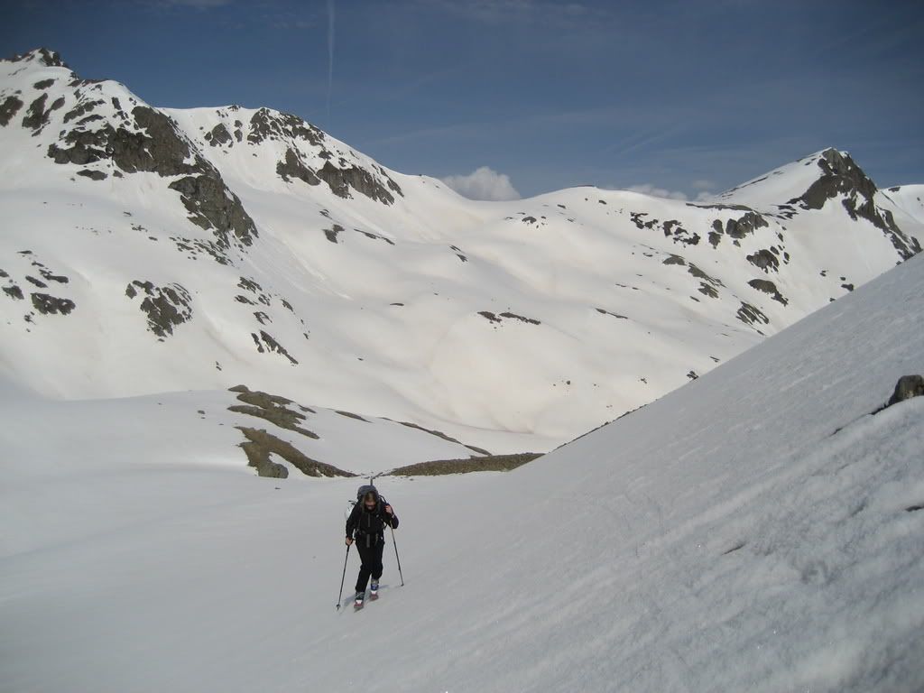
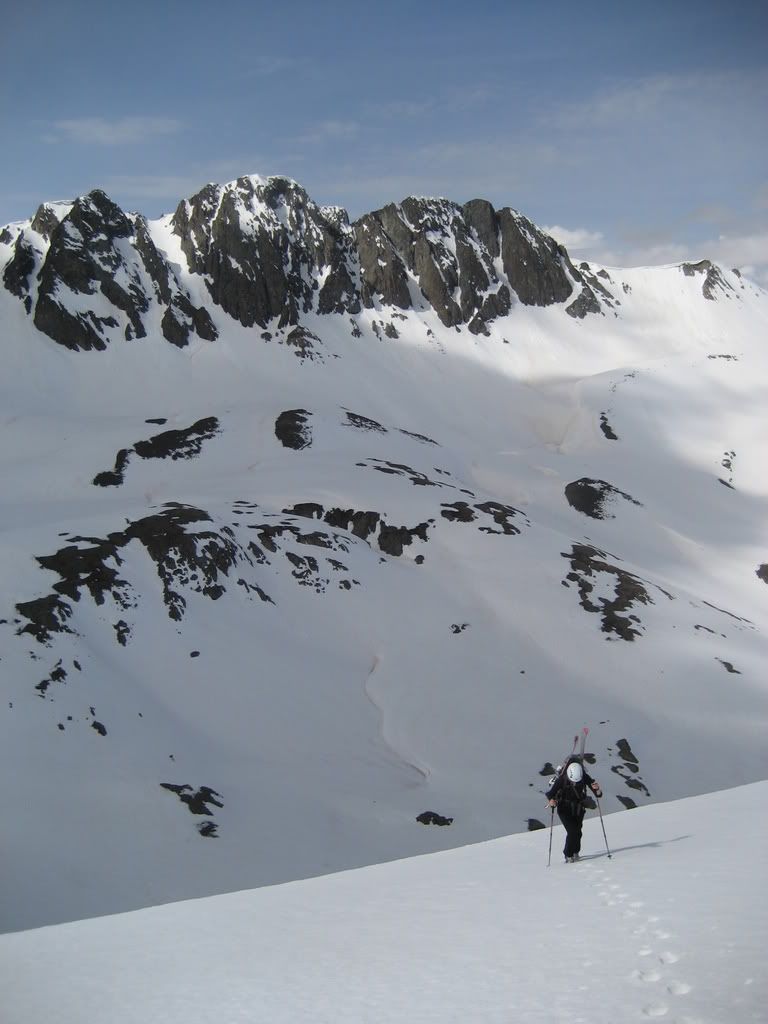
Debbie and I chose to skirt the far climbers left side of the basin to reduce the route mileage. This involved some steeper terrain but worked well. Debbie impressed me over and over again with her immediate skinning skills. I know several experienced backcountry skiers who would have taken their skis off for some of this terrain but she powered through it. Wow.
Debbie skins up steep terrain and across a hairy traverse
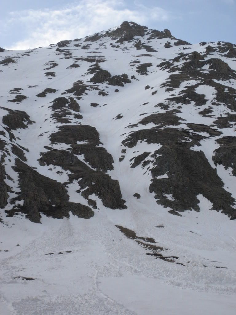
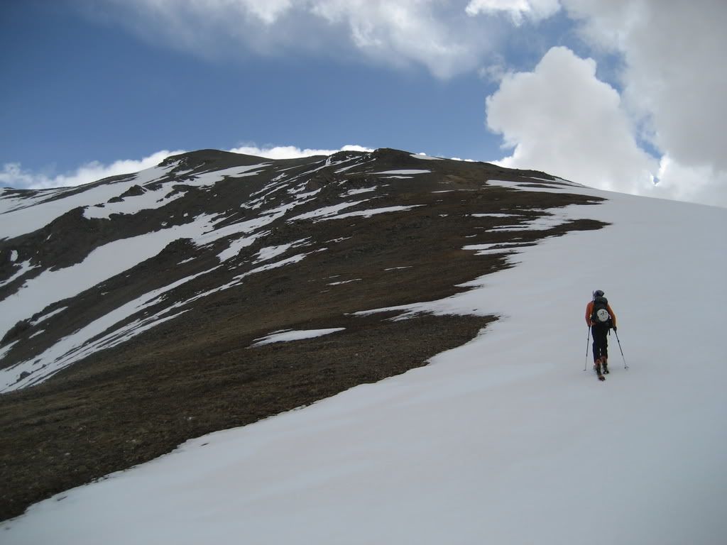
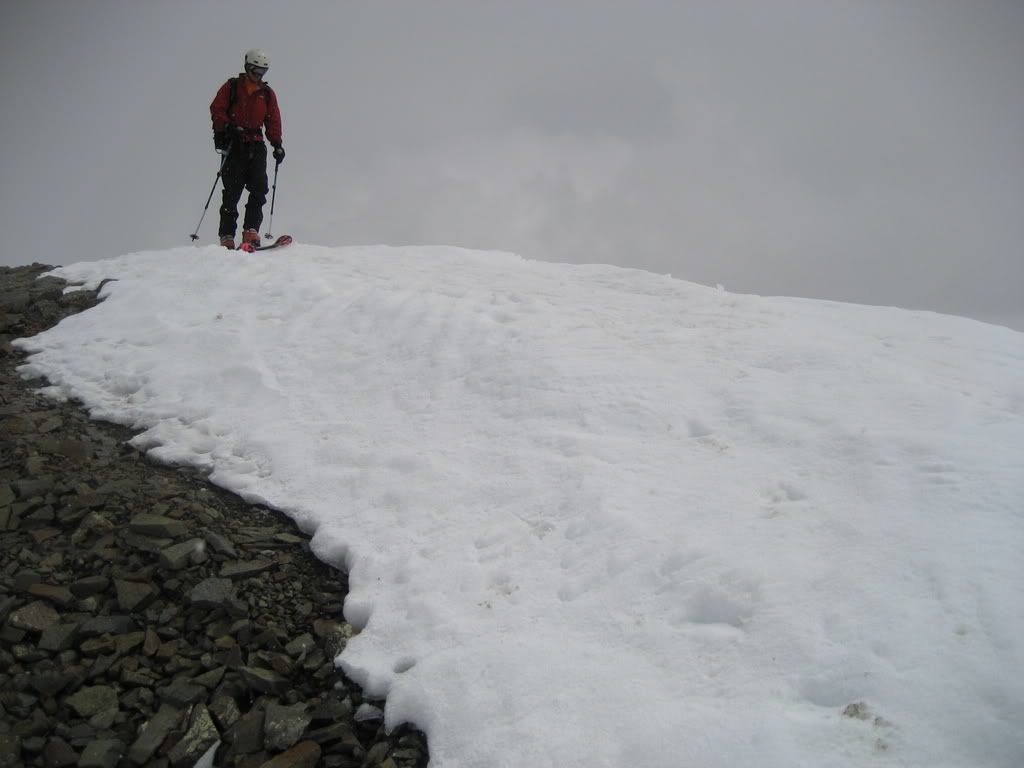
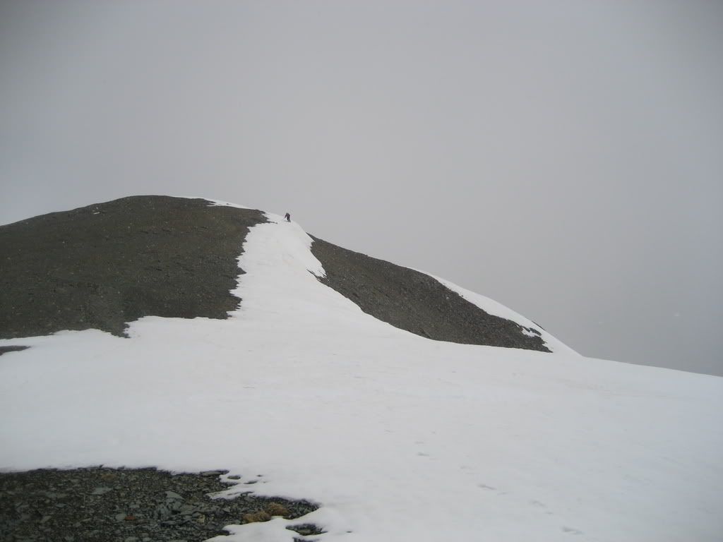
As we rounded a rugged ridgeline we found a south facing slope devoid of snow and covered in miserable scree. Luckily the scree quickly turned into easily bootable dirt and grass which led up to the summit ridge.
Booting up to the southwest summit ridge on Handies
Just as we hit the ridgeline, the two skiers made nice turns past us into American Basin. This made for a crowded 14er compared to the last 20 I have climbed (other than Pikes). At first look, it appeared for a summit descent I would have to drop onto the west face and boot back up to the southwest slopes so Debbie could get her turns.
Skiing up to the summit ridge
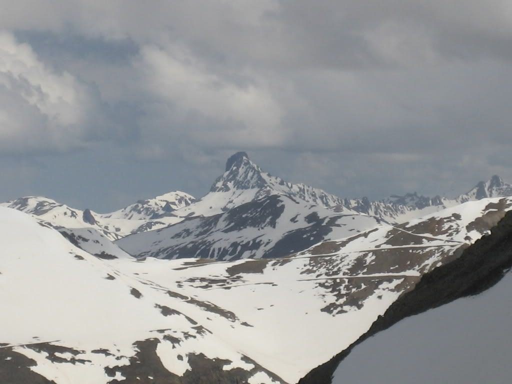
Wetterhorn looked fierce:
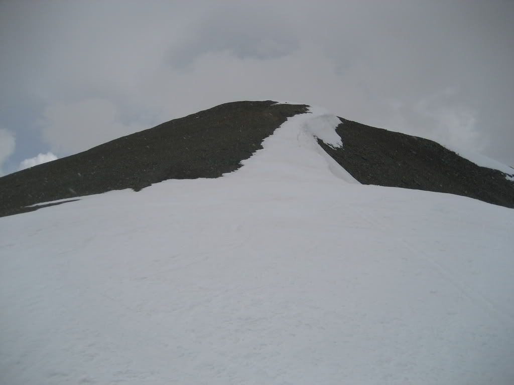
Debbie dropped her skis here while I looked for continuous snow. Fortunately I found it, a continuous line on the south ridge into American Basin was in... barely:
Strip of snow to the summit
We topped out, Debbies 45th. The weather was interesting. Grapple fell and the clouds appeared to move northwest while the wind on the summit blew southeast. Dark clouds built over Sunshine and Redcloud. Our high degree of uncertainty in the weather's next move made for a quick summit stay, time to ski. I took a quick pic of the direct east face line for beta... it looks yummy and is quite steep. Sustained mid 40s:
Looking down the east face, direct from the summit
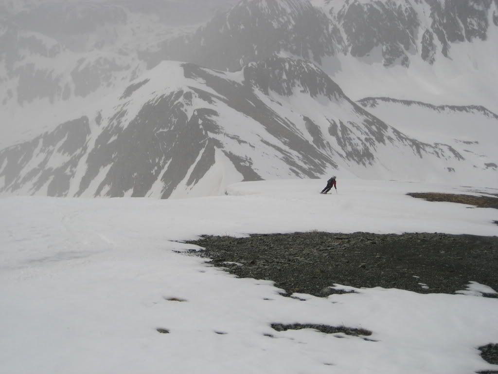
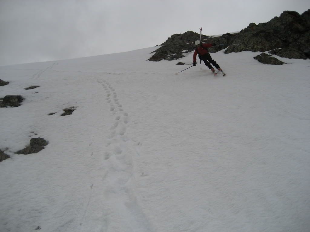
Skiing off the summit of Handies:
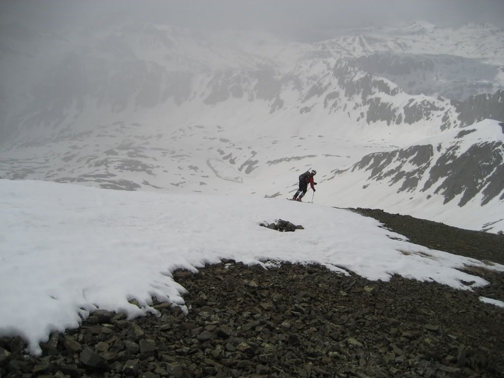
Once again, the dice rolled in our favor and the sun came out just as we left the summit. The corn softened up to perfection.
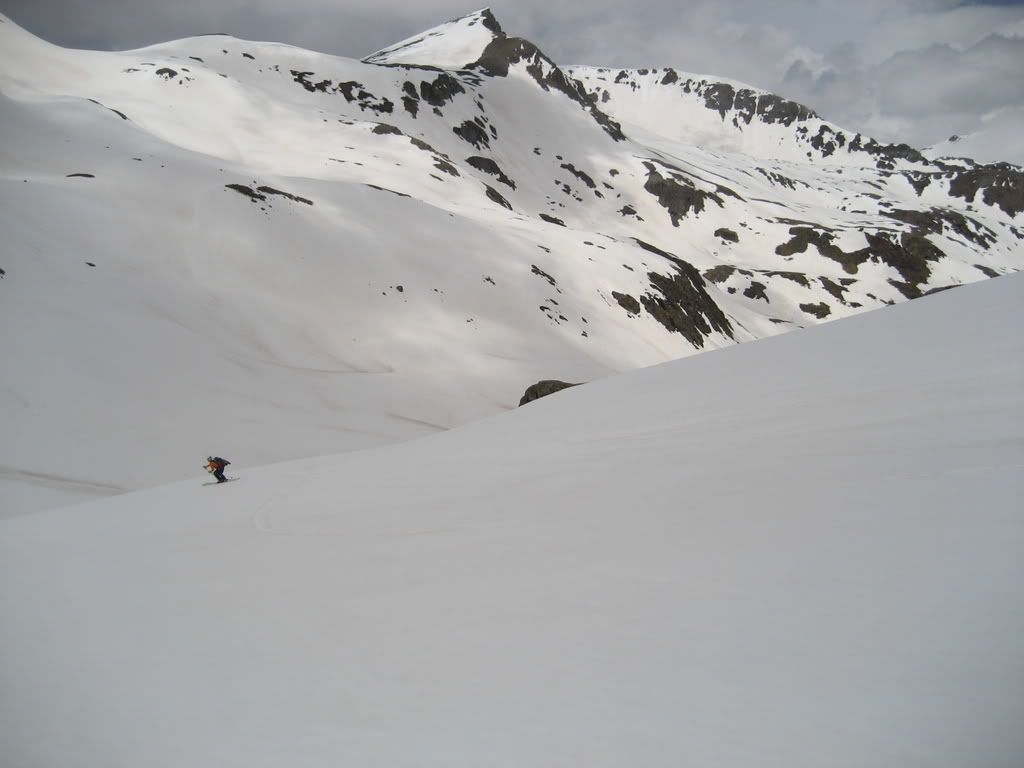
Skiing the southwest ridge of Handies
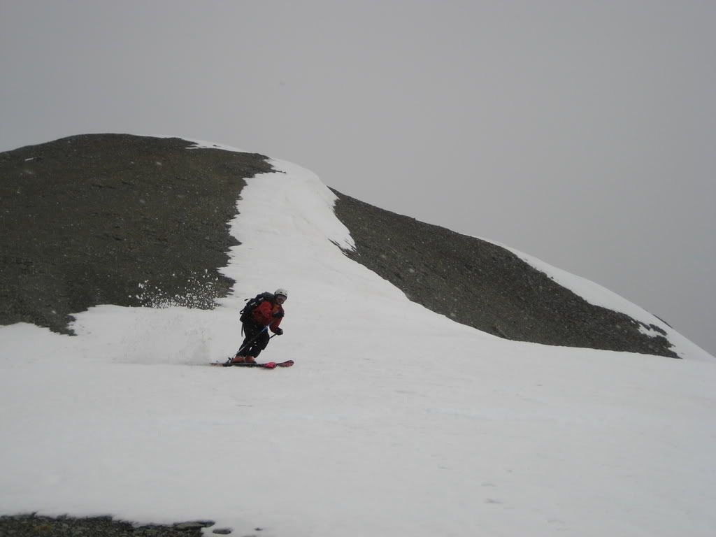
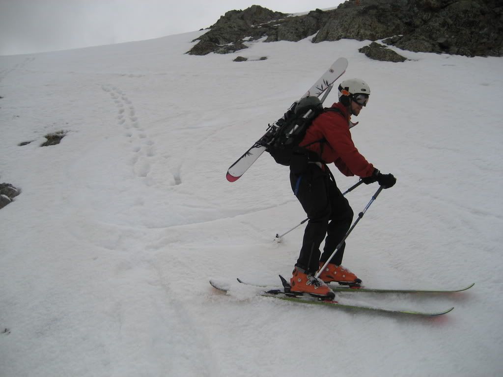
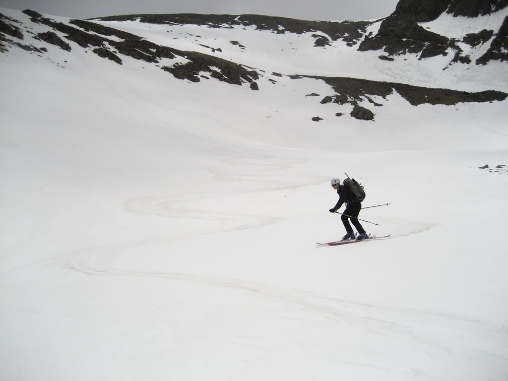
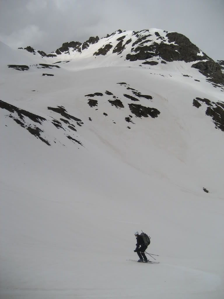
Back at Debbie's skis, she felt anxious, but quickly nailed her first BC turn.
Debbie prepares to ski American Basin
One of her first BC turns
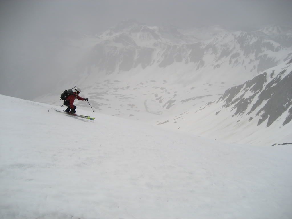
The terrain was similar to a blue at a resort with prime corn. The conditions were perfect for her. To get through a cliff band, I took her skis and she got out her axe to plunge step steep terrain.
Skiing the steepest part of the route
After glissading the steeps, Debbie put the skis back on and we finished the ski out to the truck. The area has amazing terrain for skiing. doumall
Debbie
Some more beta, the direct line west off the summit of Handies is in:
West face direct route off the summit
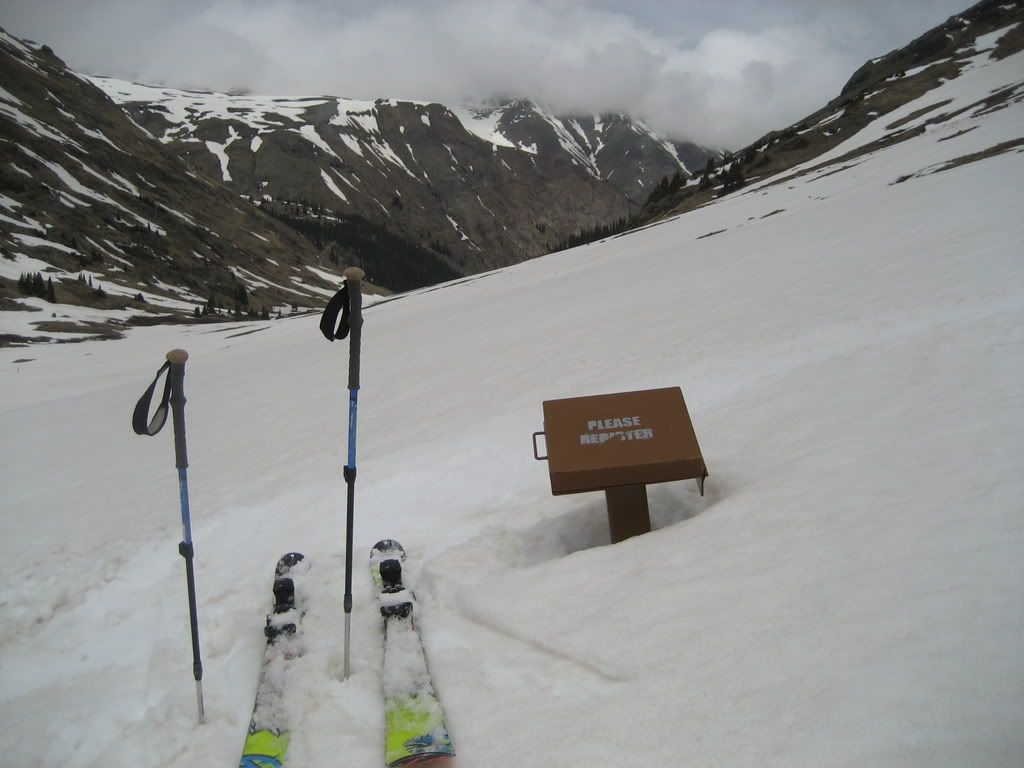
Now THIS trail register I had to sign...
The register emerges from hibernation
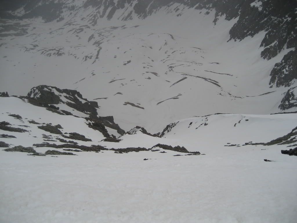
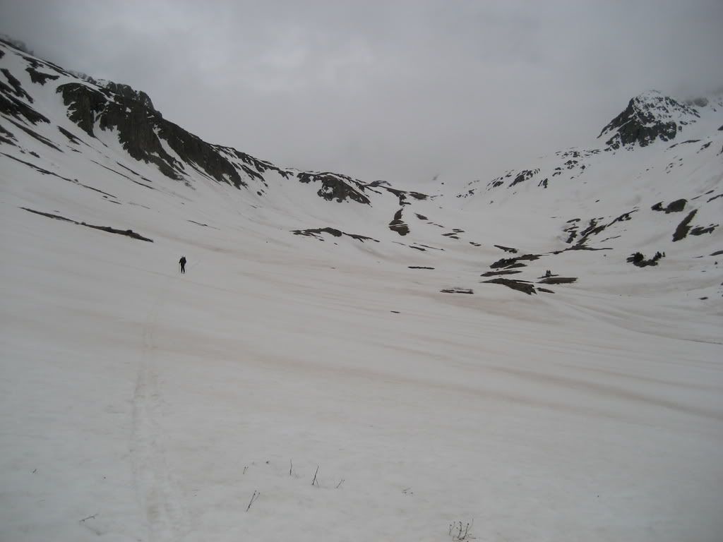
Finishing the day as the weather moves in and obscures the rugged peaks of American Basin.
... on the east face. The direct line from the summit looked to be a real winner. Dont have a really clear pic of the lower part of the face where it gets narrow but my guess is it goes. Looking forward to the TR Britany!
Damn what a sweet ass trip. I got to say doumall, your reports and pics are nothing but sweet. A job well done to the both of you. Amazing stuff
Caution: The information contained in this report may not be accurate and should not be the only resource used in preparation for your climb. Failure to have the necessary experience, physical conditioning, supplies or equipment can result in injury or death. 14ers.com and the author(s) of this report provide no warranties, either express or implied, that the information provided is accurate or reliable. By using the information provided, you agree to indemnify and hold harmless 14ers.com and the report author(s) with respect to any claims and demands against them, including any attorney fees and expenses. Please read the 14ers.com Safety and Disclaimer pages for more information.
Please respect private property: 14ers.com supports the rights of private landowners to determine how and by whom their land will be used. In Colorado, it is your responsibility to determine if land is private and to obtain the appropriate permission before entering the property.