| Report Type | Full |
| Peak(s) |
Baldy Chato - 13,417 feet "Column Ridge" - 13,798 feet Stewart Peak - 13,988 feet Baldy Alto - 13,703 feet San Luis Peak - 14,023 feet Unnamed 13166 - 13,166 feet "Phoenix Peak" - 13,904 feet Unnamed 13408 - 13,408 feet Organ Mountain - 13,808 feet |
| Date Posted | 06/15/2026 |
| Date Climbed | 06/12/2026 |
| Author | Beda681 |
| Centennials #91 and #92 - La Garita |
|---|
|
This was a very satisfying execution of an idea I've had for the last couple of years: summiting the La Garita Centennials (+Organ) in a single trip. For a long time I pictured Stewart and Phoenix as very separate peaks, and I figured that I would eventually climb them separately as I chase down the Centennials. However, at some point I was looking at a map and got very interested in the fact that both these peaks, along with San Luis, lie along the same high ridge. I decided that I wanted to turn these gentler peaks into an epic traverse. The vision wasn't too complicated: Start at Cebolla Trailhead and stay on the ridge until Phoenix Peak. Then get back ...someway... that involves Organ Mountain. I took a while before the stars aligned with me being in shape, work, weather, etc but finally on Thursday June 11th, it was time to make the long drive from Denver to the Cebolla Trailhead. Day 1 - 06/12/2026: Cebolla Trailhead to Canon Diablo (with some mountains along the way) 
It was a pretty chilly morning so I didn't stay for long and and I moved quickly across the tundra to Column Ridge. This is a really cool summit but the wind was starting to become brutal. 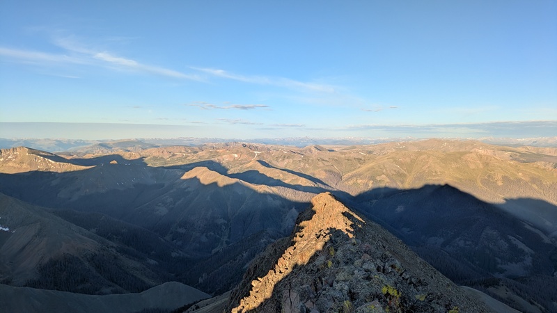
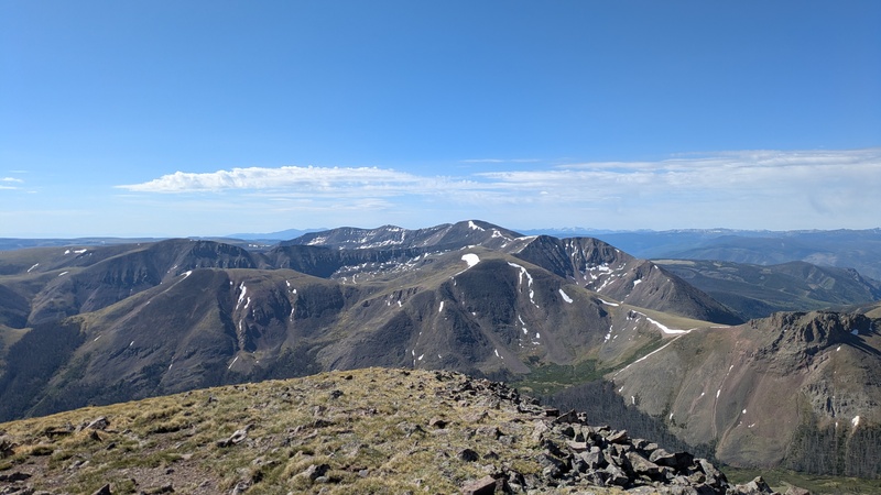
The view over to Phoenix is pretty intimidating from here, but I was prepared for a long day and feeling good. 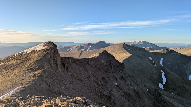
From Column Ridge it was a straightforward hike over to Stewart Peak to reach Centennial #91. The wind got really strong up here so I retreated pretty quickly down towards Baldy Alto. 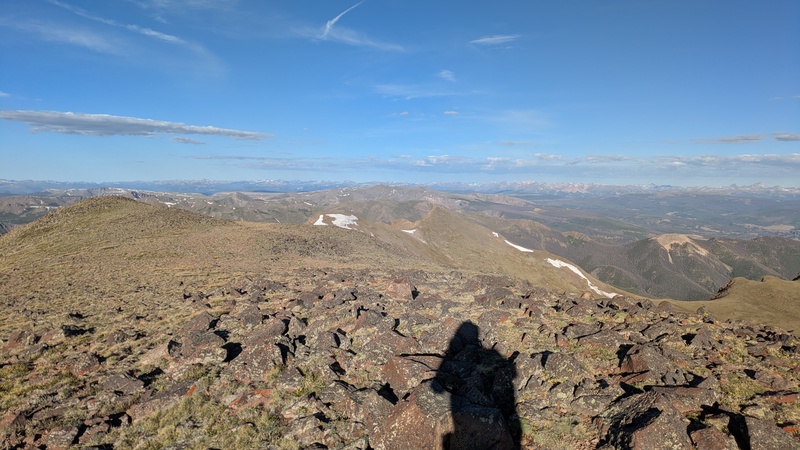
I chose not to stay on the ridge and instead ducked down into the very upper part of Nutras Creek. This probably cost me a little bit of vertical but the grass was nice and gentle for the most part. I chased about 50 more elk out of Nutras Creek, they really are everywhere here. 
Going up Baldy Alto it warmed up and wind died down a bit. The weather would be pretty much perfect for the rest of the day. The ridge gets a bit rougher between Baldy Alto and the San Luis trail but there wasn't anything that slowed me down considerably. 
Once I reached the trail progress was quick to the summit of San Luis. I really enjoyed the views from here, the La Garitas are in such an interesting perch in between a lot of really cool ranges. Really makes me wish I didn't live 5 hours away in Denver, oh well. 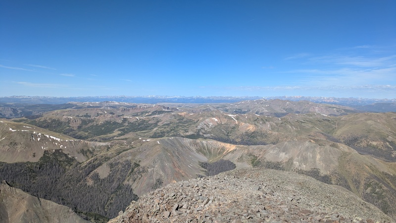

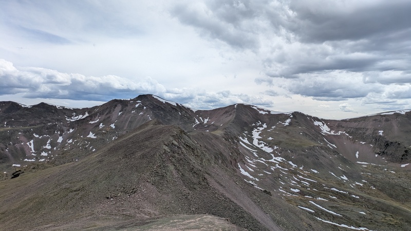
The trail down to the Colorado Trail was very much appreciated and I made quick progress. Shortly after came the lovely grass stairmaster called Point 13,166. I was pleasantly surprised by how solid the scramble up the summit block was. This is an awesome little perch and it had some of my favorite views of the day. 

From here I started to fully believe that the full traverse over to Phoenix would be possible, even though it still looked quite far. After a few more minor bumps the ridge drops down to around 12,300 before ramping up again for the final stretch to Phoenix. 
Next up there was a very broad summit that I ended up traversing under the summit of. Not sure if it was worth it but at this point my legs were starting to complain about any extra vertical. 
Regaining the ridge here revealed a last set of false summits before the true summit of Phoenix Peak. Summit fever kicked in though and I didn't feel like long until I was next to the massive cairn, bagging Centennial #92. Looking back at the whole day from here felt awesome and I soaked in the views from the top before making my next move. 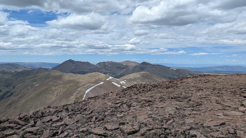

The summit of Phoenix was essentially where my concrete plans for this trip ended. I had contemplated many different options for getting back to Cebolla trailhead, and the only thing that was constant between them was Organ Mountain. The whole time planning I sort of knew that I wouldn't make a decision until I actually saw the terrain. My first idea was to camp at one of the high lakes just below the summit of Phoenix. At this point I didn't quite trust the weather to spend the night above 12,600 and there was still plenty of time left in the day. My next thought was to start making progress towards Organ by descending into Canon Diablo which seemed like the most logical option for ascending it the next day. I wasn't the biggest fan of the way the descent looked straight from the Phoenix ridge. This led me to the decision to climb over Point 13,408 and dropping down into Canon Diablo later. The ridge over there looked pretty straightforward and past the point the descent into the gulch didn't look too bad. The ridge ended up being more tedious than expected with a lot of loose talus but it wasn't too long until I was standing on the last peak of the day, Point 13,408. 
I love the massive expanse of tundra that stretches east from this summit. 
From here the descent started. I went directly north from the summit and went down the first gully that goes down into Canon Diablo. This was a pretty straightforward and direct route down until about the last 500 feet before the bottom of Canon Diablo, where fallen trees turned this into a bit of a bushwhack. 
At times there were pretty solid pieces of trail, but I assume these are just elk paths. 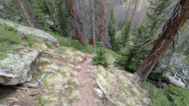
I made it down to the creek without finding any useable trail (the Roach book says there is supposed to be one on the east side of the creek which is why I was looking). Around this point I was just left with pictures of the Roach book as I forgot all the beta I had read up on this site. I ended up crossing to the west side of creek and camping at a beautful meadow. 
This was an exhausting day but I was really stoked about all the summits and the way I was set up for the next day. Day 2: 06/13/2026: Canon Diablo to Cebolla Trailhead 
Now I had to make a decision about to how to get up Organ. I didn't like the look of the bushwack directly above the trail here so I decided to use the wonderful Colorado Trail for a couple of miles. Roach describes a couple of routes on the south side of Organ and I opted for the variation that climbs the area direcly under the summit. I left the trail at around 11,500 and just started going up. My route took me up a little rib just west of the summit. Per the description you are supposed to traverse across the gully and climb a slope to gain the ridge east of the summit. I watched a couple of elk climb this rocky slope and decided that I would rather stick to the grass, so I kept going straight up until I reached the west ridge. 
This area does give a pretty sweet view of all the volcanic features on the south face. The final stretch to the summit involved some light scrambling up a gully through the pipes but with some careful steps I was able to stay on solid rock, leading me to the summit. 
This is yet another gorgeous peak and the weather was perfect for some lounging after the steep climb up. 
Now that I had reached all of my main objectives for this trip I had some more decision making to do. The plan I made at home involved dropping into Stewart Creek and then traversing back to the trailhead in the trees along the east sides of Baldy Alto and Stewart. After seeing this route from the summits of Stewart, Alto, and Organ it did not look too appealing. I still think it would be viable, but it would be a lot of bushwacking and the willows at the base of Stewart look pretty intimidating. I briefly considered descending Organ and then just riding the Colorado, Bondholder, and Cebolla trails back. I debated traversing Organ's west ridge over to to the San Luis trail and going from there. The one thing I remembered from reading trip reports is that going through the notch sucks and I wasn't too interested in dealing with that. My solution ended up being the most direct one: descending into Stewart Creek, climbing over Baldy Alto's east ridge, and from there returning the way I started out the previous day. I also welcomed the opportunity to reclimb Stewart after not enjoying it too much due to the cold morning the day before. The climb down from Organ is steep but otherwise grassy and easy. There are some willows on the north side of Stewart Creek that pose a bit of a challenge. I thought I had a route scoped out from the top but I'm pretty sure I lost it at some point and getting back up to around 12,300 was a pain. Once the willows end it is yet another steep grassy slope to get up to the ridge. 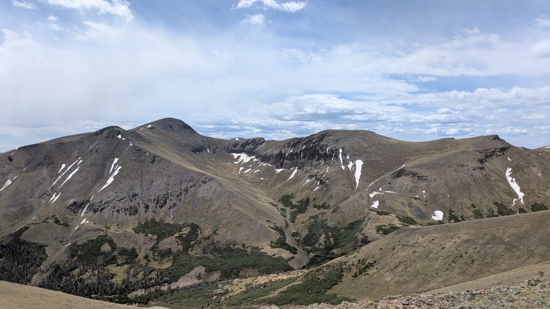

As I made the long traverse over to Stewart the weather started to slowly deteriorate, with some minor intermittent flurries. 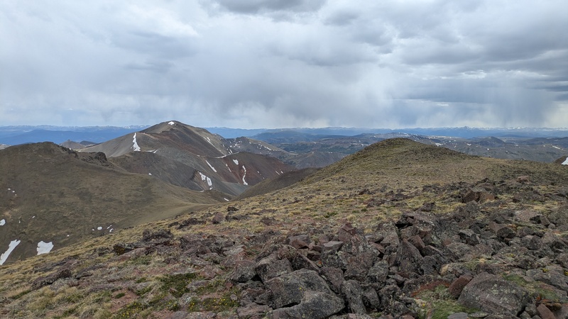
I really enjoyed the summit though and it was a great vantage point to admire what I had climbed over the last two days. I had originally budgeted two nights for this trip in case I was slow or some other setbacks occured (although I had to be back in Denver by midday Sunday). However, the inReach advertised a cooler night with some rain and since I was relatively close to Cebolla I opted to skip the second night and get down to the car. I skirted Baldy Chato on the way back and dove back into the willows above the trailhead. I found some binoculars and a hat in this area, let me know if you know anything about them (I also have a post up in the Lost and Found section). Despite staring at GPS and thinking I was on the trail at least 5 times, I missed the Cebolla trail and ended up bushwhacking though the willows and forest via some elk trails. At some point I gave up on trying to find the actual trail and I popped out onto the road a couple hundred yards west of the actual trailhead. Conclusions/Stats Thumbnails for uploaded photos (click to open slideshow):  Early morning on chato")
 Column Ridge summit")
 The long path ahead")
 Stewart views")
 Upper Nutras Creek (elk in the distance)")
 Getting closer to San Luis")
 San Luis views")
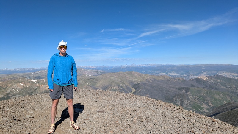
 Thank you Ben for the picture")
 A look back")
")
")
")
")
")
")
")
")
")
")
")
")
")
")
")
")
")
")
")
")
|
| Comments or Questions | |||
|---|---|---|---|
|
Caution: The information contained in this report may not be accurate and should not be the only resource used in preparation for your climb. Failure to have the necessary experience, physical conditioning, supplies or equipment can result in injury or death. 14ers.com and the author(s) of this report provide no warranties, either express or implied, that the information provided is accurate or reliable. By using the information provided, you agree to indemnify and hold harmless 14ers.com and the report author(s) with respect to any claims and demands against them, including any attorney fees and expenses. Please read the 14ers.com Safety and Disclaimer pages for more information.
Please respect private property: 14ers.com supports the rights of private landowners to determine how and by whom their land will be used. In Colorado, it is your responsibility to determine if land is private and to obtain the appropriate permission before entering the property.


