Download Agreement, Release, and Acknowledgement of Risk:
You (the person requesting this file download) fully understand mountain climbing ("Activity") involves risks and dangers of serious bodily injury, including permanent disability, paralysis, and death ("Risks") and you fully accept and assume all such risks and all responsibility for losses, costs, and damages you incur as a result of your participation in this Activity.
You acknowledge that information in the file you have chosen to download may not be accurate and may contain errors. You agree to assume all risks when using this information and agree to release and discharge 14ers.com, 14ers Inc. and the author(s) of such information (collectively, the "Released Parties").
You hereby discharge the Released Parties from all damages, actions, claims and liabilities of any nature, specifically including, but not limited to, damages, actions, claims and liabilities arising from or related to the negligence of the Released Parties. You further agree to indemnify, hold harmless and defend 14ers.com, 14ers Inc. and each of the other Released Parties from and against any loss, damage, liability and expense, including costs and attorney fees, incurred by 14ers.com, 14ers Inc. or any of the other Released Parties as a result of you using information provided on the 14ers.com or 14ers Inc. websites.
You have read this agreement, fully understand its terms and intend it to be a complete and unconditional release of all liability to the greatest extent allowed by law and agree that if any portion of this agreement is held to be invalid the balance, notwithstanding, shall continue in full force and effect.
By clicking "OK" you agree to these terms. If you DO NOT agree, click "Cancel"...
The Naked Lady Couloir has been on my list for a couple years and it did not disappoint. I started from Andrews Lake and followed the directions from wildwanderer's trip report from fall 2025 to make my way through the first mile or so in the forest.
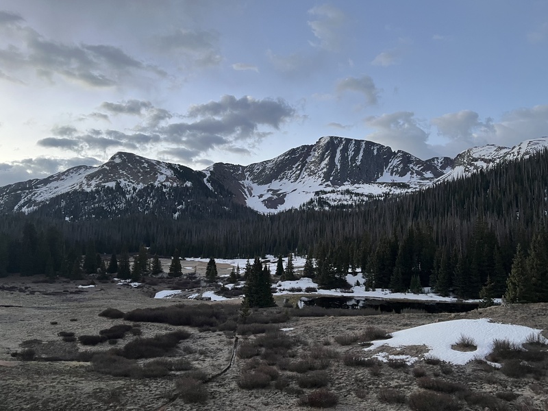
This is the first meadow you walk through on your approach. It was very wet and muddy.
I left the trail about 2 miles in. After leaving the trail I bush wacked through plenty of fallen trees. Snowdon is visible most of the way and makes it easy to know where to go.
There is a nice open area at the base of the climb to leave any gear you don't want to haul up the couloir.
Entering the couloir
The angle is between 40-60 degrees in the couloir. There are some cliff bands that had melted out that I needed to navigate around. Nothing too sketchy though. The snow was mostly solid. There was a section in the middle where I punched through about half way up my shins but it became more and more solid as I climbed higher. The very top of the couloir was exposed rock but it was easy to manage in crampons.
Looking up towards the final approach to the summit
The final climb to the summit was a mix of rock and very poor quality snow. I took my crampons off here and stayed on rock as much as I could. The scrambling is class 3/4 and was easy enough in mountaineering boots.
One of my favorite summit panoramas. The San Juans were showing out on this day.
I decided to downclimb the summer route. The snow in final few pitches to the top of the couloir was very hard and I didn't love the idea of downclimbing it.
Going down the summer route wasn't great. I had to traverse a few of these snow patches that were very slushy and I punched right through. I hugged the rock for support the trudged through. There are cairns to follow for the down climb and I was able to follow them most of the way. I eventually lost the cairned route and found my own way to the lower ridge.
Looking back on the summer route I descended
Once you leave the ridge just follow the trail on the standard route down.
Another all time day in the San Juans!
Thumbnails for uploaded photos (click to open slideshow):
Thanks for this beta! I’m gonna hit it tomorrow. How did the traverse to N2 look? What time do you think the snow started getting too soft?
Caution: The information contained in this report may not be accurate and should not be the only resource used in preparation for your climb. Failure to have the necessary experience, physical conditioning, supplies or equipment can result in injury or death. 14ers.com and the author(s) of this report provide no warranties, either express or implied, that the information provided is accurate or reliable. By using the information provided, you agree to indemnify and hold harmless 14ers.com and the report author(s) with respect to any claims and demands against them, including any attorney fees and expenses. Please read the 14ers.com Safety and Disclaimer pages for more information.
Please respect private property: 14ers.com supports the rights of private landowners to determine how and by whom their land will be used. In Colorado, it is your responsibility to determine if land is private and to obtain the appropriate permission before entering the property.


")
")
")
")
")
")
")
")
")
")
