| Report Type | Full |
| Peak(s) |
Little Bear Peak - 14,041 feet |
| Date Posted | 07/08/2025 |
| Date Climbed | 07/04/2025 |
| Author | Bonesaw |
| Suffering on the SW Ridge |
|---|
|
To preface this I'll say that I've done some mountains before. I think this would be my 38th 14er. Before I moved here I lived in Utah and spent many days in the Wasatch, Uintas, Tushars, Deep Creek, Bear River, and really any range around the state. Before that I lived in Idaho, climbing in the Sawtooths, Pioneers, Lost River, White Clouds, Boulders, and a few other ranges. Outside of some very select peaks, there are no trails to the summit. So when I saw that Little Bear had a non-technical route with no trail to the summit I knew I'd be game for it. I followed the other trip reports as best I could, opting for a lower elevation crossing of Tobin Creek to where it had already dried up. The descent and ascent across the creek were fairly easy and I feel like I was making good time 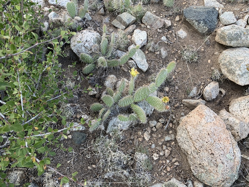
There was a ton of cactus to watch out for. Eventually the cactus thinned out and soon I was in some forest that would also thin out and give way to what I would be doing the rest of the day. 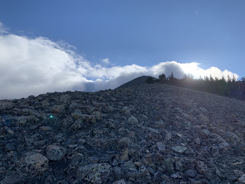
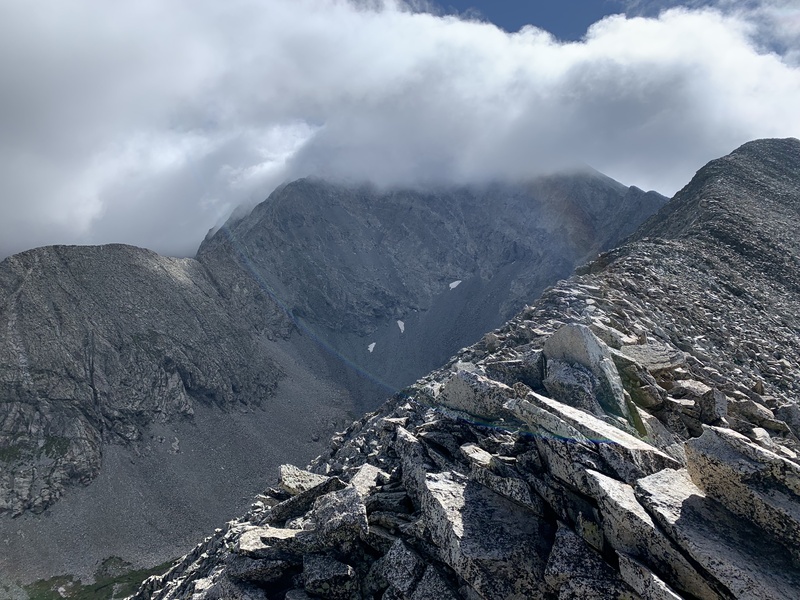
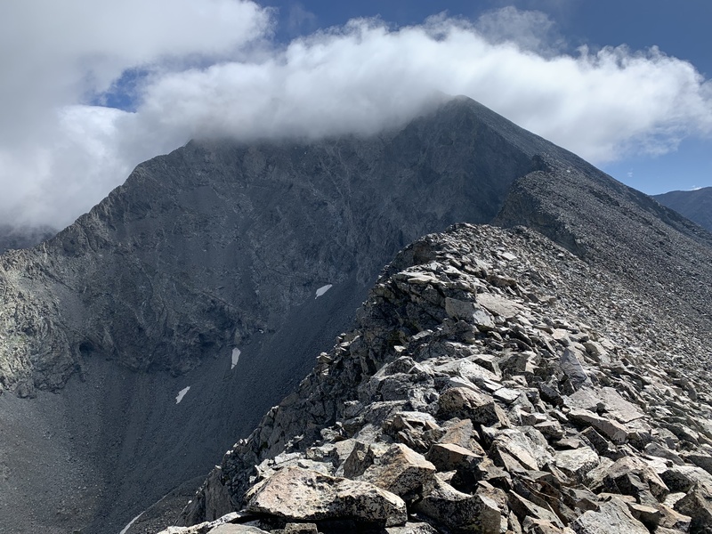
While the clouds kinda looked bad I was reminded of my hike on Diamond Peak maybe a decade ago where the closer I got to the summit, the more the clouds dispersed. Today was just like that, but holy crap was the wind on the ridge in the early morning cold. Threw on all my layers plus my gloves to stay warm. Eventually the clouds cleared and it was smooth sailing to the south summit. It had some exposure but the rock was solid so I was not afraid of the precariousness. 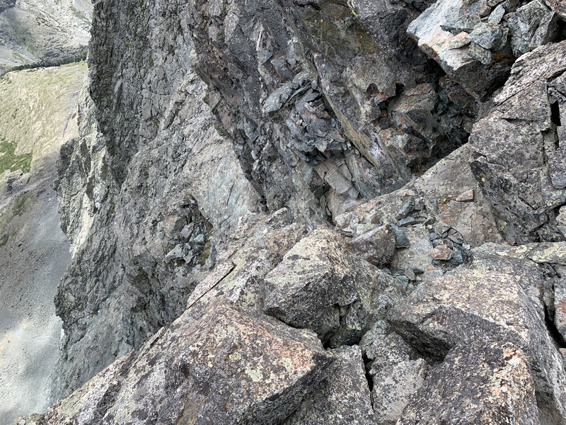
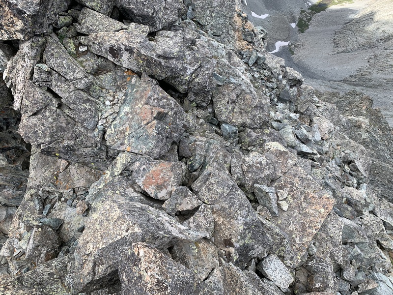
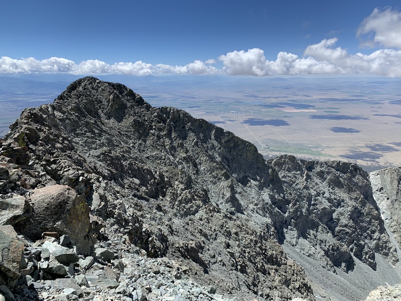
A few ups and downs and arounds later and I was there. I found the route finding to be fairly simple as there were many ledges and levels that could be taken. If things looked dicey on the ridge, I would drop into the basin on the left just a bit. What I did find interesting was the Class IV move I made on the way to the summit was not there on the return trip. I'm fairly confident this can be done as a class III climb the entire way. 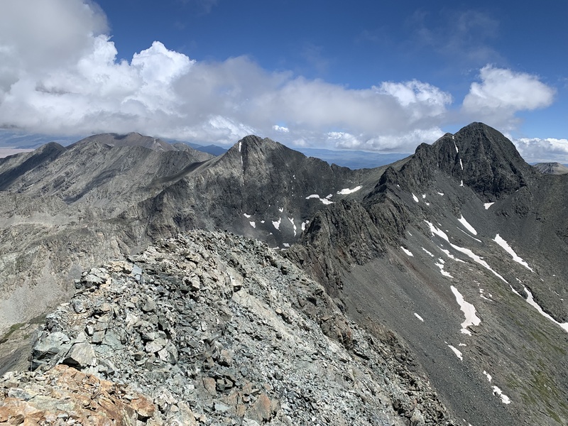
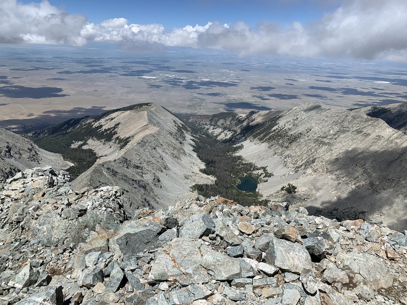
The return trip is where things started to not go as well. Instead of wearing boots I had trail runners and while they had held up well on my previous excursions the two weekends prior they were suddenly not providing enough support. Each step started to hurt just a little. I'd stop and take some breaks and look at the pretty views 
Good views but no progress. I had to keep moving. I just couldn't move fast enough though. Each step hurt a little, every rock a mental test of endurance as well as physical. I hit the trees then eventually got low enough to find the desert shrubs again. I got a little off route at this point and navigating became much harder. It was steep, rocks would tumble down in front of me, I'd be sliding through dirt downhill trying to stop myself from losing control. It took probably an hour to go half a mile of this awful hellish ridge. It was almost 8 and I did not want to be finding my way in the dark. I had a headlamp plus a backup flashlight but it's easier to see ahead with the sunlight. That's science or something. I got down further, checked my map to see where I was. I was close enough to cross the dry stream! Down 100 feet of steep nonsense, through some thick vegetation, then up another 30 feet. Soon after I found an old 4x4 trail, almost out of the woods! I had to go maybe another third of a mile to this road I had come in on, again with no trail to guide me. Actually there were maybe a half dozen old 4x4 trails criss-crossing every which way. Sorta followed those back to the road. Two minutes after official sunset I got there. The next three miles were slow and quiet as I plodded back to the Rav4. No chance was I gonna do more hiking so I was going to sleep a bit and head out early Some thoughts on the route: this is as much a mental test of your endurance as it is a physical one. From where I started, it was 14 miles roundtrip. Lots of those miles are hellish. The bushwhacking can get real bad. I felt like I had it easy on the ascent and the descent was a nightmare. The talus wasn't bad as most of the rocks were solid. But again on the descent it very much feels like it won't end. And if your footwear doesn't have extra padding or a rock plate you might be in for a bad time. I'd probably rate this as a top 5 brutal hike, up there with Mt Beulah (UT), El Capitan (MT), USGS Peak (ID), and Bountiful Peak (UT). It would be nice if things ended there and the drive home was uneventful. Yes that would have been swell. Driving in the dark though, it's just more dangerous than regular driving which is already dangerous. Lots of animals for one. I drive slow and the anxiety of hitting something is not fun. I didn't sleep much in the car. Sometime around 4:15am a few miles north of Pueblo I approach a Corolla. I get in the left lane to make a pass when suddenly they also drift into the left lane... And keep going... They went into the median, then shot out of it to the right and slammed into a guardrail, then bounced into the guardrail on the left side. I slammed on the brakes, then backed up and called 911. All their lights were off and I knew it was going to get bad quickly because there was no shoulder on the left. Sure enough while I'm on the phone an FJ Cruiser slams into them, luckily after they had exited the vehicle and were on the other side of the guardrail. A few minutes go by before EMS and Fire show up and a bunch more cars nearly wrecked. Some people stopped which was nice, I stuck around and eventually gave a witness statement since I was the only person to see it all go down. Pretty sure everyone walked away without major injuries, thankful for that. Stay safe out there Thumbnails for uploaded photos (click to open slideshow):  Ellingwood Blanca")
 Cactus Flat")
 Cloud City")
 Cloud Clear")
 Sunrise Cloud")
 No Precursor")
 Basin Flats")
 Stick your right foot over the exposure")
 Stick your left foot over the exposure")
 Lindsey Peaking")
 South Summit")
 Lake or Something")
|
| Comments or Questions |
|---|
|
|
Caution: The information contained in this report may not be accurate and should not be the only resource used in preparation for your climb. Failure to have the necessary experience, physical conditioning, supplies or equipment can result in injury or death. 14ers.com and the author(s) of this report provide no warranties, either express or implied, that the information provided is accurate or reliable. By using the information provided, you agree to indemnify and hold harmless 14ers.com and the report author(s) with respect to any claims and demands against them, including any attorney fees and expenses. Please read the 14ers.com Safety and Disclaimer pages for more information.
Please respect private property: 14ers.com supports the rights of private landowners to determine how and by whom their land will be used. In Colorado, it is your responsibility to determine if land is private and to obtain the appropriate permission before entering the property.

