| Report Type | Full |
| Peak(s) |
White Benchmark - 13,411 feet |
| Date Posted | 07/07/2025 |
| Modified | 07/08/2025 |
| Date Climbed | 07/04/2025 |
| Author | JQDivide |
| Additional Members | FoodieHiker |
| A Gorgeous Day | ||||||||||||||||
|---|---|---|---|---|---|---|---|---|---|---|---|---|---|---|---|---|
|
White Benchmark 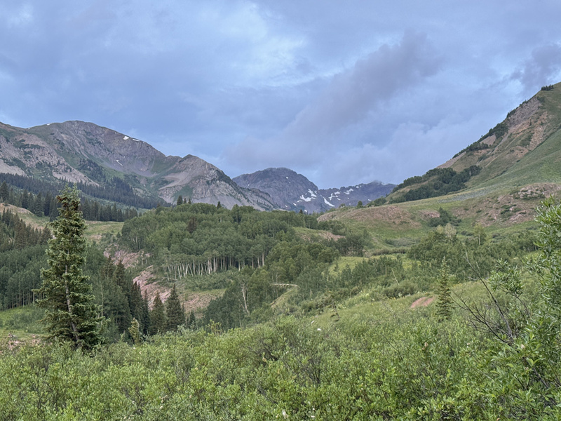
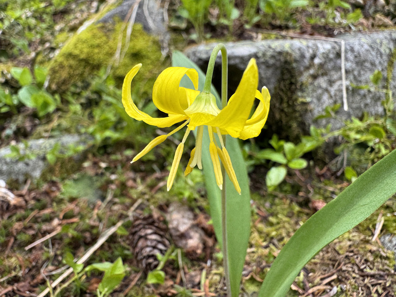
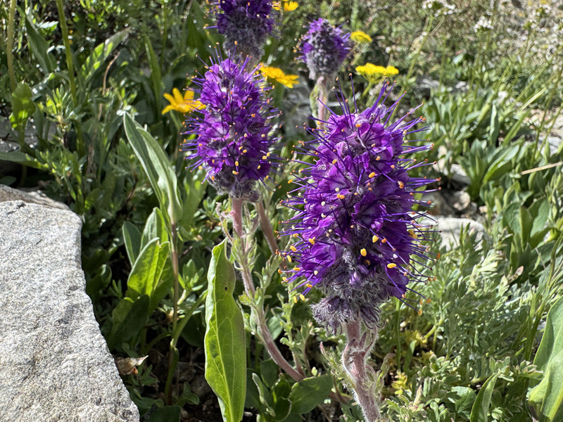
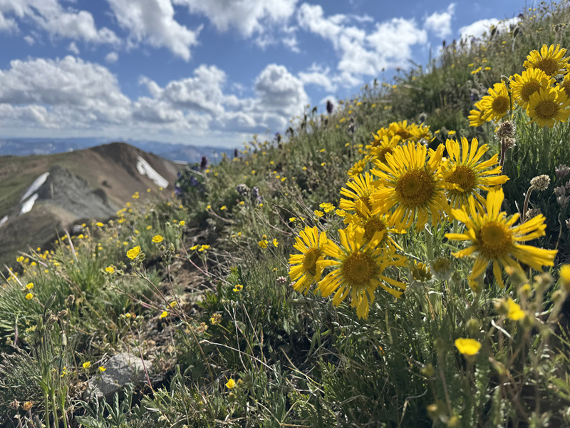
White Benchmark has been on the list for a while. We planned to hike it last year with White Rock (.comTR) and Redrock Peak (blog TR). That didn’t work out. Was not happy about that. But, now I’m very happy about that. Perspective. This was one of the prettiest hikes we have completed in the Crested Butte area. And a Top 5 for wildflowers. Staci and I are working on a CB List, this summit was #70. Just a few more to go for our “inner” circle of peaks. I took off work on Thursday, so we would hopefully be able to get one of the few camping spots along West Brush Creek Road. We had realistic expectations that we would be spending the night at the Teocalli Trailhead. But, as luck would have it, campsite No. 8 was open! It sits just about .3 miles below the TH. We could see the TH and White Benchmark from camp. We set up camp and decided we would stay two nights, then go meet friends on Saturday. Those plans came into question when we woke up Friday morning. It was raining. We watched as waves of clouds covered the peaks, moved over us and dropped rain. Then the peaks were visible again. Then more clouds. This repeated every 45 minutes or so for several hours. We got up cooked breakfast and watched the rain. A few mountain bikers came by. Two trail runners came down from the ridge trail. Everyone was soaking wet. Then a couple of vehicles came up the road looking to camp. (By the way, that road has some rough spots, I recommend a real 4x4.) Watching it Rain. Video: Hike and Summit Views 
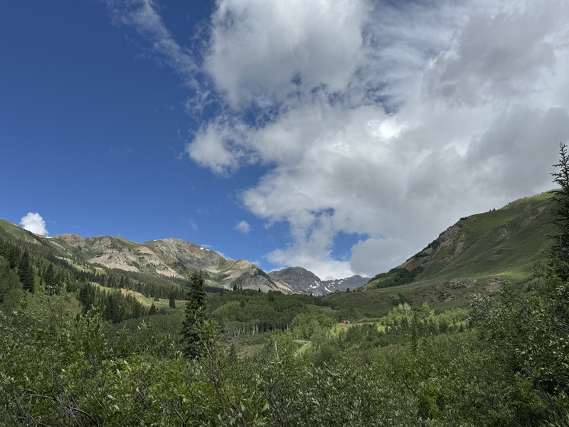
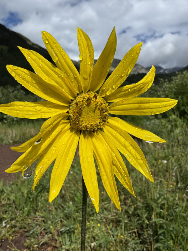
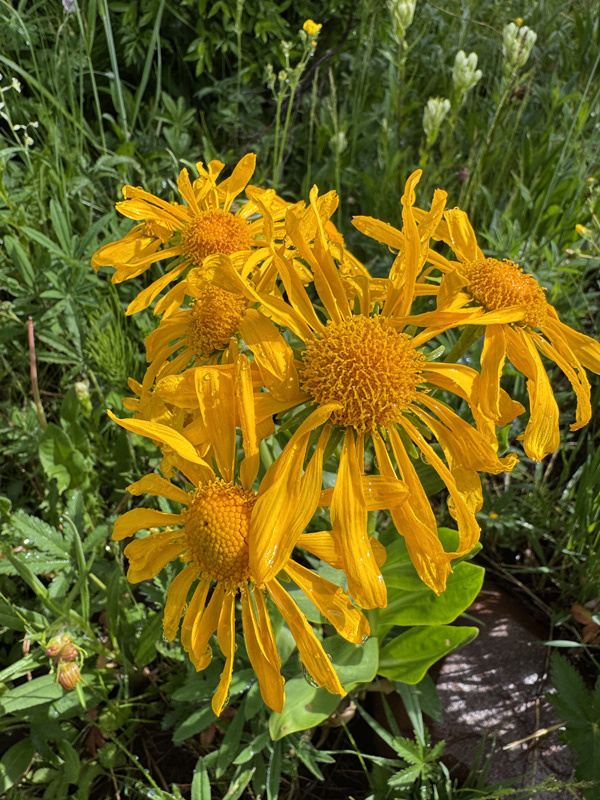
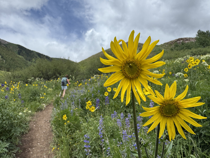
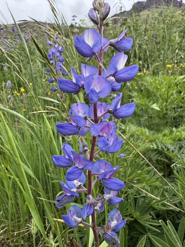
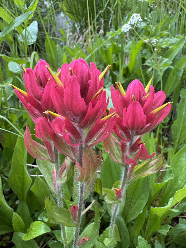
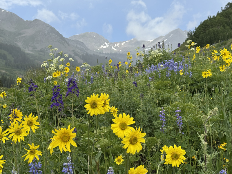
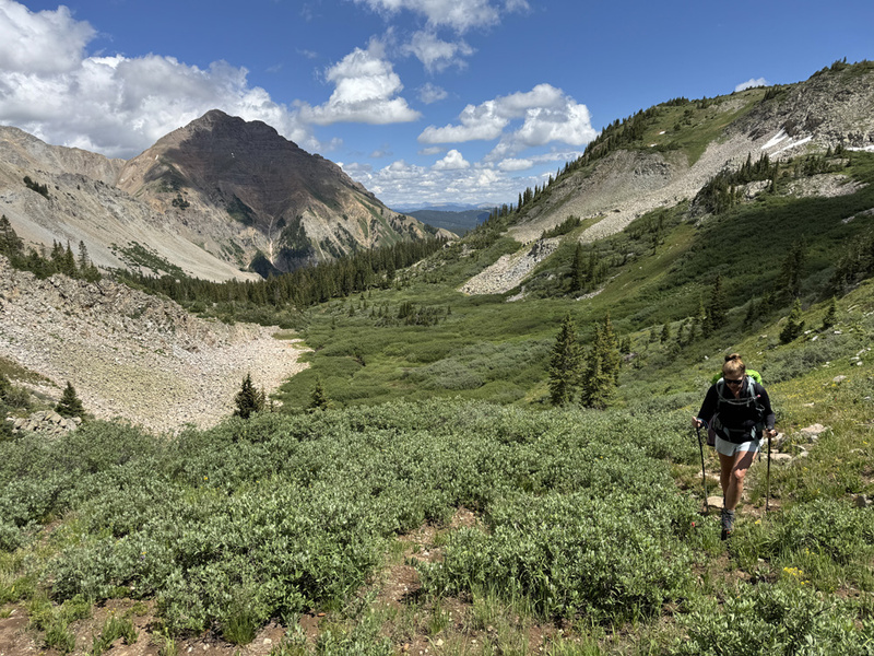
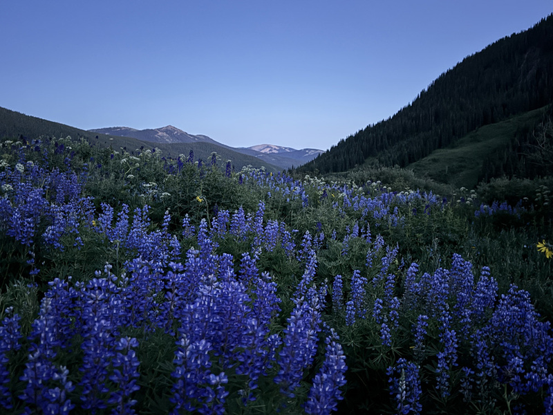
We decided if the rain cleared off by noon, we would try for the peak today, instead of Saturday. About 11:15 a.m. the sky mostly cleared. We got ready and were hiking up the road by 11:45 a.m. The flowers just above the TH were full on living up to CB's title of “Wild Flower Capital of the World.” When we turned off the main trail to West Brush Creek drainage, the flowers continued to impress. Then we saw another band of clouds and rain heading our way. We put on rain jackets and I pulled out an ultralight tarp for some protection. We hunkered down for about 15-20 minutes until it passed. The weather was perfect the rest of the day. 

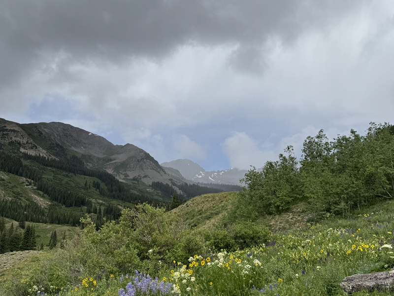

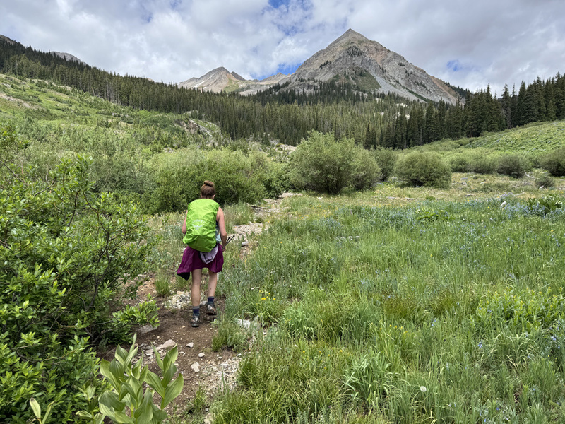

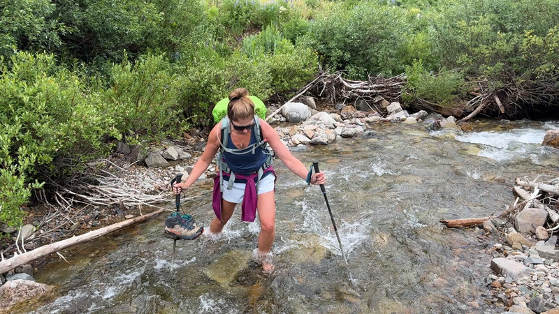
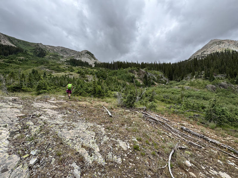
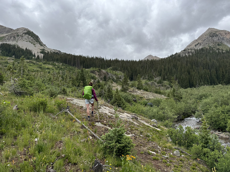
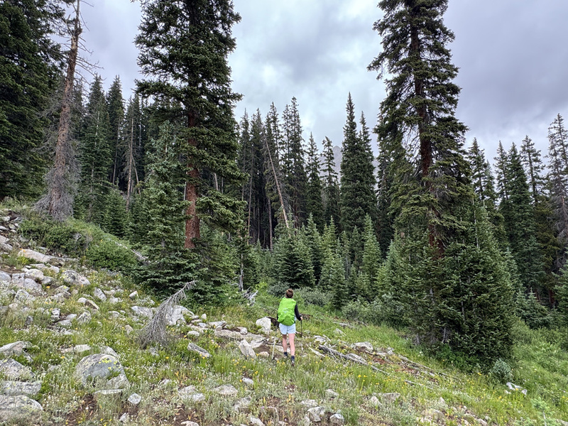
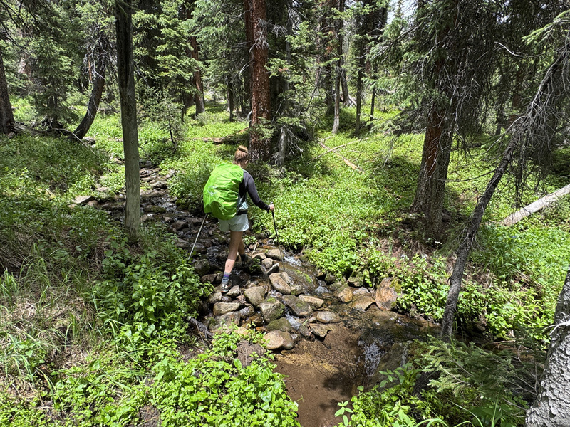
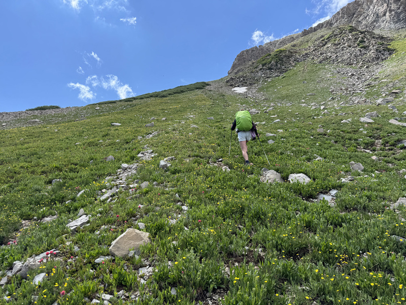
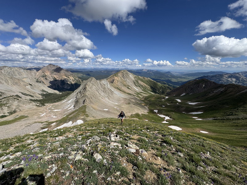
We continued to walk through millions of wildflowers as we moved into the valley. There was a hint of a trail. Near 10,500, a bit more than a mile from the TH, we crossed the West Brush Creek. Staci tried a log, but couldn’t work up the nerve to use it. That was a good laugh. So, off with our boots. (12:45 p.m.) From here we followed a track I got from the website. I think it’s Steve Benfield’s track. It mostly worked. We hiked up hill to the left to get out of the willows. Then turned right, into the forest. And guess what, there are plenty of game trails in this valley. Use them! (But confirm the direction.) About .4 miles into the trees, we eventually came to a draw with a rock wall, 11,200. We left the gps track and followed a game trail right around the wall and up and over. Easy Peasy. We followed more game trails as we walked through the forest. No need for photos, the trees all look alike. Near, 11,500 (2:45 p.m.) the trees thinned out and we came to more willows. We decide to go up and left again, and once again we found a game trail that avoided most of them. Some of these game trails are really impressive. As we hiked into the upper part of the valley, we talked about how this area resembled other areas. American Basin. Apostle Basin. So green. Running water. Mountains. Flowers. We knew we would eventually turn left, up hill near the end of the basin to hit a saddle. Well, we picked a sport near 11,800, (3:15 p.m.). There was a rock outcropping with a grassy slope to its left. This was perfectly fine… but we should have followed a game trail, which we did on the way down. Less steep, much better. 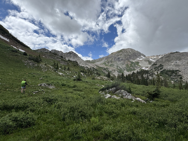
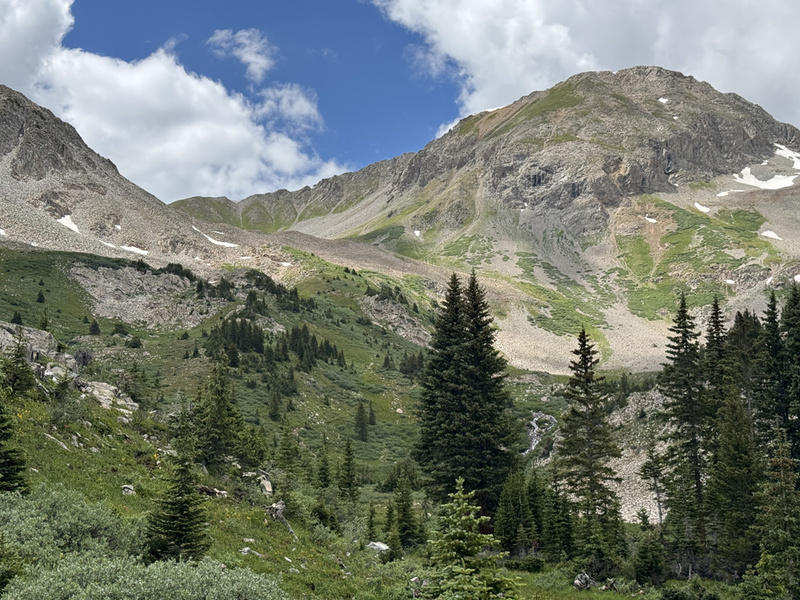
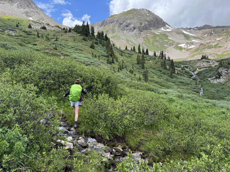

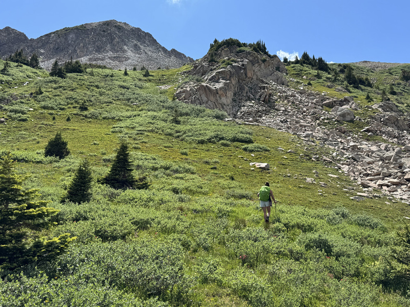
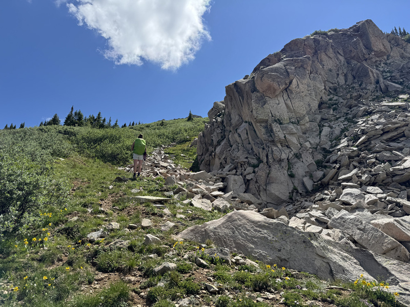
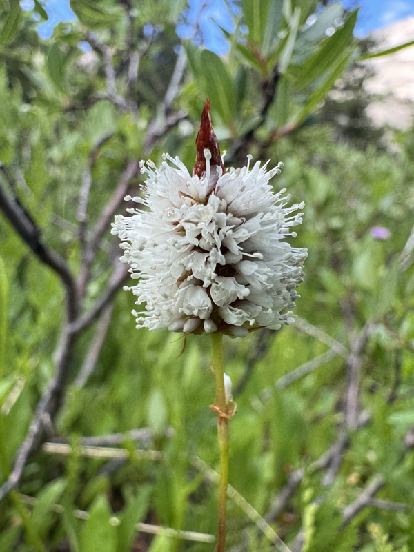
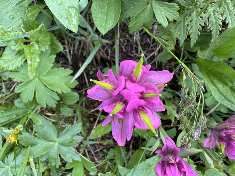
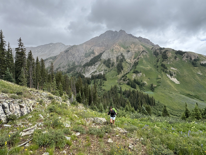
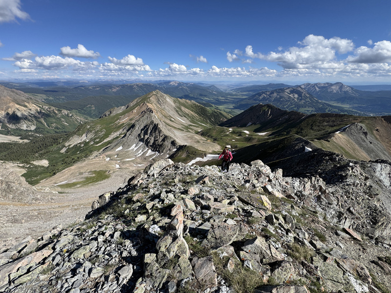
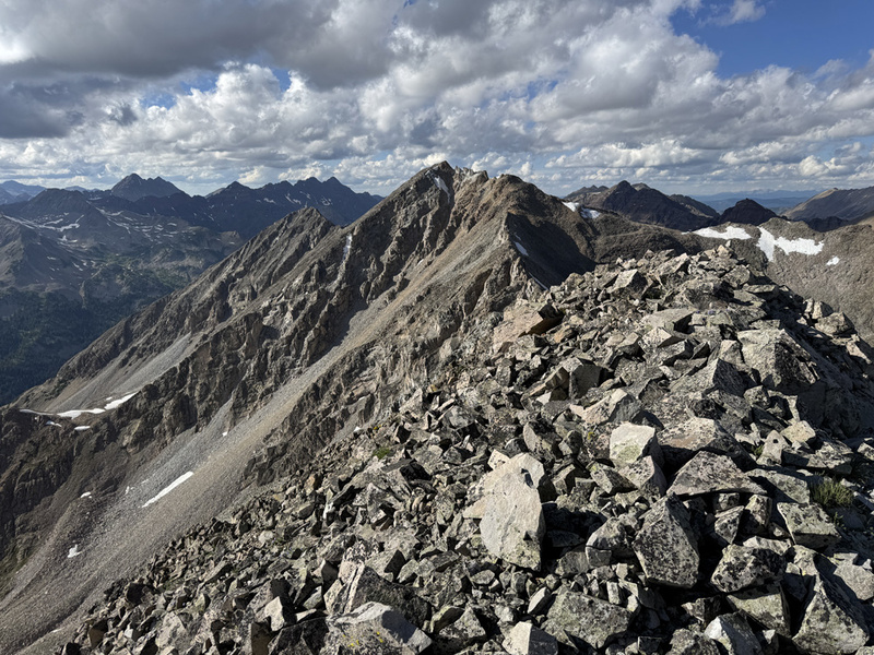
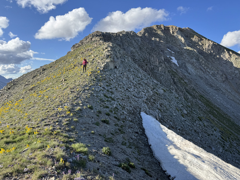
Up we went and then kind of followed a track again. Bad call. We were too high and had to cross a boulder field to reach the saddle. Again, on the way down from the saddle we followed a game trail that mostly skipped the boulders. So this saddle is the ridge from WSC Peak (blog TR) and it has a high point (12,728) and then the saddle that connects to the ridge between White Benchmark and Pt. 12,832 and Redrock. Well, 12,728 was tentatively on our list. It was always a maybe. And then we saw it couple weeks ago from 12,832. It went from a maybe to a definitely not. It might be the worst looking crumbling pile of garbage I have ever seen of a peak/point. No way. We have done other random ridge bumps for this list. But that looks like loose Class 5. I’ll pass. We crossed the boulders (4:15 p.m.) and took a short break just above the saddle before going all the way up. It got a little windy, but not bad. We put on a layer and started up hill again. I’ll just say, there have been flowers on this entire hike. From our campsite to just before the rocky ridge to Benchmark. Gorgeous. Prime flower time! 

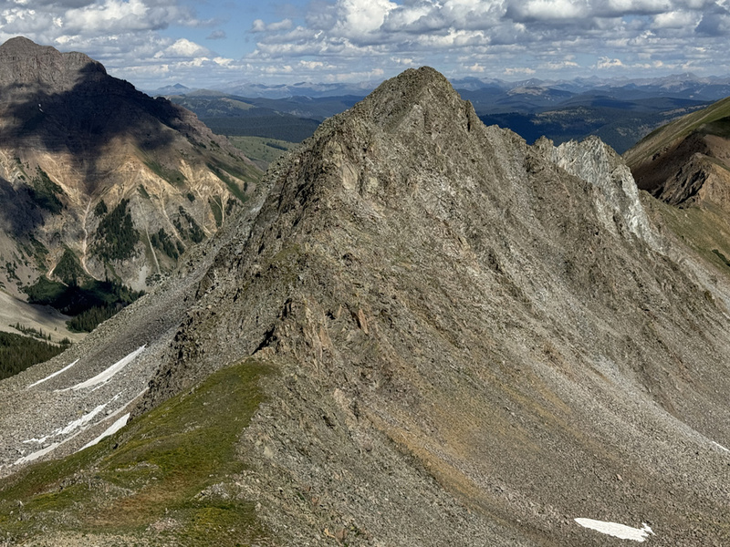
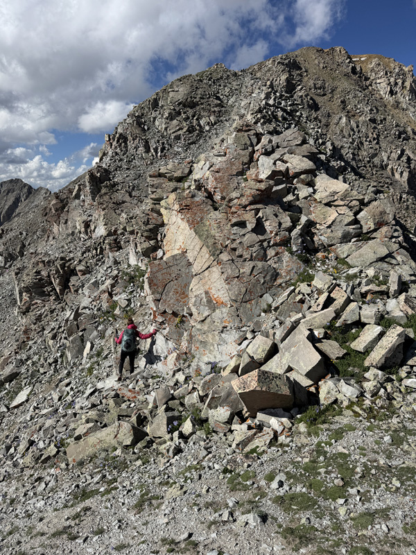
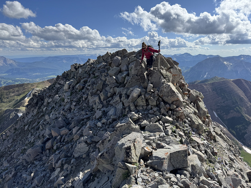
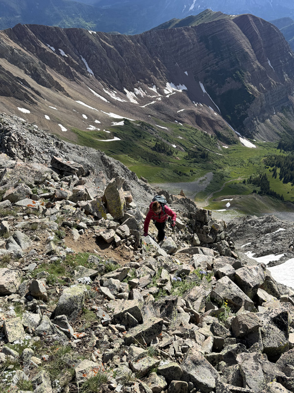
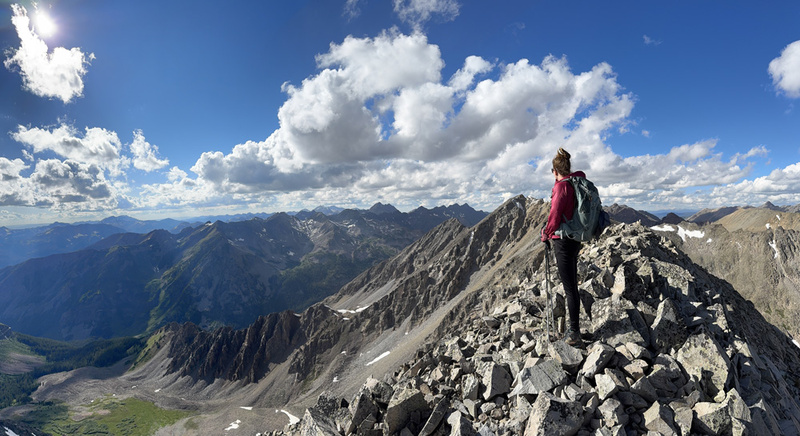
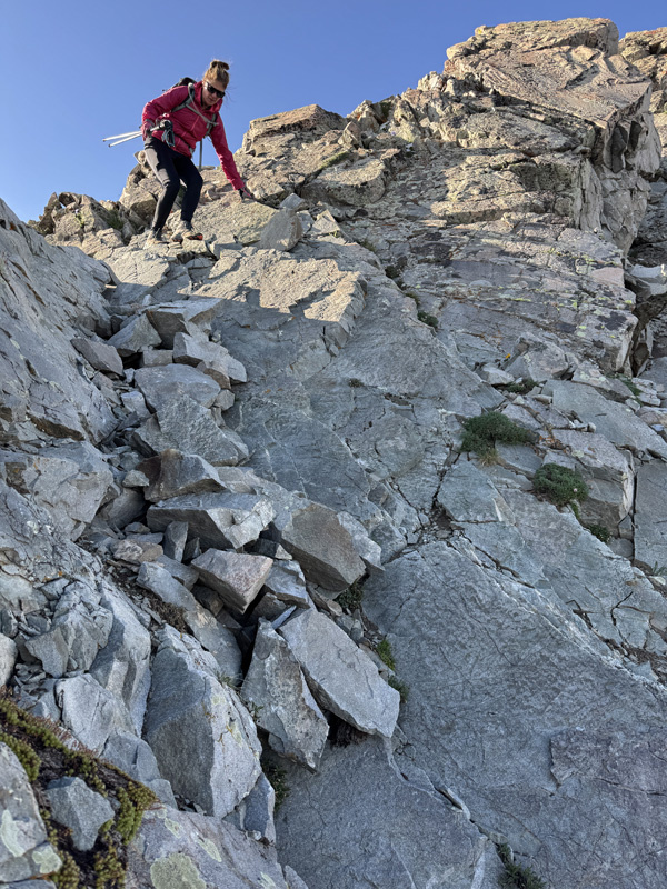
We got up to the start of the rocky ridge (5 p.m.). I’ll just say, we were a bit tired. We totally under estimated how much time and effort the ridge would take. Took us an hour to go .4 miles and about 500 feet. We knew to go ridge proper and mostly did. But every now and then, there were obvious routes to the left or right. So we stopped and thought about those. They looked easier than ridge proper. Not sure they were. One or two were very loose. Should have stayed ridge proper. The ridge was mostly a Class 2 consistent scramble. We never put away our trekking poles. But there were probably a few Class 3 moves here or there. And there were a lot of ‘no fall’ areas, usually with loose terrain. If we weren’t so tired, this probably would have been a fun ridge to scramble. But it was just frustrating. Perspective. We made the summit about 6 p.m. Took the photos and summit video. Looked at the registry. And headed down about 10 minutes later. We knew it would be dark before we made it back to camp. I wanted to get across the creek, before it was too dark. 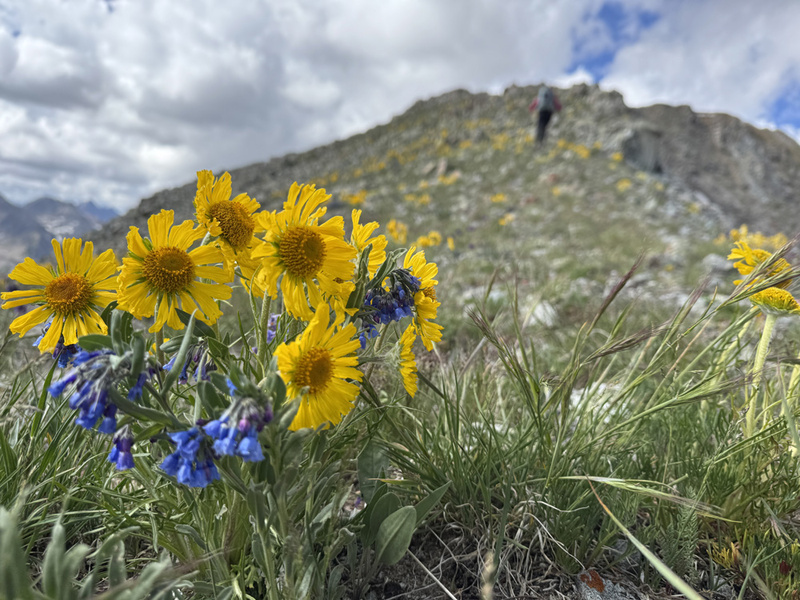

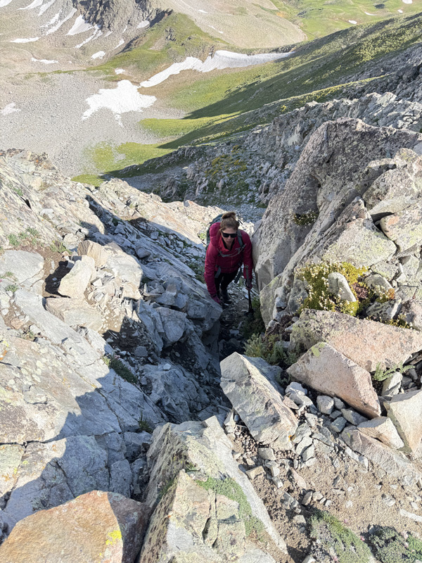
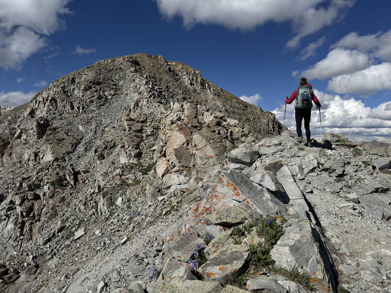
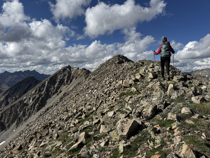

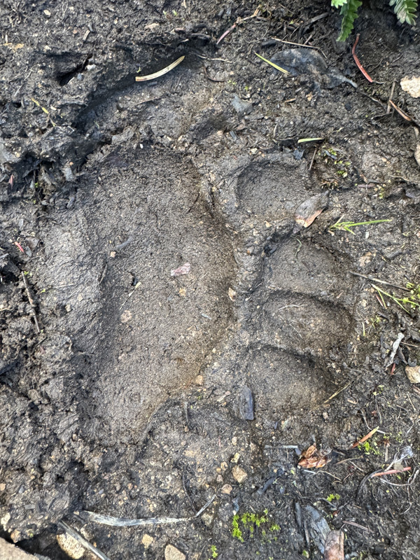
On the way back across the ridge, it was so much easier than the way up. We stayed ridge proper nearly the entire way. Had a better view of the route. Skipped those loose sections. Yes, we butt scooted a few times. But we made better time. Only about 40 minutes. From here we hit that saddle, then followed a game trail through a grassy area to avoid the boulders. Then it petered out in some boulders. We crossed a small snow field… and guess what. That game trail was on the other side. It took us down around that rock out cropping we took up. So much easier. We saw an obvious game trail ahead and took it. Wrong way. Took us up and away. We got back on track. Then we saw the bear paw print in the mud. Yikes. We started making noise. (7:45 p.m.) We also took a different game trail, one a little higher than we took in. Kind of a bad move. Not awful. We did get to see some rocky ridges and things along the base of WSC we didn’t see on the way in. Very different terrain. Kind of cool. But not as easy or direct as our way in. We eventually made our way back to our path in. Never saw a bear. We got back to the rock wall, and back into the trees. We kept getting on different game trails and then checking our track. So we would move one way or another. We probably just should have picked a trail and stuck to it. Out of the trees about 8:30 p.m. We crossed the creek about 9 p.m. I tossed a couple small boulders into the creek in hopes of crossing dry. No luck. I needed to be stronger to left bigger rocks. Ha. We crossed mostly dry, kind of wet. But we were only 30 minutes from camp. We put on headlamps and walked the rest of the way out. There were three vehicles at the TH. All of them were camping. I know, I know. People aren’t supposed to do that. But what else are they supposed to do? They drove that rough road an hour in. What harm are they doing? If they don’t poop at the TH and build a fire, what is the difference than a car sitting there all day as people hike? We told them we would be leaving in them morning, and we would save the spot for them. Give them a car horn honk as we were packing up so they would know. (That worked fine the next day.) 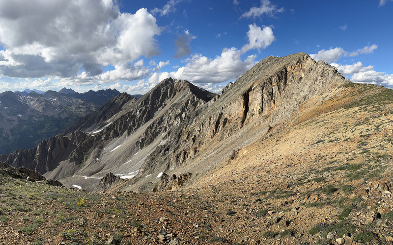


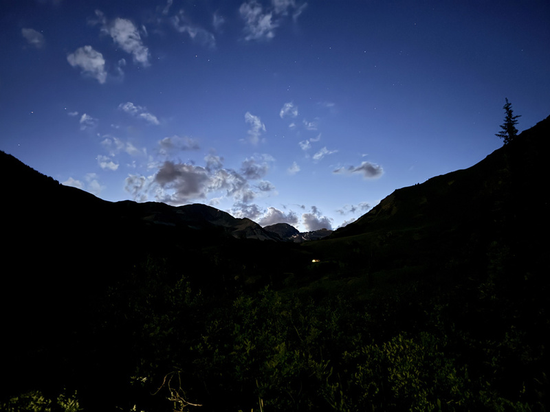
As we walked from the TH to our campsite. We noticed a light. Well, it turns out. I did leave a light on. Kind of. I left a small solar powered yard light out to charge. Ha! Forgot about that. We were back at camp around 9:30 p.m. We celebrated #70 with our traditional ice cold palomas. Then we went about heating water for sponge baths and getting dinner ready. Staci had precooked roast and potatoes. We got clean. We got feed. And opened a bottle of wine. It was a gorgeous hike. There were millions of wildflowers. It was a very good day. We met up with Brandon and Emily and their kids on Splains Gulch Road to camp. We went into CB Sunday to the Farmer's Market... ugh. CB was still a shitshow as it was all weekend. Too many people there these days. And I know I'm part of the problem. Double ugh. FLOWERS!
If you have any interest in the other peaks and points around CB, you can check out our blog: Hiking Crested Butte and Beyond. 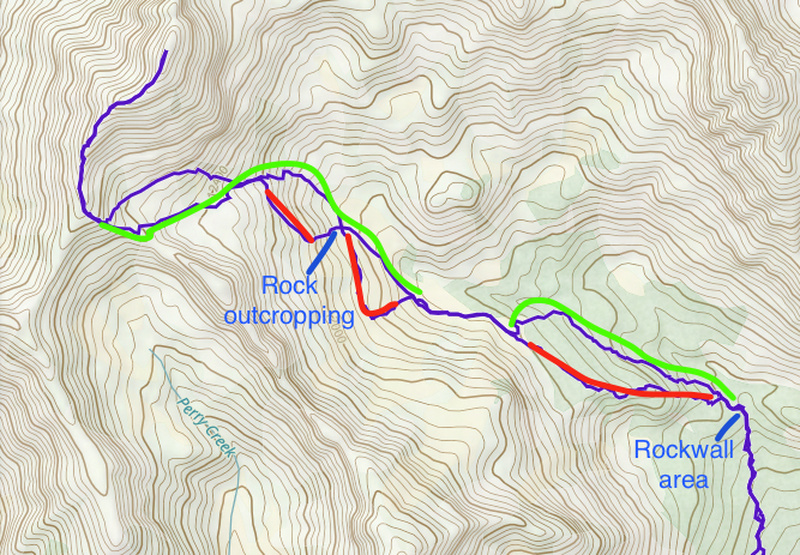
Thumbnails for uploaded photos (click to open slideshow):  Green Line is better route.")
")
 Cloudy morning")
 Sky cleared up and we took off")
 Wildflower hikes are the best")
 Clouds and Rain again")
")
")
")
")
")
")
")
")
")
")
")
")
")
")
")
")
")
")
")
")
")
")
")
")
")
")
")
")
")
")
")
")
")
")
")
")
")
")
")
")
")
 Boundary sign just off the main Teocalli trail at the first switchback.")
")
 Heading into the trees.")
|
| Comments or Questions | ||||||
|---|---|---|---|---|---|---|
|
Caution: The information contained in this report may not be accurate and should not be the only resource used in preparation for your climb. Failure to have the necessary experience, physical conditioning, supplies or equipment can result in injury or death. 14ers.com and the author(s) of this report provide no warranties, either express or implied, that the information provided is accurate or reliable. By using the information provided, you agree to indemnify and hold harmless 14ers.com and the report author(s) with respect to any claims and demands against them, including any attorney fees and expenses. Please read the 14ers.com Safety and Disclaimer pages for more information.
Please respect private property: 14ers.com supports the rights of private landowners to determine how and by whom their land will be used. In Colorado, it is your responsibility to determine if land is private and to obtain the appropriate permission before entering the property.