| Report Type | Full |
| Peak(s) |
Humboldt Peak - 14,068 feet |
| Date Posted | 06/20/2025 |
| Date Climbed | 06/19/2025 |
| Author | AdventureCO |
| Additional Members | GreenHorn |
| Humboldt Peak: Where the Marmots Outnumbered the Hikers |
|---|
|
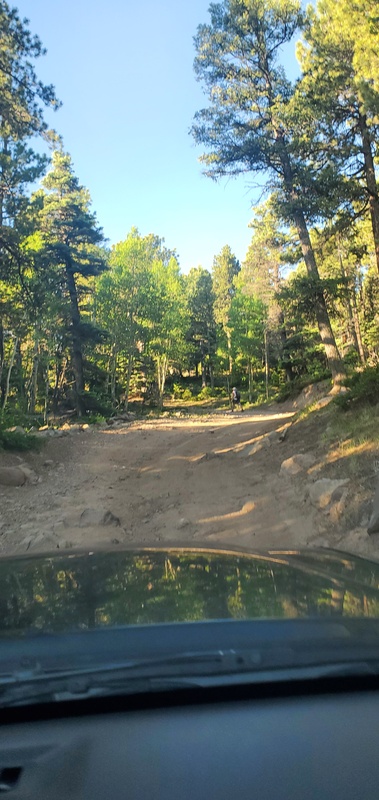
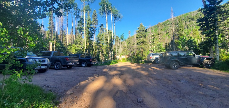
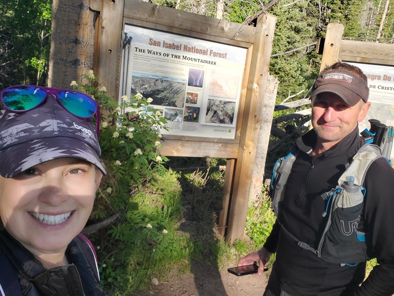
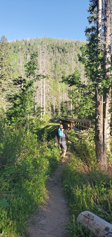
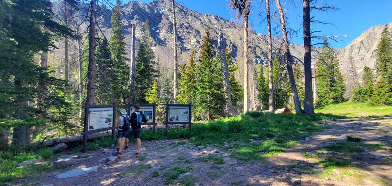
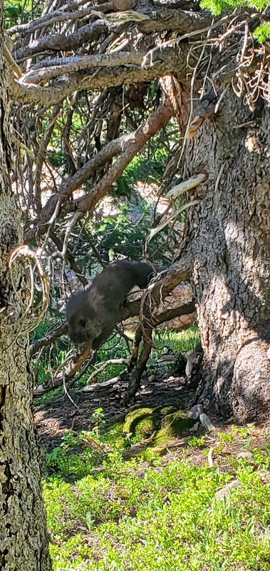
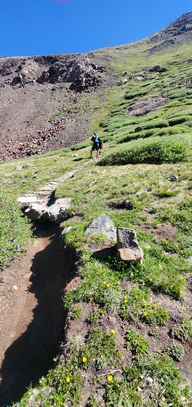
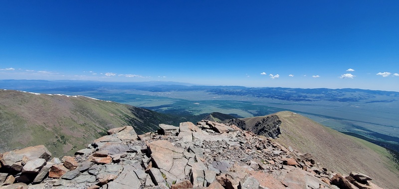
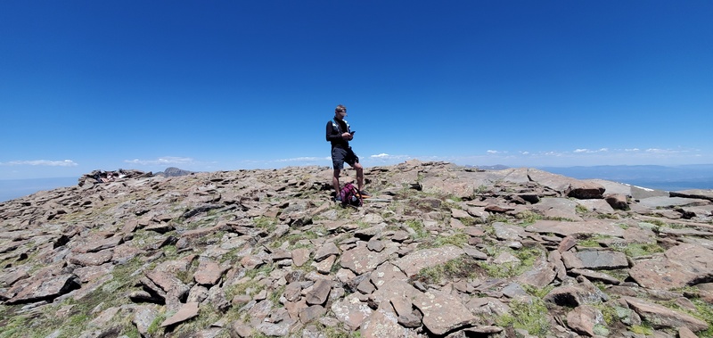
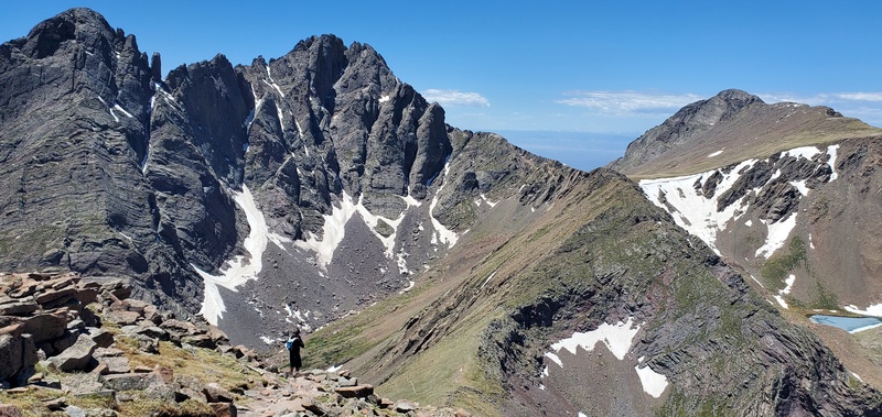
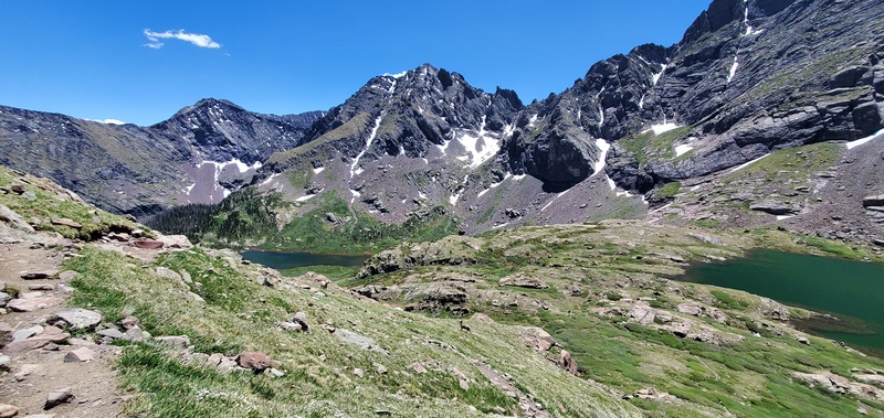
My husband, Bob (Greenhorn), and I left southwest Colorado Springs at 5:15 AM and made it to the Upper South Colony Lakes trailhead around 7:15 AM. Opting to drive up instead of hiking the road was a choice we made since the mileage up to the summit is a longer hike than I am used to for a 14er. The 2.5-mile drive from the lower lot to the upper trailhead was easily one of the worst roads in Colorado—deep ruts, rocks, and erosion, with at least one moment where I thought we might tip the Xterra on its side. There is no maintenance, and while we made it, this road is only suitable for high-clearance, 4WD vehicles. A decade ago, I drove this in a Subaru Outback loaded with kids, bikes, and a topper. I cannot imagine doing that now, but I’m sure someone will try. We started the hike by heading left past the trail signs and crossing a small wooden bridge. From there, we followed a dirt road for about 2.5 miles until it finally ended. At the junction, the actual trail picks up and heads right. From there, the trail was in good shape—some water and mud, but nothing too problematic. We kept our shoes mostly dry. A few downed trees, but otherwise very passable. This is also when the marmots made their grand entrance. They were everywhere and surprisingly bold. One even tried to come right up to us. If you're hiking with a dog, I'd recommend keeping them on a leash, and definitely don’t leave your pack or snacks unattended. As you pass the lakes, the tree line begins to fade, the views of the valley and surrounding mountains open up, and are absolutely stunning. We saw very few hikers all day, most likely due to it being early in the season and hiking on a Thursday instead of the weekend. After the lakes, the real climb begins. The steep hill leading up to the saddle is no joke. We took it slow—it’s a serious elevation gain in a short distance. Once we reached the saddle, the views expanded again, this time into the basin on Humboldt’s north side. From there, the route gets rocky and much less clear. We veered a little off-trail, along with several other hikers who were trying to pick their way through the boulders. Cairns were sparse and not particularly reliable, so it became a bit of a choose-your-own-adventure climb. We encountered a false summit and a small rock band that I scrambled over. When I reached the top of that section, I suddenly realized I was near a cliff’s edge, looking straight down into a couloir—something I wasn’t expecting. Most of the 14ers I’ve done don’t have much exposure, so it was an unpleasant (and slightly terrifying) surprise. Eventually, we reached the true summit. There were maybe 10 other people on the large, flat summit area, and the wind was almost nonexistent—rare and wonderful. We took in the views, ate lunch, and rested up before the descent. The hike back down through the boulder field was slow going for me—those rocks are no joke. Once we were back below the saddle, the pace picked up. The weather stayed warm and sunny, and we passed a few more marmots and hikers making their way up. This is where we encountered some bighorn sheep headed up the trail as well. We ran out of water with about a mile left, which made the final stretch along the hot, dusty road a bit uncomfortable. We made it back to the trailhead after about 7.5 hours total on the trail—tired but happy to be back to the car. My husband's STRAVA said our overall hike was 12.5 miles. We stopped at The Hunger Buster drive-through in Westcliffe on the way home - it was good, especially after a long day of hiking. 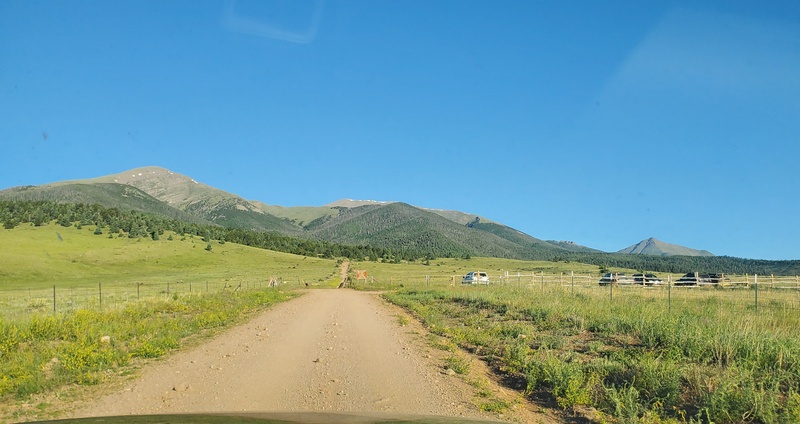
Thumbnails for uploaded photos (click to open slideshow):  Rough road to upper parking lot")
 Upper parking lot - notice the vehicles that made it.")
 Approach to the lower lot on the right (an additional 5 miles of hiking)")
 Start of the hike.")
 The first of many marmots")
")
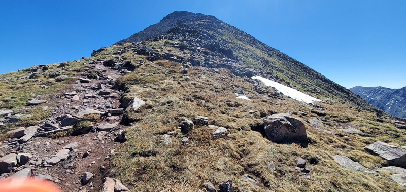
 The big hill up to the saddle")
 Bridge crossing")
 Summit Photo")
 Lots of room at the top")
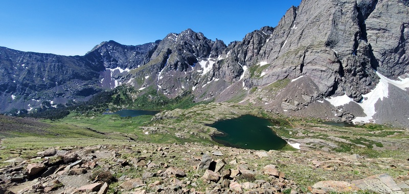
 View of the lakes")
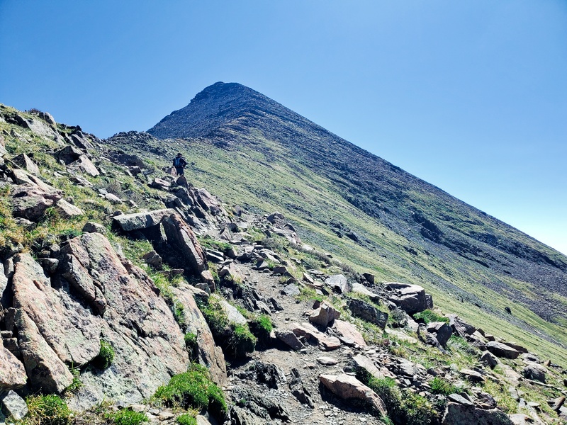
 Headed towards the false summit")
")
")
 Incredible views")
 End of road and start of the trail")
|
| Comments or Questions |
|---|
|
|
Caution: The information contained in this report may not be accurate and should not be the only resource used in preparation for your climb. Failure to have the necessary experience, physical conditioning, supplies or equipment can result in injury or death. 14ers.com and the author(s) of this report provide no warranties, either express or implied, that the information provided is accurate or reliable. By using the information provided, you agree to indemnify and hold harmless 14ers.com and the report author(s) with respect to any claims and demands against them, including any attorney fees and expenses. Please read the 14ers.com Safety and Disclaimer pages for more information.
Please respect private property: 14ers.com supports the rights of private landowners to determine how and by whom their land will be used. In Colorado, it is your responsibility to determine if land is private and to obtain the appropriate permission before entering the property.

