| Report Type | Full |
| Peak(s) |
Culebra Peak - 14,053 feet Red Mountain - 13,911 feet Wetterhorn Peak - 14,021 feet Mt. Lindsey - 14,055 feet Challenger Point - 14,086 feet Kit Carson Peak - 14,167 feet Mt. Sneffels - 14,155 feet |
| Date Posted | 05/13/2025 |
| Date Climbed | 09/13/2019 |
| Author | HikesInGeologicTime |
| Additional Members | mommyhiker, raftercurt, nitrostackr |
| Going Downhill Even Faster |
|---|
|
Note: I'm once again back to...uhh...refreshing old TRs for my podcast, which is just now starting its second season. Some edits have been made to correct typos and make other clarifications, but since this is a compilation of write-ups (with some original material linking and framing), I'll put in links to the original, unedited reports so fellow proofreaders can point and laugh at my earlier self-editing skills. Last season, I experienced some real highs and lows in my at-the-time fourteen-year quest attempting to climb all 58 of Colorado’s USGS-named fourteeners, using mountains as a distraction from difficulties in romance and friendship, and culminating in becoming more comfortable myself and finally discovering the joys of hiking my home state’s highest prominences…and then dealing with injury on another one of them. This season, I will pick up where I left off by sharing about becoming more comfortable with myself as an aromantic asexual and agender sort of being as well as finally discovering the joys of hiking some of my home state’s highest prominences…and then dealing with injury on another one of them. But fret not, for while this sounds like a classic case of the second verse being the same as the first, it is absolutely not! It’s a little bit longer and a little bit worse! I kid, I kid…sort of. After all, while last season’s official closer that ramped up to my bloodied head on such a seemingly trifling peak as the usually straightforward Handies in the southern part of the state featured multiple fourteeners that I’d legitimately relished leading up to the bloody one, this revival of several already written and long-since published trip reports I’d posted to 14ers.com features only one mountain that I would actually repeat without too much arm-twisting. Perhaps, then, I should dive headfirst - heh heh, get it, like I did when I hit my head on Handies? - into Culebra Peak, which would be my first fourteener I climbed after the top surgery, aka anti-boob job, that I’d had hovering on the horizon when I had needed to seek more urgent medical care after Handies. It would also be my final strictly Class 2 peak, or one that would be hikable without necessitating any significant use of hands as well as feet. And hey, my surgery had gone well, so well that while I’d been ordered to avoid strenuous outings for fourteen days following the procedure, I had only a minimum of qualms about booking a reservation on the privately-owned Culebra fifteen days after I no longer had to worry about underwire or mammograms. And seeing as how I had a grudge going into Culebra from prior attempts - yes, plural! - at the end of the preceding winter, I was eager to ignore what few qualms I did have to get underway before Cielo Vista Ranch, the mountain’s managers, annual shutdown of access to hikers to allow hunting starting in August every year. The July 27th result was the text body of “Recovery, Revenge, Reclamation, and Red-emption,” my trip report on climbing Culebra as well as the Centennial - member of Colorado’s Hundred Highest peaks, of which the fourteeners only make up just over 50%, for those with less blistering hobbies - thirteener next door to it: “I had a lot more riding on my third attempt of Culebra than the $150 I'd paid (a footnote I attached to the end of the original report added: ‘This, thankfully, was $300 less than it could have been thanks to exchanging rides for access fees on prior trips.’) I'd attempted it twice in March, hoping to earn a snowflake for my troubles, and come away both times with a sense of...I'm not sure appreciation is the right word, but it's the one I'll roll with...for how maddeningly long the road from Cielo Vista Ranch HQ is and how much harder even simple road walks are with a few feet of snow on them.
I consoled myself for the snowflake that eluded me by telling myself that I could wait until the road up to the 4WD trailhead opened, which would put me in prime position to take a summit victory pic atop Red Mountain A as well as Culebra. But when I emailed Carlos, the ranch manager, about a promisingly sunny and dry weekend at the end of June, I learned that he was already full up on reservations. The next weekend after that was attached to the 4th of July, which I suspected had long since filled up, and the weekend after that, I would be fresh out of the operating room following my long-awaited top surgery. I had a brief flurry of resurrected hope for my dreams of summiting Culebra and Red before 2020 on the Tuesday before my surgery. I connected my phone to the wi-fi at Denver Health Urgent Care, where I waited for a medical professional to tell me whether I needed stitches above my eye, and saw that I had an email from Carlos stating that he was contacting everyone he'd been unable to book previously to find out if later in July would work for them, maybe even on a weekday, if the weekends got too full? I squinted at the email through an eye that was already swollen half-shut, rubbed a cheek that still had flecks of dried blood on it, and seriously contemplated whether I'd be able to make the trip down to Colorado's southernmost fourteener in the next two days. Common sense eventually prevailed, probably as my assigned doctor was pinching my eyelid to ensure the glue he'd applied to the wound on it would hold, and I regretfully responded to Carlos that it seemed unlikely I'd be able to make the trip in 2019. That Friday, my surgery came and went, and it went well. It went so well that I wound up needing exactly zero of the painkillers I was prescribed, and I went for a walk through my neighborhood on a quest for iced coffee the next day. I waited another day or two to make sure I wasn't experiencing some kind of delayed reaction, and once I was able to put even the ibuprofen away, I emailed Carlos to find out if he had any openings left for the end of July. He did: the 26th, 27th, and 28th. ‘The 27th would be perfect,’ I replied, even though, in many ways, the 27th was the diametric opposite of perfect. The last time I had climbed a fourteener on July 27th, I summited...but I had to be carried down the last mile of the trail on a stretcher, then spent the subsequent two days in the hospital. The scars that linger from what I call the Longs Peak Incident are mental rather than physical, but they run deep enough that 7/27 has, in the intervening four years, been a rather upsetting day for me. I knew I was not exactly setting myself up for maximum success if I was hoping to avoid a repeat medical visit on the Incident's five-year anniversary. The surgeon had told me to avoid strenuous activity for at least two weeks after surgery; my Culebra/Red reservation was two weeks and one day post-op. But I was otherwise back to my normal energy levels by my one-week follow-up appointment, and Mariya, a fellow Denver-area hiker, was going to join me, so even if I did have a brand-new onset of PTSD spawning from a Culebra Peak Incident, at least I'd have someone around who could send for help. There was, however, no need for that. I'd felt astoundingly good in the two weeks since my surgery, but I was certainly not expecting to power up Culebra's grassy tundra slopes at what was a thunderous pace by my standards, nor was I expecting to skip across the rocky ridgeline like it was a sidewalk in Cap Hill, albeit one of the older ones that the city really ought to pave over. I'm pretty sure my pace was faster than it had even been pre-surgery; either that anesthesia has some kind of trace chemical that gives you superpowers, I'm suddenly hitting my athletic prime at 33, or testosterone is some kind of wonder drug. Whatever the explanation, I had nothing holding me back from Culebra's summit this time, and shortly enough, I got to hand my phone off to a stranger so that I could get the summit victory pic I've been waiting nearly twenty years and 33 Colorado 14ers (35 total) to get: a shirtless one.
Mariya reached the summit after I put my shirt and jacket back on, and as we watched our summitmates head back to the trailhead, we debated whether to go on to Red. The National Weather Service's doom-and-gloom monsoon-season forecast for late morning through the evening haunted my not-so-inner worrywart, as did the memory of my climb five years ago, in which bad weather had taken me from being alarmingly sick and in tremendous pain to being alarmingly sick, in tremendous pain, and hypothermic. Still, what clouds were on the horizon were thin and high, Red was aglow in sunshine with what looked like a faint trail up it, and the Centennial thirteener had been the consolation prize I'd offered myself as a way to avoid risking another bout of hypothermia in March. Thanks to Mariya's encouragement, I soon found myself scouting a path of sorts down the scree that marked much of the route between Culebra and the saddle it shares with Red.
The clouds started to loom ominously enough to fuel my anxiety as we made our way up what did indeed prove to be a primitive trail on Red. We summited just before noon, and I pointed to the in-progress rainstorm a few miles east of us as my explanation for why I didn't want to spend too long up there. We did, however, spend enough time for me to get more shirtless summit pics, including one with the empty summit register tube.
I voted to re-summit Culebra in lieu of scrambling up and across the scree coating our side of the ridgeline like dragon scales; there was no way to avoid it entirely, but staying as close to the fourteener's spine as possible at least offered some chances for respite. As we crawled our way back up from the saddle, the occasional cloud passing overhead gave me surges of consternation. Whenever I'd look up to see if the storm had changed course and was heading our direction, however, I'd see that the mere wisps up above were blowing in from the opposite direction, just passing over to say hello on their way to join the rainclouds that were bound and determined to go north - away from us! - or bust.
I was finally feeling the effects of the prior two-and-a-half weeks of non-hiking as I sucked wind back up to Culebra's summit. I felt them even harder on the descent as we picked our way across one of those unavoidable patches of scree that intersected the ridgeline. My right knee, host to an IT band that had pitched an epic temper tantrum 3.5 miles from the Crags trailhead on my first summit of Pikes, chimed in with its own complaints about the situation after we reached the Guiding Penis Cairn (thanks to my hiking partner for the imagery!) and were trundling down the tundra in what looked at first like a direct line to the car.
Cue Arrested Development Narration: It was not. We'd taken the direct line on the way up but went too far to climber's right on the way down. This led us to some surprise snowfields that would have necessitated either a short jaunt back uphill or some more rock-dancing to avoid, so we traversed the edge carefully until we came across evidence of a previous hiker's glissade. My knee was happy for the few minutes that we decided to follow in their buttprints.
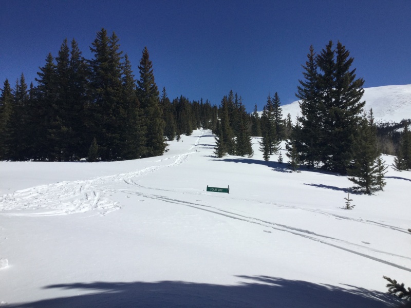
Despite the detour, it wasn't that long until we were back at the car. The drive down seemed longer than the drive up, but I was much happier to subject my Outback than my feet to it. The rain I'd worried about all day didn't start until after we signed out at HQ (though Mariya felt a drop when we were five minutes from the car, and I saw one on my windshield somewhere around Four-Way), and I would learn from talking with Carlos at the gate that someone had canceled their reservation for that day on the grounds of that National Weather Service forecast that had turned out to be much ado about nothing. Suffice to say that I was glad we had not done the same. I'd still generally prefer to wait for bluebird forecasts to do high-altitude hikes with that many ups and downs, but obviously Culebra and Red present certain logistic challenges that all other fourteeners and most other thirteeners here don't. We didn't avoid weather entirely; the stretch of I-25 from Pueblo to Colorado Springs was a sopping mess. From the safety of my car, however, it was a mere inconvenience as opposed to blue lips in the making. The anniversary of the Longs Peak Incident might always be a weird day for me, and I'm not sure I'll ever earn a snowflake for a fourteener unless I cheat and resummit Bierstadt or Quandary or something short and easy during calendar winter (which is how I earned my thirteener snowflake...I hiked Mt. Flora, a peak I'd done the prior summer, in early March as training for Culebra). But unlike my last July 27th high alpine climb, this one went a long way to prove that Murphy's Law is not exacting; sometimes, despite worries borne of previous bad experiences, everything that can go wrong actually goes right.” Awww. Talk about a sweetly simple Season Two opener that also happened to recap a lot of the highlights of Season One years before I would draft and record much of the content for either, never mind that I would discover later on that I had actually summited Flora’s false summit on that training session and would need to go back for the REAL summit in calendar winter in order to truly earn the snowflake icon next to that mountain’s name on my checklist. That aside, I give my younger self a lot of side-eye on a fairly regular basis for the choices that they made that led them - me - us? - to the myriad mental and physical scars present today, but I gotta give them…me…gollum, gollum…oh, whatever!...credit for allowing present-day me such laziness in my present-day podcasting! Alas in some ways that Culebra had gone so surprisingly well where its preceding Handies had gone so surprisingly…not, for the ease of passage even compared to what could be expected for my final Class 2 easy-peasy-breezy walk-up on The List of fourteeners encouraged me not to retreat into its naturally entropic state of laziness. I was motivated to keep going, to keep challenging myself, to put myself once again in a position evocative of the dreaded Longs Peak Incident I had referenced in that Culebra trip report. I was ready, I decided, to return to Class 3 peaks like Longs. As for how that return went, well, I will let the text of “Wetterhorn for Wusses” that I wrote and published the day after this outing I had been thinking - nay, overthinking - for so long speak for itself. Of my August 13th, 2019 return to Class 3, I wrote: “I generally save my trip reports either for something going tragicomically wrong, as happened on my last San Juan outing, or when I've climbed a non-Colorado peak that might be of interest to other forum enthusiasts who find themselves far from home without a route description to download from the 14ers app. I managed to avoid getting punched by a rock this time, and there's plenty of good beta on this very site about how best to approach Wetterhorn's summit, but I thought I'd write a post all the same to answer a question I've seen a few times in various wordings on here, one which boils down to: "Wetterhorn: merely terrifying or Lovecraftian nightmare in mountain form?" In essence, I write this as someone who lets out a high-pitched whimpering noise when examining pictures of Class 3 routes for others who do the same. A caveat up front: this was not my first Class 3 rodeo. I've summited Longs twice before, the second time because of how badly the first one went (short version: I had a two-day hospital visit, though before you let that scare you off the more challenging Front Range peak, allow me to clarify that that had more to do with a bum insulin pump and bad decision-making than the nature of the route), so I had that to draw from. I've also summited Half Dome via the Cables, an experience which I was able to put to use for reasons I'll elaborate on later. I'm not a total wide-eyed innocent to steeper stuff, in other words, so do keep that in mind if you'd rather read the perspective of someone who did this as their first all-hands-on-deck climb. I was able to start from the lower Matterhorn Creek TH, which is rated as "Easy 4WD" up to that point. It's doable in a Subaru Outback, but a sedan or anything with less ground clearance will probably be better suited parking right off the Henson Creek Road, which would add ~5.5 miles roundtrip to the day. If you start from the lower 4WD trailhead, however, you'll only have a 15-20 minute walk to the upper lot. Hikers familiar with Class 1 or regular Class 2 trails won't find anything off-putting up through the yellow-dirt section listed in Bill M.'s route description (or at least not until they're coming down :p ). The first gully, however, is pretty steep and loose in places, and I wound up using my hands for several portions of that section. For me, personally, this wound up being (or maybe just feeling) like the longest section of the whole mountain, which might be encouragement of sorts: make it past that, and the rest isn't so bad! 
There is a caveat to those last ten words, however, because if you make the choice I did at the top of the gully and decide to head to the right of the rocks pictured in photo # 14 in the route description linked above, you'll wind up scrabbling around the side of the mountain with a breathtakingly steep drop to your right. As I crawled rather than hiked across that segment, I honestly believed that it was that portion which gave the mountain its exposure rating of High, and if there was any advantage to be had from taking this option, it was that it made me view the final Class 3 pitch's descent as no biggie in comparison. Oh, and there's plenty of loose dirt in this section, too, which is not reassuring for those of us who aren't half mountain goat. I am not being melodramatic when I say I breathed a sigh of relief on gaining the brief walk-up along the ridge to the notch that acts as a gateway to that final pitch. It was here that I met a retired dentist from Grand Junction who was on his way down. We conversed as he retrieved his backpack, and there seemed a wisdom in following his cue and dropping my own pack there so that I could manage the final scramble as unencumbered as possible. 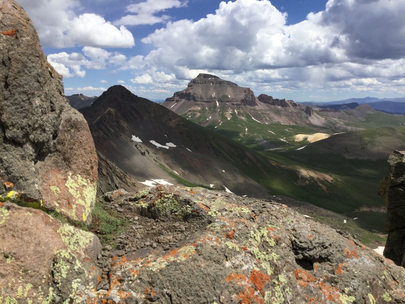
Perhaps, like me, you spent a great deal of time staring at photo # 21 in the route description, thinking to yourself that the slab at the bottom-right of the picture looked like a smooth, easy slide into the yawning void at bottom-left. While I don't think I'd have the guts to cross it under wet or icy conditions, I can say that when it's dry, it's gentler than the section of Cap Hill sidewalk between Lincoln and Sherman, and - at least on the day I was up there - with 100% fewer conspiracy theorists frothing at the mouth about chemtrails and UFOs! Sure, the final pitch is steep, but if you already survived the gully, you'll be pleased at how comparatively stable the rock is. It's not very long, either; while I am faster than I used to be (testosterone is a wonder drug!), it's still saying something to report that it took me ten minutes, max, before I was on the summit. I didn't stay on the summit too long; there isn't as much of one to explore here as there is on nearby Uncompahgre, so it was a quick matter of taking pictures of the surrounding views as well as getting one of the other two guys on the summit to take a victory pic of me with the loftier but easier-access summit in the background. Plus, I'd left the water my parched mouth craved at the base of the final notch, and besides, having started later than I'd initially planned (don't count on the rising sun's light to be your only alarm clock if you sleep at the TH, kids!), I wanted to be back on the sprintable section of trail as quickly as I could in case the clouds heading in decided to bring in reinforcements. 
Part of the reason I had a relatively easy time of the Class 3 pitch's descent was thanks to my experience on Half Dome three years earlier. I'd summited that in spite of having a quasi-panic attack in the middle of the Cables while waiting for the line up ahead of me to move; just as I was trying to figure out how to get back down, it started going up, and in proof that panicky people make GREAT decisions, I went up with it. This actually turned out to be a good call - not only did I make the top, I also had to reach it in order to hear the advice from a Half Dome repeat summiter about the trick to descending: treat it like a rappel. Grab only one cable and use it as a guideline as you slide your feet from step to step. There are, of course, no cables on Wetterhorn, but the same trick of positioning I'd picked up from following his advice applied for me in Colorado; I was able to sidestep or face in most of the way down, which not only forced me to look only as far as my next foothold (highly recommended for fellow acrophobics!), it also allowed me to keep at least one hand steady on its given hold while I took that next step. 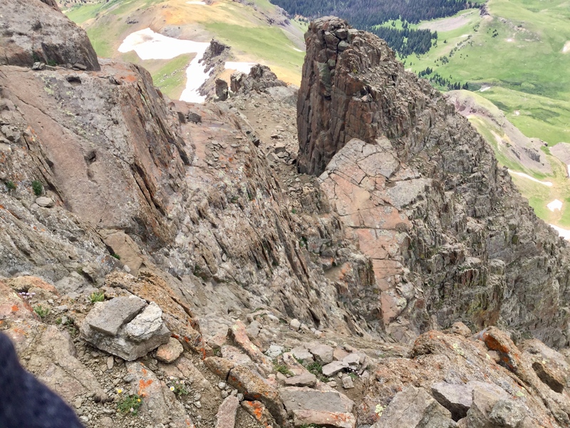
I didn't run into trouble until I retrieved my backpack, pointed the notch out to another climber, and started down. Since I hadn't liked the climbers-right option at the top of that first gully, I decided to try descending the climbers-left option. I would absolutely recommend this option over my ascent route; yes, there's a downclimb involved on the way up that then has to be re-ascended on the way back down, but the exposure is far more forgiving. I have to caution, however, that whichever route you decide to take up is the one you really ought to follow back down, as at least you'll know exactly what you're getting into. Because I hadn't ascended the same route I used to go down, I was clueless about the fact that you need to cross the tops of two gullies before you reach the right one. As it was, I thankfully only got about 50 vertical feet down the first, incorrect gully before realizing that the descent path had its fair share of loose dirt, but not nearly as much as was filling my shoes, gloves, and pants here. While making my way back to the last cairn I'd seen to try and figure out where I'd screwed up, I saw the climber to whom I'd pointed out the uppermost notch waving from above (those darn kids and their super-strength and super-speed!), and he did me a solid by pointing out the cairned notch to the correct gully that I'd missed earlier. 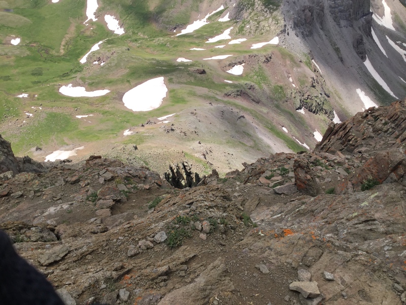
Descending that gully also resulted in a clothed dirt bath, as did my more-slide-than-walk down the yellow dirt section (I’d say that part could kiss my butt, except it kinda already did...twice), but except for a brief slow-down so I could avoid too much slipping on the one unavoidable snowfield that remains, I was in the clear. And good thing, too, since the clouds were now rolling in with a vengeance! The rest of the way back to the car was, for the most part, a literal jog, and getting a ride down to the lower TH from the retired dentist (seriously, sir, if you're reading - or listening - this and ever looking to climb some eastward fourteeners, send me a PM!) helped my tired legs considerably. I was, however, surprised at how relatively good I felt; I'm a little stiffer than normal one day later, but considering Longs had me walking funny for about a week after the second, non-ER-visit-resulting, time I did it, I thought I'd be feeling way worse (though it is worth bearing in mind that Wetterhorn is, in essence, Longs halved). And without the baggage of my first trip up Longs attached, I can now understand why so many forum participants say Class 3s are so much fun! Even if you're sketched out by heights, I'd still say to give this one the old college try, though do make sure you choose a dry day. And do it soon, because even if you do find yourself too wigged out by the upper mountain to get all the way up top, you'll nonetheless be able to revel in the late snow year's resultingly late wildflower season so that you, too, can take approximately 5000 pictures of the columbines decking out the tundra!” 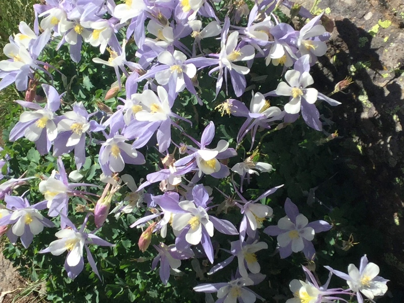

So…yeah. Yet another case of, “Awww! Why does Geo keep bashing fourteeners when there are clearly so many they love with all their heart?” And of course the answer is that love, or at least so it’s perceived by this asexual aromantic, is a complicated sort of emotion capable of turning into hate on a dime. Not to get all philosophical here, but I suspect that if you get used to the high of smooth sailing, the sense of perfection from being with that one person, place, thing, or other noun that produces all those happy brain chemicals, and then one day said noun perhaps unwittingly makes a misstep while holding a knife and stabs you in the back, all those churnings of energy and emotion have to go somewhere, but of course they can’t continue on as gracefully as before. The sea remains, but now the waters become choppy. So it was that Wetterhorn was the last stretch of smoothness that had, unbeknownst to me, pulled me to the edge of the maelstrom, and while the upset in the ocean of geographic mixed metaphors was hardly Wet’s fault, I naturally have it so indelibly linked with the Poe-esque horrors to follow that it’s impossible for me to say in the present whether I truly enjoyed my return Class 3 as much as my gushy trip report suggest I did…or whether I was simply riding high on having survived this reunion with more challenging feats of athleticism than my journey had required since the epically worse Longs. Certainly Wetterhorn’s follow-up would make me retrospectively consider my ecstasy to be more borne of mania. In “Lindsey for the Lily-Livered,” published two days after my August 18th climb (yes, only five days after Wetterhorn!), I could say I made the most of a mountain that would subsequently be closed to public access by the owners of the land on which much of it sits (though as of this writing and recording, it looks like legal access will finally be permitted again at last) and thus even more of a hassle to reach than Culebra, but at the time, my partner and I were in the clear. To return to the previous sentence, however, it would be more accurate to say that the mountain made the most out of me: “(Note [that I started off with]: I'm sure I will eventually run out of easily alliterated peaks, but for now, I'm making the most of my English degree, dangnabit!) Prior to this year, Longs was my only Class 3 fourteener. I wanted to climb more, in no small part to erase the shame of having wound up hospitalized for two days after my first summit of it, but I was a little reluctant, in no small part due to the shame of having wound up hospitalized for two days after my first summit of it. Earlier this season, I finally ran through all the Class 1 and regular Class 2 routes up fourteeners in Colorado, so I had no choice but to move on. With a solid-looking weather forecast as encouragement, I took on Wetterhorn Peak last week, and I was pleasantly surprised by how much fun I had on it! Thus encouraged by the apparent breaking of the Longs Peak Curse, I made plans with Justin, a Texas A&M student in Colorado for the summer, to take on Lindsey...and to do it via the Northwest Ridge route.
The first challenge to be approached consisted of the road. At a rating of 3/6 on this site's ranking system - Easy 4WD - I felt pretty good about my Subaru Outback's ability to handle it; Justin's car could not. Unlike most of the other AWD-necessitating roads I've driven, however, this one lacks a suitable pull-off still in walking distance of the trail itself - there are very few places to pull off, period, after Gardner, and I would not have wanted to take anything less than my 8.7" of ground clearance even to the so-called hard 2WD portion of the road 2 miles from the TH, so if you do have something lighter than a small SUV, I'd make plans to park in Gardner and meet your more gas-guzzling hiking buddy there. Also be aware that Google Maps will try to drop you several miles and fifteen minutes short of the actual trailhead, so just keep going until you reach at least the alleged 2WD trailhead. The second challenge is the flattish first mile. Hikers unaccustomed to fourteeners will likely find this section amazing; those of us who have a few under our belts spend it reflecting on the stats we read about the mileage and overall elevation gain and understand that when said elevation gain hits, it's going to hit harder than the asteroid that killed the dinosaurs. And sure enough, that ascent out of the forest is a strain on the lungs, though one punctuated by views of the waterfall and wildflowers! Still, Justin said nothing about my probable powers of exaggeration when I informed him that, according to my calculations, the climb through the forest was liable to take only slightly less than forever.
The sharp climb breaks for a while just above treeline, smoothing out into gentle, grassy hills with spectacular views of the surrounding Sangres as well as the ridge connecting Lindsey and Iron Nipple. Another steep, this time looser spike is the only route up to the ridge, however.
Once we reached the ridge, Justin and I took a break to hydrate, put on our helmets, swap out clothing layers (him), and gasp for air (me). Then the adventure began. We cut up to the ridge as soon as possible, and for the most part, this did not exceed our expectations of Class 2+ with some exposure on climber's (or is that faller's?) right. When we reached the last point before the crux, however, we realized that we'd made an error somewhere in our calculations. Justin examined the drop between him and the base of the crux wall and declared, "This is definitely Class 4, at least." He then followed up with, "This is more like the Knife Edge on Torreys than the actual Knife Edge on Torreys!" He elected to try and eventually succeed at navigating a path from his vantage point directly to the crux wall while I decided to tuck my tail between my legs and backtrack, perhaps all the way down to the gully. Happily, before I got too far down, a climber already making his descent who looked like he could free solo The Diamond before breakfast told me there was a totally Class 3 way to stay on the Ridge. When I asked him how he'd dealt with the scary, exposed segment my hiking buddy had just been straddling, the downclimber frowned and said, "I didn't see anything like that. There were good handholds and grass where I was." Fortified by this exchange, I went back up a few feet, where, wonder of wonders, I looked to climber's left and saw a clear, easy, direct line of grass and good handholds across to the crux wall exit. Some of the footholds were narrower than I was used to, but thanks in part to the solid-as-promised handholds, I never felt sketched out by the thought of the drop below me. I had to wait at the crux exit for another group of downclimbers as they, out of necessity, let more rocks than good times roll. After a few feet of easy Class 3 scrambling, I then waited again for a duo navigating the top of the crux, one of whom descended directly via the crack. Watching them was enough to convince me that I'd likely need to run through all the Class 3s before I developed the nerve for Class 4 climbing, and while I'd like to think there was at least a smidgen of Class 4 in the route I took up to the left of the crack, I'm pretty sure I followed the straight-up Merely Class 3 option.
The rest of the route up to the summit was a fairly straightforward talus hop along the ridge, most of which I spent thinking, "Okay, this next bump HAS to be the real summit. Okay, this NEXT bump has to be the real summit. Okay, THIS next bump..." When it seemed like I was running out of possible false summits, I pulled myself up...and let out an inarticulate wail of despair - a Great Barbaric Yawp, as a climber who elected to let me lead the way put it - as I saw the real summit a short downclimb and longer upclimb away. I talked to Justin only briefly on the actual summit, just long enough for us to congratulate each other and grab each other's summit victory pics. I then bid him good-bye and wished him luck with the rest of his studies, as he had to be back in Denver shortly enough that he was better off catching a ride with one of the faster climbers already heading down who had offered him a seat.
My remaining summitmates and I agreed not only that Lindsey was our mutual top pick for Least Favorite Fourteener Ever and also that the ridge route was sufficient fun going up that we did not need to repeat it on the way down. We thus decided to join forces to take on the gully for our return. The pros of this: not as steep or, well, crux-y as the ridge! The downside: much, MUCH looser than the ridge, and since it is still rated Class 3, albeit the Easy side of it, there are still a couple moves that will have you questioning every life choice you made that led you to that point.
Fortunately, these brief steep sections where facing in may be preferable are indeed brief, and since I was near the back, I had the distinct advantage of being able to watch as well as be talked through those maneuvers. The exit from the gully back to the saddle is loose but no biggie compared to what came before - there are sections of the upper gully where it is necessary to go one at a time, as there is no way to avoid knocking at least a few smaller rocks loose.
The rest of my group pulled ahead of me once we were all back at the saddle, which was fine, since I knew the rest would be tedious for me but not dangerous. I did find myself mincing down both the steep sections, however; while I generally prefer not to carry trekking poles on Class 3s as I find them more of a hindrance than a help, I would've benefited from carrying mine up to the saddle and retrieving them on the way down - the extra balance points would've been nice! Still, aside from missing the logs my hiking buddy used to get across the creek on the way up and thus making some of my ascent in wet socks, then forgetting about them on the way down and thus returning to my car with wet socks (fortunately, I had my sandals to change into anyway!), the forest side of the ridge was nothing unmanageable. Nevertheless, I was glad Justin had caught a more efficient ride down...he’d needed to be off the mountain by noon, and despite our 6 a.m. start, I did not return to my car until 3:30! This one did knock more out of me than I had anticipated; I was hoping I'd be able to stay in the Sangres to climb Kit Carson and Challenger the day after (I'd originally planned to do them the day before Lindsey, but those plans got scrapped by a low-oil light on my car that I worried meant the undercarriage had had a too-close encounter of the rocky kind on the Matterhorn Creek road - it happily turned out to be much ado about nothing, but better safe than sorry!), but after sagging into my driver's seat, I decided to wait until I was less wiped to take on a twofer that requires a re-ascent of the first half. A dinner of solidly mediocre Arby's at the Monument Flying J and a quick shower before bed capped my day, and while I am disappointed that I felt it necessary to sit at home and let such a gorgeous day slip past, the fresh bruise on my right butt cheek is reminding me that I don't need any more rocks jabbed into it just yet. And if I need any laurels to rest it on, there is the fact that I successfully summited Lindsey, which means that I can safely tuck that peak in my One and Done file...though there will be the matters of Iron Nipple and Huerfano when I start focusing more on thirteeners.”
Well, all relationships go through rough patches, or so I’ve heard. It just takes a little work and patience to get back to the smoothness. Perhaps if I kept focusing on how exciting it was that I could now get high-altitude sunburn in places that public nudity laws had previously demanded I protect, I could push through to find the fun I had allegedly experienced on Wetterhorn and the fondness I had found on my successful second summit of Longs that totally wasn’t borne of some sort of mountainous offshoot of Stockholm Syndrome, even retrieve that fondness to such an extent that I actually would someday seriously consider thirteeners outside the Front Range that don’t have nicely graded trails or at least walkable routes going all the way up them? Certainly the mental health professionals studying such a syndrome would find some sort of academic treasure trove in my subsequent summits to then-legal Lindsey as documented in a trip report that kept up my love of alliteration, “Kit Carson and Challenger for the Kinesthetically Cowardly and…Challenged,” for oh, how challenged I was indeed. This seems quite evident from the very beginning of the report I wrote of my August 25th climb: “I don't know whether congratulations are in order or not. Merely one week after I declared Mt. Lindsey my Least Favorite Fourteener Ever, its title was usurped by Challenger Point. But more on that later. To try and keep things in some semblance of order for my hiking-fried brain (also sleep-deprivation-fried and food-deprivation-fried...suffice to say that "listen to your gut" is NOT good advice when said gut is telling you that it is too urpy to eat breakfast right before a Homerian epic of a hike), I'll recount my latest adventure chronologically, starting with the drive, whose dirt road section was mercifully shorter and easier than both Matterhorn Creek and Lily Lake but did have some large ruts/bumps just before the TH that had me thinking, "Wow, it's like driving on my own personal set of rock-hardened sand dunes!" as I thumped my way over them in the dark. I did not see any cars smaller than my Subaru at the TH, and I would not want to try taking a lower-ground-clearance vehicle past that section of road. I'd set out with the intention of beginning my hike at 2 a.m., knowing that it was going to be a long one and that steep slopes - of which both peaks on the route promised decently lengthy (in my reading, anyway) sections - slow me down to a pace akin to that of a glacier making its way uphill. Buuuut the National Weather Service promised a full day of sunshine, and the hardest section wasn't even, like, real Class 3, and I was tired when I got to the trailhead, so I set my alarm for 2:30. After a good deal of time dithering about maybe resetting it to 4 when I woke up on my own at 2:16, I finally made myself get out of the car and gear up, hitting the trail at 3:36 - only 96 minutes later than planned! Thanks to the cakewalk that is the trail leading up to the gully, however, I did meet my goal of making the Willow Lake campsites by dawn. In some ways, though, I wish I'd had the mojo to get my rear in gear just a few minutes earlier - I had a clear enough view above the trees to be awed by the sunrise, but I kinda wish I'd gotten to see it from above Willow Lake to capture the colors reflected in the water.
Not long after the lake, the trail starts to climb for real, and not long after it does that, in the manner of the frog being slowly cooked to death in ever-increasing temperatures, the trail starts getting steeper and looser as it approaches the infamous gully. It makes one tragically noble attempt to reassert itself to cross a swath of grass before vanishing entirely under the rubble of stones and dirt known as Satan's Diarrheic Backside...I mean, the Challenger gully. I say to you, ladies, gentlemen, and those like me who don't quite fall into either category, that in my humble estimation, reports of the Challenger gully's sheer heinousness have been greatly *under*exaggerated. Rocks that looked as though they should have been firmly planted in the ground gave way when I pressed on them lightly; one whizzed past with such ferocity that I was still gaping at it in horror when the climber next to me (not below, thankfully!) reflexively yelled, "Rock!" on my behalf. But just as all good things must come to an end, so too must all bad things, and eventually, I found myself working my way over the more-stable rocks that pock Challenger's summit ridge...although, in proof that I was right to think, "Well, isn't this turning to a hate-screw of a hike!" only with less family-friendly wording about a quarter of the way up the gully, even the easier ridge-hop turned into a False Summit Extravaganza. I did reach the summit at last, though I neglected to make a note of what time I got there. It didn't matter anyway, however; I had already decided that, despite not feeling like I was on my A game (B+ game, perhaps...not bad enough to turn around, but at no point did I feel like I was crushing it), I was going on to Kit Carson anyway as long as the weather looked good. As I told my summitmates, "I am never doing that gully again if I can help it!" Even the sky commiserated with my gully-averse sentiments, because there wasn't a cloud in it. A few Challenger summit pics later, and I was on my way to the allegedly harder peak. I'd read enough about climbers having trouble correctly locating the Kit Carson Avenue exit on their way back to Challenger to be concerned - I've gotten, shall we say, unintentionally creative with route-finding before, and this outing promised to be taxing enough for someone of my limited abilities without me needing to backtrack up the steep slope below the route in order to figure out where I'd screwed up. I'd come prepared to idiot-proof myself, though: my trekking poles, which I usually leave in the car for Class 3 scrambles, accompanied me on this one, both (I hoped) to give me extra stability descending the gully and as a personal marker that would guide me back to the exit. Having already proven their worth on the Avenue's downward slope to the start of the KC gully, I propped them up a short distance above the trail segment leading to the exit.
Perhaps the three "real" Class 3 fourteeners (since I did Lindsey's NW Ridge for my ascent of it, I figure that counts!) I've climbed have given me a swollen head, but Kit Carson's final pitch barely registered as anything to worry about. Sure, it was steep enough that I needed to stop and gasp for air multiple times on the way up, but what loose parts couldn't be avoided by sticking to the solid rock on climber's left were brief and more easily navigable than Challenger's. At 10:50 a.m., I was on the summit, enjoying a nice moment of breezeless blue skies while I took in the views...and flipping off Challenger from its loftier neighbor's perch.
Despite my precautions, I nonetheless worried I'd screw up on the way down and somehow overshoot my poles and, by extension, the Avenue exit (or is that on-ramp, if you're returning to it from KC?). Honestly, though, I don't think I needed to use the poles as a marker at all; as long as you continue sticking to the overall solid rock on climber's left (downclimber's right, if, like me, you still need to make an L with both hands to figure out which is which), the good-sized cairns marking the exit will be in your line of sight before you know it. Climbing back up the Avenue and, eventually, Challenger ranks highly on my list of Things I Am Happy Never to Do Again. Even as I reflected to myself on the shorter peak's summit that, "It's all downhill from here!" however, I immediately recollected that a good chunk of that downhill would be torturously steep and loose. I was almost grateful for how much longer the rock-dance along the ridgeline seemed on the way back than on the way up...almost.
The first part of the descent into the gully wasn't so bad. I clung to the solid rock on my left with my left hand and used my right trekking pole for stability as I side-stepped down into the lost chapter of Dante's Inferno; my 94-year-old, walker-using grandmother has a smoother technique for descending the occasionally necessary staircase, but hey, she didn't get to be 94 by throwing caution to the wind! When the rock wall railing ceased to be an option, my crabwalk only worked so much before it turned into a full-on slide. I suspect that I may have singlehandedly - or is that singlebuttedly? - contributed to roughly 90% of erosion taking place on Challenger Point in 2019. Eventually, my new gravel underlayer and I reached the still-steep-and-loose but at least less sketchily so bottom portion. This part, which I also didn't recall being as long on the way up, was positively tedious on the way down, and I practically kissed the first switchback I saw, because I knew that meant I was back on walkable ground. I reached treeline at 4:20, found a good rock to shuck my climbing helmet, shake rocks out of my boots, de-layer, and re-apply sunscreen (if a bit too late). I reassured a guy who'd had to bow out at 13,000 feet due to leg and foot cramps that a) he'd absolutely made the right call and b) that I'd talked to his buddy near Challenger's summit and that he probably wouldn't be that far behind me, given how painstakingly I'd descended the gully. Once I was ready to go again, I booked it - it would not have been the end of the world if I'd still been on the trail after dark, seeing as how I'd had my headlamp anyway for the ascent and had even brought extra batteries for it, but I wanted to avoid breaking out either of the above if at all possible. I had to run the last half-mile of trail or so, something my exhausted legs were not thrilled with, but I did make it back to my car just as the sun was nestling out of sight behind the trees on the hillside above my car.
I checked my phone as I unlocked the car. 7:49, which meant for a 16h13m hike - not quite a Personal Worst for hiking time, a distinction still held by by my 16h33m on Longs, but impressive nonetheless! Still, considering this route had not one, but two peaks with a hefty amount of steep off-trail scrambling, not to mention a re-ascent of the first peak that essentially leaves one summiting three peaks in one day, I was content to have finished at all, and in the very last microsliver of daylight, to boot. To think that last week, I'd hoped I could've done Lindsey and this troublesome twosome in two back-to-back days! I'm now glad circumstances conspired against me; each outing gave me a thorough beatdown, and even though my hobbies clearly mark me as a masochist, even I can only take so many spankings in one weekend. But even though I tell myself I'm content with the thought that the East Coast travels I begin tomorrow will keep me from seeing a fourteener for at least a couple weeks, I already have the info for Blanca and Ellingwood downloaded on my phone.”
An argument could be made that most of my history of fourteeners is a record of what-ifs. What if I really had quit after summiting Pikes, my second fourteener, like my dad had and like I fully intended to? How many Ph.D.s, New York Times bestsellers, and Academy Awards would I have had by now if I had decided not to override everything else in my life in pursuit of peaks that only a minuscule fraction of the population even knows about, much less has any interest in? Putting aside, of course, that there are those out there who manage to complete The List while still having A Life on flatter ground - hell, I actually did manage to write and sometimes produce films, then promote them at festivals for a few pre-COVID years during the height of my list-chasing, including during the time period covered in this very episode - I can only wonder what might have happened had I fully absorbed a message I would start to promote on the .com forums when I was nearing the end of my remaining fourteeners and acted on it for myself: this is - was - only a hobby. It’s supposed to be fun. If it stops being fun, stop doing it. I say that here because Challenger, especially its horrid gully, was so much the antithesis of fun for me that that point - no, not even a peak! - would remain the low one of my fourteenering journey for another two years after I put it in my rearview mirror (and, to be a little TMI here, in my pants’ newly made rear ventilation shafts), technically for three, as it would not be until 2022 that I would finally summit my next major nemesis peak that is in fact a peak…but more on that later, although it absolutely ties into this particular tangential segue about how much different in a most-likely better way my life could have been if I had only picked up on the trend I had been lamenting as I tackled new-to-me Class 3 mountains and then wrote them up in trip reports: ever since Wetterhorn, each new entry was quick to take Grand Prize in my personal ranking of Worst Ever. The next one I climbed after an out-of-town film festival lap that gave me a bit of obviously needed space to consider what I was doing with my life (space that I clearly left empty of any consideration of the sort) did not usurp Challenger’s place as dead last in my Hate List, but it certainly did not redeem Class 3 routes in my eyes…to return to and further torment the nautical metaphor from my earlier discussion of it, that ship had sailed after violently ejecting me as it went head-to-head with a tidal wave. Nevertheless, Sneffels did make an impression on me, though less of one than it really should have; if ever there had been a time for me to take my own preaching of “this is supposed to be fun, stop doing it if it’s not” to heart, it probably should have been after Sneffels. I’ll let the text of my September 13th - a Friday! - recap of “Sneffels for the Sniveling” hopefully speak to the hows and whys that first addressed what would become an unfortunate trend in my trip reporting where I would find myself unable to write and post one until weeks, sometimes months, perhaps (as evidenced by my Winterlude reports of events taking place in 2019-2020 and not receiving their authorial due until five years later) years later: “(Apologies for the lateness of this report relative to when I climbed the peak; I usually try and type these up 1-2 days after my return to Denver in hopes of better ability to remember and report important info, but I do have an admittedly flimsy excuse that will become clear later on...) My last fourteeners before driving out to the East Coast for a Labor Day Weekend film festival and meeting with a filmmaking connection from a prior festival were Kit Carson and Challenger. The latter’s gully scarred me in oh so many ways, and so thoroughly that I would not have been displeased to return to the Centennial State and find that an early September blizzard had dumped enough snow to effectively call off the rest of summer 14er season. Or so I told myself. In reality, I spent much of my travels itching to get home before Colorado’s climate could do its usual fall-skipping thing in the high country, because while I was not unwilling to slog up the Sawatches’ Class 2s once they had a light dusting of snow on them, my still-tentative levels of comfort with Class 3 terrain meant (and mean!) that I will only tackle it on a sunny, dry day. Friday, September 13th promised exactly that for Sneffels, which was good, because Curtis and I had both agreed at the trailhead that we had been sufficiently traumatized by both Challenger’s gully as well as our descents of Lindsey’s and so wanted to do Sneffels’ sustained Class 3 SW Ridge coming and going. Curtis immediately took off in the direction of the upper trailhead, though he reassured me that he liked my pace just fine, as it was gentle enough that he’d avoid tiring himself out before his planned Wetterhorn attempt the next day. ”Good,” I managed to wheeze between the desperate gasps of lungs that were trying to adjust to going from 14’ to 14,000’ in less than a week. The trail’s pitch eased after we passed the upper lot, occupied at that time by only a single Tacoma whose driver clearly didn't possess an amygdala, and on the short stretch before Blue Lakes Pass, we picked up a group of brand-new-to-C3 hikers who would subsequently bail on following us up the ridge (and just as well - for reasons that will be made explicit soon, I would not recommend this route for a first Class 3) as well as Jack, an Iowa native and recent college graduate who was brand new to fourteeners. We blithely convinced him that it would be much more fun to come with us rather than descend the pass - he had camped at Blue Lakes the night before - and enter the gully that seemed to sneer at all who passed within its sightline.
The first section of ridgeline-adjacent scrambling was steep with a few loose-ish portions, though most likely nothing compared to THE gully, and I was pleased with how intuitive route-finding was. We passed through the notch serving as a gateway to the downclimb in good spirits, and my faster buddies quickly left me in the dust covering this steep, slide-y section. But this, it turned out, was just as well. I was still taking my sweet time picking my way up and over the rocks that the cairns led me to believe were a far more efficient path to the next gully over when I heard a thunderous crash and a frantic bellow of "ROCK!!!!!!" followed by what sounded like 85% of the mountain rolling and tumbling down the very gully to which I was straggling. Most likely the clamor only lasted thirty seconds, but it seemed like ten minutes had gone by before I felt I could exhale and yell over a profanity-prefaced, "Everybody okay?!" Curtis then shouted back, "Yeah, I think so." As he sounded way less than 100% confident in that assertion, I put a move on it as much as I was able to and scrambled my way over to the crux-bearing gully. I seem to recall that Jack was still lying prostrate shortly below the crux, wind clearly knocked out of his sails. I mostly stayed out of the way as he slowly got back to his feet and got the story on what had happened: once Curtis had reached the top of the crux, Jack had attempted to follow him. Unfortunately, he'd put most of his weight on a boulder that had looked a lot more rooted than it actually was, and it had hit his leg, torquing his foot and ankle as it hurtled past him. From the sounds of things, he'd gotten off pretty lightly, but it was no surprise that he was wincing as he tried to put weight on the injured foot. I hung back with him while Curtis continued on to do some route-scouting and also to make sure we were as clear of small projectiles hurtling in from above if/when we decided to go up and on. Despite the shock and pain, Jack was thinking about going on - it only hurt when his weight was on the side of his foot, he insisted - and while I had reservations about encouraging an injured first-timer to keep a stiff upper lip, even I had to acknowledge that it would've been hypocritical of me to make any sort of definitive statement on those lines, considering I've gone on to summit on plenty of occasions when it would have suited me far better to turn around.
He elected to keep going on for as long as he could handle it, and he further elected to let me be the guinea pig for navigating the crux now that Curtis was solidly uphill from us. I first tried using a series of small cracks on climbers' right as holds; my right foot quickly slipped off a protrusion that wasn't enough for the worn-down nature of my hiking boots, and the jolt was enough to rip my fingers from their purchase and send me flying three feet down and back...and onto Jack. Jack's injured foot, to be precise. I alternated between profuse f-bombs, apologies, and "Are you all right?!?"s as I steadied myself, made sure the only blow I'd taken was to my ego, and reassessed. Most likely climbers who don’t totally suck at climbing could've made something with the path I'd just tried; I would clearly need to figure out another option. The rocks across the gully from me - on climber's left - also looked steep, but they looked nubby enough to offer decent handholds. I picked my way over and started up, grimly satisfied when the pitch eased and I could see Curtis not too far above. Jack had his chance at inadvertent revenge on the next pitch up. I'd offered to let him go ahead; injury, first time fourteener-er, blah blah blah...he was still faster than I was. I waited below while he took the most obvious option to get up, my hand waiting on the rock I planned to use as a hold once I was clear to do so, staring vacantly in the direction of a summit I still couldn't see yet and wondering why, unlike most of the other early- to mid-thirtysomethings I knew, I couldn't be content with dreams of career advancement and family-having and -raising; nooooo, I could settle for nothing less than a series of physical challenges that very few people besides me would understand or care about and which would leave me regularly sucking wind at best and kill me at worst!...when I heard a soft exclamation of, "Rock!" from above. I was too lost in my self-mocking reverie to pull my hand back before the foretold missile in question clattered down from beneath Jack's feet, exhibiting what seemed to me a sadistic delight in mashing the middle finger of my left hand before it continued bounding merrily down to the crux wall below.
The rest of the way to the final pitch thankfully proceeded without further incident, though my own injury quickly proved to be a disproportionate source of aggravation; in proof that my mama was right and I really *am* special, I'm among the 10% of humanity's lefties, and having my preferred grabbing and pulling hand suddenly compromised in terrain where I needed to do a lot of grabbing and pulling was not ideal. Nevertheless, I didn't think much about the steep rock separating me from the summit and perhaps wouldn't have thought about it at all until just below the ridgeline marking the last 50' or so from success, when Jack got sketched out by what I can only guess was some combination of the pitch and the somewhat miserly nature of the holds I was using (though they were far more forgiving, I thought, than those on climber's right of that crux wall!). He shook his head as I got to a decent resting spot and declared that it looked like too much for him, under the circumstances. While it would have taken nothing less than the advent of the Apocalypse to make me turn around from where we'd been (and despite Curtis, who'd been watching our progress from a summit he'd long since shimmied up, frantically insisting that it wasn't that far, really!), I completely understood where he was coming from. After he confirmed that he felt pretty good about his ability to get down from where he was, I wished him well and silently wondered if he was about to spread word to Iowa about Coloradans being stupid, crazy, or both. Curtis and I took our time on the summit; there was no weather to be seen, and like its fellow high-statured San Juans, Sneffels has some stunning landscapes surrounding it! Eventually, though, we would have to make our way down. The altitude must've suppressed our mutual too-recent memories of both Lindsey and Challenger, because we seriously considered descending the infamous gully; eventually, our mutual too-recent memories as well as a desire to make sure Jack had someone around for backup in case he got stuck somewhere sent us back down along the ridgeline.
The rock face below the summit did seem significantly steeper and more exposed on the way down than it had going up, but after a few backtracks and roundabouts to circumnavigate a few small gullies whose looks gave me the pukes, I met a very patient Curtis back at Kissing Camels. All too soon after, I found myself staring in despair at Curtis, seated safely atop the rock wall I'd been scrambling when that morning's boulder had unleashed its fury on Jack, then in even more despair down the crux as Curtis explained to me what he'd done: started down climber's left, where I'd been that morning, crossed the gully to climber's right, where I'd fallen onto Jack. I mumbled a repetition of what he'd just told me, trying to tamp down the panic that threatened to turn into tunnel vision as I gaped down the drop-off to the gully floor below. It wasn't that far, really; 6-8', at best. Plus, the few remaining bits of my rational side reminded me, I'd come up it scant hours before and hadn't found my ascent route to be noteworthy in any major way, other than being better than my first attempt of the sleeker stone across the gully. Surely, if I just recollected and reversed what I'd done then, I stood a chance of beating my Friday the Thirteenth odds of having my obituary bleat about my demise at the whims of a mountain named after a long-lost Muppet!
My first step was, I decided, to ditch my backpack, a move I'd elected to take when I'd been facing the business end of Longs' Chockstone a few years before. What somehow failed to occur to me on Sneffels was that the base of the Chockstone is a lone flat respite in an infernal vortex of steepness; I was as mortified as I was grateful that no one was down below when my pack hit the gully floor and kept sliding to ever so slightly downhill of where Curtis was sitting. The embarrassment did, at least, cut a bit deeper into the panic, and now unencumbered, I was able to look down from my perch. The foothold below me didn't look super prominent from my angle, but it was there, and it looked like it was reachable even for my short legs. I clutched the edge of the rock I was sitting on, pressed my abdomen into the smooth wall beneath it, and extended my foot, which quickly - and easily - found purchase. Another stretch to the next protrusion below and to my left, and then it was a hop and skip into the gully. Curtis was kind enough to wait until my still-quavering hands fumbled at the buckles on my retrieved pack to tell me that the crux wall I'd just descended was just as bad as anything he'd seen when he'd done Capitol and Little Bear. I am not sure yet how to feel about that assessment; on the one hand, since I survived the crux, then maybe I can achieve my dreams of finishing Colorado's fourteeners after all! On the other hand, I am probably going to have to find a new therapist and potentially a prescription for anti-anxiety medication for that to be a realistic goal.
The rest of the route back to Blue Lakes Pass was slow-going for someone with a terrible sense of balance and no trekking poles, which I'd elected to leave in the car for a route that had such a small trail-to-scramble ratio, but it wasn't anything I couldn't handle, and my guilt had been assuaged some after Curtis told me he'd seen Jack reach the pass safely. My own descent to the pass offered me plenty of opportunities to photograph my purple, swollen, unbendable middle finger with Sneffels' ridge as its backdrop in what is only an injury photoshoot and totally not me flipping the mountain the bird, I swear! Below that, I enjoyed my stroll in the abundant sunshine, happily accepted a Jeep-driving couple's offer of some ice-cold waters they'd stored in a cooler in their trunk, and amused myself taking video of the outhouse and speculating as to why its only lock is on the outside.
Then I got in my car and returned to Denver, cursing much of the way as I realized that, in addition to flipping off fourteeners, my favorite finger was also my go-to for manipulating my car's turn signal. Typing, I knew, would also be a literal pain; even if you're not a writer, like I am, everyone who uses a keyboard eventually needs the D. Most of my non-essential scribing endeavors - such as, say, trip reports - were going to be reclassed as low priority until I'd regained some flexibility in my damaged digit. But even if you don't incur an annoying injury (that was entirely my own fault for not pulling my head out of my rectum in time, let me be clear!), I can't say as I'd recommend the SW Ridge as a first Class 3 fourteener route. Sure, Jack's misfortune was, indeed, mostly a matter of bad luck, but I suspect Curtis and I were able to avoid similar traps just by virtue of having tried and tested seemingly-solid-but-ultimately-not-holds on similar terrain in the past, and perhaps it seemed so second-nature to us to do those tests that we didn't bother explaining the technique to the poor sod we'd talked into coming up with us on the grounds that we were totally gonna have a better time on the ridge, dude! I have no doubt that the gully blows chunks, but I'd be willing to bet that it's a less dicey proposition overall for those new to going off-trail at high elevations. Jack, I hope you're back safe in Iowa and that you come out to Colorado again. Hit me up, if you're so inclined, and I promise I'll take you up something way more boring next time.”
I did not hear from Jack after that, so I have no idea whether or not he returned to Colorado and went for a revenge story of his own that he could someday spin into a season or two of podcasts about the regrets and remorses related to said revenge. I do know that while my next two fourteeners were boring relative to what I’d just been through - spoiler alert for the next episode of my podcast in that I finally did get around to using the info on merely Difficult Class 2 Blanca and Ellingwood before the end of 2019’s Normal People Climbing Season! - overall, my remaining list would become less and less boring…and the amount of adrenaline a given peak incited was inversely proportional to how much I liked it. Which seems like as fine a pivot as I can make to the ABC After School Special Lessons Learned portion of this particular episode. Similarly to the AASSL (hopefully the middle three initials don’t trip the Explicit Content notification) from my last non-wintry episode whose events took place, I find it necessary to throw out a reminder, only two months and four days before the culminating incident of this episode, I’d say the biggest lesson I learned was…hahahaha, what lesson?!? At least this time I hadn’t walked away with a still-oozing head wound that necessitated emergency medical treatment, but I had gone into what I’m pretty sure was the beginning stage of a panic attack and accumulated still more physical damage (although the finger has made a full recovery, as numerous drivers operating their vehicles in ways I do not approve of can attest to). And poor Jack! If indeed he never did return to my home state, I certainly can’t blame him. But of course, there would be no further stories to tell if I had learned my lesson and quit while I was still ahead; had I realized that the amount of fun I was starting to have was equal to the amount I was getting paid to have it, I could’ve wrapped up this series last year with this as the closer. Instead, the show apparently had to go on, and while it would briefly follow the trend laid out in this as well as the Handies episode of some comparatively pleasant climbing followed by some…not so pleasant times, consider this more or less the beginning of the end of anything bearing a passing resemblance to dreamy-eyed nostalgia - and given my writing style, you can certainly only imagine how much more hellish the remainder of my fourteeners would be in my eyes if what preceded them could be considered comparatively pleasant! Thumbnails for uploaded photos (click to open slideshow):  Not as innocuous as it looks.")
 More innocuous than it looks.")
 The real highlight of the day.")
")
")
 Just below the notch, maybe? Perhaps I ought to revisit this one...")
 I had a theme to maintain!")
|
| Comments or Questions |
|---|
|
|
Caution: The information contained in this report may not be accurate and should not be the only resource used in preparation for your climb. Failure to have the necessary experience, physical conditioning, supplies or equipment can result in injury or death. 14ers.com and the author(s) of this report provide no warranties, either express or implied, that the information provided is accurate or reliable. By using the information provided, you agree to indemnify and hold harmless 14ers.com and the report author(s) with respect to any claims and demands against them, including any attorney fees and expenses. Please read the 14ers.com Safety and Disclaimer pages for more information.
Please respect private property: 14ers.com supports the rights of private landowners to determine how and by whom their land will be used. In Colorado, it is your responsibility to determine if land is private and to obtain the appropriate permission before entering the property.
 March 2019 was an especially ambitious time for a first snowflake attempt.
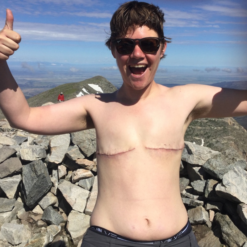 Might need to climb a few more fourteeners before I've got the abs for Grindr, however.
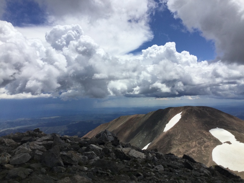 Taken on the return, when clouds and fatigue from having navigated its saddle twice made it look way less beckoning.
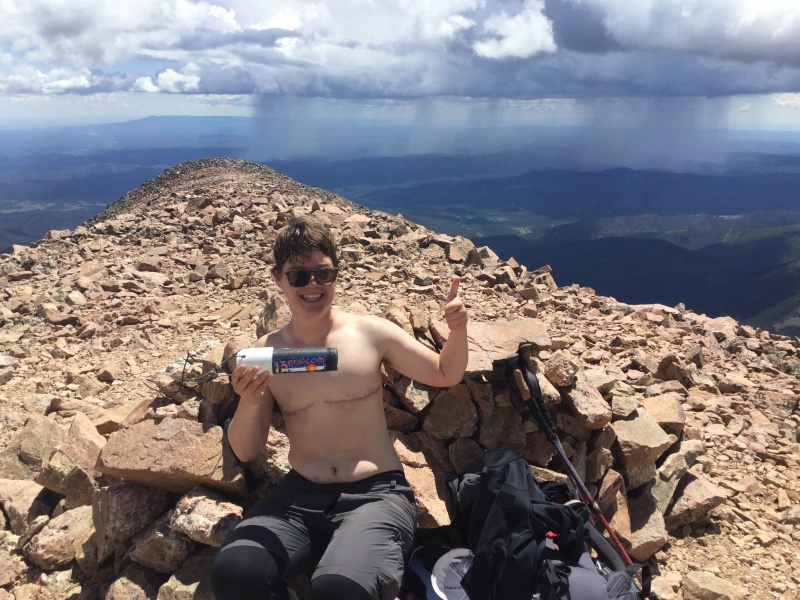 Maybe I can use this one for Grindr and claim that the 13 in 13ers represents the size of my...uhhhh...backpack. 'Cause it's 13 liters. Yeah.
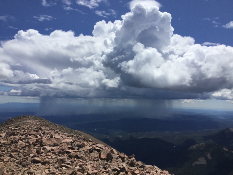 Much better appreciated from a distance than from within!
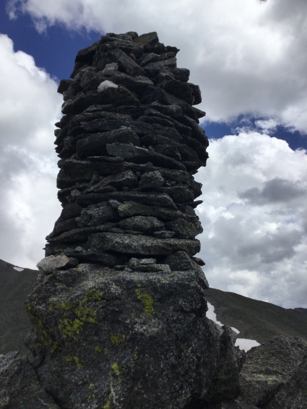 Maybe I can post this to Grindr and claim it's a selfie.
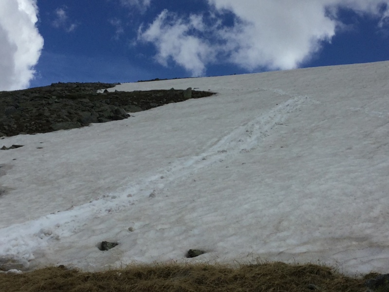 Apparently it wouldn't be a July 2019 hike without a little glissading on the way down.
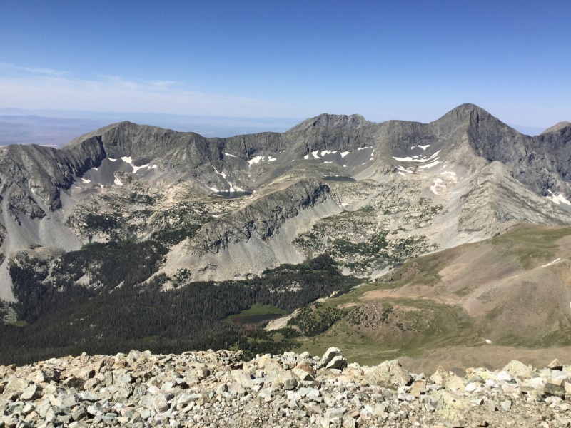 Which, if nothing else, does give you nicer views of Lindsey's outstanding neighbors, though I grabbed this particular shot from the summit.
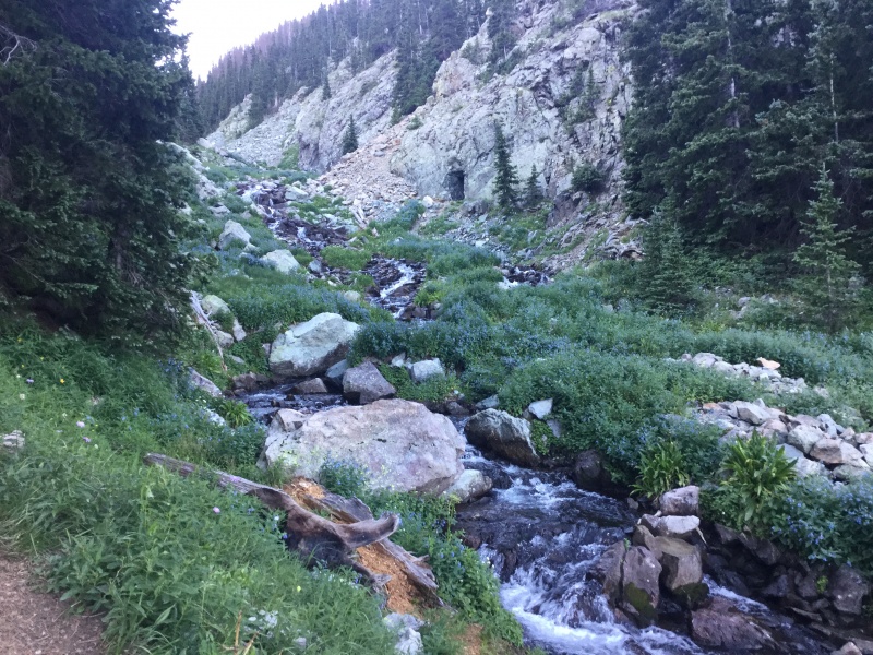 As you marvel at the eons it took for that water to shape the valley in that particular way, you may find yourself wondering why that stream was in such a hurry to get down that it couldn't have been more considerate of your spasming thighs.
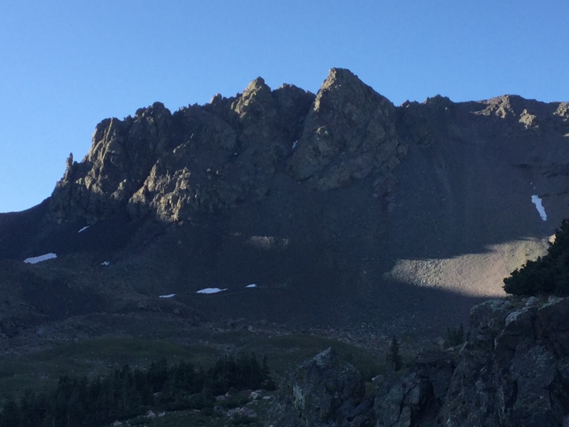 Enjoy this view once you reach it, because it only goes uphill from here...and in varying degrees of sharpness, at that!
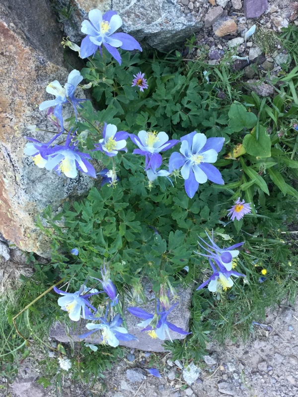 I was too hell-bent on routefinding and combating my occasional surges of vertigo to take pictures between splitting off from the standard route and reaching the summit, so in lieu of any visual imagery that might actually be useful for slightly anxious Lindsey trip-planners, have some pretty flowers instead!
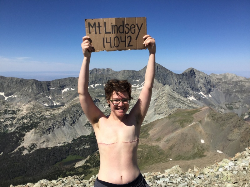 But what a victory pic it was!
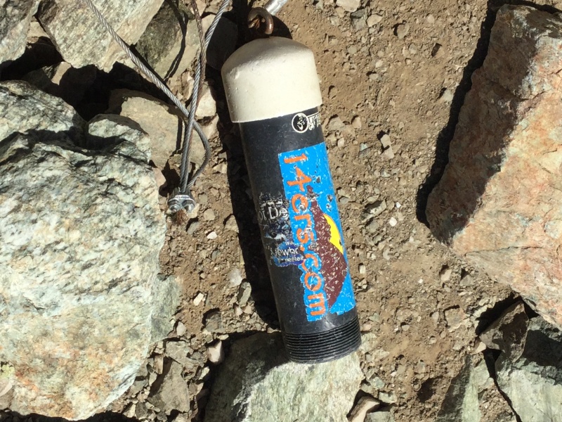 Further cementing Lindsey's status as my current Least Favorite Fourteener is the summit register tube...which was empty. If anyone sees a short-ish, bespectacled person of indeterminate gender wandering around Cap Hill, cursing Lindsey with every other breath, it's not because of a bad breakup with a newly-ex-girlfriend.
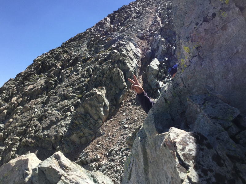 Group sweeper Johnny's fingers serve as a reference point for one of the steepest sections of the downclimb, one which I did not descend facing in; I instead mostly used a position that will have the gynecologist-visiting members of the forum cringing when I refer it to as "Feet in the Stirrups."
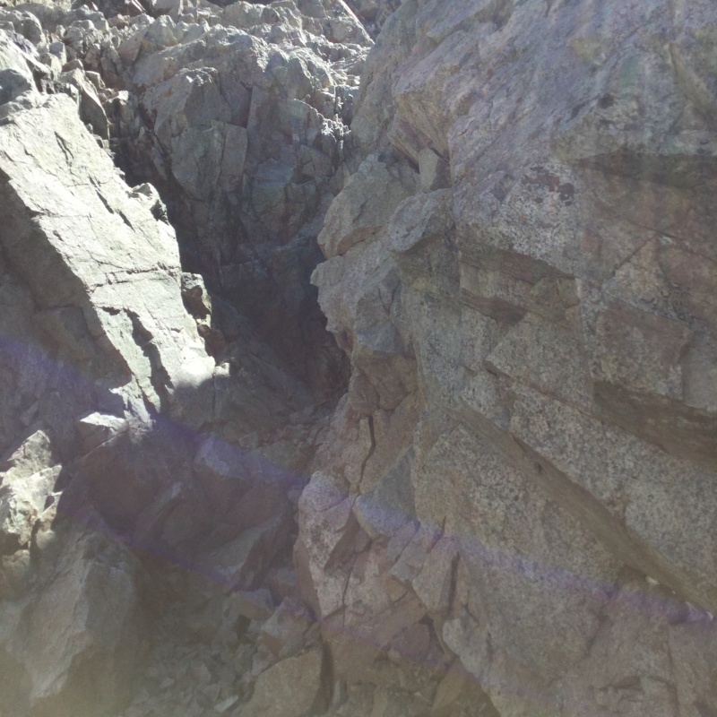 J.J. Abrams approves of this shot of the final tricky section on the descent. I came down near the crack in the darkest section at center of the photo, and that time, I was facing in.
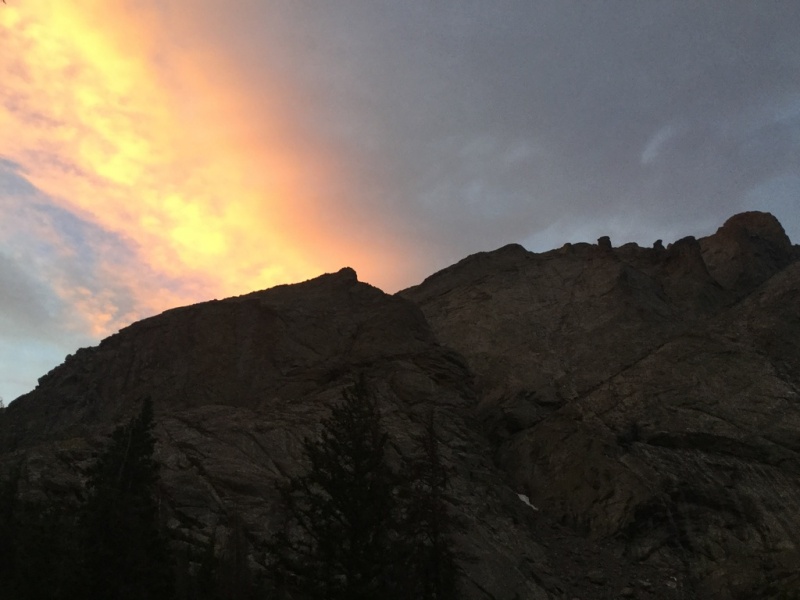 Still pretty impressive.
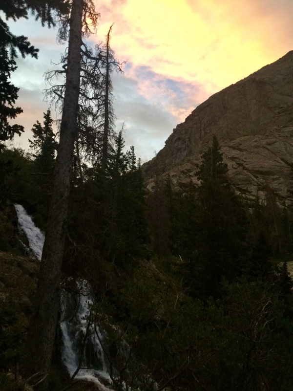 I guess I did get some water in one of my sunrise pics.
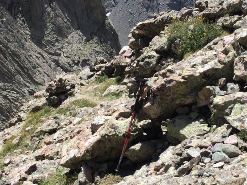 I'll admit to worrying a little about whether I'd have to make a forum post today asking if anyone hiking Kit Carson in the near future could keep an eye out for my poles.
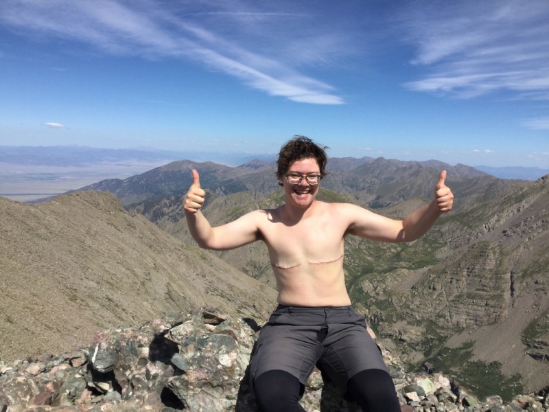 I saved the one-finger salute for when I had the summit all to myself, though I have heard that in some cultures, an upraised thumb amounts to the same intent.
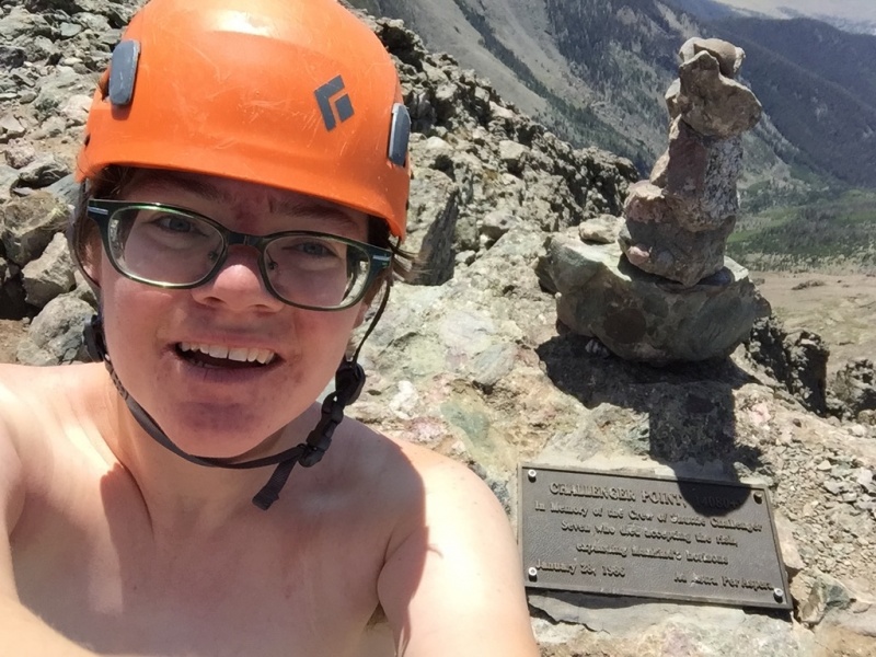 I plan to use the selfie I took on my re-ascent when I audition for a Village People revival.
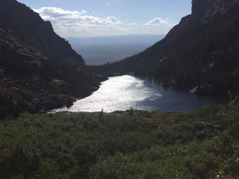 Given how late it was already, I briefly considered waiting until sunset just so I could have a lake shot with pretty colors in it.
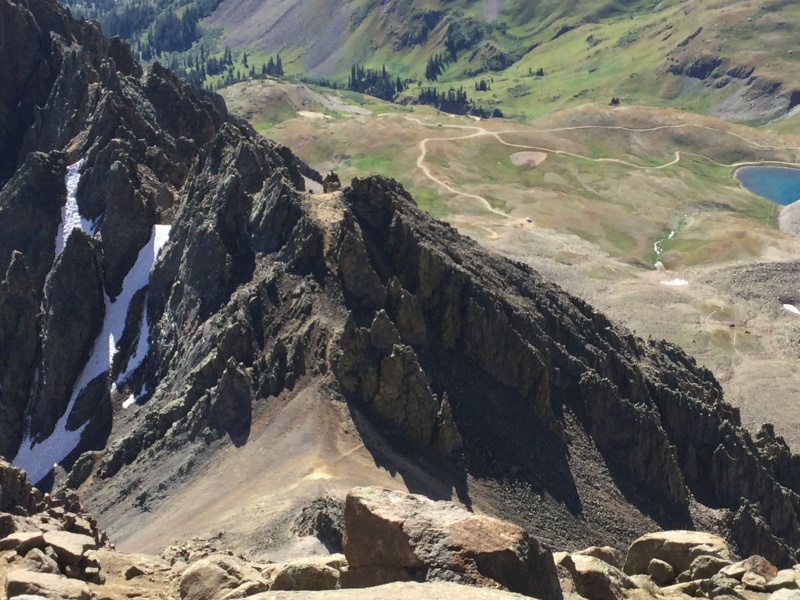 It looked almost innocuous from above, however.
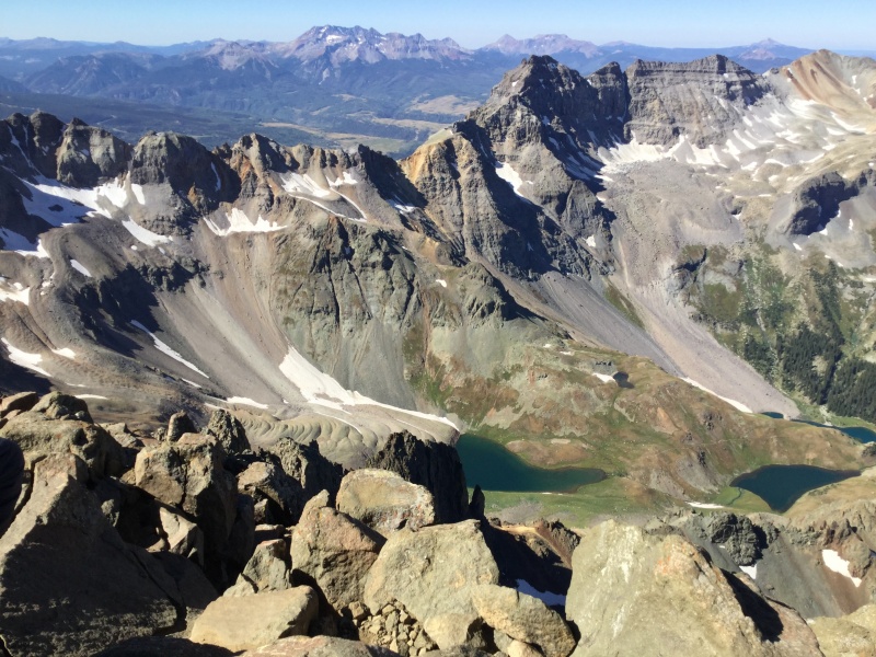 Hopefully the stunning scenery above Blue Lakes numbed some of the pain from his eventual descent.
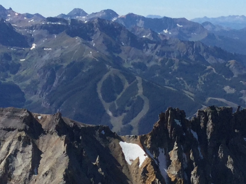 I have also made it a goal to ski Telluride someday, which seems comparatively reasonable.
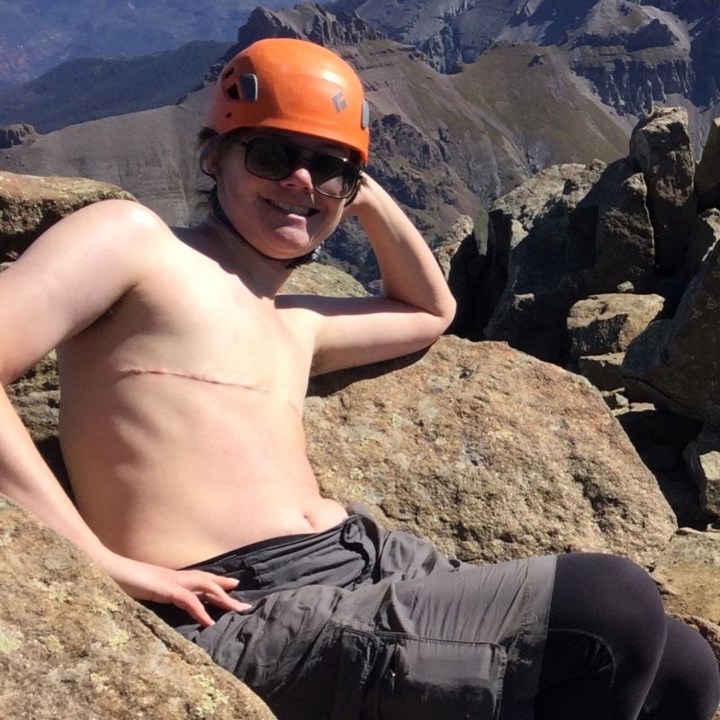 After the fawning comment my shirtless pic got on my Kit Carson/Challenger report, I knew I had to play up this one to the fullest. ;)
 Spoiler alert: I didn't die, and while this angle's not great for showing off my line (which is just to the left of the overhanging boulder that looks like an opening into the Ninth Circle of Hell), you might be sympathetic as to why I felt as if I was in a precarious situation going down.
 In another bit of unexpected Friday the Thirteenth good luck, my hat, which had tried to escape from my backpack when I'd made the idiotic decision to toss it down the crux wall, skidded to a halt just below where Curtis had been watching me, and he was kind enough to retrieve it for me.
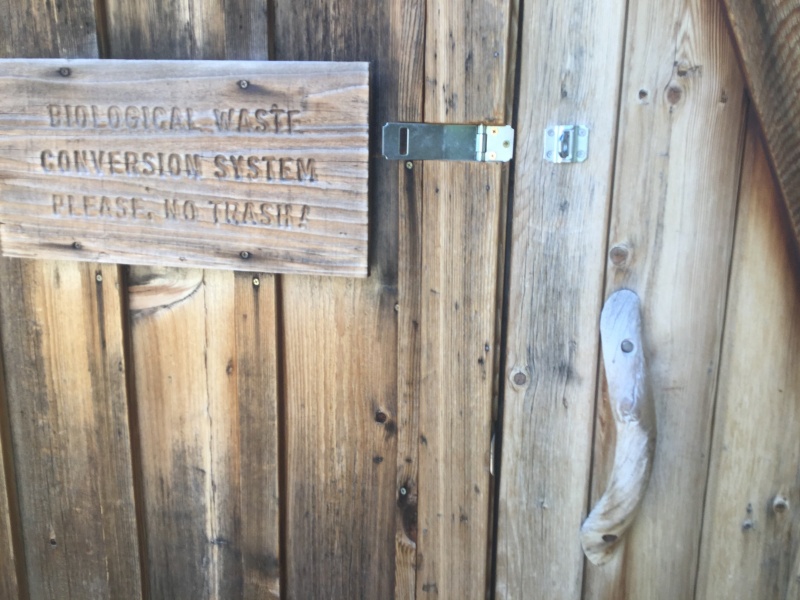 At least I have a new source of horror screenwriting material somewhere in this...
