| Report Type | Full |
| Peak(s) |
Mt. Flora - 13,129 feet |
| Date Posted | 04/29/2025 |
| Date Climbed | 04/26/2025 |
| Author | RyanB06 |
| Skiing Mount Flora: An Indescribable Feeling |
|---|
|
Mount Flora: An Indescribable Feeling Stats: CAIC Report: Low on all elevations, no listed problems Start: 6:15AM The idea for this ski tour arose 3 days before it took place. I finally got my back country skis repaired and ready for the season, eager to set out I planned two trips: One up James Peak on Friday 4/25/2025 and one up Mount Flora on Saturday 4/26/2025. The first day was uneventful and I turned around before reaching the summit as a result of me sleeping through my alarm. I used this trip mainly to find my legs back on my skis and getting used to being in the big mount terrain and warm up for tomorrow, where a large objective would be accomplished. It's 4/26/2025, this time I wake up to my (second) alarm, but at least I'm awake on time. I rushed to put my clothes on, pack all necessary gear in my bag, and load up my car without forgetting anything. By 4:30 I was on the road to Golden to pick up my accomplice for the trip. Having lots of good experience in the mountains and having completed the Colorado Trail the previous summer I knew my partner would be able to handle this tour even though it was his first real back country trip. It was a quick stop in Golden before we were on the road to Berthoud Pass, on track for arrival at 0600. Arriving at the trailhead we began preparing and unpacking our gear, and with a quick tutorial on how to put on skins and use/check beacons we were on our way up Berthoud Pass heading towards Colorado Mines Peak (CMP for short from now on). 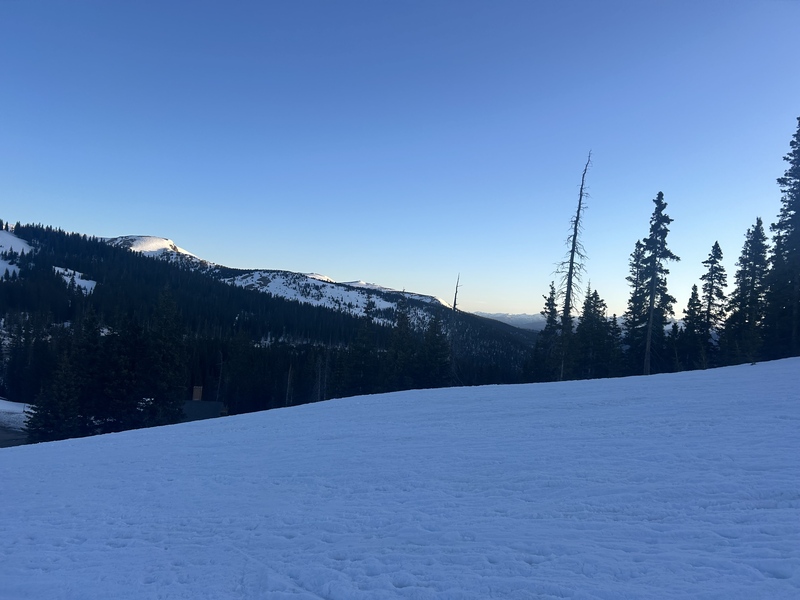
We ascended CMP and broke above treeline before the snow began to become patchy, requiring some advanced maneuvering up the peak to avoid taking our skis off. This lead us about a mile into our hike, and as we came atop a ridge going up CMP we saw ahead two options. One: take the flora trail that has no snow, meaning boot packing in ski boots, and two: a snow filled descent down into the bottom of a gully requiring another skin up the other side in order to reach the 12700ft point on the trail (extra vert, noooo). It wasn't long before we decided keeping our skis on was the main objective, so down the gully it was. 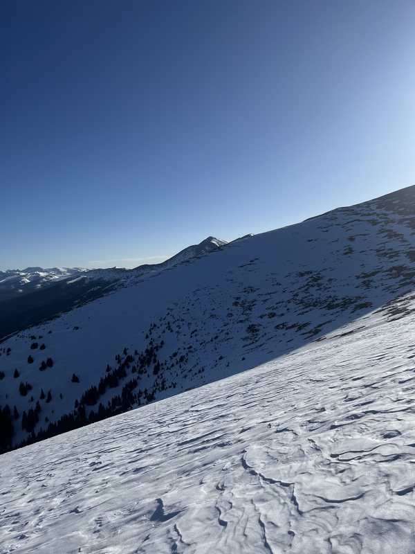

After a quick transition from uphill to downhill we prepared for the first ski descent of the day. The sun had just begun to hit the gully, so the ski down was hard pack and a little icy but not as bad as I was expecting it to be. After an enjoyable first descent and as much traversing uphill as possible we stopped for a quick water+snack break, transitioned back to uphill mode, and began making our way back up the other side of the gully. At the top the snow began to become sparse once again, and this time there was no escaping it. After playing the "how long can we keep skinning" game for as long as possible we finally strapped our skis to our backpacks, loosened our boots, and made our way onto the Mount Flora trail which we followed until the summit. 

After hiking across the ridge we were rewarded with our first good view of the mountains south face, which lead us to our first switch up of the day. We originally planned to descend above Ethel Lake and ski down before we toured back up, but seeing the south face I mistook it for the east. Excited to see some real snow and potential lines for the first time, we rushed to spot a fun looking line and it wasn't long before we spotted a long gully of snow that we decided would be our descent for the day. 
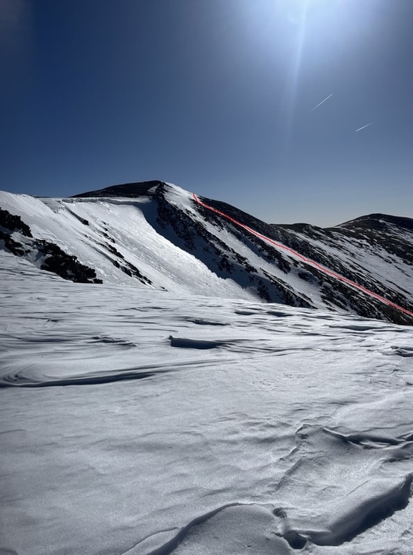
standing on the trail looking at the south face of Flora we suddenly heard voices behind us, and we turned around to see the first group behind us of the day making their way up the trail on foot (much quicker than we were making progress, I wish I brought my hiking shoes). We decided we should get a move on and began hiking again following the dirt trail. There were a few points where snow covered the trail again. When there was, we took the advantage and hiked on the snow instead of the dirt, hopefully saving our ski boots form being too chewed up by the end. The trail was pretty and passed quickly as we scrambled our way up towards the summit of Mount Flora. It was around this time the elevation began to kick in as we huffed and puffed to the summit. 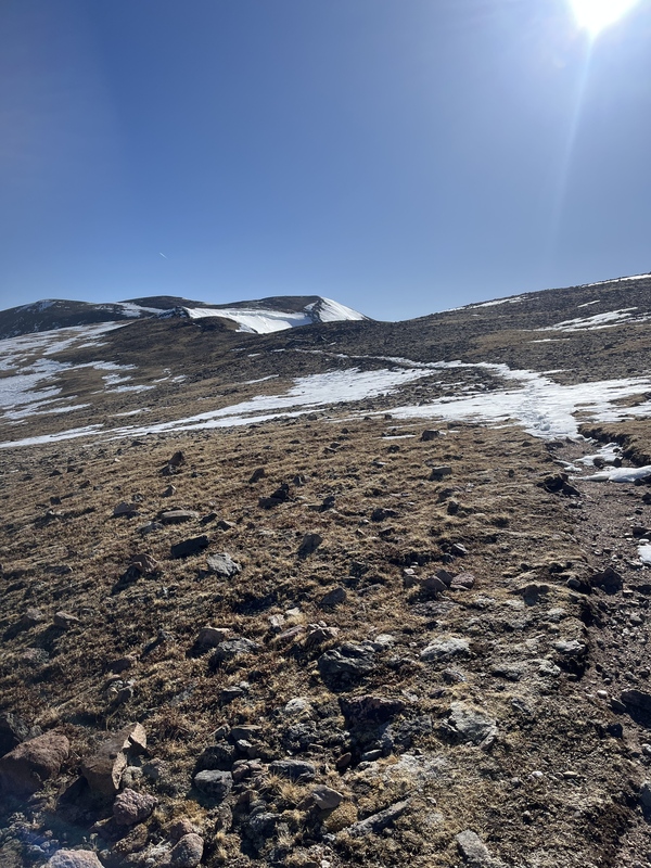
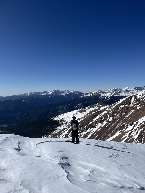

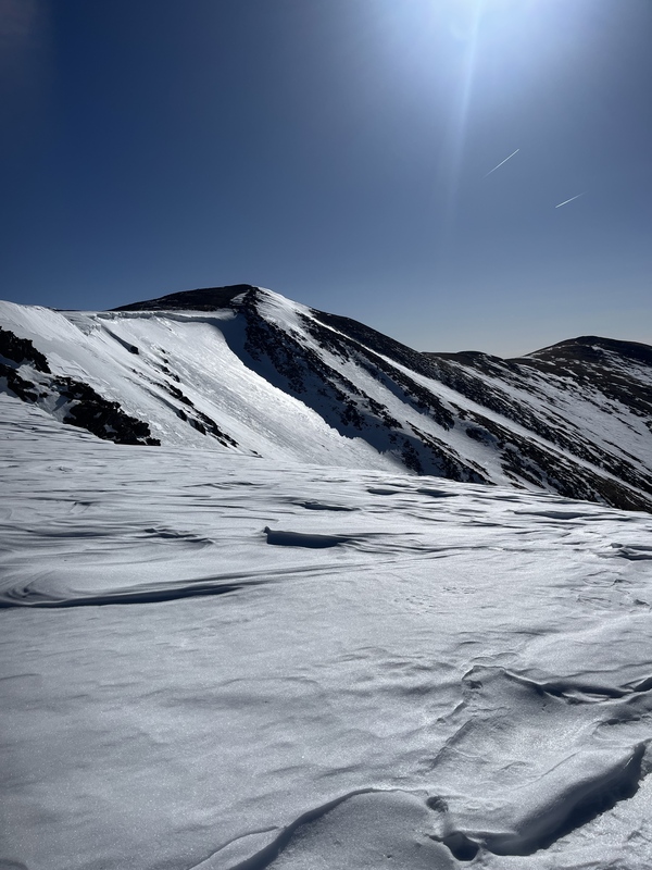
Finally we reached the summit just after the two hikers before us! We took a quick break on the summit, catching our breath before I walked down to look at the entrance to our line. After scouting out the entrance, which was looking great and the whole line seemed to hold consistent snow, we began to transition to downhill mode again and donned our helmets and goggles. we carried our skies from the rocky summit over to our drop in point where we clicked in and began to prepare for our descent. 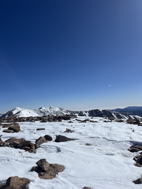
The descent wasn't much different than the line we took down the gully conditions wise, it was still a little early for the snow to soften up much but the skiing was fun. The hard pack made the line very fast, as the pitches reached between 35-45 degrees briefly at the steepest parts. With the low avalanche conditions and hard pack snow the descent was mostly worry free, as the cold snow was not yet prone to wet avalanches as we summited early enough. If you have been back country skiing in the Colorado mountains I'm curious to ask if this is an experience you may have also encountered. The run wasn't the most techy, cliff filled, or steepest run I've ever skied but it was still my favorite run of all time. The big mountain feel, skiing off the summit surrounded by cliff walls, steep rocky pitches, and other huge mountains made the line the most enjoyable run I've skied to this date. Back country skiing is one of a kind and if you haven't tried it yet, get out there and go, be safe, but enjoy what the mountains have to offer. 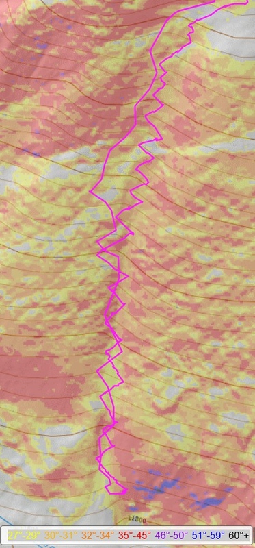

We skied down the line, stopping at the bottom of the gully before it began to flatten out so we could regroup and discuss our ascent plan to make it back to the top. After talking we identified two solid options for us to take: 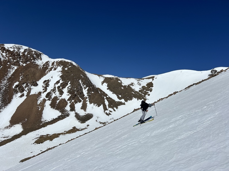
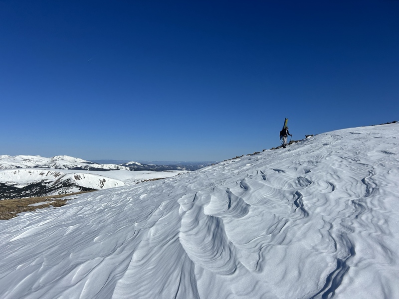
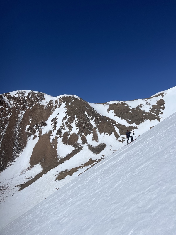
We stepped out of our bindings and began to transition on the side of the slope, slapping our skins on the steep terrain and beginning to skin up the slope. It started icy and steep as we struggled up the slope. We were able to make about 3 zig-zags before we needed to rest again, sitting on the side of the slope or standing for a few minutes before the slog upwards continued. It was here we made the biggest mistake of the day. Standing on a south facing gully we were taking more sun to our faces than any person who forgot to bring sunscreen on their adventure should have. This time is what would make the next 3 days full of aloe vera and stinging sun burns on our faces, hands, and arms. But that's besides the point. It's safe to say I wont be forgetting sunscreen again. 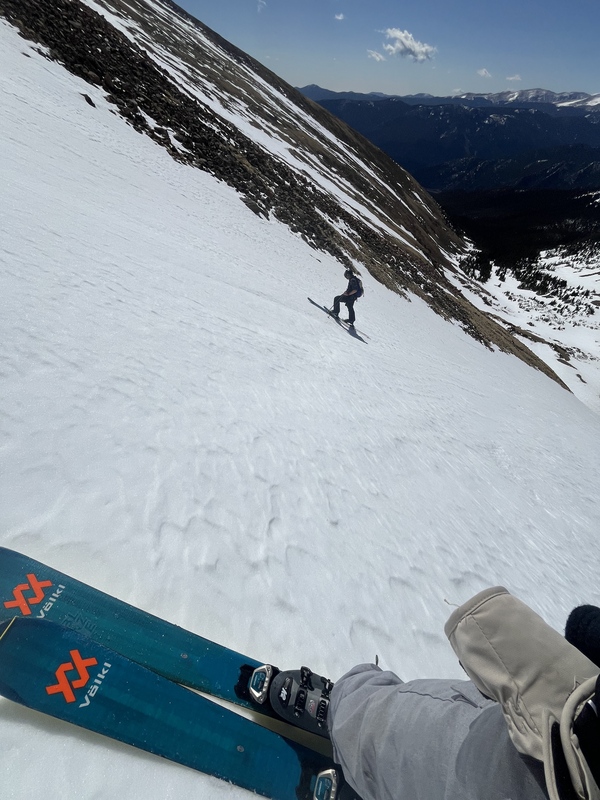
Zig-zagging up the slope we made slow but steady progress as the sun beat down on us. The snow began to soften and crumple under our feet in some places, and we knew our time was beginning to run short. My partner decided to traverse all the way skiers left and begin to climb up the rocky portion of the face while carrying his skis with him. I opted to stay on the slope and skin, as we were only a short distance from the top and even closer to some non-avalanche terrain I could easily skin across to get to the summit. With my partner gone and only my thoughts to entertain me, I skinned like no other and was near the top in a short time. I waited just below the summit for my partner to rise over the rocky convexity in front of me. 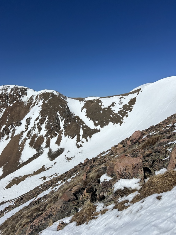
It wasn't long before my partner joined me and we made it back to the summit, relieved to be done with the climbing for the day. We took some time to rest and celebrate on the summit after our first big ski tour. We celebrated with snacks and some drinks before we packed up our gear and started to prepare to head back to our car. It was at this point when we heard the two people from before, and we spotted them on the ridge going towards Eva, heading back towards us. We quickly gathered our gear and began down the trail, carrying our skies in our arms as we stumbled down the trail back towards our car. It was mostly dirt and rock trail but it was much easier going down hill thankfully 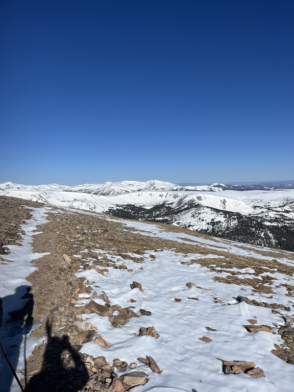
. Thumbnails for uploaded photos (click to open slideshow):  Skinning back up the gully off the south face of Mount Flora")
 Looking over a large cornice before the summit")
 Working on reaching the summit")
 After running out of snow to ski on we began hiking")
 Beginning to skin back up the opposite slope")
 Just beggining the skin up Berthoud Pass towards Colorado Mines Peak")
 Skinning up our ski descent")
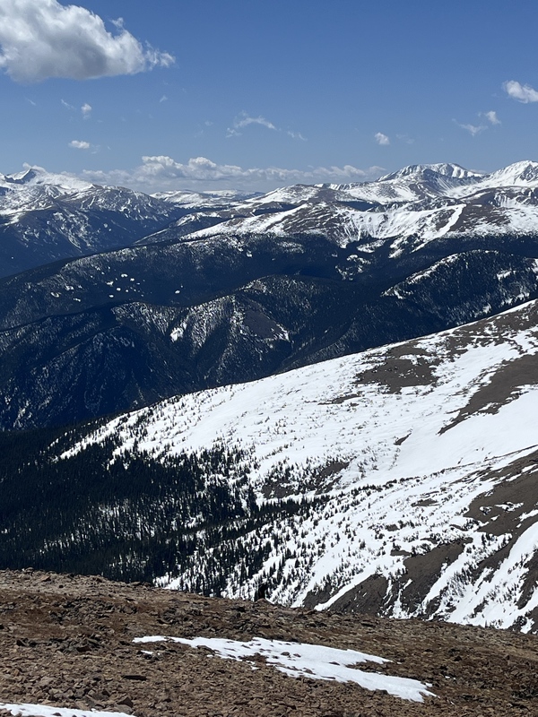
 On the summit looking towards Parry Peak and Mount Eva")
 The summit was in sight, but we still have a long hike to go")
 Looking down the ski descent just below the Mount Flora Trail")
 Mount Bierstadt and Mount Blue Sky in the distance")
 Getting to see the summit (and east face) for the first time")
 Trail ahead")
 Taking in some views")
 Skiing down our line")
 Colorado Mines Peaks impressive east face")
 Looking at the ski lines above Ethel Lake (our original plan)")
 Looking at other lines, thats the cornice from before!")
 Following the dirt back to the car")
 Skiing down the gully")
 Our planned descent")
 Our descent of Mount Flora on CalTopo")
|
| Comments or Questions | |||
|---|---|---|---|
|
Caution: The information contained in this report may not be accurate and should not be the only resource used in preparation for your climb. Failure to have the necessary experience, physical conditioning, supplies or equipment can result in injury or death. 14ers.com and the author(s) of this report provide no warranties, either express or implied, that the information provided is accurate or reliable. By using the information provided, you agree to indemnify and hold harmless 14ers.com and the report author(s) with respect to any claims and demands against them, including any attorney fees and expenses. Please read the 14ers.com Safety and Disclaimer pages for more information.
Please respect private property: 14ers.com supports the rights of private landowners to determine how and by whom their land will be used. In Colorado, it is your responsibility to determine if land is private and to obtain the appropriate permission before entering the property.

