| Report Type | Full |
| Peak(s) |
Hagar Mountain - 13,246 feet |
| Date Posted | 04/03/2025 |
| Date Climbed | 03/27/2025 |
| Author | 123tqb |
| Additional Members | cyairalikethemist |
| Heinous Hagar |
|---|
|
Heinous Hagar
With a recent warming trend in the high mountains it was about high time to ski something steep. Getting together some friends from the Front Range and others from Summit, we had a solid big crew for an objective ski off I-70. We chose Hagar's SW Face since CAIC wasn't listing a persistent slab problem on that elevation/aspect, and all we'd have to worry about was the potential for a wind slab up top and wet snow problems from the freeze/thaw cycle. The weather looked somewhat favorable since there were clouds in the morning, hopefully insulating us from solar radiation for at least a little while. Being somewhat in the middle of the FRange and Summit, everyone met at the Dry Gulch TH at 04:30. With me delaying my alarm, me, Jack, and Cycy were a bit later than we'd originally hoped, so Noah and Nathan had to wait at the parking lot for quite a bit before we even arrived. We did all manage to get there in the end, and had our gear packed and were ready to go by 05:00 or so. We did a quick beacon check and headed parallel to I-70 down the Dry Gulch road. I personally enjoyed the darkness for the first few hours of the morning. It feels a little ethereal not being able to see anything but what's right in front of you. We skinned on the road until it ended at the bottom of the drainage, where we continued into the trees for the next hour. The skintrack wasn't too hard to follow, other than some mandatory side-hilling on an icy crust. So far, the snow was super supportable and appeared to have had a decent freeze over the course of the night. Another reason this was a good objective for the day was that Loveland Ski Area grooms a cat road in the upper basin, which we reached just after sunrise. 


We started to make our way up the cat road, now well lit by the low sun. At one of the various water/snack breaks we took, Jack dropped his water bottle, which started rocketing downhill on the melt-freeze crust. Both Jack and I attempted to stop its slide, but narrowly missed. It ended up stopping in a bootprint in the gully, which I went down to retrieve his only water source for the day. Oops! From here we discussed the tentative plan, which was to have Noah, Nathan, and Jack continue on at their quicker pace while Cycy and I took it a little slower. 


The fast group stopped at a thin spot on the cat road, now well in view of the SE Face. They made a plan to head slightly looker's left of the main face to put in a bootpack and headed off in that direction. Cycy and I weren't too far behind, and when we reached this point on the cat road the boys were just about reaching their transition point for the booter. We followed their lead. They were a good ways up the bootpack when we got to the transition, where Noah had very conveniently left his crampons for her to use. They didn't fit his new boots, and anyways the booter seemed solid enough to not need crampons. 


Now it was time for us to start booting. I had decided not to bring my own crampons or axe, and didn't necessarily feel like I needed them. My ski boots were getting enough purchase in the ready-made booter to just use my ski poles for balance. It took us about an hour and a half to climb. During our ascent, Noah, Nathan, and Jack were radioing down about the snow conditions, which originally appeared to be warming up pretty fast. We discovered upon all reaching the top of the climb that the snow was indeed not warming up, and was in fact just some wind affect at the top and very firm below. The clouds were still covering us pretty well, which didn't look very promising for corn skiing on the way down. Noah and Jack had stopped at the false summit to prep for their descent while Nathan had continued on to the true summit. I followed Nathan and Cycy stayed with Noah and Jack. We all transitioned and prayed for a little bit of sun effect for our way down. 


We took it one by one down the SE Face on unimaginably icy snow. The turns had to be slow to maintain an edge, but we all managed to ski it safely. Nathan took a slight spill on his way down, nearly losing a ski but managing to catch it before it shot down a couple hundred feet. On Noah's descent he noticed some cracks in the snow that didn't propogate, but were concerning nonetheless. I personally attribute these to the warming cycle and subsequent snowpack creep from the day before, but it's hard to say since we didn't investigate the matter much further. Regardless, we all tried to maintain our pace down the mountain lest anything started to move. We all ended up on some dry tundra below the runout and regrouped for the way out. 
After regrouping we decided to party ski out the drainage, going east-southeast to reach some more steep slopes back to the lowest part of the cat road. We did our best following the skintrack out through the trees, but ended up a bit more on top of the creek. A little bit of bushwhacking and shenanigans and we were back to the open portion of our tour up in the morning. We transitioned once we were within a stone's throw of I-70 to head back up to the car, a tad exhausted but satisfied with our objective. 

Thumbnails for uploaded photos (click to open slideshow):  Garbanzo bean wrap and a silly selfie.")
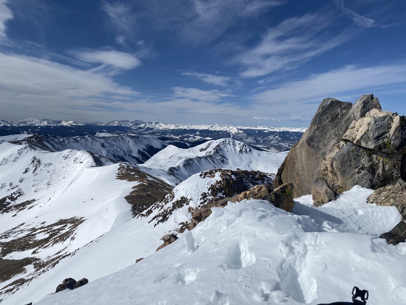
 Looking towards Summit from the summit.")
 Sunscreen all over.")
 Time to start the bootpack.")
 Hagar from below.")
 Cyc skinning up the cat road.")
 The upper cat road on the way to Hagar.")
 Alpenglow.")
 The avalanche slopes in the basin.")
 The cat road.")
 It only gets better!")
 More sunrise pics.")
 The start of the cat road in the upper basin.")
 Jack, Nathan, and Noah standing on the cat road.")
 Making our way through the trees in Dry Gulch.")
 Love a good alpine start.")
 Nathan climbing to the true summit.")
 Headlamp skinning.")
 Jack and Noah on the false summit, Nathan on the true summit behind.")
 Sunrise!")
 The Citadel viewed from the cat road.")
 The southeast face of Hagar.")
|
| Comments or Questions |
|---|
|
|
Caution: The information contained in this report may not be accurate and should not be the only resource used in preparation for your climb. Failure to have the necessary experience, physical conditioning, supplies or equipment can result in injury or death. 14ers.com and the author(s) of this report provide no warranties, either express or implied, that the information provided is accurate or reliable. By using the information provided, you agree to indemnify and hold harmless 14ers.com and the report author(s) with respect to any claims and demands against them, including any attorney fees and expenses. Please read the 14ers.com Safety and Disclaimer pages for more information.
Please respect private property: 14ers.com supports the rights of private landowners to determine how and by whom their land will be used. In Colorado, it is your responsibility to determine if land is private and to obtain the appropriate permission before entering the property.


