Download Agreement, Release, and Acknowledgement of Risk:
You (the person requesting this file download) fully understand mountain climbing ("Activity") involves risks and dangers of serious bodily injury, including permanent disability, paralysis, and death ("Risks") and you fully accept and assume all such risks and all responsibility for losses, costs, and damages you incur as a result of your participation in this Activity.
You acknowledge that information in the file you have chosen to download may not be accurate and may contain errors. You agree to assume all risks when using this information and agree to release and discharge 14ers.com, 14ers Inc. and the author(s) of such information (collectively, the "Released Parties").
You hereby discharge the Released Parties from all damages, actions, claims and liabilities of any nature, specifically including, but not limited to, damages, actions, claims and liabilities arising from or related to the negligence of the Released Parties. You further agree to indemnify, hold harmless and defend 14ers.com, 14ers Inc. and each of the other Released Parties from and against any loss, damage, liability and expense, including costs and attorney fees, incurred by 14ers.com, 14ers Inc. or any of the other Released Parties as a result of you using information provided on the 14ers.com or 14ers Inc. websites.
You have read this agreement, fully understand its terms and intend it to be a complete and unconditional release of all liability to the greatest extent allowed by law and agree that if any portion of this agreement is held to be invalid the balance, notwithstanding, shall continue in full force and effect.
By clicking "OK" you agree to these terms. If you DO NOT agree, click "Cancel"...
Winter Mt. Shavano via Esprit Point E ridge, S sub-ridge Trailhead: Angel of Shavano Distance: 7.5 mi RT Elevation gain: 5,400 ft YDS class: Class 2 Special gear: poles, optional helmet
This route combined some of my favorite hiking activities. Come warmer weather and melted snow, I enjoy plotting nonstandard paths up alpine objectives. I love the complimentary pair of discovering something new, whether it be a novel perspective or route, and uncovering something old among the mountains' trove of archaic secrets.
Artifacts and other historical impressions in the land abound, both human and non-human. The remnants of past activity in hunting, logging, mining, and recreation often landmark fascinating stories logged in periodicals of the time. "Off-trail" wilderness too usually belies a whole network of tracks tramped in over generations of hooves and paws inscribing their own narratives as well.
Come winter I like trying, well--winter 14ers! I am not a fan of avalanches, though, and my stamina is rather middling. I wanted to use my experience completing previous winter 14ers and charting off-trail routes to account for these concerns on this southerly Sawatch sentinel.
Upon research, some previous route options for winter Shavano include a standard route variation up the east ridge direct, ascending the Angel, or taking on the 13er subsummit Esprit Point over to Shavano. I was a bit skeptical of tackling the East ridge direct by myself after seeing previous reports of arduous & potentially dangerous snow conditions near treeline. I've also personally noted some spooky collapsing and otherwise difficult trenching conditions on similar Sawatch E-ridge direct features such as on Princeton below treeline cutting the upper road switchbacks. The other TRs taking ribs up Esprit like the SE from Angel of Shavano TH or E from the standard Shavano trail seemed too steep or roundabout, and I didn't want to risk dealing with avalanche potential alone on the Angel either.
Looking for a more direct and avalanche-foolproof way, I noted an east and then south-facing ridge leading to Esprit Point from the Angel of Shavano TH that seemed somewhat mellow steepness-wise and fairly dry from satellite & webcam images. The south-facing aspect below treeline and wind-blown ridge crest above both clued me in to a potentially feasible route that might not be swamped with snow.I found some discussion of this ridge in a forum post with multiple experienced users having summited this way. From the other TRs featuring Esprit Point, the rest of the way to Shavano from this sub-peak was a simple tundra crossing over to the summit summer trail.
I checked the webcam that pirouettes in the south Arkansas river valley until it zoomed in on the Shavano group. I could see some brown poking through the bare aspen groves on Esprit's lower E ridge flank & only a little snow clutching the upper ridge. Although the actual planned route below treeline was obscured by evergreens, I trusted from the low snow amounts I had seen on similar aspects, slope angles & elevations on other peaks that this might be a useful way to access Esprit Point's summit.
Peakbagger app Copernicus satellite image. The angel is at top left, Esprit point E ridge just below center. Area of concern for snow around lower-right pink date text
I consulted the Peakbagger app's Copernicus Sentinel-2 L2A weekly satellite image layer to gauge snow coveras well and noticed a discrepancy between the amounts pictured in the webcam and the satellite image dated for that same day. Perhaps it's some sort of reflection artifact, but the Copernicus satellite seemed to show noticeably more filled-in snowfields than the real-time webcam viewed from the same morning. I wonder if the satellite was mis-dated and was really taken a day or two prior. In the future I'll yield a bit less credence to these satellite images in my decision-making since conditions might be better--or worse--than pictured.
With this information in mind, I wound up the ancient glacial valley on the graded & plowed CR 240 and pulled in to the short CO Trail parking loop near the Angel of Shavano Campground. I followed the bootpacked & melted out CO Trail up the moraine until I could branch off back towards Esprit Pt. This area shows up as an avalanche-prone 30-35 degrees in slope angle as noted in daway's report, but thanks to the lower elevation, S-facing aspect, & probably this very slope angle oriented to absorb more direct solar radiation I barely saw a hint of snow in this area.
Looking back on CO trail to the left turning off to the right near top of moraine
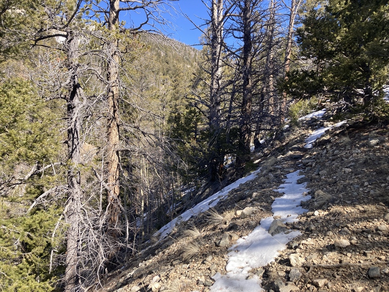
Towards the top of the moraine I struck off on a deer track that led back west along the moraine's ridge towards Esprit Pt. I dodged barrel cacti & piles of ungulate scat and forded a shallow drainage full of snow and aspen logs. As I approached the yawning ravine funneling down from Esprit's E face, a game trail materialized at its edge. Although this way hadn't gotten too much human traffic, the creatures of the forest might have blazed a trail for me already!
Game trail above ravine
The game trail continued along the rim of the precipitous gulley & could easily be regained after crossing the occasional snow patch or arboreal obstacle. After a little while I encountered a flat spot overseen by grafittied aspens and realized I was crossing a road from an old nearby mining complex. The track continued up along the gorge from here and now felt a bit wider and more cleared out--I wondered if the miners had broken this trail to catch some relaxing views on the upper ridge.
After I got back from this trip, I looked this mine up in historic Salida newspapers. I found that it was once owned by celebrated Salida-area resident L. E. Blank after which the standard TH Blanks Gulch is named. In July 1927, Blank hosted forty-seven CMC members at his foothill ranch for a 1927 July Shavano climb led by Miss Fay Edwards of Salida.
Game trail on right. I've seen official trails less tracked out than this one!
At times the path appeared to peter out or was blocked by a steep section or fallen tree, but just 10 feet to the left or right usually another game trail continued the push uphill. The lower ridge past the mining road was the steepest of the whole route--1000 ft in 0.4mi--but not unbearable especially with the aid of poles. The trails closer to the gully were still mostly bone-dry with only a few avoidable icy patches. More snow hung around on the shadier ridge proper off to the right.
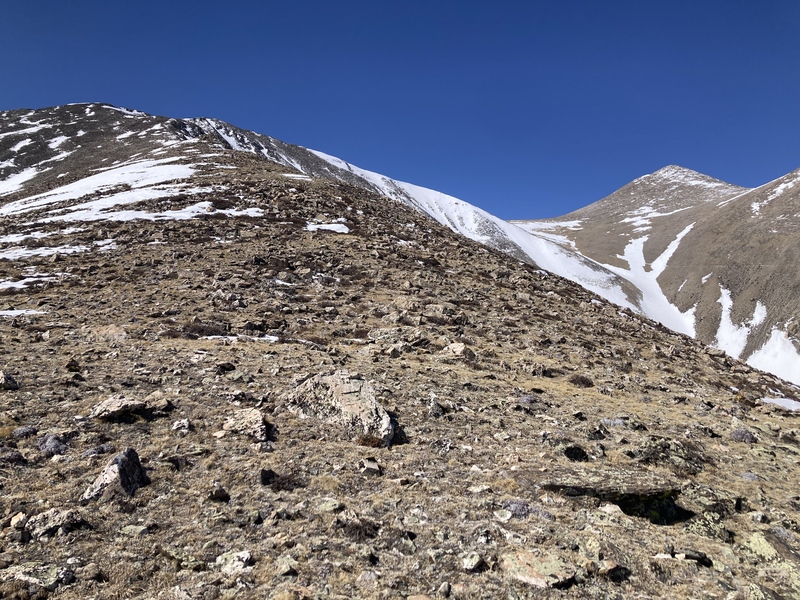
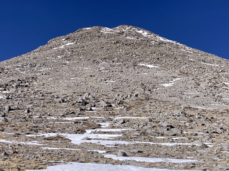
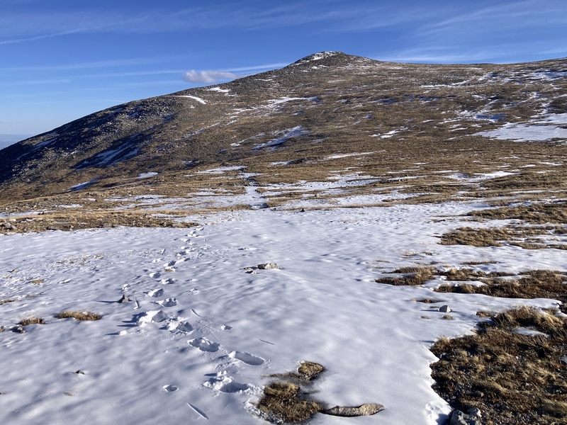
First good look at the ridge above treeline
Eventually the aggressive gradient and decent tree cover let up and I was granted full views of the upper ridge. The deepening snow at this elevation encroached over the game trail. I kept ascending through the mostly supportive sno-cone consistency drifts among the trees. After enough postholes I eventually contoured west along the talus slope with its unproblematic snow patches. A dry alpine rivulet free of stones and slush guided the rest of the way directly up to the upper ridge crest.
Refrozen slushy snow in trees near treelineNearing treeline, I crossed over straight ahead around here to work around snow in treesCame up grassy mini-stream areas on slope at bottom of image
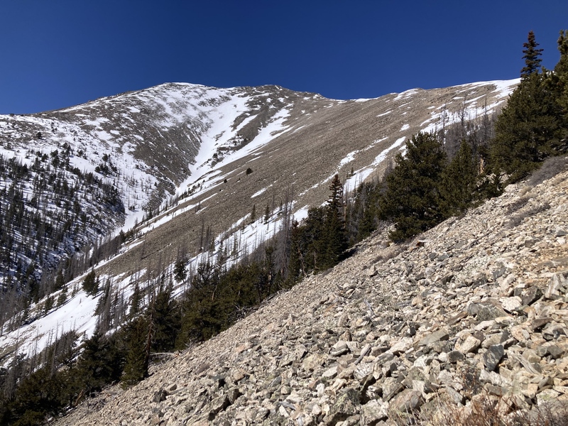
Shavano & his Angel met me arms wide atop the rib. A stout weather break perhaps once enjoyed by Blank and crew stood sentry on the ridge tip surveilling the Arkansas valley below. Looking ahead up the rest of the E-facing ridge to Esprit Pt, I saw that the snow still wouldn't be much issue. The lower section was a gentler stroll up rocky tundra before it started getting rockier.
Atop upper ridge, Shavano at rightRock ring atop ridge
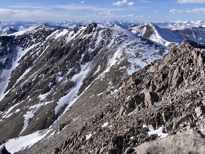
The panorama also provided a good opportunity to scout the standard Shavano E ridge route. Significantly more unavoidable snow covered the south-through-east apron of the ridge near treeline. It looked like it could be possible to connect dry patches up to the ridge crest to avoid postholing too much, but I probably would have wanted snowshoes up there. Up until this point on the Esprit Pt E ridge and for the rest of the day I didn't need or desire them at all.
Standard E ridge
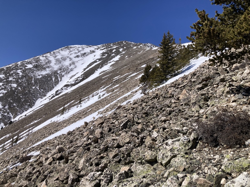
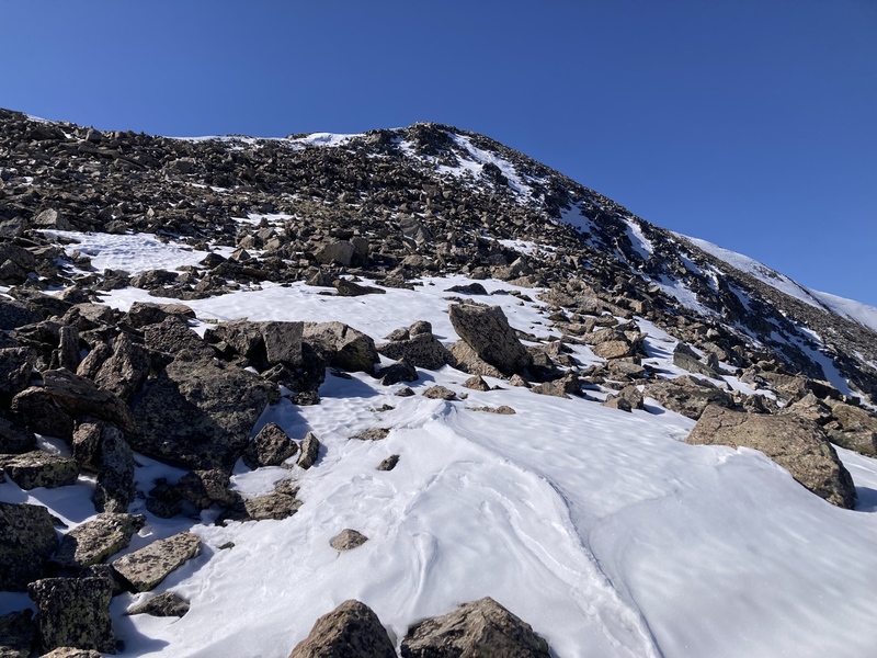
I resumed with careful footing up the increasingly rocky terrain. At times a faint climbers trail cut through the jumble, but otherwise the small-to-medium size scree was fairly stable. A few short wind-crusted snowfields held my weight or otherwise provided stepping stones to cross. Soon enough I arrived atop Esprit Point's elongated summit ridge.
Gets rockier with elevationAngel & ShavanoClose to Esprit summit, sometimes these wind crusts held my weight
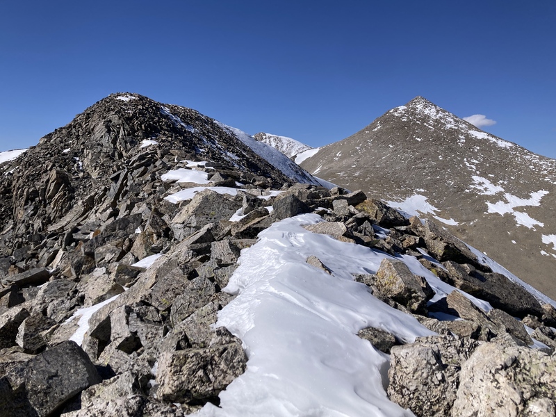
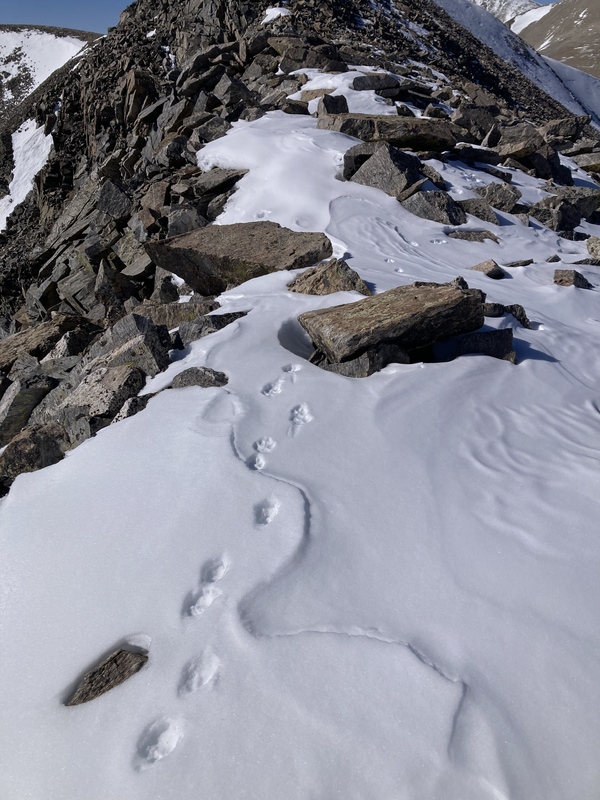
The ridge had the beginnings of a cornice with some supportive wind crust, but mostly I stuck to boulder hopping. On many winter 14er summits across multiple ranges I've seen canid tracks from some fox or coyote way up high on mountain ridges and Esprit Point added another sighting to the list--maybe the critter was hunting for pika. The wind forecast was minimal, and even up here on the summit ridge it didn't arrive as much more than a stiff breeze.
Esprit ridge crestOn more times than not I've seen these canid tracks way up on high elevation ridges in winter
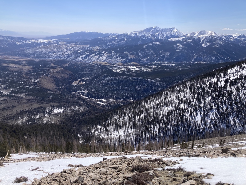
After arriving at Esprit's summit, the rest of the route opened up before me and I could finally get some relief from walking on rocks. The tundra saddle between Esprit & Shavano was swept nearly dry and expectedly came with increased sustained winds.
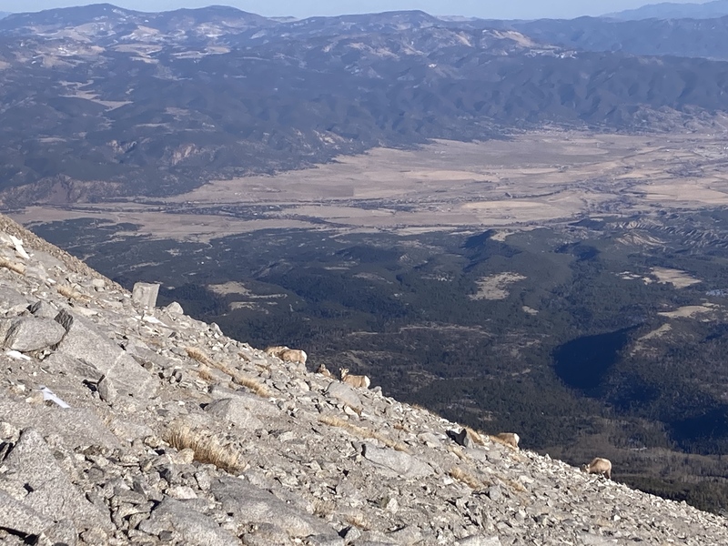
At this point I really wasn't sure where the summer trail up to Shavano was. I knew CFI has been working on a reroute and I could see an obvious trail to the summit filled in by snow, but I also spotted a braided trail system off to the left. Upon approaching a little further, however, a previously camouflaged bighorn sheep herd including some rams with very mature horns looked up at me from grazing over the most apparent trail. I thought it best to leave them be and reroute via the braided slushy gravel paths.
Sweet sweet tundra!Horned guardians on Shavano trail, centerEwe gotta be kid-ding me!
The detour directed me towards some large, fun scrambly blocks just below the summit ridge. Footsteps from a recent hiker up the standard E ridge led the way through the rest of the minor snow and boulders to the top.
Shavano summit looking to TabLooking north
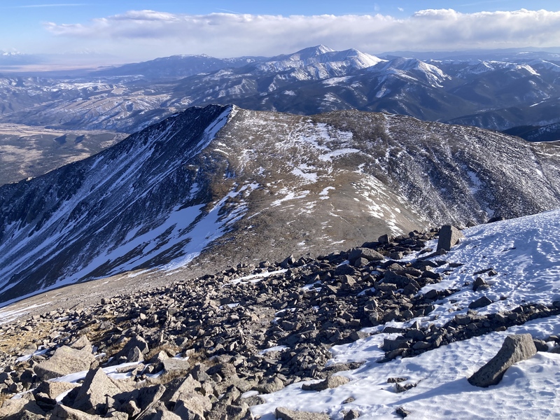
After seeing Tabeguache from the Shavano summit I was satisfied that I only planned for the latter. The E-facing slopes leading up to the Tab summit ridge held more snow than the route I had taken, and I was already on my second pair of socks after getting the first damp from postholing through the large-grained snow earlier. It looked like I could thread through rock patches to avoid too much trouble, but was glad not to deal with it after gaining decent elevation already and having a longer rocky return still to go.
Coming down trailRe-ascending Esprit
The sheep had moved away a bit so I didn't have to skirt around them so far on the way down Shavano. The last elevation gain that remained was a mellow 200 ft back up to Esprit. I might have considered taking the more direct and possibly less blocky SE ridge of Esprit for the way back, but I had to pick up some gear I had stashed on the E ridge.
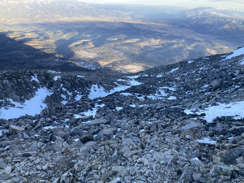
Parting shotUppermost talus stretch below ridge crest. Found a faint trail leading to reasonable crossing of the snow gully
I realized not long after starting the rocky descent that it would have been nice to have a helmet despite the class 2 rocks. On a smoother angled boulder surface my legs cartoonishly slipped out from under me and I caught a good chunk of my weight on another rock with my elbow. As someone who's struggled with concussion injuries, it probably would've been bad news if it was my head clunking on a boulder instead. The talus was mostly stable and not Elks-level loose, but it wouldn't have hurt to have some extra margin for injury in such an unfrequented area.
Looking down rest of ridge
Otherwise the descent went without a hitch and I made it back to the weather ring near treeline around headlamp-time. It was a bit harder to retrace my steps in the dusky ambiance--I fumbled down another desiccated tundra stream, crossed some refrozen snowfields, and contoured over my last patch of steep talus for the day on the way back to the trees.
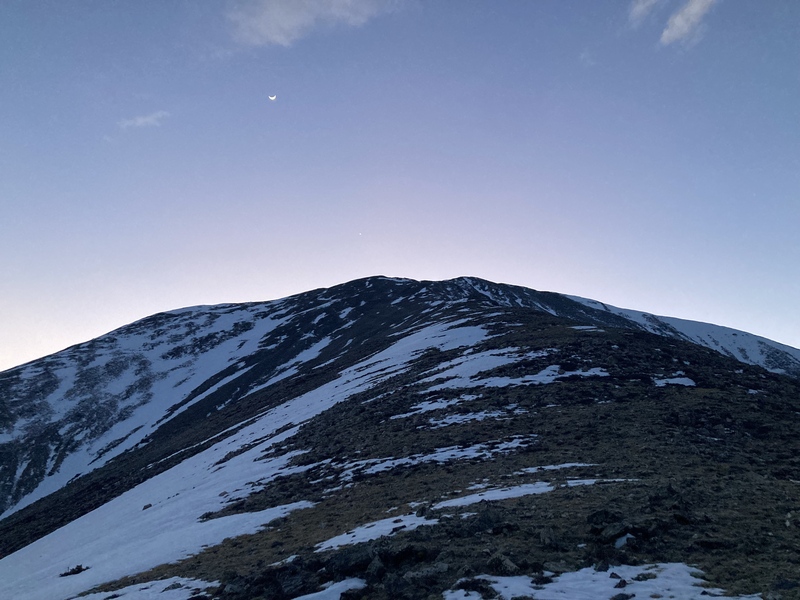
The faint aurora of the sun's last light crowning Esprit Point faded to an inky star-speckled canvas contrasting the crescent moon's Cheshire smile. In the dark I couldn't initially regain the game trail I had used on the ascent and ended up too high up on the ridge with more snow and downed trees. It wasn't long before I ran into a track closer to the gorge on the west side of the ridge, but not too long after that it dissipated. I continued lightly bushwhacking downhill until I encountered another game trail and repeated this process of lost-and-found until I reached the old mining road.
After the mining area, the slope eased up and the worn path along the ravine was more obvious. It led me back to the shallow snow-filled depression crisscrossed with blackening aspen logs and soon I came upon the moraine edge. Instead of returning along the top of the moraine back to the CO Trail, I decided to cut directly down the scrubby slope to save time--it looked like quite a few deer had done the same anyhow. Once again upon the CO Trail, it was only a few minutes before I reached my car for a long but successful 11 hr outing.
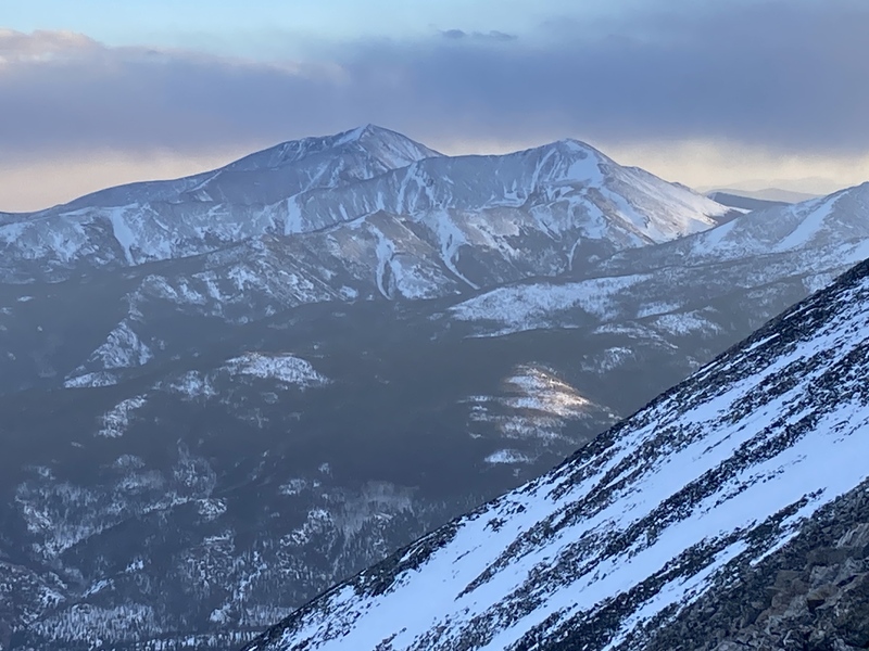
Mts. Ouray & Chipeta at sunsetCheshire twilight
The gain on this trail really smoked my legs--granted I hadn't gotten out on steep trails too much this winter, and I'm for sure glad I didn't take the even steeper and more sustained SE ridge up to Esprit. However, it's uncommon to find a winter 14er trail that doesn't require flotation and avoids avalanche hazards. After a larger snow dump I'd be more cautious of wind-deposited snow layered on the steep snowfields among the talus near treeline and would probably opt for sticking to the low-angle trees just below the upper ridge.
I really appreciated the ages of animal cousins and perhaps a period of prospectors crafting the trails tracing this subalpine ridge. If I had more stamina and an earlier start I likely could have tagged Tabeguache, but I'm planning to explore another off-trail route for that mountain as well. Thanks for reading!
My GPS Tracks on Google Maps (made from a .GPX file upload):
I did this route yesterday thanks to your post mid week, did not see this TR till i was driving up in the morning, i created a GPS track off the one you showed in the conditions report. my snowshoes and axe took a hike with me, but spikes were needed for Tab for the 2nd part of the ridge. I lost the trail some in the woods on my return, but it was a well defined trail for the way up, reminded me of the East ridge up Sunshine, steep and filled with obstacles.
For those wanting to add Tab into the mix, my watch said 9.36miles RT with 7,850ft gain, when i loaded the GPS track into caltopo i got 11.41miles RT and 6,414ft gain, either way prepare for a long hard day, took me 14hrs RT with a 25.5lb pack, im also not a fast hiker. i will say, i enjoyed this route till my return from Tab, having 2 peaks to re-climb, and that long talus ridge + the woods to navigate was a lot, i slid a few times in the woods in the loose dirt. this worked well for me yesterday being solo and not having to worry about snow issues, nice work testing it out for us and sharing it.
@jbealer awesome I'm glad it worked out! Yeah it seems like winter Shav+Tab is a bit of a bear distance & gain-wise even for the standard route too, also thought that the positive for this route up Esprit was that it was safer solo & avoids sketchy avy conditions. But the tradeoff is much more rocks down Esprit & more difficult/loose routefinding on the way back below treeline for sure
@econner it might be tough lugging skis up the ridge especially below treeline, it's not a super thick bushwhack but low-hanging branches and also the rocks above treeline might make hauling skis a pain. If you look back at the peak conditions someone did ski the Angel a little bit prior to my trip, hard to tell from the pic but I saw their tracks riding down. I'm by no means an experienced skier but I'd probably wait til later in the spring for more snow and just ascend the angel or standard route
This is such a cool post. I'm thinking about doing your route soon and was wondering if you thought about approaching from the Mt. Shavano and Tabeguache Peak Trailhead as opposed to the Angel Campground you started from. It seems like you could take 254 higher and avoid being off trail for a little bit longer while still ending up on the ridge that you took. Just wondering if you considered doing that and what made you decide to go from the campground instead of the trailhead.
Thank you!! Yeah normally in winter the standard Shav/Tab TH gets snowed in & ppl start from the Angel TH even if they want to do the more usual winter route up the Shavano E ridge direct. I bet the road is clear now tho given the lower snow this year, yeah that would save some elevation gain for sure and give you a closer tour of the mine ruins in that area!
Caution: The information contained in this report may not be accurate and should not be the only resource used in preparation for your climb. Failure to have the necessary experience, physical conditioning, supplies or equipment can result in injury or death. 14ers.com and the author(s) of this report provide no warranties, either express or implied, that the information provided is accurate or reliable. By using the information provided, you agree to indemnify and hold harmless 14ers.com and the report author(s) with respect to any claims and demands against them, including any attorney fees and expenses. Please read the 14ers.com Safety and Disclaimer pages for more information.
Please respect private property: 14ers.com supports the rights of private landowners to determine how and by whom their land will be used. In Colorado, it is your responsibility to determine if land is private and to obtain the appropriate permission before entering the property.


")
")
")
")
")
")
")
")
")
")
")
")
")
")
")
")
")
")
")
")
")
")
")
")
")
")
")
")
")
")
")


