Download Agreement, Release, and Acknowledgement of Risk:
You (the person requesting this file download) fully understand mountain climbing ("Activity") involves risks and dangers of serious bodily injury, including permanent disability, paralysis, and death ("Risks") and you fully accept and assume all such risks and all responsibility for losses, costs, and damages you incur as a result of your participation in this Activity.
You acknowledge that information in the file you have chosen to download may not be accurate and may contain errors. You agree to assume all risks when using this information and agree to release and discharge 14ers.com, 14ers Inc. and the author(s) of such information (collectively, the "Released Parties").
You hereby discharge the Released Parties from all damages, actions, claims and liabilities of any nature, specifically including, but not limited to, damages, actions, claims and liabilities arising from or related to the negligence of the Released Parties. You further agree to indemnify, hold harmless and defend 14ers.com, 14ers Inc. and each of the other Released Parties from and against any loss, damage, liability and expense, including costs and attorney fees, incurred by 14ers.com, 14ers Inc. or any of the other Released Parties as a result of you using information provided on the 14ers.com or 14ers Inc. websites.
You have read this agreement, fully understand its terms and intend it to be a complete and unconditional release of all liability to the greatest extent allowed by law and agree that if any portion of this agreement is held to be invalid the balance, notwithstanding, shall continue in full force and effect.
By clicking "OK" you agree to these terms. If you DO NOT agree, click "Cancel"...
After tracking the weather/avy conditions for a few weeks, I saw the perfect chance to try a harder 14er on the first day of winter, I chose Wilson Peak. I slept in my car at Cross Mountain Trailhead and woke up a minute after the solstice - at 2:22 am. My car said it was 3° out, clear skies with some moonlight.
I left the trailhead at 3:05 am and followed a skin-track.
Following a skin track early in the morning
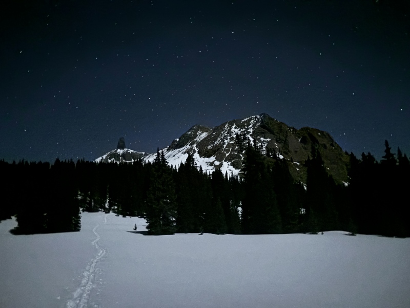
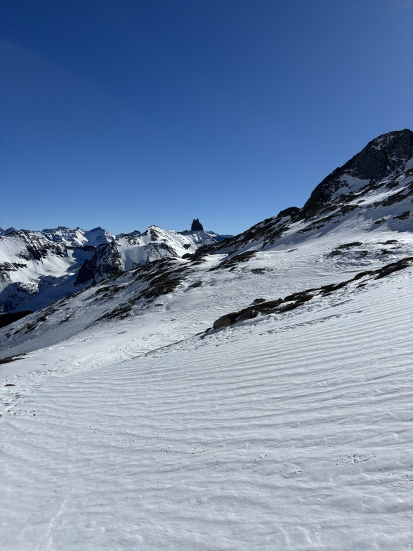
Lizard Head from the approach in the moonlight
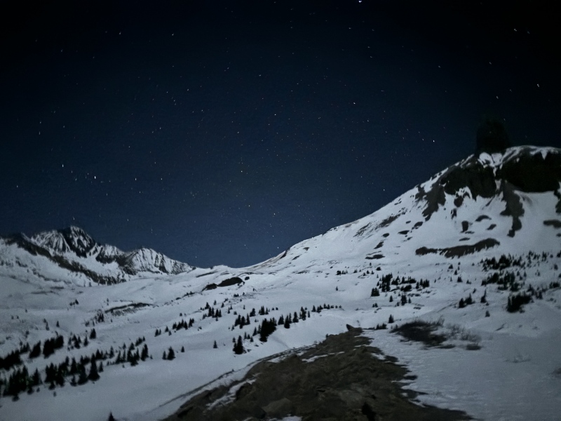
Looking up toward the pass between Lizard Head and Cross Mtn
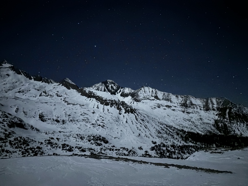
The skin track ended after about 3 miles, I broke trail the rest of the way up over the pass and into Bilk Basin.
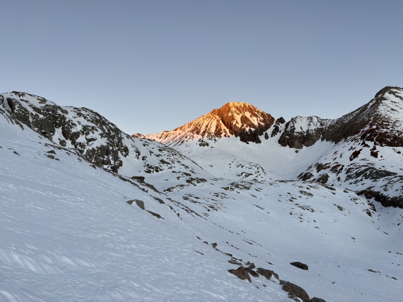
The first good views of Wilson peak
The sun began to rise as I I dropped into Bilk Basin and worked around the end of Gladstone's NE Ridge. From there I turned West and cut across instead of following the summer route. I work past the lake, avoiding avy terrain as best as I could, but the snow was thin and didn't show signs of sliding.
Lizard head in the rising sunBreaking trail in the sunrise
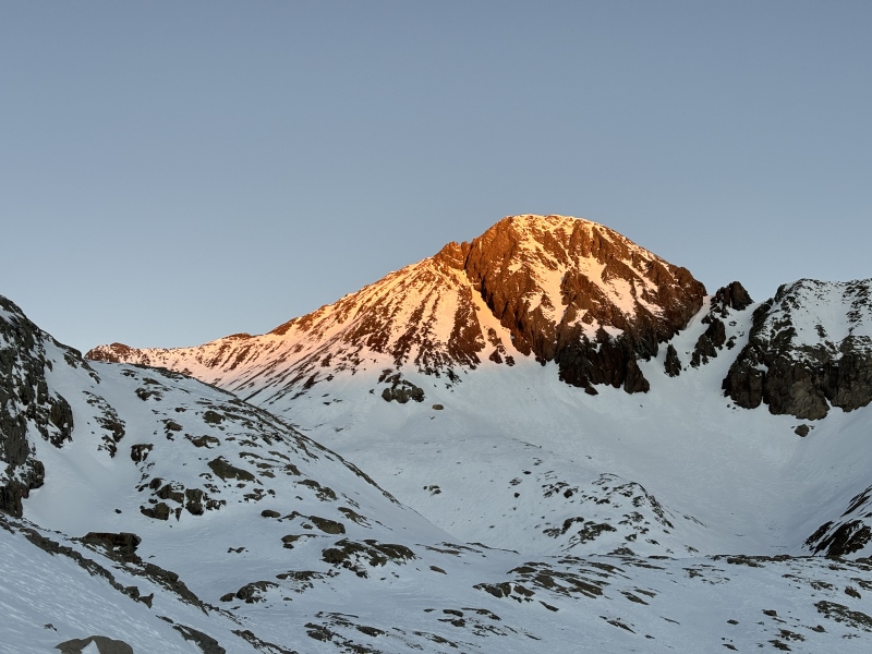
The rising sun on Wilson Peak
Another beautiful shot of Wilson Peak
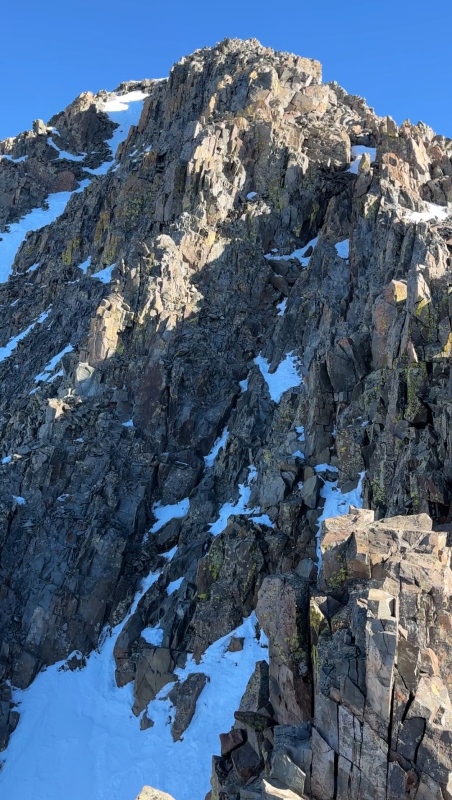
Looking up the South Slopes
Going up the south face/slopes really slowed me down. I started out on the snow with my snowshoes, but kept on breaking through the thin crust. I switched over to the rocks, but it was loose and I kept on sliding down. I was happy to finally make it to the summit ridge and false summit.
The summer route on east facing slopes looks more loaded with snow
Looking down while climbing the south slopes
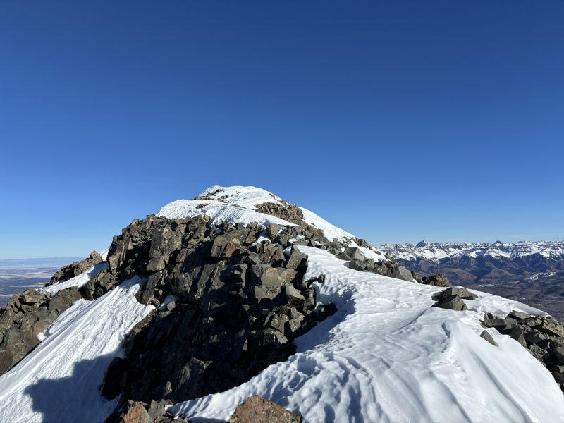
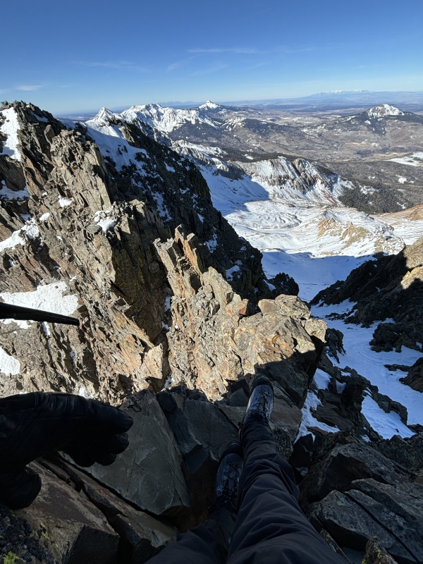
The summit ridge
Looking back at the crux - it is on the right side in the shadow
I left my pack on the false summit and started down the NorthWest side of the ridge. I stayed more towards the apex of the ridge and it was a little harder than 3rd class. I could have dropped down more, but the snow was loose and unconsolidated - so I stuck to the rock. Some of the rock was loose, but just give every hold the kick/hit test before committing. It was a bit spicy but I liked it!
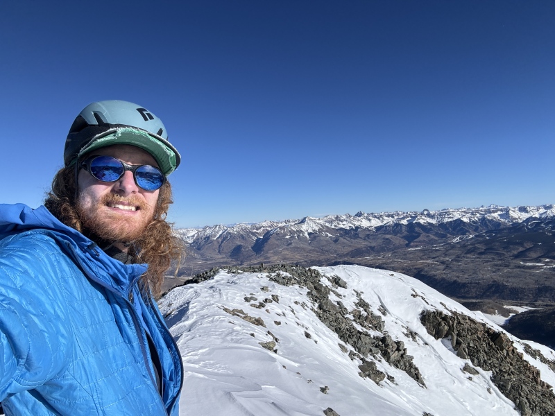
Last steps to the summit
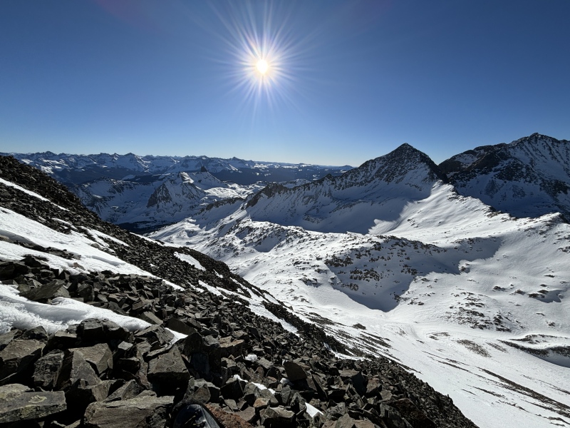
Winter Summit!
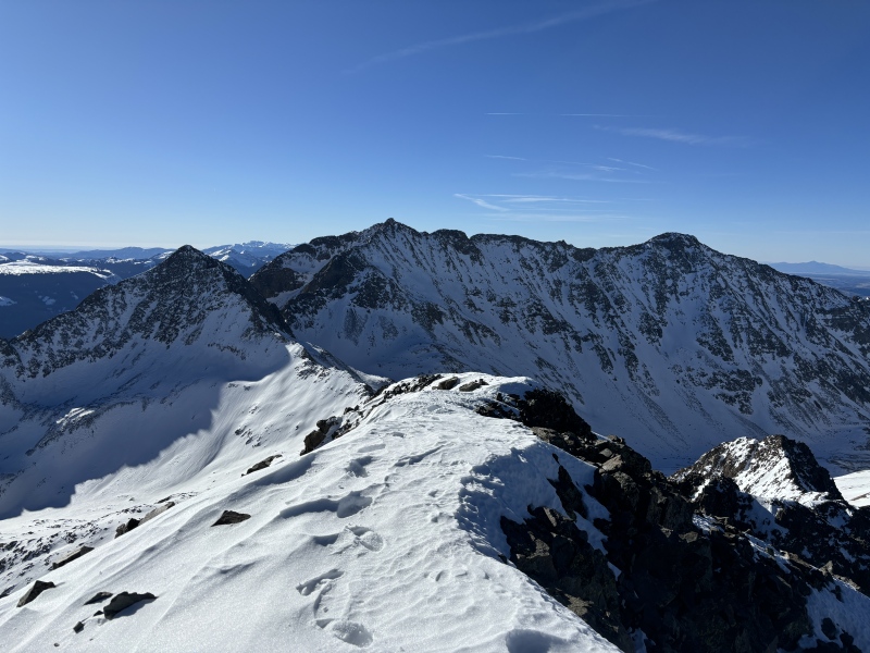
View of Mount Wilson - El Diente from the summit
Looking down on the crux (right side of ridge in photo)
Lizard head on the descent
On the descent, the sun beat down and the snow softened up. Going back up to the pass by Lizard head took all of my energy. I finally saw some skiers when I was about 2 miles from the trailhead. I reached the trailhead at 2:50, finishing the day at 11 hours and 45 minutes. Not my fastest day out in the winter, but overall a beautiful day!
Happy Winter!
My GPS Tracks on Google Maps (made from a .GPX file upload):
Caution: The information contained in this report may not be accurate and should not be the only resource used in preparation for your climb. Failure to have the necessary experience, physical conditioning, supplies or equipment can result in injury or death. 14ers.com and the author(s) of this report provide no warranties, either express or implied, that the information provided is accurate or reliable. By using the information provided, you agree to indemnify and hold harmless 14ers.com and the report author(s) with respect to any claims and demands against them, including any attorney fees and expenses. Please read the 14ers.com Safety and Disclaimer pages for more information.
Please respect private property: 14ers.com supports the rights of private landowners to determine how and by whom their land will be used. In Colorado, it is your responsibility to determine if land is private and to obtain the appropriate permission before entering the property.
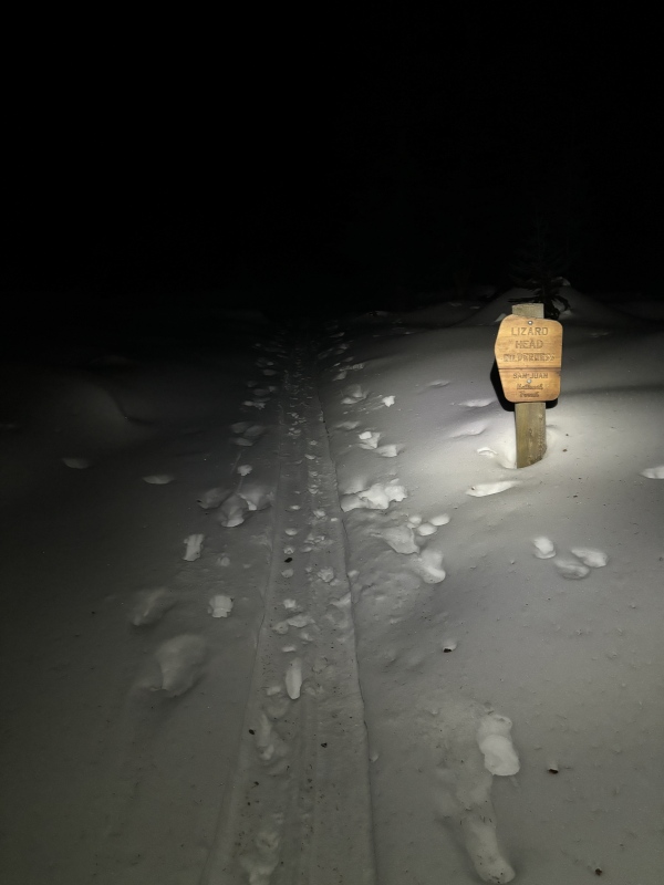
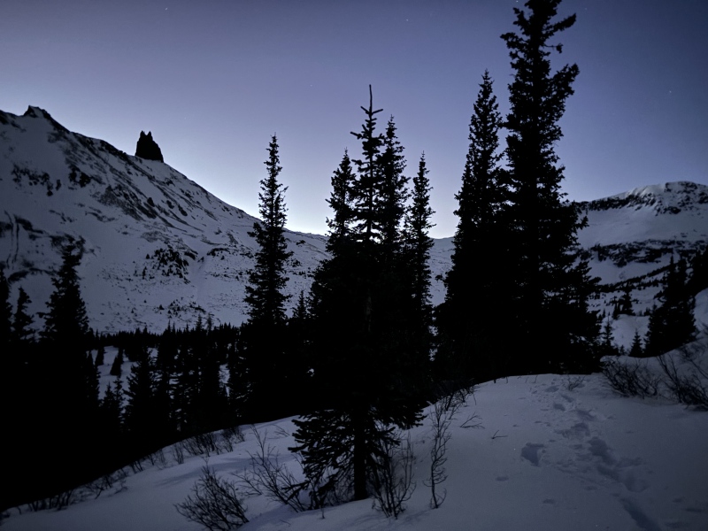


 Following a skin track early in the morning")
 Lizard Head from the approach in the moonlight")
 Looking up toward the pass between Lizard Head and Cross Mtn")
")
 First good views of Wilson Peak")
 The rising sun on Wilson Peak")
 Another beautiful shot of Wilson Peak")
 Looking up the South Slopes")
 The summer route on east facing slopes looks more loaded with snow")
 Looking down while climbing the south slopes")
")
")
 Summit!")
")
 Looking down on the crux (right side of ridge in photo)")
 Lizard head on the descent")
 Breaking trail in the sunrise")
 The summit")


