Download Agreement, Release, and Acknowledgement of Risk:
You (the person requesting this file download) fully understand mountain climbing ("Activity") involves risks and dangers of serious bodily injury, including permanent disability, paralysis, and death ("Risks") and you fully accept and assume all such risks and all responsibility for losses, costs, and damages you incur as a result of your participation in this Activity.
You acknowledge that information in the file you have chosen to download may not be accurate and may contain errors. You agree to assume all risks when using this information and agree to release and discharge 14ers.com, 14ers Inc. and the author(s) of such information (collectively, the "Released Parties").
You hereby discharge the Released Parties from all damages, actions, claims and liabilities of any nature, specifically including, but not limited to, damages, actions, claims and liabilities arising from or related to the negligence of the Released Parties. You further agree to indemnify, hold harmless and defend 14ers.com, 14ers Inc. and each of the other Released Parties from and against any loss, damage, liability and expense, including costs and attorney fees, incurred by 14ers.com, 14ers Inc. or any of the other Released Parties as a result of you using information provided on the 14ers.com or 14ers Inc. websites.
You have read this agreement, fully understand its terms and intend it to be a complete and unconditional release of all liability to the greatest extent allowed by law and agree that if any portion of this agreement is held to be invalid the balance, notwithstanding, shall continue in full force and effect.
By clicking "OK" you agree to these terms. If you DO NOT agree, click "Cancel"...
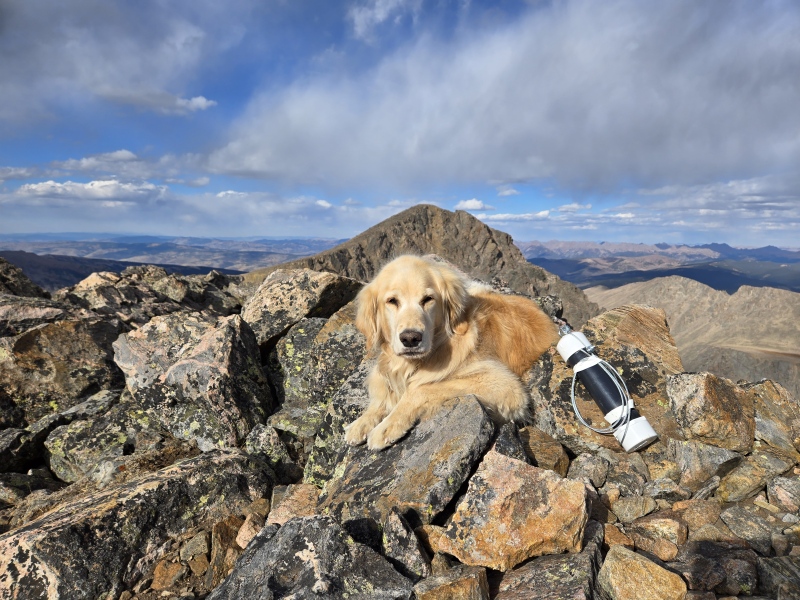
I didn't do a very good job of writing trip reports last summer, and while there's a pretty good reason for that, I knew it was time to get back on that horse this year with a route that hasn't been written about on this site since 2012. My last trip report was in this same area on a somewhat common route but I wanted to finish off this cirque with something a little different as I try to avoid stepping on the same trail twice when there is just so much to see out there. Enter killing two birds with one stone: another notch in my slow Centennial journey and a good reason for the return of helpful trip reports (and because I know you're all dying for a Harper update). You'll be happy to know that the angel returned to the high heavens for what would be her 195th unique ranked 13,000+ ft peak on this hike. Stay tuned for #200 coming soon.
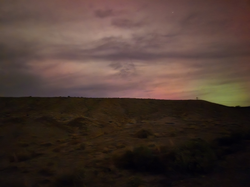
To be honest I needed some "alone" time on a long route and I liked the adventure of this one, not really knowing how long it would be or how much gain I'd end up with but also knowing that the terrain shouldn't be all that difficult and that there should be a trail most of the way, or at least through the trees. It's been a good year for long hikes for us as we got well conditioned by finishing the Colorado Trail earlier in the summer. Since then, Harper has joined me for several double digit days for summits so I knew she'd have it in her. I went to my boss' office at 4:55 on Thursday and asked for Friday off, and by 6:00 I was driving out of Telluride and heading towards Half Moon Trailhead. We stopped for a little bit outside Grand Junction to see if we could capture some aurora borealis pictures, but all we got were some very faint green and pink. Still pretty cool. By 12:30 am we were in bed in the back of my jeep just a little ways off from the trailhead. Tigiwon Road was in much better shape than in years past and any 2wd could make it up right now. No giant mud pits that look like they could swallow your vehicle this time.
Aurora near Grand Junction.
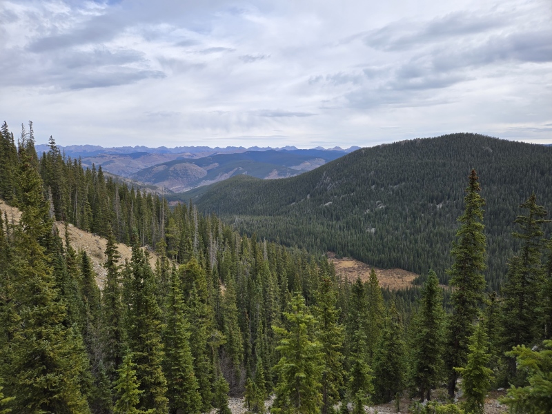
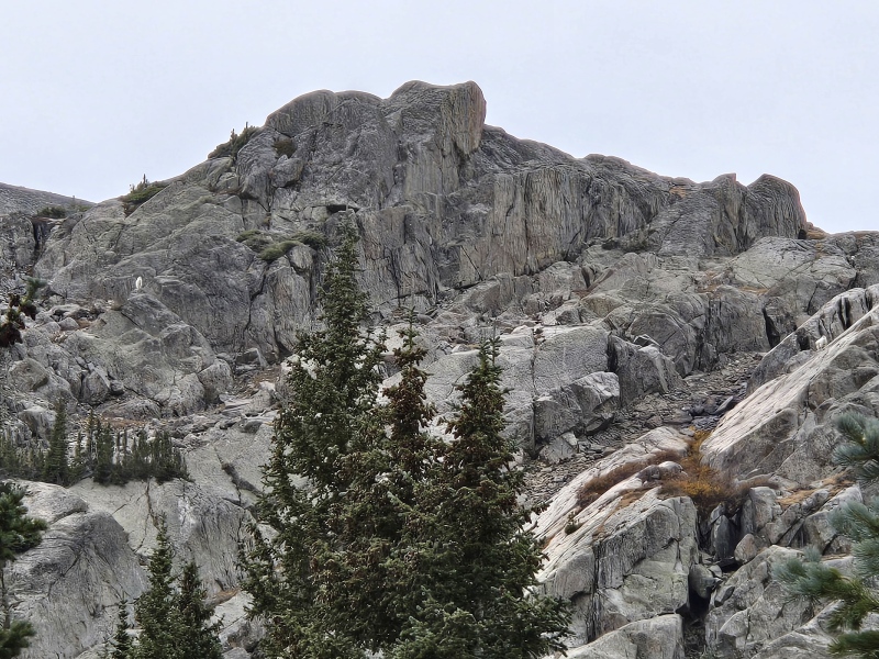
We got a late start the next morning as usual, but we hit Fall Creek Trail moving at close to 3 miles an hour so we made up for it quickly. The plan was to take the Fall Creek Trail up to Lake Constantine, then to Tuhare Lakes, then climb the south face of Holy Cross Ridge from the boulder field between the lake and the summit. I didn't have a lot of information on this hike beyond Tuhare Lakes but from the old trip report linked above it sounded like this route went at class 2. It did. This was actually a really pleasant way to get this remote centennial and I'm not sure why it isn't taken more often given the difficulties of all other access points to this summit. Halo Ridge is still on my list one day, but for those looking at ways to separate out these peaks or avoid the commitment of Halo Ridge I wouldn't hesitate to recommend this route.
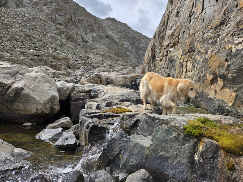
Looking back on Minturn from partway up Fall Creek Trail.You can always count on her to find the water.Lake Constantine comes into view after 4.5 easy miles on trail.
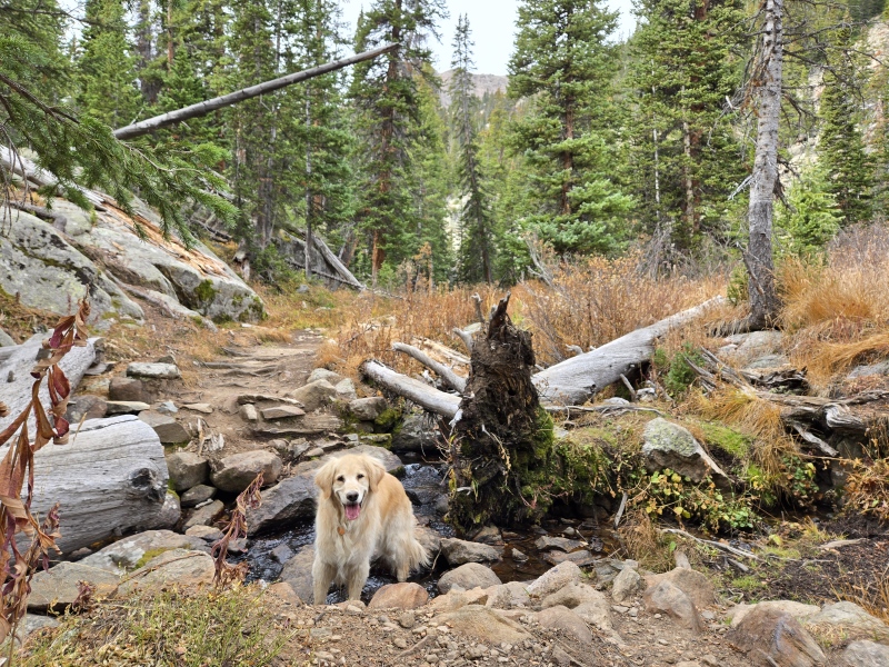
Fall Creek Trail has an unnecessary amount of downhill on the way in, but I was trying not to think about that for the return trip. We only saw one person all day, a woman coming down from the shelter just as we passed the turnoff, and an unoccupied tent at Lake Constantine. Other than that we were totally alone. I was glad we didn't see any signs of large fauna on the trail while down in the woods.
Beautiful trail between Lake Constantine and lower Tuhare Lake.The last paintbrush holding on to fall as tightly as I am.Looking up toward Fall Creek Pass.
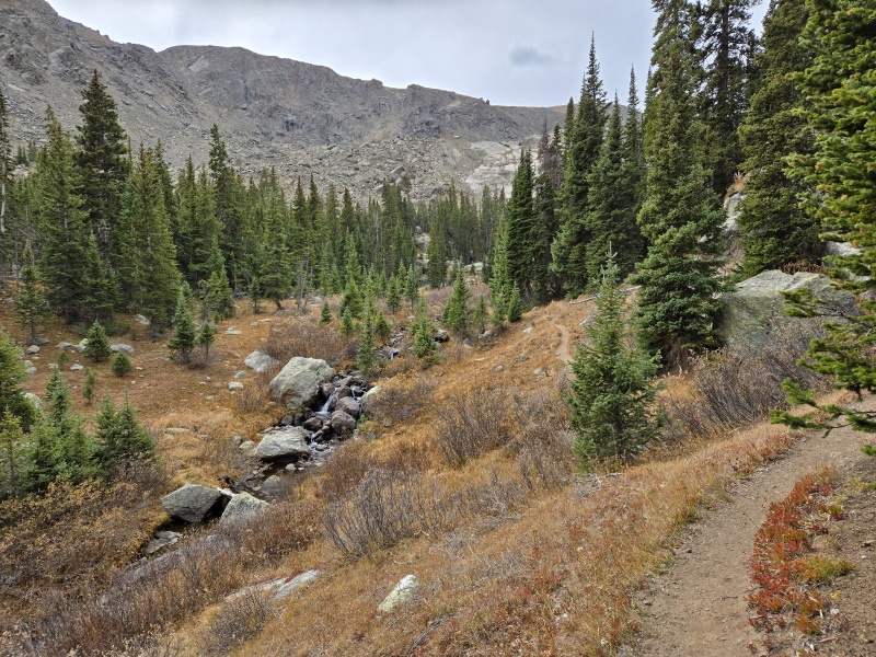
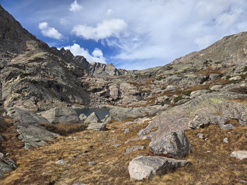
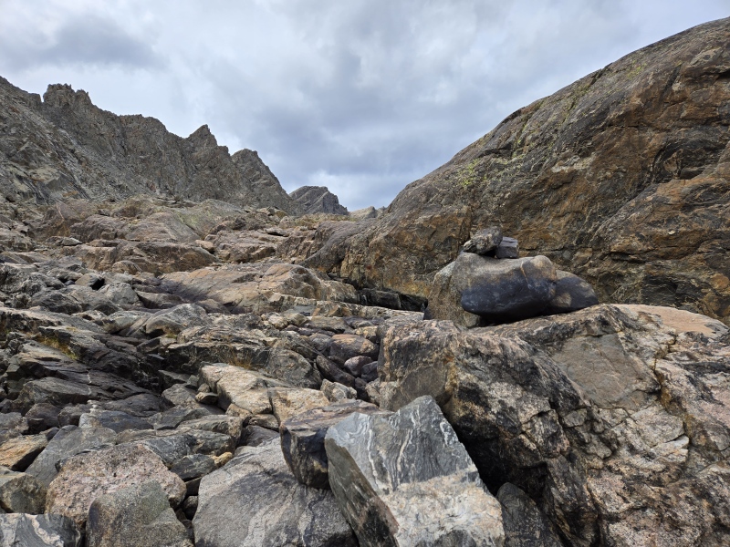
Shortly after Lake Constantine you'll veer right at a faint and unmarked trail split next to the creek. Left would take you up Fall Creek Pass on what looked like a really good trail. Right takes you to Tuhare Lakes. There's a pretty good and easy to follow trail up to the first Tuhare lake, but between the first and second lake this trail starts to peter off and after the second lake you'll be on your own for almost the entire rest of the route with an occasional cairn randomly popping up at times to remind you of civilization.
Looking up toward lower Tuhare Lake.Can you spot the two mountain guardians in this picture? Looking up toward Fall Creek Pass. Waterfall beneath lower Tuhare Lake. Faint trail continues right of this. Lower Tuhare Lake comes into view. Upper Tuhare Lake is on the next bench and while the trail gets faint here, you can see that it's pretty easy to find a way up through grass and rock. The reason I do these things.Looking down on lower Tuhare Lake.
The trail between the two Tuhare lakes can be faint at times, but it's obvious where you need to end up. There are some unnecessary cairns marking several possible routes here. I lost my way on the way down but there were no difficulties finding my way back to the trail at lower Tuhare Lake.
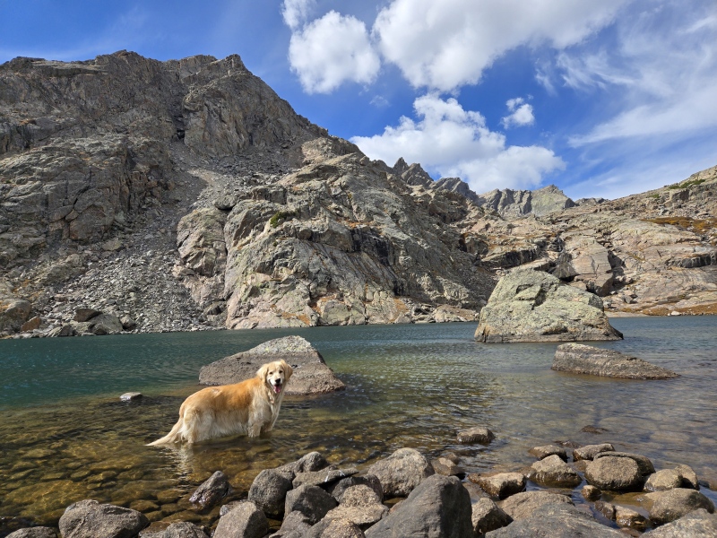
"Are you coming, mum?"Pool between the lakes. CairnUpper Tuhare Lake.
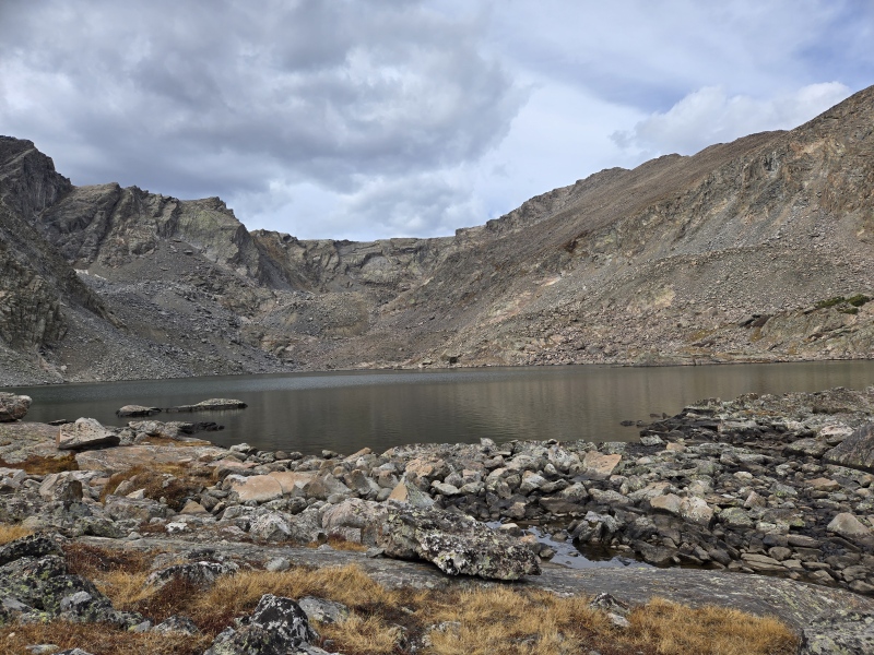
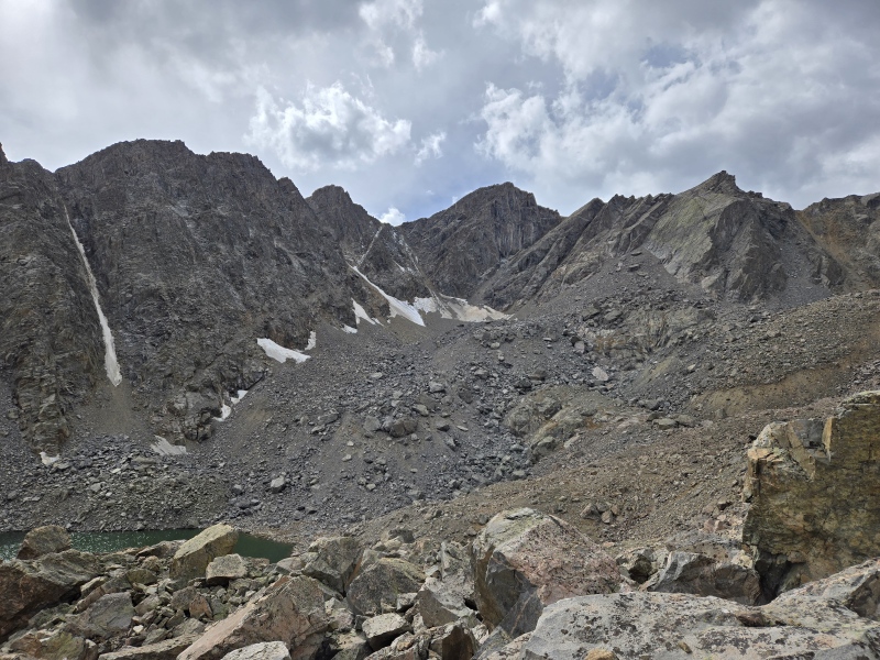
Once you reach the upper lake you can see the summit and almost all of the rest of the route. You're aiming for that gully that is directly opposite of the lake, then from there you just pick your way up to the summit over pretty stable class 2 rock. There are two ways to get to that gully on the right side of the lake and I'm strongly advising the lakeshore route over the boulder field route that rises above the lake. It's the same kind of rock on both, which is to say deceptively VERY large boulders that require leaps and big steps to get over, and with a dog, lots of lifting and encouraging. However, the difference between the two routes is that the boulder field has several large gulches that require you to dip down into to continue and really pick your path, while the lake obviously avoids that and is a little more straightforward with the path picking. Don't get me wrong - it's fun rock and would go pretty quickly without a dog but if you want to keep your life as easy as you can just follow the lake. You still get plenty of boulder time, and the rocks are just as beautiful on both rotes.
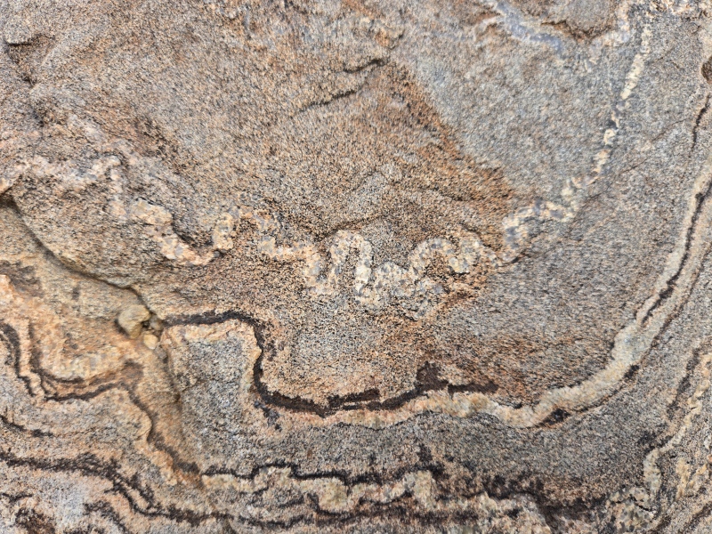
Paws and patterns.Snake in the rock.
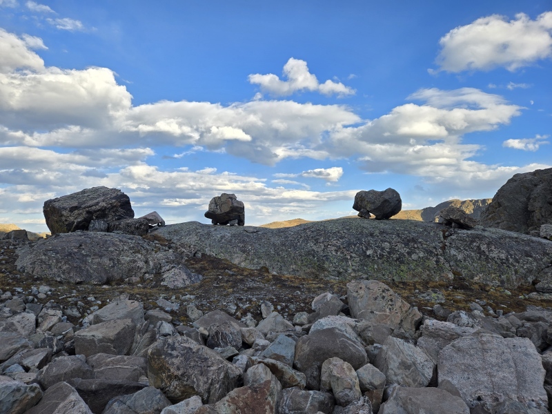
The patterns on the boulders around the lake were just magnificent. Stripes, swirls, colors, textures - the above pictures are just a couple of examples. You'd be hopping along, focused on finding your next long step, then you'd just stop in your tracks looking at these beautiful and unique canvases underfoot. And they are BIG. I probably would have tried to take one of these rocks home if they were smaller, but the patterns just don't show up as well on a smaller scale and small rocks are actually hard to find in the boulder field/along the lakeshore. It's okay. I'm perfectly happy taking home some pictures instead. Do any geologists in the group know what kind of rock this is?
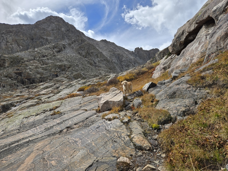
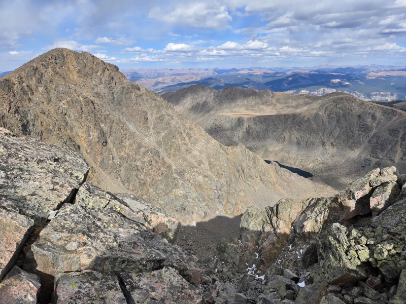
Looking over at UN 13,786, in the boulder field. Gully you're aiming for to the right. Looking up the gully.
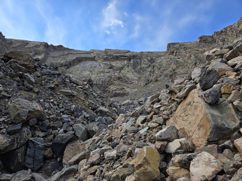
Once through the boulder field, which took a lot longer than anticipated, we made our way to the pretty obvious gully and were pleasantly surprised to find that it too was stable rock.
Looking back down the gully. "This is great, mum."
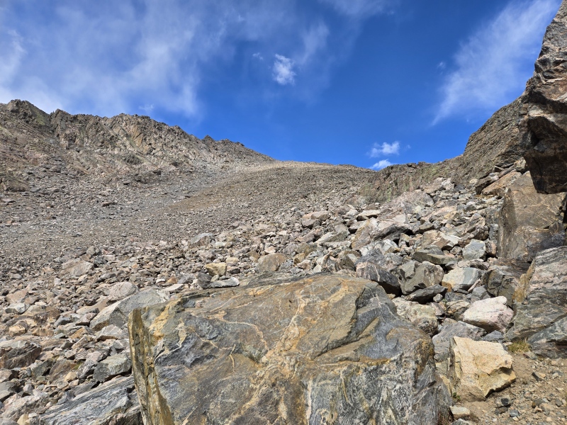
The gully is pretty short, then when you reach the top of the funnel the rest of the mountainside with the summit comes into view. Pick a path and make your way up! There are occasional cairns but no one way to do this. I swung out on my way up and took a more direct route on the way down. You really can't go wrong.
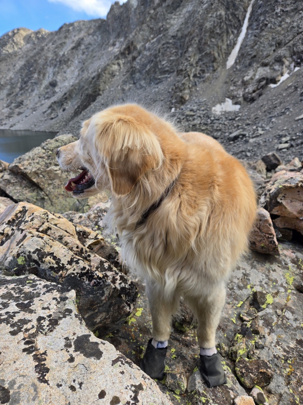
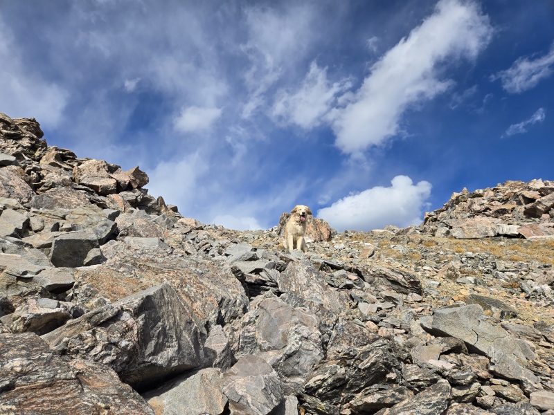
Booties booties booties 'cause there's rocks everywhere. Rocks everywhere. Rocks everywhere.Cairn at the top of the gully. 700 feet later, Harper was ready to use her angel ear-wings to fly back down to the lake for a swim.
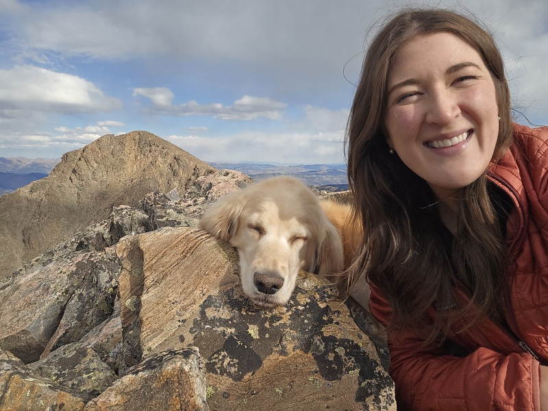
I aimed for the ridge where Harper was waiting patiently, then we picked our way another 100 feet to the summit where we took a good long break.
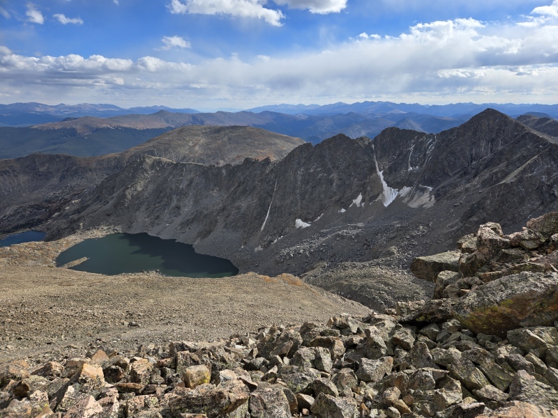
Harper doing Harper things. Namely, not smiling for a single summit picture when she's done nothing but smile all day. Rotten little angel. Looking down on Tuhare Lakes from the summit. The gully is that crack to the right. Holy Cross, Notch, the shelter, and Harper's peak ("Harper's Halo") just out of sightHow we feel when the canister is closed too tight for us to get it open. Harper couldn't sign her #195 but that's okay. We'll make this trip report instead.
I sent a few "I'm alive" texts, called my parents who were on their way to the airport to move to France for the next 3 years (not a joke), and ate the $20 worth of candy I bought at the gas station in Rifle the night before. After a nice long break we set off for the return trip, but between the summit and the gully I watched my phone go from 50% to 15% battery in about 25 minutes without any aps running and on airplane mode. Before we could make it to Lake Constantine my phone decided to die entirely and with it my GPX route, but at least we were able to make it back on trail. Another 30 minutes later it was getting dark though, and the second fun electronics event happened when my headlamp battery was so low the light only hit the ground if I held it beneath my hips, and even then it barely showed the ground. At this point I was very glad of the 6-foot wide trail, as I went from practically running down the trail to slowly picking each step by feeling for the smoothed out tree branches and hard dirt, differentiating the trail from the soft forest floor that was off trail. Harper walks behind me at night (no, never a guard dog) so was little help and wanted to know what all this extra fun was for. I was ecstatic when we passed the sign for the Notch turnoff, but it felt like it took forever to get from there to the trailhead. The faint light of the bathroom finally came into view though and by 9:00 we were grabbing dinner in Leadville and sending new "I'm alive" texts with a little more enthusiasm.
Overall I thought this was a great route. It's a great way to see more of this area, grab a peak that is otherwise pretty high-commitment from all other sides, and get in some longer miles without too much gain. The lakes, colorful rocks, and happy little angel dog were just icing on the cake to this centennial day.
Guardians of upper Tuhare Lake before my phone died.
My GPS Tracks on Google Maps (made from a .GPX file upload):
The rocks with snakelike stripes are called 'migmatite.' You get migmatites when fully formed metamorphic rocks are partially re-melted geologic activity subsequent to the rock's original formation. In the case of your hike, the original rocks were parts of volcanic islands that had formed in the middle of a prehistoric ocean. Subduction of a nearby tectonic plate moved several groups of these volcanic islands like a conveyor belt until they reached the plate boundary, where they collided and combined to formed a new aggregate landmass roughly 1.7 billion years ago. This collision subjected the rocks to huge pressures and temperatures, causing migmatites to form in the lower parts of the cratons. Around 65 million years ago, a huge and novel uplift called the Laramide Orogeny forced huge portions of the basement rock upward to form the modern-day Rocky Mountains, and in the intervening time the overlying younger rocks have been stripped away by erosion.
That's way more information than I thought I'd get, and thank you for the explanation! In all my hikes I've never seen rock like this and thought it was so unique. I'm surprised there isn't more across the state, but I have a lot more hiking to do and now I'm on the lookout for more areas with migmatite.
yes been meaning to chime in here for a while. Well played 13Retriever. I have been eyeing this route or something along these lines for forever now yet have not quite gotten there.
Seems like a viable alternative to standard holy cross route - which to me for some reason just doesn't call my name the same way.
Caution: The information contained in this report may not be accurate and should not be the only resource used in preparation for your climb. Failure to have the necessary experience, physical conditioning, supplies or equipment can result in injury or death. 14ers.com and the author(s) of this report provide no warranties, either express or implied, that the information provided is accurate or reliable. By using the information provided, you agree to indemnify and hold harmless 14ers.com and the report author(s) with respect to any claims and demands against them, including any attorney fees and expenses. Please read the 14ers.com Safety and Disclaimer pages for more information.
Please respect private property: 14ers.com supports the rights of private landowners to determine how and by whom their land will be used. In Colorado, it is your responsibility to determine if land is private and to obtain the appropriate permission before entering the property.


")
")
")
")
")
")
")
")
")
")
")
")
")
")
")
")
")
")
")
")
")
")
")
")
")
")
")
")
")
")
")