| Report Type | Full |
| Peak(s) |
Engelmann Peak - 13,370 feet Robeson Peak - 13,129 feet |
| Date Posted | 08/04/2023 |
| Modified | 08/16/2023 |
| Date Climbed | 08/04/2023 |
| Author | mijoflynn |
| Engelmann and Robeson from Bard Creek (no bushwhacking, no steep slopes, no gullies) |
|---|
|
This was my seventh summer visiting Colorado, but I've spent most of my time in the Tenmile and the Sawatch, so this year I stayed in Idaho Springs, with the goal of hitting some of the central Front Range thirteeners that are so frequently climbed by members of this site. I've added a bunch of green check marks, but on the last day of my stay Engelmann and Robeson were still holding out, and it felt wrong to leave them unclimbed given that I've spent a month and a half looking at them from the place I'm staying. 
But how to hike them? I did Parnassus and Bard from Herman Gulch earlier in my stay, so I didn't really feel a need to do the whole Law Firm loop. You can hike just Engelmann and Robeson from Ruby Gulch, but then you have to descend one of the four steep gullies, Robeson's steeper northwest ridge, or Engelmann's even steeper west slopes, and at the end of the summer, just considering any of those options made my knees hurt. I kept thinking back to my earlier hike of Bard, from which you can see the gentle, grassy east sides of E & R. 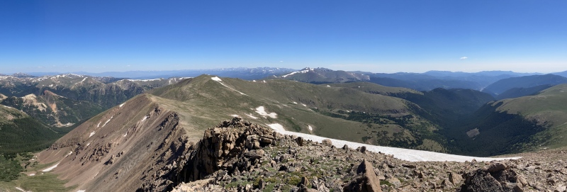
So I went looking for information on hiking those peaks from that direction. There are no relevant TRs on this site (which is why I'm submitting this one), but there were a couple of brief condition reports from 2020 saying that the Bard Creek Trail was an alternate way up, and when I contacted dwoodward13, he generously added a little bit of beta suggesting it was a really pleasant way to climb them. So I set the alarm and headed to Empire in the morning. To get to the Bard Creek Trail, Take S Main St, which turns into County Road 252, aka FS Road 777.1, aka Bard Creek Road. There's lots of opinions online about how bad Bard Creek Road is, but advice about exactly how bad and exactly how far up it you can get is all over the map. I'll try to give my opinion, with specific coordinates, in the hope that it will be more helpful. 2wd vehicles can, and probably should, park at the large parking area on the left just before the paved road turns to dirt (39.746659, -105.685965), because it gets rocky and narrow pretty quickly. I have a Jeep Cherokee Trailhawk (same clearance as a Subaru, 8.7", but better angles), and drove a little bit farther, to a small pulloff just past Empire Pass that I noticed on Google Maps (39.741710, -105.687235) -- normally I'm more daring, but I've already blown out a tire on Leavenworth Creek Road this summer, and didn't want to do something else to the car right before the two-day drive back to the midwest. Turns out I could have made it another three-quarters of a mile, to a parking area on the right with room for ten or twelve cars (39.74455, -105.69794); Subarus and the like should stop here. There's a couple of cabins in the process of being built a little further up the road (they were apparently also in the process of being built in 2020, when dwoodward did this route, so the pace of construction isn't setting any records), and shortly beyond them is the crux of the drive -- a rutted, pitted incline with a bunch of rocks pointing up at odd angles like they're anti-tank obstacles waiting to rip out someone's undercarriage. I'd want a lot more clearance than my car has before I tried that stretch. 


If you can get past that crux, though, you should have no problem getting all the way to the end of the road. Long stretches are perfectly smooth dirt; I only saw one more halfway gnarly section, a little past an old mine at (39.73484, -105.72679). The road's narrow, and because it's a shelf road in places, there aren't many pulloffs, but it's totally navigable for anyone who can get past the crux. The road ends at (39.73594, -105.73732) -- almost exactly 3 miles, and about 1300' of gain, from where I parked. There's not much of a trailhead, in the sense of a wide parking area; at a rare point where there's room to turn around, the forest service has just stacked rocks across the road blocking further vehicular traffic, and posted a sign stating that the Bard Creek Road is now the Bard Creek Trail. 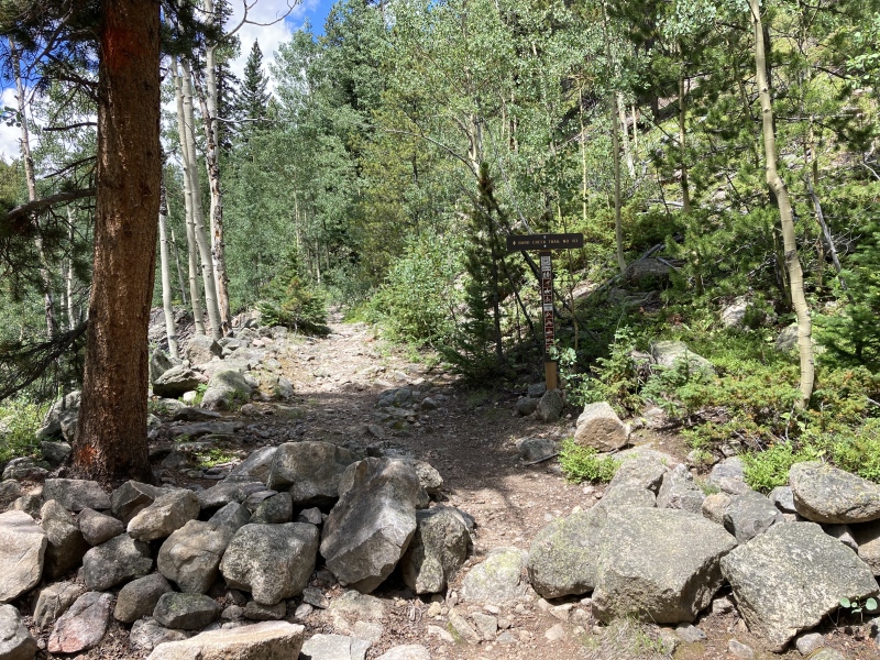
The Bard Creek Trail goes west from here until it reaches the head of a cirque below Robeson, and then turns south, loops around the east and south sides of Bard, and heads west until it meets up with the Watrous Gulch trail. A lot of the reports I found online were by people starting from Herman Gulch, saying that the portions of the trail around Bard are sketchy and hard to follow. Dwoodward told me that the eastern end of the trail, by contrast, was really well-maintained, probably because it's used for the annual Devil on the Divide trail run. He was right -- the trail was absolutely excellent. There was never a moment when it was even a little unclear where the trail was going. Plus, much of it is a very gentle incline on springy turf, moss, and pine needles -- exactly what my knees needed at the end of six weeks of hiking. It's such a nice trail that you can absolutely cruise -- I did the first 6 miles and 2800' of gain (consisting of the road and the trail) in just a tad over two hours. 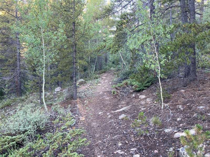


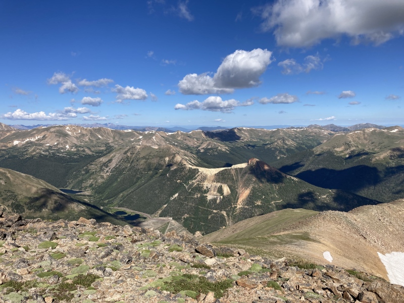
About five miles from my parking spot, the trail starts to switchback up the side of the basin and move in and out of treeline; you'll catch glimpses Bard off to the southwest. I followed the trail another mile or so to (39.73042, -105.78596), at which point it enters a clearing at the bottom of Engelmann's southeast ridge. I'd originally planned on following the trail even further, looping around to the south side of the ridge, but the climb from this clearing looked so manageable that I just turned right and started up. 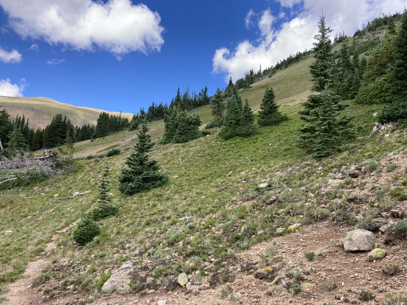
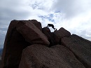
It's steep -- about 350' in two-tenths of a mile -- but it's less steep than what you climb on the other side, much shorter, and it's almost all on grass (there's a small section of stable talus at the top). And then it's over, you top out on the ridge, and the rest of the hike looks like this . . . 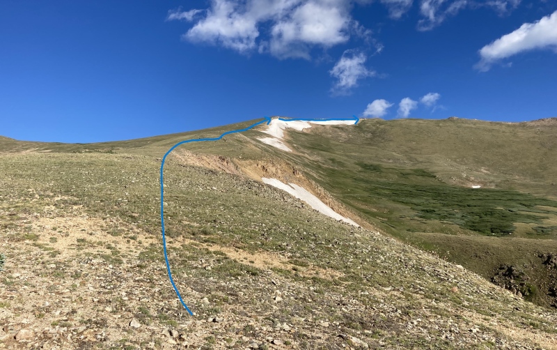
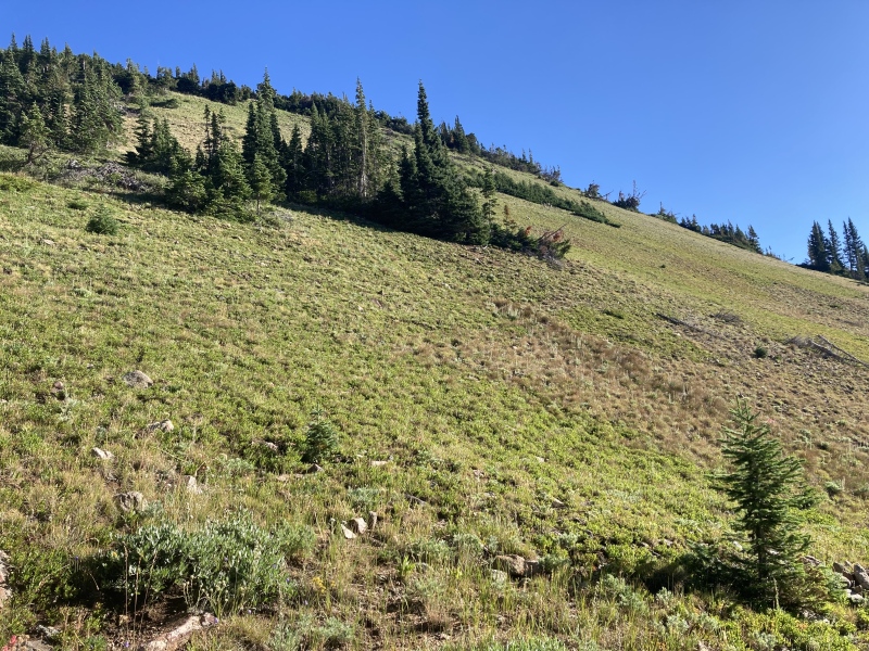
. . . just a gentle climb on grass and tundra. It's longer than it looks (about 1.25 miles and 1350'), but presents it absolutely no difficulties: just follow the ridge up, then turn right and stroll over to the true summit. 
Turn around and head toward Robeson. This is the same easy stroll that's been described by TRs taking other routes to these peaks: down about 500' and then back up 300', all on tundra. 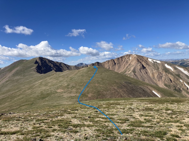
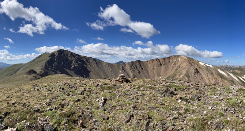
The route back to Engelmann's southeast ridge is clearly visible from Robeson's summit. Again, easy tundra. It's all downhill from here. 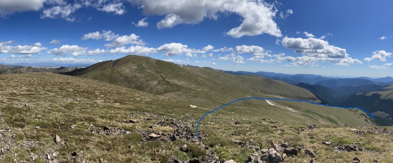
I saw one truck at a campsite about halfway up the road, and not a single person all day. My GPS clocked the hike at 16.5 miles and 4980', and I was back to my car about seven hours after I started. If you can drive all the way to the TH, you're looking at more like 10.5 miles and 3700'. I'm sure my route could be improved -- like I said, the south side of the southeast ridge appeared on the map to be easier than the southeast slope I went up, and I imagine it's possible to go straight down into the basin from Robeson and intersect the Bard Creek Trail further south. Bard Peak could also be added to this loop without much problem. Dwoodward said in his CR that he thought this should be the standard way up Engelmann and Robeson. Ruby Gulch is obviously better for anyone doing the full Law Firm loop, and it's a lot shorter for anyone wanting to do just E & R. But there are days when bushwhacking up 2000' in a mile sounds like a great way to build cred, and then there are days when having to descend the same 2000' down a crappy scree-filled gully sounds like a great way to break both ankles. Today, at the end of my hiking summer, was definitely the latter, and this was a relaxing way to bag my 29th and 30th peaks in 45 days without hating life on the way down. Hopefully this TR raises the profile of an alternate way to bag these two peaks on a low-energy day! Thumbnails for uploaded photos (click to open slideshow): ")
")
")
")
")
")
")
")
")
")
")
")
")
")
")
")
")
")
")
")
|
| Comments or Questions | ||||||
|---|---|---|---|---|---|---|
|
Caution: The information contained in this report may not be accurate and should not be the only resource used in preparation for your climb. Failure to have the necessary experience, physical conditioning, supplies or equipment can result in injury or death. 14ers.com and the author(s) of this report provide no warranties, either express or implied, that the information provided is accurate or reliable. By using the information provided, you agree to indemnify and hold harmless 14ers.com and the report author(s) with respect to any claims and demands against them, including any attorney fees and expenses. Please read the 14ers.com Safety and Disclaimer pages for more information.
Please respect private property: 14ers.com supports the rights of private landowners to determine how and by whom their land will be used. In Colorado, it is your responsibility to determine if land is private and to obtain the appropriate permission before entering the property.