
| Report Type | Full |
| Peak(s) |
Henry Mountain - 13,272 feet Fossil Mountain - 12764 Square Top Mountain - 13,007 feet |
| Date Posted | 07/27/2023 |
| Modified | 01/26/2024 |
| Date Climbed | 07/25/2023 |
| Author | WildWanderer |
| From Gold Creek Campground |
|---|
|
Henry Mountain – 13,272, Fossil Mountain – 12,764 and Square Top Mountain – 13,007 
RT Length: 10.96 miles Elevation Gain: 3927’ I started from Gold Creek Campground outside of Ohio City. The road in was an easy 2WD dirt road, that led me to a dispersed campground maintained by volunteers. There are about 5 sites, with vaulted toilets. I didn’t feel right using the empty campsites, as I wasn’t really camping, but sleeping in the back of my truck, so I parked at a dispersed site directly across the road, near the trailhead, at about 10,050’. Also, it was quieter, as a family with two small children and rather loud dog were staying in the campground. There was a makeshift corral for horses there as well. 
I was on the trail at 5am the next morning. The trail starts at the north end of the camping area. 
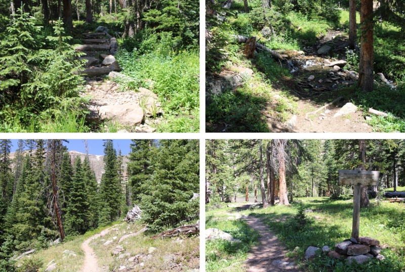
I followed Trail 532 northwest for 2.5 miles to Mill Lake. This is an easy to follow, class 1 trail the entire way to the lake. 
There is one junction early on that isn’t on a topo map, but it’s well marked. Just keep going towards Mill Lake. 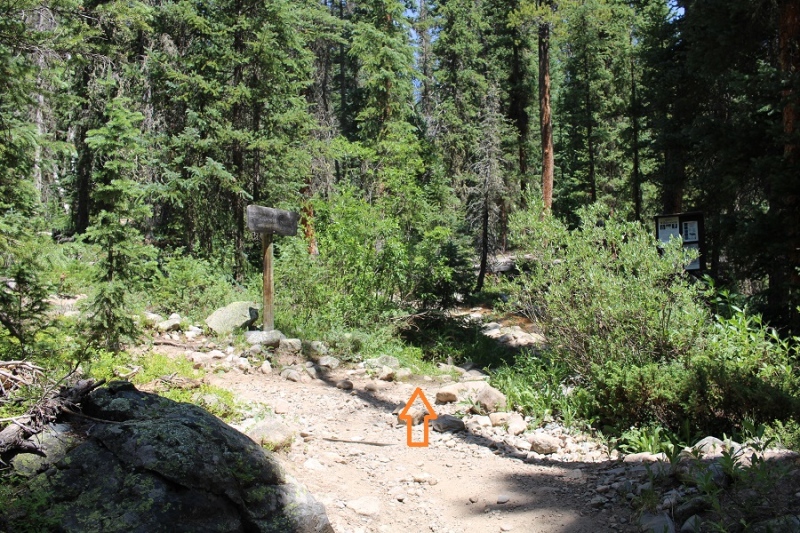
At Mill Lake you can clearly see Fossil Mountain. The easiest way to get there is to turn right, and head northeast through the trees until you see the ridge. It’s a short (100 yards at most) hike to get there, and the bushwhacking is easy. 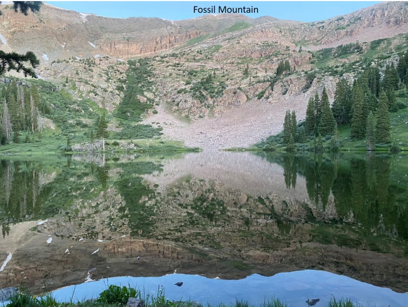
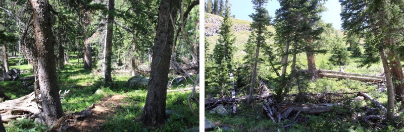
The route will be easily visible. There are rock ledges if you go to far left or right. You want to take the tundra northeast until you make it to the ridge, and then turn left and follow the ridge west. Here I gained 850’ of elevation in .75 miles 
Here’s looking at the last bit of the route to the ridge. There’s no need to hike all the way to the top of this little bump in the ridge, as it isn’t ranked. I skirted it and headed towards Fossil Mountain. 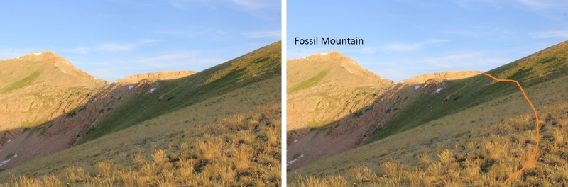
Now the hike became fun. The ridge goes at a class 2 scramble until the base of Fossil Mountain, then becomes an easy class 3 scramble to the summit. 
Here’s the overall route I took 
And some step-by-step pictures 
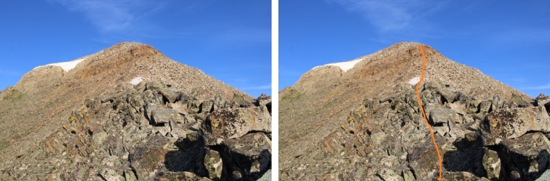
I went straight up and over this large rock formation. It was easy class 3. You can go to the right to get around it, but you’ll be met with loose talus and a gully. 
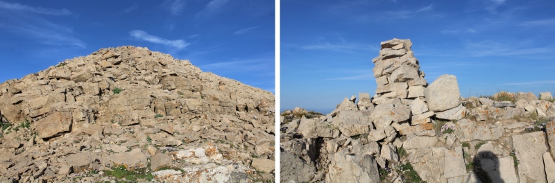
I summited unranked Fossil Mountain at 7am Fossil Mountain: From the summit of Fossil Mountain, looking to the northeast you can see the other two peaks I was headed for today, Square Top Mountain (unranked), and Henry Mountain 
It was a straightforward ridge hike to get to Square Top Mountain, where I pretty much stayed on the ridge. There were some easy class 3 moves, and at times I needed to dip to the left or right. The rock is very loose in areas, and very stable in others, so basically it keeps you on your toes. I lost about 180’ of elevation going to the Fossil/Square Top saddle. Here are some pictures of the ridge to Square Top Mountain. 
From the saddle, here’s looking up at the path towards Square Top. The first half was on tundra, and then the rocks began 
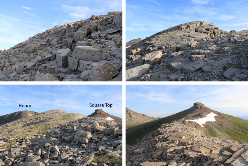
It was here I noticed a small herd of elk. I stayed where I was until they noticed me, then watched them watch me as they ran away. Check out the herd of elk: Ok, continuing with the ridge. This part looked difficult, but I found it was easy class 3 if I just kept to the ridge. 
Now to summit Square Top Mountain. This was relatively simple, as there were several options. I went up the gully nearest me (and down the one on the other side). The rocks here were loose, but the angle was light. 
After ascending the gully, I turned left and easily walked to the summit 
I summited Square Top Mountain at 8am Square Top Mountain: Looking to the northwest I could see Henry Mountain 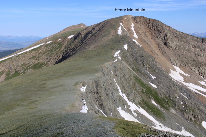
I descended Square Top Mountain to the northwest, and hiked on tundra to the summit of Henry. There were some very faint fame trails here I utilized. 

As I came to the top of the ridge, I was greeted by 4 mountain moats. Usually, mountain goats are pretty tame and just watch me. These ones did for a while, but as soon as I got out my camera and they could hear the shutter snap, they took off. Well, three of them did, the other one stood and looked like he was ready to fight, but then turned and followed the others 
The summit of Henry Mountain is to the northwest, so I headed northwest towards the obvious highpoint on more tundra 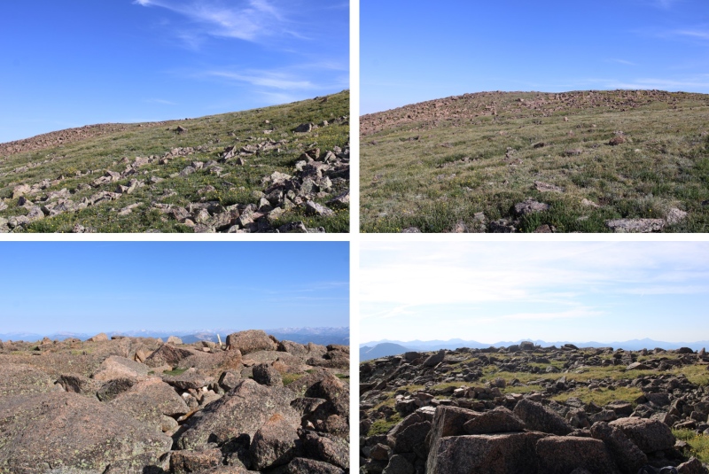
I summited Henry Mountain at 8:40am 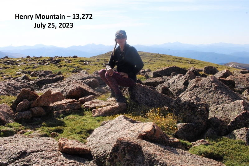
Henry Mountain: This was an out and back hike for me, so I turned around and retraced my steps back to Fossil Mountain 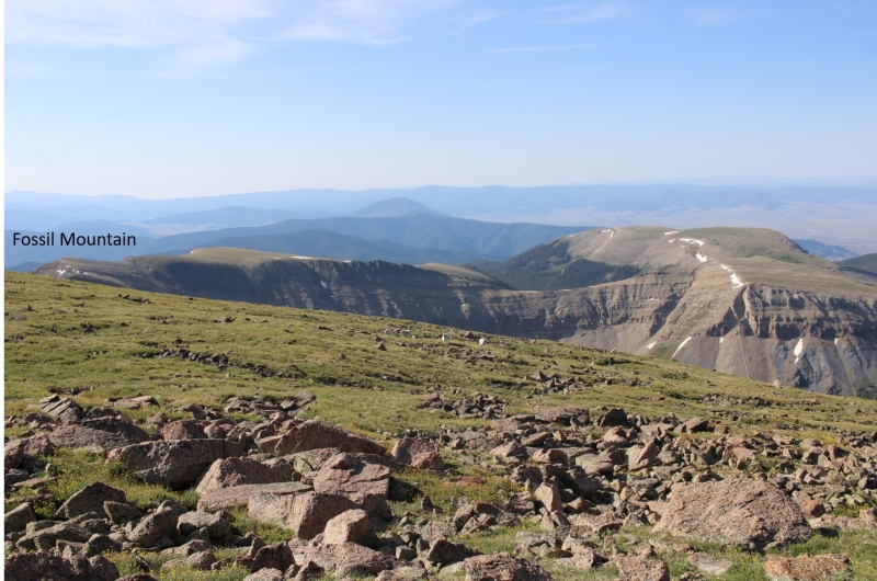
Here’s the overall route I took, skirting Square Top this time 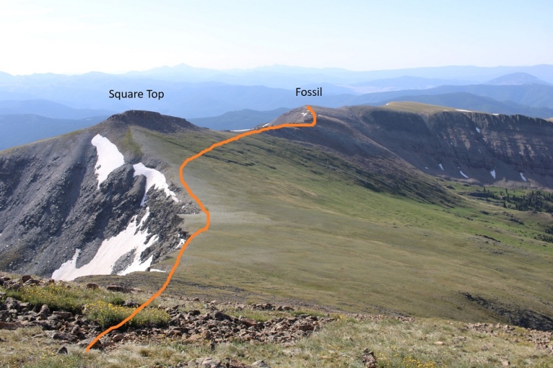

And some pictures of that rocky ridge between Square Top and Fossil 
Then down to the Fossil/Square Top saddle 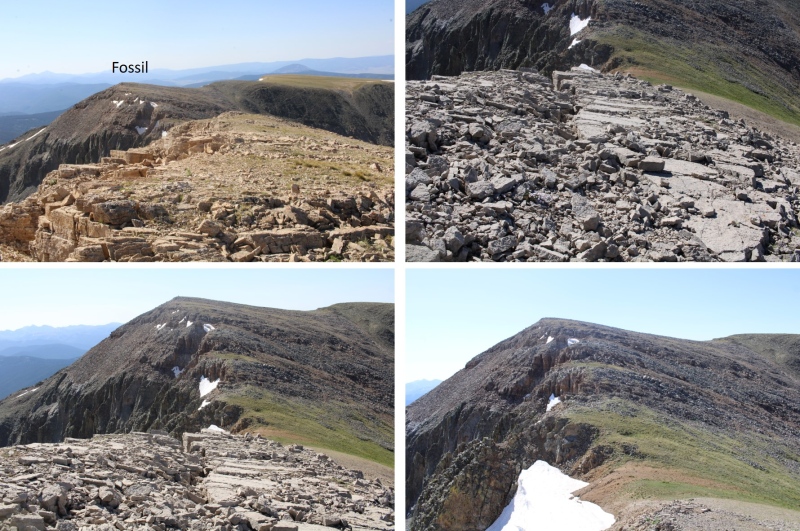
And up the ridge, back to the summit of Fossil. This part was class 2 
At the summit of Fossil Mountain I was greeted to 4 ptarmigans on the summit cairn. They actually led me for a bit down the trail. 
I descended Fossil Mountain to the northeast, staying directly on the ridge. Here’s the overall route. Note where I entered/exited the trees, as it kept me on tundra and avoided the rocky sections and brought me back to Mill Lake. 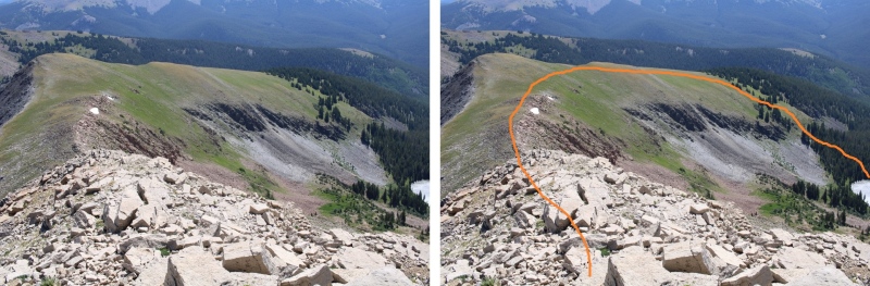
Here’s looking at that easy class 3 section down the ridge. Once again, I stayed directly on the ridge and kept it easy class 3 

Then back towards the tundra 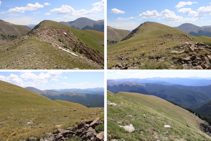
As soon as I came to the first group of trees on the tundra I turned right, and headed down towards the lake 
After a quick bushwhack in the trees, I could see the lake and a trail below 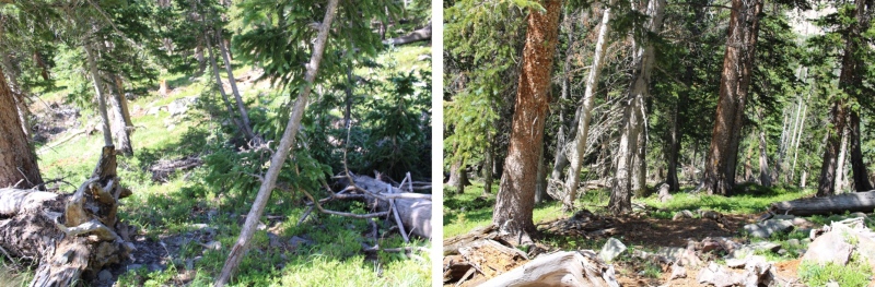
I followed the trail around the east side of the lake, back to Trail 532, and then followed that trail back to the trailhead 
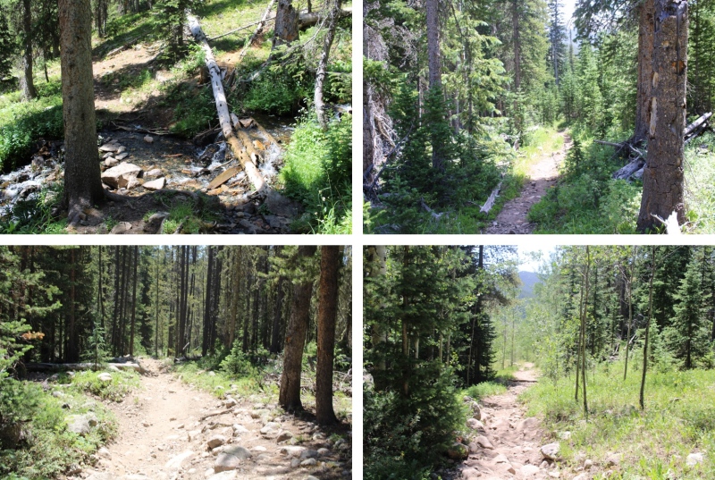
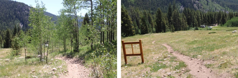
I made it back to my truck at noon, making this a 10.96 mile hike with 3927’ of elevation gain in 5 hours. Please, note, I spent a lot of time admiring the wildlife and looking for cool rocks. 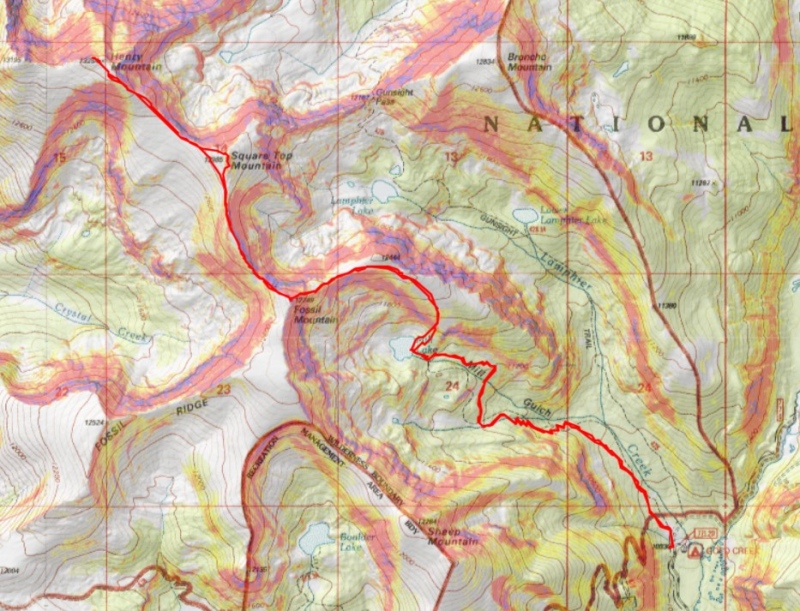
On to the next trailhead! Thumbnails for uploaded photos (click to open slideshow): 


|
| Comments or Questions | ||||||
|---|---|---|---|---|---|---|
|
Caution: The information contained in this report may not be accurate and should not be the only resource used in preparation for your climb. Failure to have the necessary experience, physical conditioning, supplies or equipment can result in injury or death. 14ers.com and the author(s) of this report provide no warranties, either express or implied, that the information provided is accurate or reliable. By using the information provided, you agree to indemnify and hold harmless 14ers.com and the report author(s) with respect to any claims and demands against them, including any attorney fees and expenses. Please read the 14ers.com Safety and Disclaimer pages for more information.
Please respect private property: 14ers.com supports the rights of private landowners to determine how and by whom their land will be used. In Colorado, it is your responsibility to determine if land is private and to obtain the appropriate permission before entering the property.



