Download Agreement, Release, and Acknowledgement of Risk:
You (the person requesting this file download) fully understand mountain climbing ("Activity") involves risks and dangers of serious bodily injury, including permanent disability, paralysis, and death ("Risks") and you fully accept and assume all such risks and all responsibility for losses, costs, and damages you incur as a result of your participation in this Activity.
You acknowledge that information in the file you have chosen to download may not be accurate and may contain errors. You agree to assume all risks when using this information and agree to release and discharge 14ers.com, 14ers Inc. and the author(s) of such information (collectively, the "Released Parties").
You hereby discharge the Released Parties from all damages, actions, claims and liabilities of any nature, specifically including, but not limited to, damages, actions, claims and liabilities arising from or related to the negligence of the Released Parties. You further agree to indemnify, hold harmless and defend 14ers.com, 14ers Inc. and each of the other Released Parties from and against any loss, damage, liability and expense, including costs and attorney fees, incurred by 14ers.com, 14ers Inc. or any of the other Released Parties as a result of you using information provided on the 14ers.com or 14ers Inc. websites.
You have read this agreement, fully understand its terms and intend it to be a complete and unconditional release of all liability to the greatest extent allowed by law and agree that if any portion of this agreement is held to be invalid the balance, notwithstanding, shall continue in full force and effect.
By clicking "OK" you agree to these terms. If you DO NOT agree, click "Cancel"...
Weather report was great and it proved to be a beautiful day in the Herman Gulch area. I set out at about 6:30am to climb The Citadel, Hagar Mtn and Mt Bethel. I originally planned to take the Dry Gulch route and climb Bethel first, but after seeing that the road into dry gulch was gated about 1/2 mile back on I-70, I opted for the CDT route through Herman Gulch. Not sure this was the most efficient decision, but it all worked out.
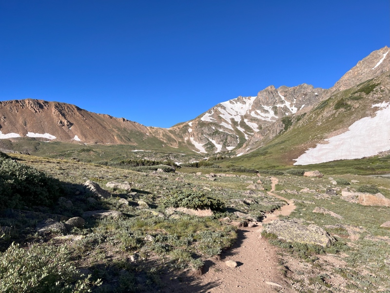
After a little over and hour into the hike I entered the basin near Herman Lake and was rewarded with awesome views of my first objective. The Citadel looks awesome from every angle but I was a little concerned the snow might be an issue up high since I didn't bring microspikes. Turned out to not be a problem.
View of The Citadel from near Herman Lake.
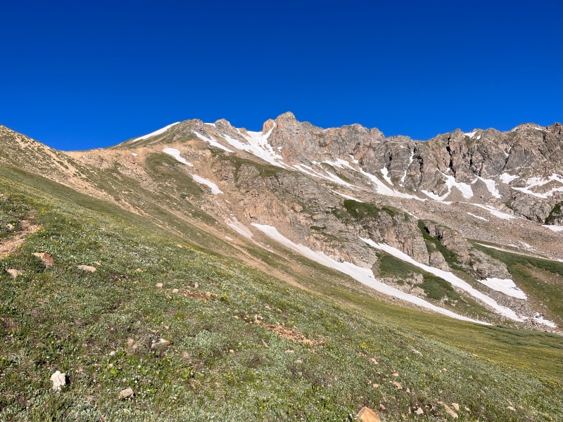
Nearing the pass, The Citadel continues to look impressive.
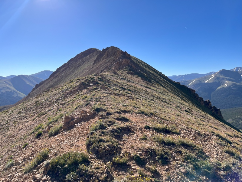
The Citadel from near the Citadel-Bethel saddle.
From here I decided to go for Citadel and Hagar first and if I still felt strong, I could get Bethel on the way out. The hike up the ridge was not overly eventful until I reached the rocky outcroppings. Moving to the left across a small scree field, I found the correct gully just prior to the Citadel-Hagar ridge. While there are some sketchy sections on this mountain I found this gully to be a low class-3 at worst. Not too bad! On the summit, I ran into Eric relaxing on top. After comparing itineraries, we decided to team up.
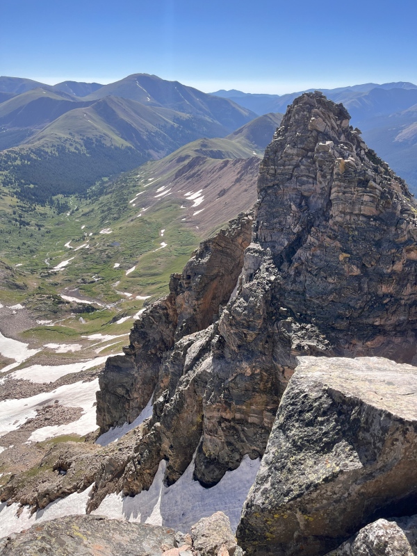
From the summit of The Citadel looking over the SE tower. I'm glad that's not the true summit!
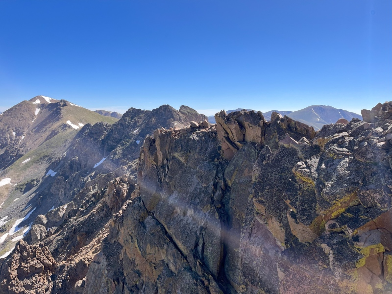
After an uneventful descent to the Hagar-Citadel saddle, Eric and I continued up the Hagar ridge. This can be kept class 2+ even though it looks sketchy from the saddle. There are nice, natural ways to navigate around the worst parts. The "knife edge" was overrated. I don't think I really would have called it that and found it easy to navigate.
View of the knife edge from the summit of Hagar.
After a quick return to the saddle we again ascended the loose scree field, walked past the gully on The Citadel and soon found ourselves back on the path. Mt Bethel is climbed via a nice meandering ridge on a well-worm path. There are 2 major false summits on this ridge that force you to gain/loose about 400 feet. The second can be easily traversed. The final ascent up Bethel is a very steep walk that got our hearts racing but the view from the top were incredible.
Mt Bethel from the Bethel-Citadel saddle.The View of most of our route from the summit of Bethel. Hagar is on the left, The Citadel is the rock ridge just left of center and Mt Pettingell (which we didn't climb) on the right.
Once at the top we debated how best to descend. Bethel is VERY steep in all directions but we really didn't want to walk back down the ridge the way we came which would add several miles to our hike. Looking at the contour lines on the map, we decided the east ridge offered the most shallow descent and would take us close to the car. Most of the ridge is a steep meadow with about 100 feet of loose scree in the middle. Once we hit tree line we continued down the ridge through a mostly open forest. Towards the bottom there was a bit of blow-down but not enough to cause any serious delays. We pretty much walked right into the parking lot.
Thumbnails for uploaded photos (click to open slideshow):
Comments or Questions
Caution: The information contained in this report may not be accurate and should not be the only resource used in preparation for your climb. Failure to have the necessary experience, physical conditioning, supplies or equipment can result in injury or death. 14ers.com and the author(s) of this report provide no warranties, either express or implied, that the information provided is accurate or reliable. By using the information provided, you agree to indemnify and hold harmless 14ers.com and the report author(s) with respect to any claims and demands against them, including any attorney fees and expenses. Please read the 14ers.com Safety and Disclaimer pages for more information.
Please respect private property: 14ers.com supports the rights of private landowners to determine how and by whom their land will be used. In Colorado, it is your responsibility to determine if land is private and to obtain the appropriate permission before entering the property.