| Report Type | Full |
| Peak(s) |
Hassell Peak (13215) |
| Date Posted | 10/31/2021 |
| Date Climbed | 10/30/2021 |
| Author | krishcane |
| Snow and paw prints on Hassell |
|---|
|
One thing I like about checklists is that it gets me investigating places I probably wouldn't think to go otherwise. Hassell Peak is one of those places - an out of the way 13er behind more popular Pettingell Peak and the Citadel. It's also just a Class 2 hike on the Continental Divide Trail, so not considered a big trophy challenge. Which means... you get it all to yourself on October 30th. The first 2.5 miles I followed the insanely popular Herman Gulch Trail toward Pettingell, but this late in the year, there were only a few cars at the trailhead just after dawn. I saw 5 different solo hikers during that ascent to around 11,800, and got the expected stunningly beautiful morning views in the places where the forest opens up. 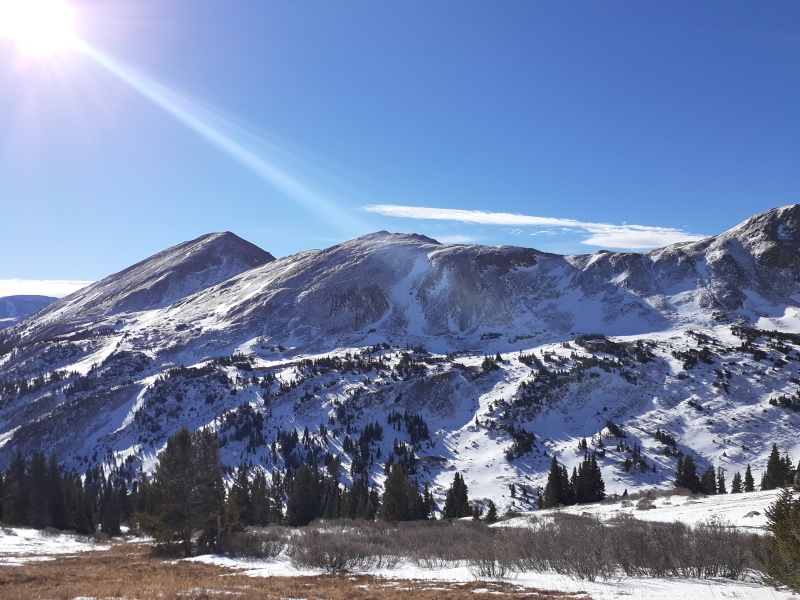
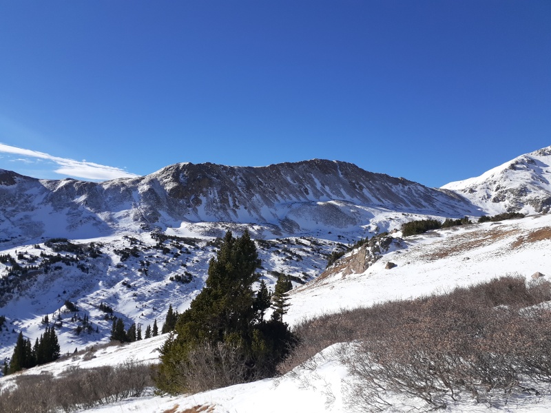
Just before reaching the lake and the popular spots, however, the Continental Divide Trail separates from the Herman Gulch Trail, heading north on what is now the Jones Pass Trail. Only one brave soul had gone this way before me since the foot or two of snow the previous week. 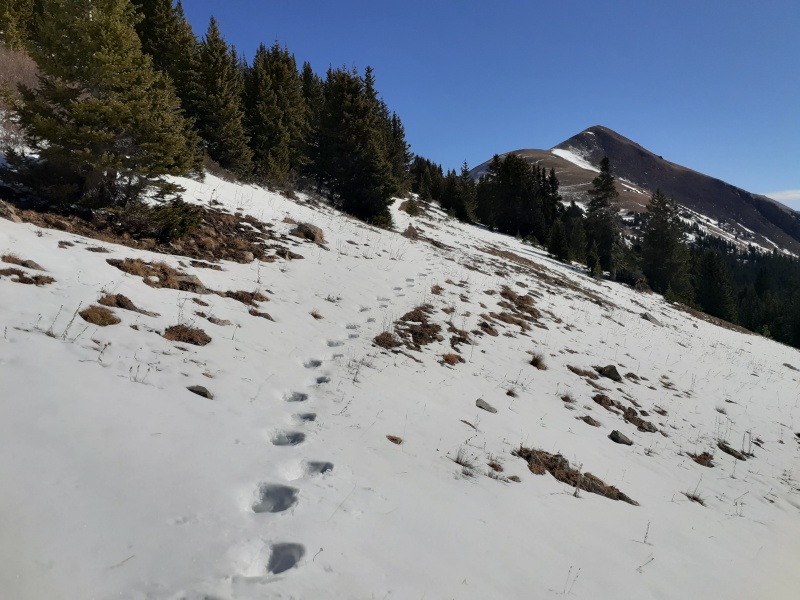
The trail passes over the low (11,900-ish) saddle with Mt. Machebeuf, drops a hundred feet to Woods Creek, and then begins to climb Hassell Peak proper. Didn't look bad on the map. No doubt trivial without snow. But the unexpected feature on this trip was the Woods Creek valley already had thigh- to waist-deep snow in it. The one mile from the saddle to getting out of that drainage took me two hours of the postholing in the most beautiful sufferfest I have ever seen. The snow was so perfect! Not a track to be seen! But every step was exhausting. Once I was finally up onto the Hassell Peak ascent, I took this photo where you can see my track. 
Obviously, flotation would have been good here. I just thought, "Hey, it's only October! This won't last long. It's just a drift." For miles. Because once I started up Hassell, it didn't really get any better like I thought it would. 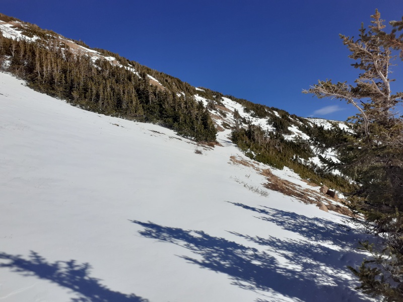
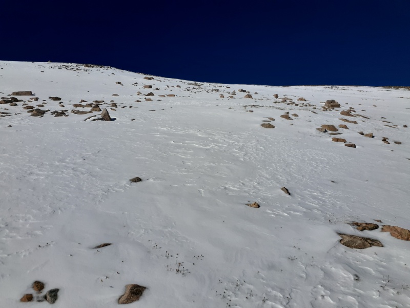
Surely, I thought, I just have to grind up this last part, and as soon as I turn the corner at the top of this ridge, the east face of Hassell will be all wind-swept and I'll just climb right up. 
Ha ha. Not so much. Still a good two feet of snow on most of the east face. Would've been absolutely epic to ride, if I'd brought my board. It was perhaps just steep enough for an avy, but was it deep enough? Had we been though a melt and freeze cycle? Can you have an avalanche in October? Hmmm... my beginner avy training wasn't sufficient to assess, and I started to think seriously about risk. Plus I was getting really tired of postholing, and I'd still have to grind across the Woods Creek valley on the way back. The Continental Divide Trail was totally invisible under the snow - GPS told me where it was, but I focused on bridging together short sections of deep snow between visible bare patches, in hopes of avoiding avalanche danger and also getting the occasional step or two where I didn't sink to my knees. 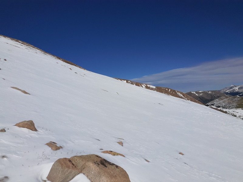
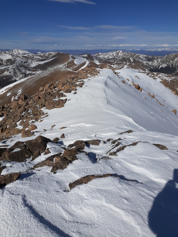
I hung in there and got to the summit ridge, where I was treated to some snow-free patches. One major benefit this day - almost zero wind. Even on the ridge and summit, there was like a 5 mph breeze, with gusts to 10. Base temp maybe 25. Virtually picnic weather for fall on a high peak. 

I 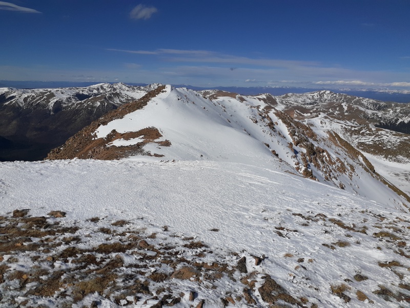

Then I found... paw prints! Apparently a cat was walking around up here in the snow, and when things melted a bit, the prints were left in relief. Pretty cool. 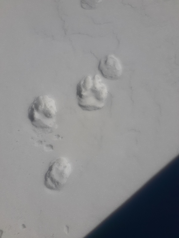
The short walk to the other maybe-summit turned out to be waist-deep snow in places, and I wasn't sure if some of it was cornice, so some care was required. I made a few advances crawling, I'm not ashamed to admit. Safety first! Well, obviously not... safety first would have meant turning around miles ago. So, like, safety third!! 
I decided to grab that unnamed 13er point 13,100-ish south of Hassell on the way back and then see if the actual CDT route might be a little less slope angle and thereby less danger of a snow slide. So I followed my prints back to the Hassell summit cairn and then went more due south, departing from my ascent route up the east face. 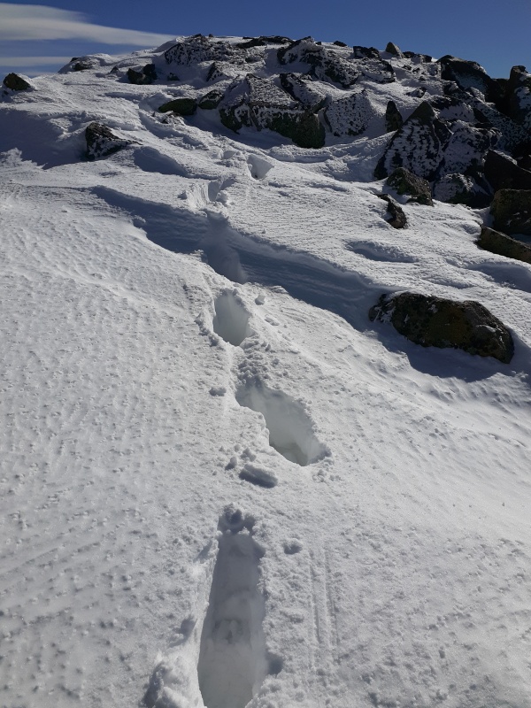

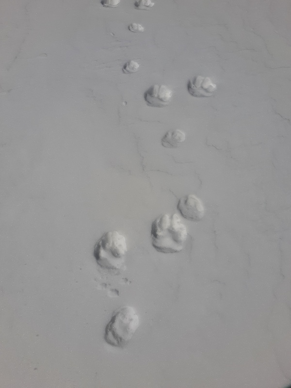
Remember those cat prints in relief because the snow melted after the cat crossed it? Well, I found a much cooler example once I was back in the Woods Creek valley. I had seen these little lines of snow towers in the distance several times while on Hassell's summit, not knowing what they where, but this was the first time my route took my close to them. Check it out - elevated cat paw print snow towers! 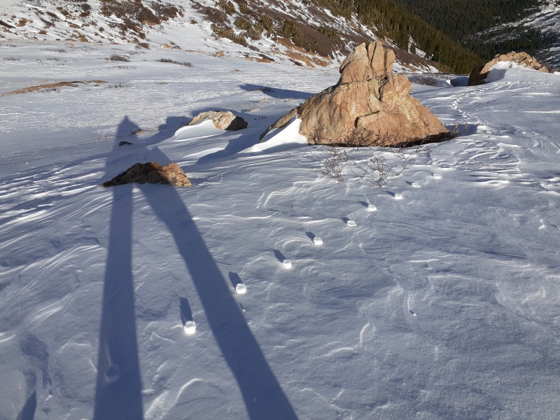

You might be able to tell from the angle of the shadows that the sun was getting low by the time I got back to Woods Creek valley. Now I had to get back up to the saddle, which would have been nothing in the summer... 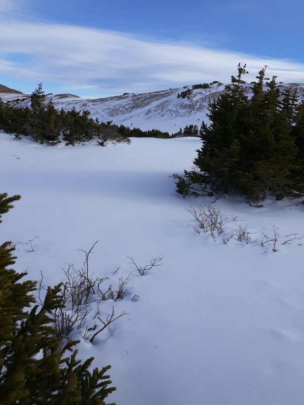
Problem was, the snow. When I crossed the valley the first time, I swung way west, trying to maintain altitude from the saddle, before realizing that I was going to have to drop down to Woods Creek no matter what or cross a dangerous snow slide zone. So I did, and it was awful when I finally gave up the altitude because the snow was so deep. So on the way back, I thought to follow the CDT via GPS and hope it would be better. Nope. It was worse. That photo above shows the "trail". I'm right on trail, but it's literally waist deep. At one point it got so deep by a tree well that I had to crawl across the top of the snow because otherwise I was postholing too deep to move. It was EXHAUSTING. It just didn't occur to me that flotation might be needed this early in the year. I lost the sun during this push, and it got COLD. Also, I was covered in snow and very tired, which didn't help. After a good hour of grinding, I made it to the saddle ridge, still technically right on the CDT. See, here's the "trail": 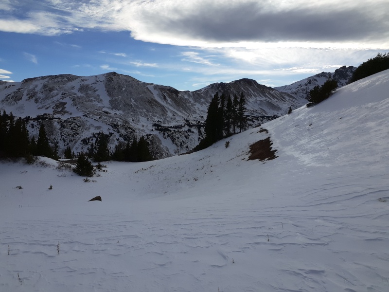
A few more hundred yards of kneedeep snow (downhill now, at least) got me back to the part where I had left the trail on the way up, and then I was easily able to walk in my previous footprints, which were mostly less than a foot deep. It was still 3.5 miles from here to the car, and the sun was behind the ridge, so it was a race against fatigue and twilight, but my crampons made it easy to walk fast on the icy trail, and I made it to the car just as real darkness fell. What a great trip! Hassell is probably considered not-very-interesting to most mountaineers, but in the shoulder season, things certainly got a lot more interesting, and the isolation meant beautiful untouched snowscapes and some pretty cool paw prints. Thumbnails for uploaded photos (click to open slideshow): ")
")
")
")
")
")
")
")
")
")
")
")
")
")
")
")
")
")
")
")
")
")
")
")
")
")
")
|
| Comments or Questions | ||||||||||||
|---|---|---|---|---|---|---|---|---|---|---|---|---|
|
Caution: The information contained in this report may not be accurate and should not be the only resource used in preparation for your climb. Failure to have the necessary experience, physical conditioning, supplies or equipment can result in injury or death. 14ers.com and the author(s) of this report provide no warranties, either express or implied, that the information provided is accurate or reliable. By using the information provided, you agree to indemnify and hold harmless 14ers.com and the report author(s) with respect to any claims and demands against them, including any attorney fees and expenses. Please read the 14ers.com Safety and Disclaimer pages for more information.
Please respect private property: 14ers.com supports the rights of private landowners to determine how and by whom their land will be used. In Colorado, it is your responsibility to determine if land is private and to obtain the appropriate permission before entering the property.


