Download Agreement, Release, and Acknowledgement of Risk:
You (the person requesting this file download) fully understand mountain climbing ("Activity") involves risks and dangers of serious bodily injury, including permanent disability, paralysis, and death ("Risks") and you fully accept and assume all such risks and all responsibility for losses, costs, and damages you incur as a result of your participation in this Activity.
You acknowledge that information in the file you have chosen to download may not be accurate and may contain errors. You agree to assume all risks when using this information and agree to release and discharge 14ers.com, 14ers Inc. and the author(s) of such information (collectively, the "Released Parties").
You hereby discharge the Released Parties from all damages, actions, claims and liabilities of any nature, specifically including, but not limited to, damages, actions, claims and liabilities arising from or related to the negligence of the Released Parties. You further agree to indemnify, hold harmless and defend 14ers.com, 14ers Inc. and each of the other Released Parties from and against any loss, damage, liability and expense, including costs and attorney fees, incurred by 14ers.com, 14ers Inc. or any of the other Released Parties as a result of you using information provided on the 14ers.com or 14ers Inc. websites.
You have read this agreement, fully understand its terms and intend it to be a complete and unconditional release of all liability to the greatest extent allowed by law and agree that if any portion of this agreement is held to be invalid the balance, notwithstanding, shall continue in full force and effect.
By clicking "OK" you agree to these terms. If you DO NOT agree, click "Cancel"...
Trailhead: Lake Isabel (4WD, 2WD is close by and wouldn't add too much)
Partners: solo
Class: 3/4
I've been planning this trip for the past couple years, and almost did it last Labor Day after a Wemi backpack, but the distance, elevation gain and off trail navigation always made it high on the difficulty scale. I had also originally planned it as a day trip. But with the addition of a new UL bivy, I decided a quick overnight would be the best for this group. My overnight gear adds on roughly 7 pounds.
Day 1: Pack into Camp + Pt 13,054 (Pyramid Mountain)
Mileage: 9.47
Elevation gain: 5,372'
Route: West Ridge NEW/old route?!?!?
Class: 2
I drove to the end of the road and found a big water tank, but no trailhead sign, so I turned around and took the pullout just to the south, about 10' away. I went to bed hoping that I would find the actual TH in the morning. My phone showed that I was right next to it. Google maps had photos, and I recognized a log.
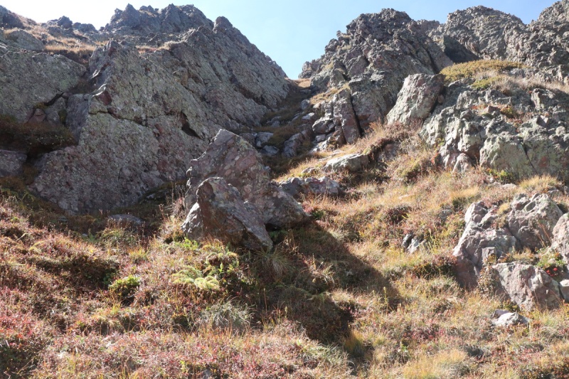
I woke up the next morning and finished packing and getting ready. I got onto the trail with first light. A few feet away from my truck, the trailhead sign was hiding in the trees just to the right. The trail starts very sandy, but then gets rocky quickly as you enter into the canyon.
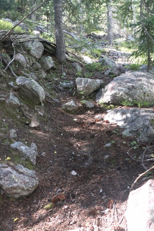
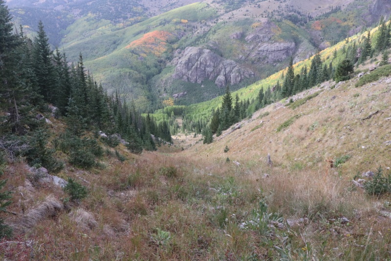
Once into the canyon the trail is fairly good and well defined, though it crosses the stream a dozen times, and one time the crossing was very long and you don't need to go up the scree slope to the south, despite the use trail scree. Some crossings were rock hopping, and others were on logs. Fall water levels were low enough that none of the crossings were bad. Spring might be different.
Typical stream crossing
Lil waterfall
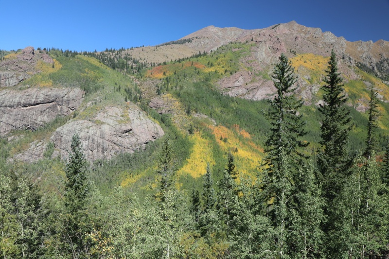
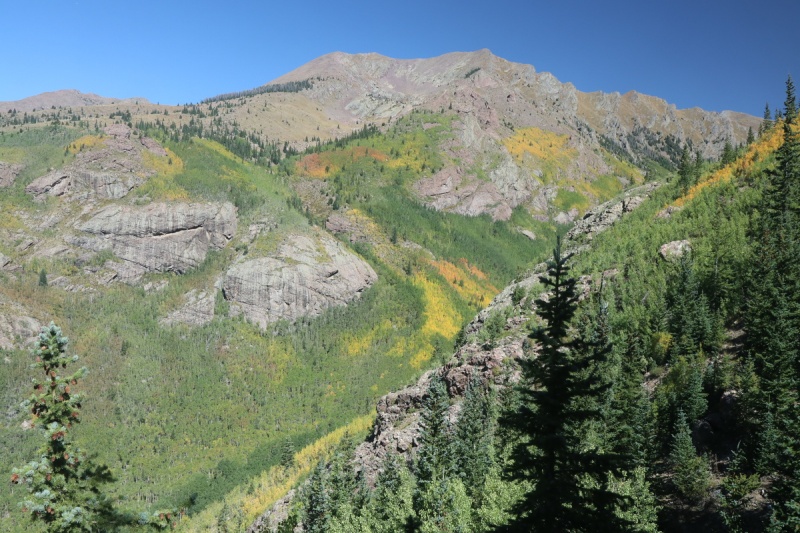
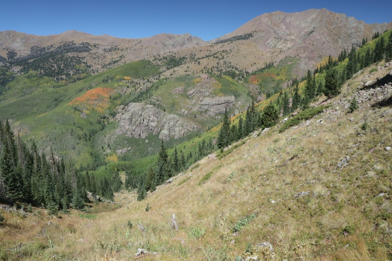
The stream crossings come in clumps with a half dozen coming quickly, then a nice break staying on the north side of the stream, before another bunch of crossings. The higher I went, the more the trees were turning towards fall.
Fall colors!
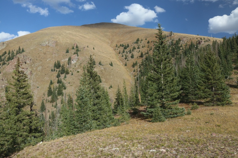
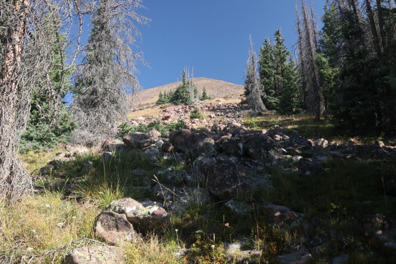
At 10,200' after passing a humongous boulder by the trail, I find an established campsite area with a few packed down spots. I had thought to get up a half mile further to 10,400' where both routes diverged, but I couldn't pass up a good camp spot! So I dropped my overnight gear (as in take out bundles and NOT set up), and got quickly back on the trail up to my goal for the day: Pyramid Mountain.
When I looked at other TR's for this peak, everyone seems to approach from the south and have an absolutely horrendous bushwhack. Meanwhile looking on my GPS and on Caltopo, there's a trail that goes from 10,400' on the north side to the west ridge. So all the potential bushwhack would be on an old trail. Why has no one does this before (or in a long time)??? So I decided to be adventurous and see if I could find this trail/route.
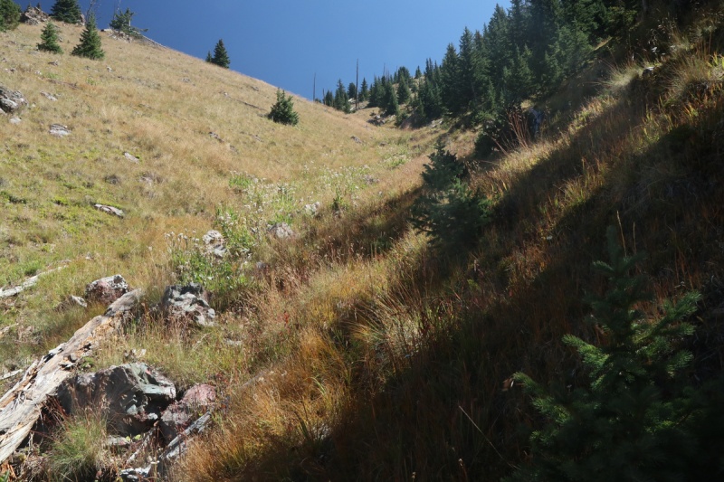
At 10,400' there's a box on a tree where my GPS showed the old trail. Well it wasn't obvious there, so I went a bit higher, but didn't see anything, so I decided to zig zag up and eventually I found the TRAIL. It was thin in spots, but in other areas it was very obvious. Even a cairn or two, but not many. So you will need to be able to follow game trails a bit.
Fall colors on 13,028
An obvious trail section
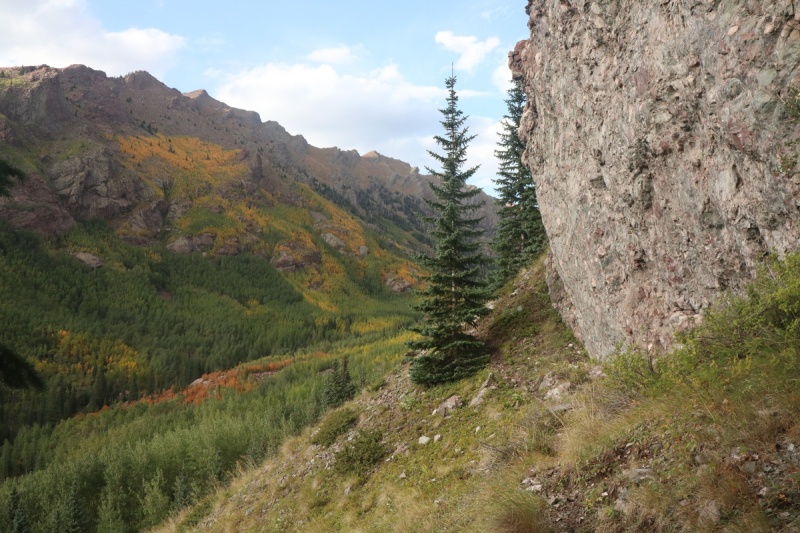
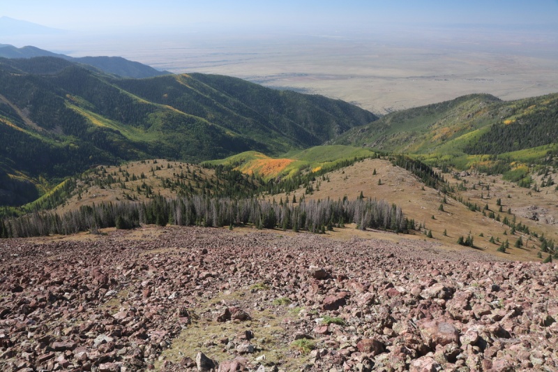
The trail traverses around the north slopes over a couple gullies as it winds it way up to the west ridge. Right before the ridge, where the trail looked to go straight up a ridge section, I saw an open gully meadow and figured I would just scoot right up the gully. There's no bushwhacking and I found plenty of elk/deer beds in this valley. While the gully is steep, it makes for easy travel.
Colors along trail
13028 colorsLooking up the grassy gully
Looking down, midway in the gullyLooking up the grassy valley
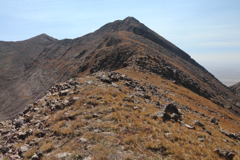
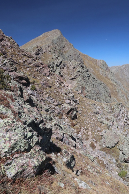
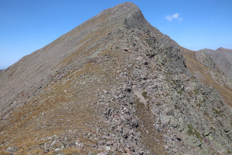
As I went up the dogleg to the east, I got a view of the upper west ridge. All smooth going!
Approaching the west ridge from the grassy gully
The west ridge was easy grassy tundra walking up to the first rocky prominence where I got a view of the final ridge to the summit. EASY PEASY!
devil plantRemainder of ridge to summit of Pyramid Mtn
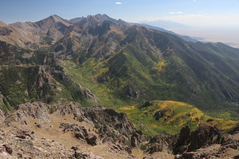
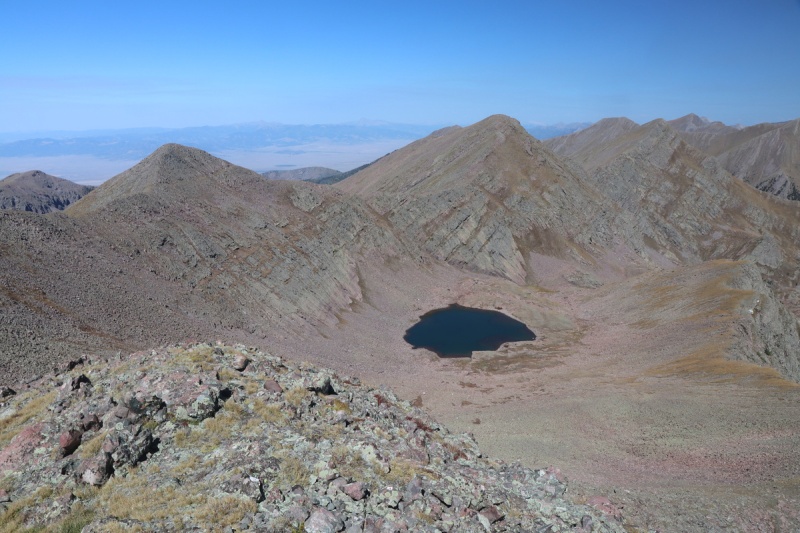
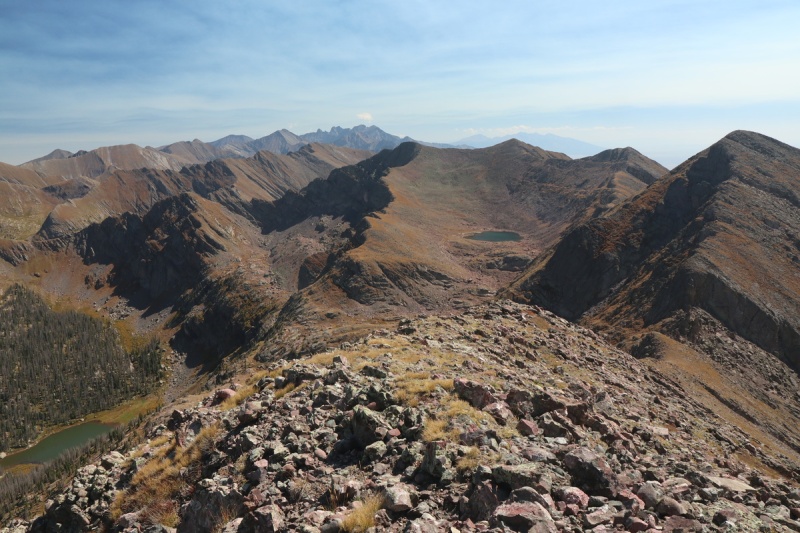
The view from the rocky bump was pretty spectacular, so I snapped a bunch of photos, after walking closer to the edge.
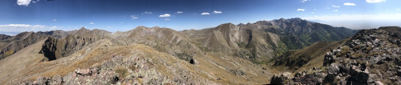
Adams to Kit Carson peaks
Pretty pano
After tearing myself away from the best view of the trip, I did a quick contour and got back on the ridge to the summit.
West ridge to Pyramid MtnLooking down west ridge
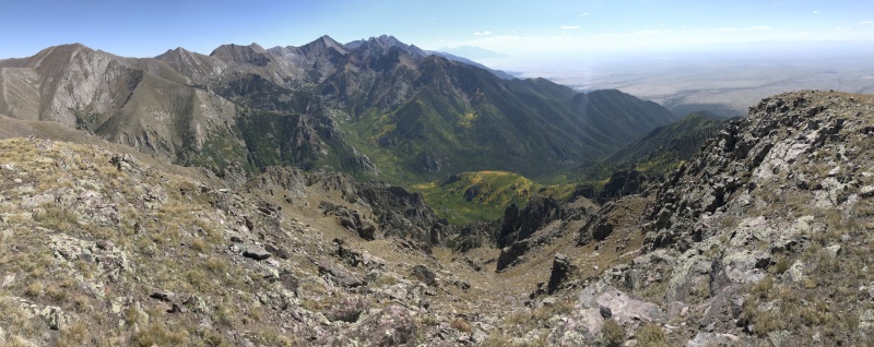
Spent some time enjoying the only summit of the day, since all I had to do was get back down to camp, eat and sleep.
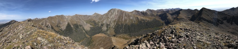
Pyramid Mtn summit pano
Mas Alto peaks for tomorrow
After a nice long stay, I started back down the west ridge. I had toyed with doing a loop, but the route to the lake looked tedious with a lot more route finding than I wanted at this point.
View down west ridge from summit
I went further down the west ridge than where I reached it on the way up, mainly to take a good photo of the route. The steep descent back to the valley approach below wasn't pleasant, so don't go this way. The trail on my map showed it going over the ridge here, but I couldn't find it and didn't want to search too long either.
West ridge from where the trail meets it - once upon a time, a long time ago
The lighting was getting good as I was going down the grassy gully, and I could help myself taking a few more fall color shots.
Fall is prettyDown the grassy gully
I got back to the traverse section of the trail and followed it back to where I started, and went a bit further, hoping to find the end where it met the main trail. While I went further, it seemed to disappear into the scrub, so I followed some game switchbacks and hit the trail a little above where I left it.
Nice waterfall along the new/old trail
Nearing the trail end
More fall colors
I got back to my camp with plenty of time to ice soak my feet and ankles in the nearby stream crossing and then set up camp and eat dinner. Was in my bivy well before the light fully faded from the valley to my west.
Camp
Day 2: Pt 13,028 (Menos Alto Peak), Pt 13,060 (Alto Peak), Pt 13,062 (Mas Alto Peak) + Pack out of Camp
Mileage: 10.53
Elevation gain: 4,560'
Class: 3/4
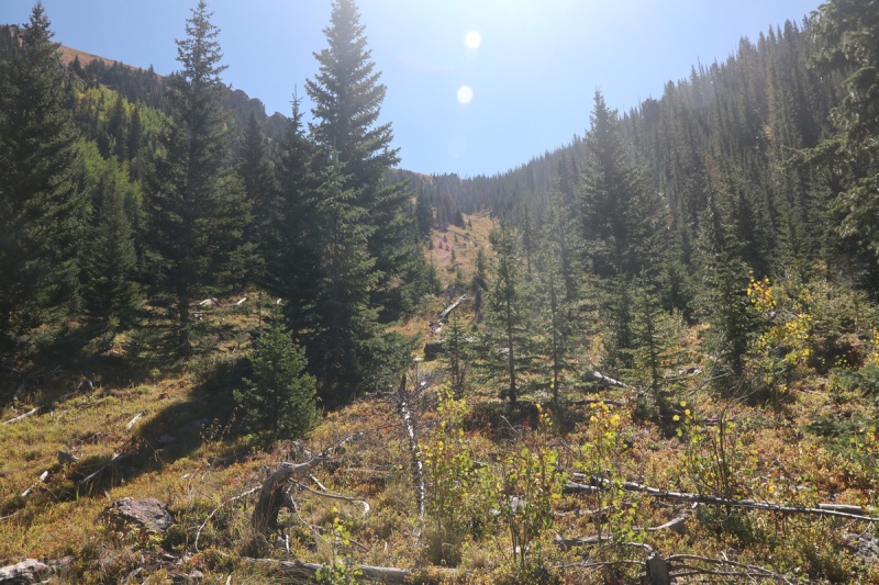
I slept in a bit longer than planned, but fall is finally starting to arrive, and it was a cooler morning than we've had recently. I started back up the trail and left it to cross the stream around 10,400' in a nice open area. From there it was a steep but open bushwhack up the colorful slope I saw the evening before. As I got higher up, I crossed an obvious trail that traverses the slope high up. I made mental note of taking this on the descent. The "trail" is more climbers style, and goes straight up the slope in scree. But any kind of trail is better than bushwhacking, so up it I went.
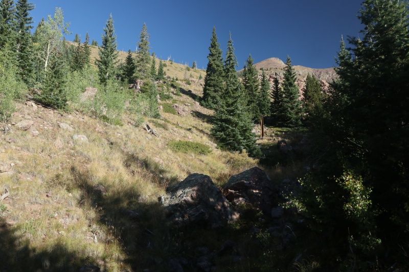
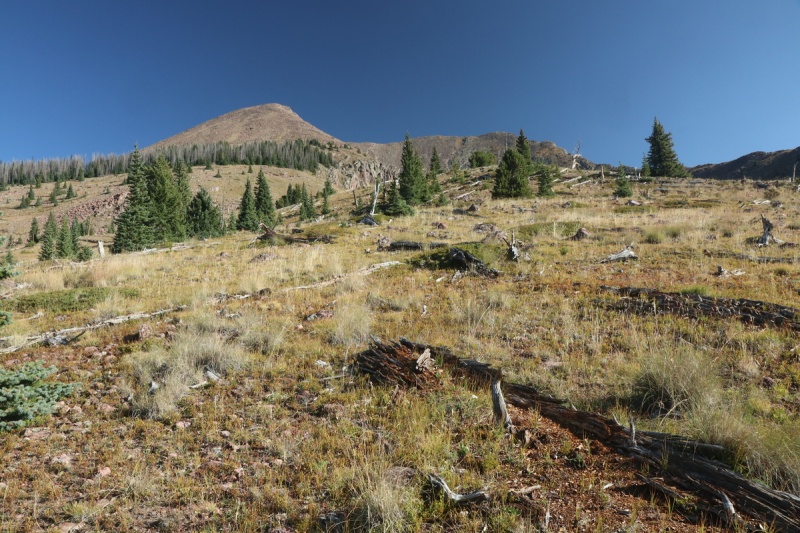
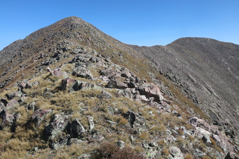
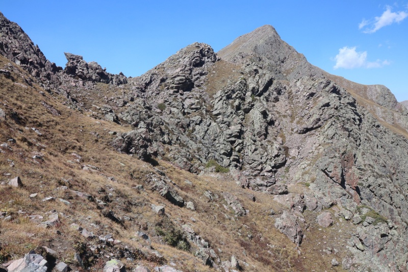
At an upper clearing, the trail fizzles out and I left it to gain the more westerly ridge up Menos Alto Peak. Fairly easy and open tundra walking until reaching the talus section.
Looking up ridge, where I left the trailgrassy ridge before the talus
I found an easy path between the upper forrest area, and then tried to follow the couple of grassy patches within the big talus field as best as possible, making my way up to the bump on the ridge I would see the top of 3 times today.
Path through trees to talusLooking down the ridge from the talus slope
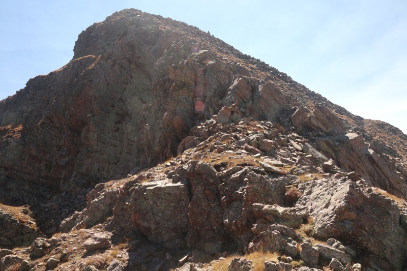
I got up the steep talus section, to see the remainder of the route to the summit, slightly to the right of the ridge.
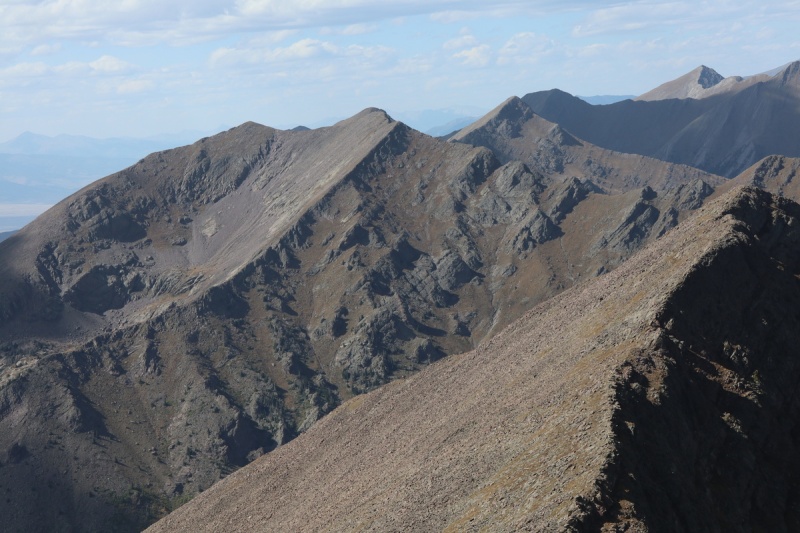
Menos Alto on the rightMenos Alto from ridge bump
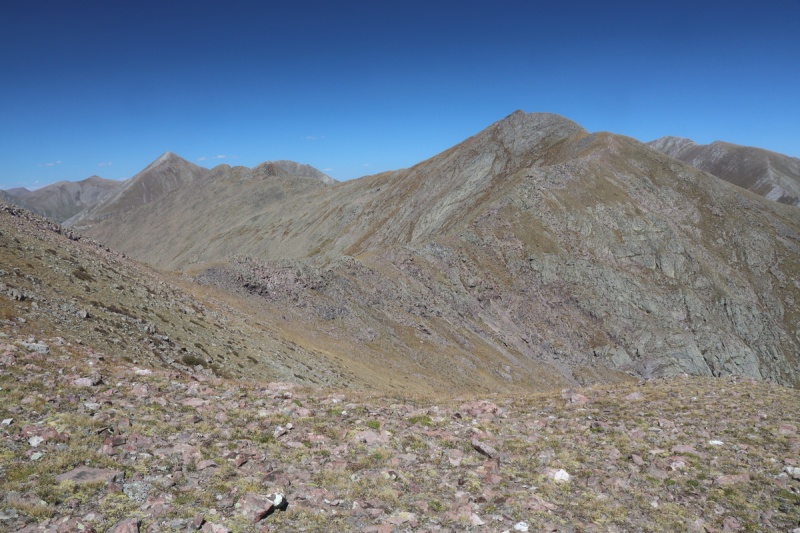
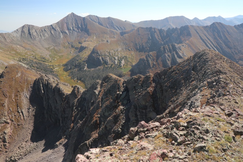
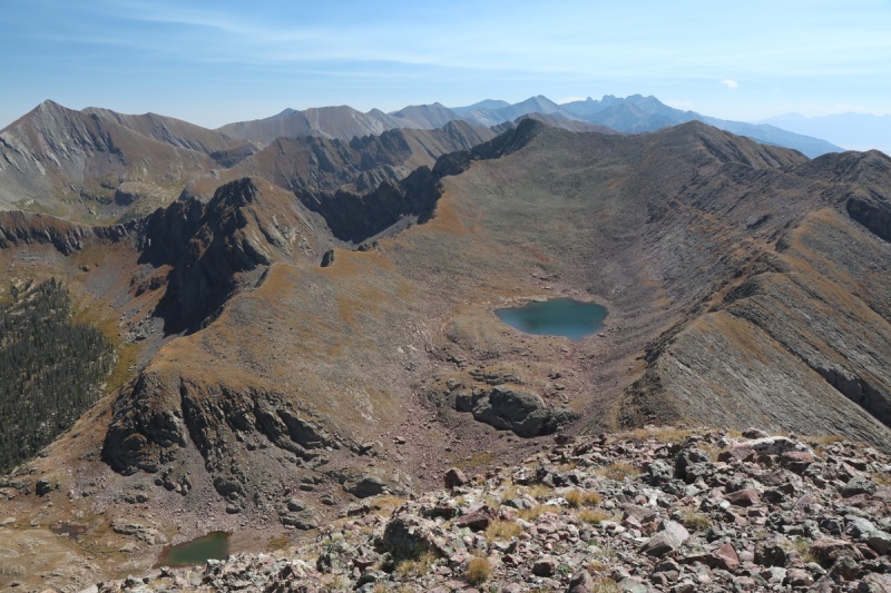
A rather nice summit view presented itself from the first peak of the day. I can see why the east ridge doesn't get climbed often, or at all.
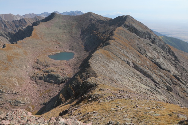
Mas Alto lake, with the other 2 peaks todayEast ridge of Menos Alto
Menos Alto pano
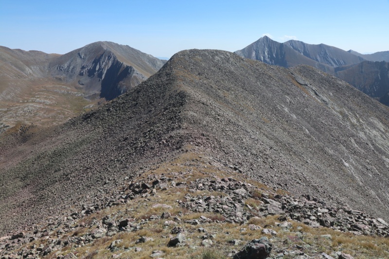
After a short summit break, I retraced my steps back to the first ridge bump and made my way to the grassy ramp that goes across there second bump, so you don't have to hike over the top of it.
Oh Hi grassy ramp, saving me elevation gain!
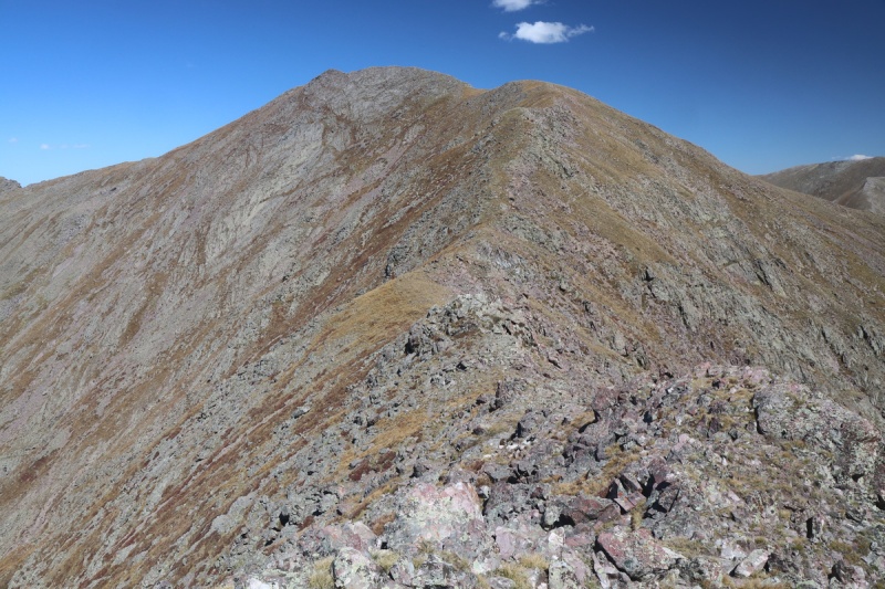
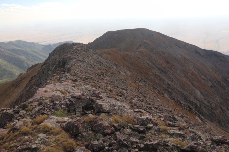
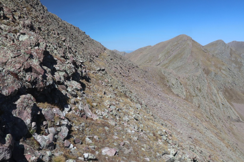
The ridge over to Alto is the longest of the day, but is very easy.
Ridge to AltoLooking back on ridge so far
Final pitch of AltoLooking back on ridge and first peak with Mas Alto lake
I didn't stay too long on the second peak, as I would be back again. Plus the descent was going be more involved with route finding, and I wanted to get to it ASAP.
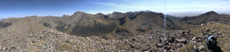
Alto pano
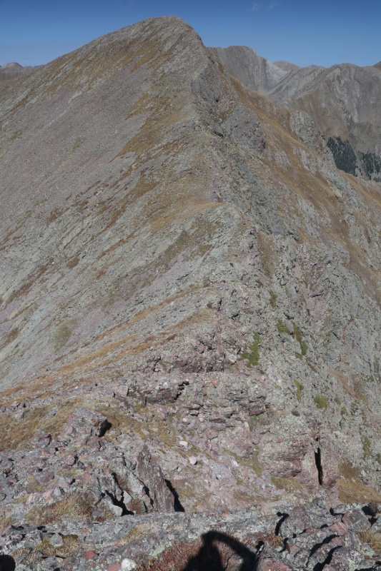
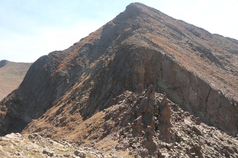
The north ridge off of Alto has a lot more rocky terrain where it more closely resembles scrambling. I dodged a bit to the west on the descent to make travel easier, while on the return I did more scrambling closer to ridge proper. Wasn't expecting this!
North ridge off Alto
Looking down the north ridge off Alto and on to Mas Alto peak
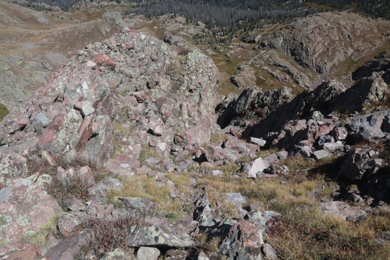
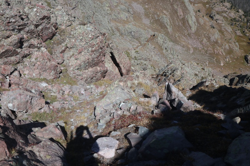
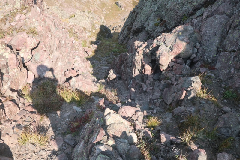
I wasn't sure exactly where to drop to the east down the steep grassy gully, but I could see that a couple options went. I ended up choosing a class 3/4 descent, and then chose the gully just to the north for the return, since it was easier.
class 3/4 gully I went downMidway down gully
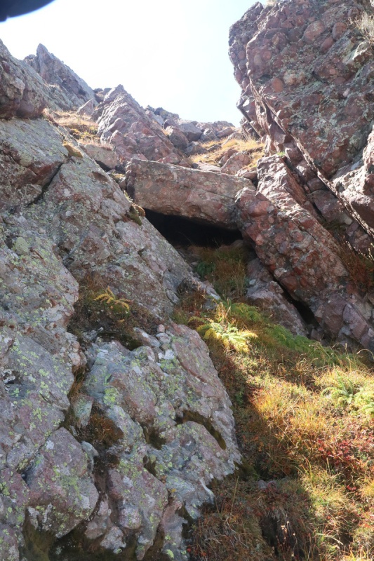
Looking at the choke stone that made gully class 3/4
Grassy gully from the bottom traverse
Once I got lower down into the grassy gully, I could see the grassy ramp that traverses the east face. I made my way down to it, and followed it back up to the ridge to Mas Alto.
Start of the grassy ramp on the east side
Last section of grassy ramp as it gets back to the ridge
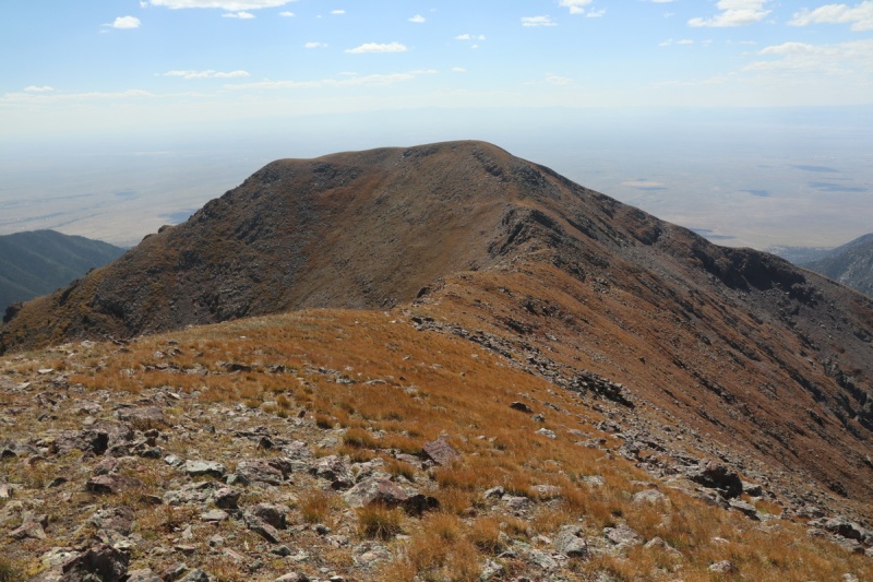
After that bit of route finding excitement, it was an easy stroll up to Mas Alto Peak
Looking back on Alto Peak north ridgeRidge up to Mas Alto
I enjoyed the last new summit for as long as I could, but I had a long trek back and down to camp, then out to the trailhead tonight. Shouldn't have slept in - common story.
View of Alto peaks from Mas Alto
Mas Alto summit pano
I got back down the ridge an followed the grassy ramp back to the steep class 3 gully to get back onto the ridge. Class 3 grass. I used my knees since I'm short. This time I took the gully just north of my other one. It was just class 2 here, with lots of scree.
Looking down the scree class 2 gully (before the class 3 grass)
Back up and over Alto Peak, with only a pause for another photo, as the sun is making long shadows that are so pretty.
Long ridge back home
I followed the grassy ramp splitting the ridge bump and then up the final bump for the 3rd time today, before the long talus descent.
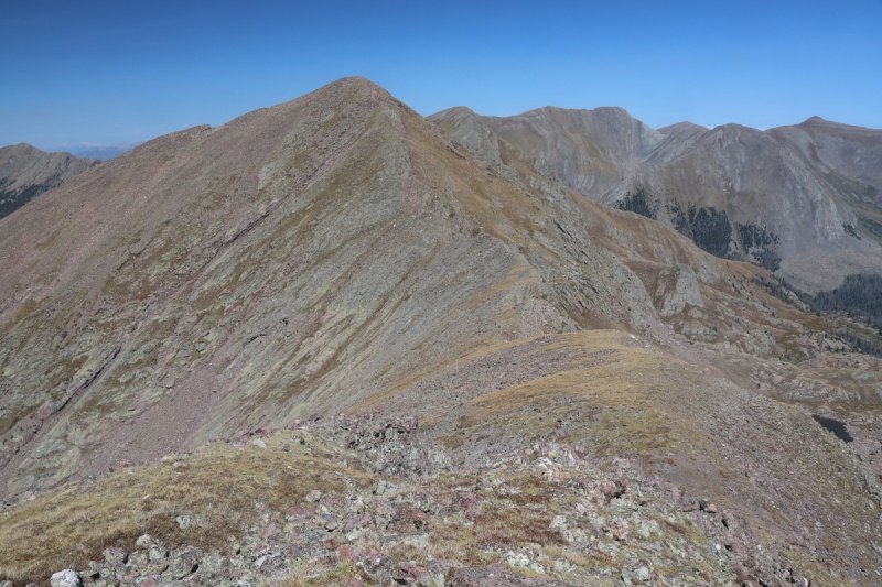
Now with the sun farther to the west, I could get a couple nice shots of the route up Pyramid Mountain from the day before. Such an easy route!!!
Pyramid Mountain
On the return route, I dropped down off the ridge and went through the valley since It looked so grassy. It wasn't. Travel on the ridge was easier and I would take that route.
This time I followed the climbers trail as it traversed farther upstream to the east and then finally switchbacked down into the valley below.
At first I went a bit too far west when the trail got faint, but then went back a bit east to where there was an easy and pretty stream crossing.
Waterfall at the best stream crossing with a cairn on other side
Once across the stream, I found a slightly open willow crossing and then BAM the trail, with a cairn! So there ya go. Just a wee bit above the 10,400' contour, is a much better access route to a trail up this section.
cairn by stream crossing to trail
I got back down to my campsite and packed everything up from my stash. I had just enough water with electrolytes to get back to my truck. I went as fast as I could, since I knew I was going to loose the light sooner than I wanted, and a few of the stream crossings would get tricky in the dark. I made it to about a mile left, when I finally had to break out the headlamp for the final stretch, I got back to the trailhead fairly exhausted and foot sore. I went to the TH register to sign out, when I saw an entry that interested me. There was another woman up the trail that day, AND she said she was doing 13ers too. I didn't see her, so which peaks? I love her trail name, and so do many others I've asked. So WHO are you Princess of Darkness???
Who are you Princess of Darkness?
These lowly mostly forgotten peaks held quite a few surprises and trails that should see more use. The fall colors are spectacular, and will only be better further into the season. I see a return to actually hike to Lake Isabel in my future!
My GPS Tracks on Google Maps (made from a .GPX file upload):
Thanks for this report, Otina. I tried a variation of your route up 13,054 last spring and turned around due to deep postholing leaving the valley floor, so it's nice to know the ridge goes!
Glad you were able to get Pyramid amongst these others. I day-tripped it last year via the standard route. I didn't think the bushwhacking was bad at all (maybe 20 or 30 feet total?). I used the GPS from Russ58's TR as a reference. That said - your route looks fun as well!
Pyramid Mountain has so far been one of my favorite 13ers, from the south. No bushwhacking whatsoever (there's a TR on here that describes the workaround), crazy dramatic views, and game trails that take you pretty much to the summit. Cool to know it goes from San Isabel though! Can't wait to go get the Mas Alto trio.
Thanks much Otina,
I see - its right near Venables and Comanche, but accessed from the West. Thanks for the map on the TR. I've been exploring in the Sangres last winter and a bit in summer. From the Eastern side.
Looks like a good trip, defo Pyramid Mountain.
Take care, Ute
13054 - I was wondering the same thing! 10/22/2021 10:53am
I was looking at this EXACT route as well, after seeing the "possible" 1.2 mi trail on GaiaGps and CalTopo and the satellite images of grassy gullies up to the west ridge. I too was wondering why no one had approached from the San Isabel trail side. Had hoped to get this peak this year, but it didn't work out. Thank you for posting, good to know the trail does exist and that route is as I envisioned it to be.
Caution: The information contained in this report may not be accurate and should not be the only resource used in preparation for your climb. Failure to have the necessary experience, physical conditioning, supplies or equipment can result in injury or death. 14ers.com and the author(s) of this report provide no warranties, either express or implied, that the information provided is accurate or reliable. By using the information provided, you agree to indemnify and hold harmless 14ers.com and the report author(s) with respect to any claims and demands against them, including any attorney fees and expenses. Please read the 14ers.com Safety and Disclaimer pages for more information.
Please respect private property: 14ers.com supports the rights of private landowners to determine how and by whom their land will be used. In Colorado, it is your responsibility to determine if land is private and to obtain the appropriate permission before entering the property.


")
")
")
")
")
")
")
")
")
")
")
")
")
")
")
")
")
")
")
")
")
")
")
")
")
")
")
")
")
")
")
")
")
")
")
")
")
")
")
")
")
")
")
")
")
")
")
")
")
")


