Download Agreement, Release, and Acknowledgement of Risk:
You (the person requesting this file download) fully understand mountain climbing ("Activity") involves risks and dangers of serious bodily injury, including permanent disability, paralysis, and death ("Risks") and you fully accept and assume all such risks and all responsibility for losses, costs, and damages you incur as a result of your participation in this Activity.
You acknowledge that information in the file you have chosen to download may not be accurate and may contain errors. You agree to assume all risks when using this information and agree to release and discharge 14ers.com, 14ers Inc. and the author(s) of such information (collectively, the "Released Parties").
You hereby discharge the Released Parties from all damages, actions, claims and liabilities of any nature, specifically including, but not limited to, damages, actions, claims and liabilities arising from or related to the negligence of the Released Parties. You further agree to indemnify, hold harmless and defend 14ers.com, 14ers Inc. and each of the other Released Parties from and against any loss, damage, liability and expense, including costs and attorney fees, incurred by 14ers.com, 14ers Inc. or any of the other Released Parties as a result of you using information provided on the 14ers.com or 14ers Inc. websites.
You have read this agreement, fully understand its terms and intend it to be a complete and unconditional release of all liability to the greatest extent allowed by law and agree that if any portion of this agreement is held to be invalid the balance, notwithstanding, shall continue in full force and effect.
By clicking "OK" you agree to these terms. If you DO NOT agree, click "Cancel"...
Elk Tooth - Finishing Up the Indian Peaks Wilderness
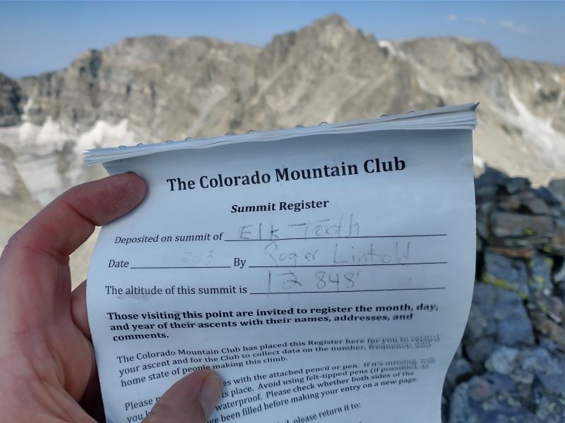
Elk Tooth - 12,848'
Indian Peaks Wilderness
August 13th/14th, 2021
Stats : ~19 miles, ~5K'
After a long trip to nab Ogalalla Peak last year (TR Here), I was down to just Elk Tooth as my final remaining to finish off the ranked IPW summits. I had some plans to head there off and on throughout the summer, but with a busy schedule and a bigger focus on trail running this year I just didn’t find the time. Finally, I got off my butt and grabbed an available permit for Middle St. Vrain, followed by an invite to some others to join. I was happy to get a thumbs up from Kimo and Anna. (Especially since Kimo has been my partner on a large chunk of my past IPW summits, so would be good to finish with him.) The one request they had was to change to an approach from RMNP versus the Middle St Vrain drainage. That was fine by me, so plans were set.
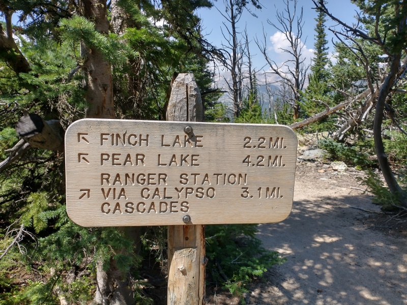
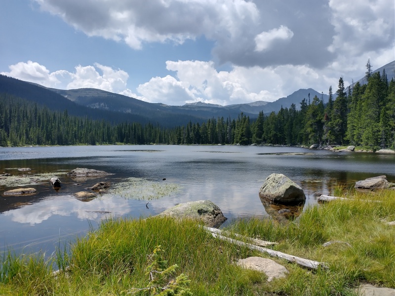
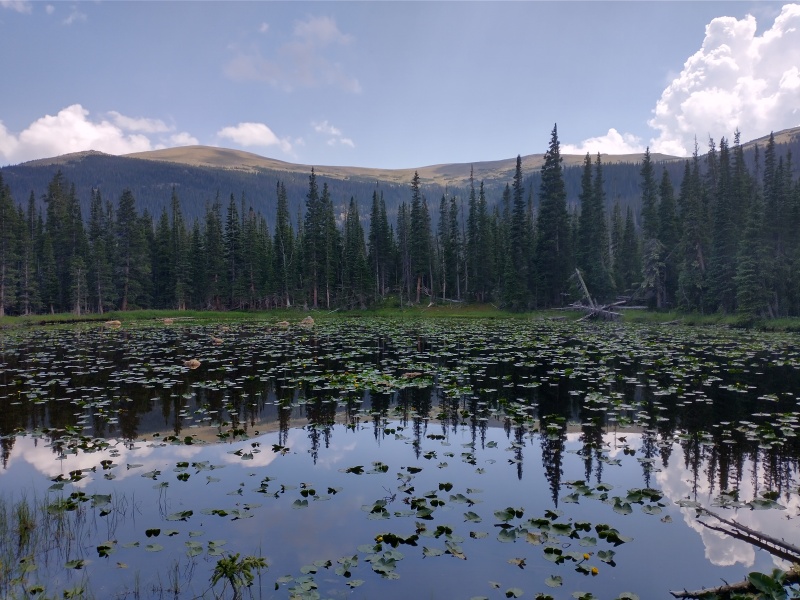
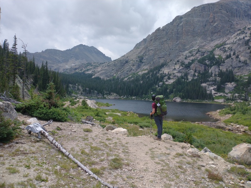
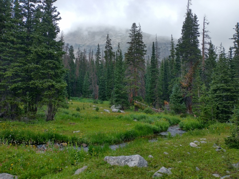
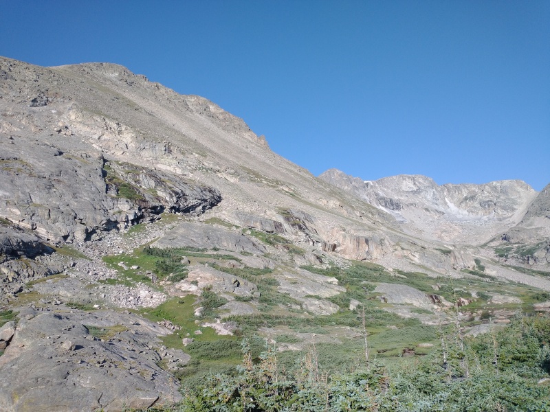
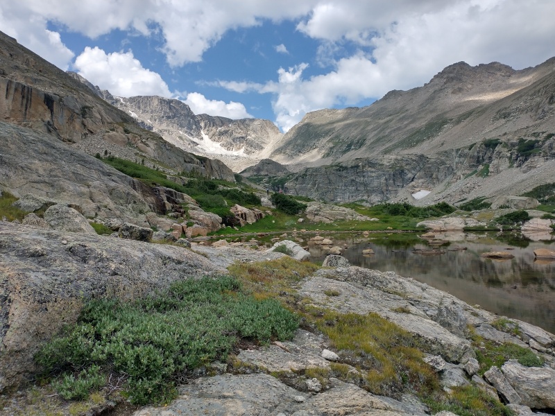
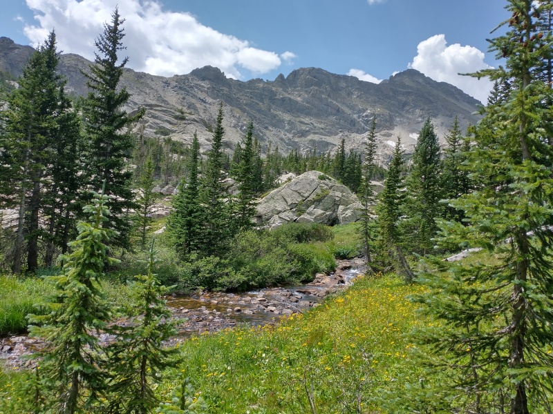
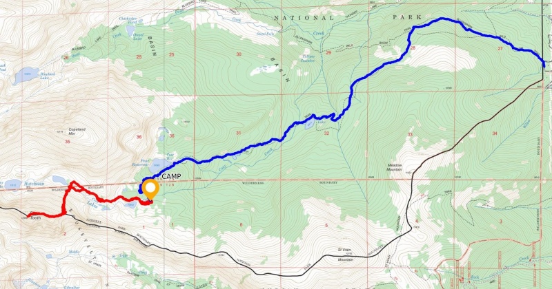
We started out from Allenspark TH around 11AM, passing a lot of workers thinning trees in the area, assuming fire prevention. After a nice full year of trail running in the mountains with a light pack, hoofing it with an overnight pack was a bit of an unwelcome change. That said, it is a nice gradual ascent past some nice scenic locations in RMNP. Rough markers of the ascent: Reach Wild Basin trail intersection ~2 miles, Finch Lake ~4 miles, and Pear Reservoir ~6 miles. Some nice views of Copeland to the west and distant Longs to the north on the way up. About when we reached Pear Reservoir we started getting a light rain. Our permit was for the Cony Creek Dispersed area, so we looked for a site as far west in the permitted area as possible. We settled on a nice area a quarter mile or so below the Lower Hutcheson Lake at about 10,800’. From Pear Reservoir to camp was ~1 mile, so total approach came to 7 miles. After setting up camp and grabbing a bite to eat I took a short stroll up to near the upper Hutcheson Lake to get an idea for the morning’s approach.
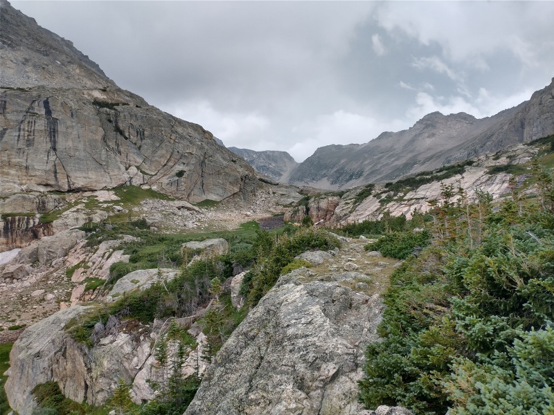
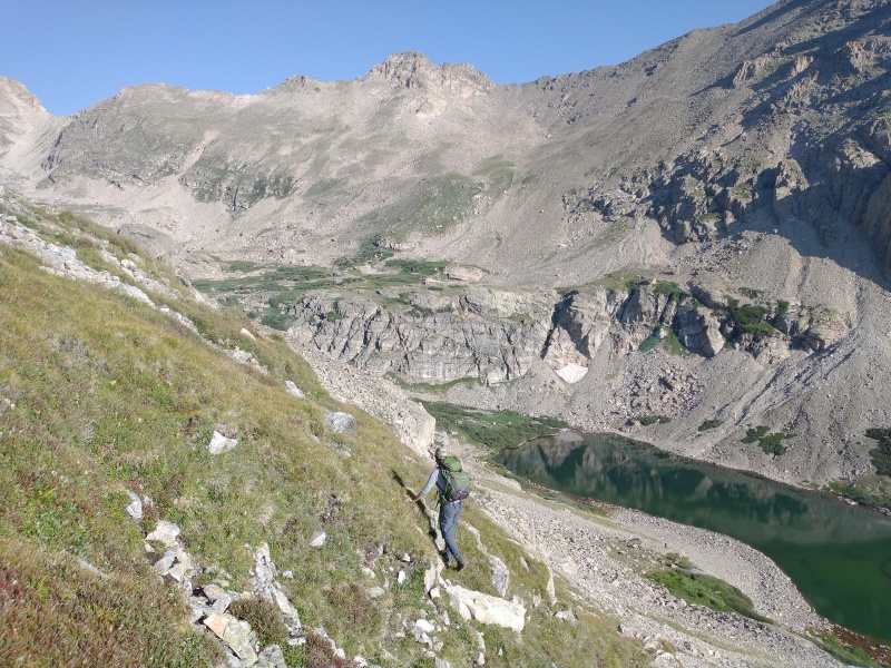
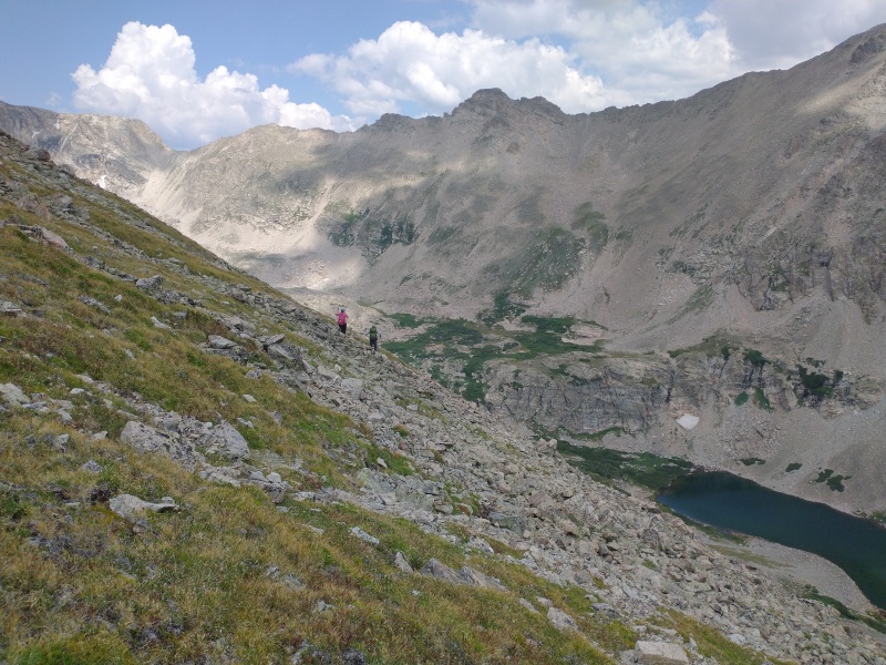
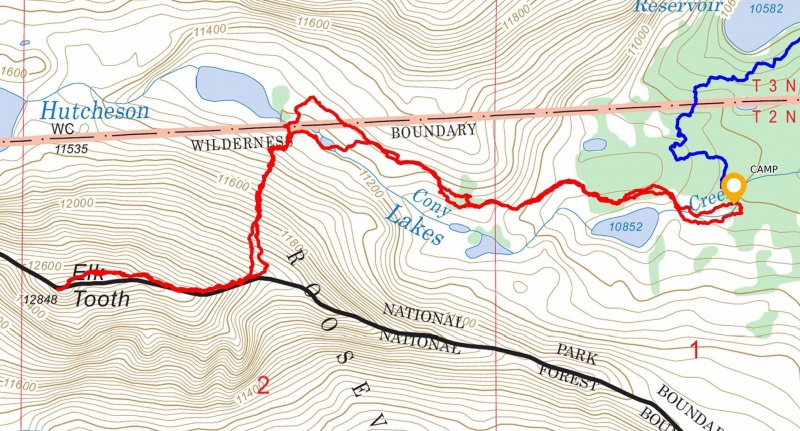
The next morning, we took off from camp around 7:30 and retraced my path from the previous evening. Although still pretty wet from the previous evening rain, different pieces of trail were easy to connect up to the upper lake. Our plan was to cross the small finger of land that splits the Upper Hutcheson Lake to get to the northern slopes of Elk Tooth, however upon arriving we found a moose standing exactly in this spot. While discussing a different way around, the moose wandered off into a small patch of trees to the north of the lake. We made a quick scamper across to get out of his zone as fast as we could.
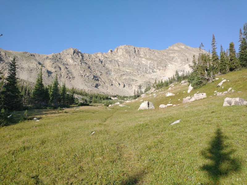
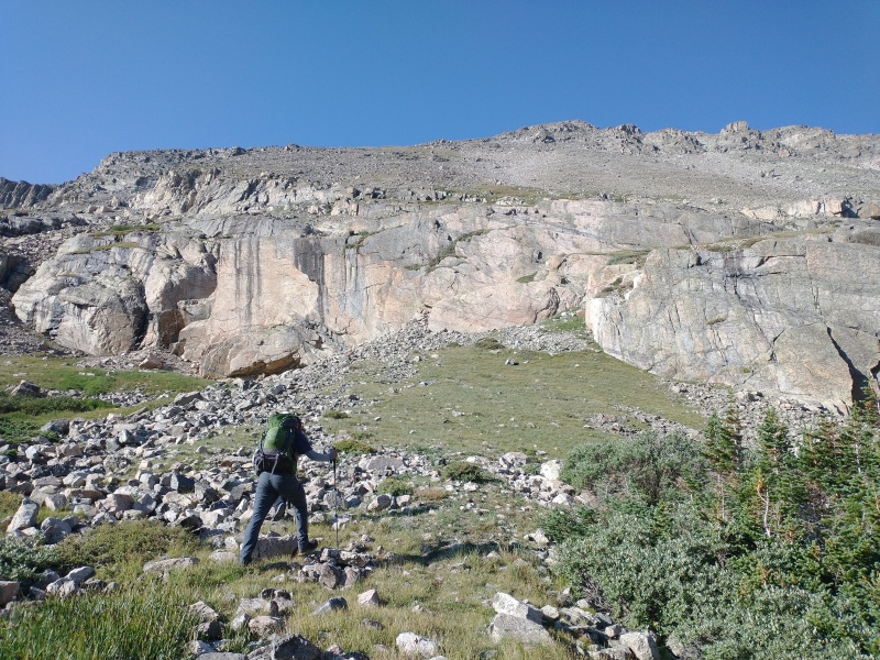
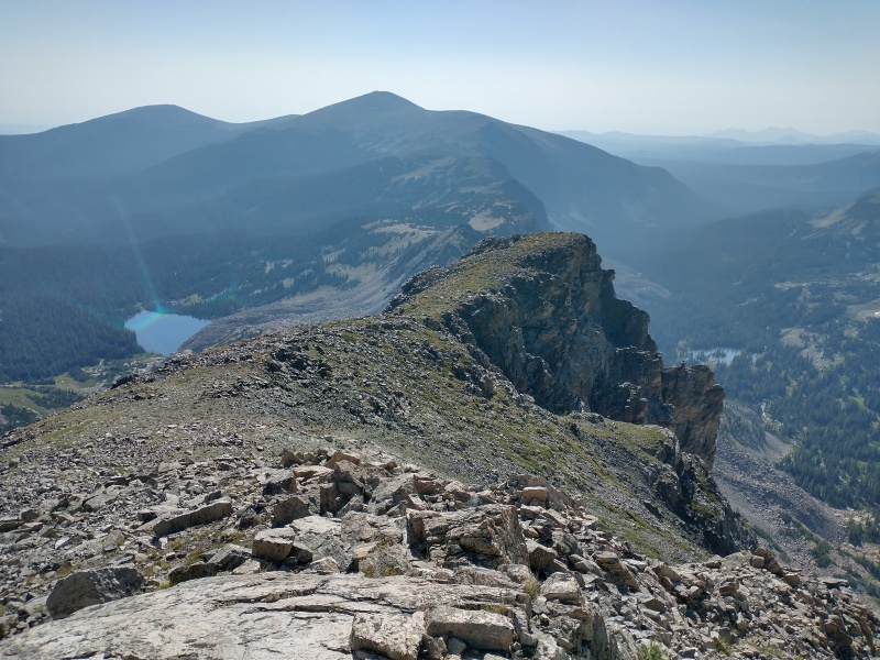
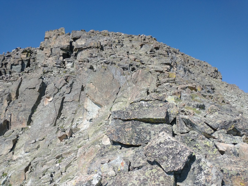
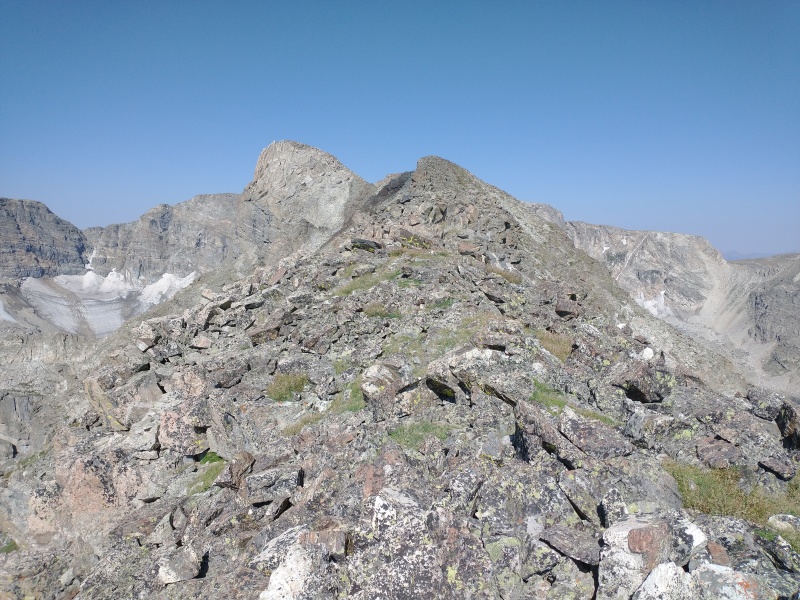
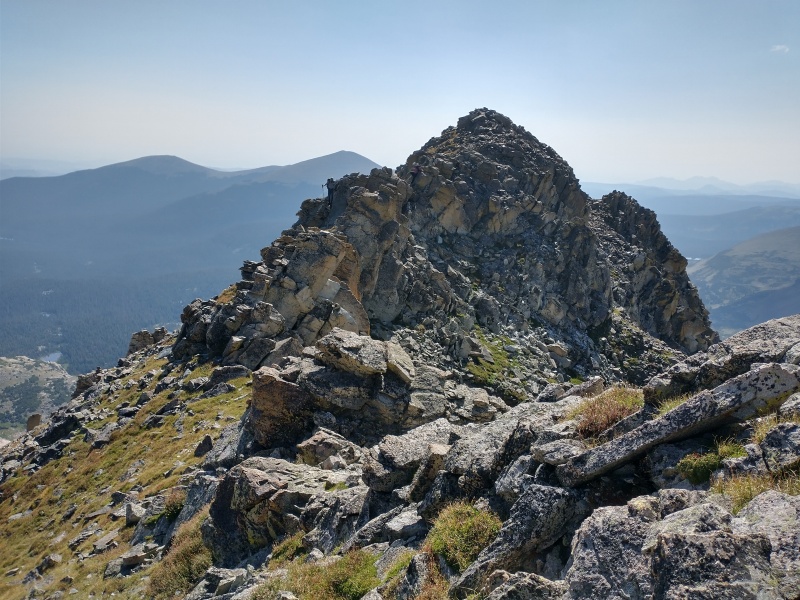
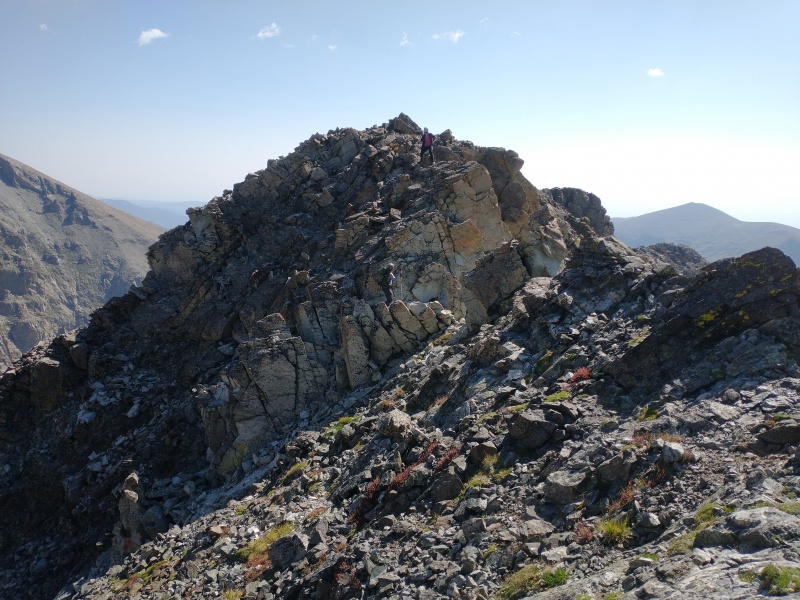
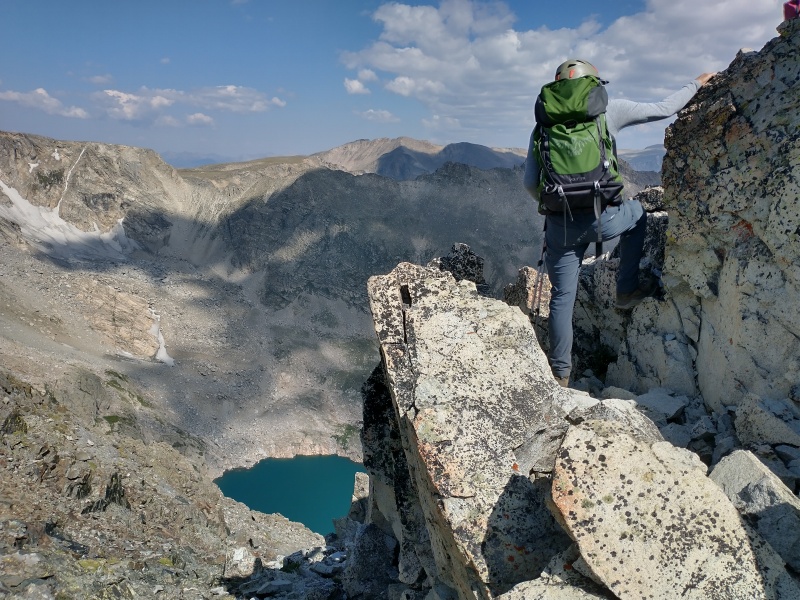
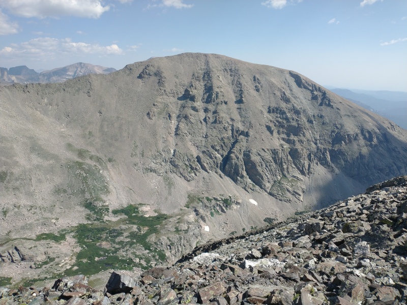
From lake crossing split, our path headed straight up the northern slope aiming to hit the right as close to 12,200’ as possible. The first portion of the slope was pleasant (but steep) grass, but about halfway up it switches to loose talus. Nothing bad, just a bit annoying and made the going slow. Once at the 12,200’ shoulder, the ridge heads west for .5 miles/700’ to the summit. We stuck to the ridge top the whole way, mainly class 2 with occasional class 3 moves. Total ascent from camp was only 2 miles, but a deceptively long/slow 2 miles.
We descended the same route which went well, this time no sign of the moose. I did take the opportunity for take a quick swim in Lower Hutcheson Lake on the way back to camp. Refreshing. After packing up, we headed back down. Nice trip with some good people, great way to finish off a pretty great list that is the Indian Peaks Wilderness.
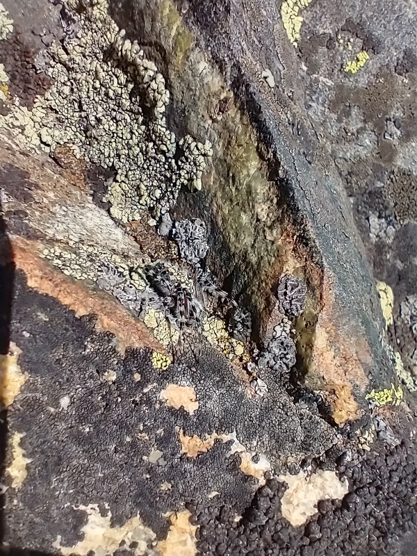
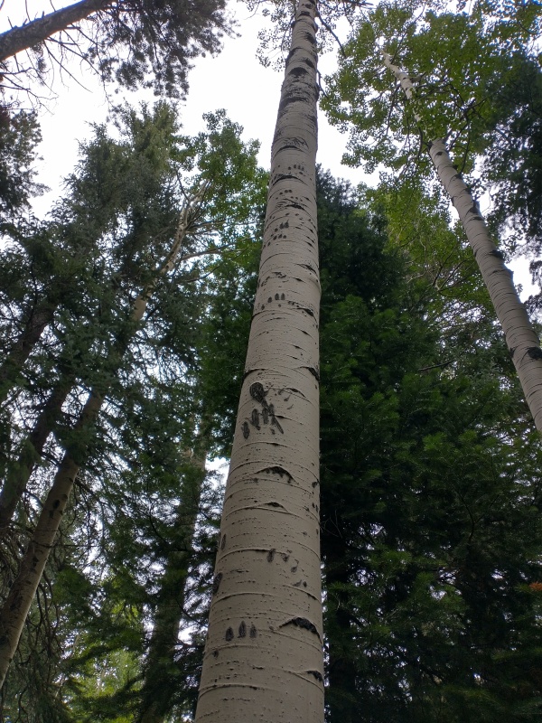
Reaching the Wild Basin Trail split.Finch Lake on ascent to camp, near mile 4.Looking south towards Meadow Mt (my first IPW summit!) and St. Vrain Mountain.Arriving at Pear Reservoir around mile 6.Camp, Copeland Mountain hiding.Exploration hike to Upper Hutcheson Lake through the rain after setting up camp.The next morning, the conditions improved. Elk Tooth summit just out of sight on the upper right.North slope we will use for the ascent to the ridge.Approaching small cliffs, bypassing to reach slope.Steep grass slope ascending from Upper Hutcheson.Reaching the 12,200' saddle along the ridge, looking back east.Starting up the ridge.See the spider?Ridge, Elk Tooth summit the lighter rock in the distant left. Definitely has a "tooth" look.Along the ridge.Some of the difficulties along the ridge.Kimo on the ridge, Cony Lake below.
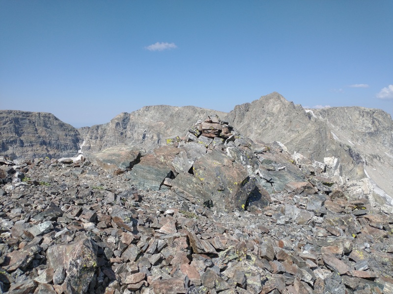
Summit!Summit register, Ogalalla in the background.Copeland Mountain from the summit.Descending back down the slopes.Last look at the Cony Lake basin.Descent to camp.Bear tracks headed up a tree, seen along the Finch Lake Trail.Map of total route.Close up of summit from camp.
Thumbnails for uploaded photos (click to open slideshow):
Awesome job on the ranked peaks. Love your style on these, you really immersed and camped in some areas that I never even touched since I pretty much tried to daytrip everything. Hope you keep enjoying adventures here for years to come. As you know, it's a special place.
Congrats on finishing the IPW! It is an excellent accomplishment. I'm a few peaks short, really just some of the dinkier ones that I never got around to doing (including Lonesome, which is ... Lonesome). What ls your list? I used Roach's list, but he missed some things such as the 2 peaks west of Neva (11,831 and 11,801).
http://www.climb.mountains.com/Project_Island_files/CO_Range_IPWA.shtml
I wanted to climb any mountain that either has 300' of prominence or a name on the USGS map (Lone Eagle counts, for example), which is consistent with the "rules" establishing that there are 58 14ers (according to Andrew Hamilton). But one can get hung up on things like Devil's Thumb, which has a name but isn't a "peak" or "mountain", and doesn't have prominence. I have climbed it, but in principle it makes the whole project technically harder.
Then there's the Watershed...
Anyway, your accomplishment makes me think I should go and finish this off!
Thanks, the lists I use for all my wilderness area completions are the ranked summits only. (This List)
That said, there are some I add in anyway. For example, probably my favorite summit in the IPW is Iroquois Peak, however its actually not part of the ranked list. Regarding those 2 11ers near Neva, I really enjoyed those..was always surprised they weren't in Roach's book.
I imagine that someday I'll probably revisit this as well as some of my other completed wilderness areas and go after any of the named that I didnt get in the first go around.
Cool! By that list I have them all except Lonesome. I agree Iroquois is worthy, if only because it is one of the hardest (ranked) to get to. As far as farther down the list, it seems ridiculous to include all those funky little gendarmes on the Kasparov Traverse. There must be 100 similar dinky spires in the IPW that don't get the same attention.
Caution: The information contained in this report may not be accurate and should not be the only resource used in preparation for your climb. Failure to have the necessary experience, physical conditioning, supplies or equipment can result in injury or death. 14ers.com and the author(s) of this report provide no warranties, either express or implied, that the information provided is accurate or reliable. By using the information provided, you agree to indemnify and hold harmless 14ers.com and the report author(s) with respect to any claims and demands against them, including any attorney fees and expenses. Please read the 14ers.com Safety and Disclaimer pages for more information.
Please respect private property: 14ers.com supports the rights of private landowners to determine how and by whom their land will be used. In Colorado, it is your responsibility to determine if land is private and to obtain the appropriate permission before entering the property.

")
")
")
")
")
")
")
")
")
")
")
")
")
")
")
")
")
")
")
")
")
")
")
")
")
")
")
")
")
")
")
")
")
")
")
")
")
")