| Report Type | Full |
| Peak(s) |
Mt. Little Xuebaoding 17,847 ft |
| Date Posted | 02/12/2021 |
| Date Climbed | 08/21/2020 |
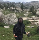
| Author | WSN |
| Highest Mountain I have Climbed So Far |
|---|
|
I had a few outings near Chengdu, China in the summer of 2020. I’ve posted a trip report earlier. This time I am reporting a multi-day trip of climbing a mountain, which is the highest place I have ever stepped on. Mt. Little Xuebaoding (elevation 5,440 m, or 17,847 ft) is a few miles away from Mt. Xuebaoding (meaning “Snowy Treasure Peak”, 500 ft higher than the “little” one). Both are at the east edge of Tibetan Plateau, and to the north of my home-city Chengdu. Mt. Little Xuebaoding, also known as “Du-Ri peak” (coming from a longer local name in Tibetan), has a large glacier on its west face, severing as the standard route. That glacier is not too steep and has no crevasse, so this mountain is regarded as an entry-level technical mountain or maybe even non-technical. However, it is still dangerous due to variable snow conditions. Not sure if anyone died on it or not, but there are reports about serious injuries. Also, Mt. Little Xuebaoding is less famous than the regional highest peak Mt. Xuebaoding. It was first ascended only 7 years ago, although it is significantly easier than Mt. Xuebaoding. 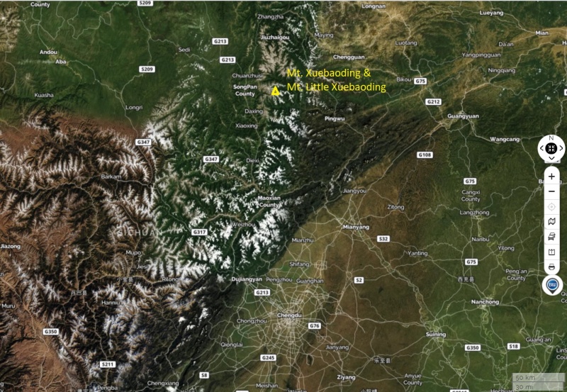 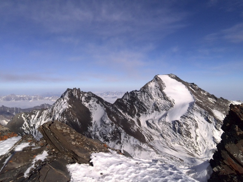
There is no specific reason I chose Mt. Little Xuebaoding as my goal in the summer of 2020. Maybe I just wanted to do something familiar, similar to climbing Cristo Couloir on Quandary Peak. But I also knew that the elevation and distance in that region are 1.5 times higher/longer than the counterparts in Colorado 14ers. As a coward, I did't have the guts to go solo. Unfortunately I failed to find a partner, so I had to hire a local guide to climb with me. The guide also arranged horses to transport heavy backpacks to the base camp. The timing of climbing in west Sichuan (province) mountains is always a big issue. Summer is supposed to be the best time but also is in the monsoon season. A window of consecutive sunny days is usually very rare. I waited for almost a whole summer until I had such a window starting from Aug. 19, 2020, and it was after a major storm of heavy rain and certainly consequent landslides and road shut-downs. Anyway, I managed to drive to the village in the valley of Mt. Little Xuebaoding, after a detour of several hundred miles. 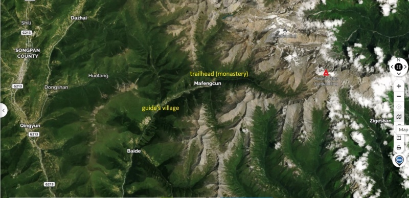 That village might be the easternmost Tibetan settlement in China. The boundary between two cultures - Tibetan and Han (majority in China) lies on the mountains at the end of the valley. Among them, the majestic Mt. Xuebaoding can be seen clearly from the village. But I was not prepared for it yet. Maybe I could have a try in the next year. 
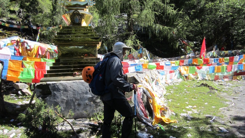
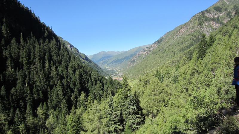
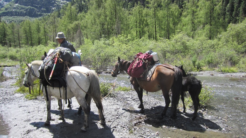
Day 1 - Approach I stayed in the guide’s house in the village at 3,200 m (10,500 ft) for one night before we left for the Little Xuebaoding base camp in the morning of Aug. 20. Our team consisted of 4 members: me, another climbing client of guide, the guide himself and an assistant – the guide’s newly married wife. The latter two are ethnic Tibetans and in their 20s, so they can move fast at high altitude without feeling too tired as me. I first met the other climber mentioned above only at guide’s home. He was really a rookie. Let me call him the rookie. I suppose he won’t see this report so he is not offended. The approach is a little bit longer than 10 km and with an elevation gain of 1,100 m. 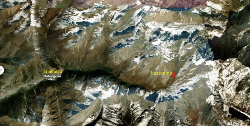 The “trailhead” is at the end of road in the valley, where a small monastery is located. 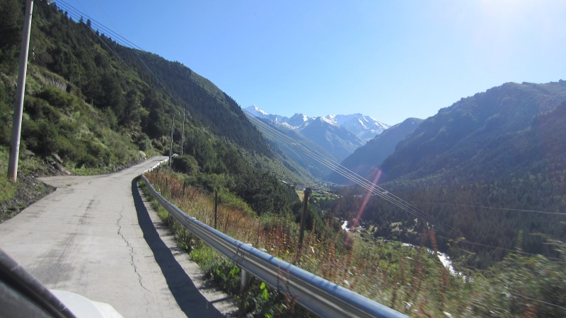
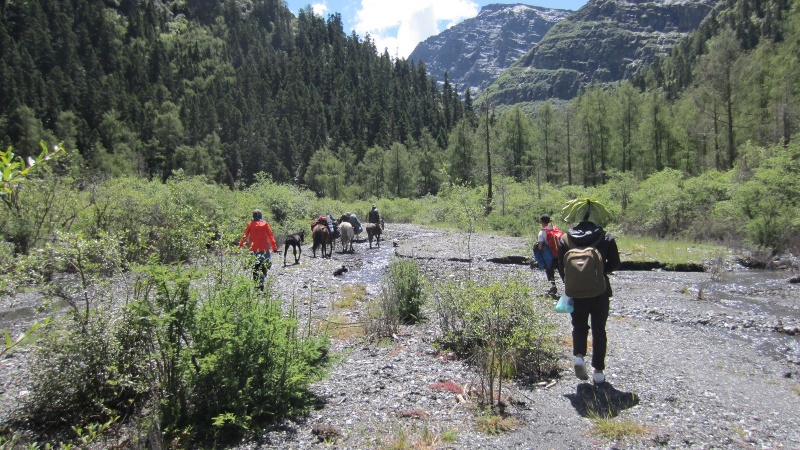
In the wet season, the surface runoff became much larger. At many places water stream ran on the trail, forcing us to rock-hop. 
Because Mt. Little Xuebaoding had a very small climbing traffic in recent years, the trail was not well-maintained. Maybe we were the first team in that summer or at least one of a few teams. Therefore, we had to frequently break the trail in the vegetation.
The biggest problem was crossing the creek. We couldn’t find a place that worked in the past. We threw big rocks into the creek, which helped a little. Finally we got to the other side with shoes mostly wet, slightly better than wading directly.
The valley turns to the north. We saw Mt. Little Xuebaoding in front of us.
The west face of Mt. Little Xuebaoding (aka. Du-Ri Peak)
We met the returning packhorses on a steep slope.
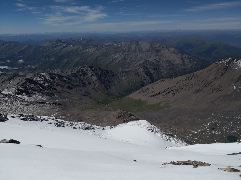
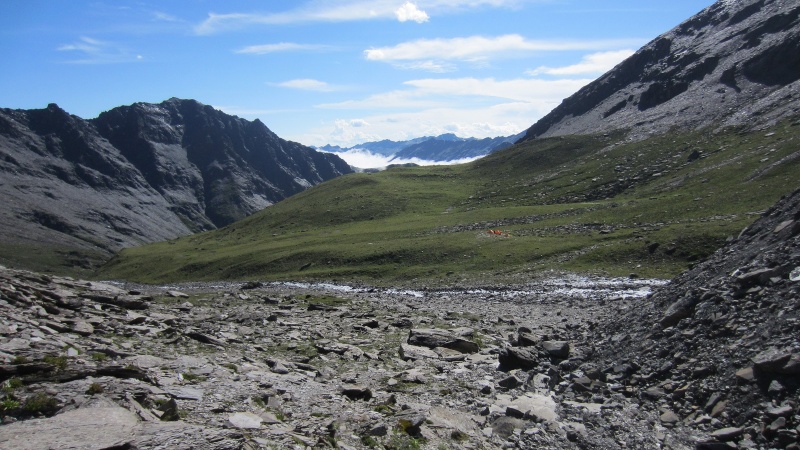
In the upper basin, below our goal (the peak in the right).
We found our luggage and set up tents. Our base camp was at 4,400 m (14,400 ft). The summit of Mt. Little Xuebaoding could be seen from here.
Day 2 - Summit day We got up early for an alpine start. Not super early though. We hit the trail at 4:00 AM. First we followed the valley floor, then we turned right and went up. 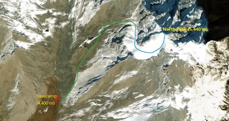 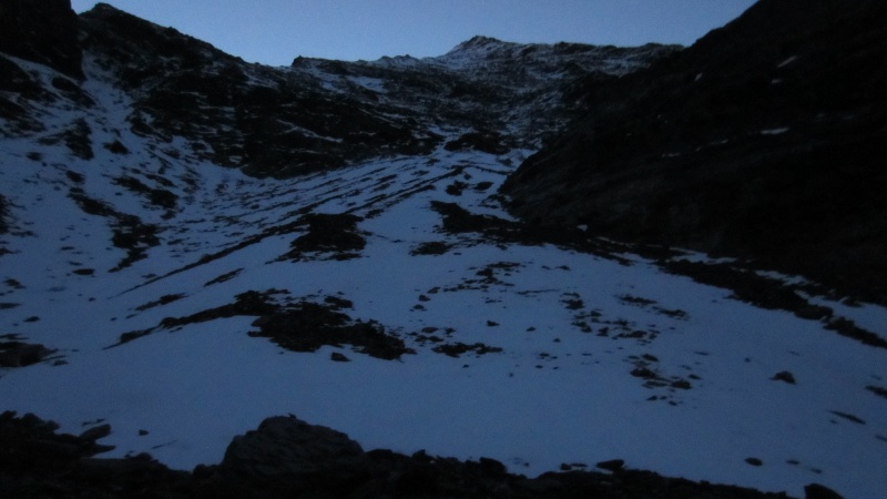
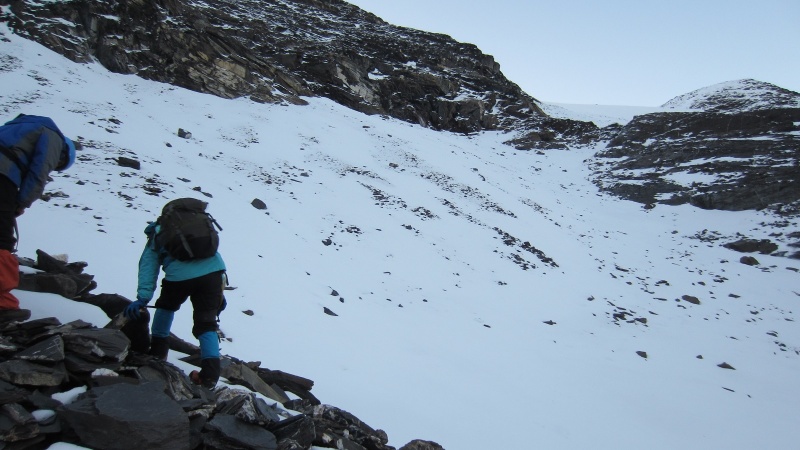

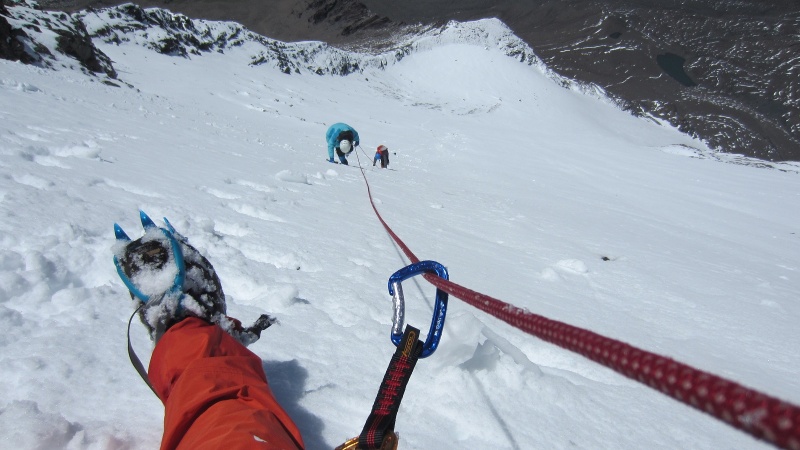
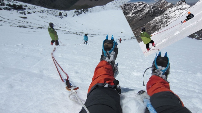
The west face slope is as long as the Cristo Couloir of Quandary Peak, but 1,000 m (3,300 ft) higher in elevation, which means less oxygen. At first the snow was in perfect condition: hard enough for walking without sinking, and soft enough for planting ice axe into it. I felt it was OK to go alone, so I kept a distance from the other 3. 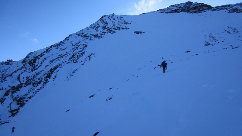

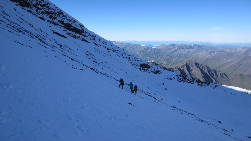
They had to stay together, mostly because the rookie had no ice axe and needed to be protected. But at first they were not roped up. 
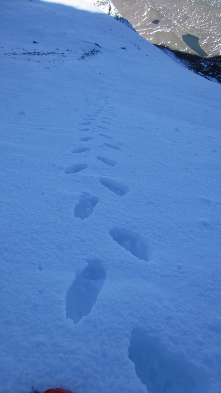
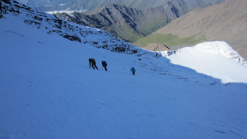 Snow became softer higher up. Usually it was 1-2 feet of powder snow between a breakable thin crust surface and a hard snow/ice bottom. I was really struggling on such kind of snow. I had to rest every 10 steps, and then every 5 steps, 3 steps… 
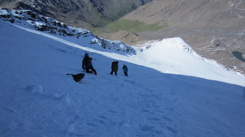

Near the top of the snow slope where we must semi-traverse, we had to rope up. The female assistant took the lead and the guide stayed behind us to potentially protect. 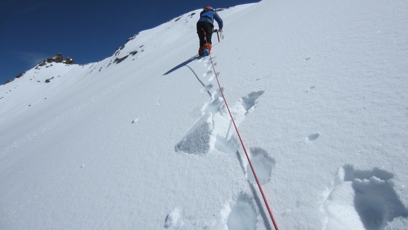

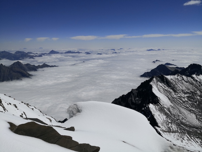
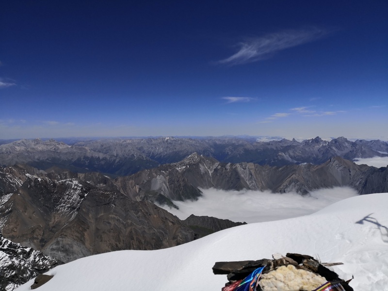
After 4 hours on the snow slope, we reached the ridge, which is in fact quite narrow. The other (east) side was a sea of clouds. Really spectacular. Also shocking at that moment. 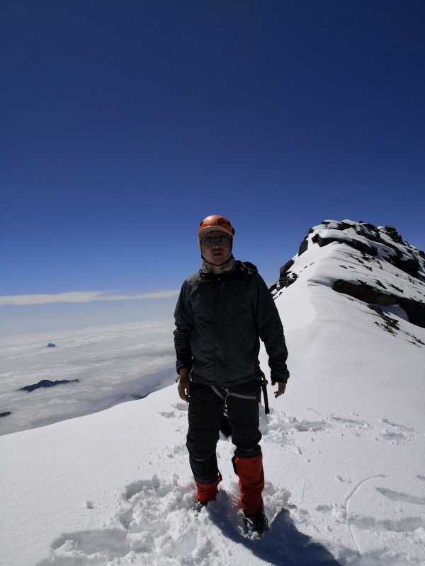
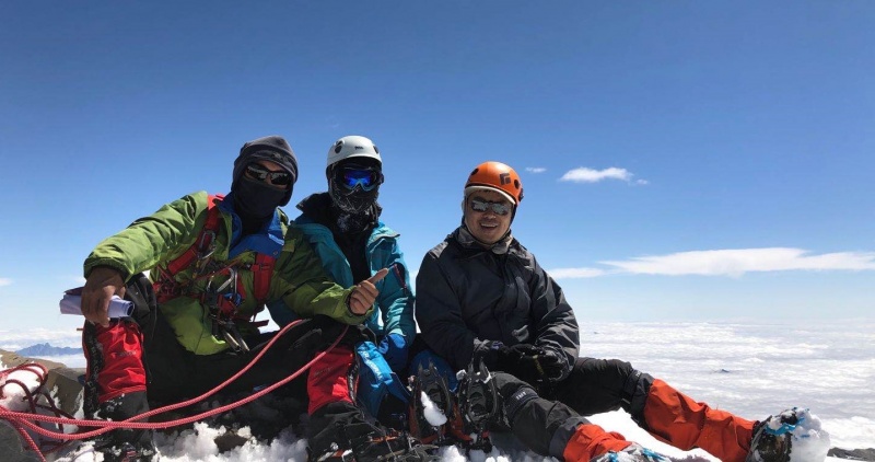
Then we turned north and walked for a while to reach the north peak. 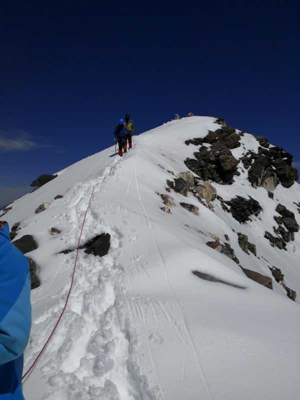
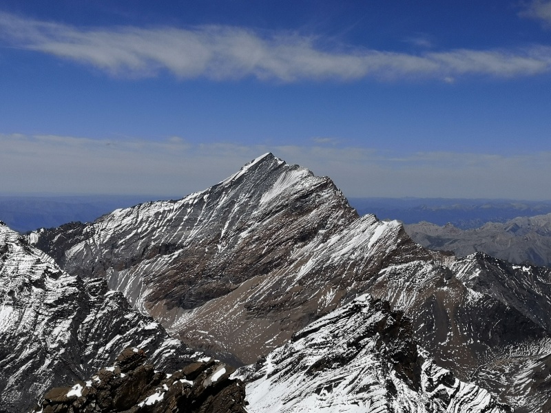
It looks like that the south peak is higher, but it was not easy to reach under that condition. Also most people climbed only the north peak according to the reports I read. Anyway, we didn’t have any desire or energy to traverse to the south peak at that time. 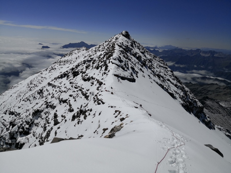
Views on the summit 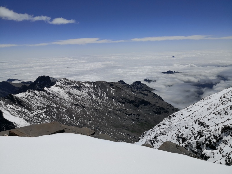
We started to descend by noon. At first we were still roped-up, and even down-climbed face-in. Soon we found that we were not likely to slide because the snow was warmed up and softened. Then we walked casually. I even glissaded with the driving force from the guide. 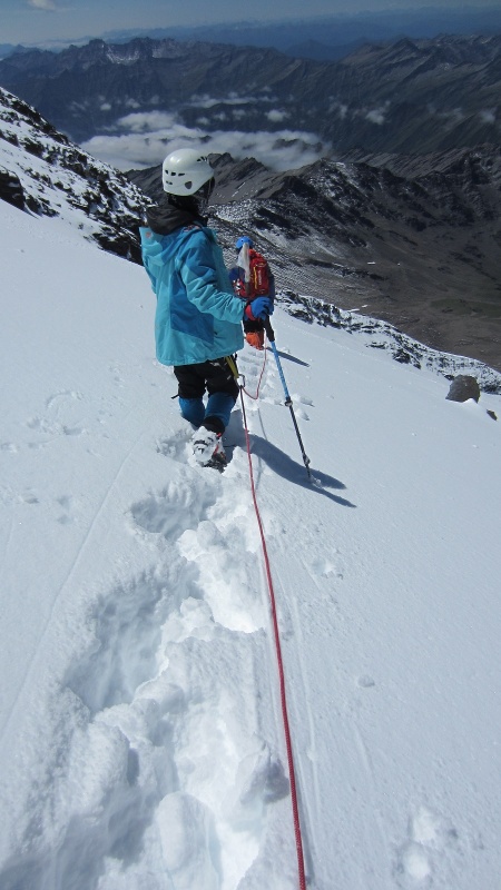
Before I got to the tents by 4 PM, I heard a loud sound like a rock fall. Then I realized that was the avalanche on the slope where we passed earlier. Perhaps we had produced weak spots on the snow so wet snow avalanche was triggered later in the afternoon. So a good lesson was taught- the snow might not be supportive in a summer afternoon. 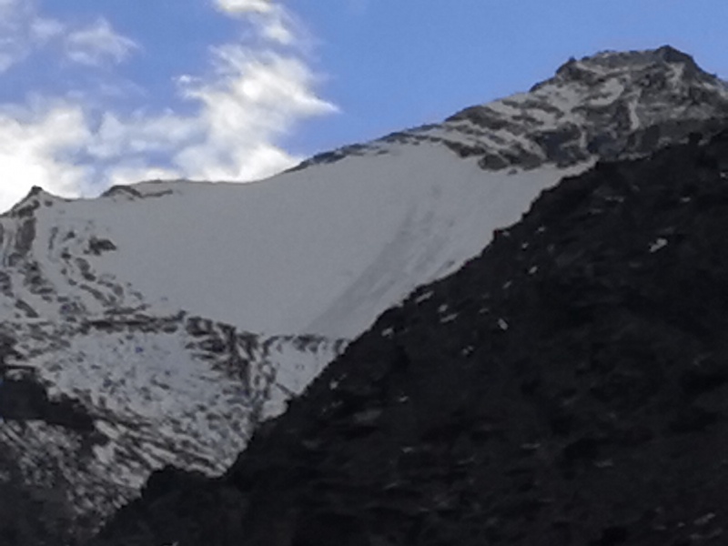
Day 3 - back to the village We stayed another night in the base camp as planned. Next morning, we packed up, left our heavy backpacks in the camp site for pick-up and went down the valley. We got to the village in the afternoon. 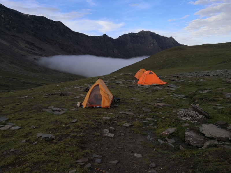
End of the story. Thumbnails for uploaded photos (click to open slideshow): ")
")
")
")
")
")
")
")
")
")
")
")
")
")
")
")
")
")
")
")
")
")
")
")
")
")
")
")
")
")
")
")
")
")
")
")
")
")
")
")
")
")
")
")
")
")
")
")
")
")
|
| Comments or Questions | |||||||||||||||
|---|---|---|---|---|---|---|---|---|---|---|---|---|---|---|---|
|
Caution: The information contained in this report may not be accurate and should not be the only resource used in preparation for your climb. Failure to have the necessary experience, physical conditioning, supplies or equipment can result in injury or death. 14ers.com and the author(s) of this report provide no warranties, either express or implied, that the information provided is accurate or reliable. By using the information provided, you agree to indemnify and hold harmless 14ers.com and the report author(s) with respect to any claims and demands against them, including any attorney fees and expenses. Please read the 14ers.com Safety and Disclaimer pages for more information.
Please respect private property: 14ers.com supports the rights of private landowners to determine how and by whom their land will be used. In Colorado, it is your responsibility to determine if land is private and to obtain the appropriate permission before entering the property.