
| Report Type | Full |
| Peak(s) |
Jagged Mountain - 13,833 feet Peak Six - 13,712 feet Knife Point - 13,270 feet |
| Date Posted | 12/17/2020 |
| Modified | 12/18/2020 |
| Date Climbed | 07/16/2020 |
| Author | supranihilest |
| Additional Members | Garrett, whileyh |
| Eight Days in the Weminuche, Days 7-8: Jagged, Knife Pointy Thingies | |||||||||||||||||||||||||||||||||||||||||||||
|---|---|---|---|---|---|---|---|---|---|---|---|---|---|---|---|---|---|---|---|---|---|---|---|---|---|---|---|---|---|---|---|---|---|---|---|---|---|---|---|---|---|---|---|---|---|
Table of ContentsThursday, July 16, 2020: Day 7 - Jagged Mountain and Peak Six Thursday, July 16, 2020: Day 7 - Jagged Mountain and Peak Six This was it. Our big day: Jagged Mountain. It had poured all night and we awoke to a dark, overcast morning. I felt both a sense of dread and placidity about our climb. We'd go as far as we could and if the weather didn't want to play nicely we'd try in the afternoon or the next day if we had to. The Weminuche might be known for its violent storms but we weren't going to let such nuisances win. As we left camp early that morning around 6am everything was wet. We hadn't even walked 100 yards and we were soaked from the waist down. It hadn't warmed or gotten sunny enough to evaporate last night's deluge. We hoped the rock would be drier. The trail took us west briefly, ascended a short hill, and then went southwest towards Sunlight Lake. We left the trail here and went directly north up grassy and boulder-strewn slopes. 
Route finding was a bit unusual in that our objective was obvious - how could it not be, it's the biggest goddamn mountain over there - and yet the easiest way up what should have been easy grass slopes wasn't all that easy. We generally meandered uphill but had to avoid several enormous, slabby blocks of rock near the flats below Jagged's north face. These blocks split the slope into several different broad, grassy gullies, and it was difficult to cross between these gullies due to the granite blocks, boulders, and pits in between them. 
We found our way up not via the gully closest to Jagged (farthest west) but the gully one over, to the east. For prospective Jagged climbers it is important to take good mental notes of your approach route, since it can be difficult to determine which way down is best. 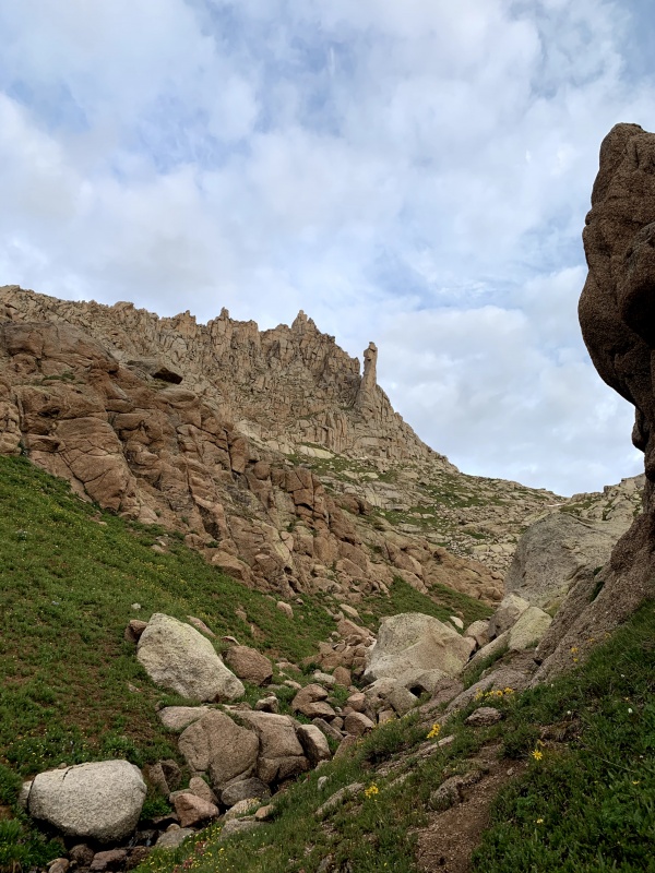

Our ascent gully contained a bit of unexposed Class 3 scrambling and some snow, but overall was mostly grass and the ubiquitous granite boulders and gravel of the area. 
Having made our way to the upper flats below Jagged we contoured west and got a better look at Jagged's north face. 
We were able to avoid the snow as we made our way to the base of the route, which consisted of a small amount of Class 2 slabs. Garrett, who had done Jagged 1.5 times before (his partner refused to finish the climb on his first time) knew exactly where to go. We dropped our packs at the base of a vaguely diehedral-like set of boulders, slabs, and corners, put on harnesses and helmets, and tied in. I would take the first lead and Garrett and Whiley would follow. I clipped the protection, runners, and a cordelette to my harness, Garrett and I checked each other's knots and his belay device, and then I set off up the route. 
The initial section of climbing was just scrambling to a large platform (shown below with me standing on it). I placed one piece below the platform, which is where the climbing got harder. 
Gerry Roach mentions a Class 4 slab as the first pitch in Colorado's Thirteeners. I didn't look too hard for that slab, but it might have been to my left on the platform. In any case that slab was rather damp and would have sucked to climb up. I placed another solid cam in a nearby crack and instead went up a set of Class 5 steps and blocks, making a more direct ascent. The climbing felt like Class 5.6 to me but I probably sandbagged it given the altitude and how on edge I felt about the weather. I wore trail runners but some may want climbing shoes, at least for the lead. There was really only one or two hard moves and I was at the rappel anchor above me, which consisted of some cord and webbing with a quick link slung around a large block. 
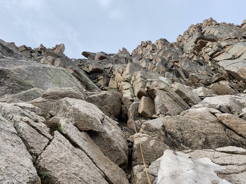
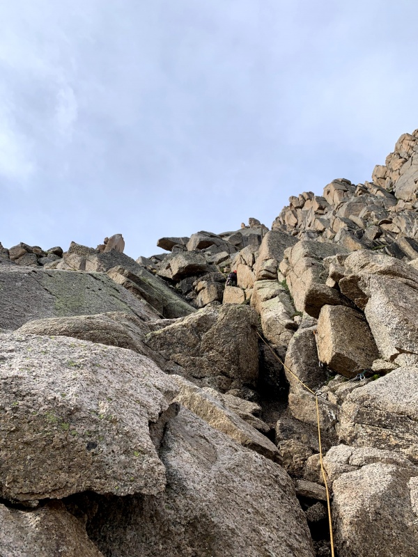
I didn't bother building a gear anchor atop the first pitch as the webbing and cord looked to be in good shape and there weren't too many opportunities for solid gear anyway, so I clipped into the rappel anchor and belayed off of that. 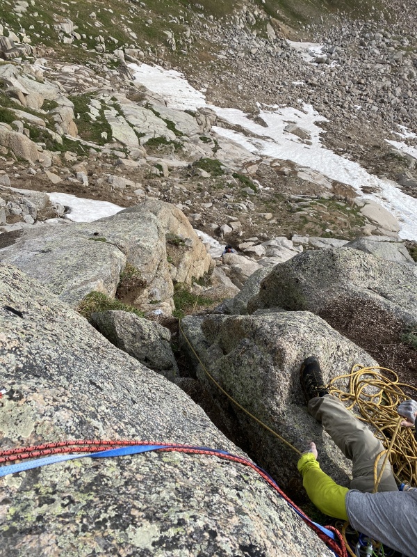
Whiley, who was tied into the middle of my rope (a 60 meter half rope; yes, one half rope by itself is usually not sufficient, but we felt safe on the easy climbing and wanted to save weight), followed me up followed by Garrett. 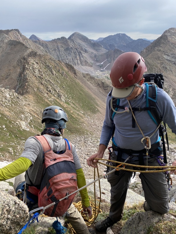
We untied here and Garrett backpacked the rope, then led up alongside Jagged Couloir on steep and awful grass-and-gravel ledges. The scrambling here wasn't particularly difficult - Class 3 at maximum - but it was relatively sustained, exposure was high, and the gravel footing didn't give much confidence. 

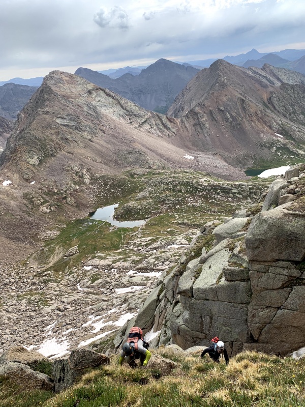
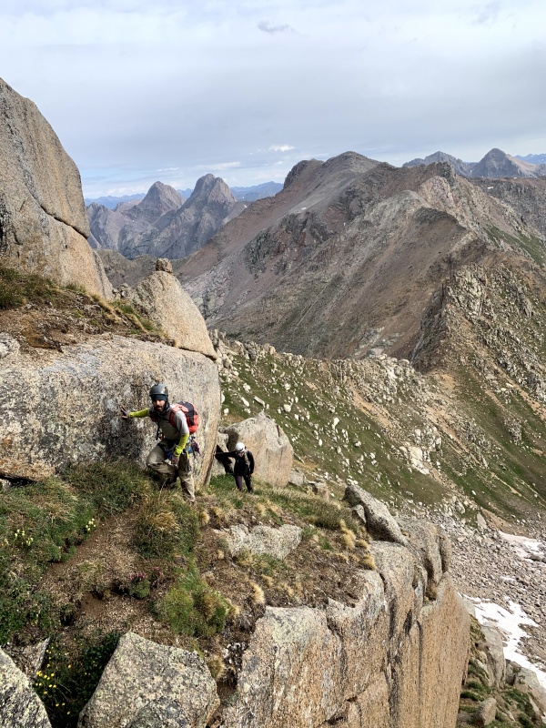
A few hundred feet of hair-raising scrambling led us to a blank north facing wall and a set of big, blocky steps that trended up and west. This was our second pitch, so we got the rope back out, with Garrett taking the lead this time. 
The crux of pitch two came right off the ground, at least the way we did it: a crack only six feet tall but merely a foot wide, which sucked to jam into, especially with a pack on, and required sickly and contorted wriggling to get up because there were no hands or feet until we were high enough to mantel out. There might have been an alternative around to the right, but this was more obvious so we all sucked it up and scraped and swore our way up the crack. 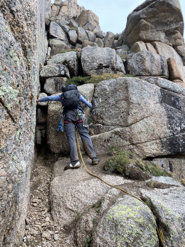

The crux here on the second pitch was really the entirety of the second pitch as far as difficulty, and it goes straight west to the third pitch, which Garrett also led. We probably didn't need ropes for the third pitch, which was approximately Class 4 and probably 20 feet high. The third pitch topped out at a notch that led around to Jagged's south side and a fairly obvious ledge which wrapped east. There was one awkward move around a bulge with extreme exposure behind us, then a bit more Class 2+ ledge and some blocks, before the final summit pitch, a Class 4 chimney with a pair of questionable-looking but solid-feeling chockstones at the top. 

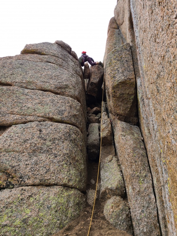
In just a few minutes the three of us were on top of Jagged Mountain. Dragging all that gear around for the last week had been worth it! 
We weren't sure how long we had until it rained so we immediately began searching for our rappels. 
A couple of bolts with hangers and no chains lead over the north side. We didn't take it, and later learned it would require two ropes (I think 80 meters total, possibly more) to get down. Instead we scrambled west down a couple of short moves and slung a large boulder tilted against the summit block. Our rappel anchor wasn't redundant but the rappel into the north-south notch was short and quick. 
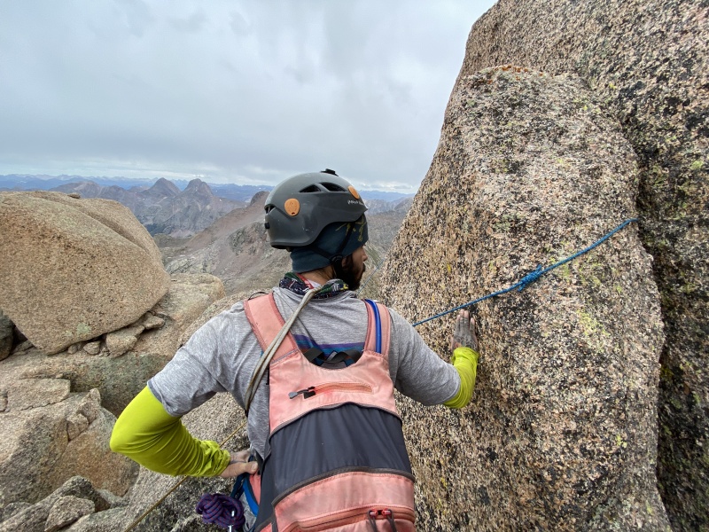

Whiley doesn't much like rappelling so Garrett went first and provided her with a fireman's belay while I checked that she was clipped into the rope properly. 
We passed back through the notch, quickly rappelled the short third pitch, then setup another rappel down over the second pitch. 


From there we scrambled down the cruddy gravel ledges, making sure to be very careful not to lose our footing given the eastern exposure. When we reached the top of our first pitch, and thus the final rappel to the ground, we used the previous belay anchor and before we knew it we were all down. 
We were elated to have climbed such a magnificent peak, and happy to be off of it as well. Jagged is certainly a major accomplishment but the near constant exposure, insecure footing, and threat of storm had kept us on edge all day. We still weren't sure when the storm would hit, and not being the types to waste even the smallest window, we packed up our gear and headed toward Jagged Pass to the northwest. We could get Peak Six even if it rained, though it would be pretty miserable if it did. 
Given that we didn't want to carry the climbing gear for Peak Six's talus hop, and knowing the marmots would shred our expensive gear if we left it on the ground, Garrett rigged up all the gear and connected it to a cam that hung over the side of a boulder. Sorry, marmots, I know those chubby little cheeks would have loved to eat a fine meal of rope and protection, the most expensive thing they'll ever have in their lives. 
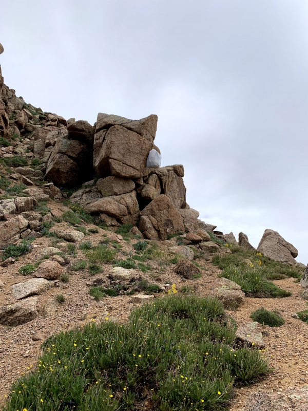
From the pass we dropped west down incredibly loose, orange gravel, then began a lengthy traverse north-northwest across annoying, angular talus. 
There were a couple of minor slabs and a bit of easy scrambling to reach the western bowl, and then it was all talus to the top. 

Slogging up the talus was a tedious and tiring affair but this was the easiest way to do it. We were already nearby, and on the summit we were greeted by some of the finest views Colorado has to offer. We were in the Weminuche, after all. 


As you can see, the clouds never quite lifted, nor had they given us more than nervous anticipation all day. Still, the quartzite of Peak Six would be as slippery as ice if it were wet, so we took our photos and descended back towards the lake. 

We rounded back around the mountain towards Jagged Pass, then crawled our way up the loose granite pebbles. Jagged Pass is pretty unpleasant overall, but who cares? We'd just climbed our asses off! Shortly after arriving at the pass and divvying up the technical gear the thunder began. Talk about perfect timing. We raced across the tundra north of Jagged and found ourselves an overhanging boulder to sit under while the sky opened up. 
Rain in the Weminuche is usually torrential, and this was no exception. Even in our little cave we got a little wet as it splashed around us and ran into pools at our feet. It got pretty cold waiting out the storm, but it was better than getting absolutely soaked. When a brief lull came Whiley and I booked it down to camp with the gear while Garrett climbed Vallecito Mountain, which he had orphaned on a previous trip. It took Whiley and I a bit of extra effort to find our way down, given the moderate complexity of the terrain, but when we reached the lower slopes and the trail we knew we were home free. It was a good thing, too, since we were soaked from the waist down due to all of the tall plants we passed through. Garrett returned a couple of hours later, and we all settled into our tents and cooked up warm food. In the early evening the storm returned, this time without relenting as darkness crept into the basin. The sound of the rain hammering the tent was cacophonous yet comforting. Who knew if we'd be hiking out the next day in a downpour or whether we'd have clear skies? We didn't care much as we drifted off to the sound of the heavens. Day 7 StatisticsClimbers: Ben Feinstein (myself), Whiley H., Garrett M.
Splits:
¹High due to GPS drift bouncing around while moving slowly on Jagged. Friday, July 17, 2020: Day 8 - Knife Point and Sunlight Creek Deproach When we awoke it was cold. Our tents were soaked and the rain flies hung limp and pitiful, but the storm had passed. We got up and slowly got ready. Our only real objective for the day was to hike back to Beartown, but we wanted to get another peak or two first, if we could. 
We left camp in the same direction as we had the day before, and this time instead of leaving the trail north towards Jagged we continued west into the upper basin. Everything was still wet from the night before but with the coming sun we knew we'd be nice and warm. Knife Point was up first today. 
We were all pretty quiet today. Our trip was beginning to wear us all down. The upper basin was exploding with wildflowers as we hiked up. 
As we approached Knife Point's cliffy eastern face we turned south, running into a large herd of goats. 


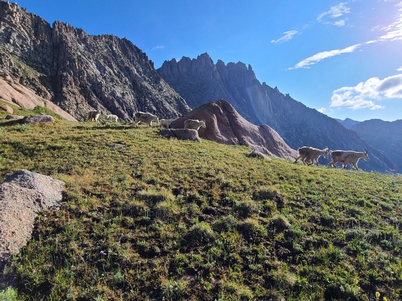
A series of grass ramps between the smooth granite slabs and outcrops led to a steep, grassy slope, which eventually gave way to the obnoxious granite gravel of the area. 


There was a short and inconsequential Class 2+ scramble to Knife Point's small summit. 
On the summit Knife Point's sheer west face dropped away into Noname Basin. Though we couldn't see the point, we could tell where it got its name from. 


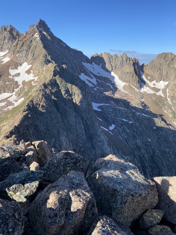
We basked in the views for a while, happy with how successful our trip had been. Eventually we made our way down - much faster due to the deep scree that made up Knife Point's upper slopes. 
We considered Peak Ten, but only briefly. All three of us were exhausted. Our feet hurt. Nobody had dry socks or footwear anymore. One of my big toes was bleeding, and one of Garrett's boots was split open in multiple places and held together with tape. It was time to return to civilization. We hiked quickly back to camp and tore down, then began the long deproach back to Hunchback Pass and Beartown. 
The hike out of Sunlight Basin was really no better on the way down than on the way up, owing to the bushwhacking required. 
Once we were on the main Vallecito Creek Trail Garrett and Whiley went ahead while I plodded on behind. The trail to and from Beartown is one of the few times where one can say "and I walked UPhill BOTH ways!" At least in my case I didn't have to do it in snow, nor did I do it en route to school (though this trip did school me), but it was still a lengthy and tiring hike up the deadfall beyond Rock Creek. As I neared the pass I breathed a sigh of relief, since the trail lowered in angle and I knew I was almost at the end. 
I got a second wind going up over the pass, then dropped down and contoured around back to the road and the trucks, where I met my compatriots. 
We collected ourselves for a few minutes, happy to be free of the weight of our packs, which were noticeably lighter yet somehow still felt like a million pounds. I guess nearly two dozen twelvers and thirteeners will do that to you. We threw our gear into the trucks and drove back over Stony Pass to Silverton, where we gorged ourselves stupid on barbeque. I'm curious how much weight each of us lost on this trip, and no amount of ribs and brisket and fried pickles and mac 'n' cheese could possibly fix that completely, but I'll be damned if we didn't try to gain it all back right then and there. That's one sign of a great trip: you eat until you feel sick and are still hungry. I can't overstate how much fun this trip was, and how awesome Garrett and Whiley are as climbing partners. It's difficult to have such a huge trip go so successfully, and we had done it despite the huge packs, the many miles of absolute choss, alternately baking in the sun and being soaked to the bone, never being totally dry, the doubts that we could pull it off, and beating ourselves into the ground for eight straight days. The Weminuche Wilderness is without a doubt one of Colorado's most magnificent places, if not the most magnificent, a truly sacred and hallowed place. It's that magic that kept us going, and it's that magic that draws us back, like a siren's call. Thanks for reading. Day 8 StatisticsClimbers: Ben Feinstein (myself), Whiley H., Garrett M.
Splits:
Thumbnails for uploaded photos (click to open slideshow): 


|
| Comments or Questions | ||||||||||||||||||
|---|---|---|---|---|---|---|---|---|---|---|---|---|---|---|---|---|---|---|
|
Caution: The information contained in this report may not be accurate and should not be the only resource used in preparation for your climb. Failure to have the necessary experience, physical conditioning, supplies or equipment can result in injury or death. 14ers.com and the author(s) of this report provide no warranties, either express or implied, that the information provided is accurate or reliable. By using the information provided, you agree to indemnify and hold harmless 14ers.com and the report author(s) with respect to any claims and demands against them, including any attorney fees and expenses. Please read the 14ers.com Safety and Disclaimer pages for more information.
Please respect private property: 14ers.com supports the rights of private landowners to determine how and by whom their land will be used. In Colorado, it is your responsibility to determine if land is private and to obtain the appropriate permission before entering the property.




 Download GPX file used in this map


