| Report Type | Full |
| Peak(s) |
Aztec Mountain - 13,311 feet Bullion Mountain - 13,190 feet Mt. Valois - 13,173 feet Amherst Mountain - 13,164 feet Organ Mountain - 13,040 feet Sheep Mountain - 13,073 feet "Peak Twenty Two" - 13,107 feet Sheridan 12,794 12,442 Endlich Mesa 12,490 |
| Date Posted | 09/14/2020 |
| Modified | 09/15/2020 |
| Date Climbed | 09/07/2020 |
| Author | bergsteigen |
| The Wemi beatings will continue until morale improves |
|---|
|
Aztec, Bullion, Valois, Amherst, Organ B, Sheridan, Sheep D, Pk 22, 12,442, Endlich Mesa
I came into this trip with roughly 7 plans of attack for these peaks. With the Caltopo app, it's fairly easy to plot out routes and get an idea of mileage and elevation gain. The amusing thing, I used none of these "plans", as the terrain and my lack of speed made me have to change the plan at least 3 times each day. I'm blaming the lack of speed on my inconsistency this season. I'm hiking like an out-of-stater, and that's not enough to keep my tolerances and my speed on rough terrain high enough to roll over peaks like I'm used to. Endlich Mesa is a misspelling for Endless... The road up to the trailhead is very rocky and can take a considerable amount of time. Plan on 1-2 hours. I took 1:20 up and 1:40 down, only because I was really tired and wanted to get to the trailhead and sleep. On the way down, I didn't want to hurt my truck. A Subaru made it, although it was a very old one, so maybe they didn't really care about damage. On the way up, I passed a couple hunters with a horse trailer. I was in bed and fully asleep before they arrived and woke me up briefly. So lower vehicles can make it, but I'm guessing 3-4 hours!!! Day 1: Pack in to camp
I packed up my pack in the dark, and made sure my solar panels were deployed on my truck roof before setting out with the onset of civil twilight. The hunters were packing up their horses too. I got up the trail and to the beautiful first overlook after 1.4 miles and about 600'. I took my first photo, and realized my camera battery was flashing. Uh Oh! My spare battery was in my bike pack - in the truck. So I had a dilemma. Do the trip with a battery that would die soon, and then use my iPhone (yuck). Or do I drop my pack and return to pick up my spare battery. Since I took ~400 photos on this trip. I did the sensible thing and returned for the battery. 
With the added distance and mileage, my very remote thought of doing a through hike over a bunch of peaks, the way Furthermore did, was pretty much out for the day. I had a span of many days without storms, but I still lost too much time. It was a silly plan anyway. Once up on the mesa, travel goes pretty quickly, as there is little gain or loss for a few miles. 
About half way to the descent into camp, the 2 hunters passed by me. I talked with the guy on the horse for a while. It's too bad I didn't capture his surprised face when I told him my plans. With the start of archery season the day before, I figured I would see some hunters, so I talked to all of them, to make sure I wouldn't be hiking where they would be. 

Since I was my own pack horse, I took a lot longer than the hunters to get into camp. They had already caught their dinner from the reservoir before I arrived. I took a short break where the trail drops down to the reservoir. A few zones of steep scree, but in-between is a slow contouring descent. 

I got into my chosen camp above the reservoir around noon. The reservoir is really low this season, barely any water left. Instead of dropping my overnight gear, and heading up for an afternoon ascent on Valois, I hung out in camp reading and chilling my feet in the stream. First time I would regret not doing Valois early, a recurring theme... Day 2: Aztec, Bullion
This morning I had planned on doing Sheep first, then on to Amherst and Organ. But I was looking up at the drainage for Sheep all day previous, and I just didn't like all the granite slabs and cliffs in the trees. It looked like there could be some serious route finding. Furthermore said that it was time consuming from Sheridan. So I thought I might roll the dice and see if I could do a large traverse starting from Aztec and then drop from the drainage in the full light at the end of the day. Bushwhacking in the morning is never good. So I adjusted the plan at 5am, and was starting up the trail to Columbine Pass with the light increasing before sunrise. The trail up went pretty fast by Lake Marie, and then up onto the mesa above. The route is fairly well cairned, though I did miss a few in the granite slabs, but you still travel in the general direction.


When I got up to the pass with Florida, the unranked 13er, I decided to follow the ridge over to Aztec, instead of continuing on to Columbine Pass. I hoped it would be a faster route. I didn't realize the bump along the ridge was an unranked 13er, Bullion. 
It was a quick ascent up to the summit of Bullion, where I got a nice view of the ridge route over to Aztec. The ridge didn't look too bad, but It did have a bunch of rough sections. 
The ridge off Bullion had one small class 3 notch, nothing too bad, but enough that I was starting to look for a faster option to get back to Florida on the return. Along the way, I got a fly over by Air Force 1! At first I wondered what all the noise was, and looked up to find 2 large planes closely surrounded by fighter jets. The first plane had 4 and the second had 3. I didn't manage to get a photo, since by the time I realized, they were pointed at the sun, and my camera couldn't focus fast enough. Once on the main east ridge bump to Aztec, I got a good view of the route ahead. So far it didn't look too bad. The route over to Columbine Pass looked a bit more involved. Hmmmm plans... 
The first section of ridge went well, then the scrambling started. The gendarmes got a bit more intense. The route more loose. ie Time consuming. Very time consuming. I skirted a few towers to the south, and worked my way closer to the peak. The closer I got, the more involved the route got. Along the way, the inevitable happened, and my camera fell out of it's case, since the zipper is broken. The camera is attached to the case, but the lens still hit a rock, and the lens cap and the polarization filter flew off. I managed to recover the filter, but the lens cap is a needle in the talus scree haystack. So I had to use my sunglass cloth case as a camera lens condom. Works, but annoying. I'll have to get some of those stretchy lens caps for emergencies! Finally I got to the final notch saddle before the summit pitch. Here the route goes slightly to the north of the ridge proper, and is class 3 and more solid. 

Once on the solid rock, the ascent to the summit went much faster! It was also a lot more enjoyable. While enjoying the summit, I got another flyover. Much closer and so I was able to snap a bunch of photos.
While the view of Chicago Basin from Aztec was very nice, it doesn't compare to the view you can have with snow in spring! 


It became apparent that I was not going to be able to do the large peak traverse today. So once again, I was regretting not ascending Valois this morning on my way to Aztec. That would have made more logistical sense for the day and week plan, and would have saved a couple days at the end of the trip. Ahhhh Valois! From here I had thought of many exit routes off Aztec, but I figured heading down the west ridge and then down the Silver Mesa would be best. Too many cliffs and elevation loss to get back to Florida enroute to Valois. The route down the very long Mesa would still take much of the afternoon, as it was deceptively long! The west ridge was infinitely more enjoyable than the east. The rock is solid, and the scrambling a lot more fun! There is one notch that required class 4, but it's really short. I didn't head over to Kennedy, since I had already skied that unranked 13er a few years ago. 

Once I had traversed onto the Mesa, travel became faster, if still slower with all the granite slabs. 
After the long Mesa walk, I met up with the trail back to the Reservoir and was able to make much faster time. Still I returned back to camp in the late afternoon. 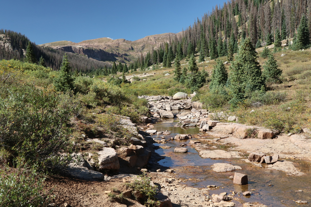
Day 3: Valois, Amherst, Organ B
Today I figured would be long, but I would get all 5 13ers and then pack out of camp. Worst case, I would get all the peaks, but have to spend an extra night. Haha. I started up the same trail to Lake Marie, but exited before the trail went up to the Mesa. The start of the ridge up Valois looked interesting with all the granite slabs, and took a bit of route finding to get on top of. 
I started out on some grassy ramps on the west side of the ridge, and then made my way up to the ridge proper after a little while. Once on top of the first granite cliffs, the route was fairly easy. 


Once on the first prominent bump on the ridge, the route to the summit comes into view, and the narrowing of the ridge is pretty nifty. 

While the narrows look intense, it was a simple walk over and up to the broad summit 
After a couple photos I was quickly on my way. The route over to the Amherst ascent gully looked ... time consuming. Granite slabs everywhere! Dropped the east ridge until I could gain access to the grassy slopes below. From there it was a steep grassy descent to the lake below, where amazingly, there was a bit of a trail. 

I left the trail/game path and dropped into the willows and granite slabs and marshes to make my way to the base of Amherst. It took much longer than anticipated, and most of the marshes had dried up! Total time sink! Once again, wishing I had done Valois on one of the days previously!!! 
After getting above the stream, I could see the loose scree gully to get up to the ridge with Amherst. It was NOT fun. Class 3 scree crawling. Loose and nasty. Did NOT enjoy. 

When I got to the top of that monstrous scree gully, I almost cried at the terrain I would now have to endure to get my "easy class 2 peaks". I seriously contemplated turning around and just leaving. A sign that I've been under way too much stress lately. But I continued, since the peaks were so close, and there was no way I was going to repeat that gully 2 more times on top of what I already had to do! There is a very steep scree and grassy scree contouring game trail over to the SE ridge of Amherst. It was slow at times, as I had to kick steps into the ball bearing scree to not slide down the slope. But eventually I made it to where I could finally ascend Amherst. (My track will show that I tired to ascend too early.) From the SE ridge/E face area, it was just a steep kitty litter scree ascent to the summit area. 


I also didn't want to go over to Organ either, as the scree was just so off putting, but I sucked it up and did it. Once at the saddle, the route was actually pretty enjoyable. 


I went up the west ridge of Organ, and traversed under the summit boulders. From there you go up the E/SE ridge to near the summit, and then traverse up to the north, before backtracking south to the summit boulders. 


I went over to the southern summit block, but it didn't look good to climb, so I went back over to the northern one. You have to pull yourself onto the block to the right/north and then step onto the bigger block. I'm short, so I had to do a few harder moves to get onto the lower block, but there are great hand holds on the far end of the block to pull you up, and a left foot on the big block to push you up. Not quite elegant, but it worked. I got up there when there wasn't any wind, so I was able to stand on the summit block. At this point I figured I had used up too much time to get to Sheep D and Pk 22, so I enjoyed my summit stay a bit longer. 
The return back to the red scree gully went fast than the way out. I guess I "got used to the terrain" along the way. What happens when you are out of practice and hiking like an out-of-stater! 
When I got down from the nasty gully and made my way through the time consuming granite slabs and marshes over to the game trail, the late afternoon light said I would be arriving close to sunset to camp! So much for getting all the peaks and packing out tonight! At least the game trail forged a path through the willows and remained a very strong trail until the base of Valois. Then it petered out to nothing, so it may be tricky to find in the opposite direction. 
I got into camp with local sunset already shadowed in camp, and ate most of my remaining food. I hadn't exactly planned for this extra night out, but I had enough food to pull it off. Day 4: Pack out of camp
I got up early and pack up camp and bolted out. A group with headlamps was wandering around my camp the night before, and as I was heading out around the Reservoir, there were a bunch of tents in view. Oh the humanity of Labor Day Weekend! Ran into my backpackers and a lot more hunters on the trail out. Once back up on the Mesa, the distance went quickly, even with a full pack of overnight gear. 
I talked to all the hunters, and let them know where I saw the game. A sizable herd of Elk was up near the saddle of 12,442 as I was ascending. 
The funny thing is, both nights I camped at the trailhead, I was visited by at least 2-3 deer! Poor hunters.
Day 5: Rest & Recovery
My feet were pretty beaten down by the previous 4 days, so I figured if I took a complete day off, I could do a mega day and get the orphan peaks I had left behind. So I read my book and took a short walk, and ate very well. 
Day 6: Sheridan, Sheep D, Pk 22, 12,442, Endlich Mesa
I woke up really early, so I could get the route done and have enough daylight to exit the Mesa before full dark. I had panned on using the waning full moon as a good light source, but as I woke up, it was dimmer than expected. Getting out of my truck I could smell smoke faintly and the sky only shown with the brightest of stars. Well, with internet service at the TH, I looked up the air quality, and it was within my tolerable zone. Not ideal, but I had already invested my entire trip on these peaks, it was time to get them done. I got on the trail and made speedy work of the trail to the base of the route up to Sheridan. I tried to make it for sunrise, but was a bit late. Though with the smoke, it didn't really matter. The show was before sunrise today.
While I have no plans to complete any list of 12ers, getting to the summit of Sheridan had it's uses. I could better see the granite slab labyrinth over to Sheep D well. 


It was a steep grassy descent down the east ridge of Sheridan. Glad to have that over, I knew I wouldn't reascend that! Once down from Sheridan, the granite slab-athon started immediately. Quite fun, but slower going than otherwise. But that's the whole zone here, granite slabs. I'm now used to them after 4 days! 


While time consuming, the slabs themselves weren't too hard. There was always a class 2 way to be had. You can also make it as hard as you want too, all the way to 5 if you wish it! 
The slabs end with a bit of a granite cliff, but a cairn points the way to get down. You can drop elevation and get off the cliffs sooner, but I followed the cairn. From there it was a gradual ascent to the broad summit of Sheep D 

Somewhere along the slabs and way up to the summit of Sheep, the smoke got worse, way worse. Now into my unacceptable range. But as Pk 22 was close in reach, I continued onwards. I followed the game trails that start down the north ridge, and noted where Furthermore took his gully. All you have to do is take the slope immediately to the left/west to get onto the steep grassy gully slope to get down off the peak. 

Once off Sheep, I did a low traverse over to the north ridge of Pk 22. You can go up a grassy slope before that, but I wanted the view. 
I followed the steep grassy western slope until I reached the south side of the peak, and then made my way to the class 3 summit boulder. 

I was glad the summit boulder had a cairn on it, as it meant I didn't have to go any farther. That ridge looked airy! I didn't spend too long up there, as I had a long way to go back, and the smoke destroyed the views. From my earlier perch on Sheridan and Dillon's TR, I knew the lower drainage would go, so I could traverse around Sheridan back to the trail. It took time, but was easy enough. I stayed in the center of the drainage until the stream got bigger. Then I contoured high on the left/south side till I got to Sheridan. There are plenty of game trails in the area to follow, lower down. 


The start of the low traverse around Sheridan went quickly, but then became pretty steep and lots of scree. The elk imprints are everywhere. At the end I just had to go up a steep slope to get to the trail on the other side. Again, I have no plans to ever do a 12er list, but am not opposed if there is a ranked one in my path. I debated 12,442. I didn't really want it. But it was right there. Only 300'. I wasn't going to do it, but when I go to the saddle and the trail, I found myself heading up. At least it went quickly and soon I was on the summit. 


While on 12,442 I could spot an easier game trail on the other side that skirts Sheridan. Much easier than what I did. The descent went quickly and I was back on the trail. Up and around and over to Endlich Mesa, another 12er. Barely any work to get this add on, and now I have 5 ranked peaks in a day. LOJ is evil. 
Soon enough I was back to that first overlook from 6 days ago. The view has changed dramatically, and is why I wouldn't hike in these conditions if I wasn't already a captive audience - AND have seen the view before. Hiking these 13ers is more than just a checkmark to me. 
I got back to the mostly empty trailhead. All the backpackers were gone, and only a few hunters remained. I hope they are ready for the snow tonight! I have no idea how that horse trailer will get down the road if the snow hits here hard! I didn't plan to spend 6 days up on Endlich Mesa. But at least I never have to drive this road again! (Lime Mesa is another access point) 
Thumbnails for uploaded photos (click to open slideshow): ")
")
")
")
")
")
")
")
")
")
")
")
")
")
")
")
")
")
")
")
")
")
")
")
")
")
")
")
")
")
")
")
")
")
")
")
")
")
")
")
")
")
")
")
")
")
")
")
")
")
|
| Comments or Questions | |||||||||||||||||||||
|---|---|---|---|---|---|---|---|---|---|---|---|---|---|---|---|---|---|---|---|---|---|
|
Caution: The information contained in this report may not be accurate and should not be the only resource used in preparation for your climb. Failure to have the necessary experience, physical conditioning, supplies or equipment can result in injury or death. 14ers.com and the author(s) of this report provide no warranties, either express or implied, that the information provided is accurate or reliable. By using the information provided, you agree to indemnify and hold harmless 14ers.com and the report author(s) with respect to any claims and demands against them, including any attorney fees and expenses. Please read the 14ers.com Safety and Disclaimer pages for more information.
Please respect private property: 14ers.com supports the rights of private landowners to determine how and by whom their land will be used. In Colorado, it is your responsibility to determine if land is private and to obtain the appropriate permission before entering the property.


